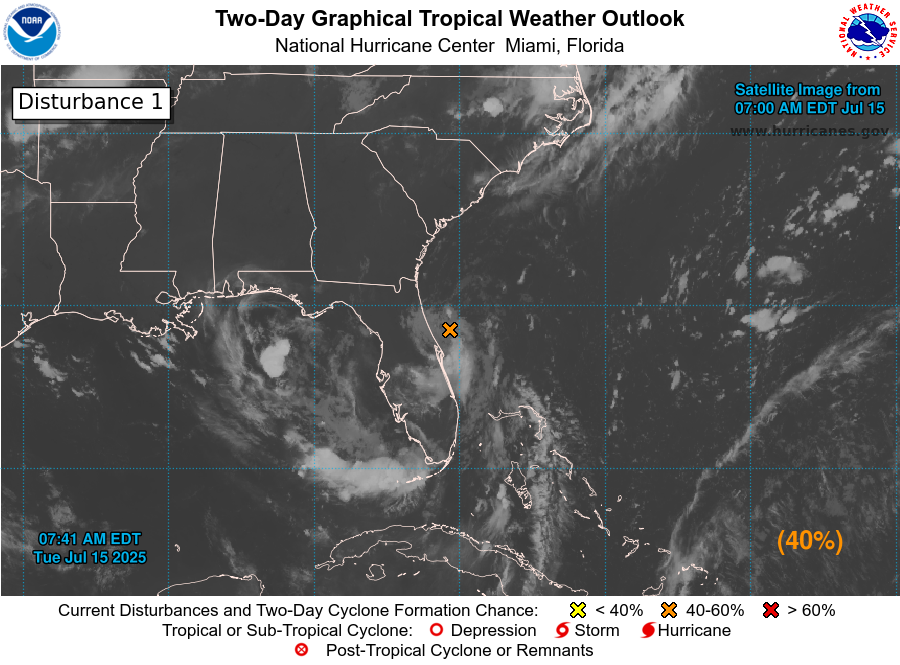
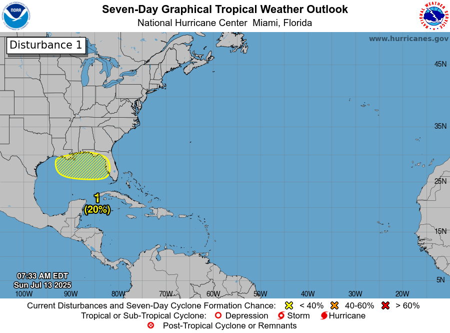
A Tropical Wave Located Over The Eastern Tropical Atlantic Will Be Watched Next Week As It Heads Westward: A look at satellite imagery today revealed a tropical wave located over the eastern Tropical Atlantic near 30 West Longitude. This wave is producing some limited thunderstorm activity. A look at environmental conditions indicates that the wind shear values are at between 5 and 15 knots, which is favorable for further development. That said, there is no low or mid-level circulation associated with this wave & thus it has a long ways to go to develop, if it ever does.
All of the main model guidance do show at least some development of this tropical wave as it heads westward into the Central Atlantic next week possibly reaching the Lesser Antilles late next week. That said, none of the models forecast any sort of robust development, instead they most show this wave possibly becoming a strong tropical wave that brings very squally weather to the Lesser Antilles around Thursday or so of next week.
For now though, I am going to be keeping close tabs on this tropical wave, no matter what it does. Reason why is because analysis of the environmental conditions of the area between the Lesser Antilles and the west coast of Africa reveals that the wind shear values remain favorable for development as far west as 55 West Longitude. Because of this, it wouldn’t surprise me to see this wave try to develop into perhaps a tropical depression as it heads westward into the central Tropical Atlantic. With conditions forecast to be unfavorable west of 55 West Longitude, weakening of whatever tries to form would possibly occur as it approaches the Lesser Antilles later next week.
For now, this wave is something that should be watched, but it’s nothing to be concerned or worried about.
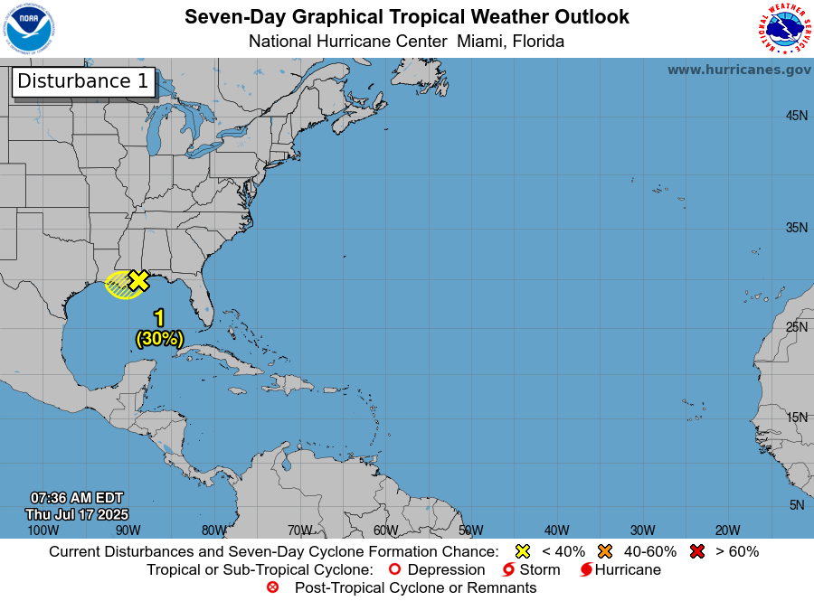
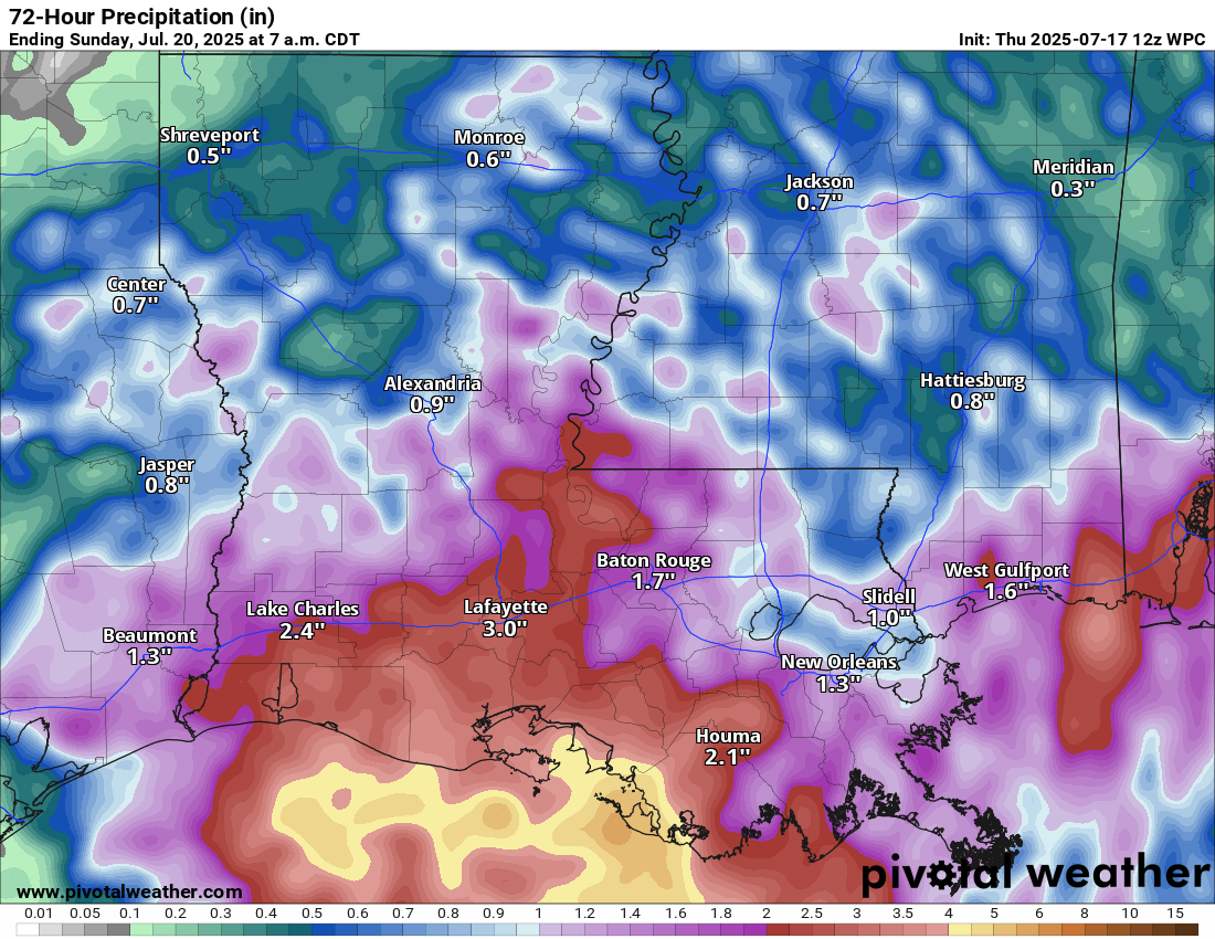
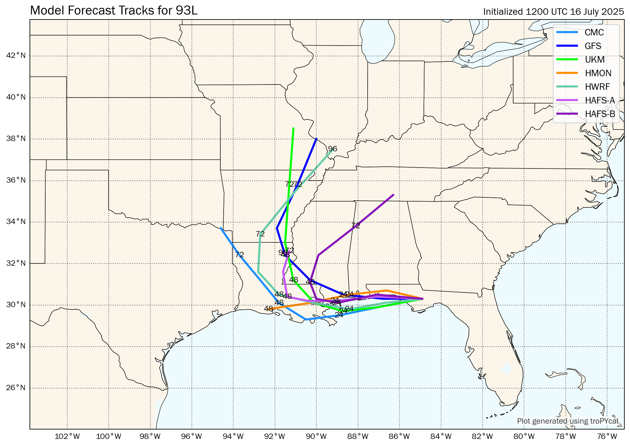
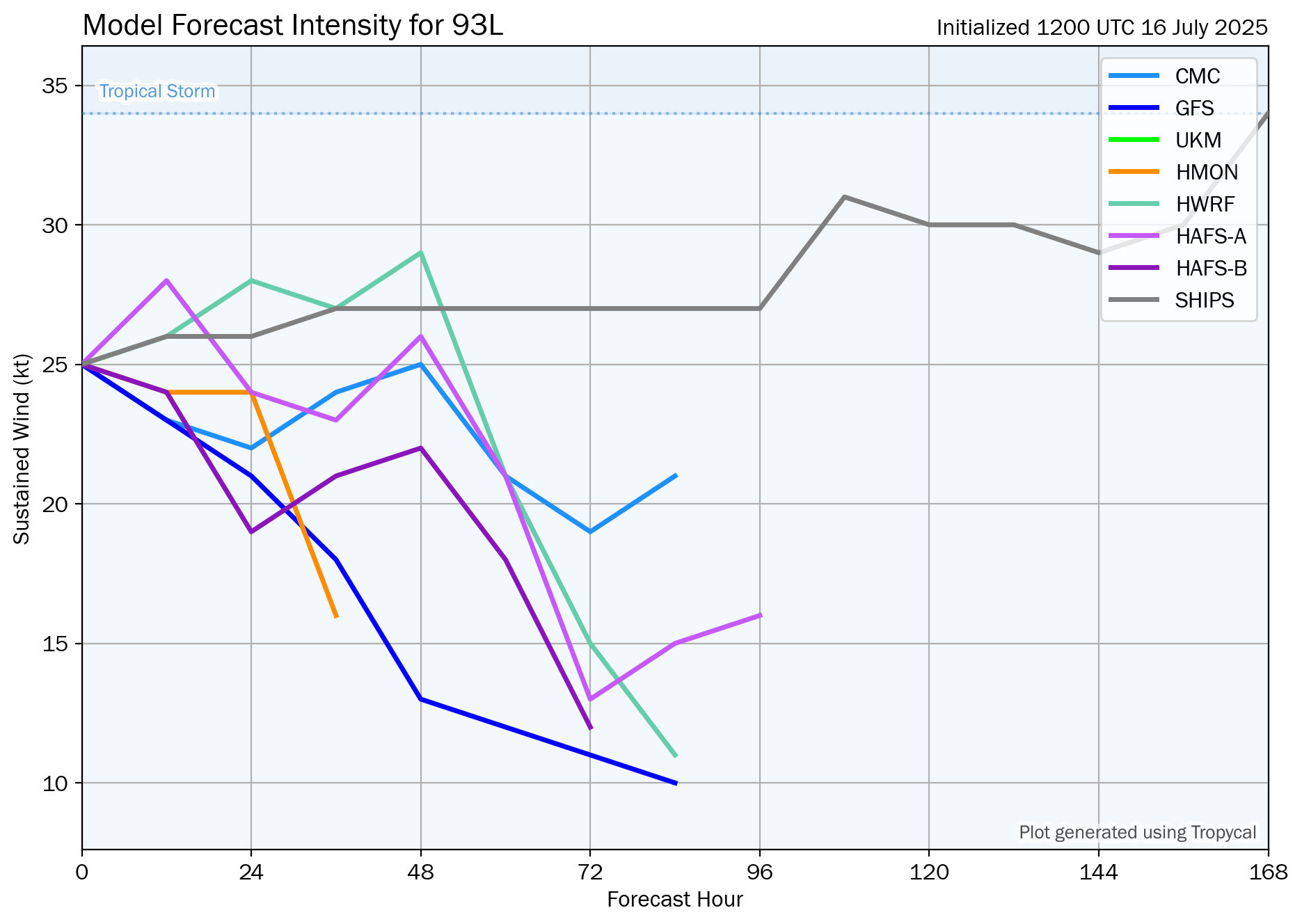
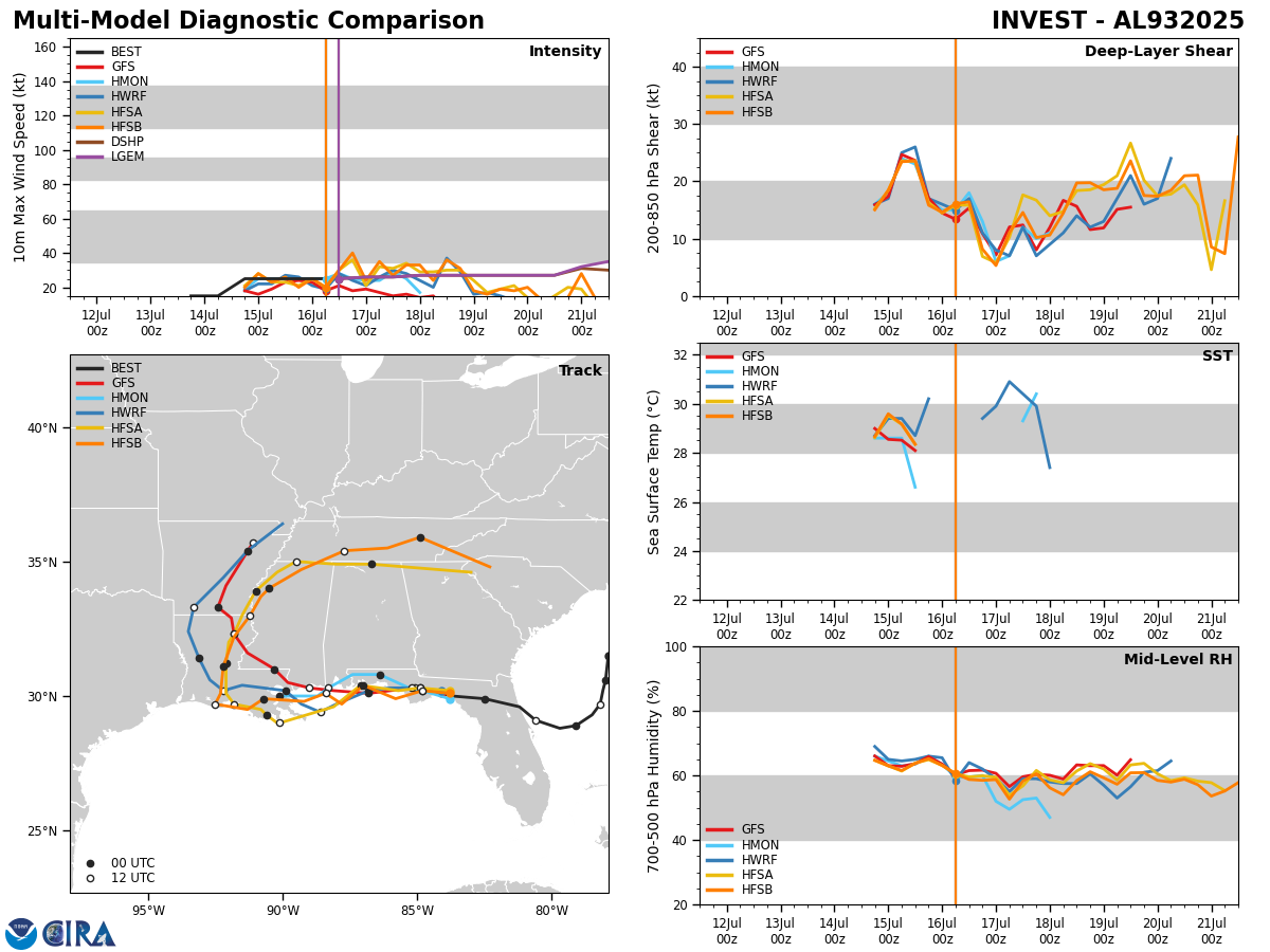
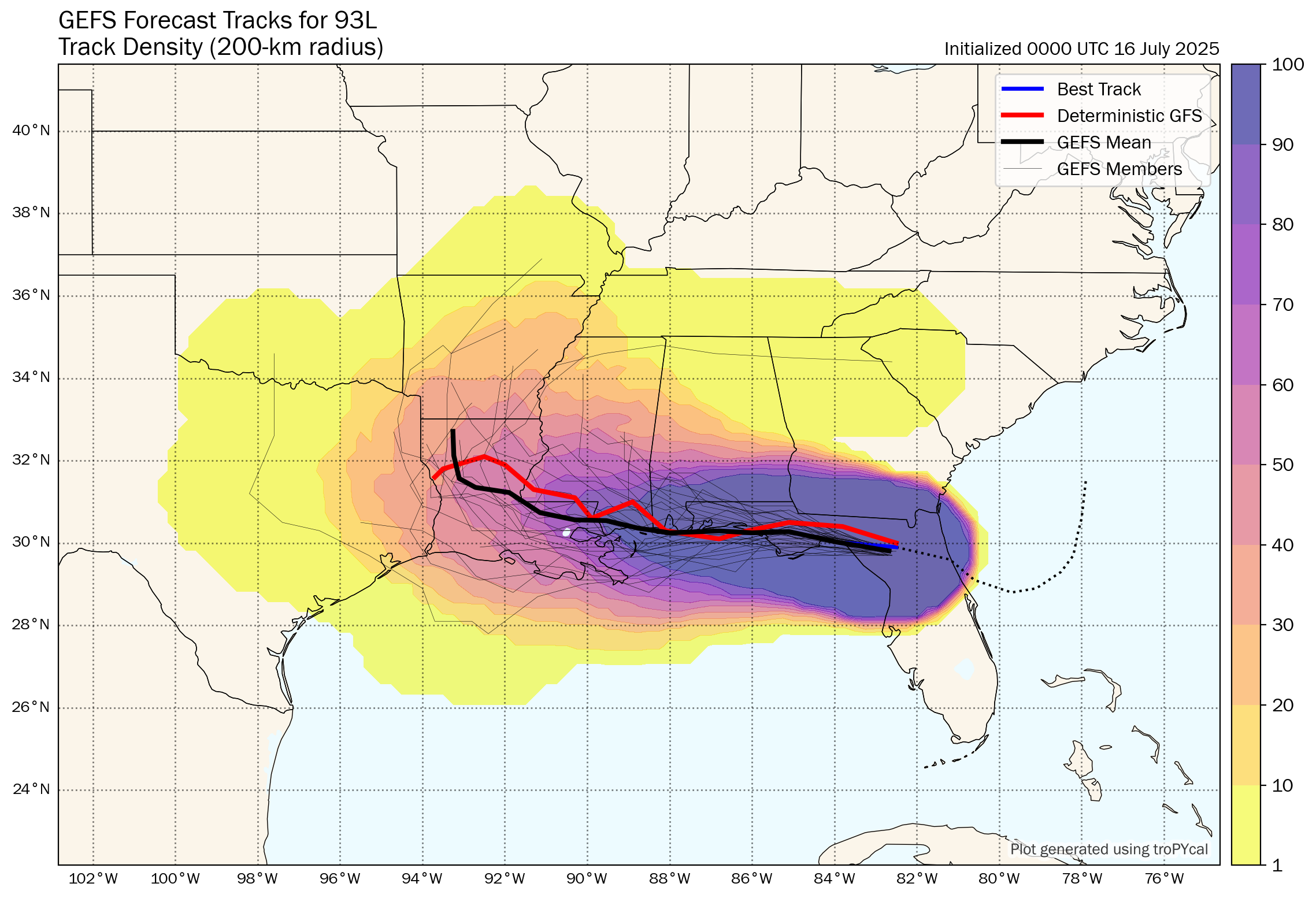
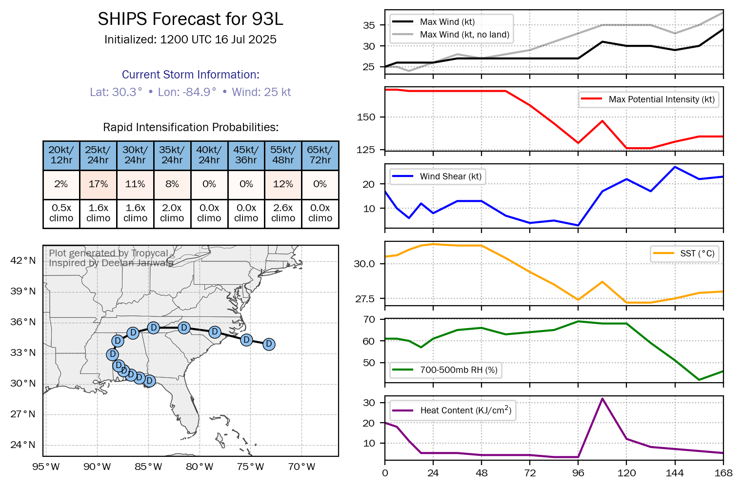
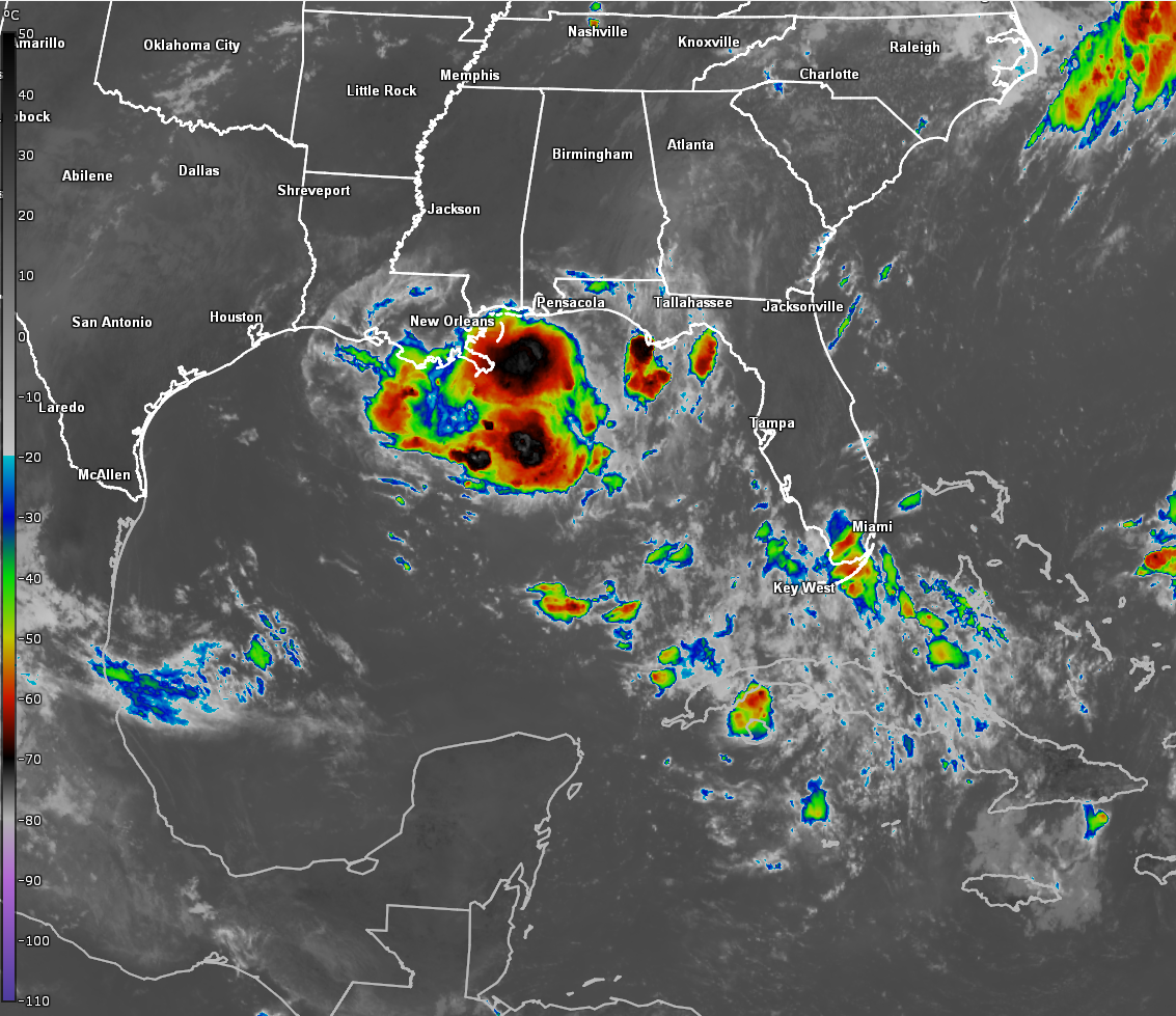
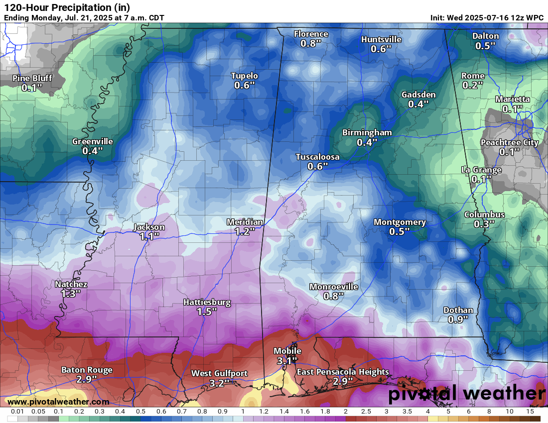
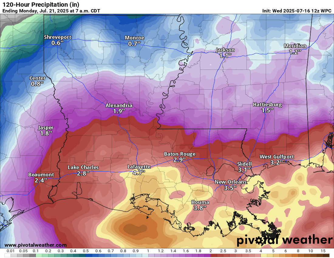
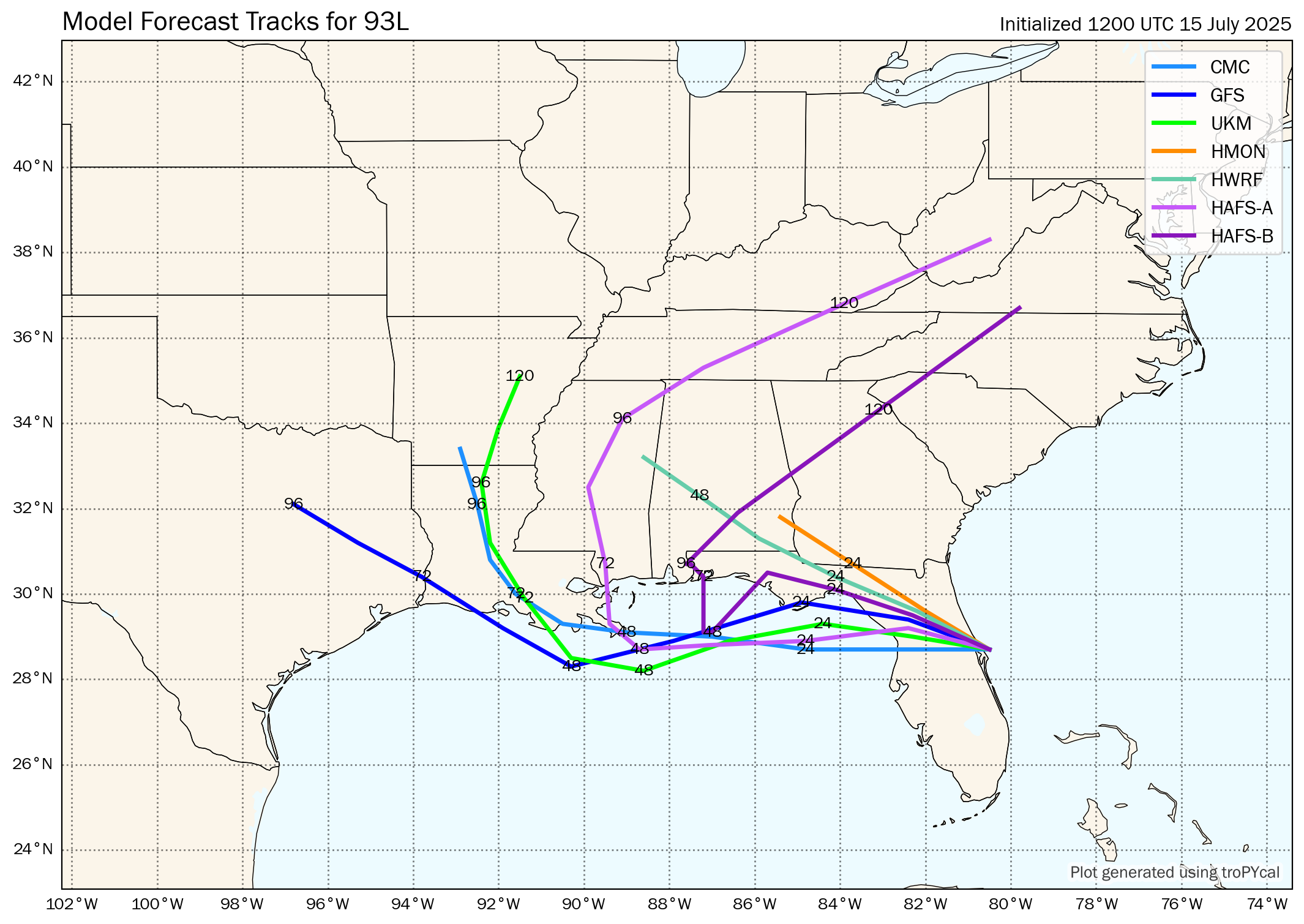
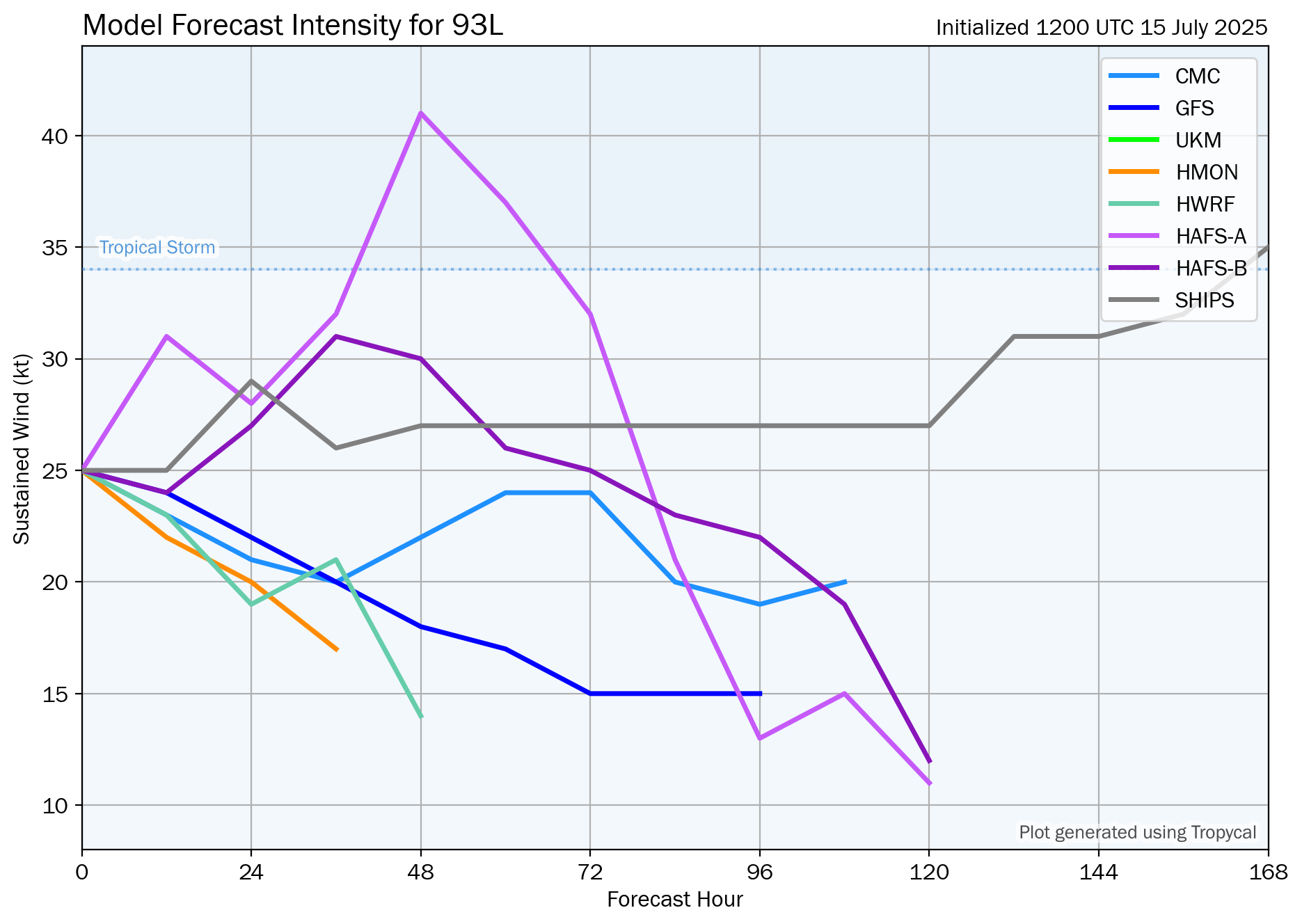
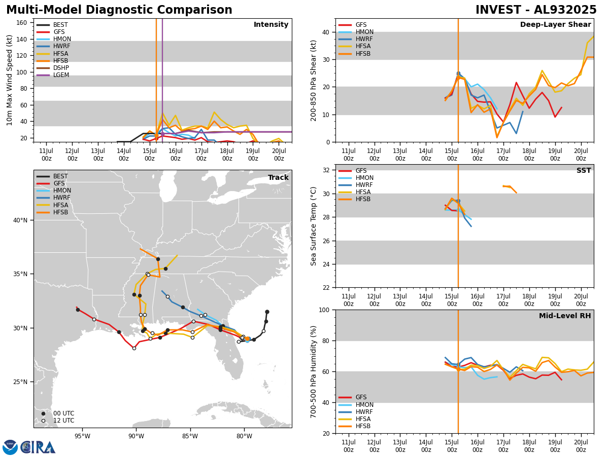
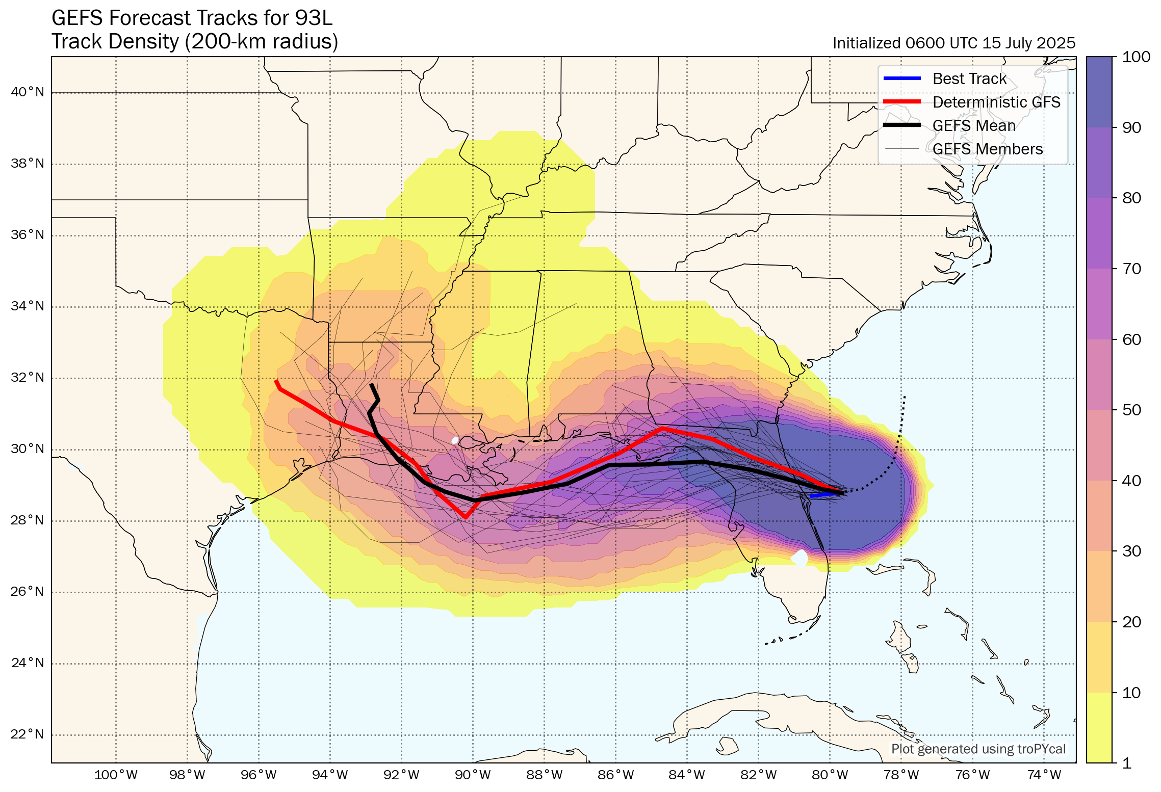
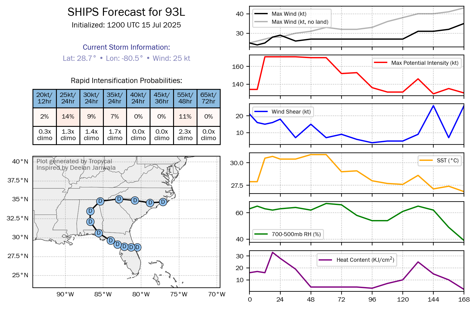
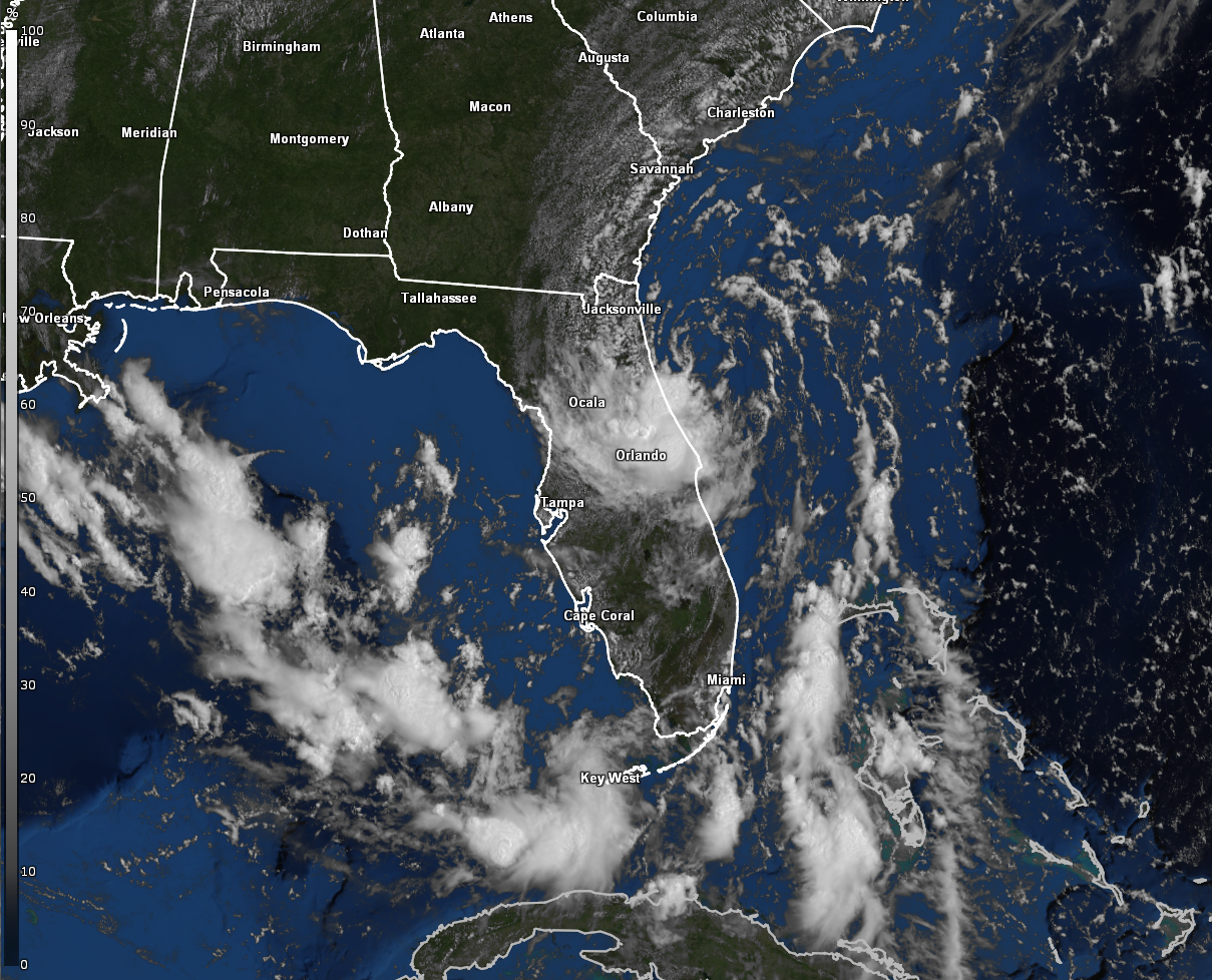
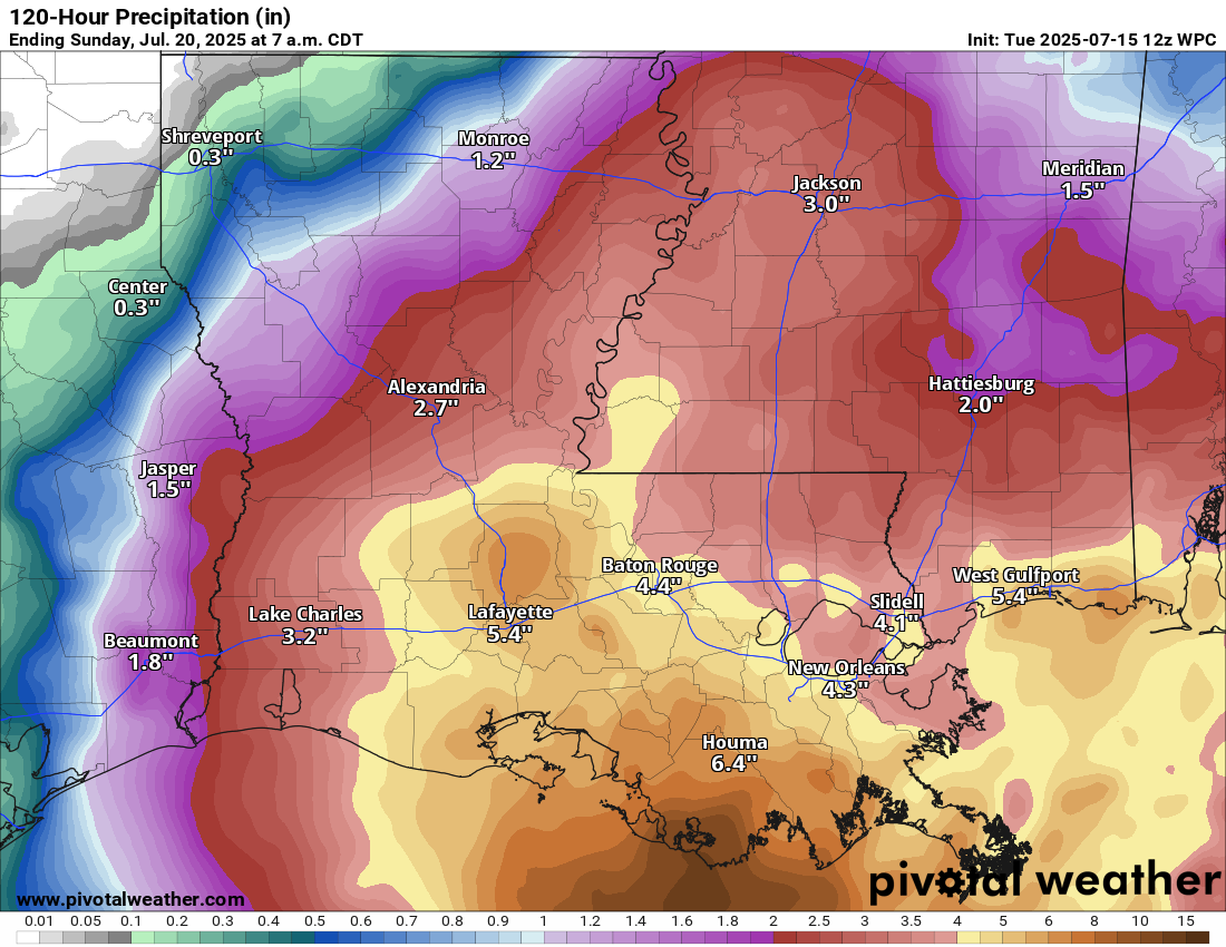
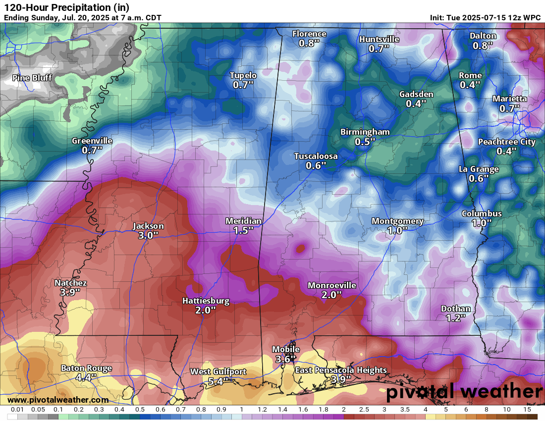
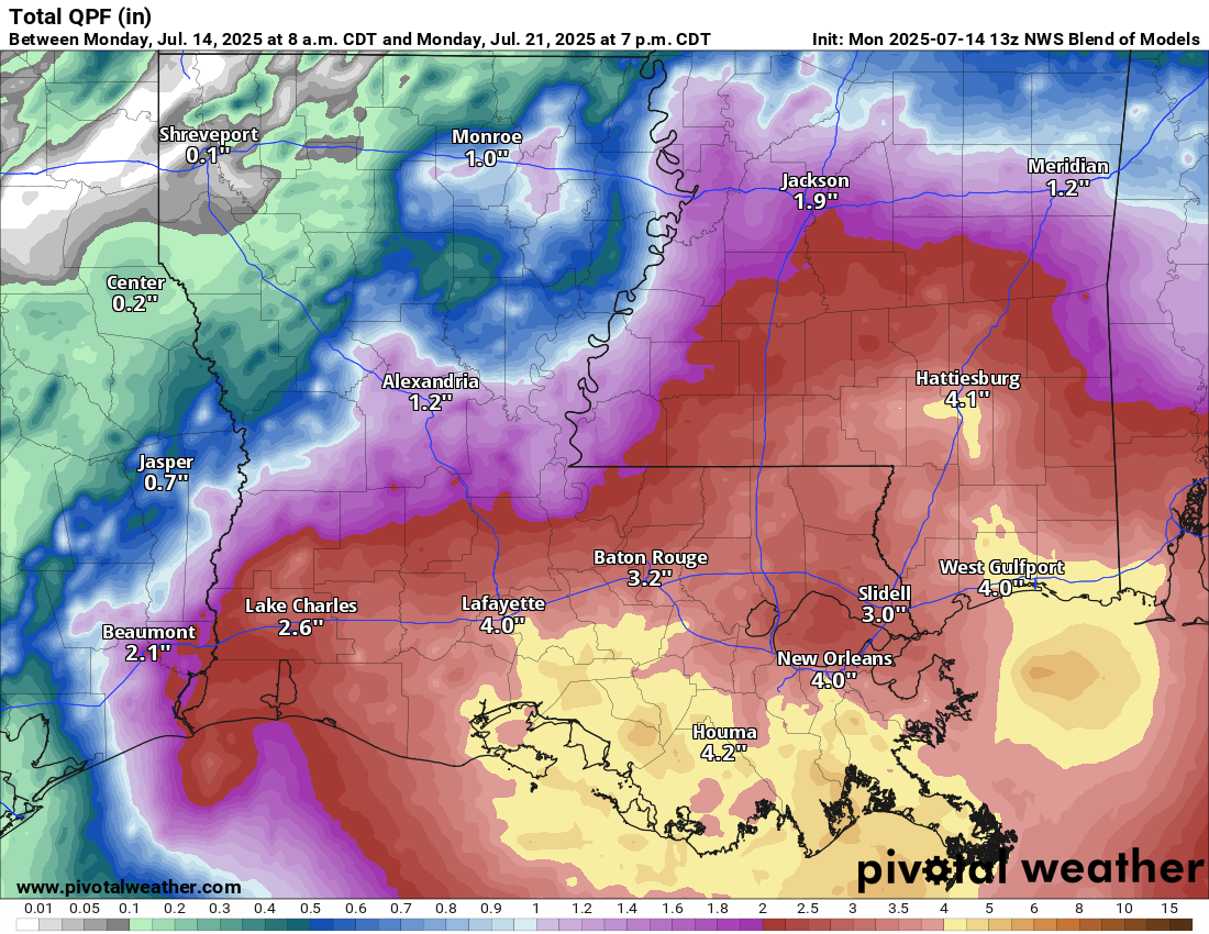
Invest 93-L Make Try to Loop Around & Track Back Into The Northern Gulf Next Week: Invest 93-L is now inland over Louisiana and is expected to bring some additional rainfall to mostly western and southwestern Louisiana throughout the rest of today.
The disturbance that is Invest 93-L is then expected to quickly track eastward across the southeastern US this weekend and then dip back to the south. This could lead to Invest 93-L to re-emerge in the northern Gulf around the middle part of next week or so.
While the potential for Invest 93-L to move back into the northern Gulf during the middle parts of next week & try to develop is something to keep an eye on, I’m not too concerned about it. The reason why is because none of the model guidance show any sort of development from it later next week. In fact, the European ensemble model guidance forecasts that Invest 93-L has perhaps a 20-30 percent chance of development in the northern Gulf later next week.
It’s something to watch, but it’s nothing to be concerned or worried about.
I plan on taking this weekend off as we need to do the very frustrating & stressful task of shopping for a “new” vehicle. Reason why is because we were involved in a 4 vehicle chain reaction accident last Thursday & the insurance totaled our car. Fortunately, we walked away from the accident with only some minor body aches.
Anyways, the next tropical weather discussion will be issued on Monday unless the tropical wave over the eastern Tropical Atlantic starts to develop.