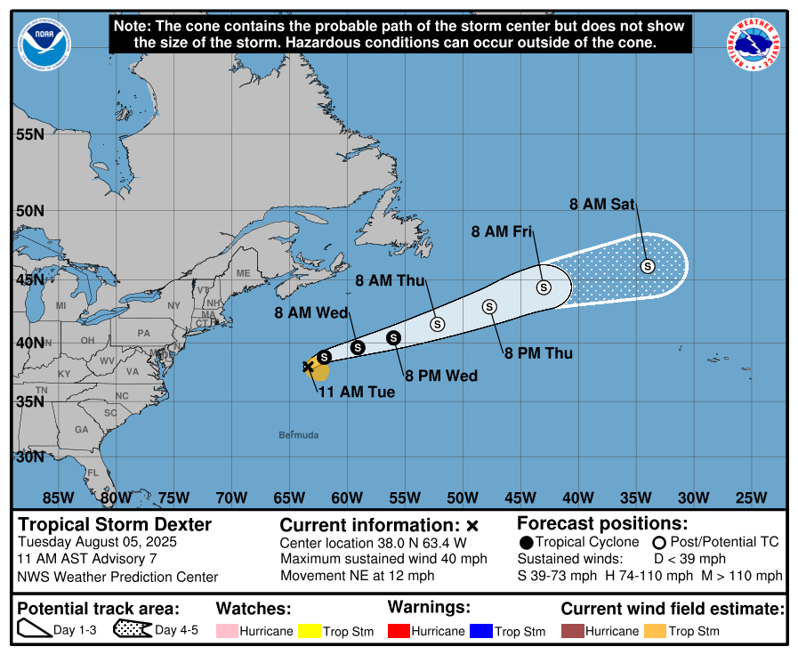
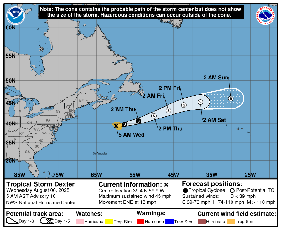
Tropical Storm Dexter: Dexter is producing deep amounts of convection as it heads northeastward towards the open Atlantic. It is expected that the storm will become post-tropical by Thursday and then reach the area north of the Azores as a powerful non-tropical low pressure system.
From there, the low pressure system that was once Dexter should reach the British Isles by Tuesday and Wednesday of next week as a strong storm system.
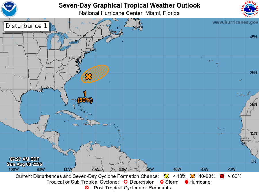
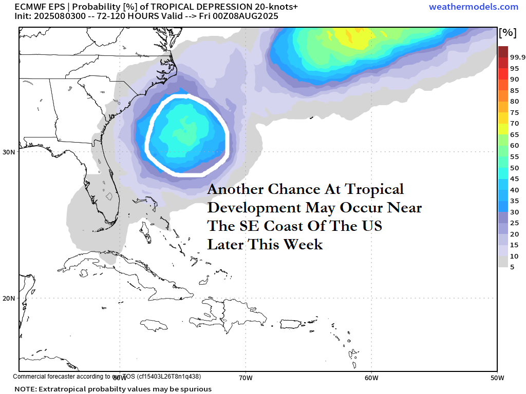
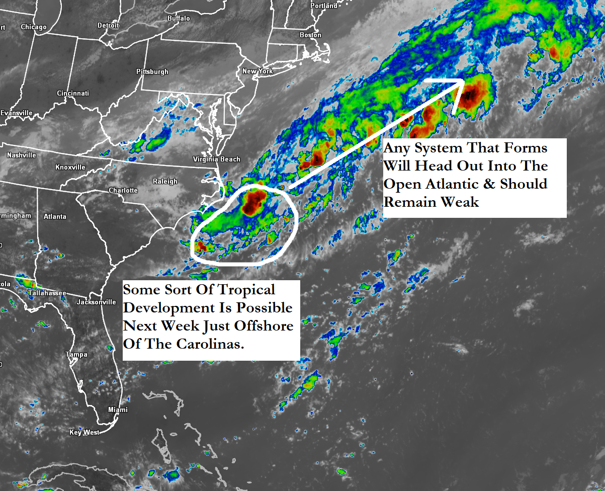
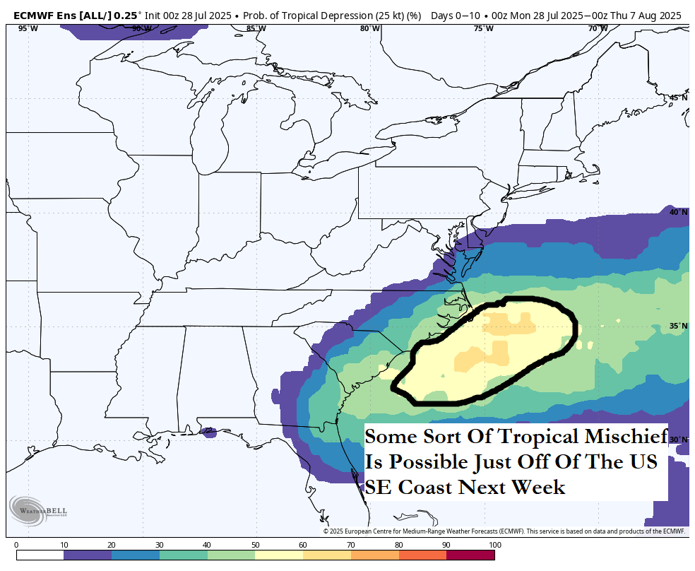
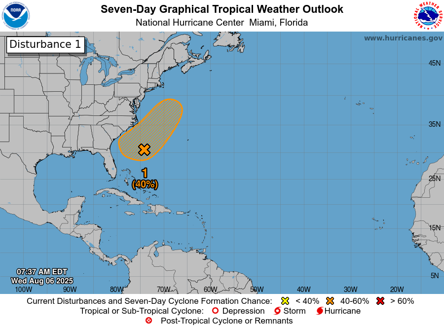
Low Pressure Offshore Of The Southeast US Coast: Weather analysis today revealed that a low pressure system has formed offshore of the US Southeast coast. Even though a low pressure system has formed, satellite imagery indicates that there is only limited amounts of convection occurring with this system.
It is looking increasingly more likely that this low pressure system will stay offshore of the Carolina coastline and not be a direct impact. This further offshore track may end up lessening the heavy rainfall threat to the Southeast US coast over the next several days.
Any development into a tropical depression or even a tropical storm will be very slow to occur and if it does happen, it probably wont occur until this weekend as this system passes to the east of the outer banks of North Carolina. From there, this system is expected to turn to the northeast and pass well offshore of the New England coast by early next week.
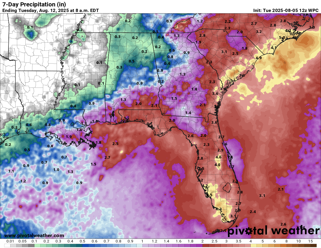
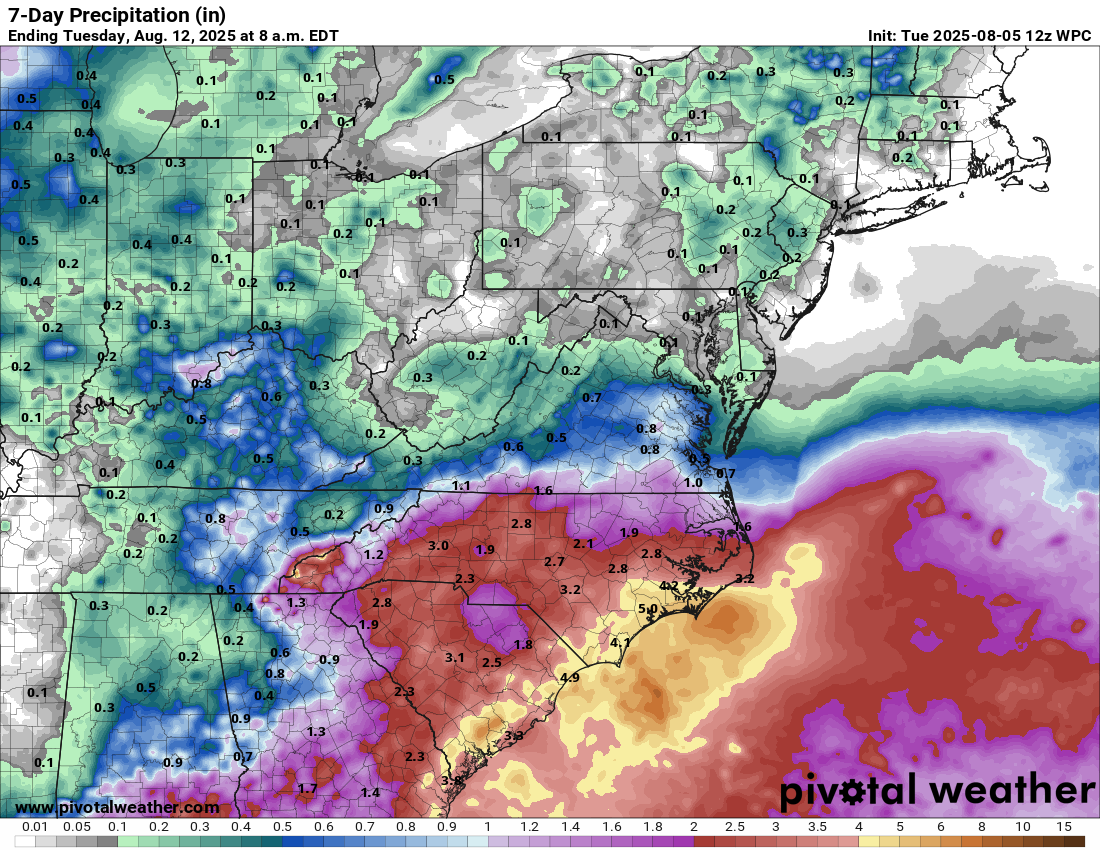
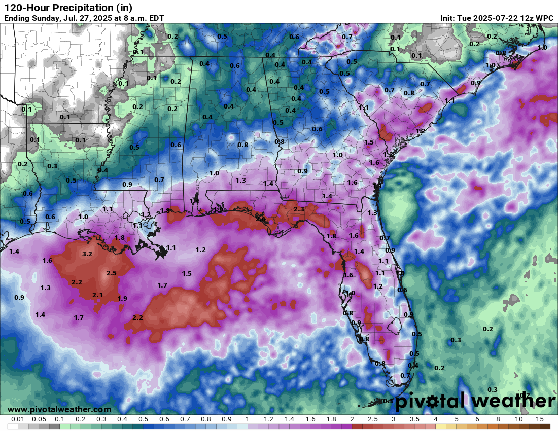
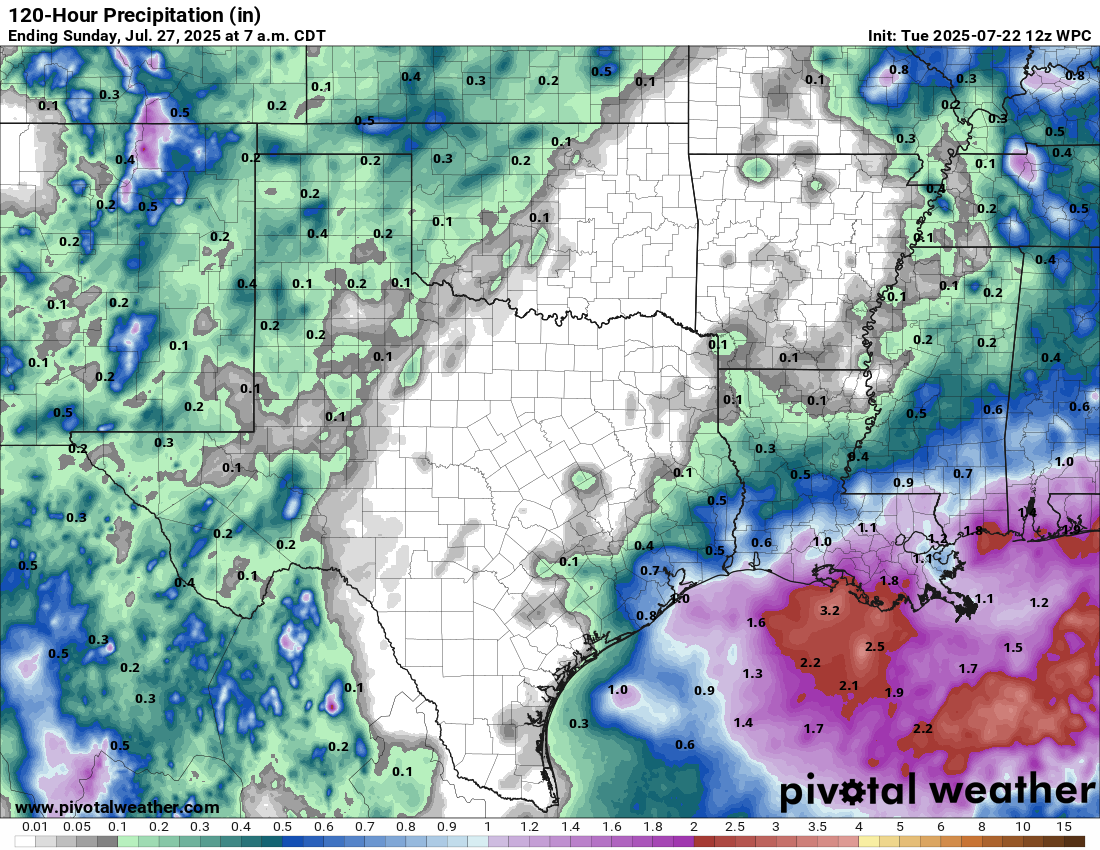
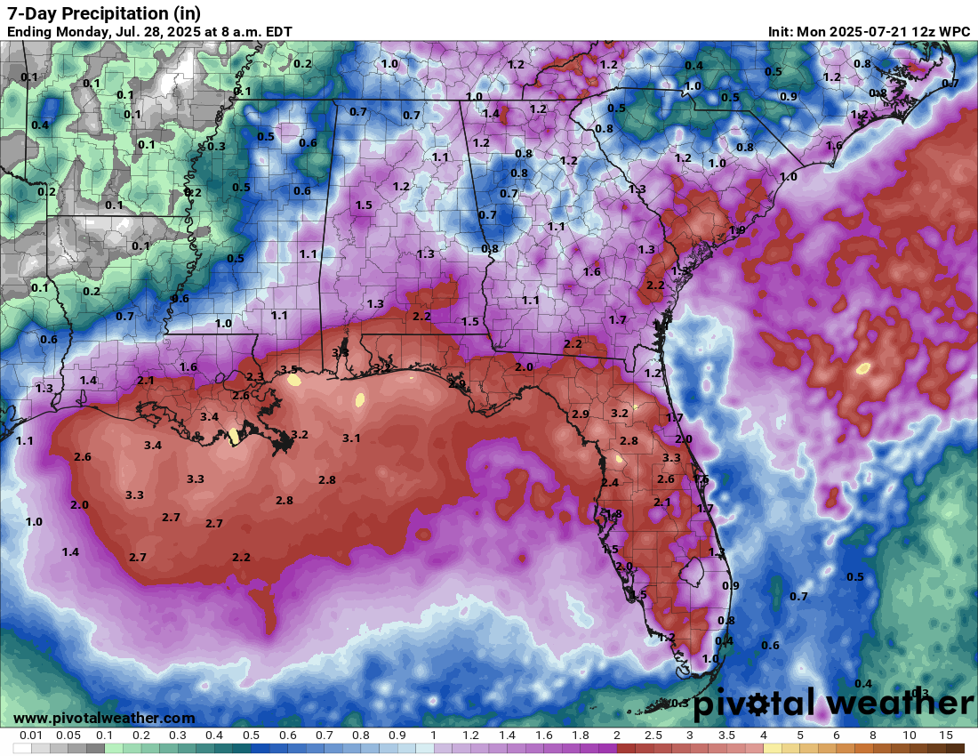
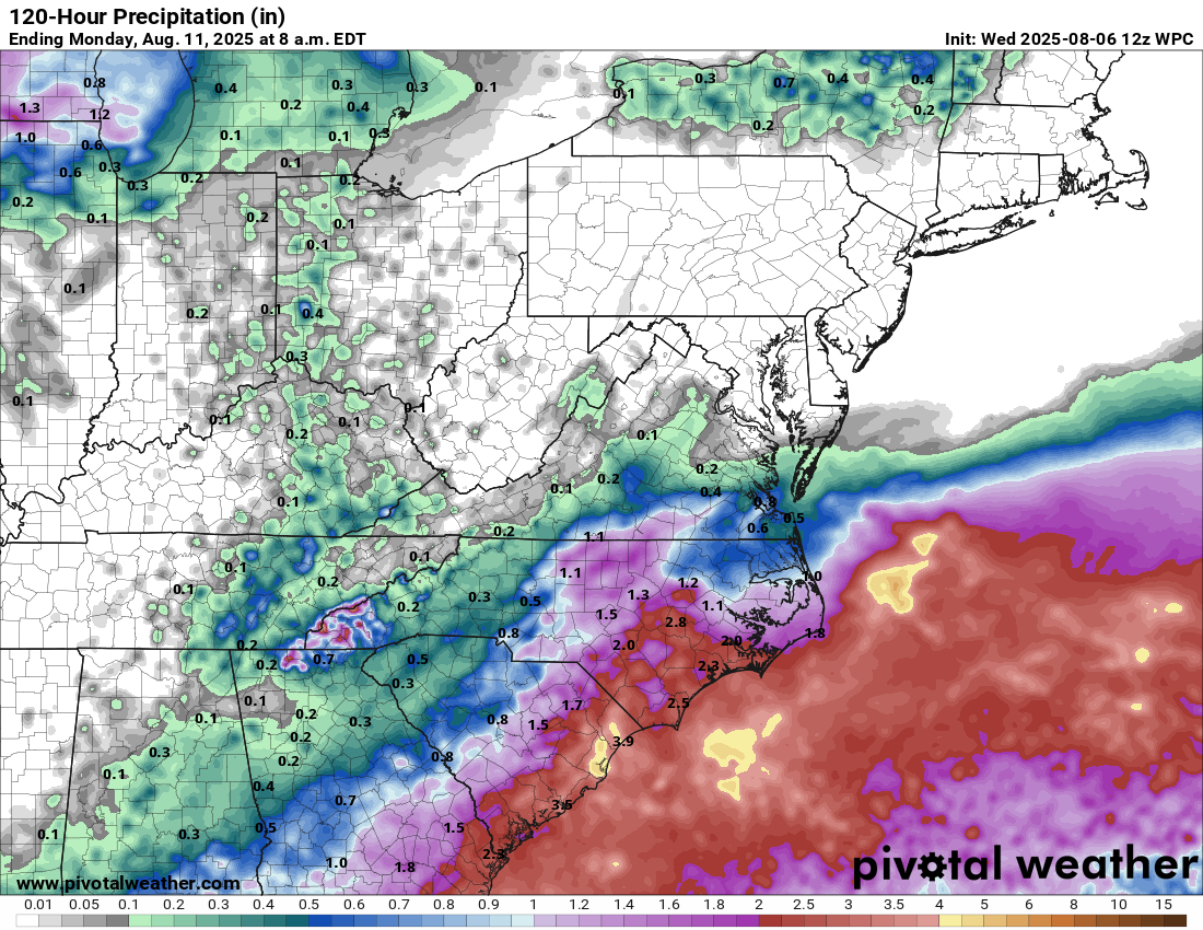
The main impact from this system, whether it develops or not, will be locally heavy rainfall and rip currents. Rainfall totals of 2 to 4 inches look likely along the immediate coasts of North Carolina and South Carolina from Thursday through Sunday.
Forecast Rainfall Totals From Thursday Through Sunday:
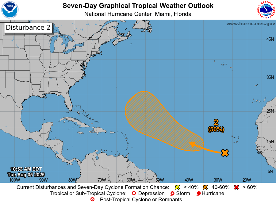
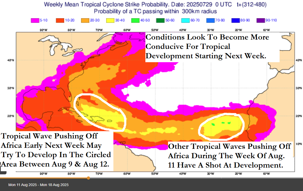
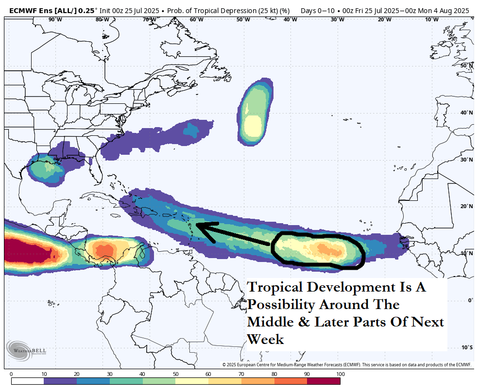
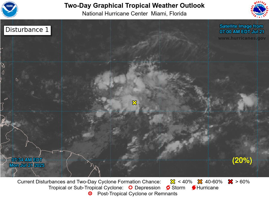
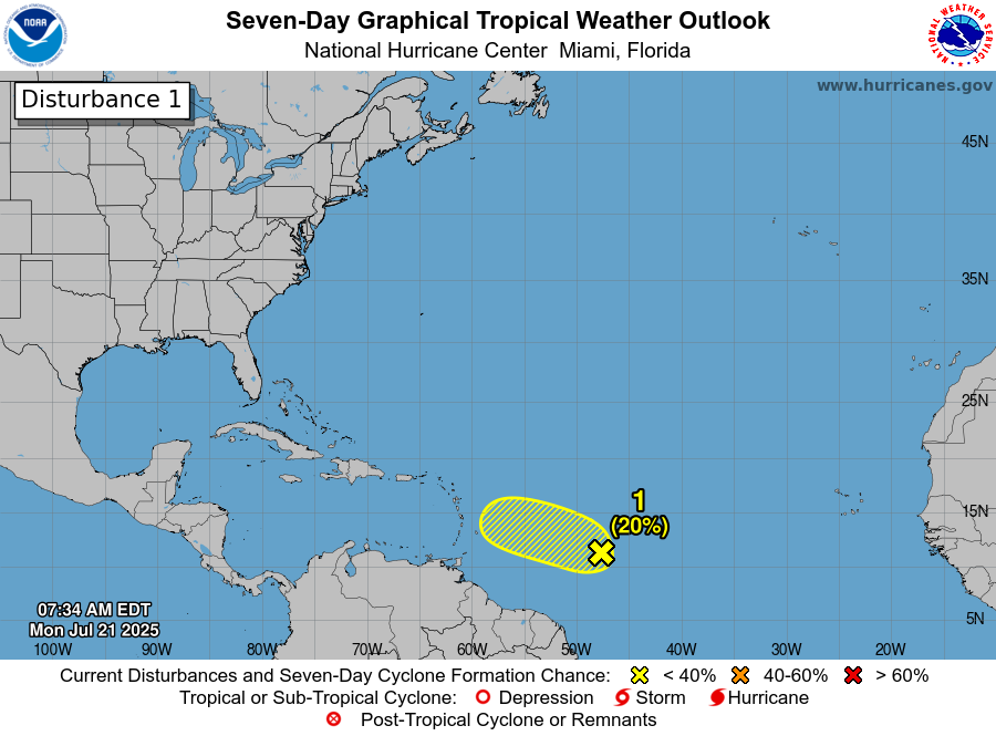
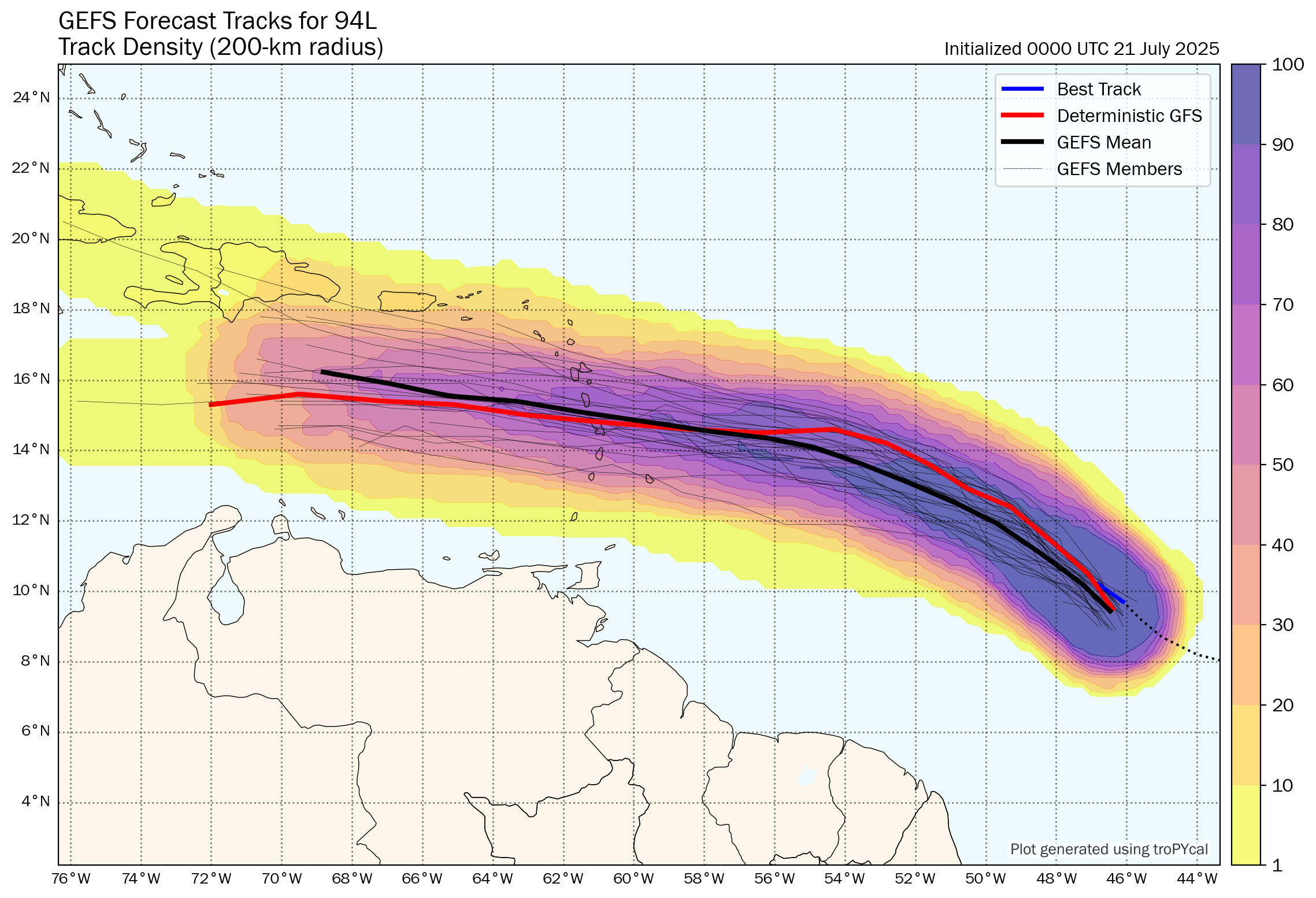
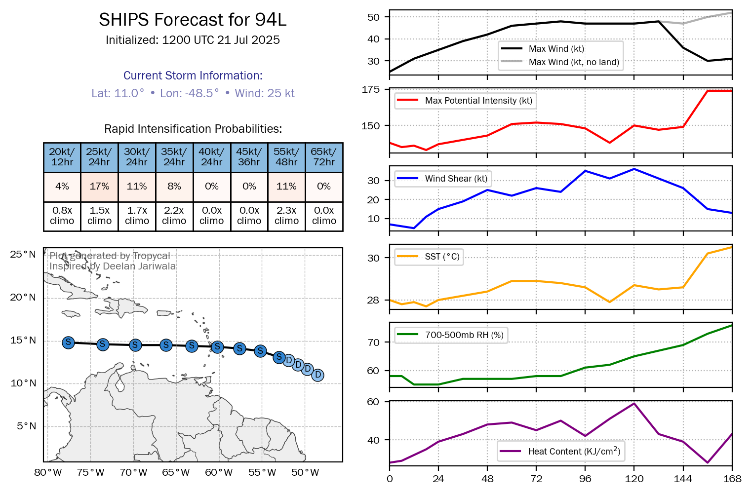
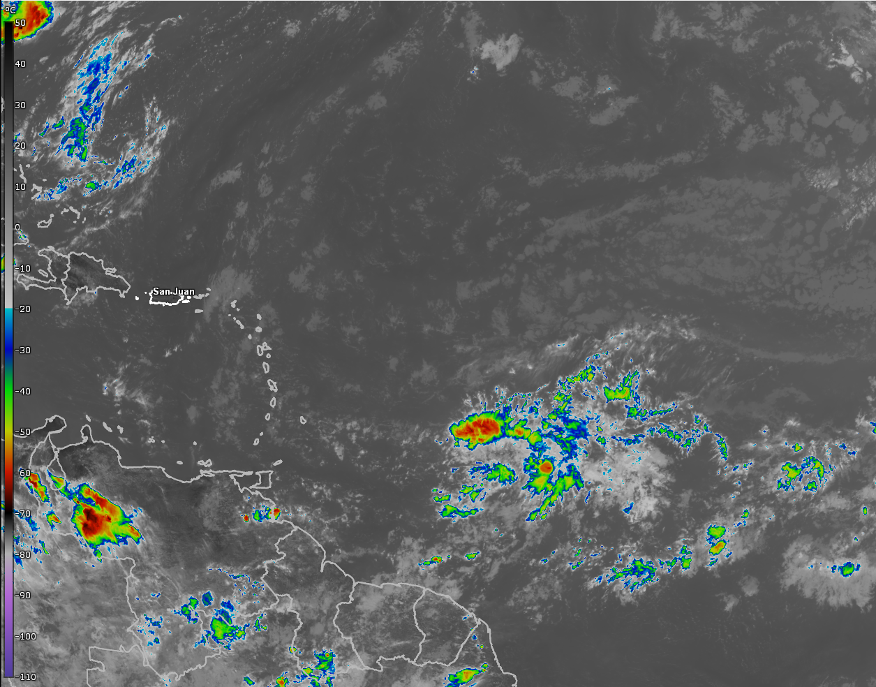
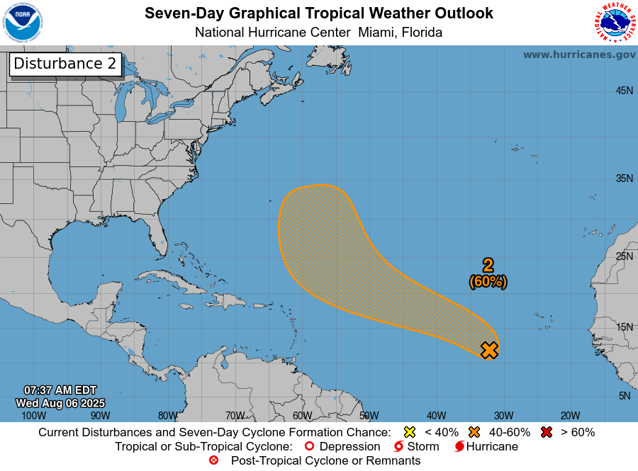
A Tropical Wave Over The Eastern Tropical Atlantic May Develop Into A Tropical System In The Central Tropical Atlantic Late This Week Or This Weekend: Satellite imagery today showed that a tropical wave located over the eastern Tropical Atlantic near about 33 West Longitude is producing disorganized convection.
It seems likely that we will see slow development of this tropical wave as it moves in a west-northwest to northwest direction. Because of this slow development, it seems possible that this wave will develop into a depression or even a tropical storm by this weekend.
All guidance seems to now point to this system curving to the northwest and north well before it reaches the Lesser Antilles. The reason for this is due to a weakness in a high pressure ridge over the central Atlantic that’ll allow this system to turn northward before it’s able to be steered by a strong western Atlantic high pressure ridge.
Most guidance are pointing to this system staying to the east of Bermuda during the first half of next week. That said, interests in Bermuda should keep an eye on this particular wave, in case it tracks just far enough west to be an issue.
Bottom line is that this wave, whether it develops or not, poses no threat at all to the Lesser Antilles, the Caribbean, the Bahamas or the United States.
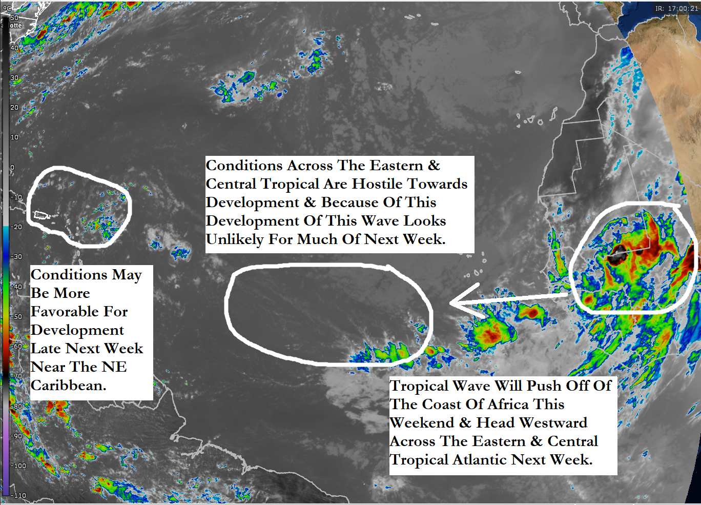
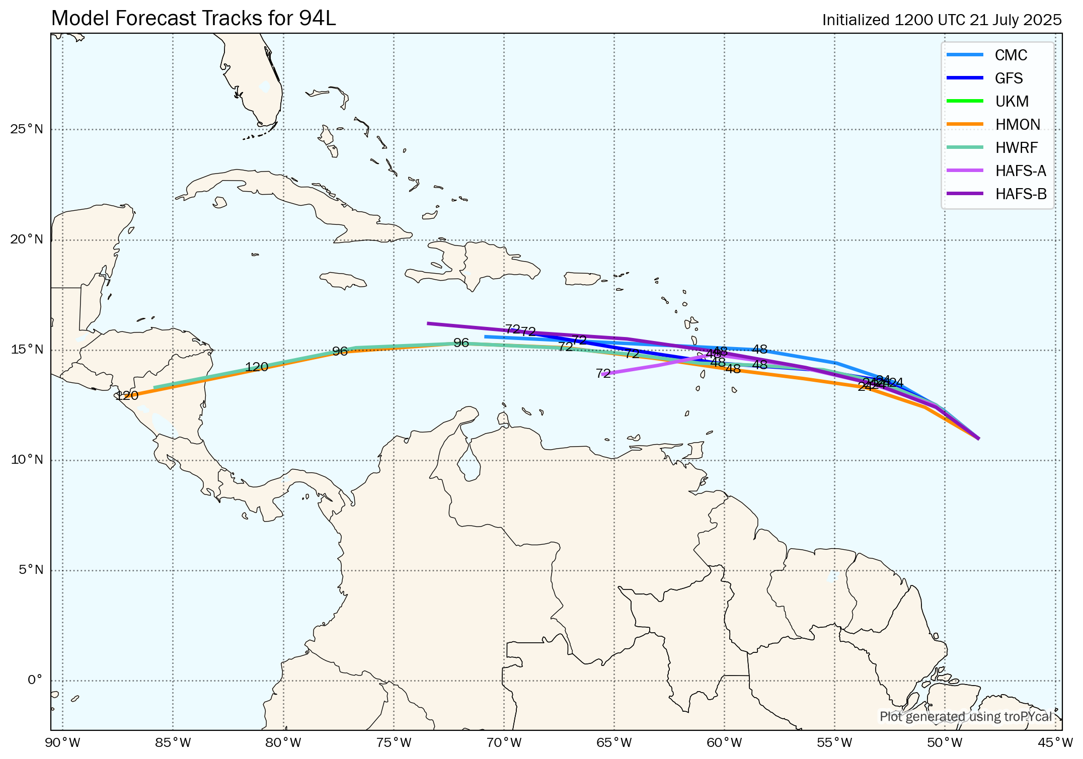
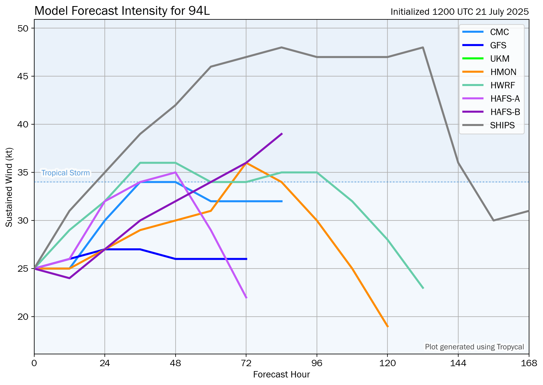
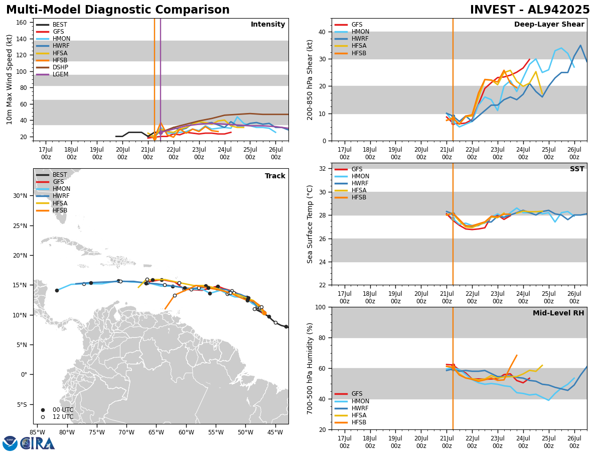
Another Tropical Wave Pushing Off Of The Coast Of Africa By This Weekend Could Be Trouble: I think that we are going to have to keep very close tabs on a tropical wave that’ll be pushing off of the coast of Africa by the end of this week or early this weekend as it could end up being a real big trouble maker.
The weather pattern for this weekend through next week is expected to consist of a strong high pressure ridge which will guide this system due westward next week towards the Caribbean or the southwestern North Atlantic where conditions are expected to be favorable for development.
Model guidance such as the GFS and the European models are pointing towards this system to impact the Lesser Antilles between Wednesday and Friday of next week. Beyond this, guidance seems to suggest diverging forecast tracks with some ensemble members showing a track from east-southeast to west-northwest across the Caribbean. Other ensemble members suggest a track towards the Bahamas by late next week and next weekend.
At this point, it would be pure speculation to say where exactly this wave will track or how strong it could become. As I mentioned yesterday, the steering winds next week will likely steer this wave due westward & this could very well put the Lesser Antilles at risk of seeing a tropical system between about Wednesday and Friday of next week.
My recommendation to those of you in the Lesser Antilles is to closely monitor the progress of this particular tropical wave once it splashes down in the eastern Atlantic around Friday or Saturday.
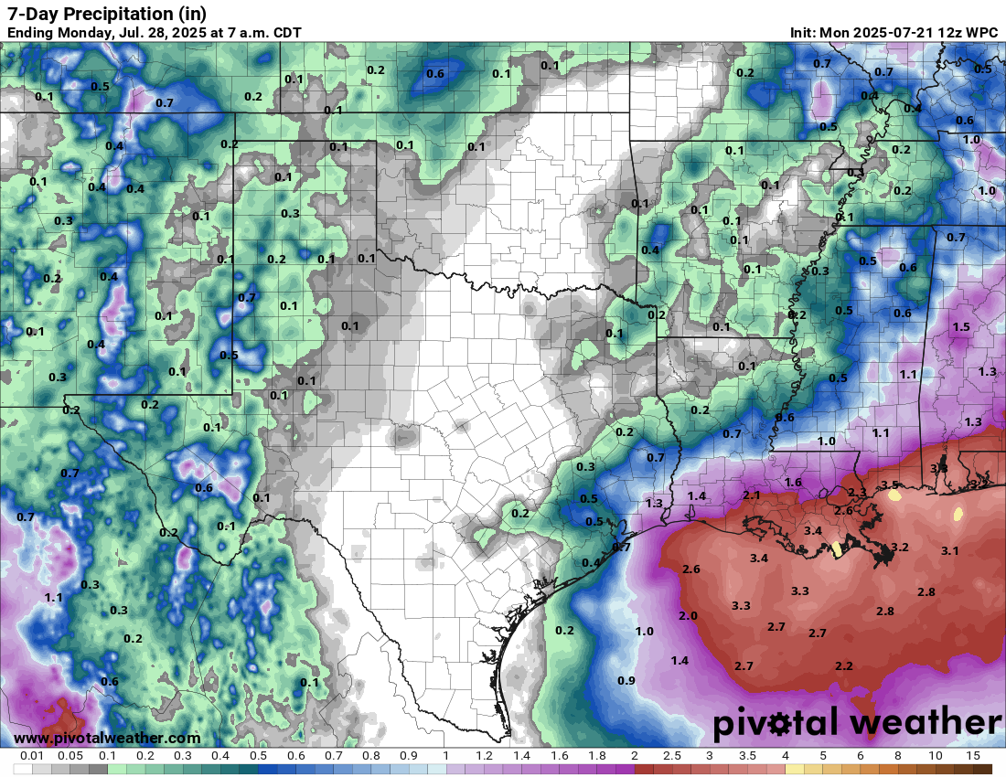
Eastern Gulf Low Pressure Development Possible This Weekend: Satellite imagery and weather analysis indicated that there is a trough of low pressure located over the Bahamas today. While there is no low or mid-level spin with this system, the environmental conditions are favorable for development.
It is expected that this low pressure trough will move westward reaching the southeastern Gulf by late Thursday or Friday where it might need to be watched for signs of development.
Some of the model guidance do show a low pressure center forming from this trough that moves northward across the eastern Gulf this weekend reaching the northeastern Gulf coast by about Monday.
Overall, I think that the chances of tropical development of any low pressure system that forms over the eastern Gulf this weekend is around 20-30 percent or so.
One thing that this system will do, whether it develops or not, is to bring a wet several days to the central and eastern Gulf coast from later today right through this weekend.
I will be keeping an eye on this system and will have updates as needed.
The next tropical weather discussion will be issued on Friday.