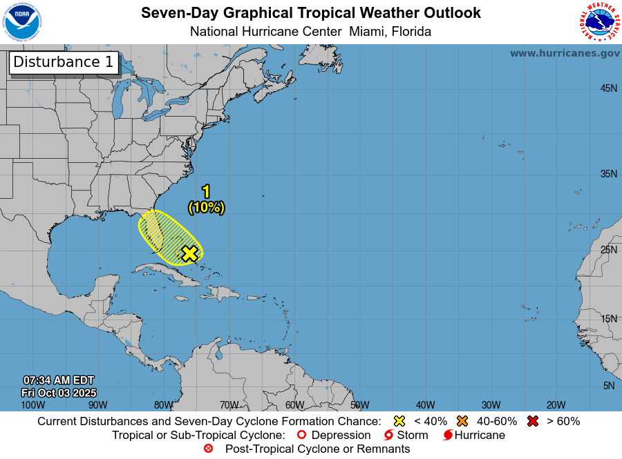
A Strong Coastal Storm Is Expected This Weekend From Coastal North Carolina To Southern New England: A strong cold front is currently pushing through the Southeastern United States & likely will make it as far south as the Florida Peninsula over the next day or two. This front will set up a strong temperature gradient along it and help to develop a low pressure that forms offshore of Florida’s East Coast by late Friday.
As we get into Saturday, it is expected that the coastal storm system will be located just offshore of the South Carolina and North Carolina coasts. This low pressure system will create gusty winds and heavy rain across eastern North Carolina and northeastern South Carolina during the day on Saturday.
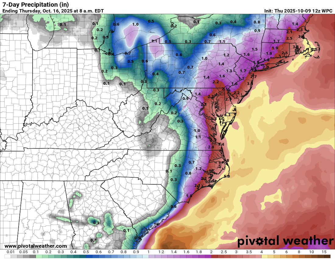
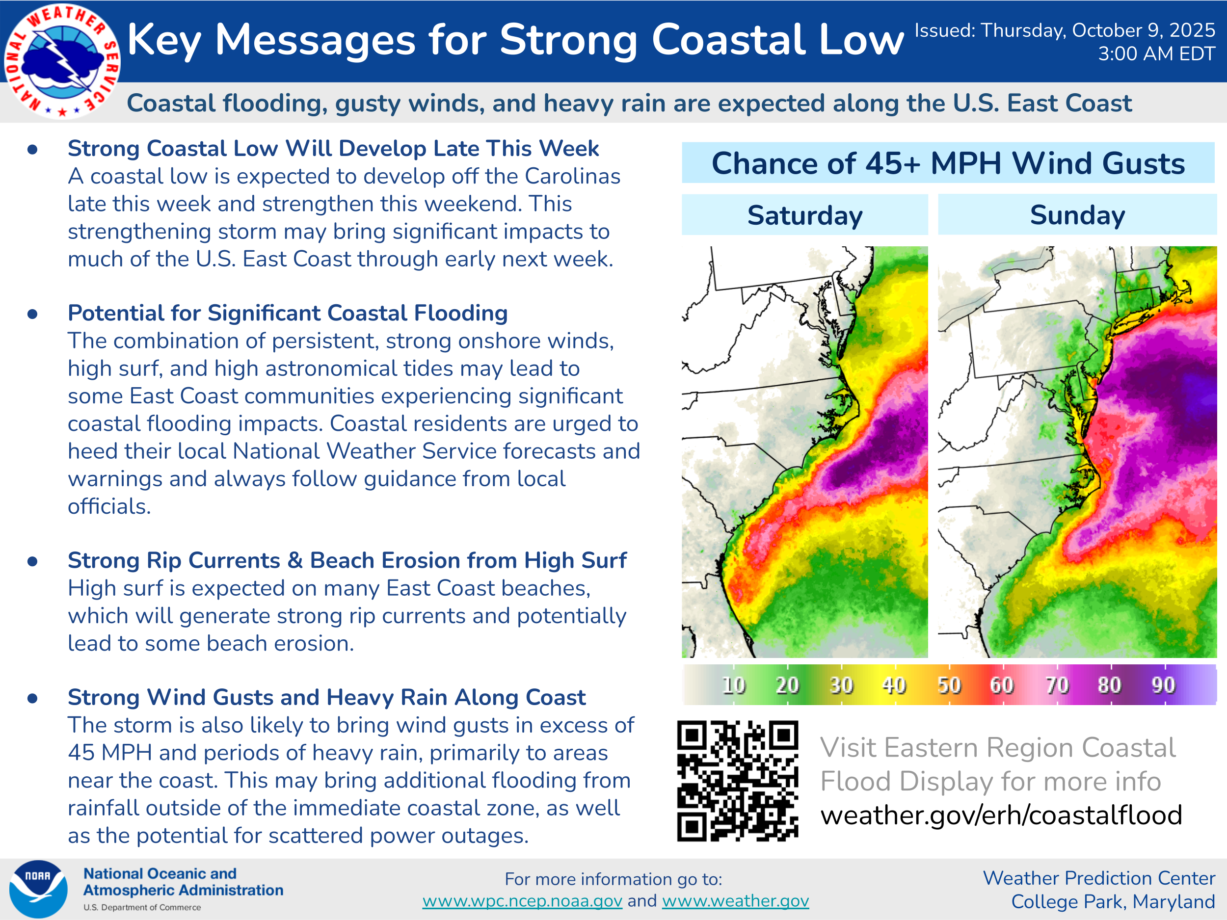
Turning to Saturday night and Sunday, strong onshore winds with gusts of 50-60 mph can be expected along the North Carolina Outer Banks and across the Tidewater of Virginia. Moderate to major coastal flooding is likely at the time of high tide along the North Carolina Outer Banks and across the Tidewater of Virginia during Saturday night and Sunday. Additionally, major coastal flooding is also very possible across the lower Chesapeake Bay on Saturday night and Sunday.
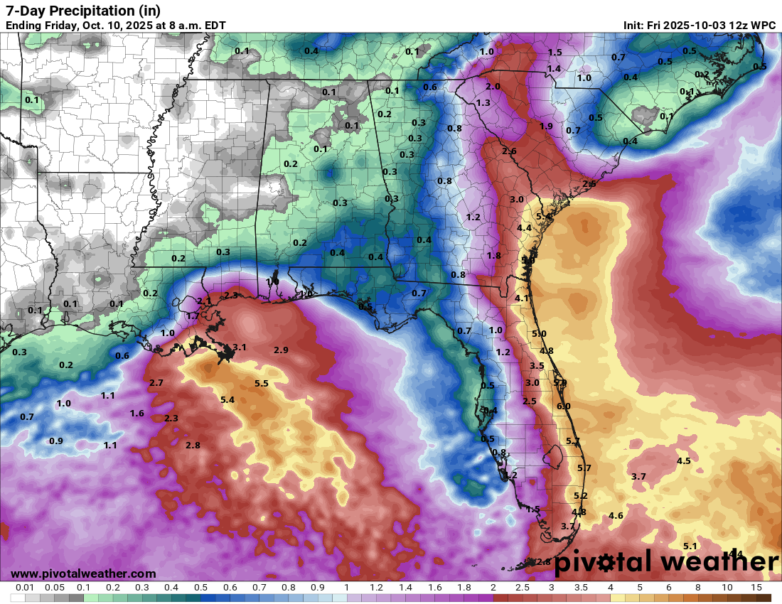
Additionally, during the day on Sunday, that low pressure system is likely to strengthen even more as it tracks northward reaching coastal parts of Virginia . This will lead to heavy rain, wind gusts of up to 60 mph, moderate to major coastal flooding, beach erosion and very high surf to occur from the Outer Banks of North Carolina and points north, including the Tidewater of Virginia, Chesapeake Bay, the Jersey Shore, Long Island and Southern New England.
Significant impacts from this storm are likely to last through Monday into Tuesday from the Jersey Shore and Long Island through Southern New England before the low pressure system weakens and heads out into the open Atlantic.
It should be noted that this storm system will start its life as a non-tropical storm on Friday and Saturday. It’s possible though that this storm system could acquire some characteristics of a hybrid sub-tropical type storm as we get into Sunday and Monday. If this occurs and we do see a sub-tropical storm form from this system, it would get a name (Karen). Whether this storm becomes a sub-tropical storm or remains a non-tropical storm, its impacts from the North Carolina coastline to Southern New England will be the same.
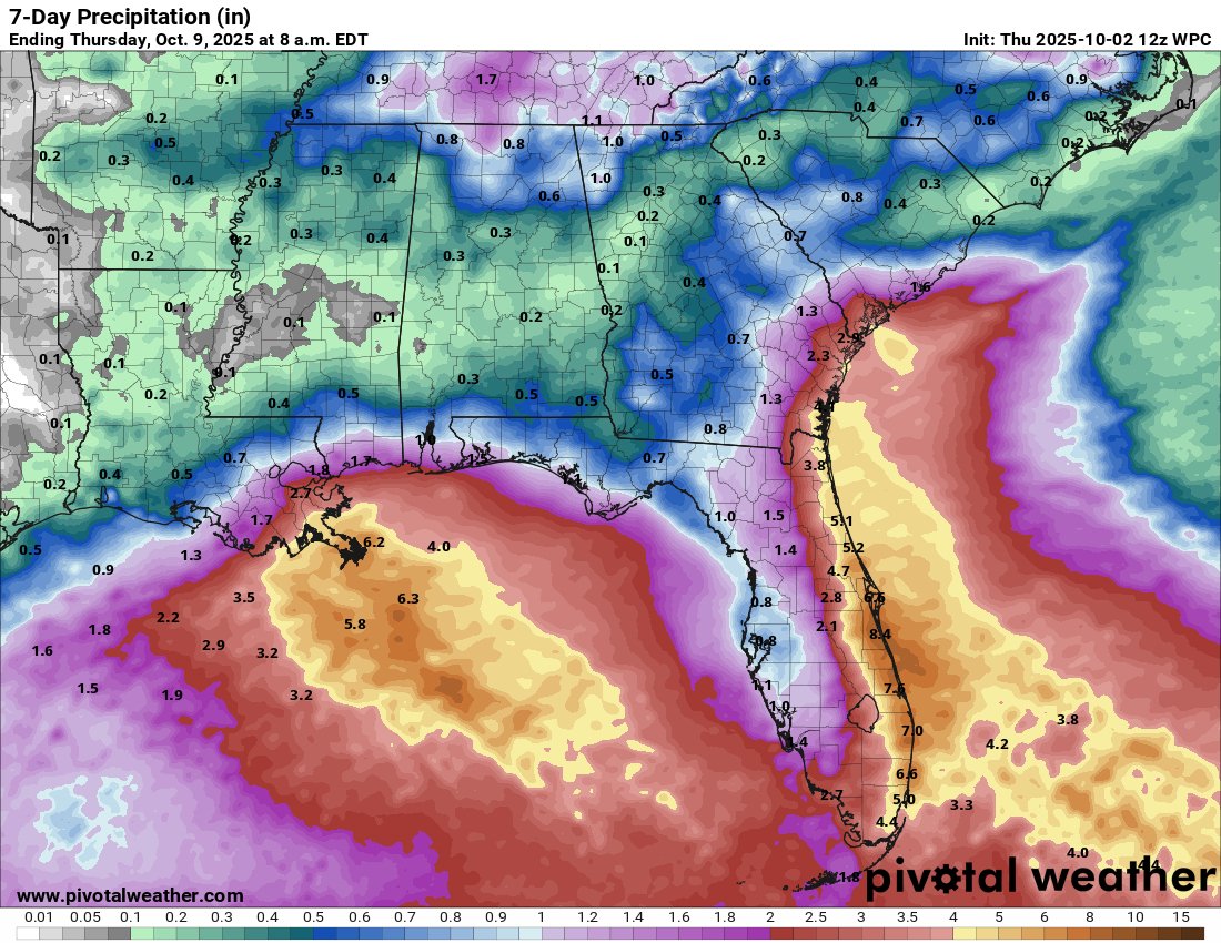
Bottom Line Is That this is expected to be a long-duration coastal storm & because of this, there will be significant coastal impacts in the way of coastal flooding over multiple high tide cycles from the North Carolina Outer Banks to Southern New England. Additionally, heavy rainfall with amounts of 2 to 4 inches and strong onshore winds with gusts of 50-plus mph can be expected along the coast from the North Carolina coast to Southern New England can be expected.
Everyone from eastern North Carolina through the Mid-Atlantic states to Southern New England need to keep very close tabs on this storm and be ready for a long-duration storm that lasts 2 to 3 days or so.
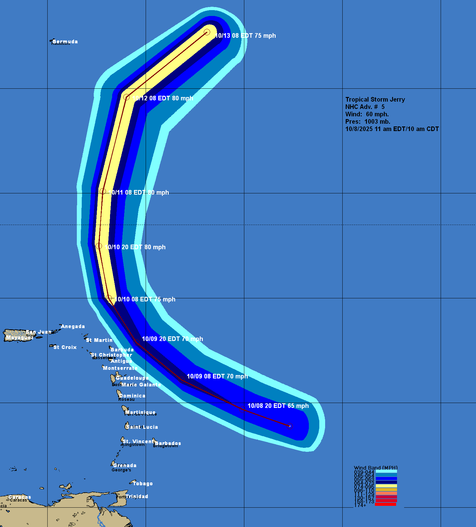
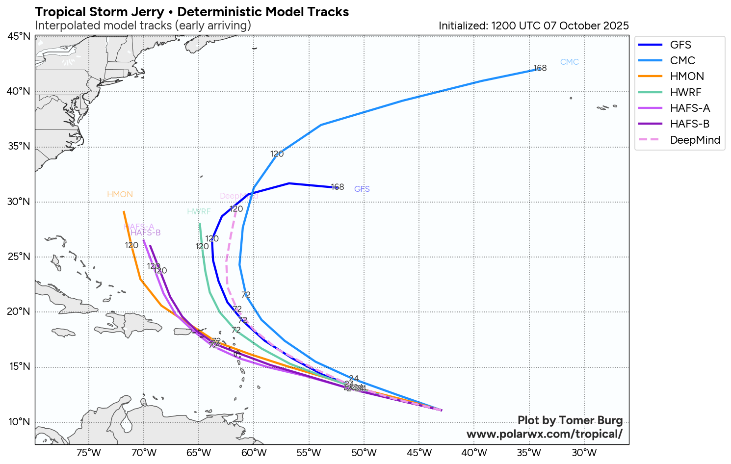
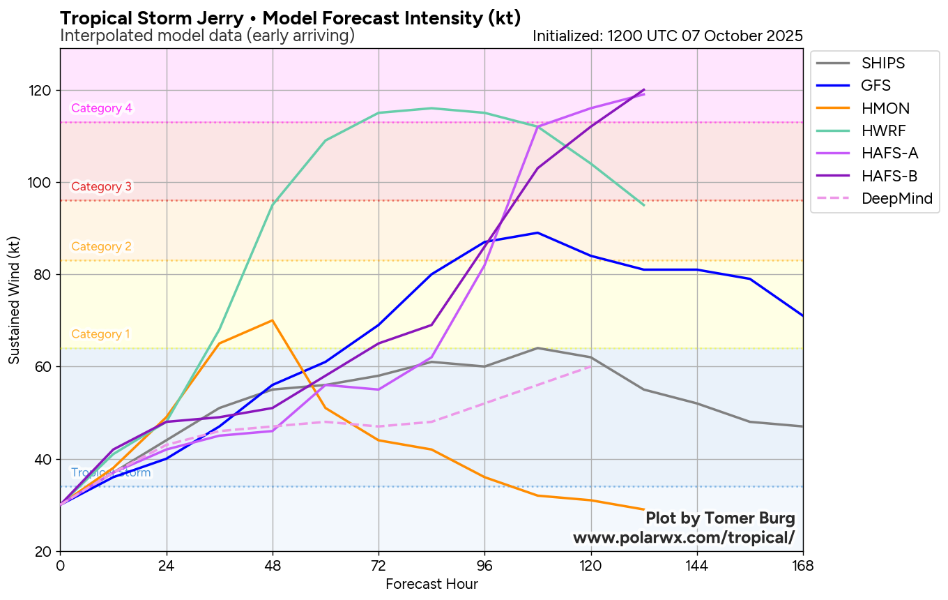
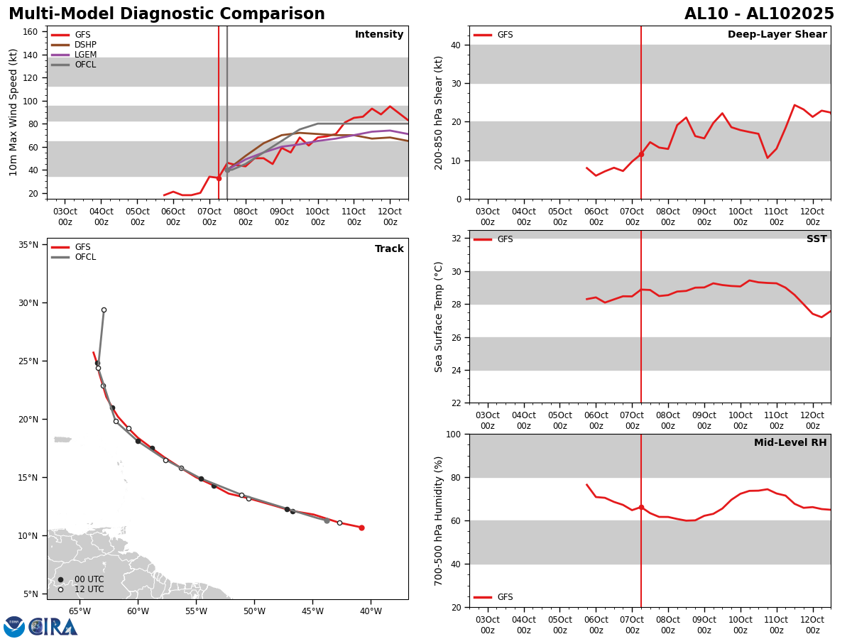
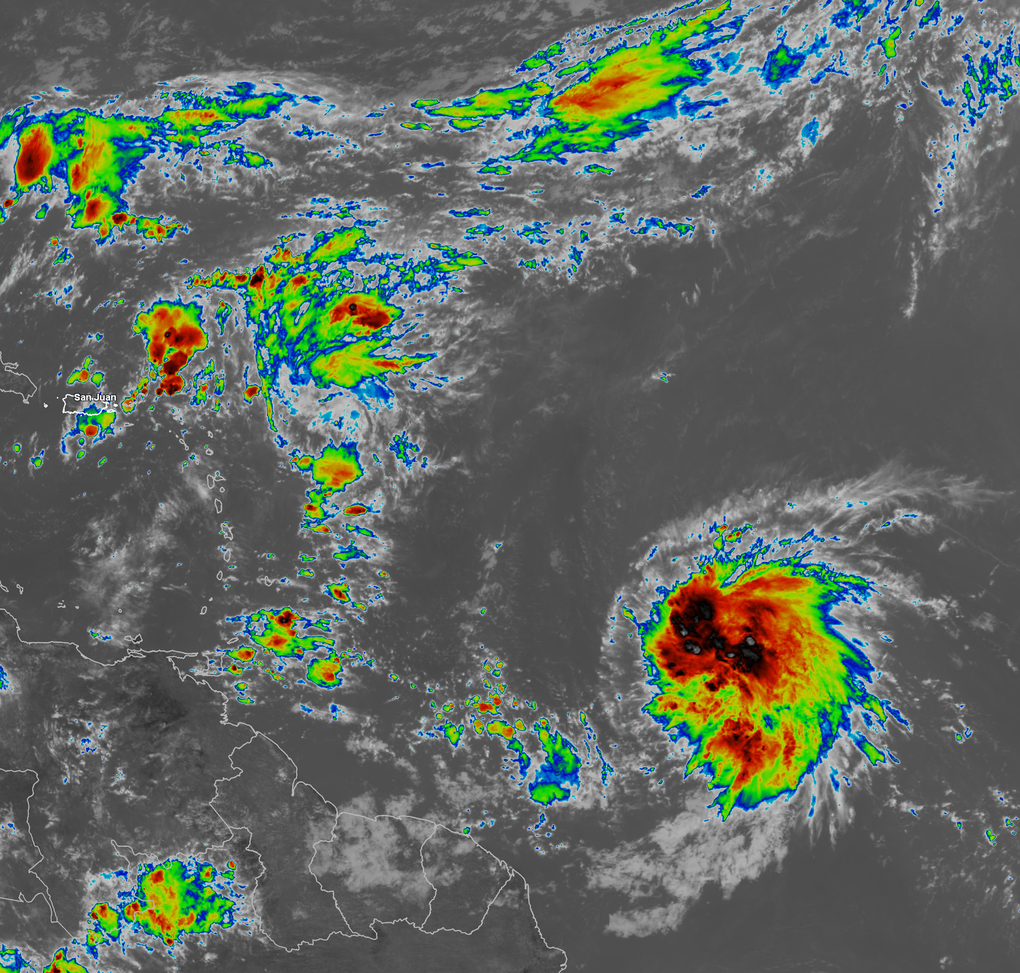
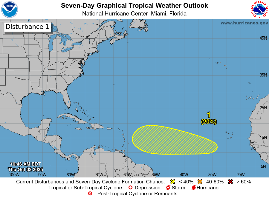
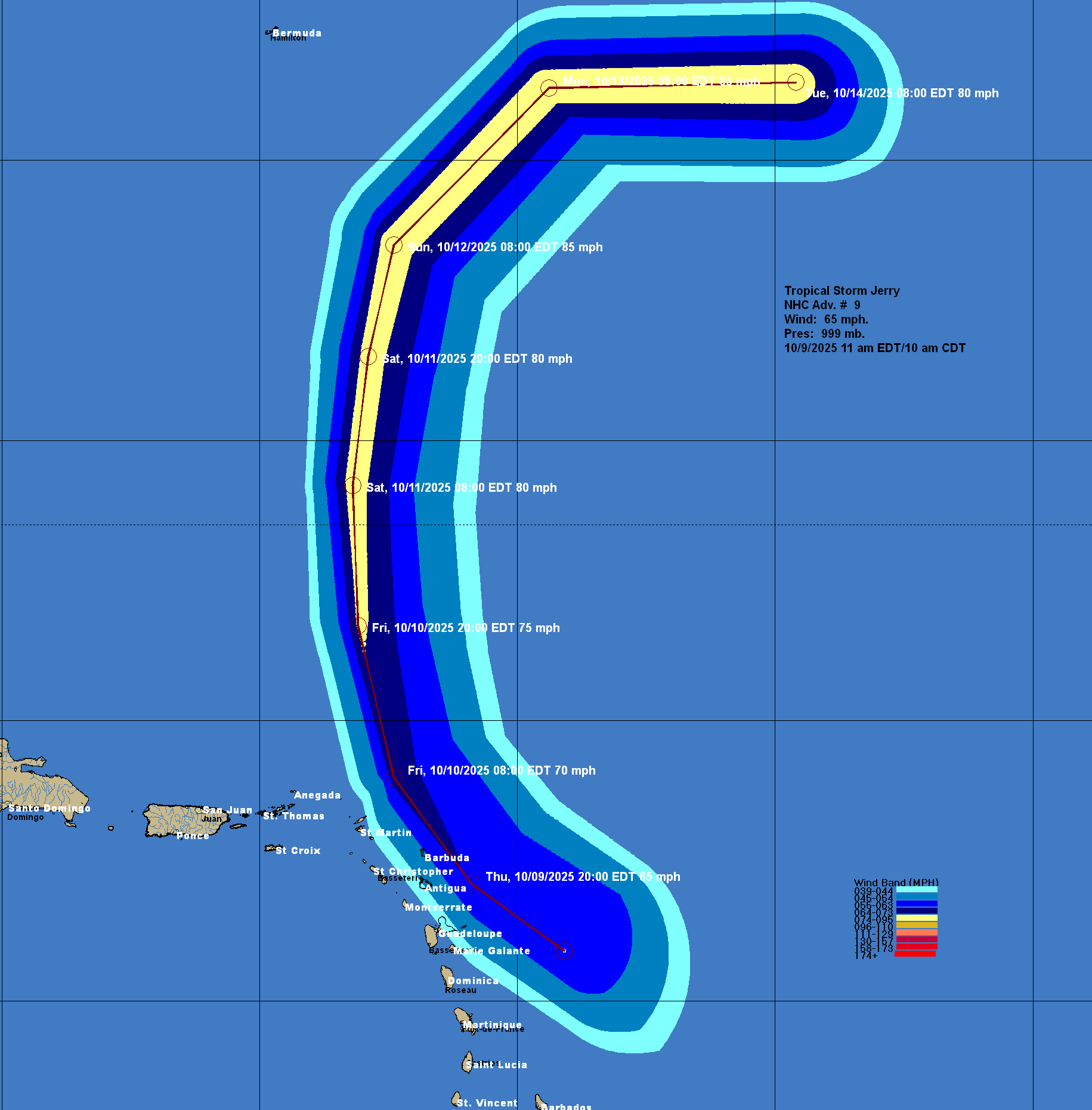
Tropical Storm Jerry: Jerry is still a lopsided and rough looking tropical storm today. Most of the strong winds and deep convection are found on the eastern side of the storm. Still though, reconnaissance aircraft have found that Jerry has winds of up to 65 mph.
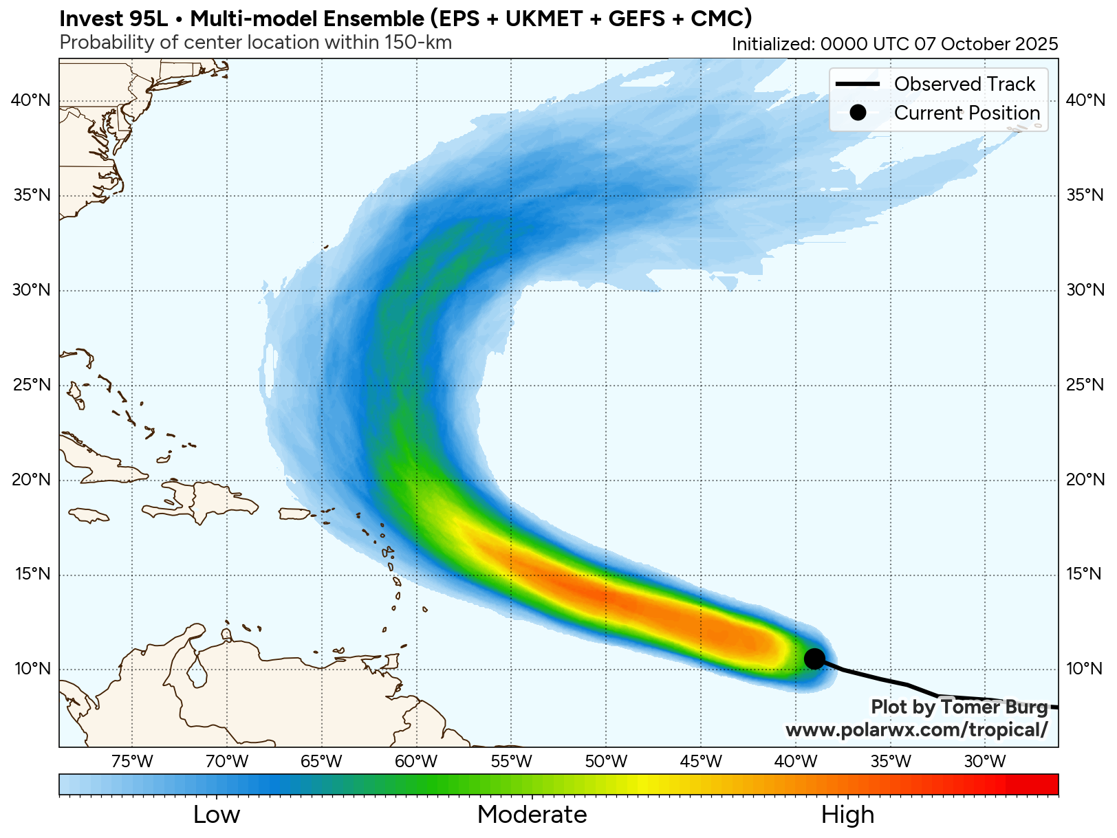
It now looks like that Jerry will head a little closer to parts of the Leeward Islands as compared to what was forecast just yesterday. Because of this, the islands of Antigua and Barbuda are very likely to see tropical storm conditions starting later this afternoon and continuing through tonight. Those of you on the islands of Antigua and Barbuda should be ready for tropical storm conditions.
Elsewhere across the Leeward Islands, Jerry should pass just barely far enough east to miss the rest of the Leeward Islands with tropical storm force winds. That said, any further west shifts in the track of Jerry would put tropical storm force winds over St. Martin and Anguilla during tonight into Friday morning. My advice for those of you on the islands of St. Martin and Anguilla is to prepare for tropical storm force winds, just in case.
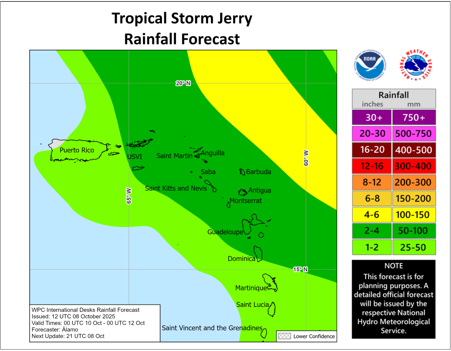
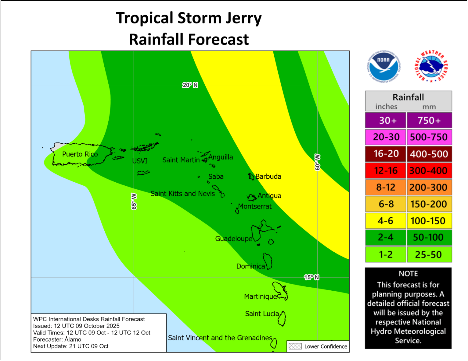
Additionally, a tail of moisture on the backside of Jerry is also expected to impact all of the Leeward Islands and the Virgin Islands leading to squally weather to occur from tomorrow through Saturday. Some of this moisture may also reach as far west as Puerto Rico later Friday into Saturday. Any persistent squally rain bands on the back side of Jerry could lead to localized flooding across the Leeward Islands and Virgin Islands as rain totals of 2 to 5 inches can be expected.
Finally, Jerry does not pose a threat to Bermuda as the storm is expected to turn to the north and northeast well east of the island.
The next tropical weather discussion will be issued on Friday.