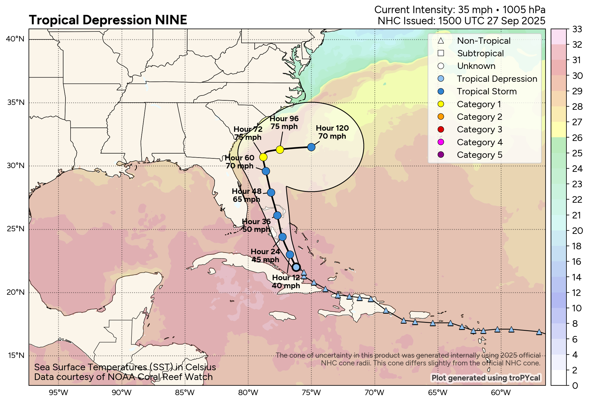
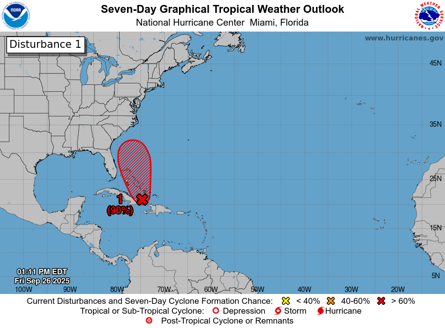
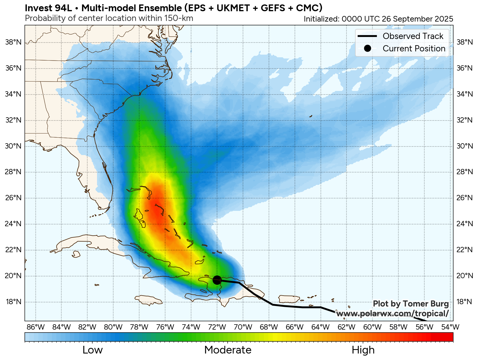
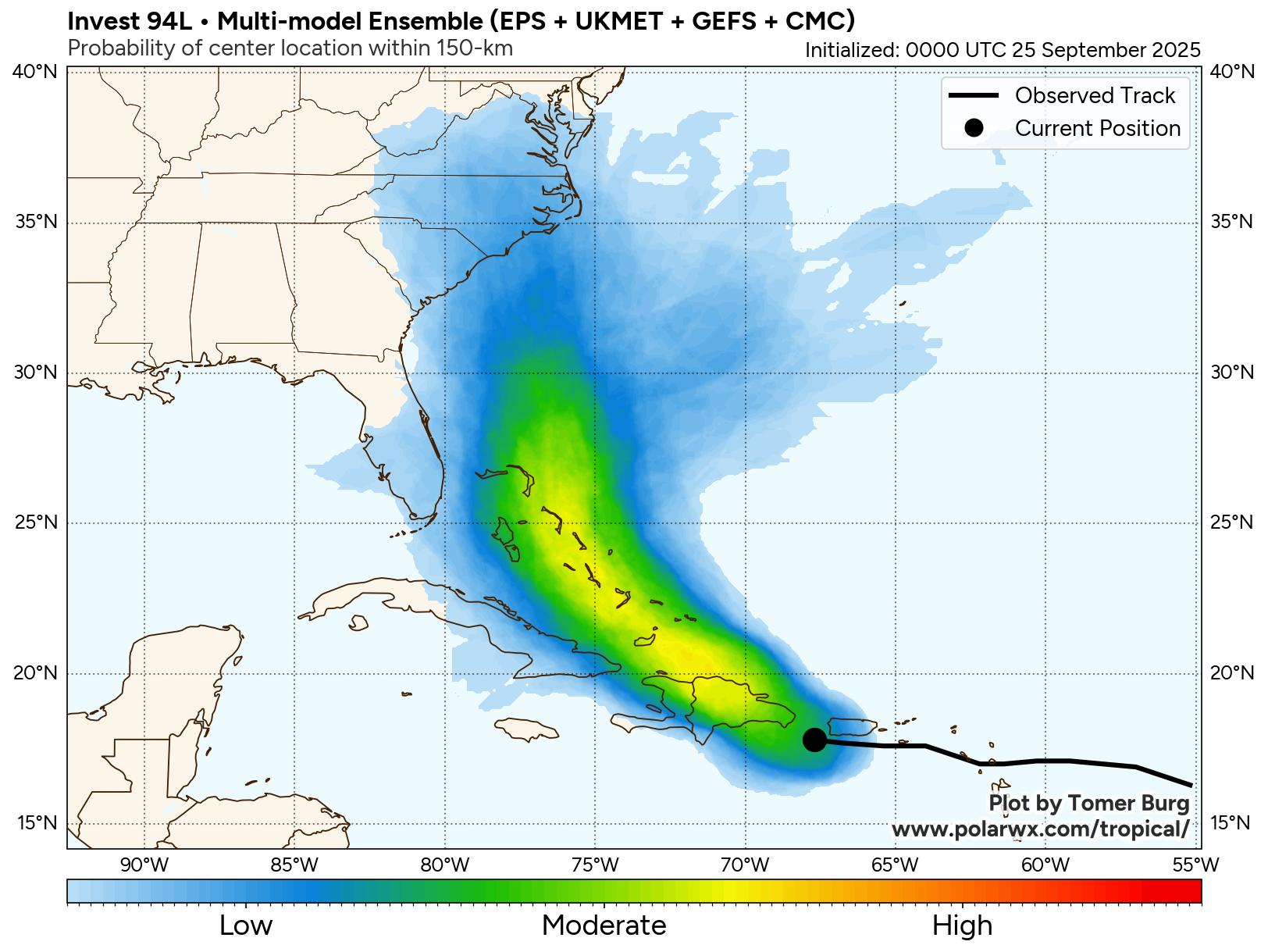
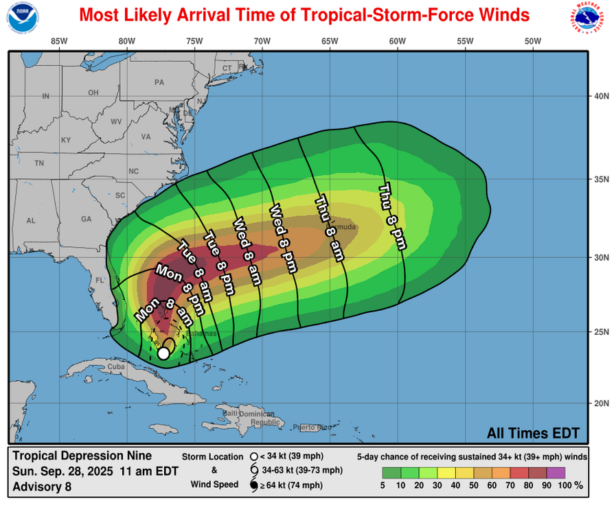
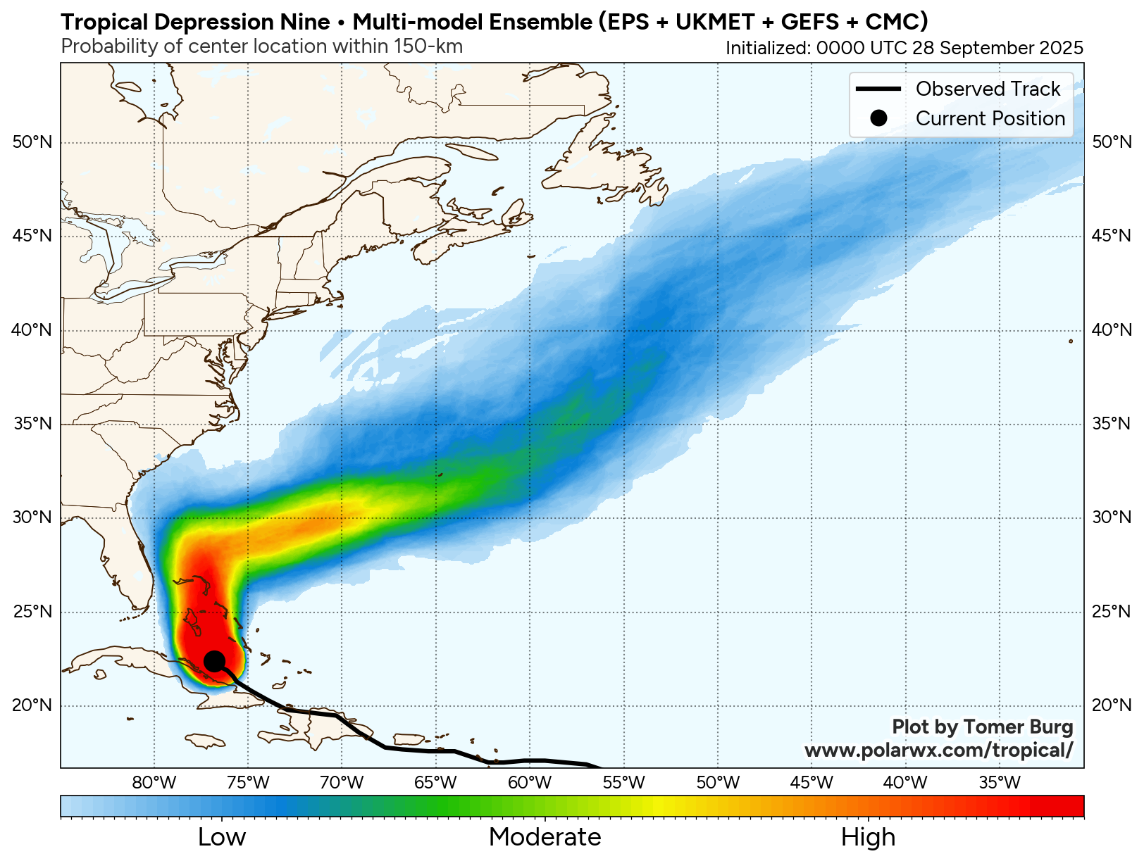
Tropical Depression #9 (Future Imelda): It is looking much more likely today that Future Imelda will turn sharply to the east as we get into Monday and Tuesday and thus head away from the Southeastern United States. This is, obviously, great news for the Carolinas as the impacts from the storm will be much, much less than what was anticipated even a day or two ago.
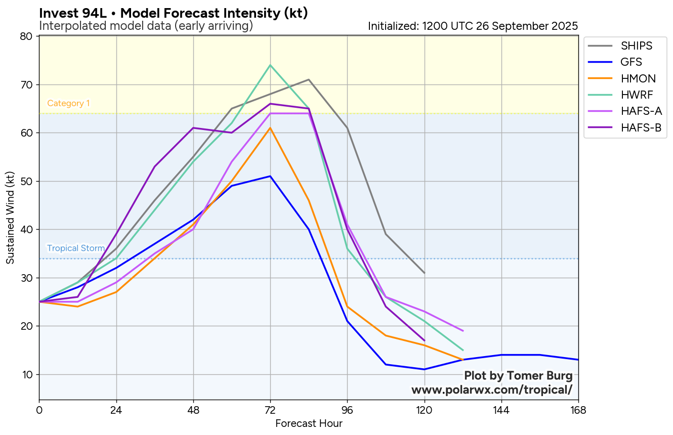
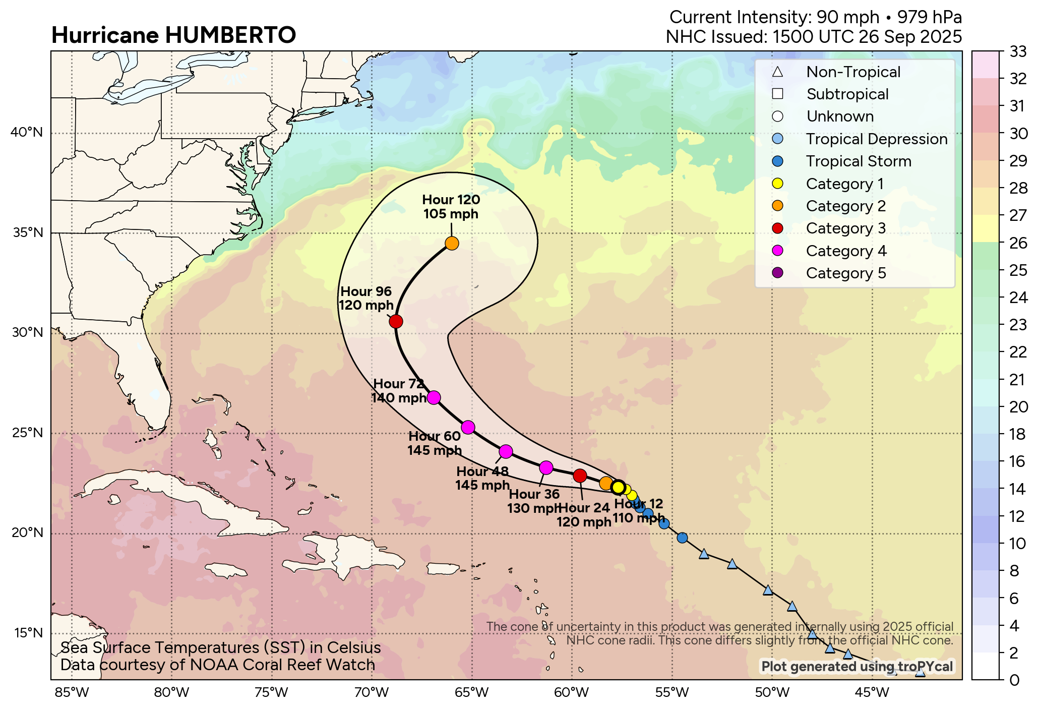
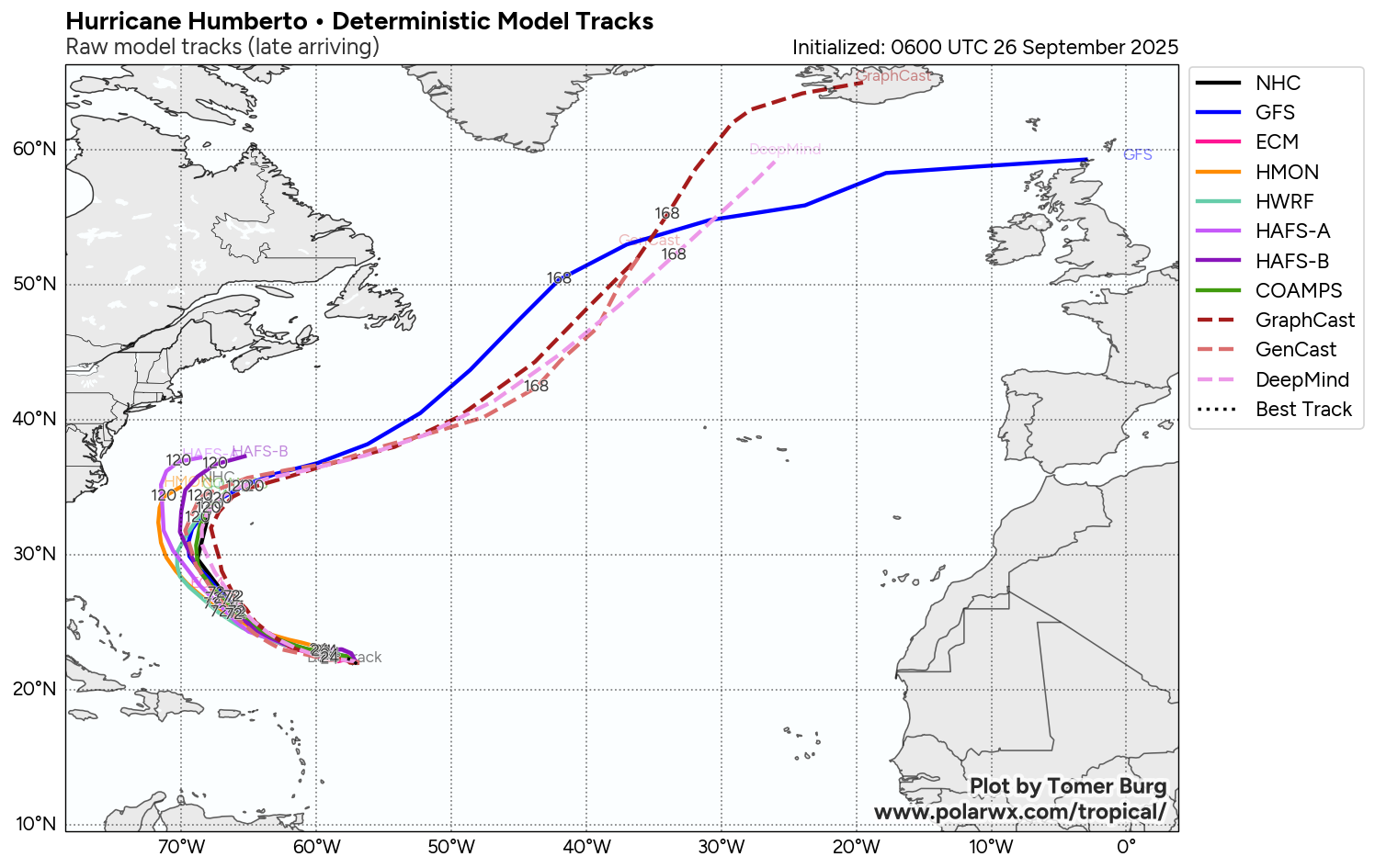
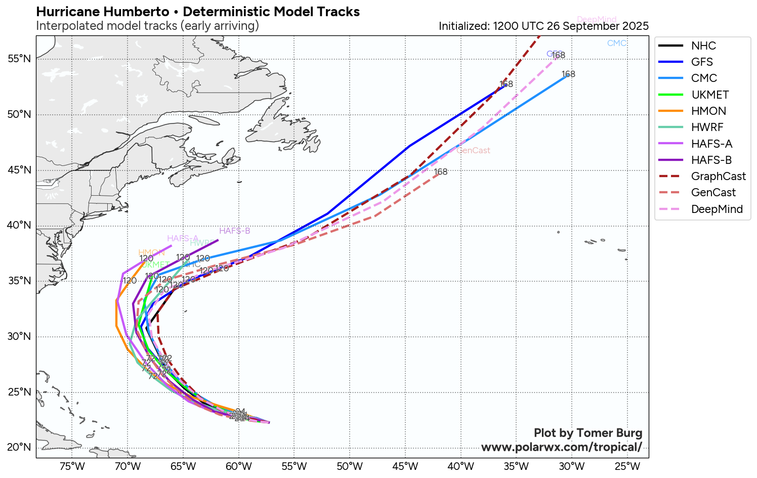
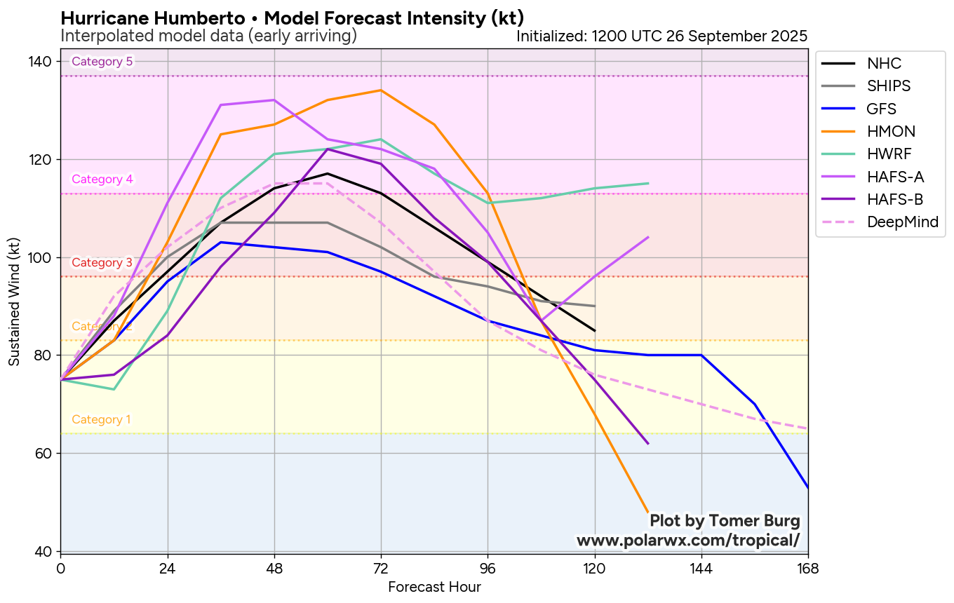
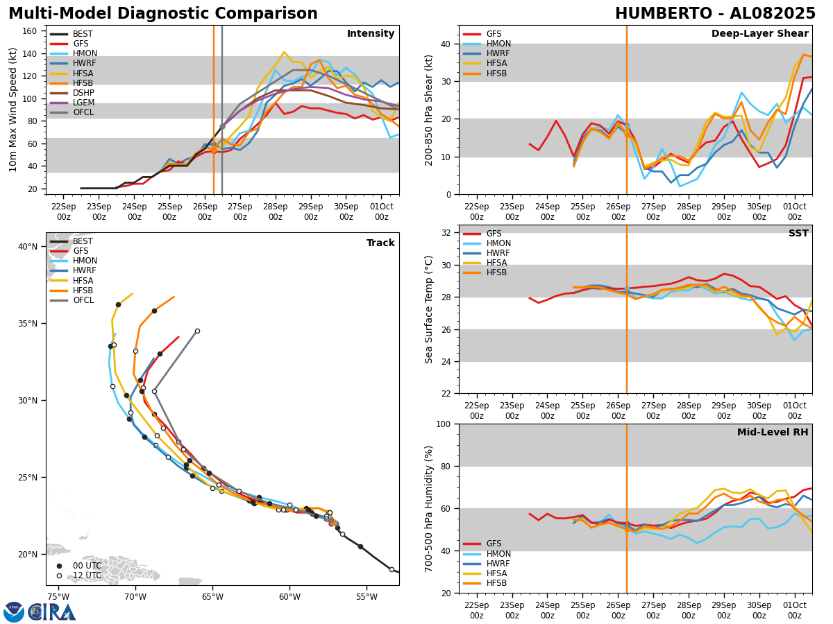
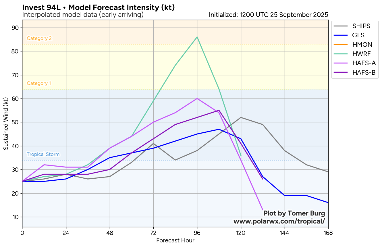
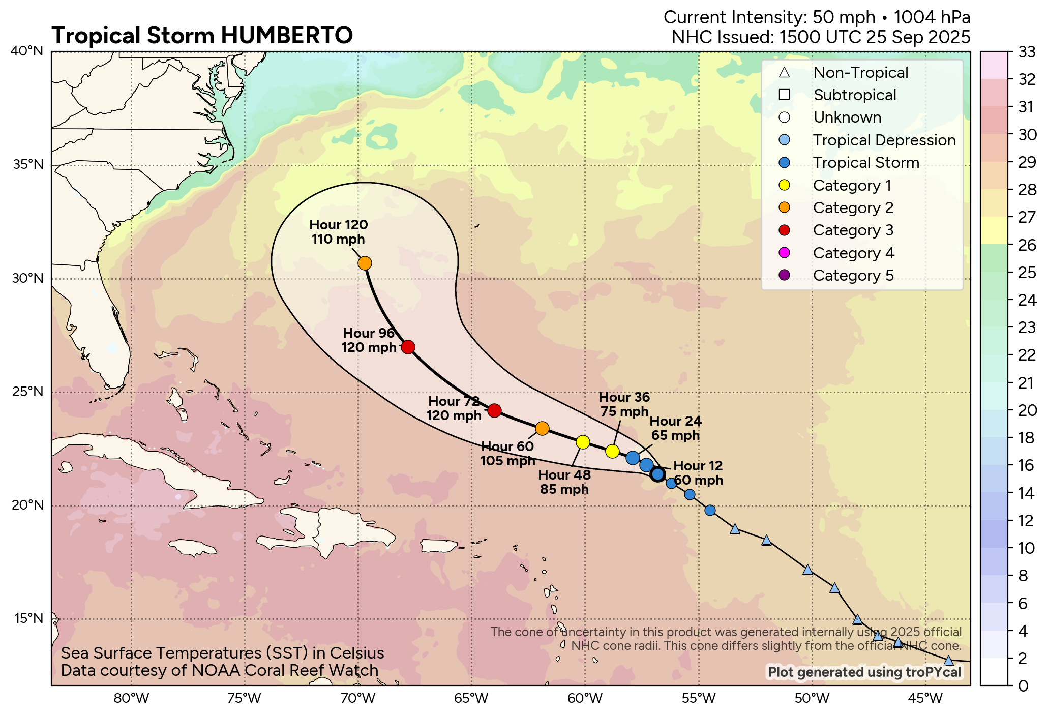
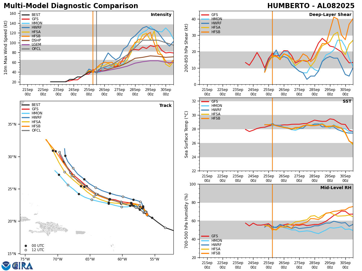
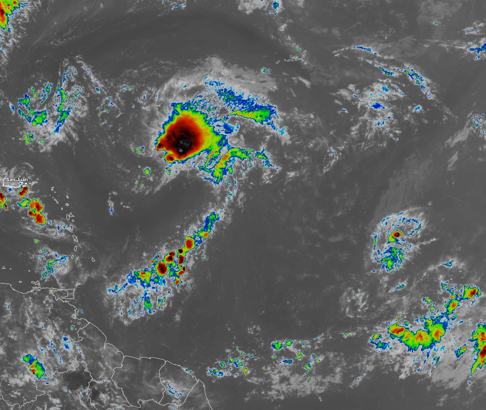
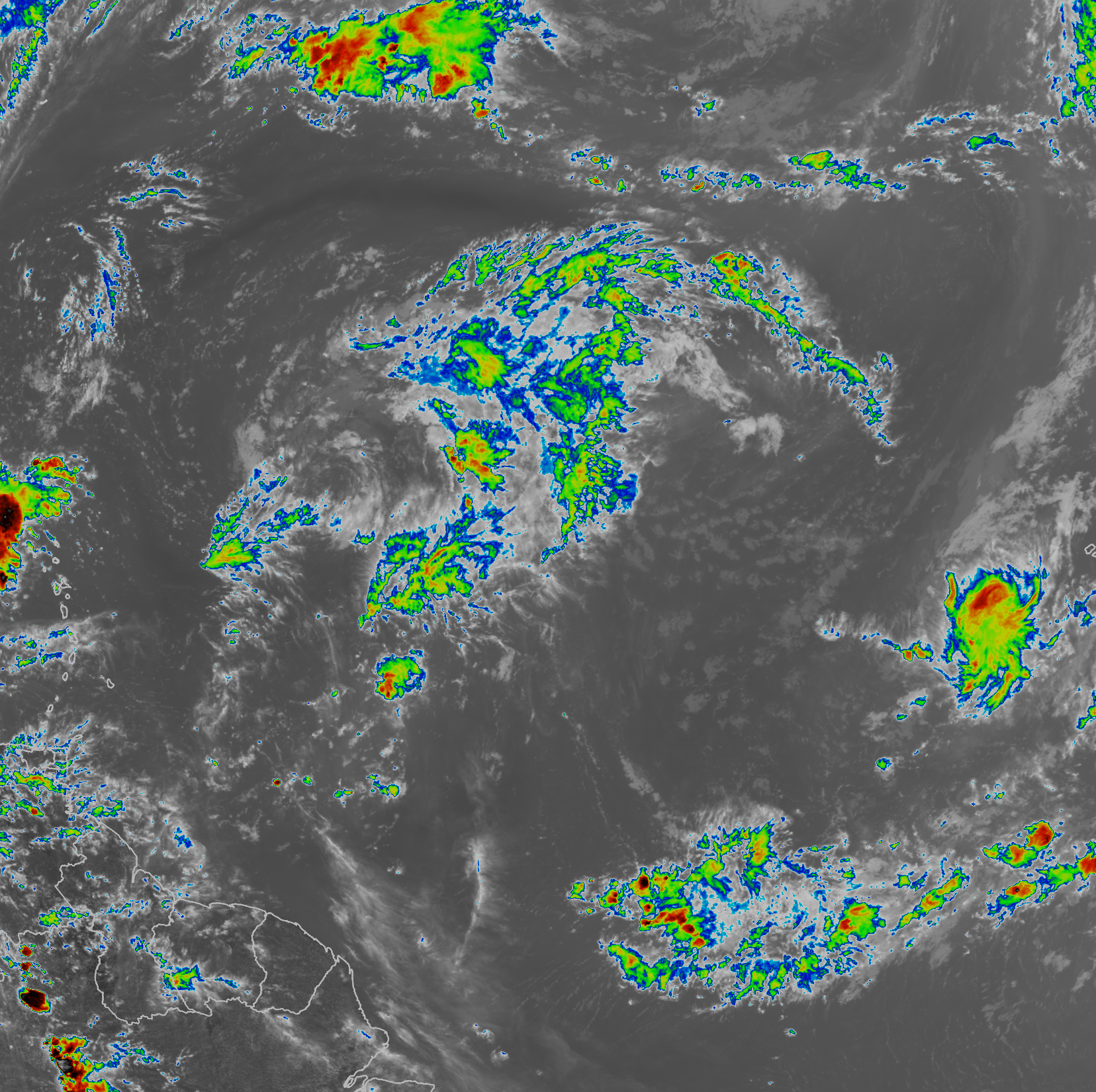
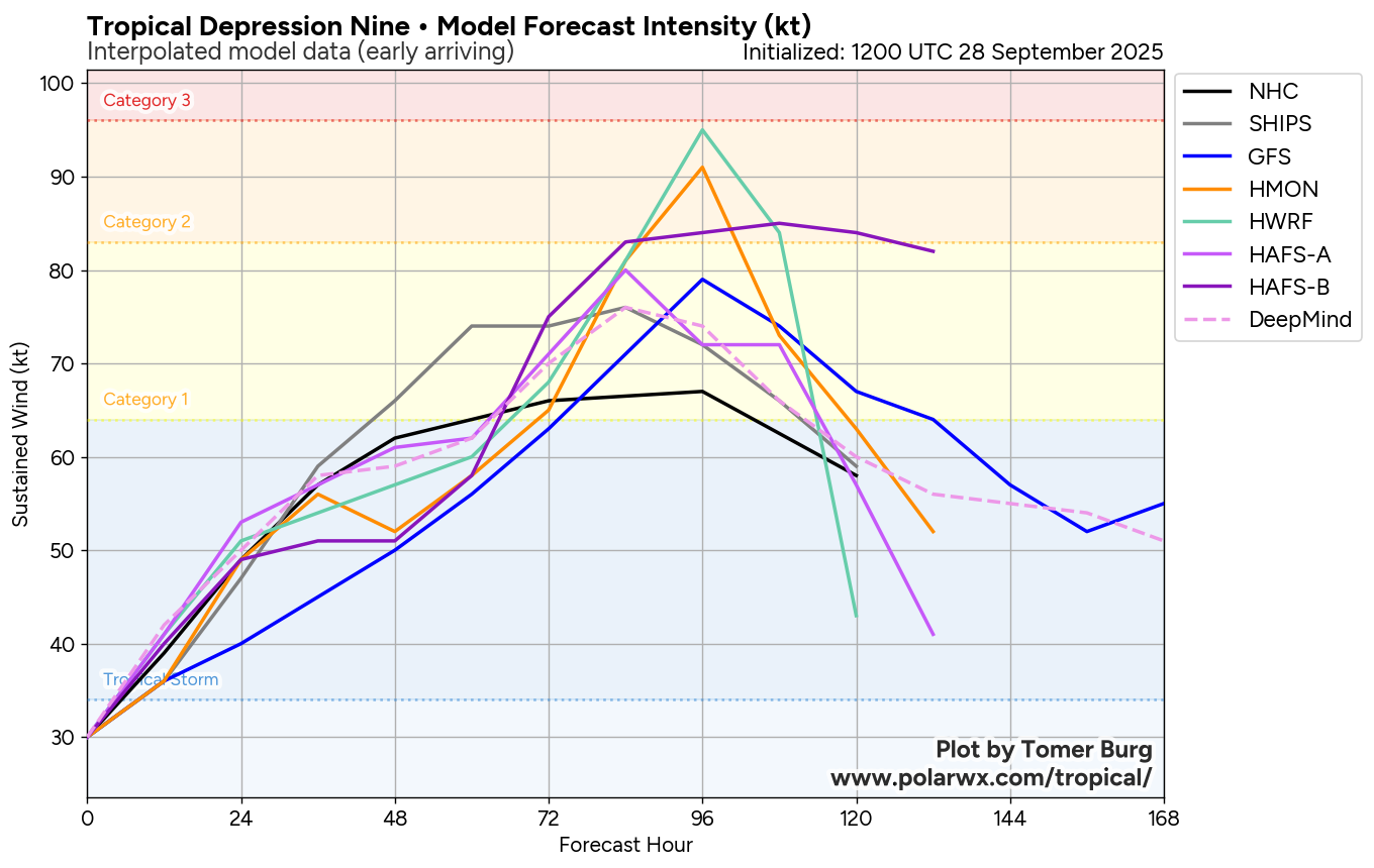
TD 9 is still disorganized with the center of circulation located just south of Andros Island in the Bahamas & convection extending northward from there towards the Carolinas. To the east of TD 9 is Category 4 Hurricane Humberto, which is expected to close the distance from TD 9 over the next 24 hours and become a big influence on where the depression will track throughout this coming week. It should be noted that Humberto peaked at a 160 mph Category 5 hurricane yesterday & the size and strength of Humberto will have quite a huge influence on pulling TD 9 sharply to the east.
There has been a delay in how quickly TD 9 is organizing and this has caused the depression to not move as quickly to the north as what was expected. Because of this, it is missing the window for it to link up with the upper level low pressure system over the Southeastern United States, which would have pulled it inland into the Carolinas.
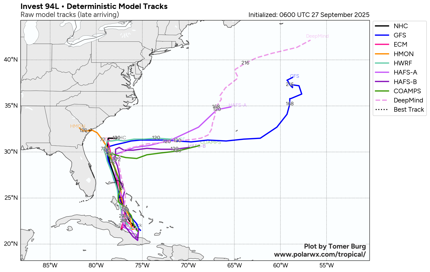
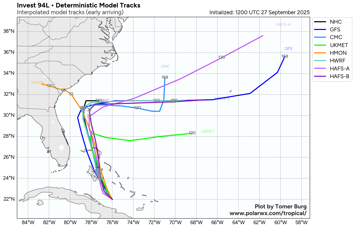
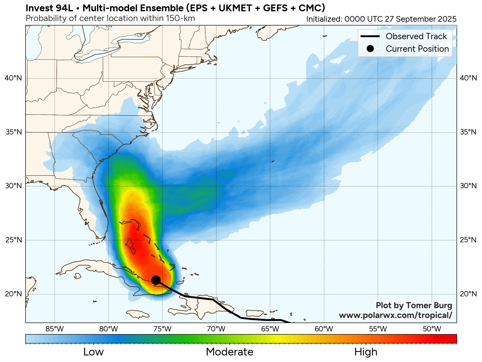
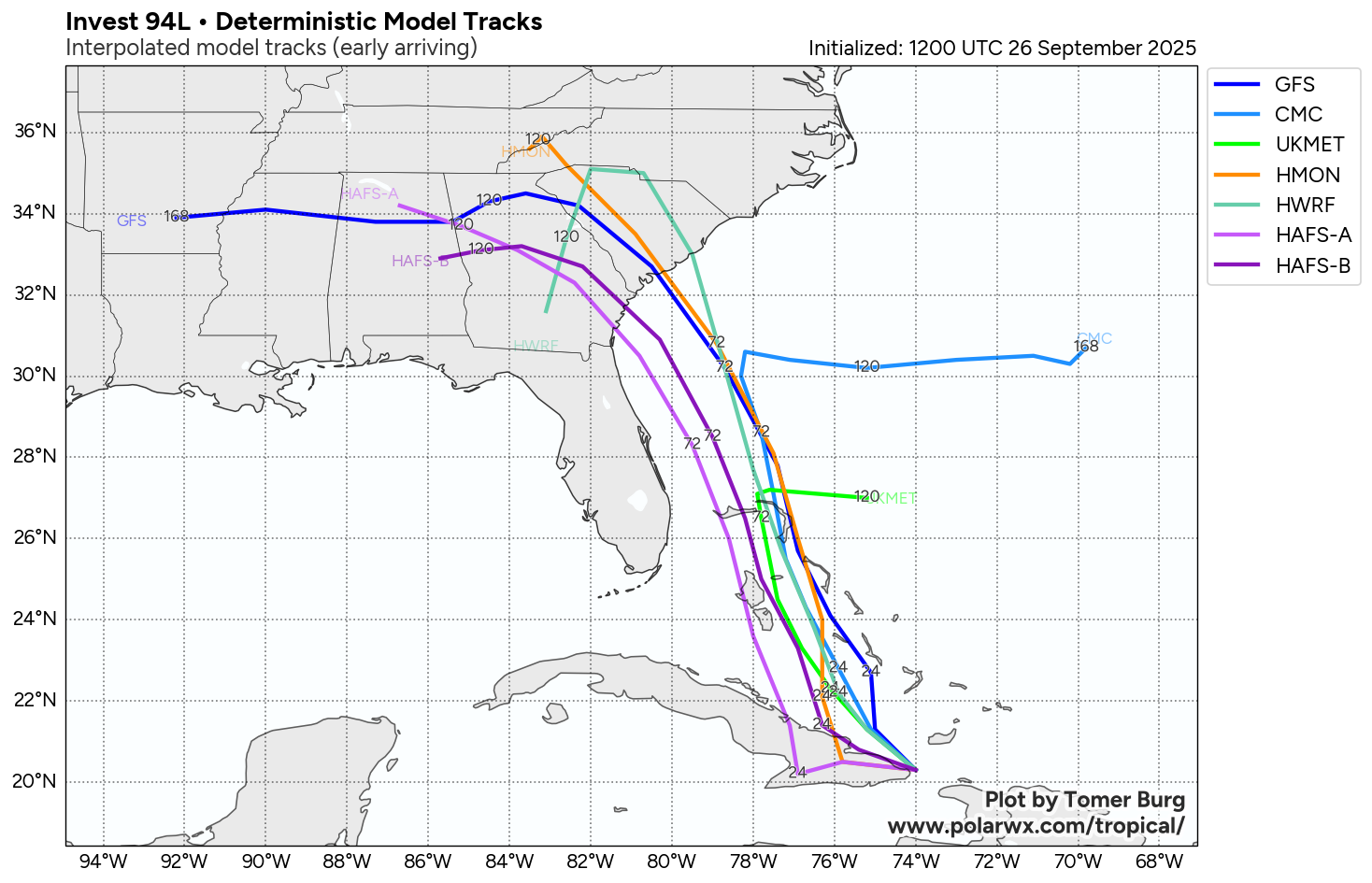
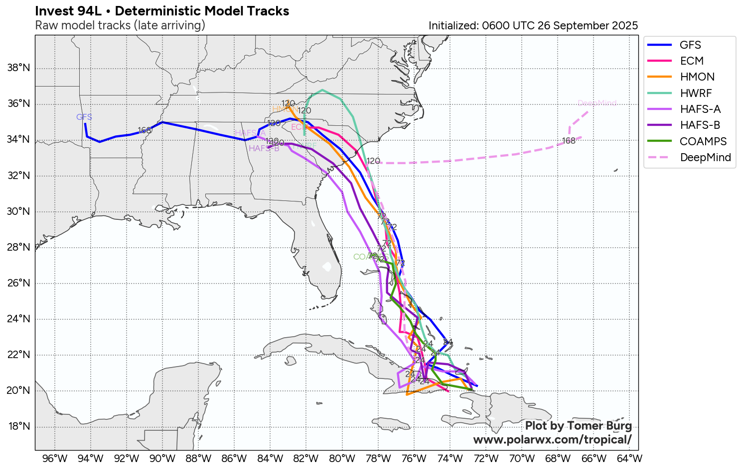
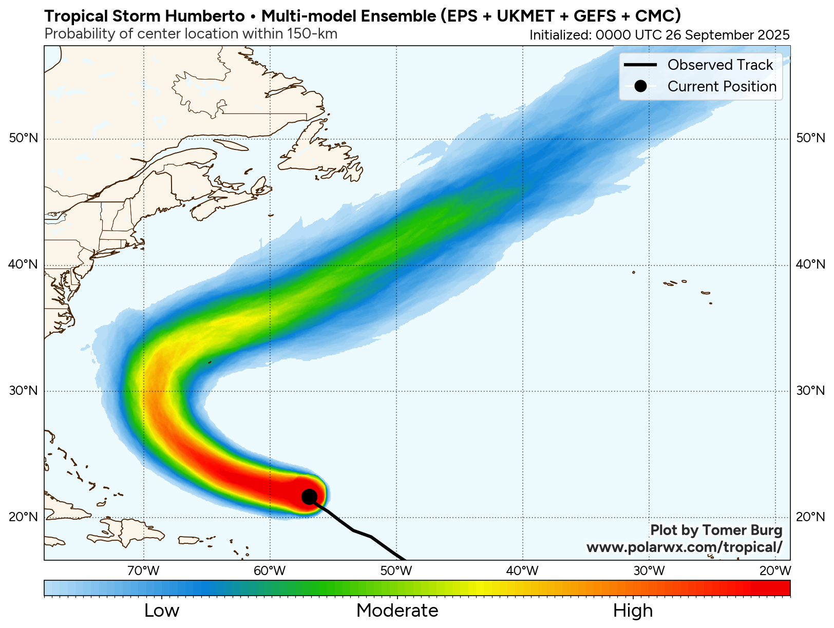
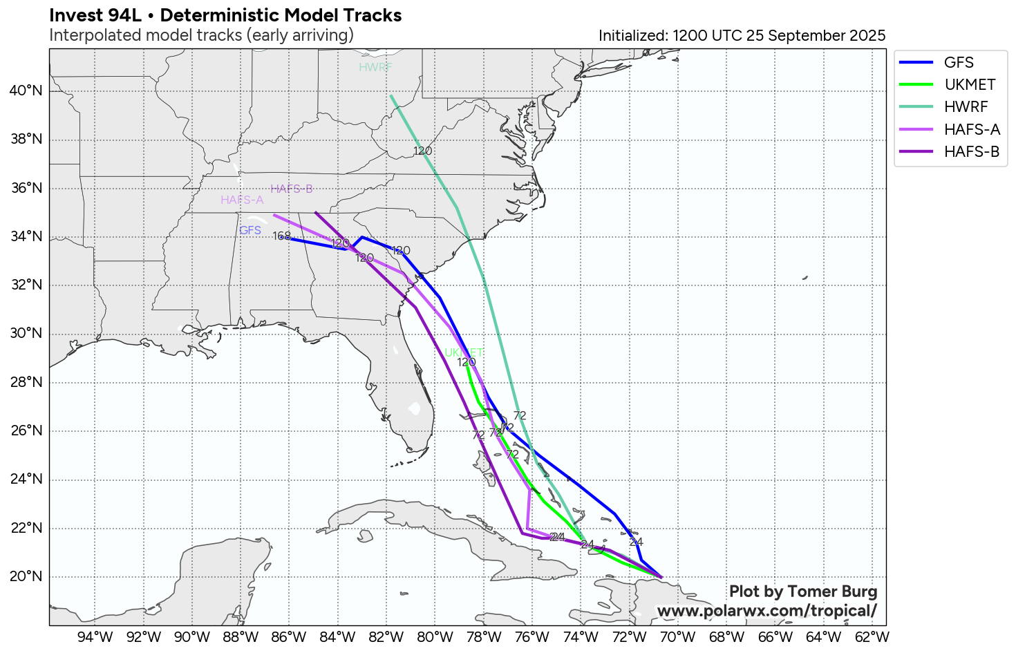
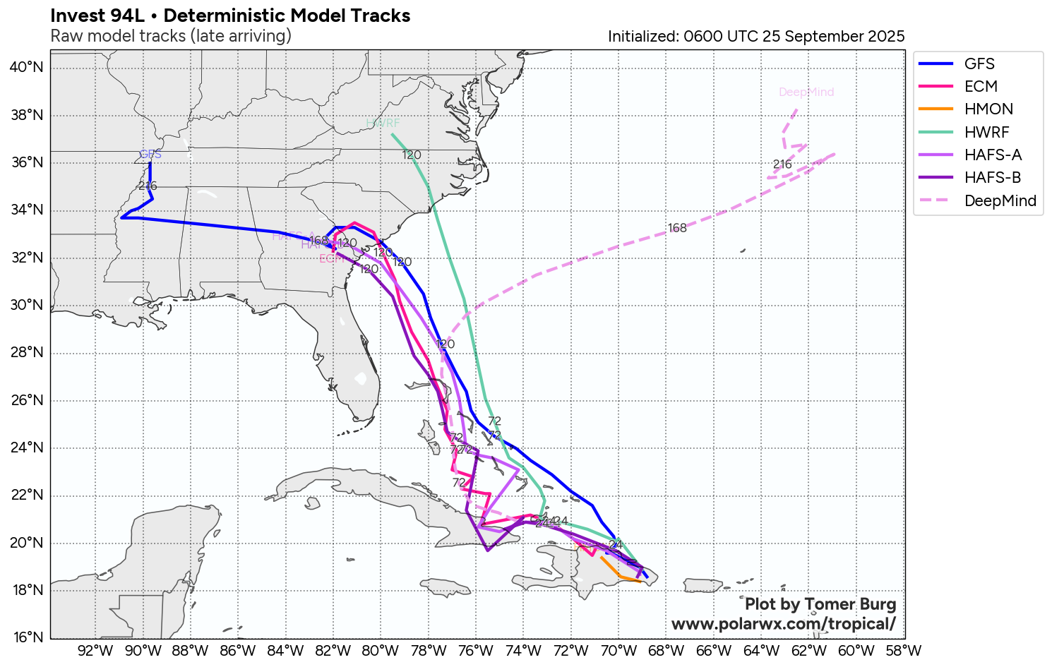
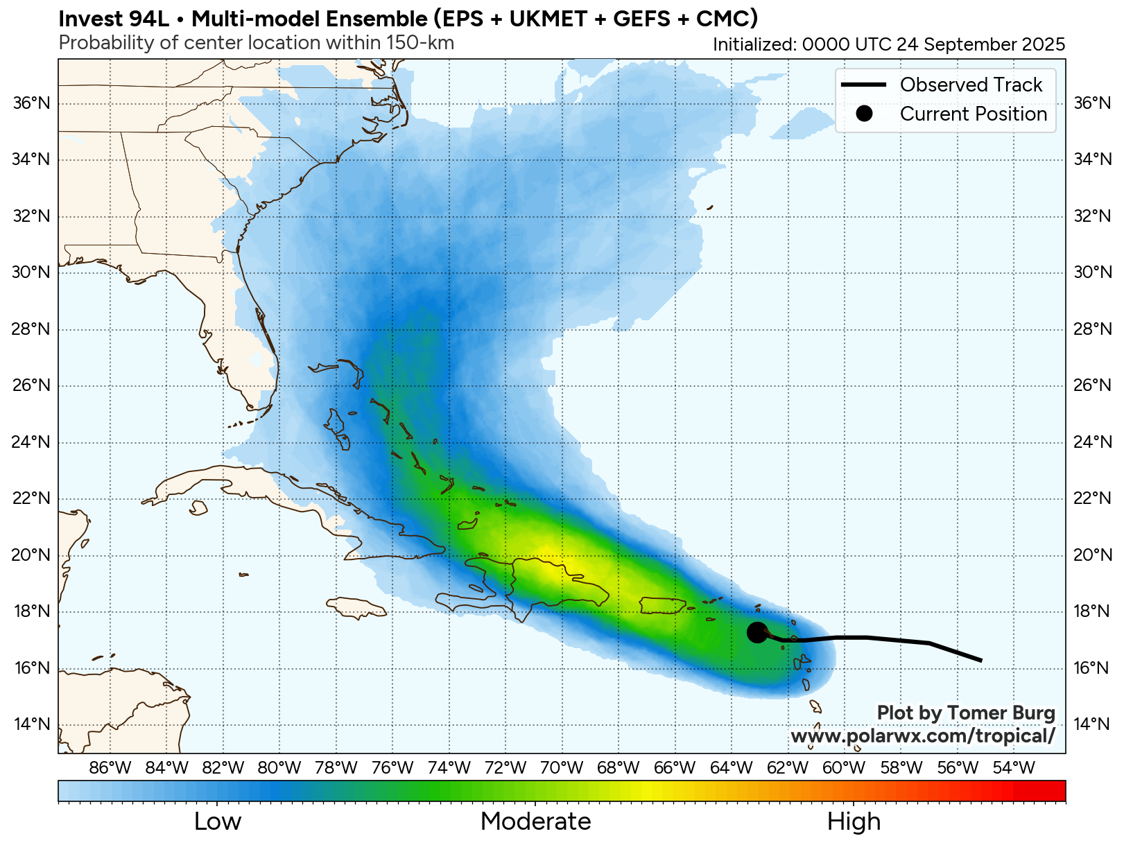
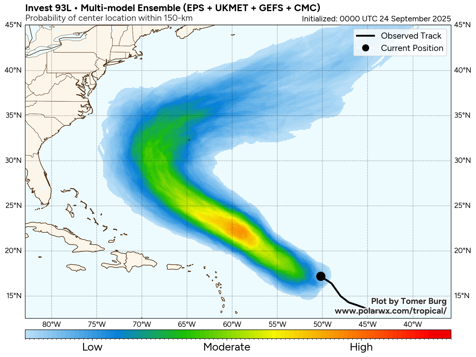
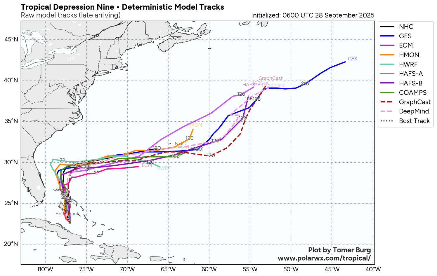
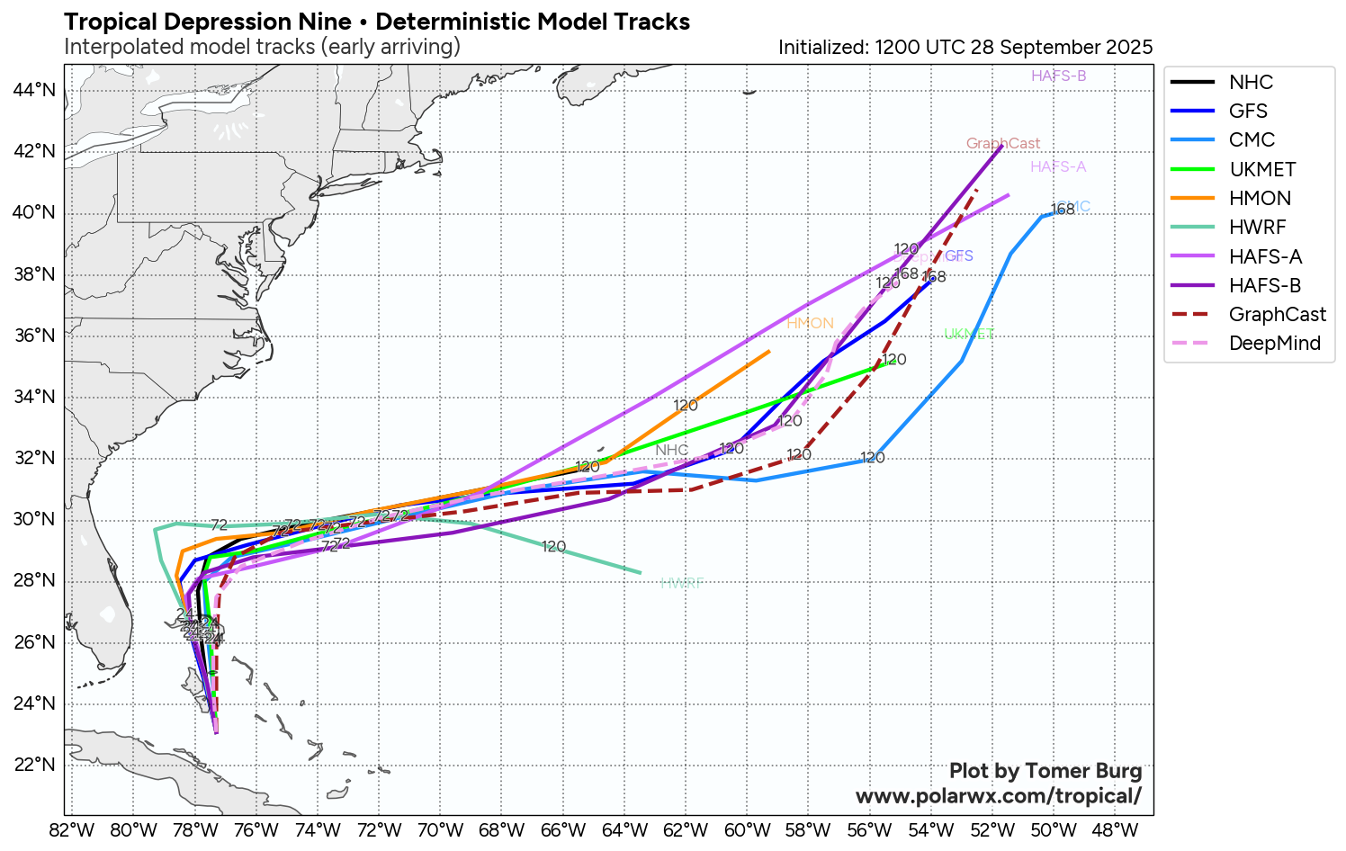
Instead, what looks to occur is that the upper level low pressure system will weaken by Tuesday and large and powerful Humberto will become the main influence in where TD 9 will track. This should cause TD 9 to turn sharply to the east right off of the northeast Florida or east-central Florida coast as we get into Tuesday and Wednesday. From there, it seems plausible now that Future Imelda will track towards Bermuda & potentially impact the island later this week. This is what a majority of the ensemble members are now showing – a quick movement to the east-northeast towards Bermuda & then out into the open Atlantic.
That said, there are a few ensemble members of the European model that do show TD 9 getting left behind by Humberto & languishing just offshore of the Carolina and Mid-Atlantic coastline later this week through next weekend. For now, this is not expected as most indicators seem to point towards a quick exit to the east-northeast. That said, this is something that’ll be watched, just in case.
Forecast Impacts:
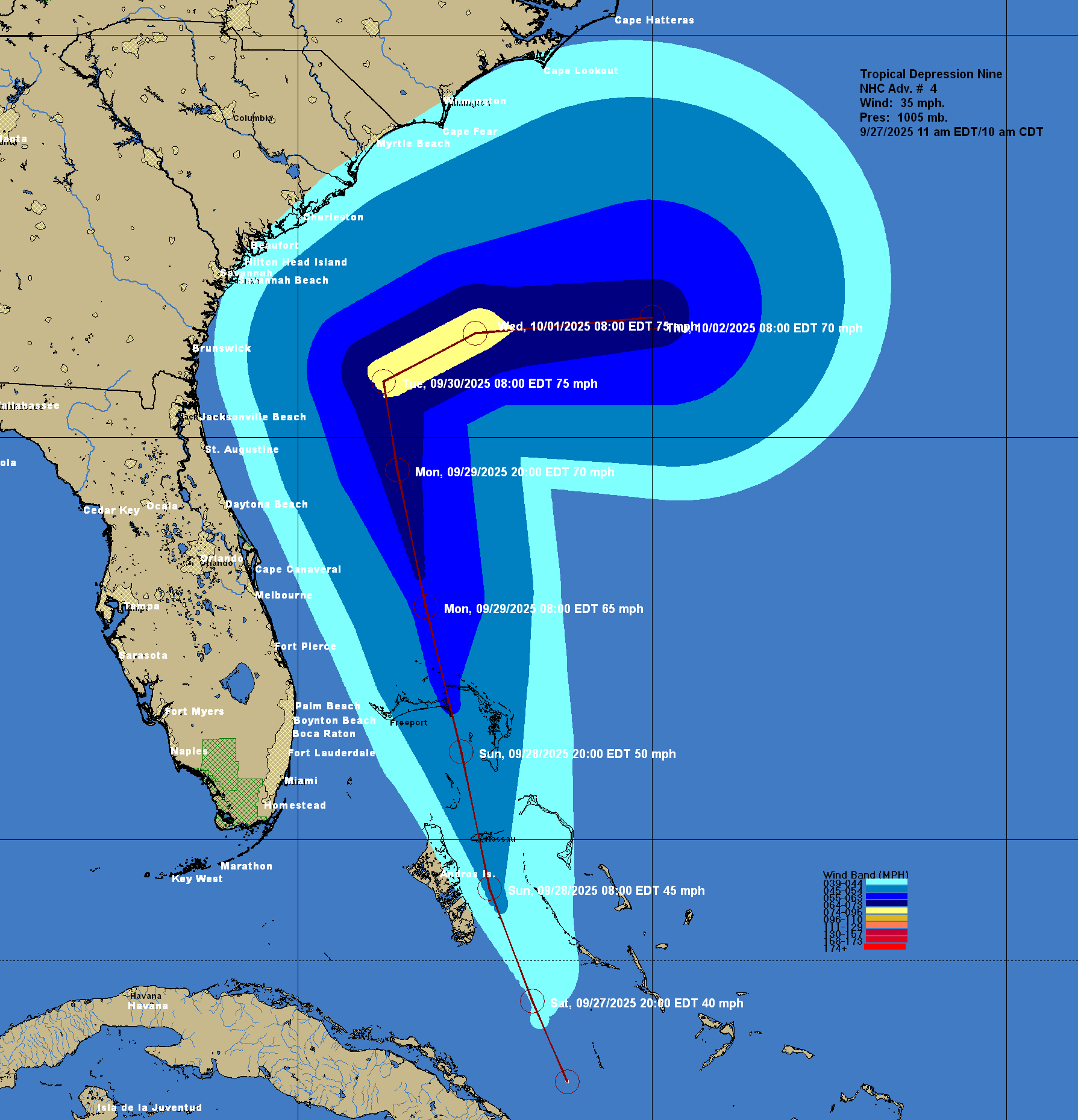
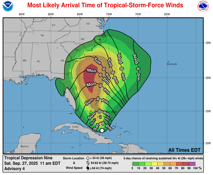
As for Florida’s East Coast – Any tropical storm force sustained winds will very likely stay well offshore of the east coast of Florida as TD 9 (Future Imelda) tracks to northwest and parallels Florida’s East Coast over the next couple of days. Instead, I think that we’ll see occasional heavy showers that’ll affect the immediate coast of the Treasure Coast and Space Coast of Florida mostly during the day on Monday. Some of these showers may produce wind gusts of up to 40 mph in squalls. Overall, not a big deal at all. These squally conditions will quickly come to an end by Tuesday morning.
As for the Carolinas – Even though TD 9 is now expected to remain far to the south of the Carolinas, heavy rain still looks to be a threat as the moisture from TD 9 interacts with a stationary front in the area.
This means that rainfall totals of 2 to 5 inches can be expected along the immediate South Carolina coast as well as along the immediate coast of southeastern North Carolina from today through Wednesday. This rain will lead to scattered areas of flash flooding. In addition, gusty winds in squalls, rough surf and beach erosion can be expected along the entire coasts of South Carolina and North Carolina over the next 2-3 days.
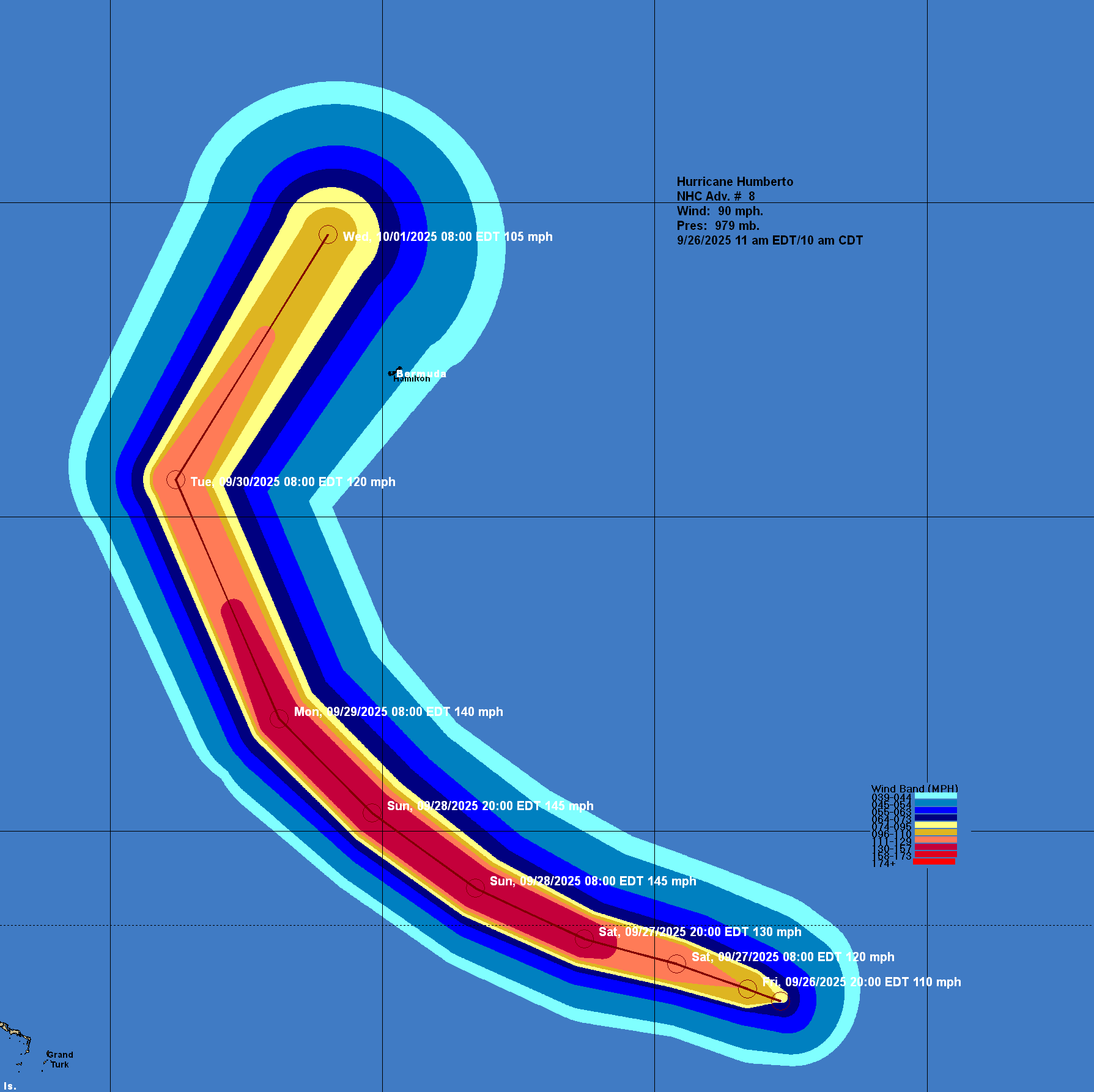
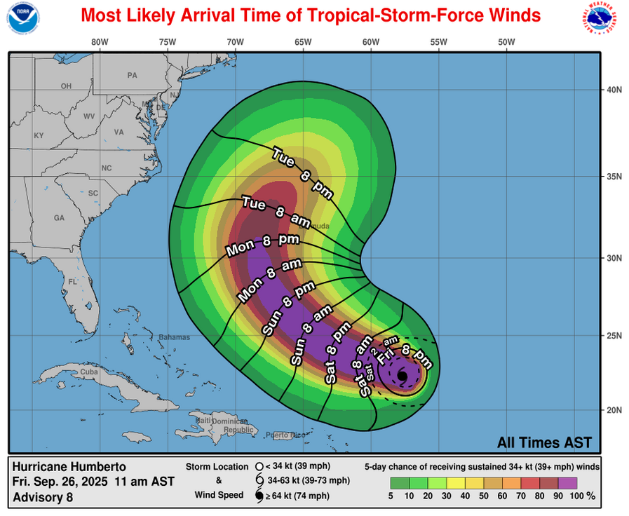
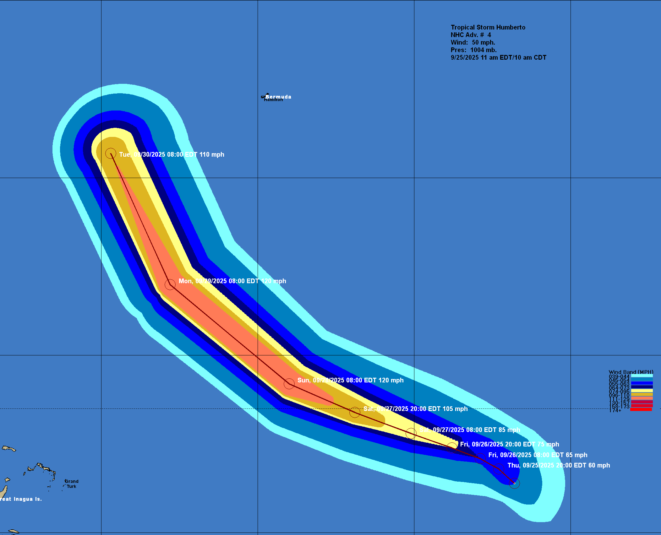
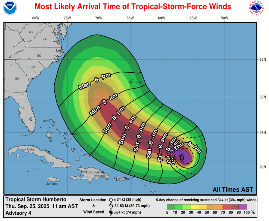
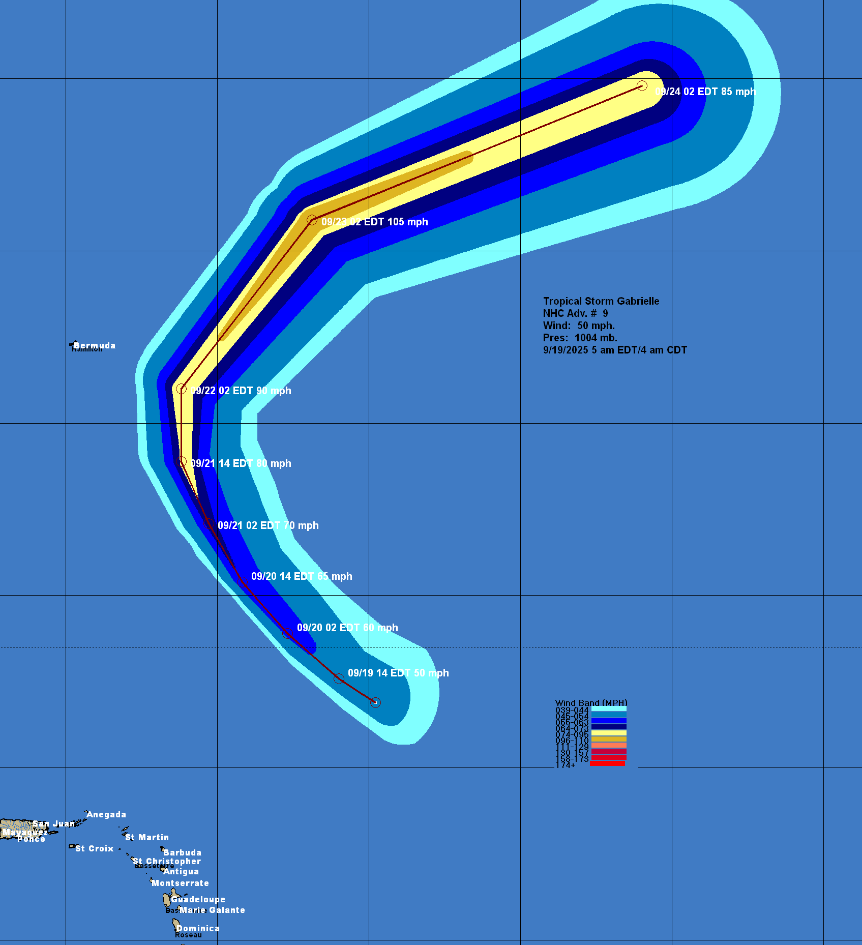
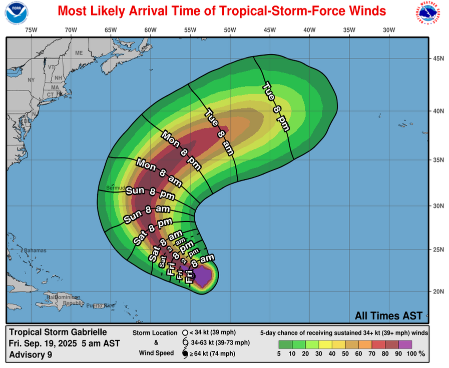
For Bermuda – Direct impacts from Future Imelda are a possibility late this coming week should this system head directly to the east-northeast. This means that heavy rain, tropical storm to hurricane force winds and extremely rough seas are a distinct possibility around Thursday and Friday. It’s definitely something to watch closely, if you are on the island of Bermuda.
Imelda’s rich plume of tropical air will collide with a stalled front along the coastal Carolinas Monday and Tuesday, bringing the threat of several days of heavy rainfall and scattered flash flooding ahead of the storm along the coastal plains of the Carolinas from Charleston, South Carolina, to Wilmington and Morehead City in North Carolina. Rainfall totals should generally stay in the 3- to 5-inch range for these areas.
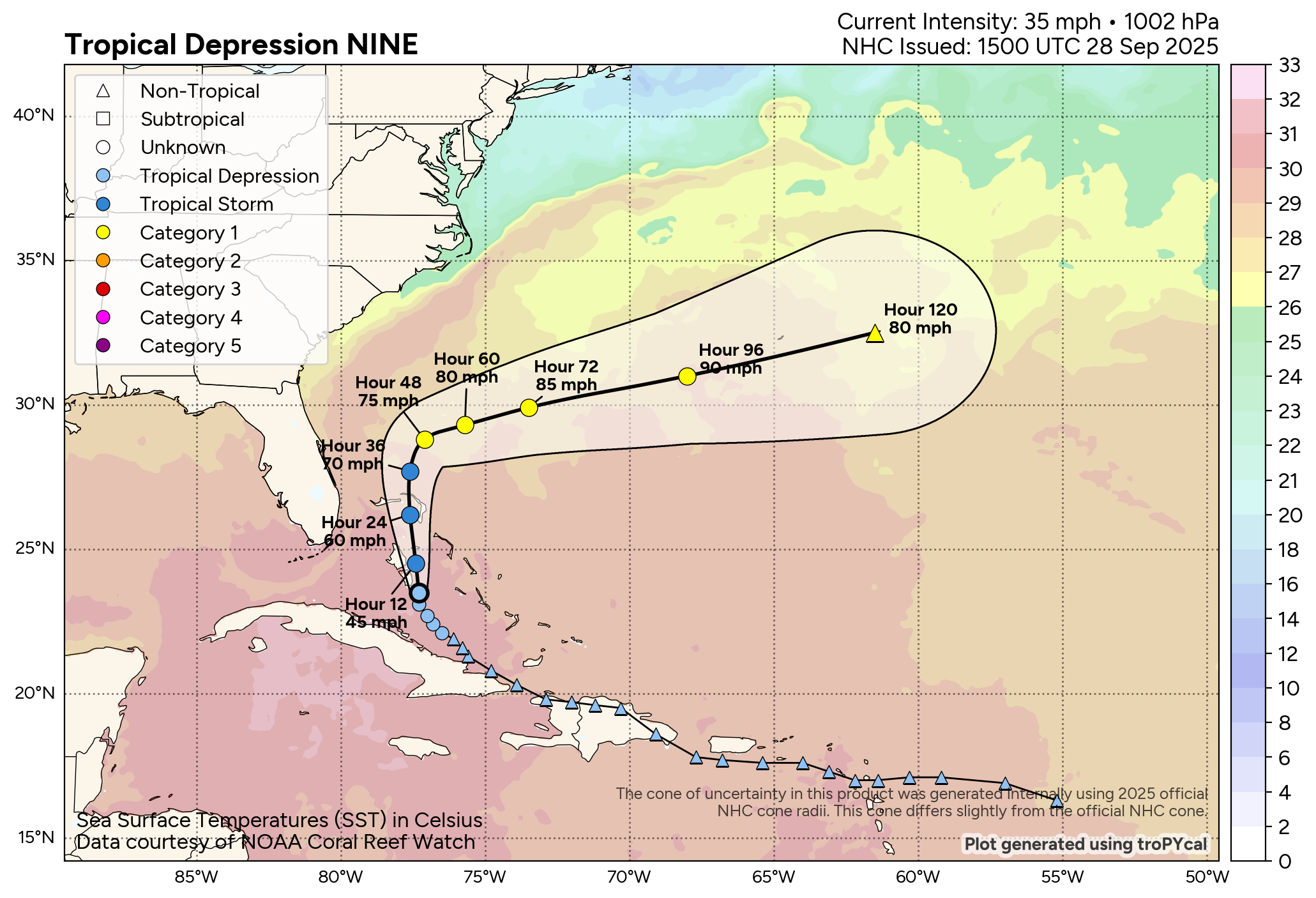
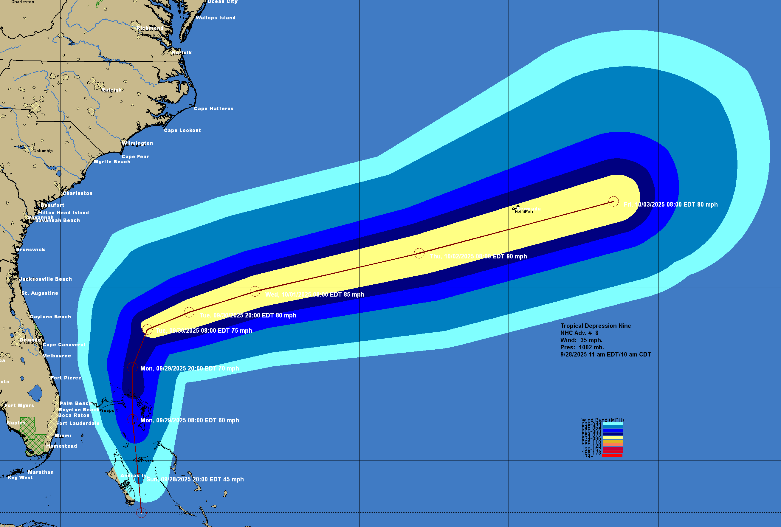

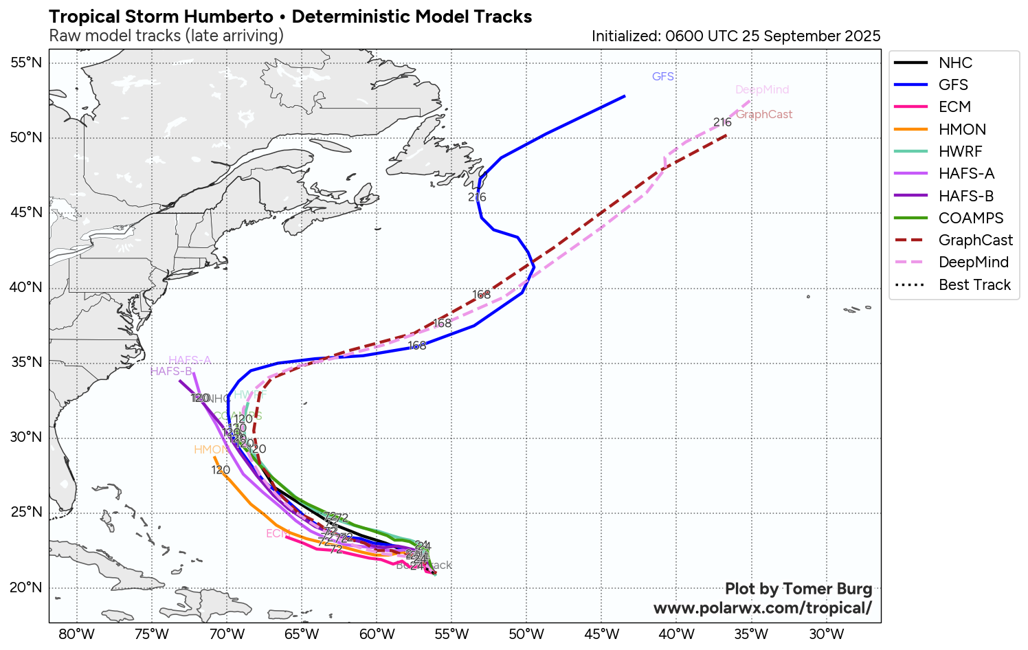
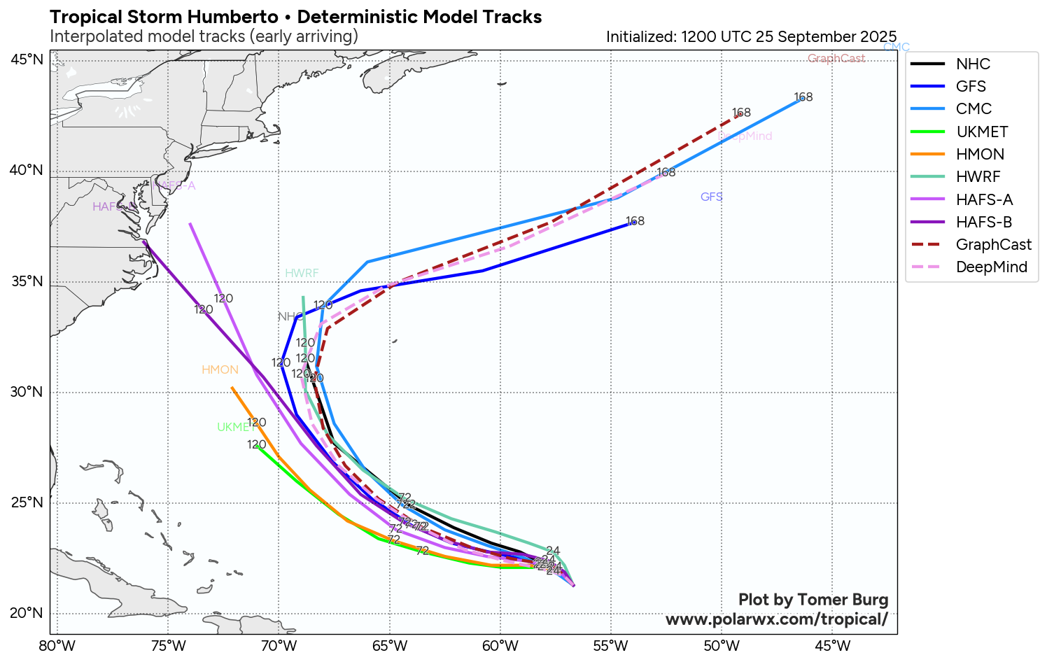
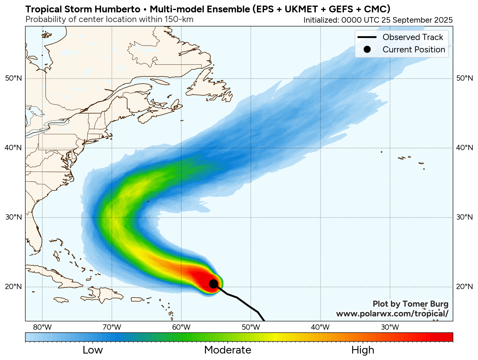
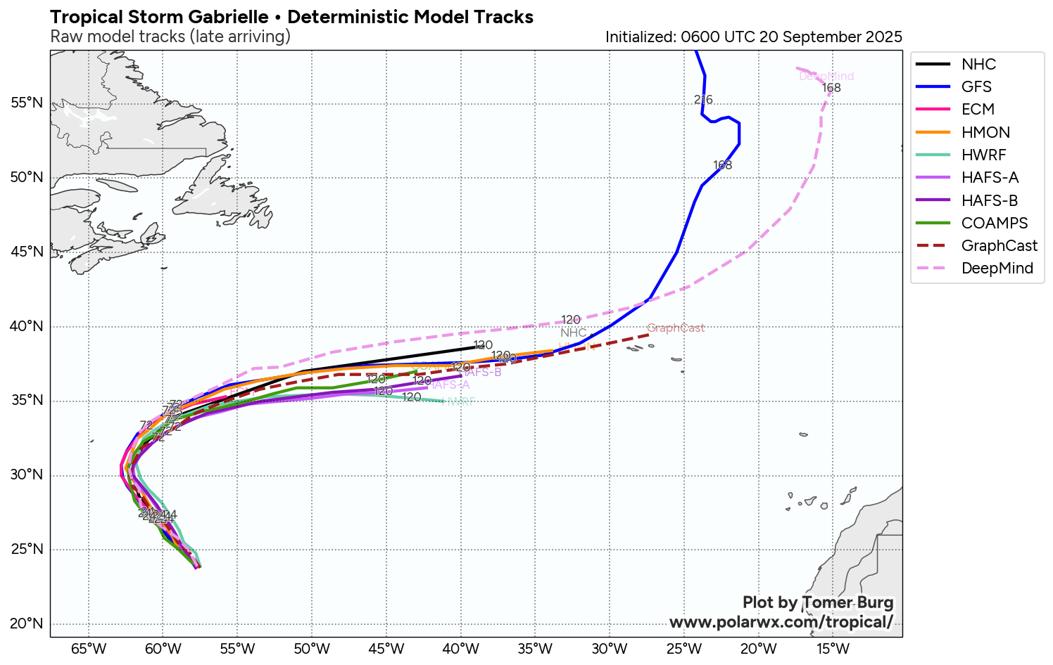
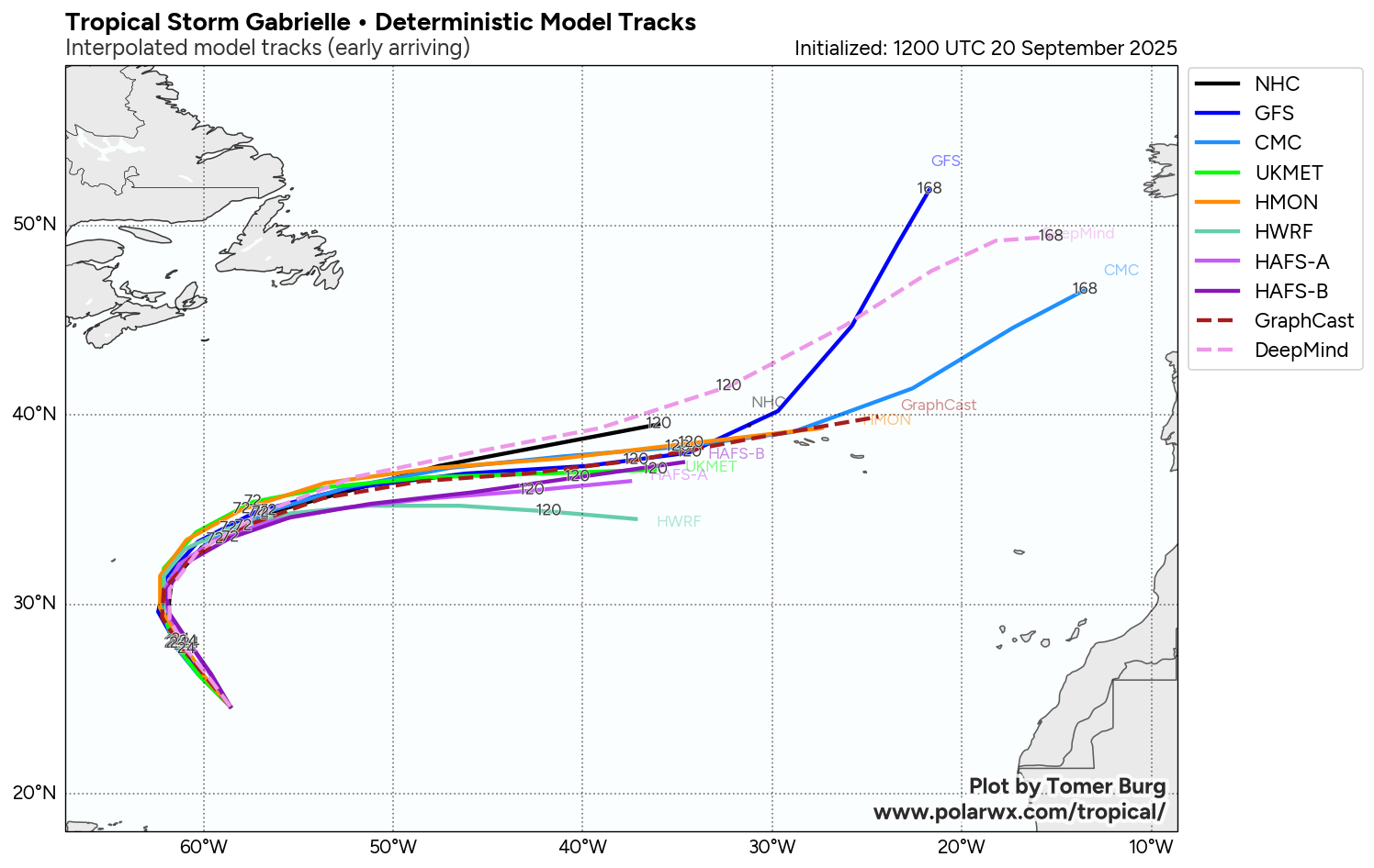
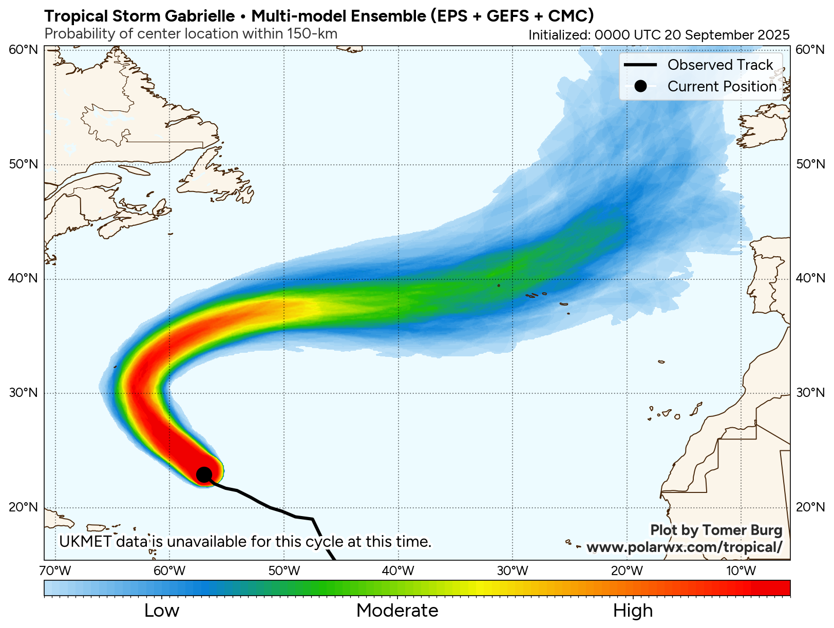
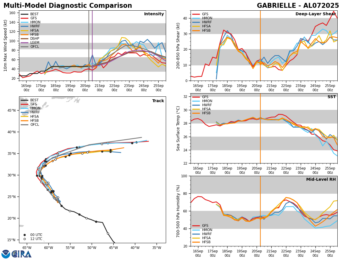
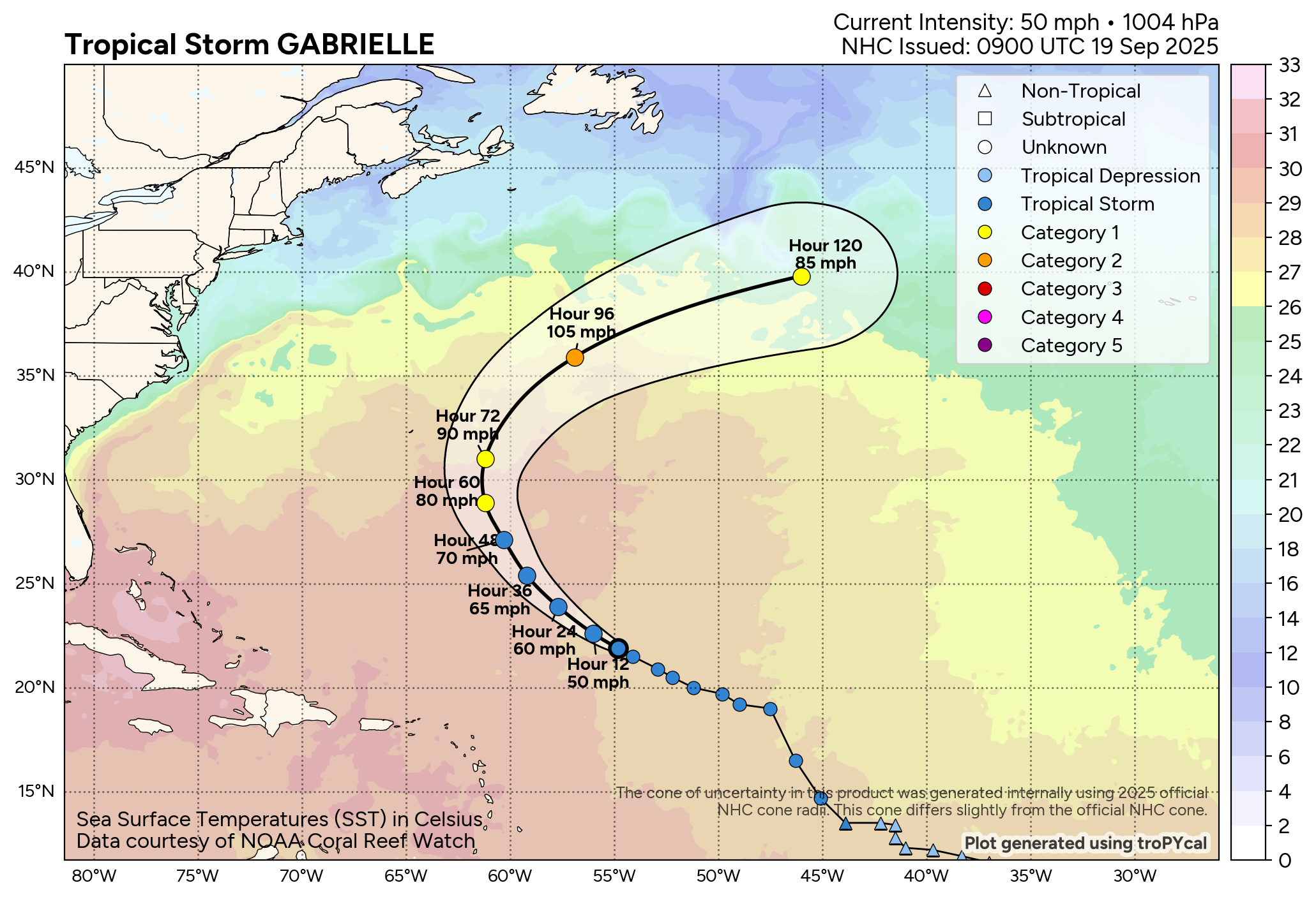
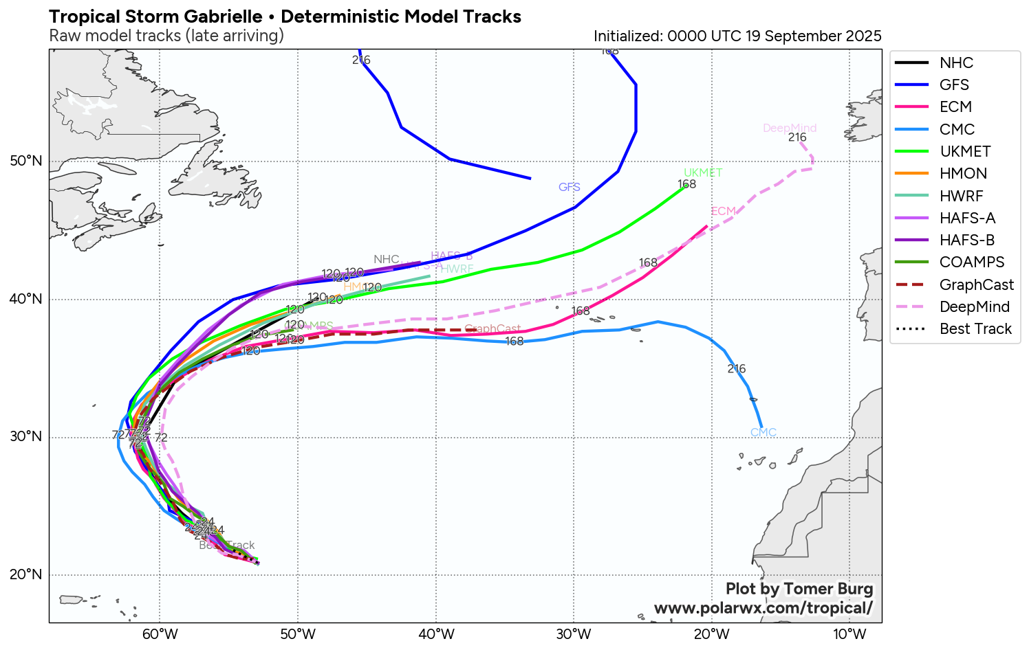
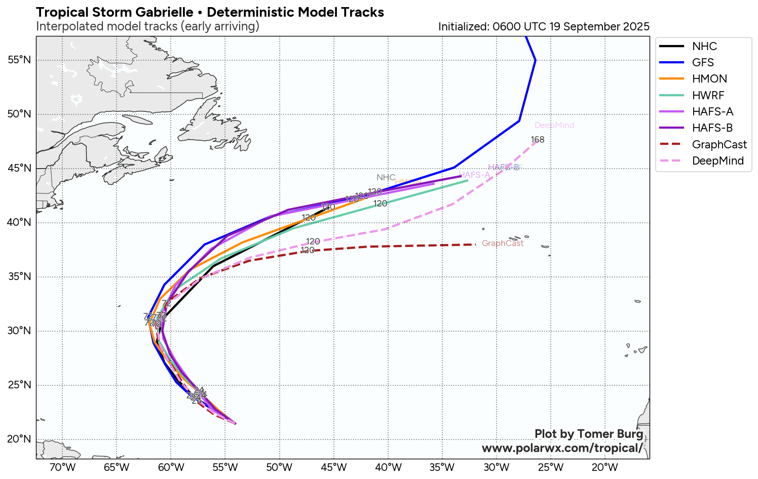
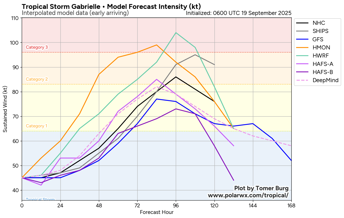
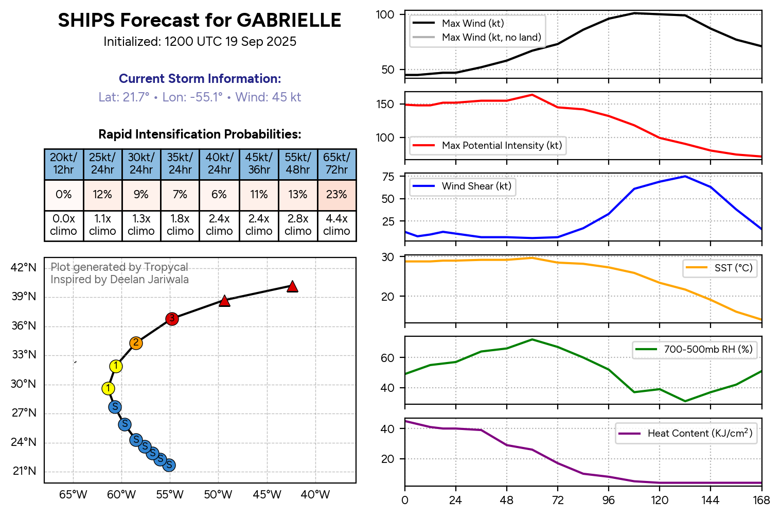
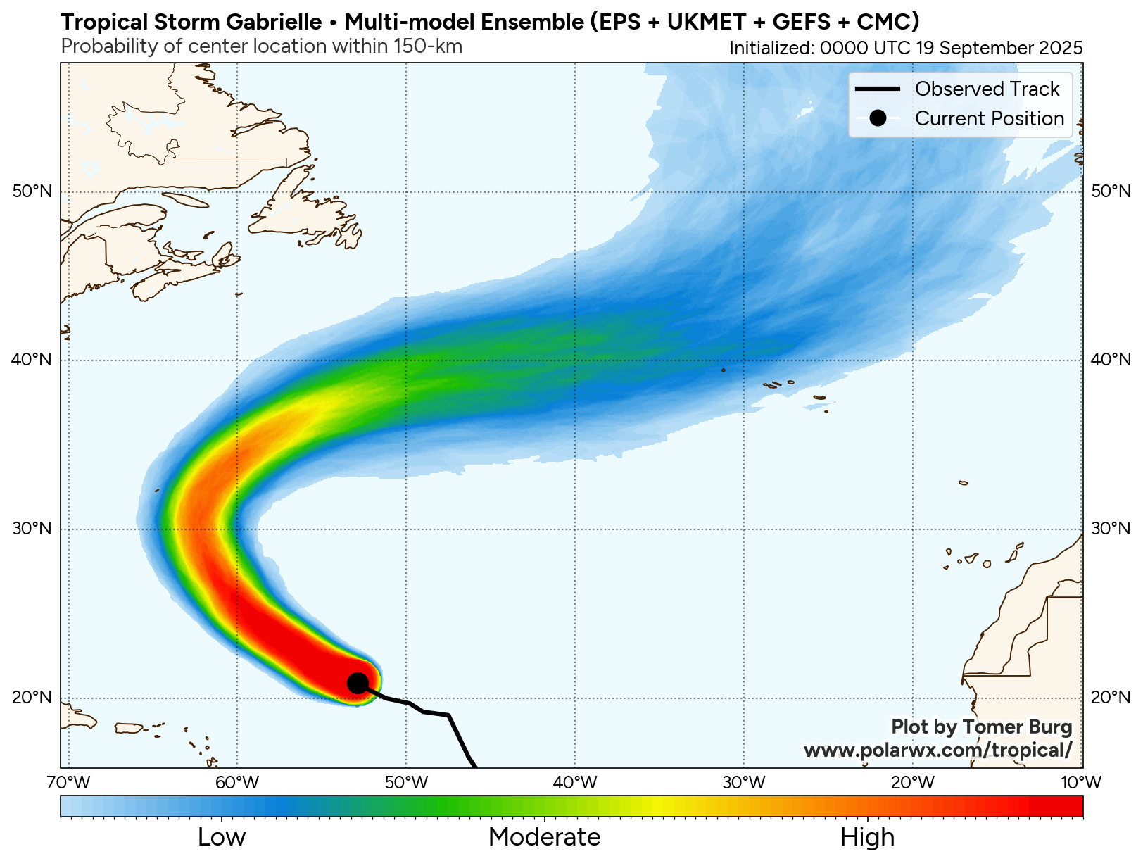
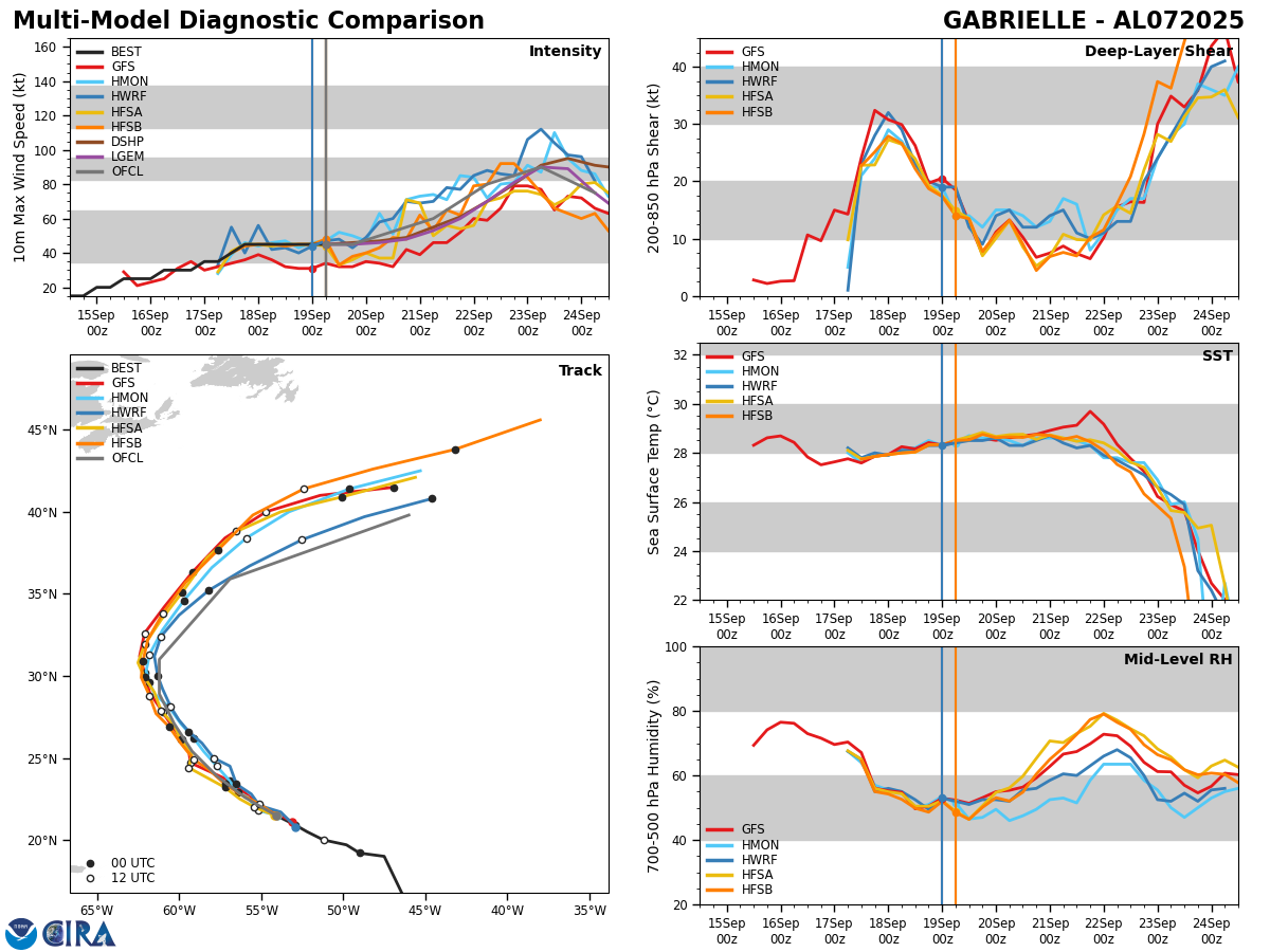
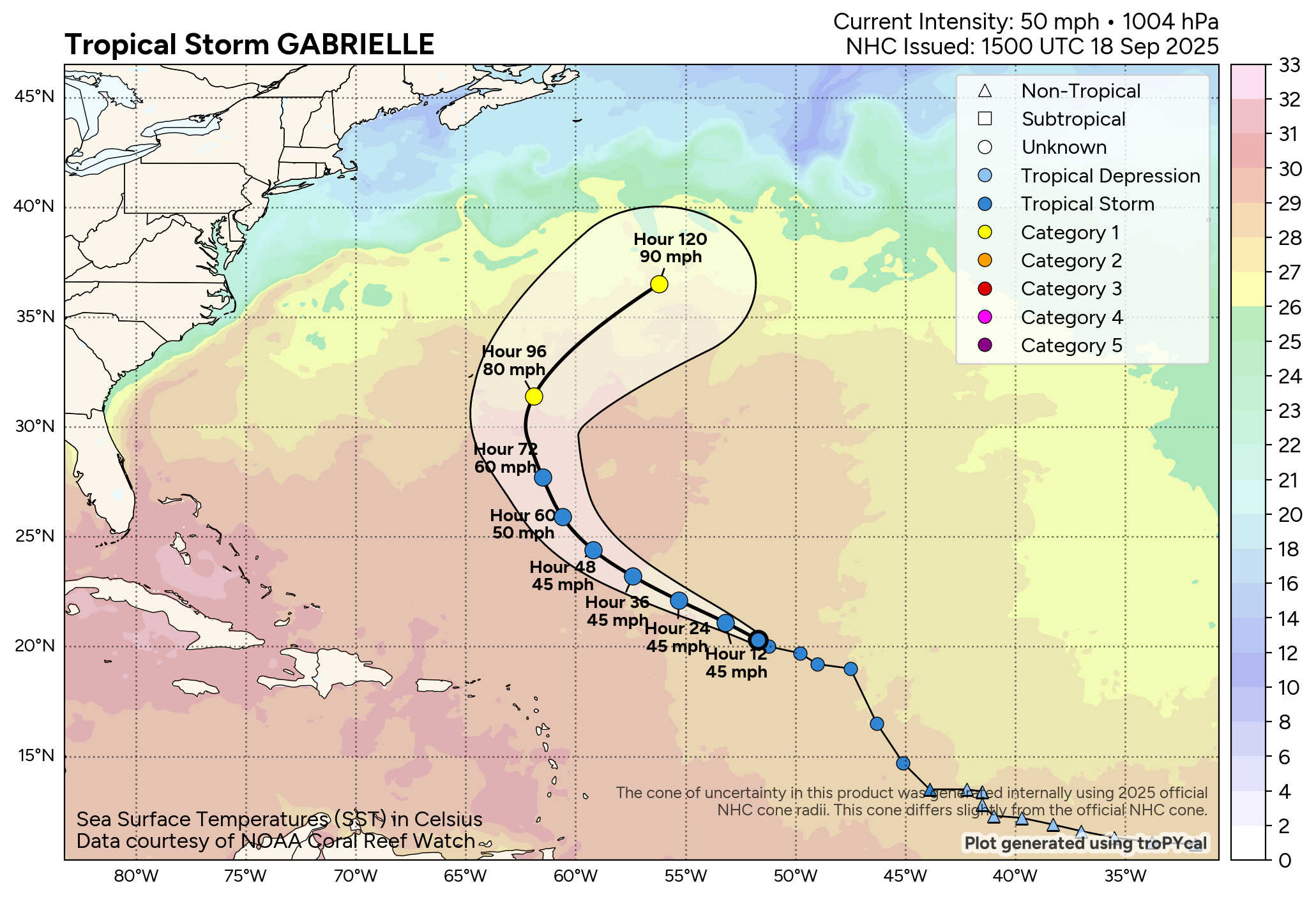
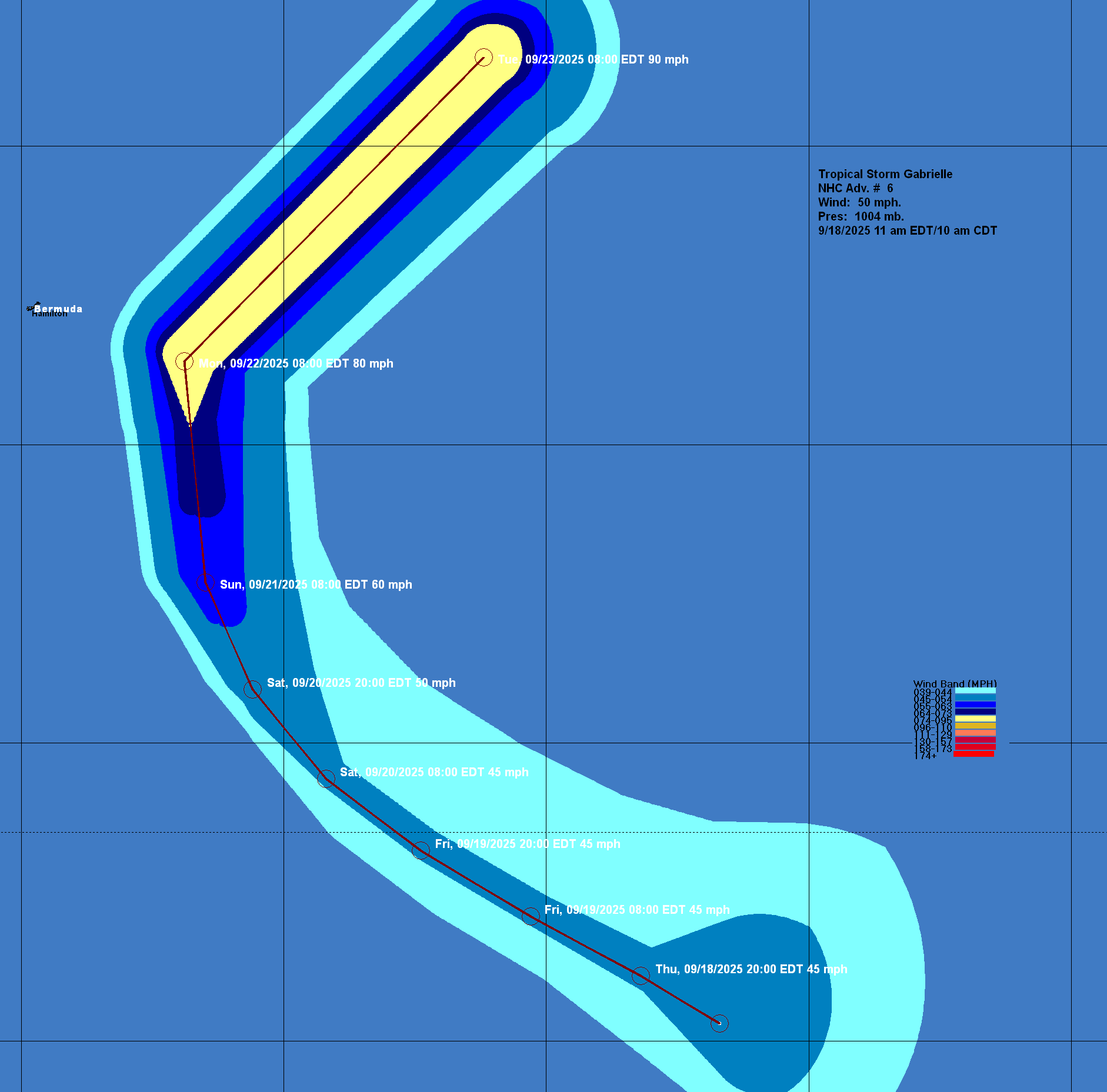
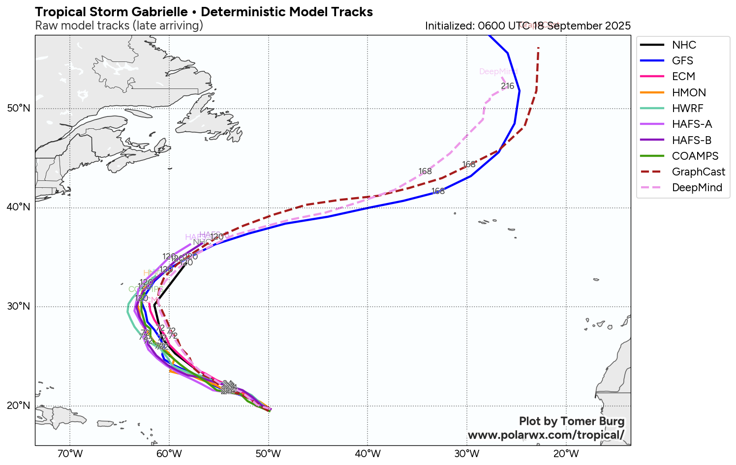
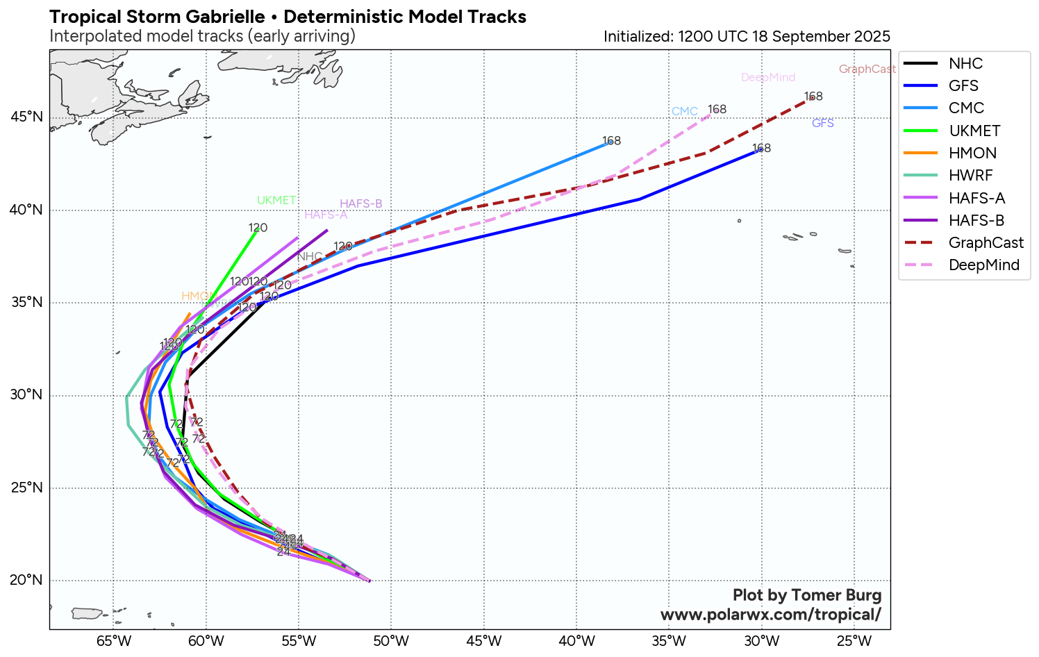
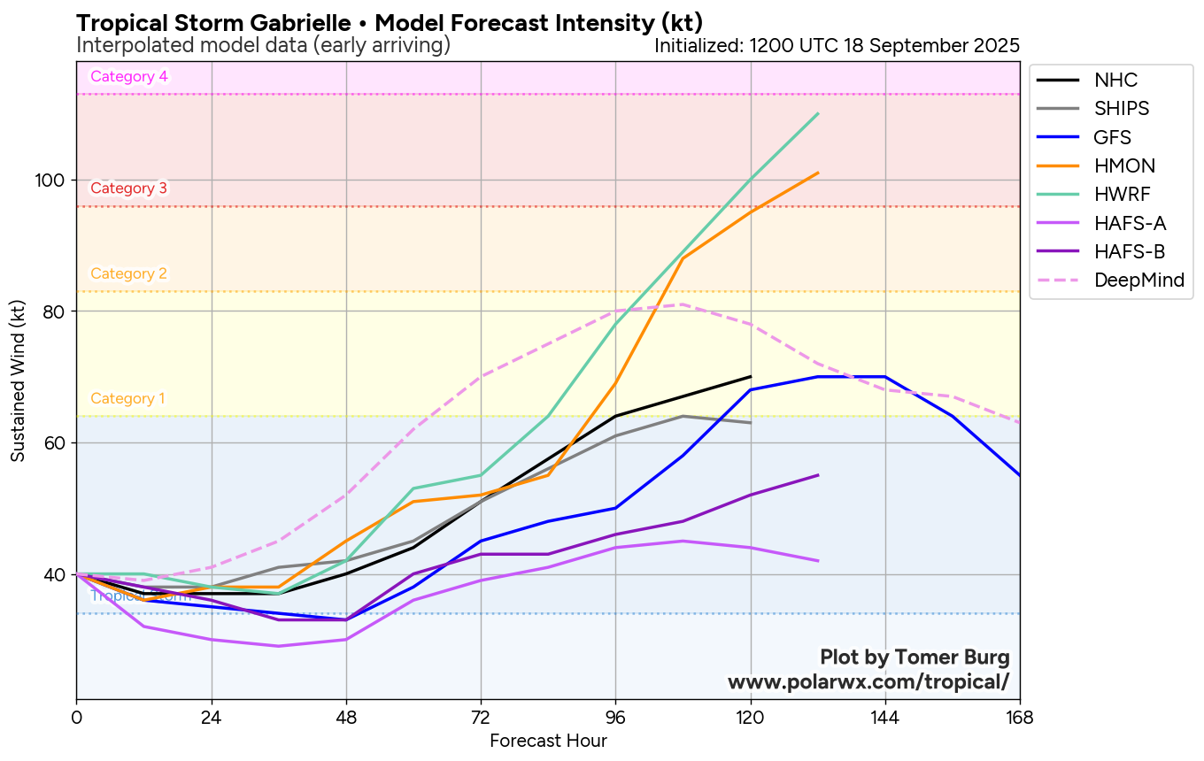
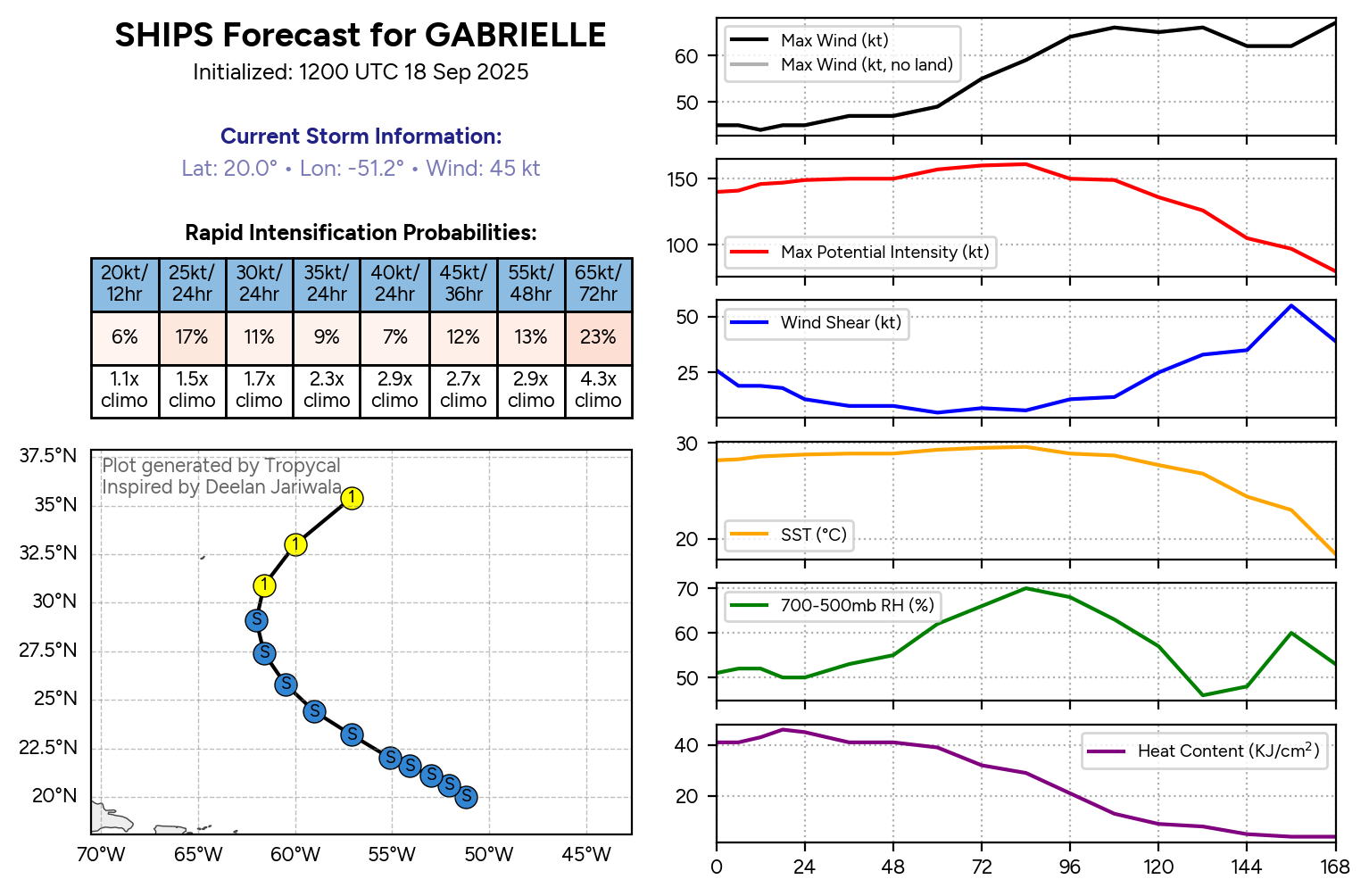
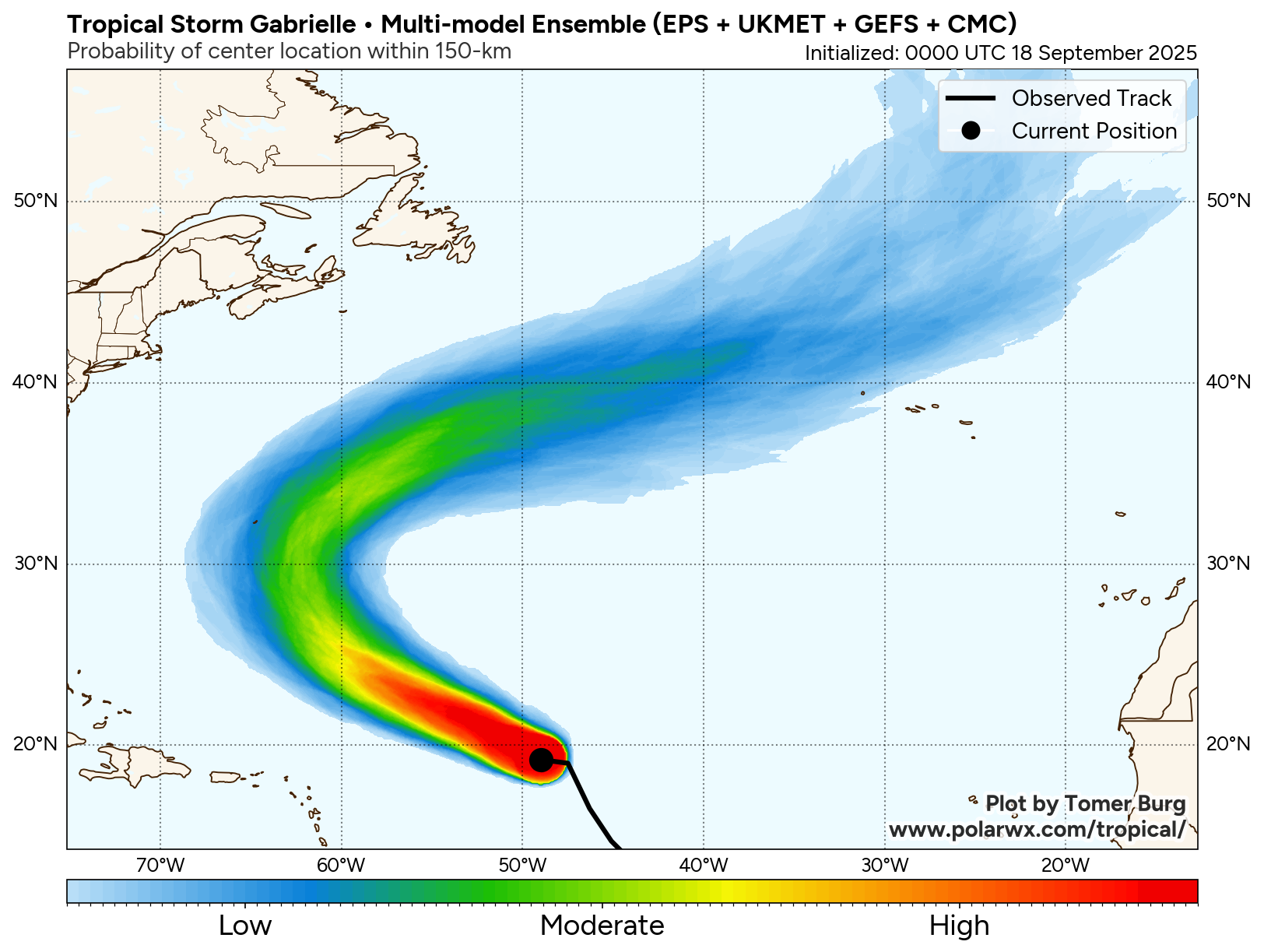
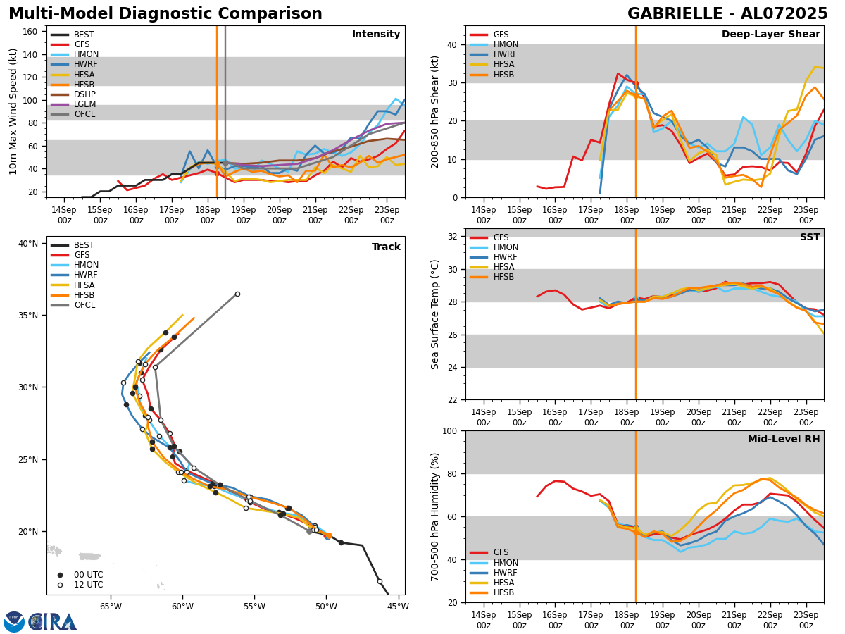
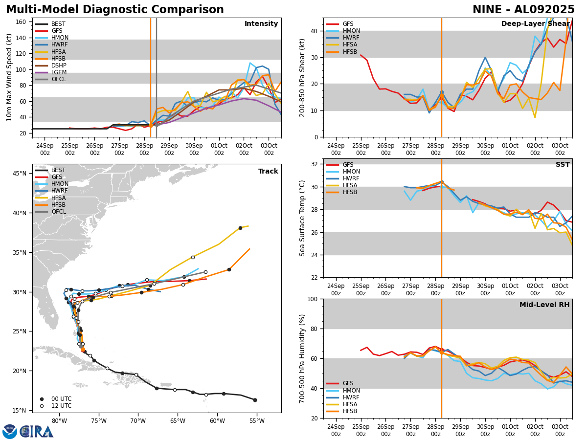
Model Track Forecast:
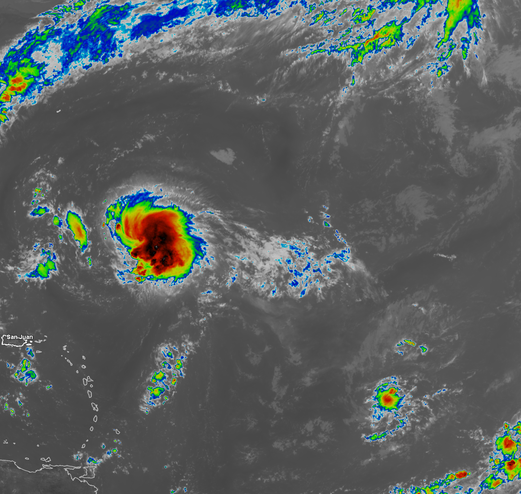
Satellite Imagery:

Looking Beyond Humberto & TD 9 (Imelda): Unfortunately, we are still not done with the hurricane once Humberto and Imelda exit stage right late this coming week. In fact, I still think that we’re going to be tracking tropical systems through the month of October and very probably well into November.
The latest European weekly models is pointing to the possibility of a brief break in activity during the week of October 6.
Beyond this, the European weekly models seem to suggest activity will pick up big time starting during the week of October 13 in the area that includes the Gulf, the northwestern Caribbean and the southwestern North Atlantic. This includes the Yucatan, Cuba, the north-central and northeast Gulf Coast, Florida & the Southeastern US coast, the Bahamas and Bermuda. This very active tropical activity may then continue through the week of October 20.
In fact, the European weekly model is forecasting 140 percent of normal activity during the week of October 13 and 160 percent of normal activity during the week of October 20.
So, unfortunately, I think that we’re looking at yet another year with a lot of tropical storm and hurricane season late in the hurricane season.
This is something that I will be keeping a close eye on and will have updates as needed.
The next tropical weather discussion will be issued on Monday.