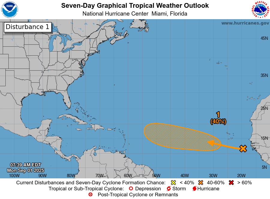
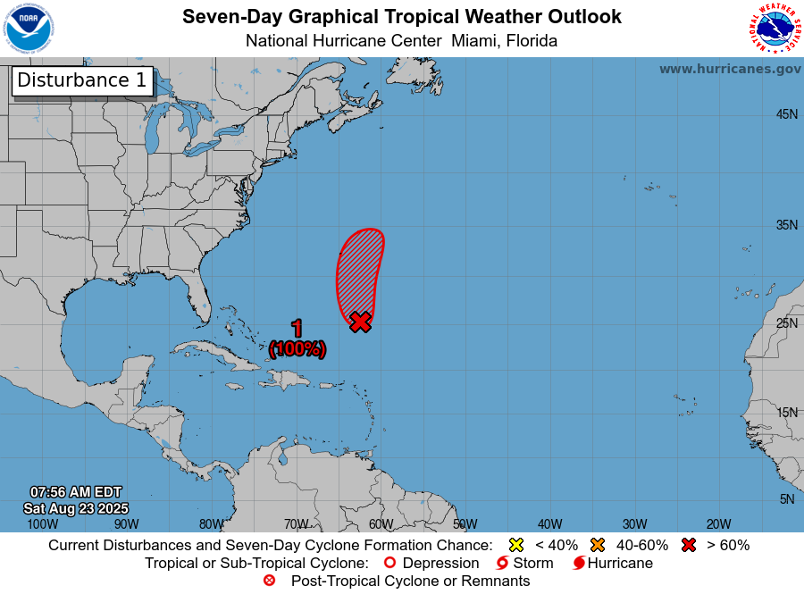
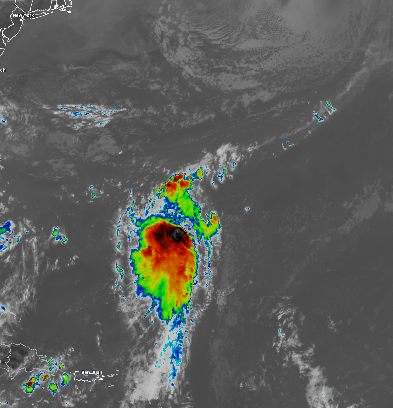
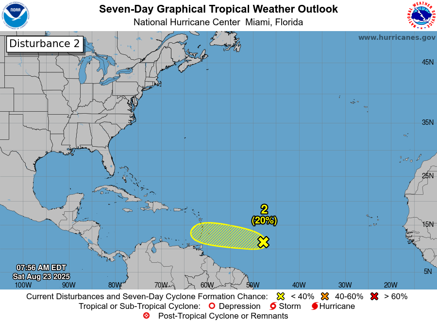
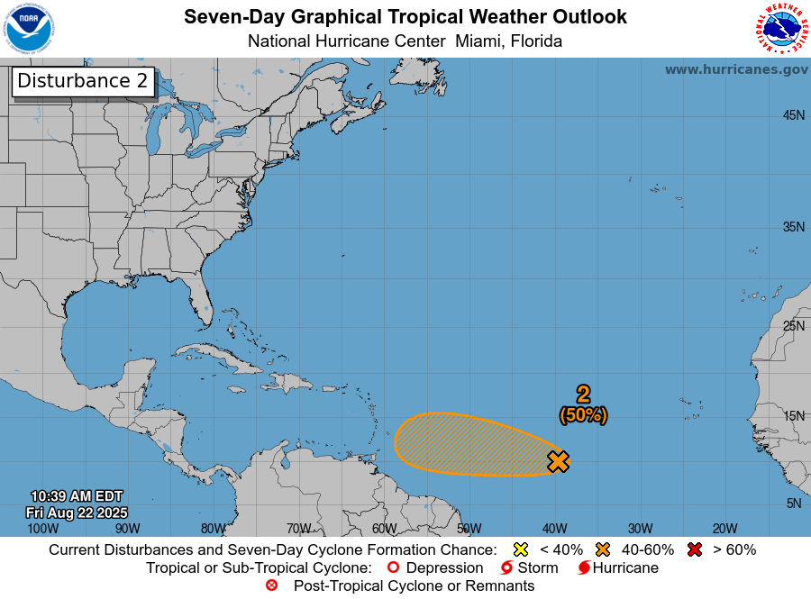
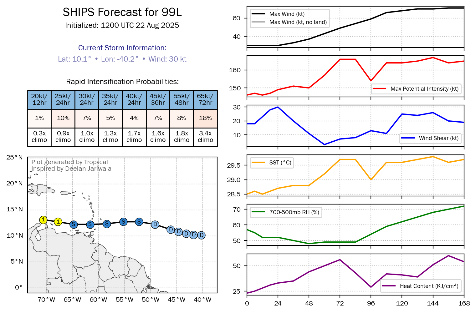
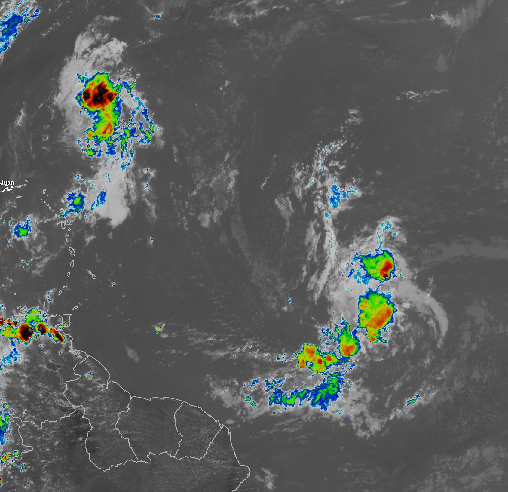
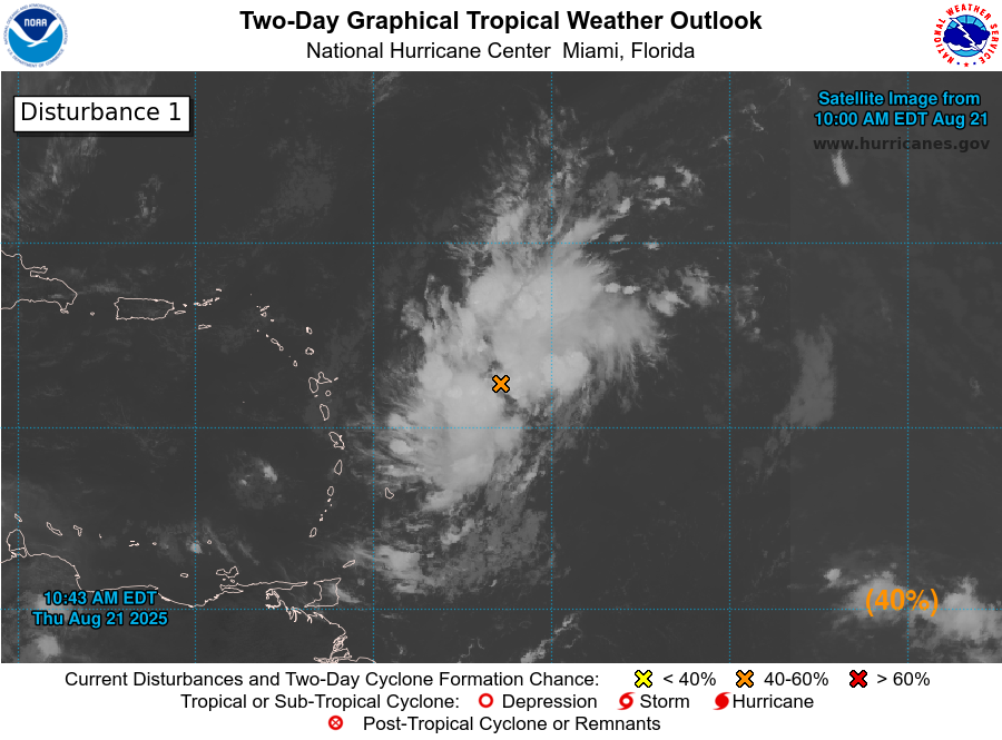
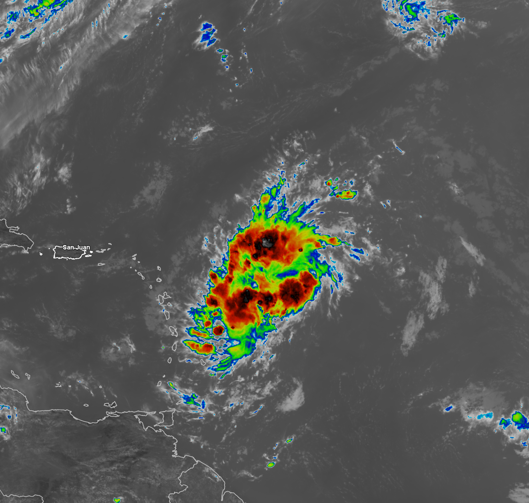
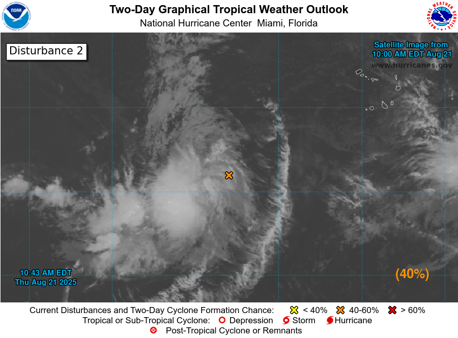
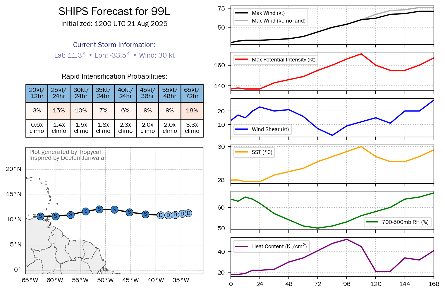
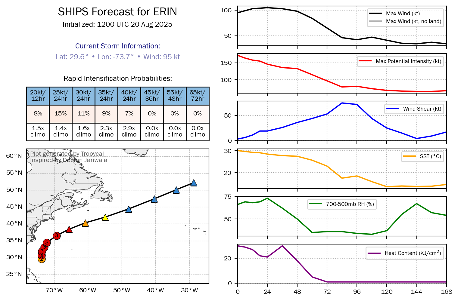
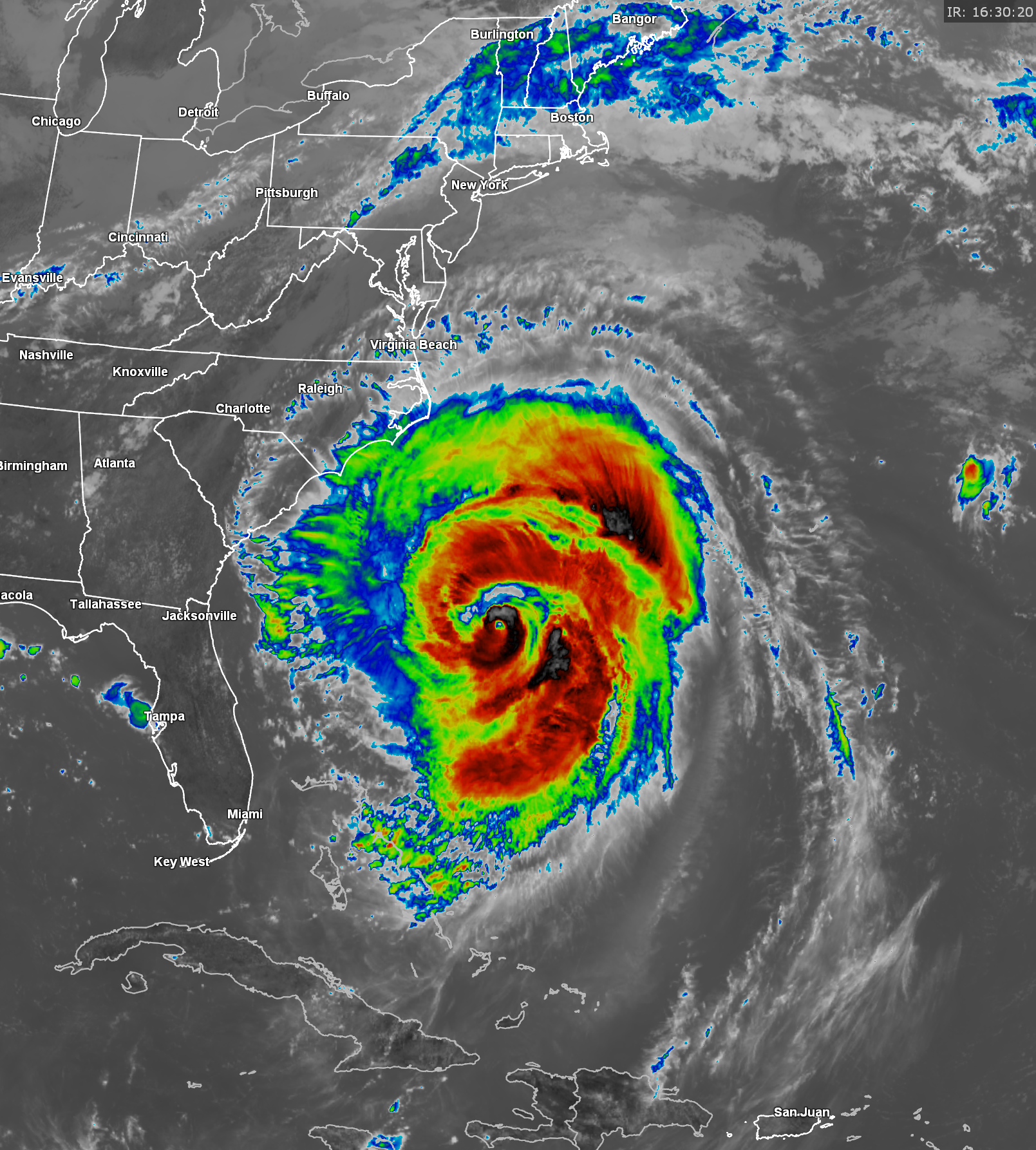
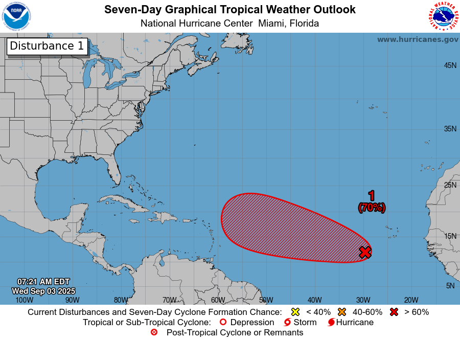
Tropical Wave Located Over The Eastern Tropical Atlantic: Satellite imagery and analysis of the latest weather data today revealed that the tropical wave that’s located over the eastern tropical Atlantic along about 32 West Longitude is still pretty disorganized. A look at the satellite imagery shows that there is disorganized shower and thunderstorm activity with the wave and that the cloud structure seems to have a bit of curvature look to it. That said, there is no defined areas of low or mid-level circulation with this wave.
All-in-all, I think that this wave still has at least a couple of more days until it may start development.
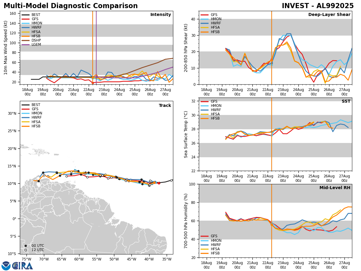
Looking at the environmental conditions around and ahead of this wave reveals that this wave continues to move within a narrow ribbon of low wind shear with much stronger wind shear located just to the north and just to the south of where this wave is located. Because of this, I still think that the development of this wave will be slow to occur over the next few days.
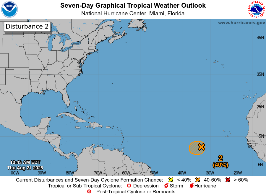
Looking further west, the environmental conditions become more favorable for development west of about 45-50 West Longitude. This means that the development chances of this wave look to increase by the time the wave reaches the area about 45-50 West Longitude late this weekend or early next week.
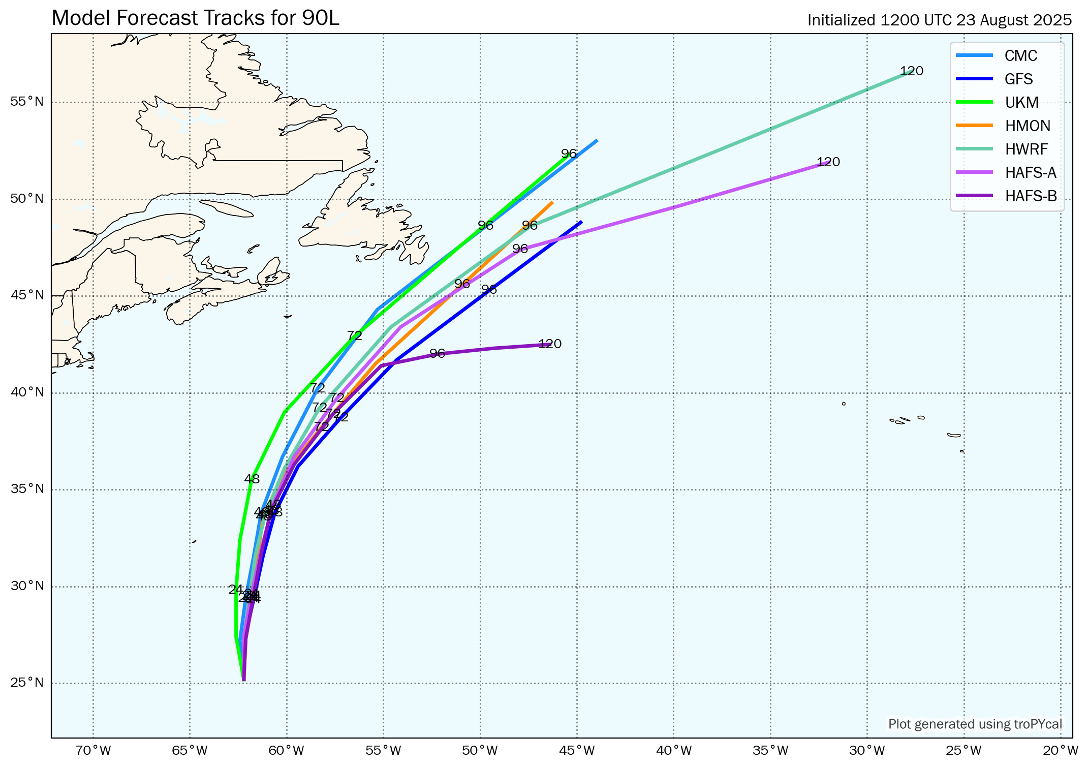
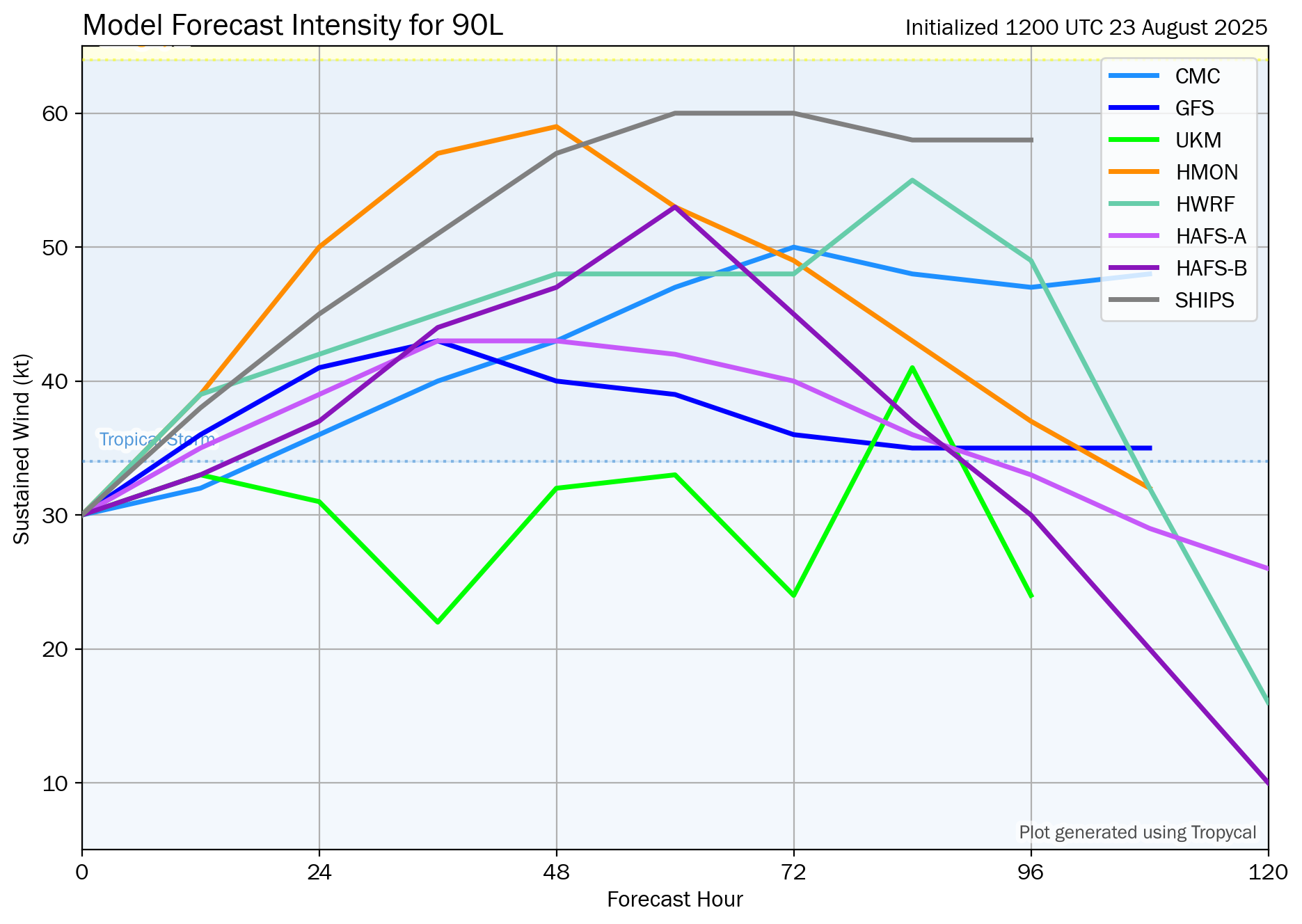
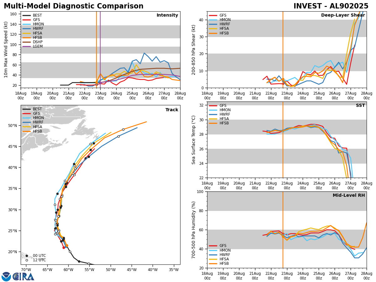
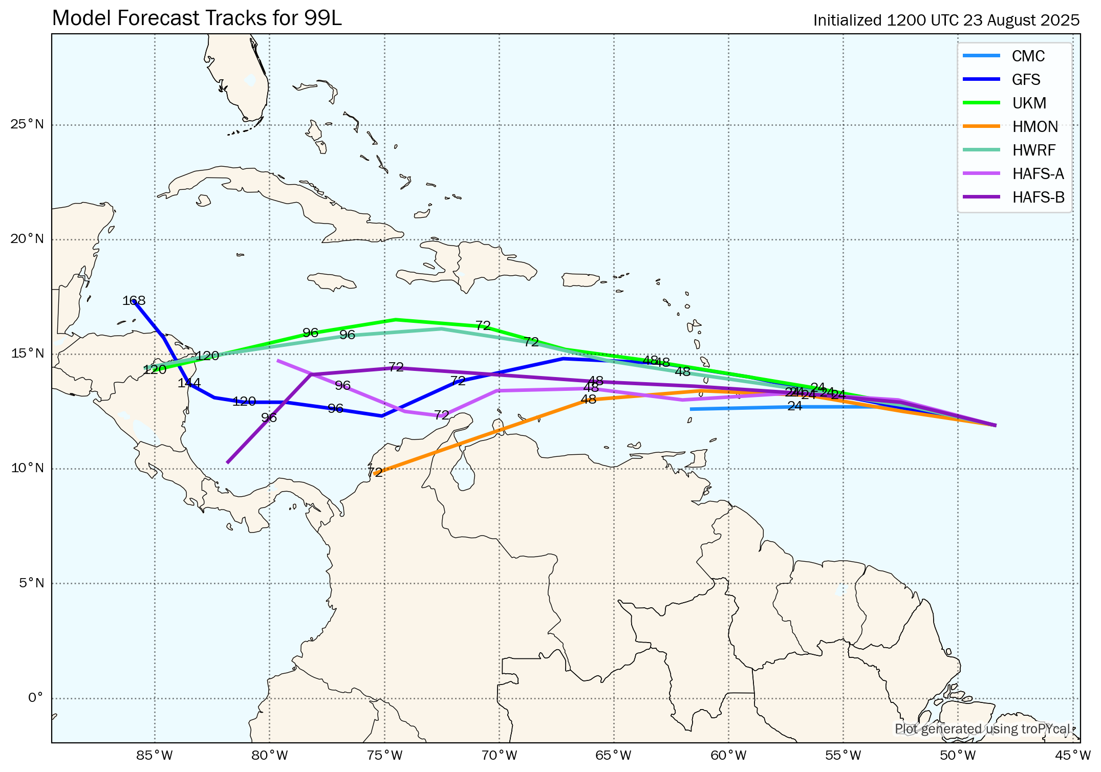
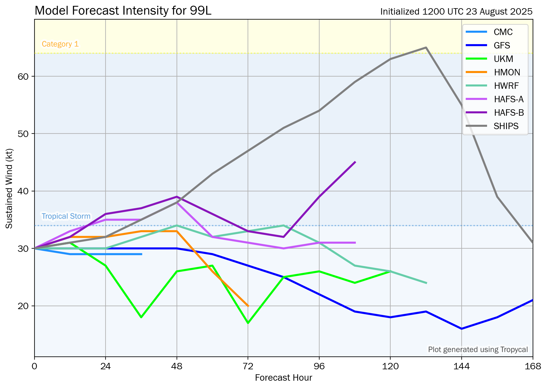
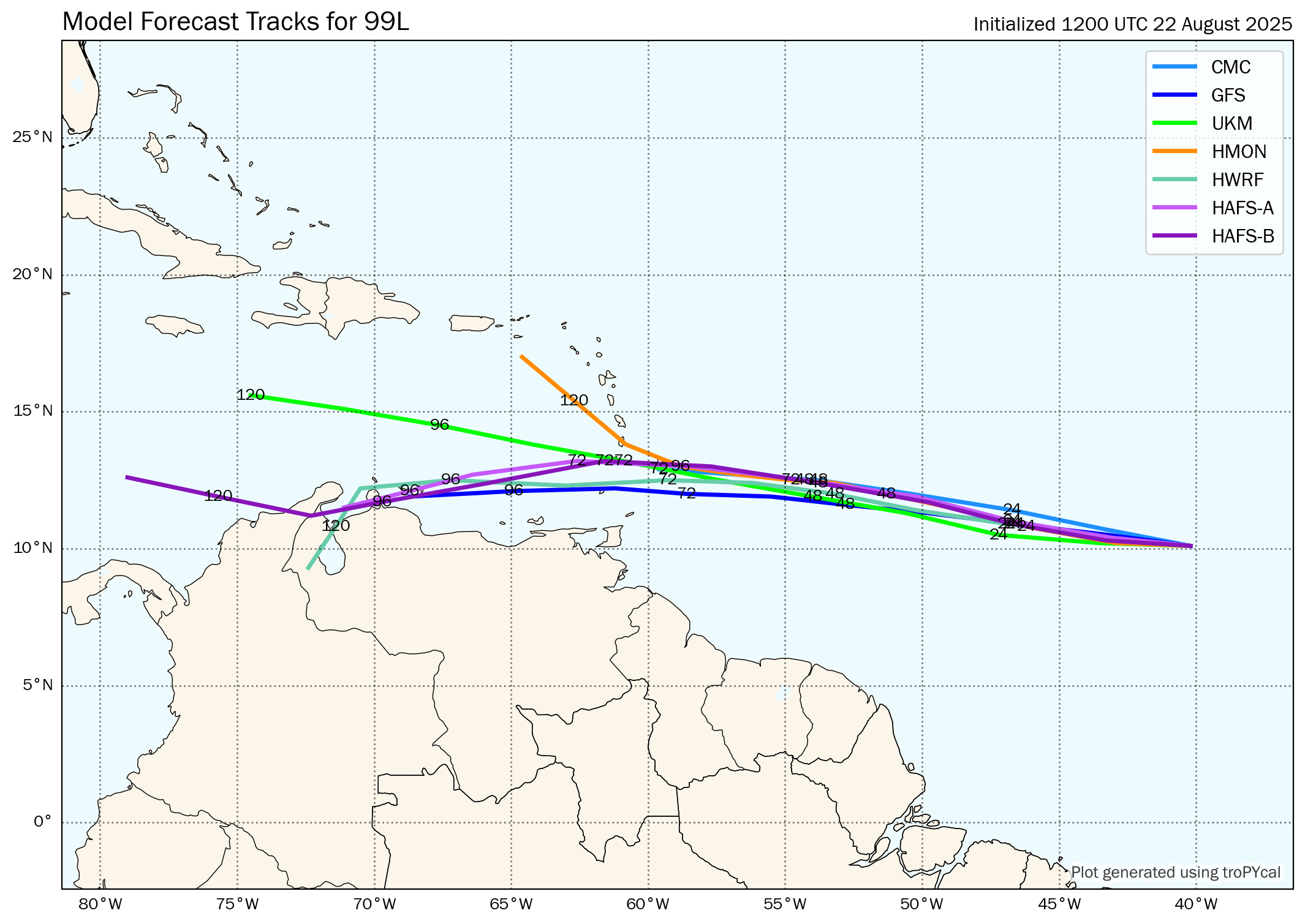
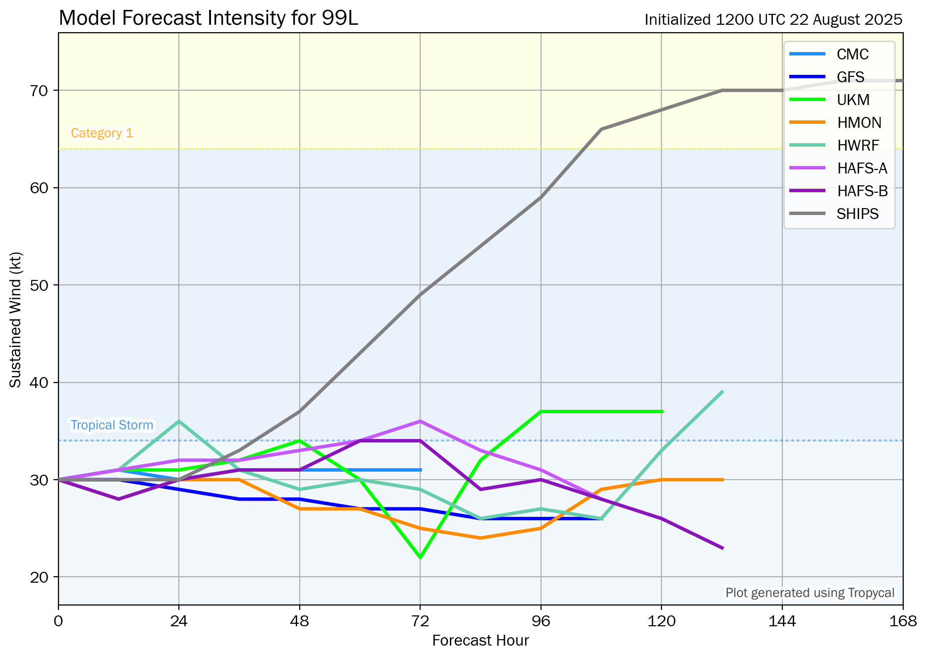
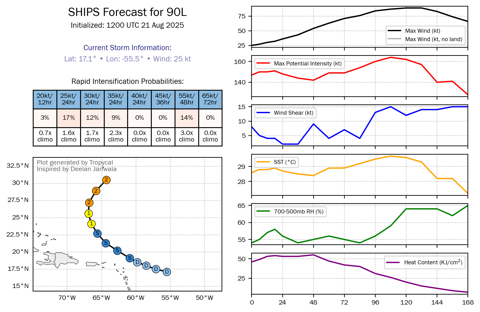
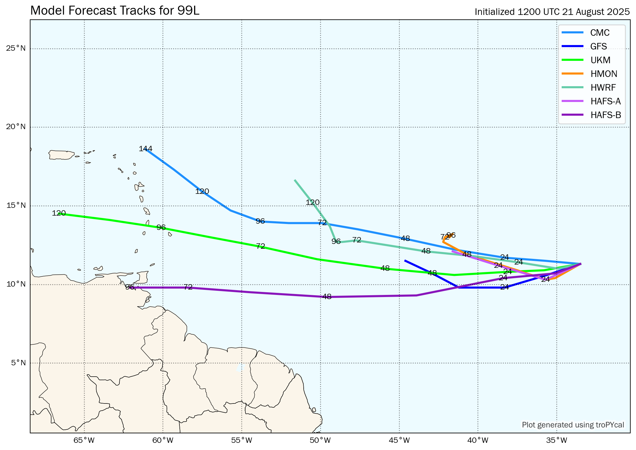
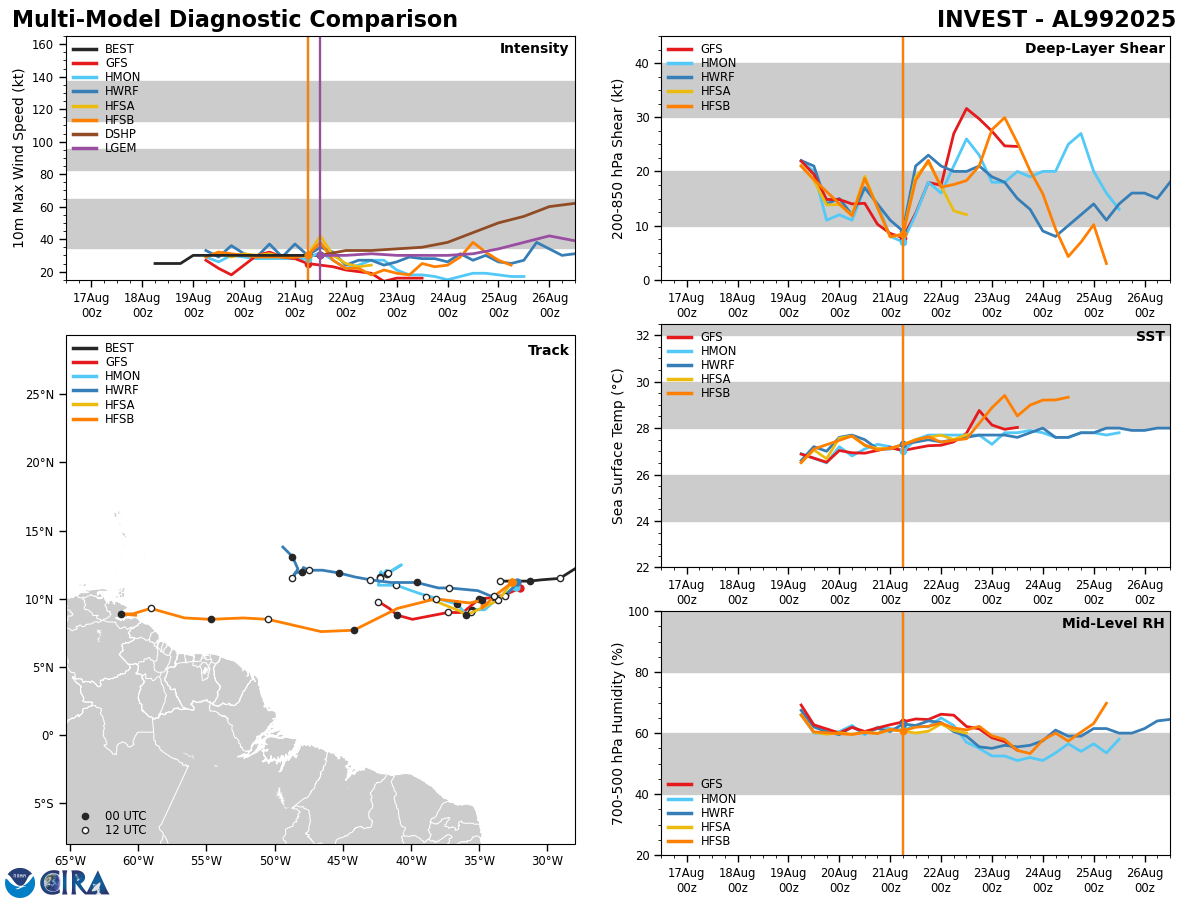
As for the latest model guidance, they all do show some slow and gradual development by this weekend. That said, they’ve all been very inconsistent with their forecasts & have fluctuated wildly from run-run with both forecast track and forecast strength. This says to me that the forecast of this wave is highly uncertain & it may be a few more days until we get a better idea of where this system might go and how strong it might become.
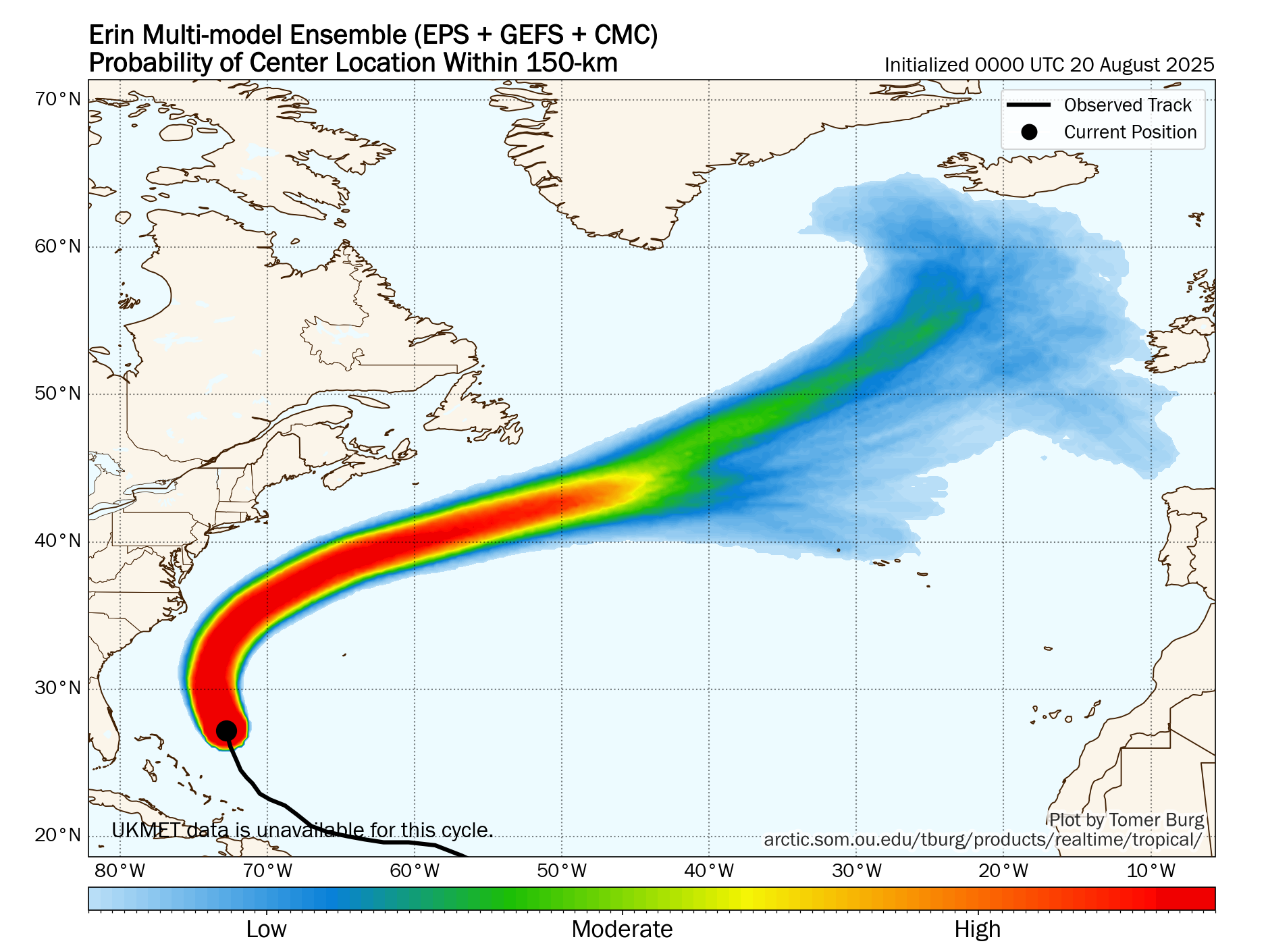
The latest GFS model run now shows little or no development from this wave over the next week or so due to its forecast of no relaxation in the unfavorable conditions that seems to be affecting this wave right now. It does show a safe path well to the north and east of the Lesser Antilles. The GFS model then forecasts strengthening of this system by next weekend when it turns northward and heads towards Bermuda.
The latest European model forecast from its 06Z run now shows this wave becoming a rapidly strengthening hurricane by Monday and Tuesday of next week as it heads westward towards the Lesser Antilles. This is a big difference from last night’s 00Z European model run when it forecast this wave to strengthen some to perhaps a tropical storm by early next week & this run of the European model forecasts a direct impact on the Leeward Islands, Virgin Islands and Puerto Rico between Wednesday & Friday of next week as a weakening tropical storm. Again, be aware that all of the models have been very inconsistent, so buyer beware when looking at them.
As for the ensemble guidance – The GFS ensemble model guidance continues to cluster around a scenario that keeps this system north of the Lesser Antilles around Tuesday or Wednesday of next week. Beyond this, there are a fair number of ensemble members that show a very close brush or a direct impact with the island of Bermuda around next Friday or next Saturday.
The European ensemble model guidance seems to have trended both weaker and with more members showing a track keeping this system to the north of the Lesser Antilles during the second half of next week. That said, there are still about 30 percent of the ensemble members that do still show a direct impact on the far northeastern islands of the Caribbean.
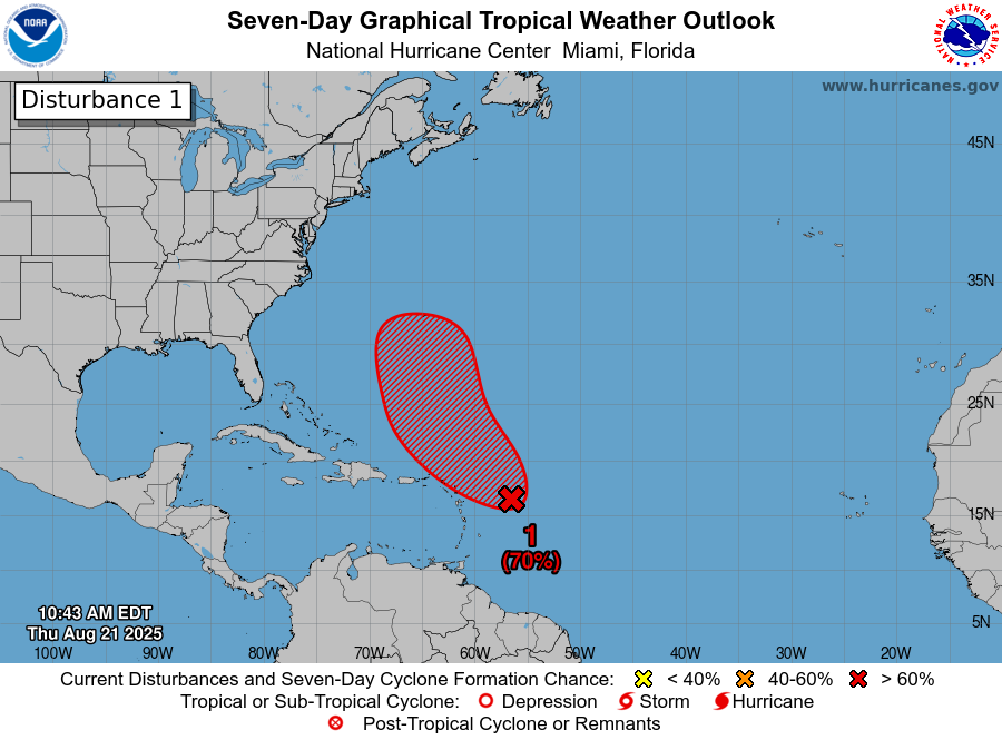
Here Are My Thoughts: First, I think that we probably will not see any notable development during at least the next 2-3 days or so due to not very favorable environmental conditions. I think any development may wait to happen until this weekend and during the early part of next week when this system moves past the 50 West Longitude line.
Second, my recommendation for those of you in the eastern and especially the northeastern Caribbean is to monitor this system very closely. That said, this system is still at least 7-9 days away from affecting the islands of the eastern Caribbean, if it does at all. This means that we have more than plenty of time to keep an eye on this wave, no matter what it does.
Looking beyond this, it seems more likely than not that this system will probably be turned northward and then turned northeastward away from the US East Coast. The reason why this looks quite plausible is due to the fact that the weather pattern over the eastern United States is quite amplified with a persistent upper level trough & frequent fronts moving off of the East Coast. This should support the idea of anything moving towards the East Coast of the US to be turned safely well before it gets close.
There is, however, the potential for some sort of threat or even a direct impact to the island of Bermuda late next week into next weekend depending on how sharp the turn to the north and northeast is.
The bottom line is that this system could become some sort of a threat to the islands of the northeastern Caribbean, including the Leeward Islands, Virgin Islands and Puerto Rico around Wednesday or so of next week. There is, however, more than plenty of time to keep an eye on this wave.
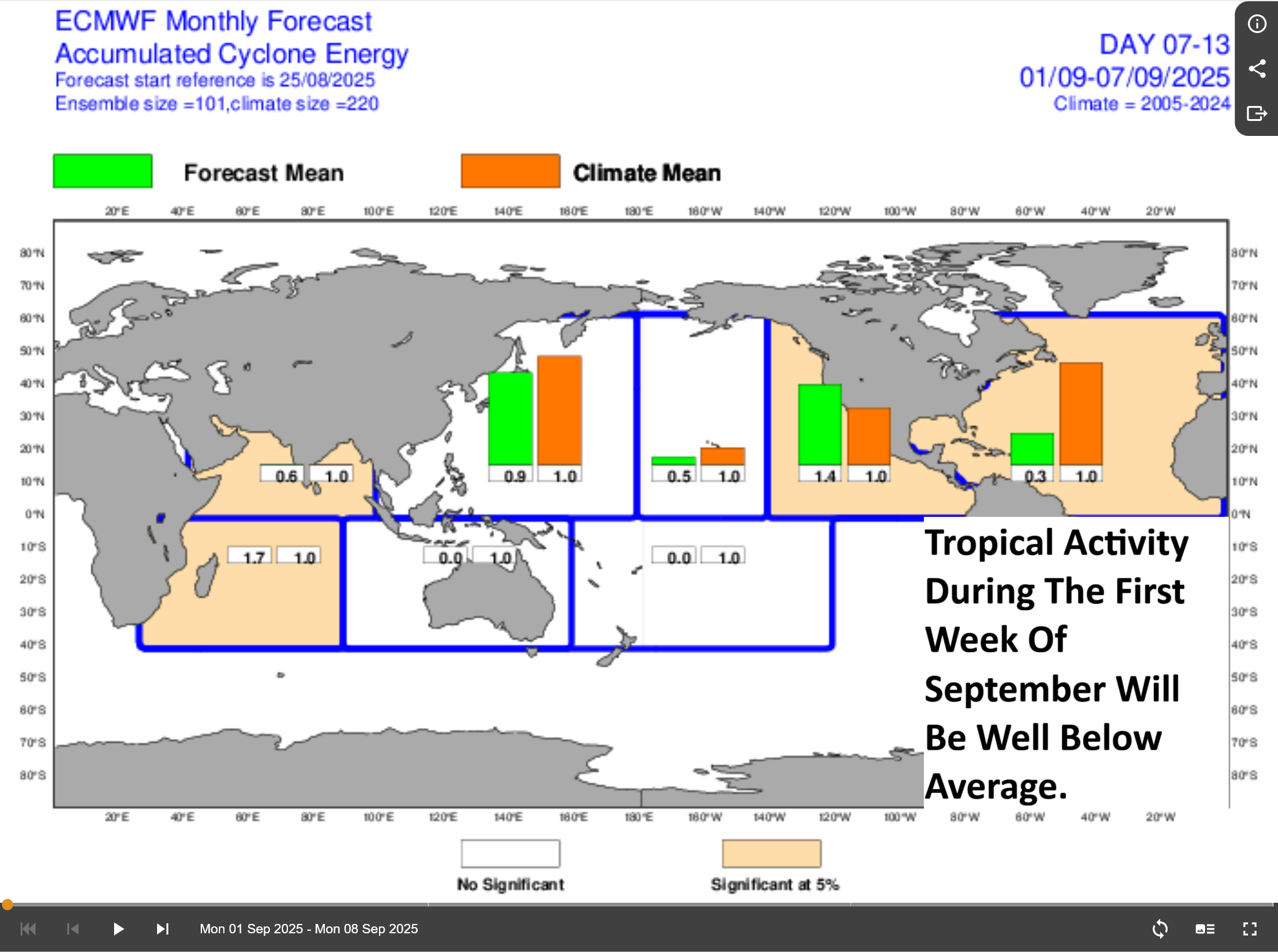
Western Caribbean Or Bay Of Campeche Tropical Mischief Possible Later This Month: As I wrote in my evening update a couple of days ago, in addition to monitoring the tropical wave over the eastern Tropical Atlantic, I’m also keeping an eye on the western Caribbean for possible tropical development during the second half of this month.
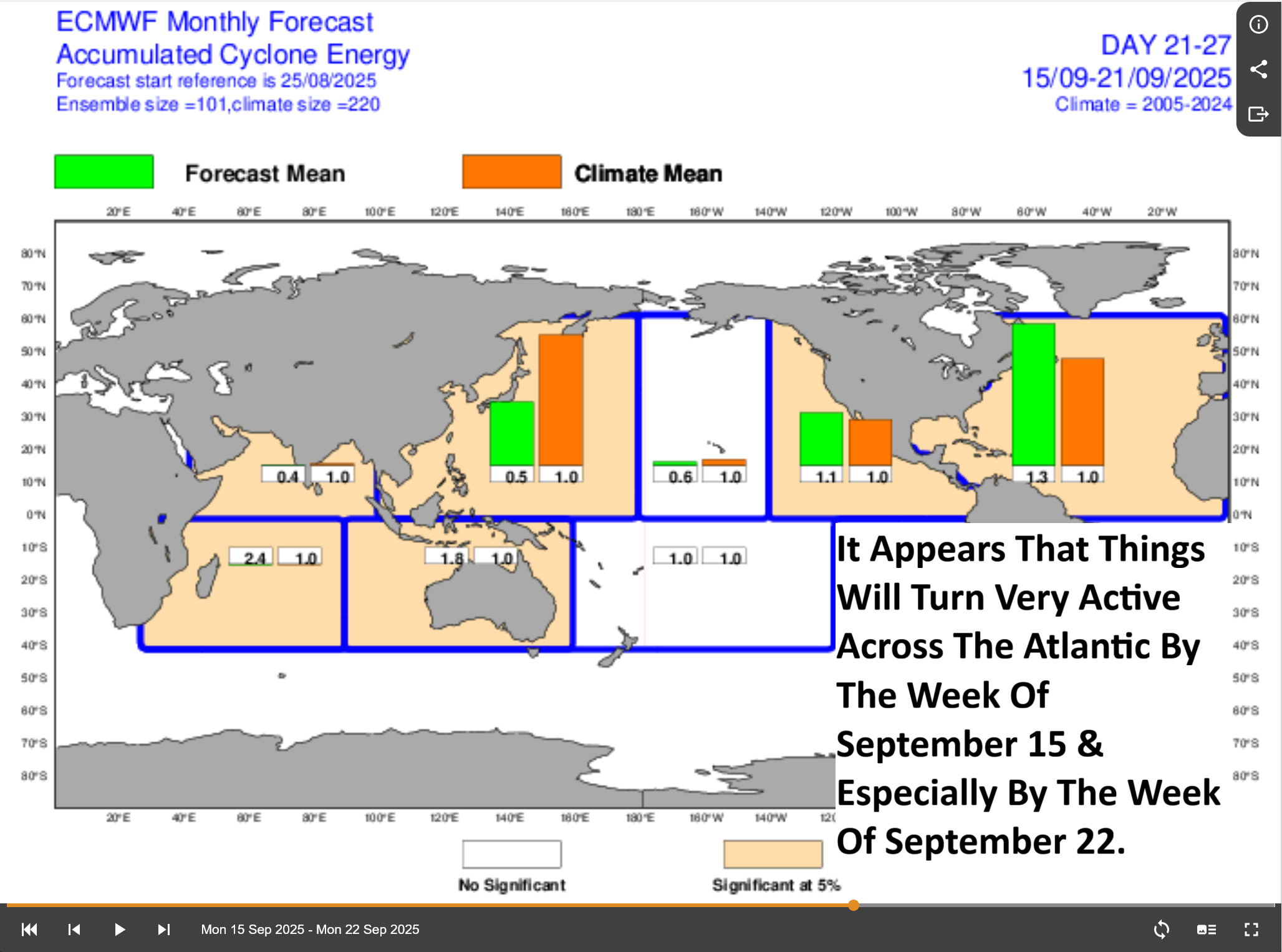
There is some support in the model guidance that suggests there may be some increase in tropical development chances in the far western Caribbean and in the Bay of Campeche during the week of September 15. Those tropical development chances seem to really increase during the week of September 22 across the western Caribbean and across the Bay of Campeche & this is when I think we may really need to watch the western Caribbean for potential tropical development.
Supporting the idea of potential western Caribbean or Bay of Campeche tropical development are the expectations of an upward motion pulse of the Madden Julian Oscillation making its way into the Caribbean and the Atlantic by the second half of this month. This should cause increased stormy weather and a favorable background state for tropical development.
This all means that our eyes may really need to turn to the western Caribbean for the second half of this month & unfortunately, I think that anything that tries to form in the western and northwestern Caribbean will end up being pulled northward into the Gulf rather than being shunted westward into Central America. The reason why I think this is because of the persistent weather pattern of a Eastern US upper level trough, which if it remains in place would pull anything from the western Caribbean northward into the Gulf.
More updates on the possibility of Western Caribbean or Bay of Campeche development will be posted as needed.
The next tropical weather discussion will be issued on Friday.