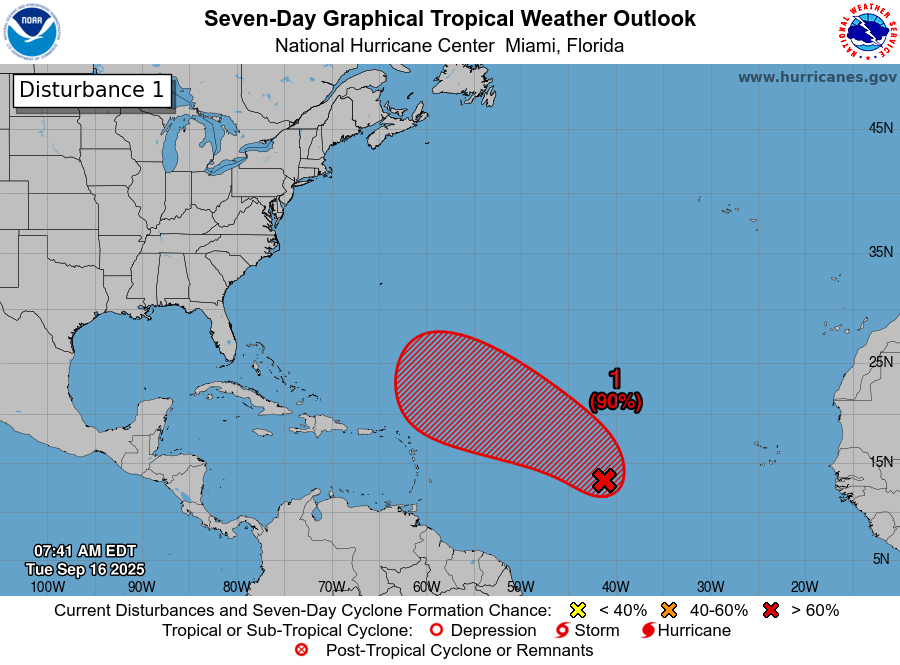
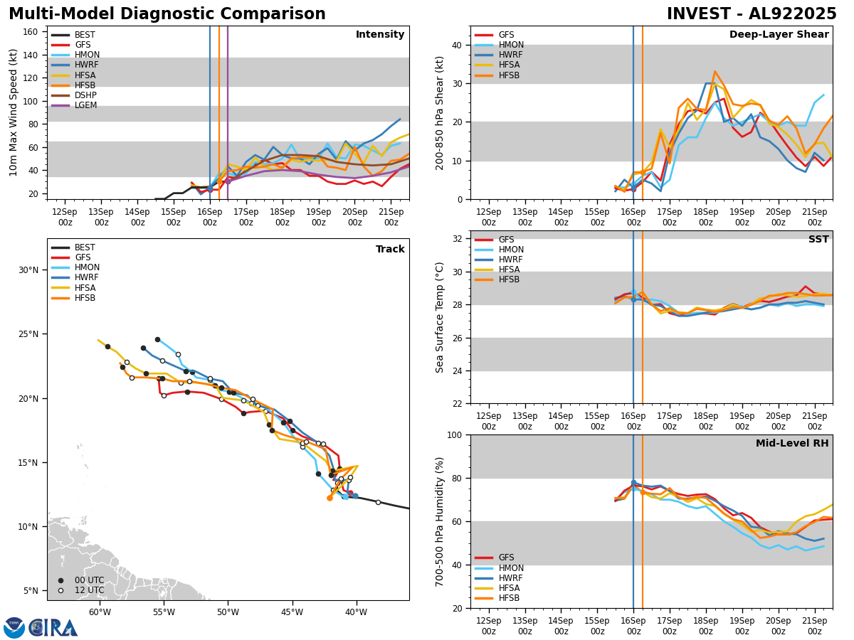
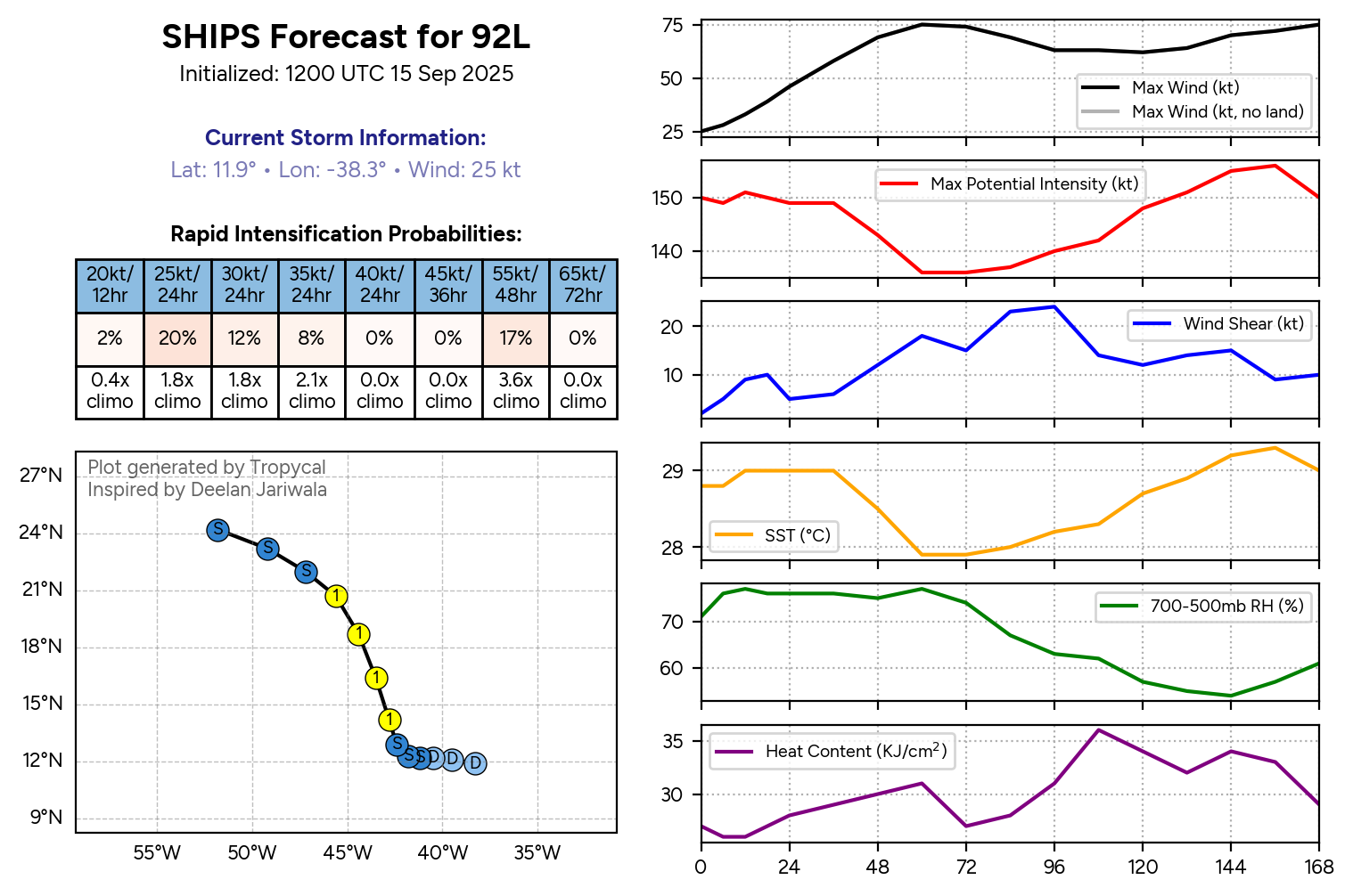
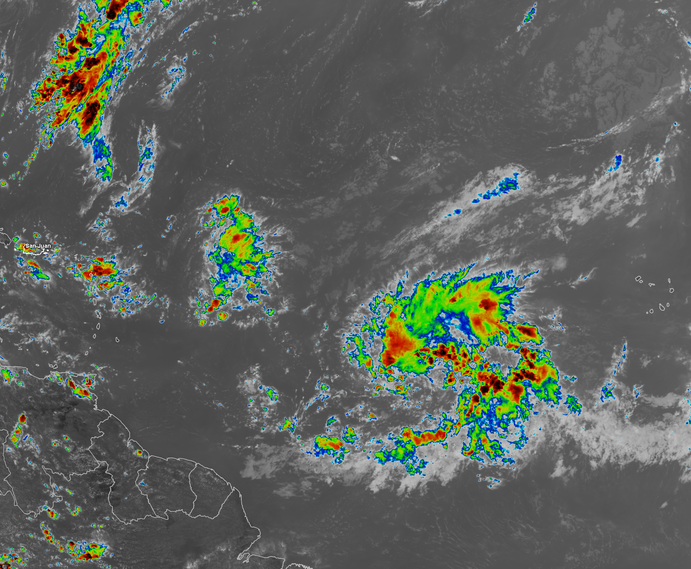
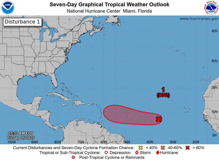
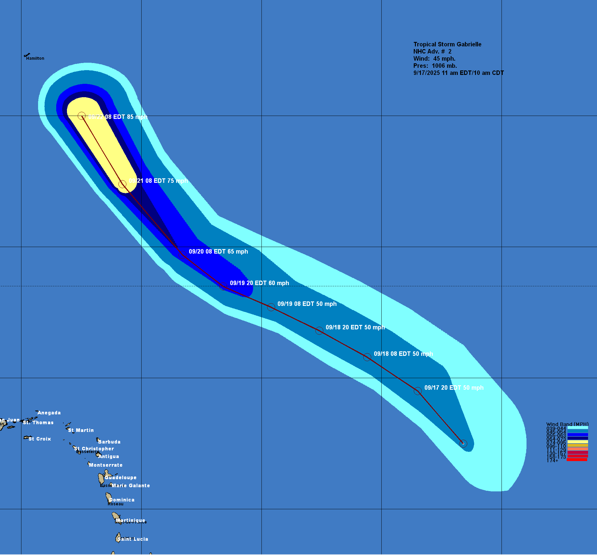
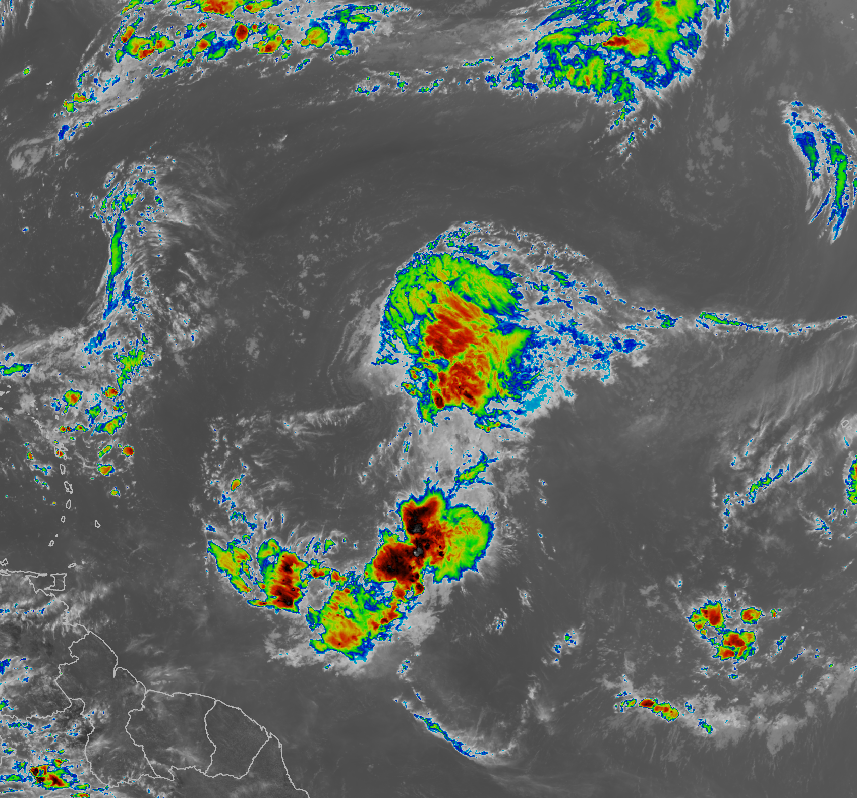
Tropical Depression #7 (Now Tropical Storm Gabrielle): I’m actually surprised that they upgraded Invest 92-L to a tropical depression earlier this morning given what it looks like on satellite imagery (now, I’m really surprised they upgraded it to Tropical Storm Gabrielle).
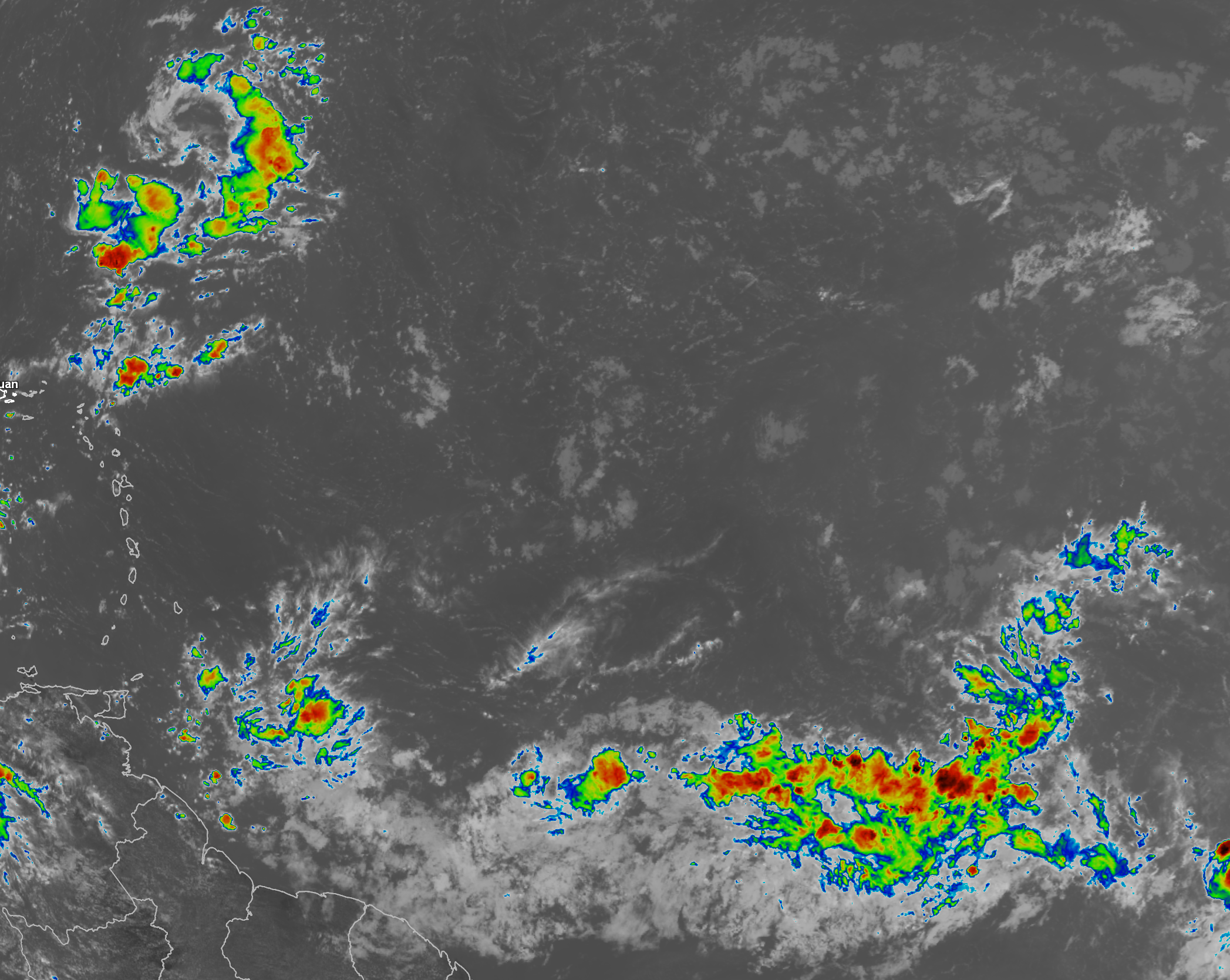
Satellite imagery today reveals that this system seems to lack any sort of a defined low-level circulation. In fact, it still looks like a tropical wave to me, especially with how elongated and disorganized it is.
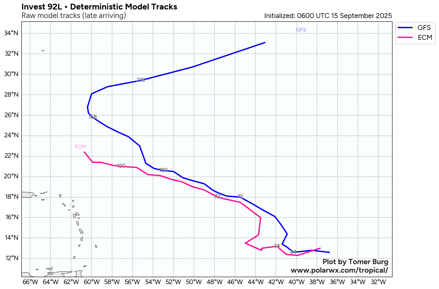
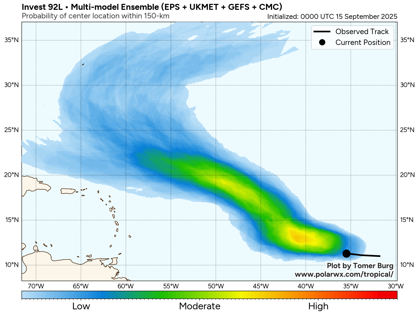
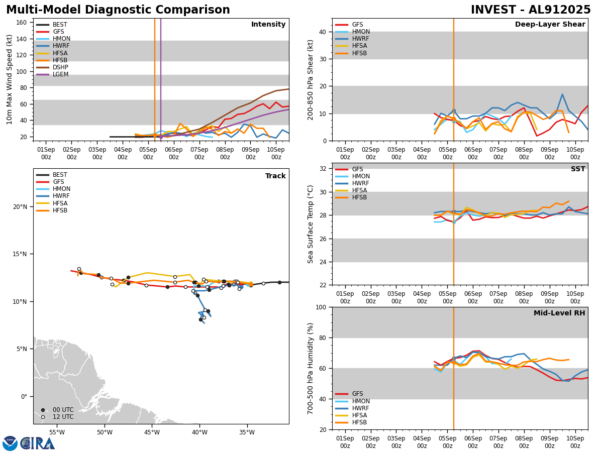
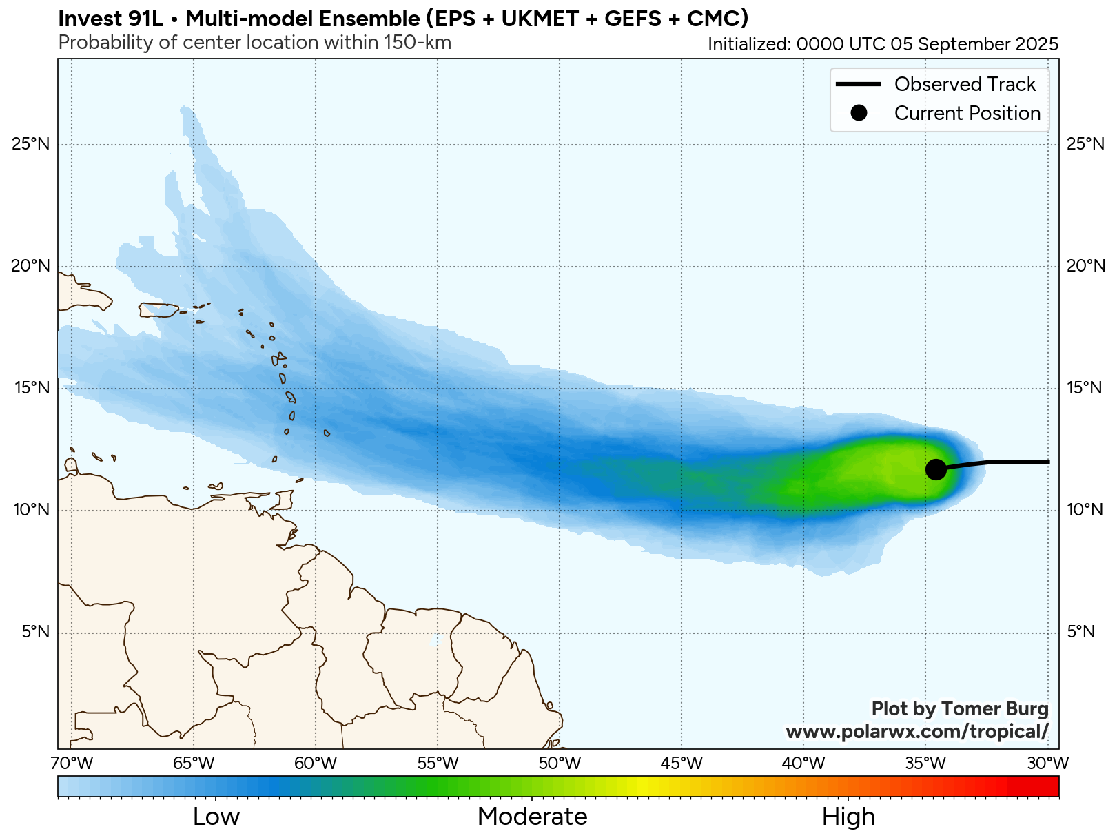
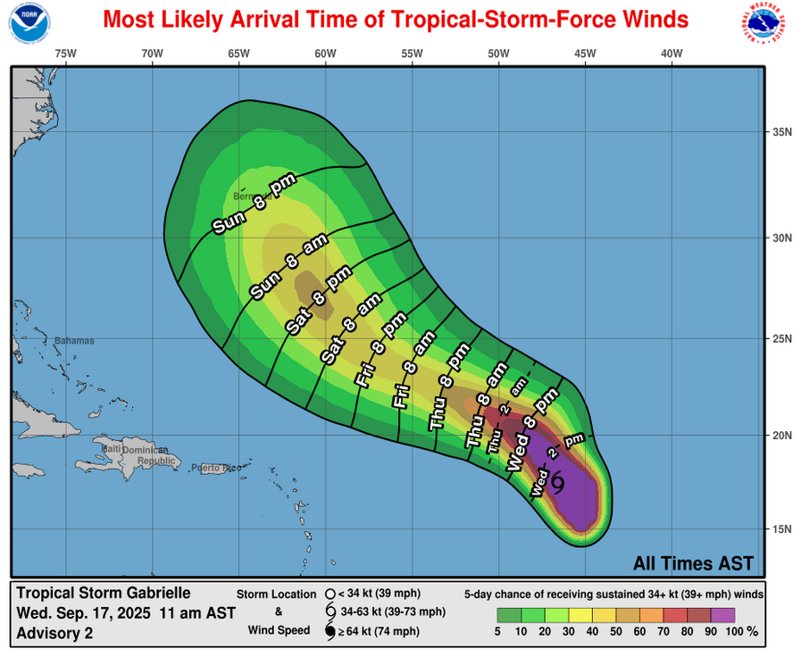
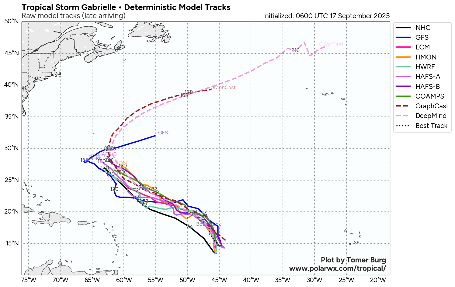
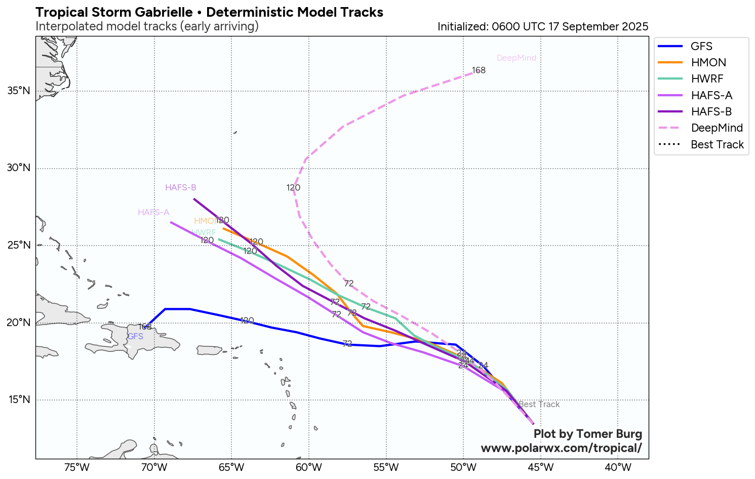
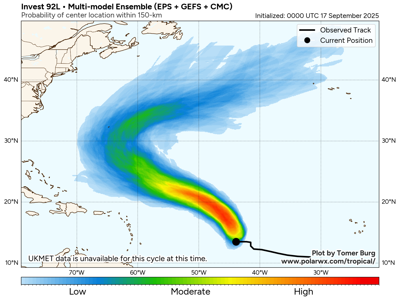
Anyways, now that we have Tropical Depression 7 designated by the National Hurricane Center, the depression seems to be moving on a west-northwest to northwest direction and this general direction is likely to continue for the next few days. Because of this, it is quite likely that this system will pass well to the east and northeast of the Lesser Antilles during this weekend.
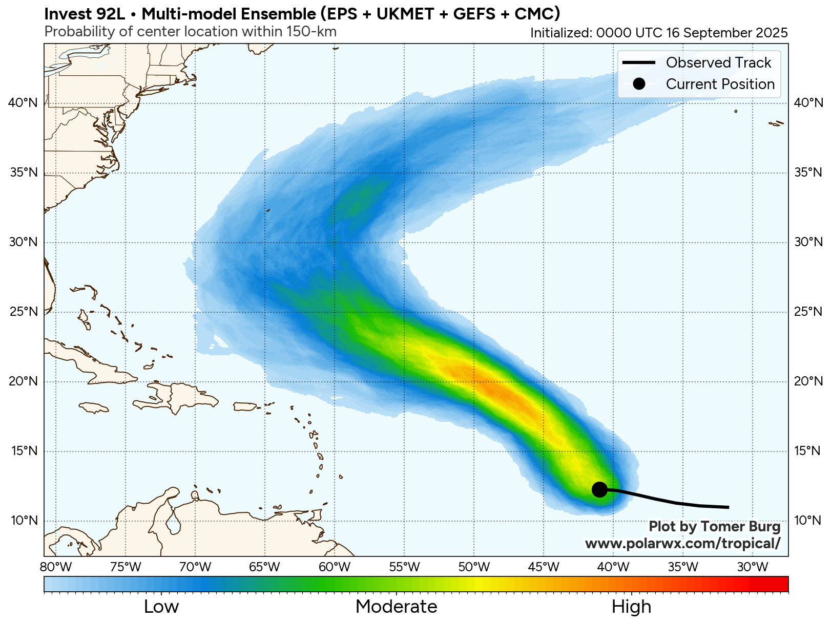
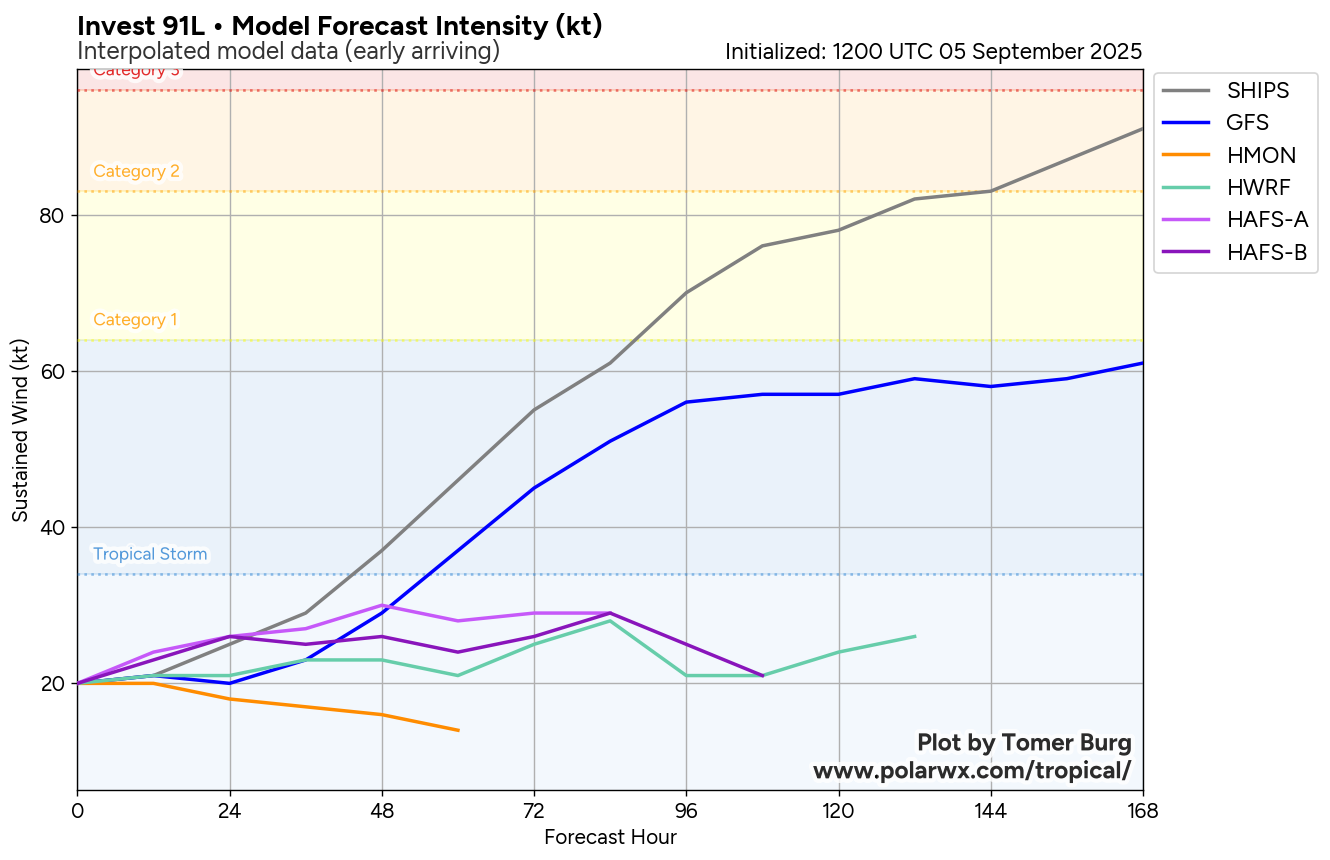
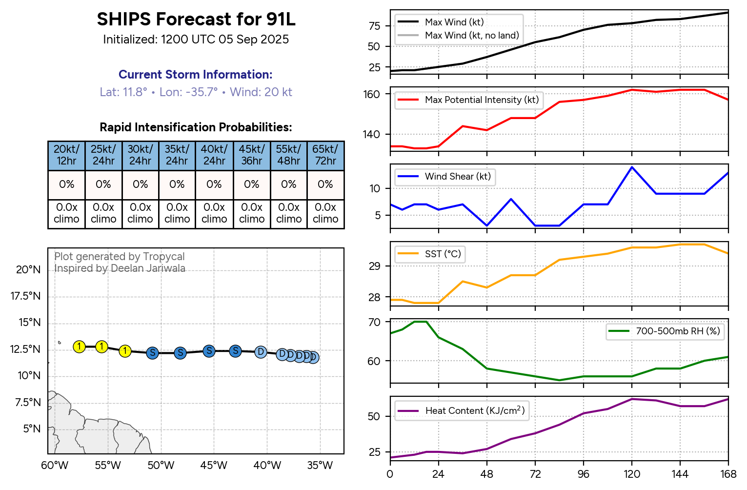
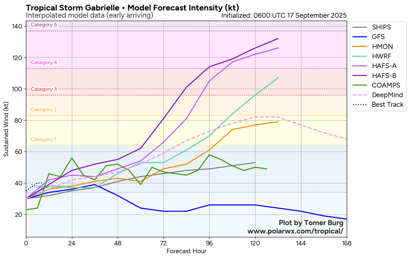
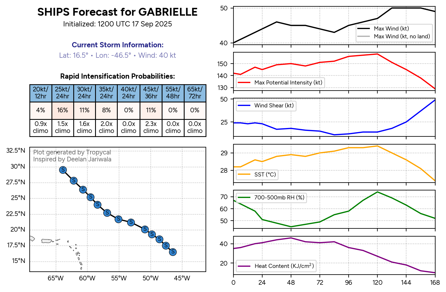
Beyond this, it continues to look quite possible that this system will be a threat to the island of Bermuda around Tuesday of next week. Also, this system is probably going to struggle to strengthen over the next few days due to moderate amounts of wind shear & ingestion of dry air. Once we get into this weekend and early next week, however, this system may move into an environment that’s more favorable for strengthening & because of this, Bermuda may have a hurricane threat around Tuesday of next week. The uncertainty lies to whether the depression will track directly over the island or pass to the east of the island. My recommendation to those of you in Bermuda is to monitor this system extremely closely over the coming days.
As for the Bahamas and the East Coast of the United States, it continues to look fairly likely that an upper level trough located over the western North Atlantic will keep this system from heading towards the Bahamas or the East Coast of the United States. Instead, this upper level trough will deflect the depression and turn it to the north and northeast away from the Bahamas and the US East Coast. It should be noted though that if this system does become a strong hurricane in the middle of the North Atlantic, it could send another round of rough surf and rip currents to the East Coast of the United States during next week.
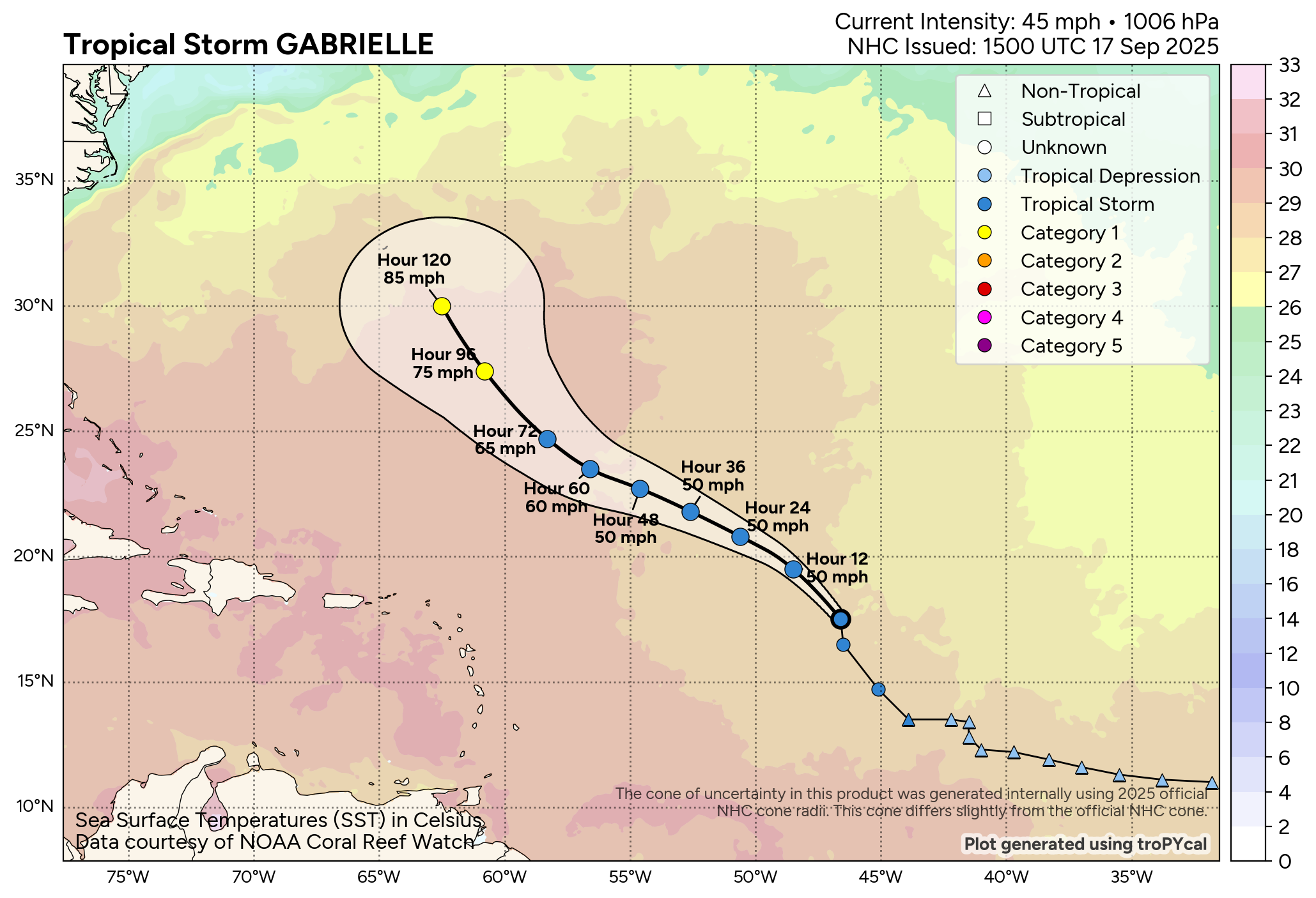
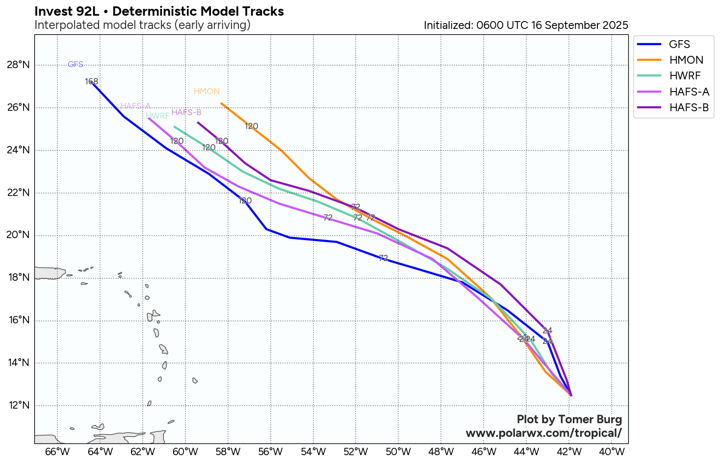
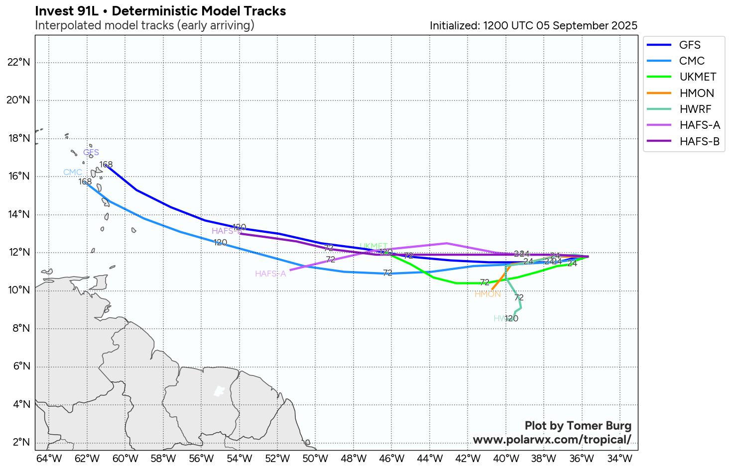
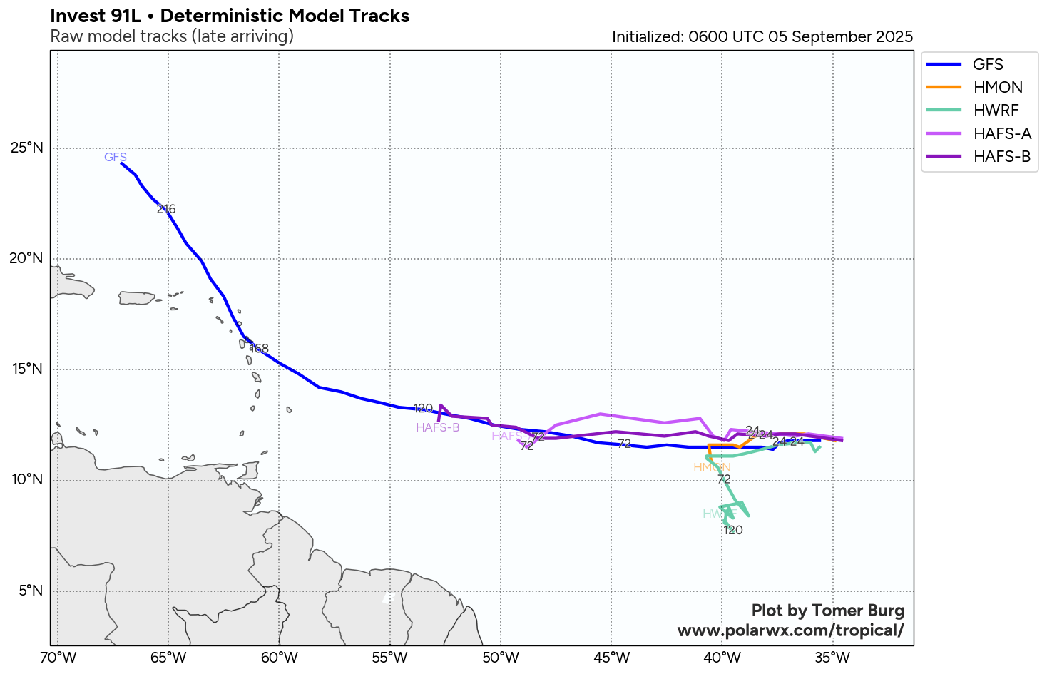
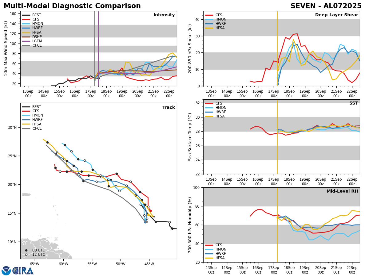
Model Track Forecast:
Satellite Imagery:
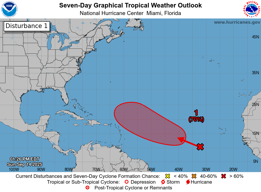
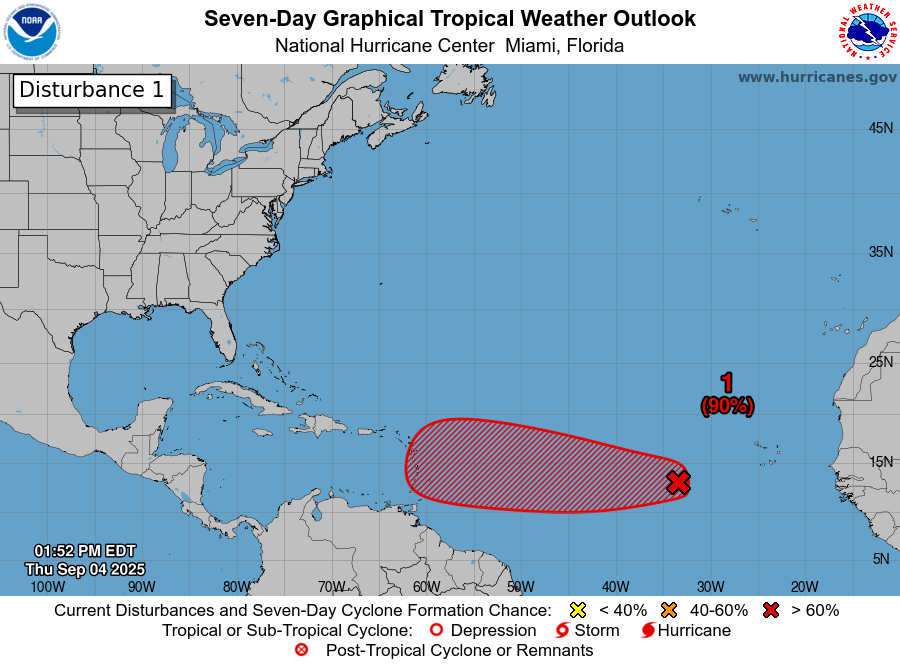
Elsewhere Across The Atlantic, Caribbean & Gulf: There is another tropical wave that’s located over the far eastern Tropical Atlantic that’s producing some disorganized convection. All-in-all, this system may not really develop at all due to marginally favorable environmental conditions. Also, it is expected that this wave will eventually curve out into the open Atlantic well before it reaches the Lesser Antilles.
Looking much closer to the United States, satellite imagery and weather analysis indicates that there is a surface trough of low pressure stretched from the far northwestern Caribbean northeastward to across central and south Florida. There is scattered convection occurring all along the surface trough. It is expected that this surface trough of low pressure will remain in place & because of this, expect a continuation of scattered showers and thunderstorms across the northwestern Caribbean, the Florida Keys, South and Central Florida and the northern Bahamas over the next couple of days or so.
It should be noted that some of the model guidance forecast that this mess will evolve into the development of a surface low pressure system over the Bahamas around this weekend. While this is something that will be watched closely, it appears that the environmental conditions may just be too unfavorable for any sort of tropical development.
Finally, we may have to turn our eyes towards the western Caribbean and the Bay of Campeche as soon as late next week.
The ensemble members of the GFS model show a uptick in members forecasting development in the Bay of Campeche between about Wednesday and Friday of next week.
Meanwhile, the European ensemble model guidance shows a little increase in the chances for tropical development over the Bay of Campeche as well as over the western Caribbean next weekend.
The Google Deep Mind AI ensemble model is pointing towards the northwestern Caribbean being a spot to watch for tropical development around next weekend.
All-in-all, the gradual increase in tropical development chances over the western Caribbean and Bay of Campeche in about 10 days or so from now does not surprise me & it fits in to what I think will be an area to closely watch for development chances between September 26 and October 10.
The next tropical weather discussion will be issued on Thursday.