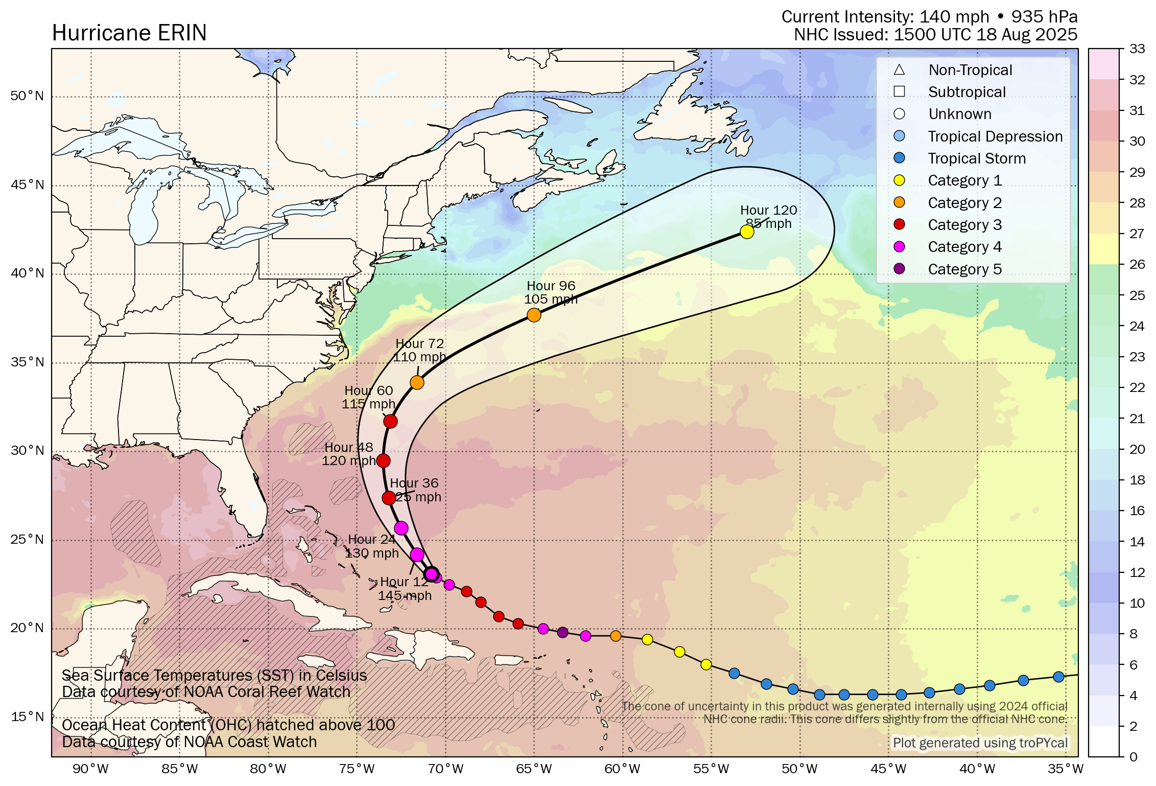
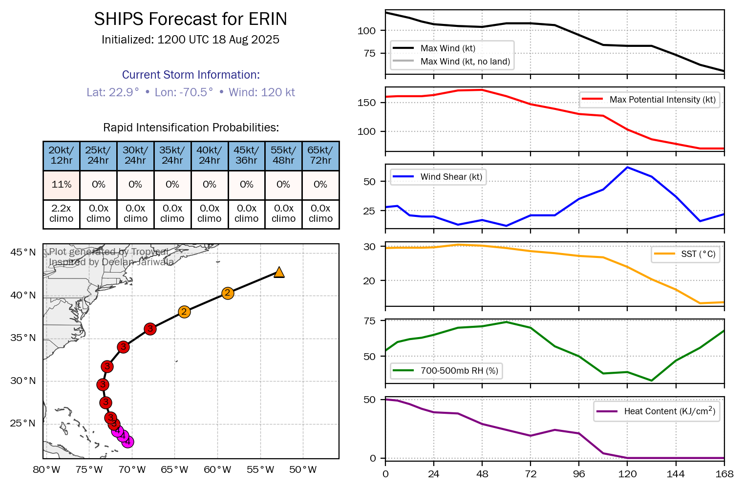
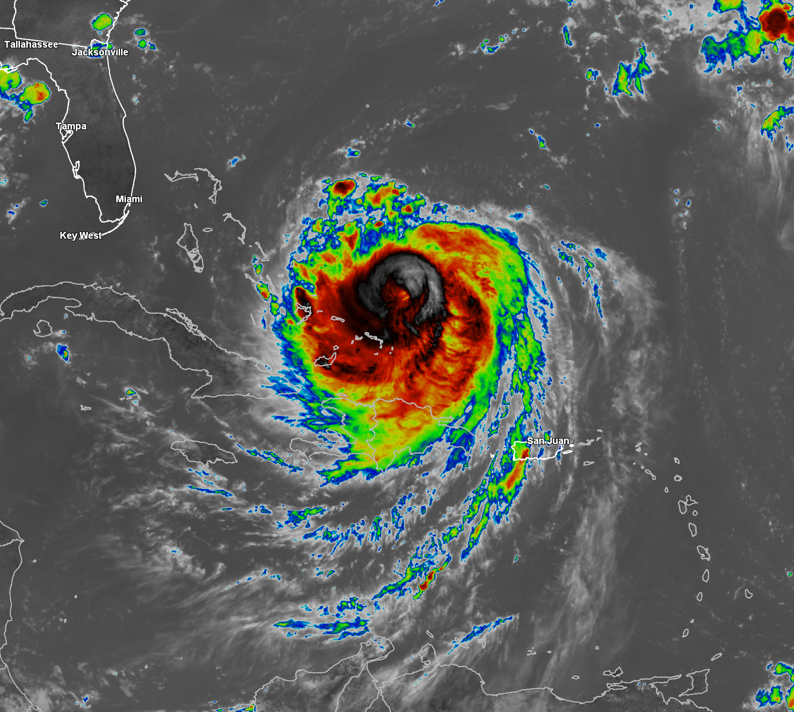
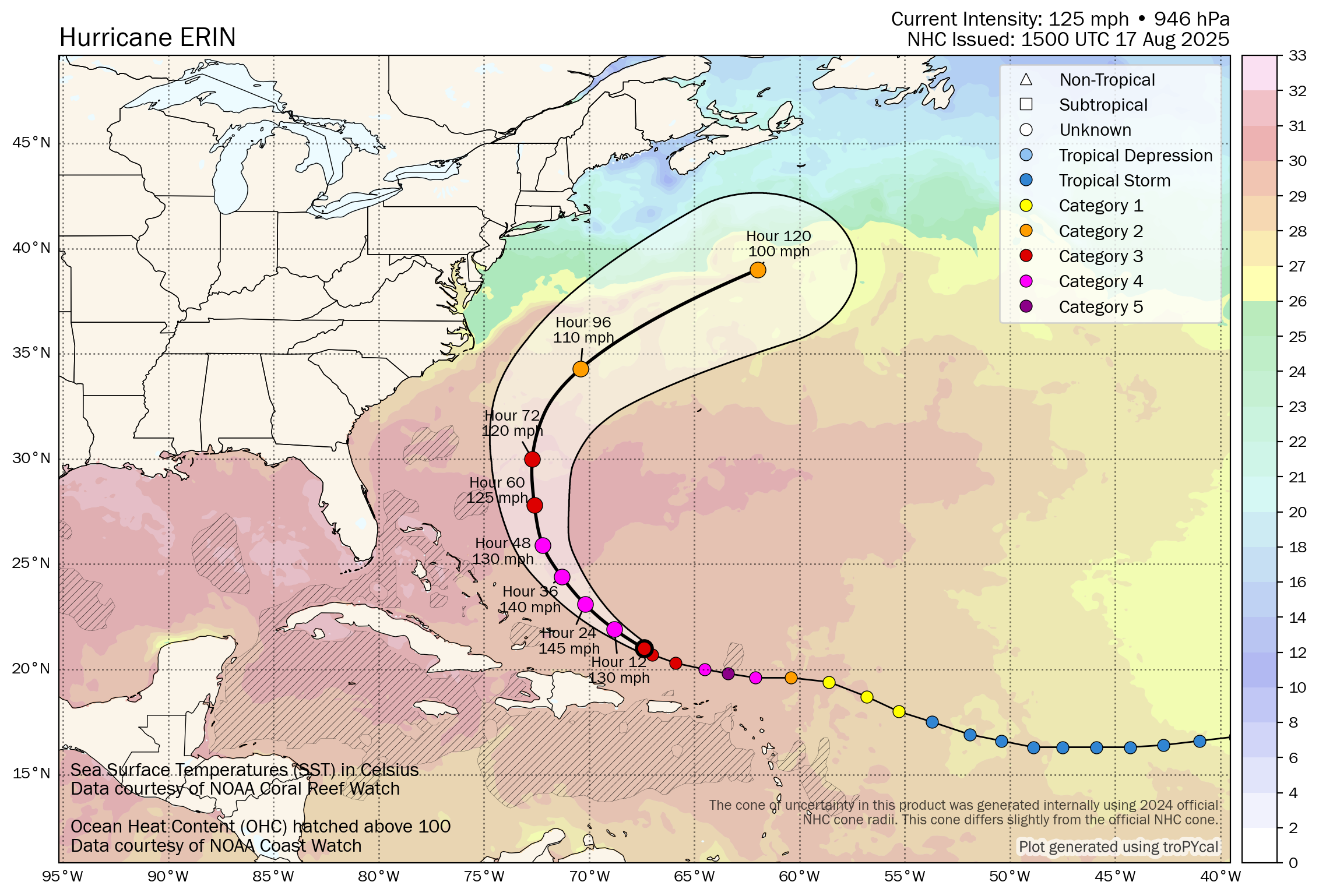
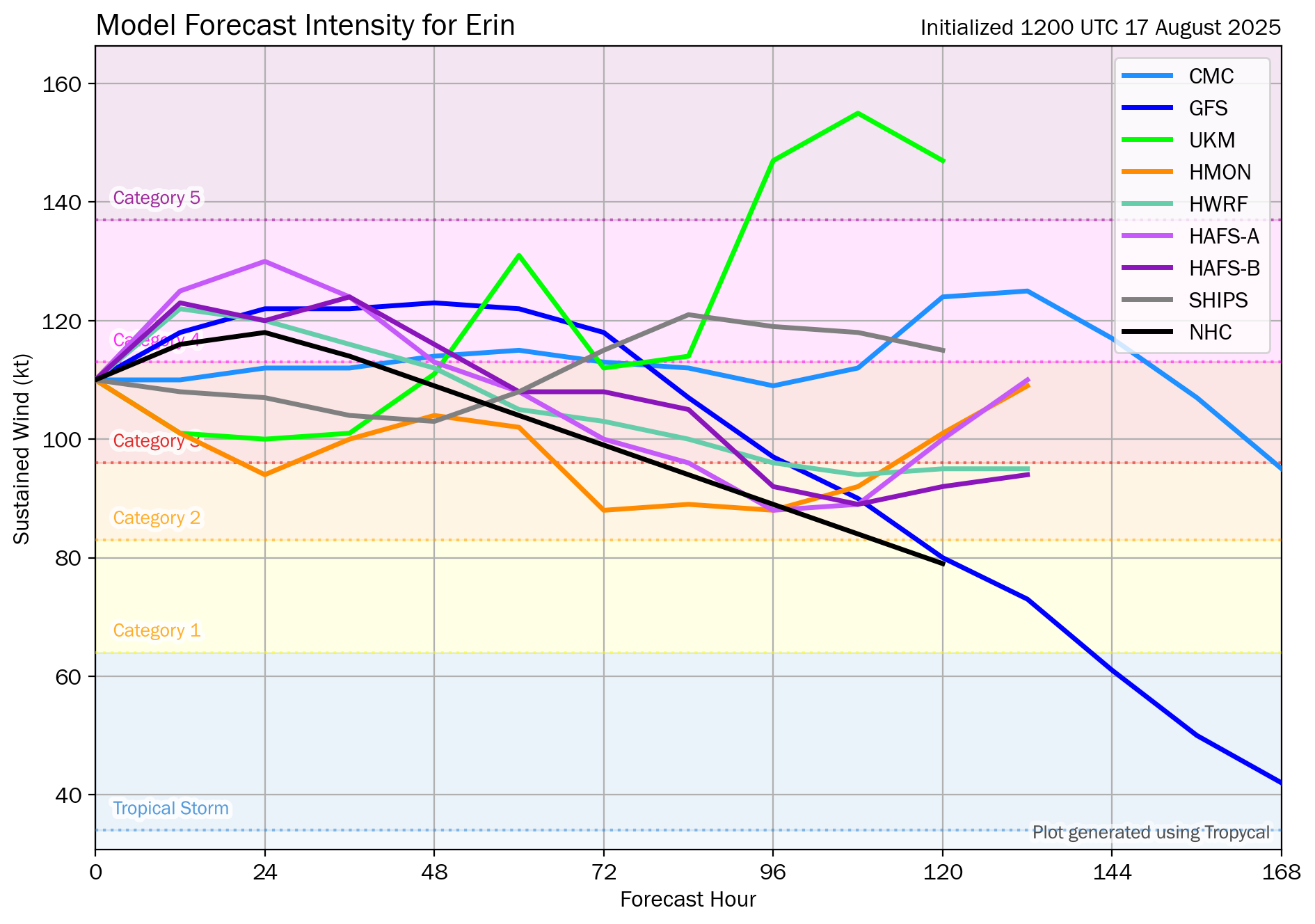
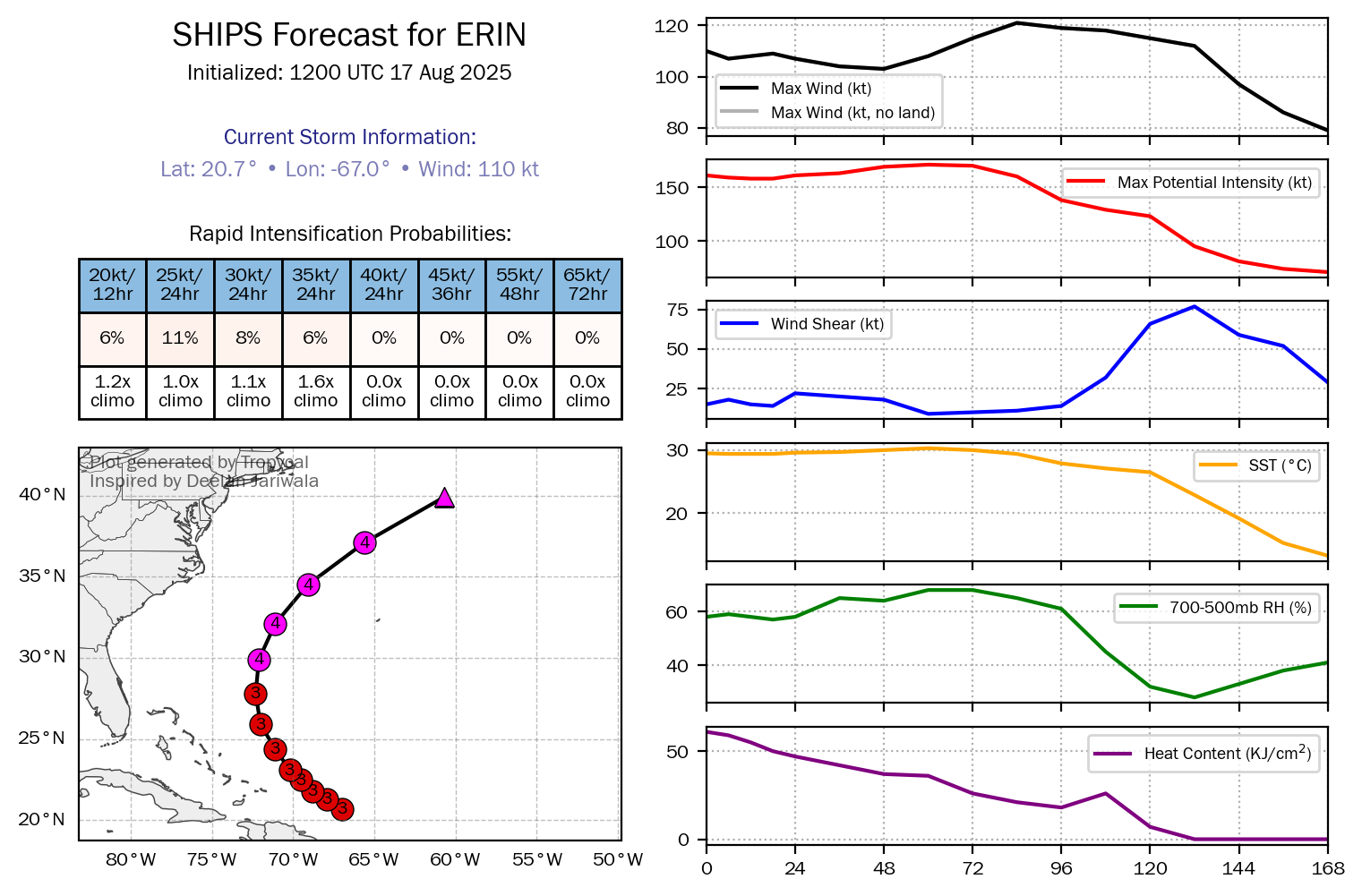
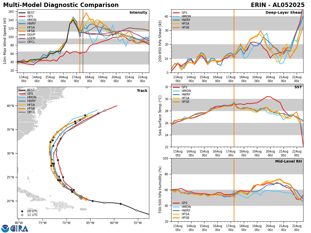
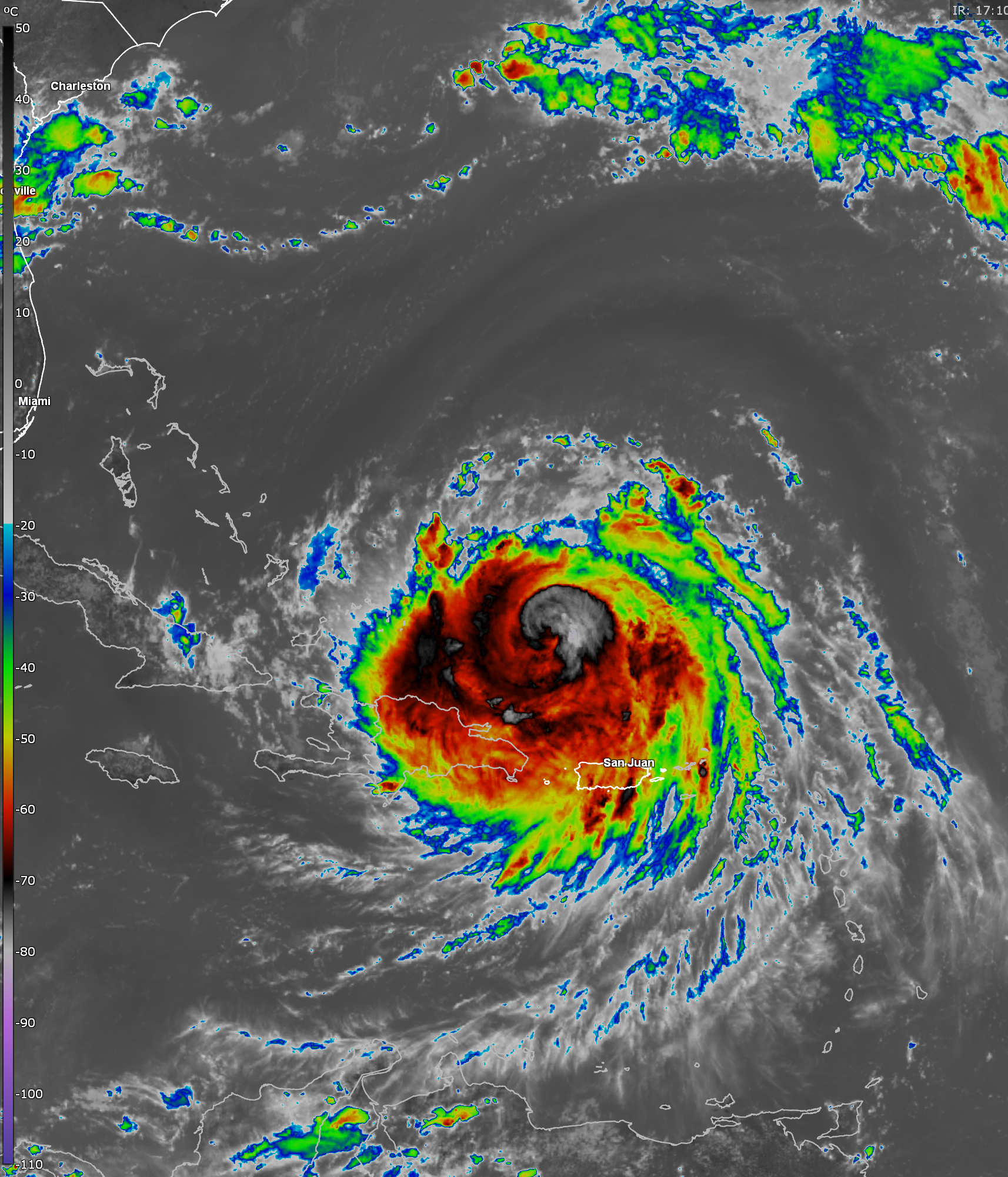
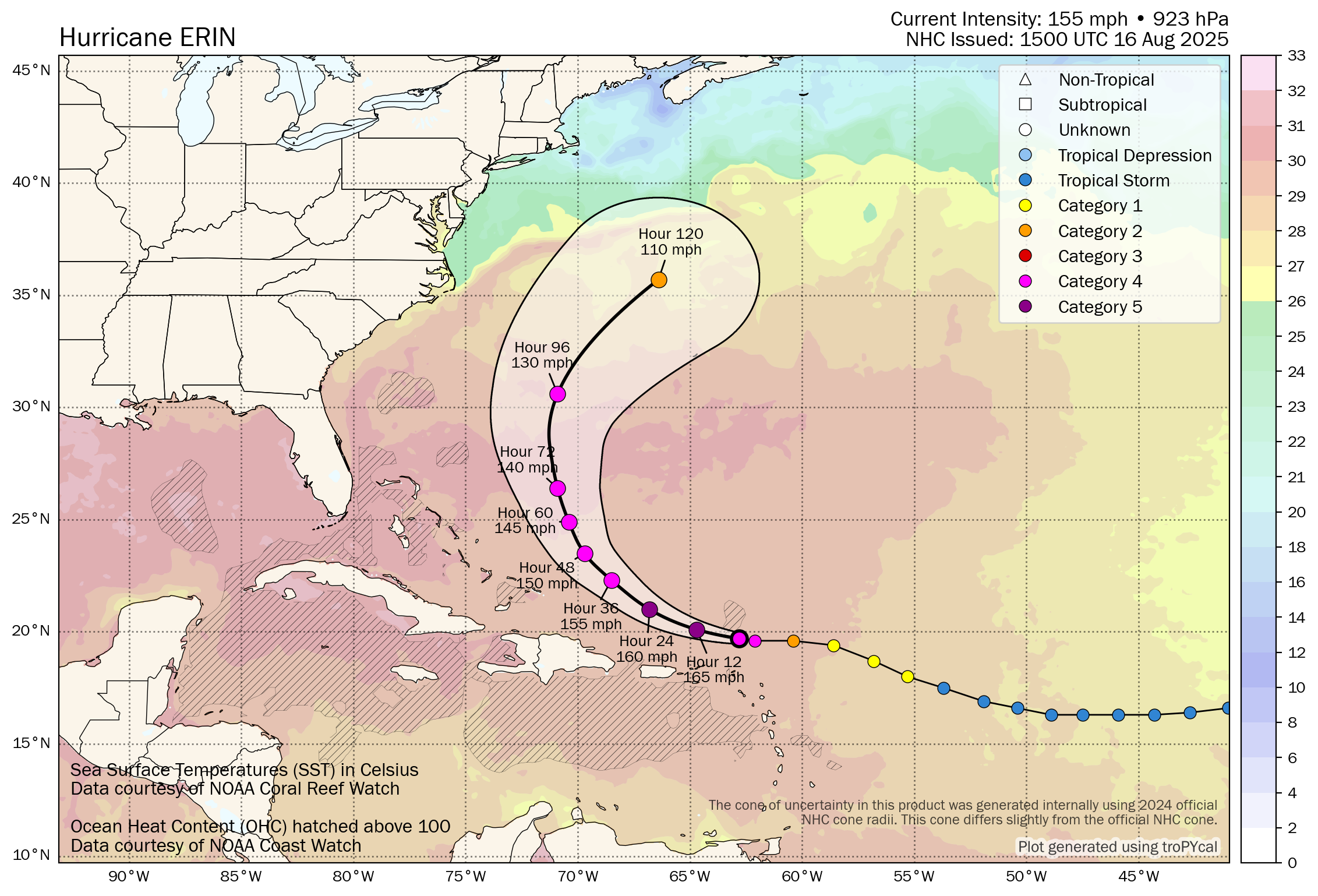
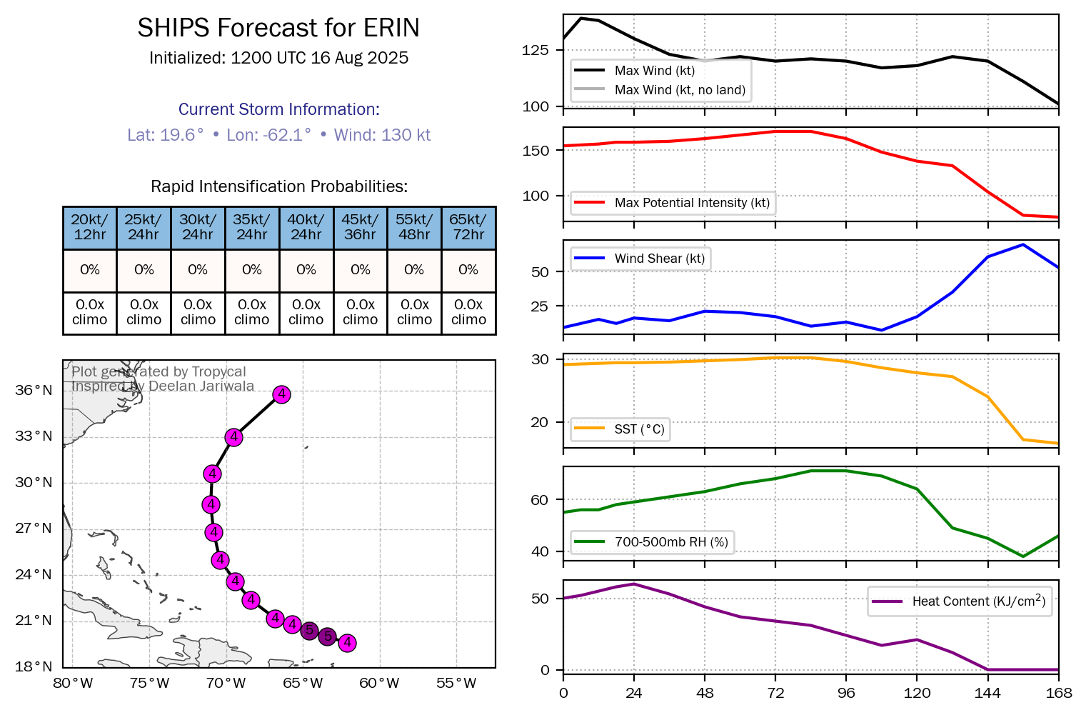
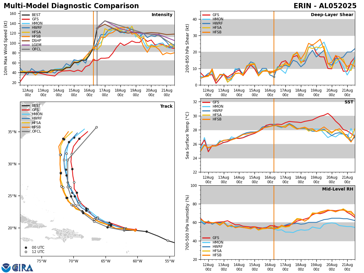
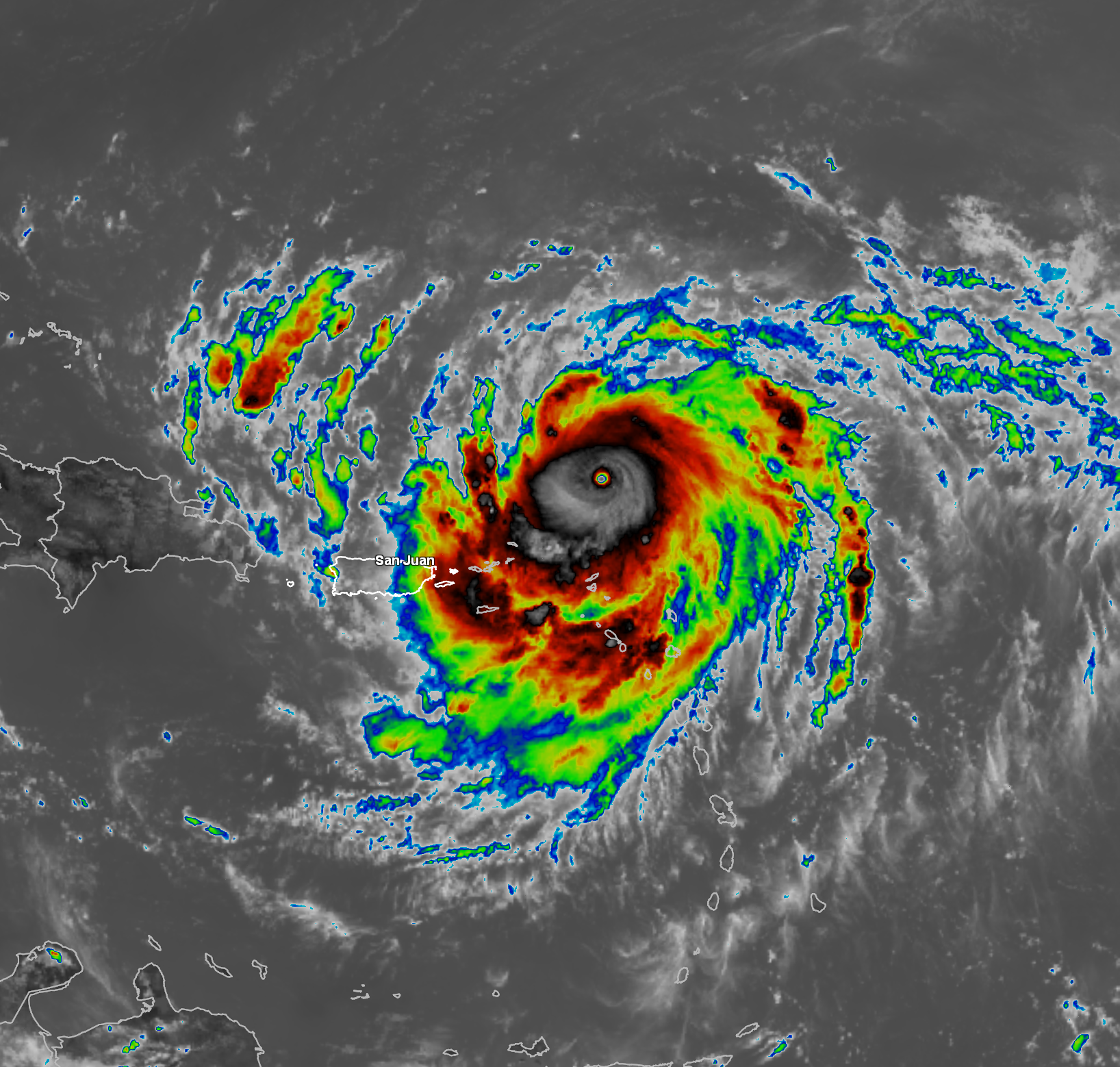
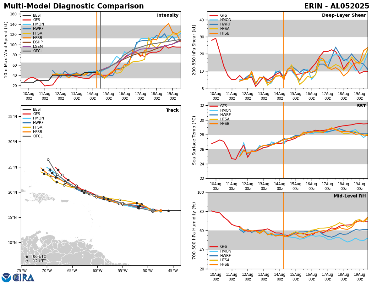
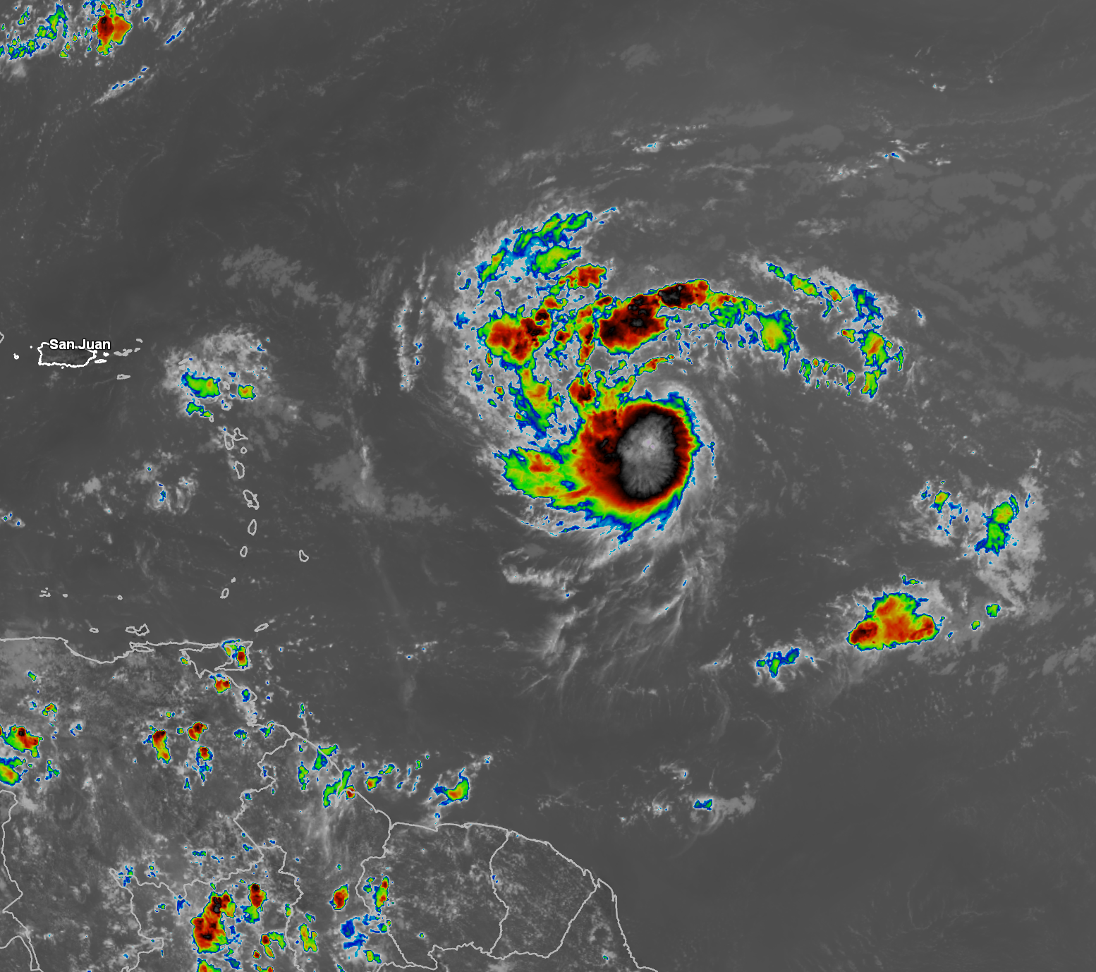
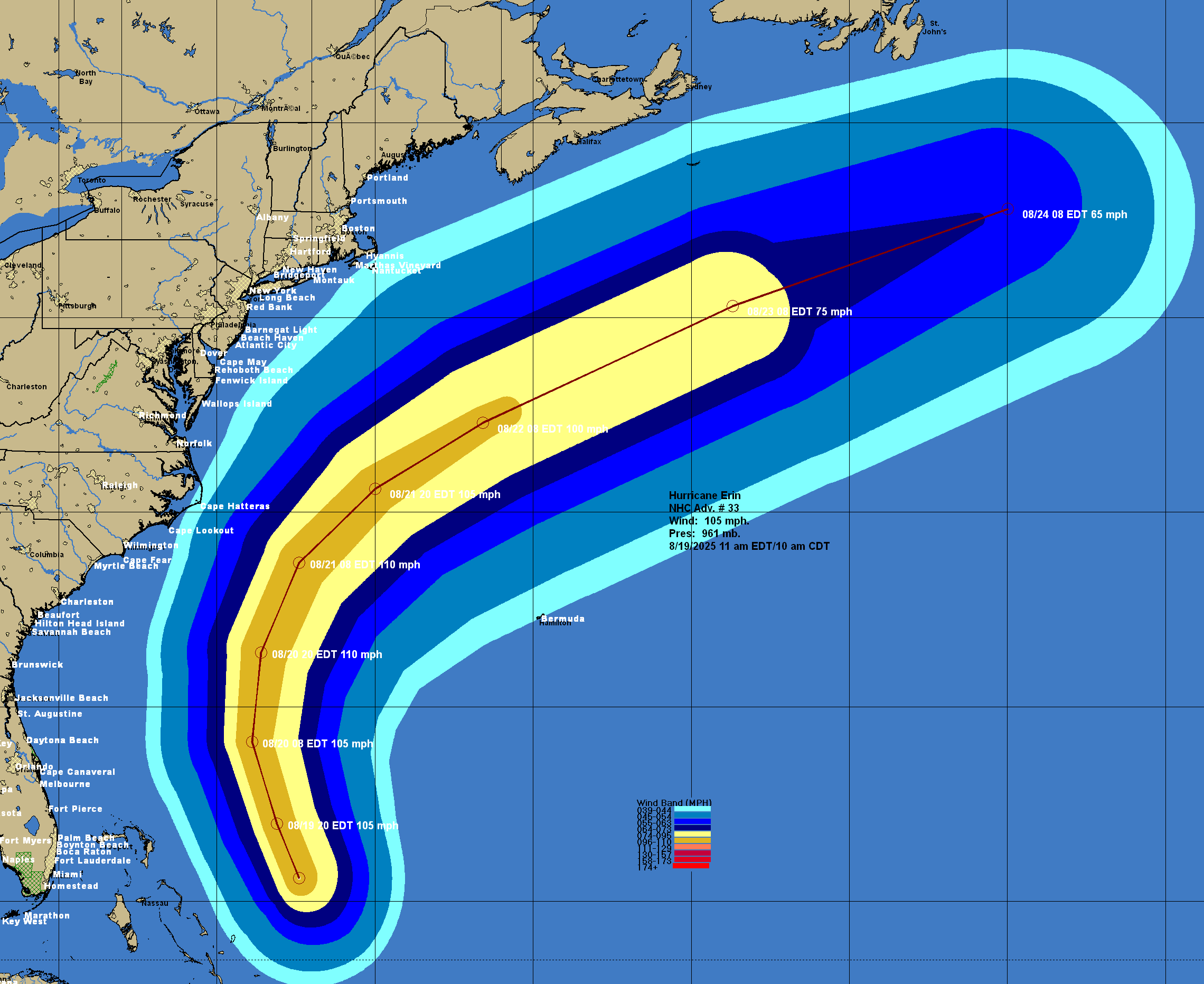
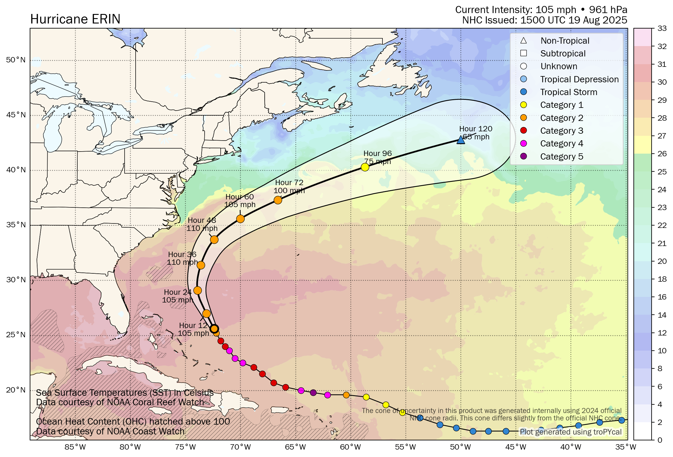
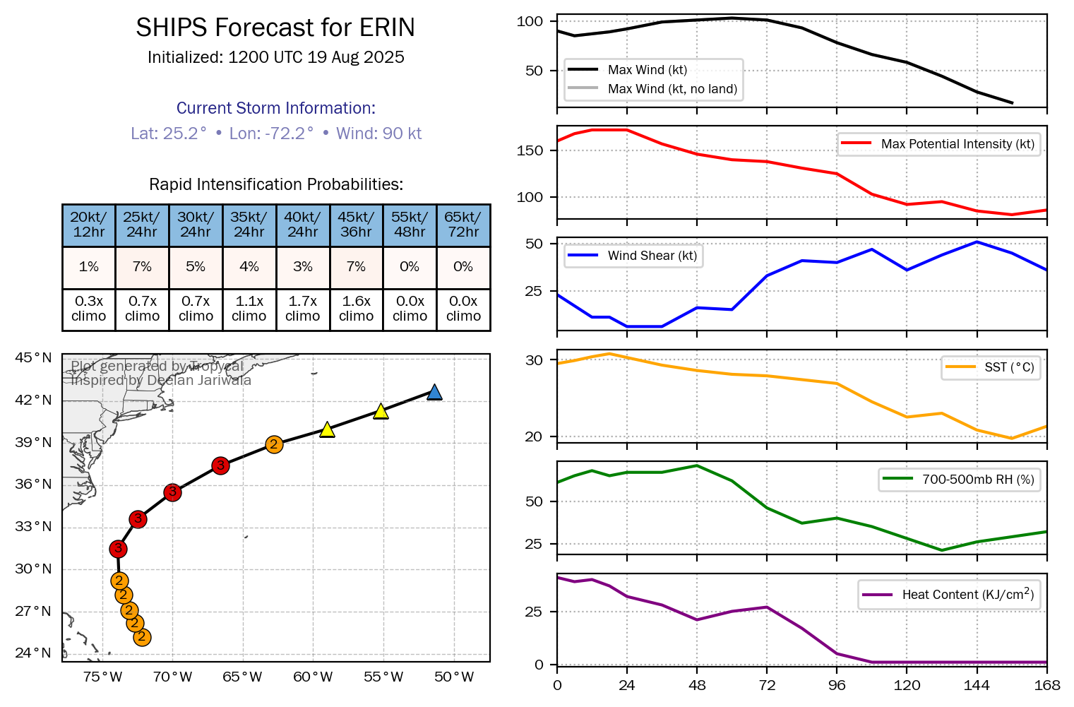
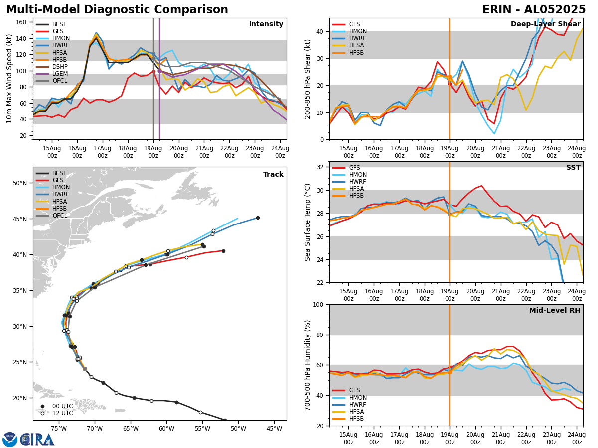
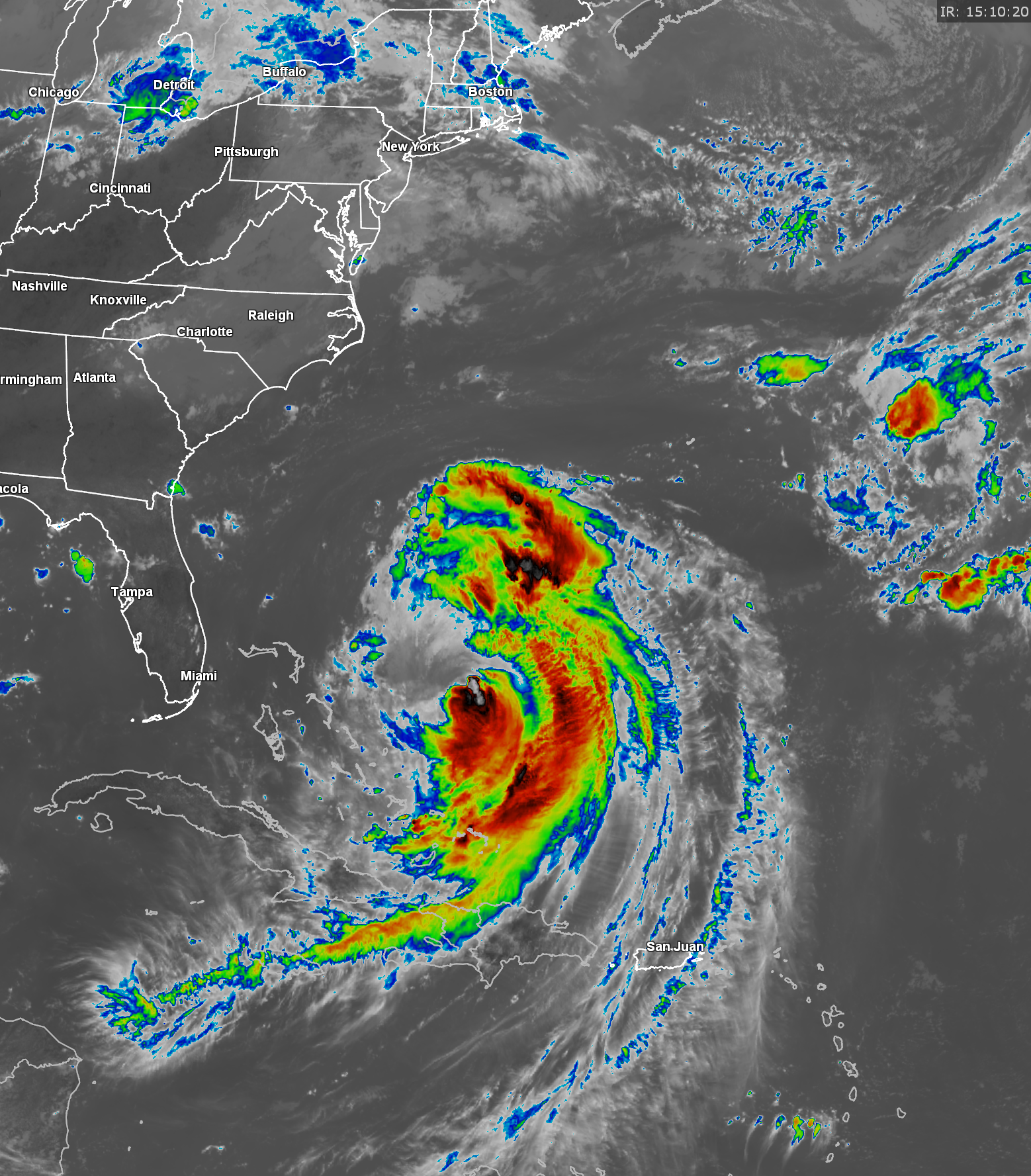
Hurricane Erin: Moderate amounts of wind shear combined with dry air has taken a big bite out of Erin today. Reconnaissance aircraft have found that the hurricane has weakened to about Category 2 strength. Additionally, satellite imagery indicates that most of the deeper convection is occurring on the eastern side of the hurricane with the western side void of convection.
Even though Erin is weaker today, it will mean very little for the East Coast of the United States and the Outer Banks of North Carolina.
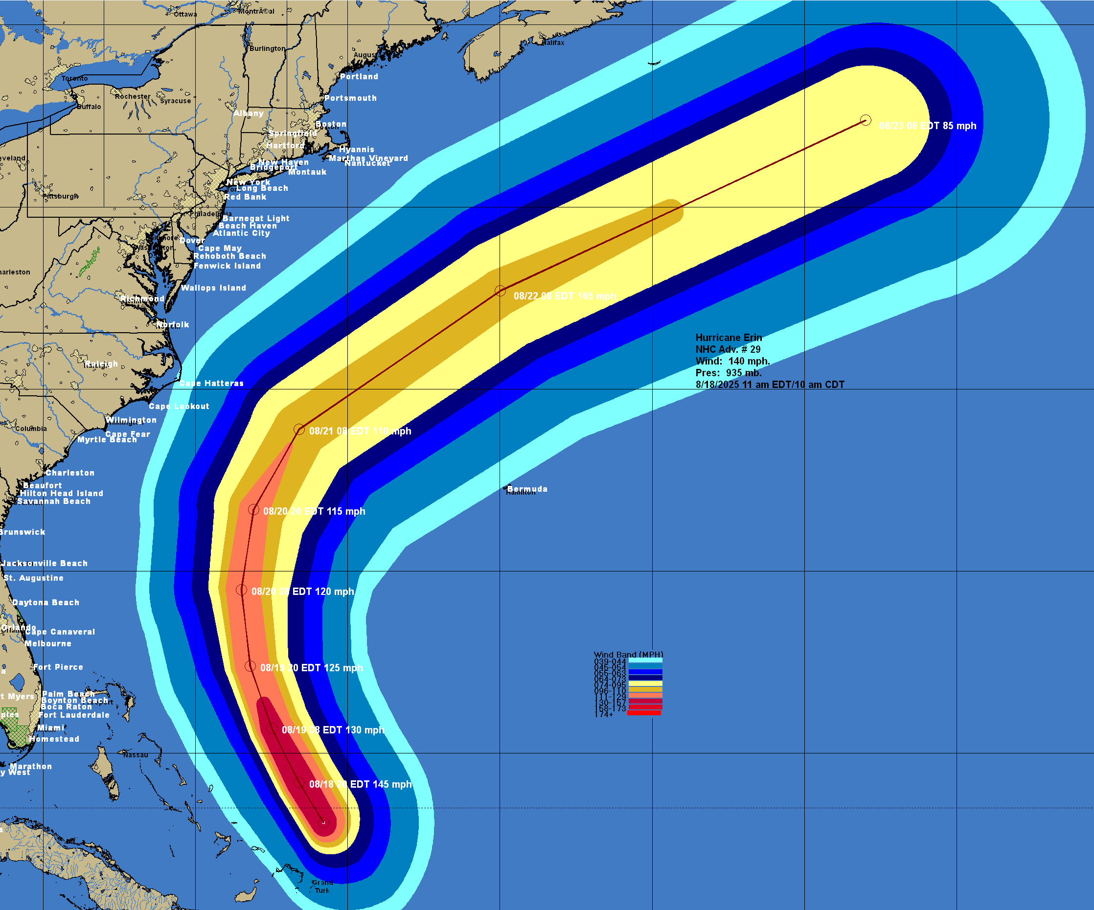
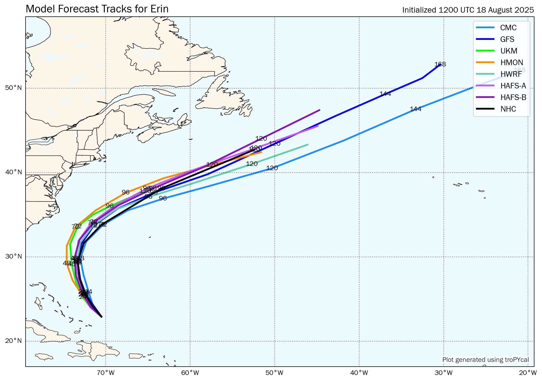
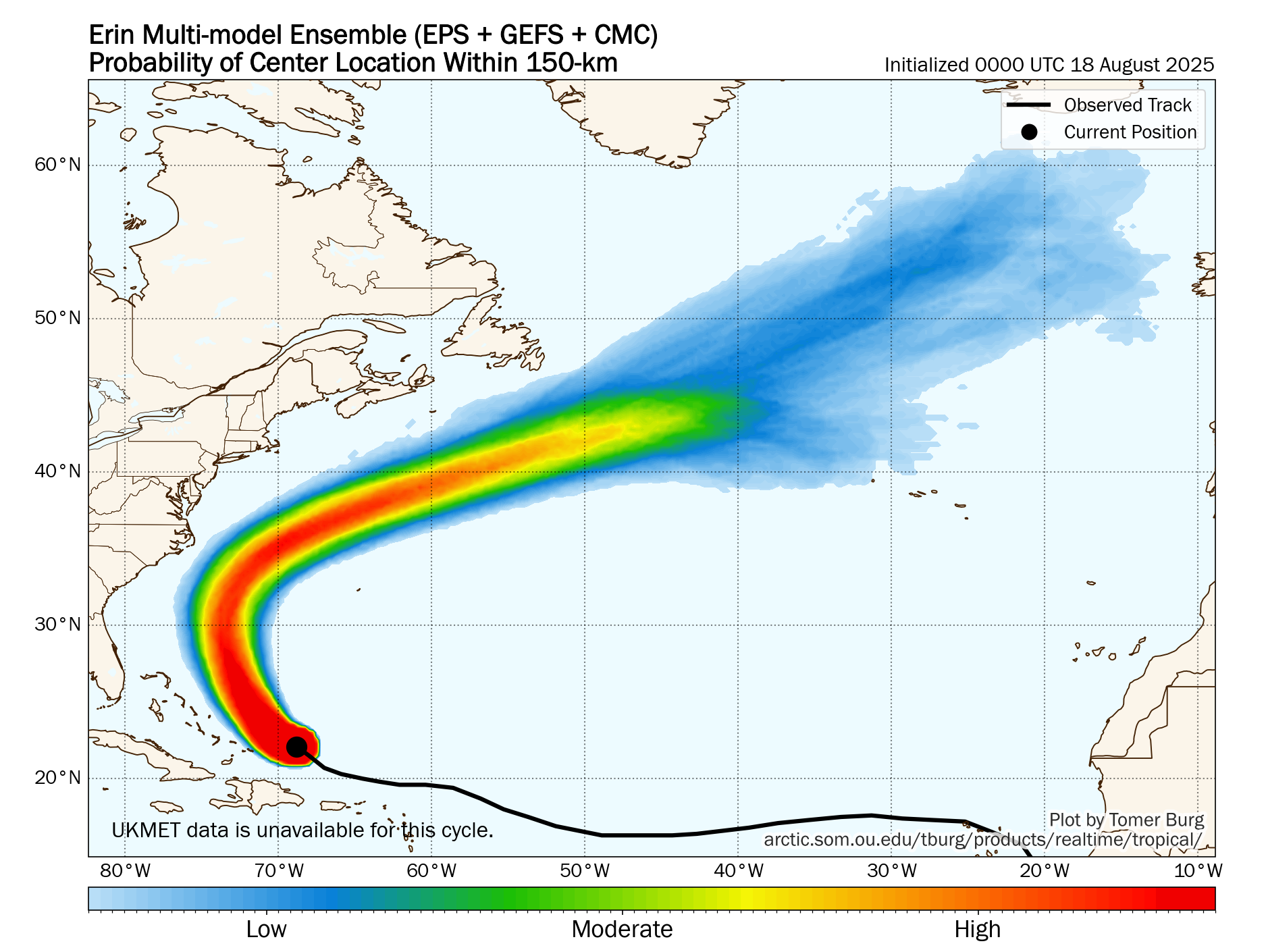
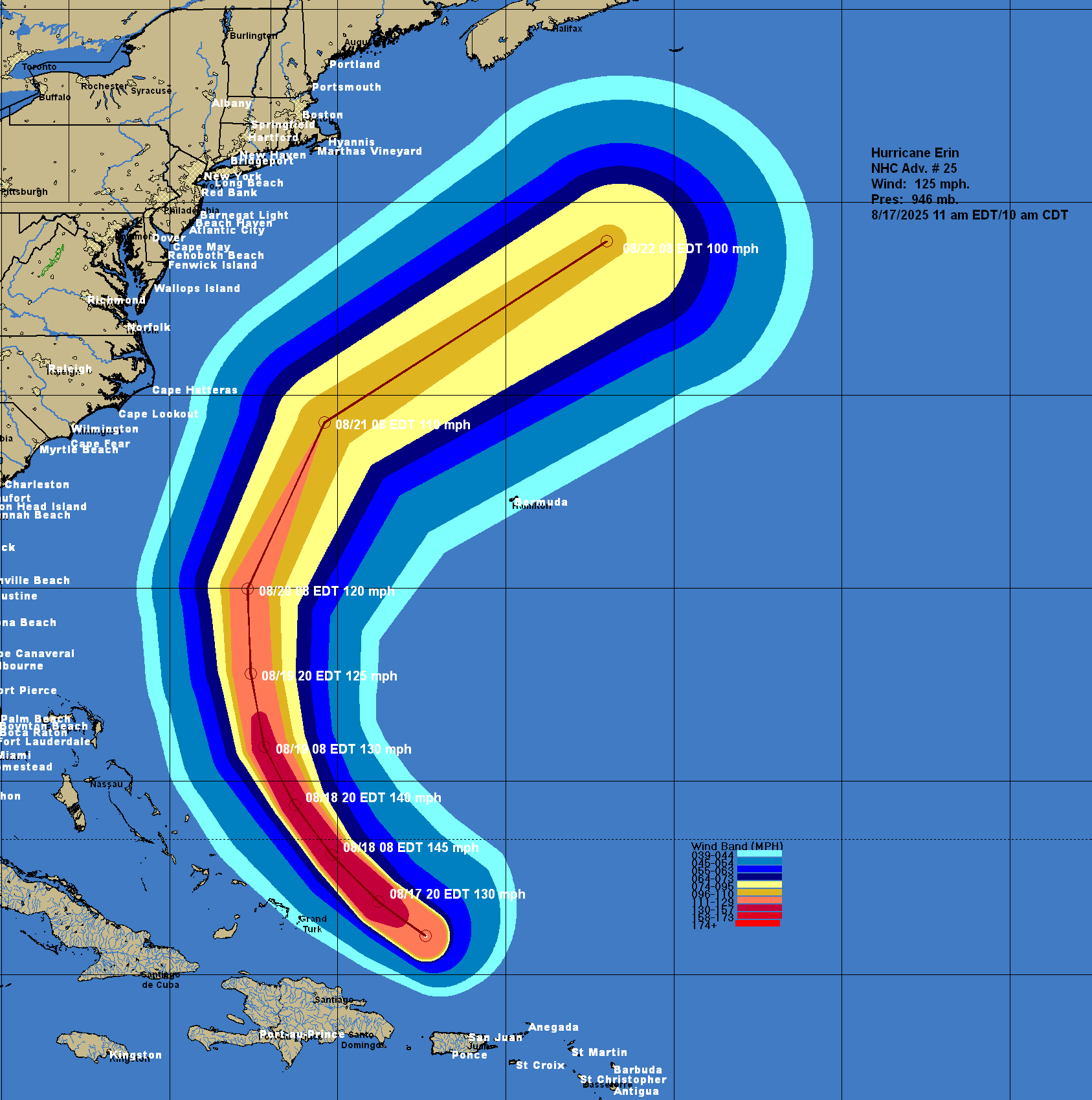
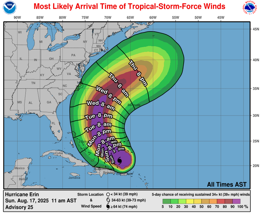
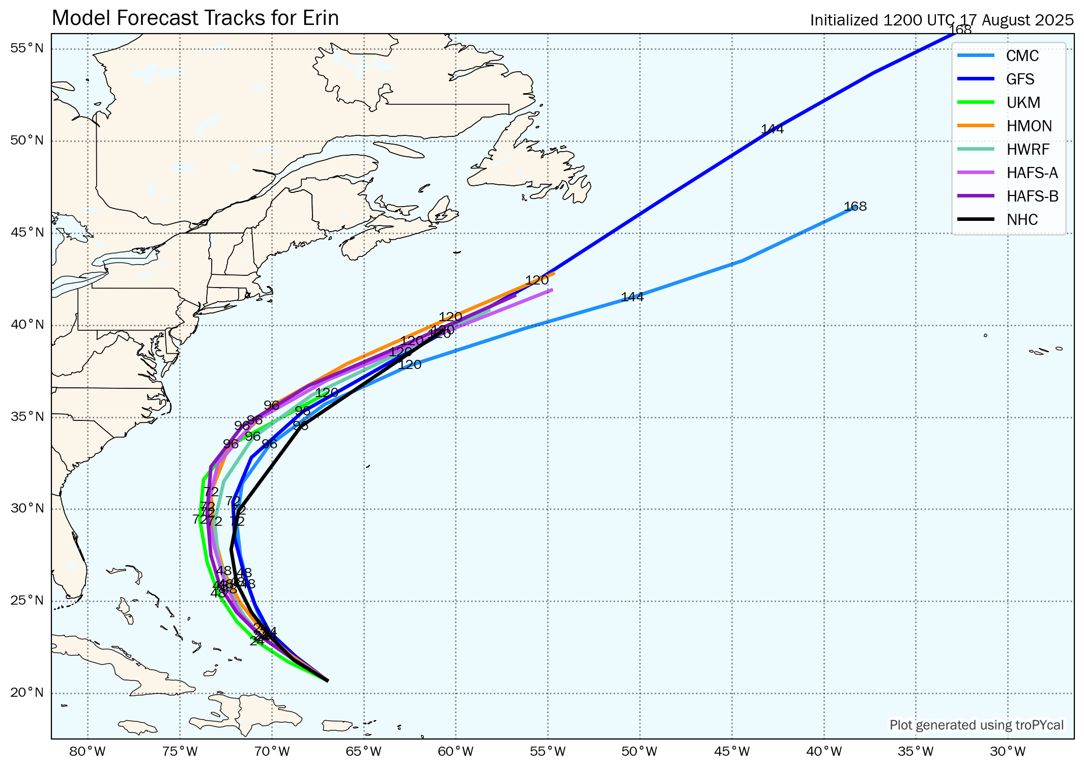
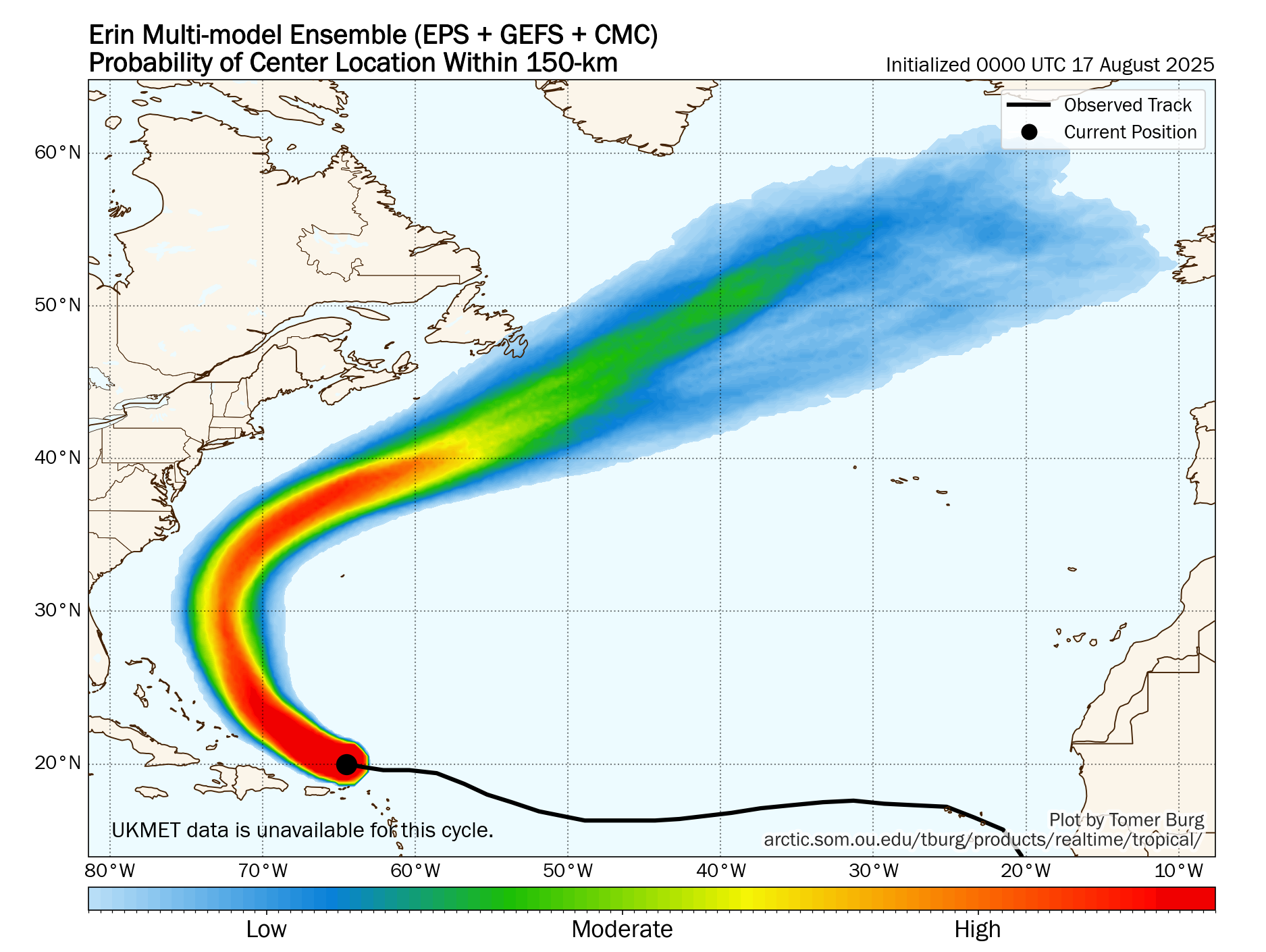
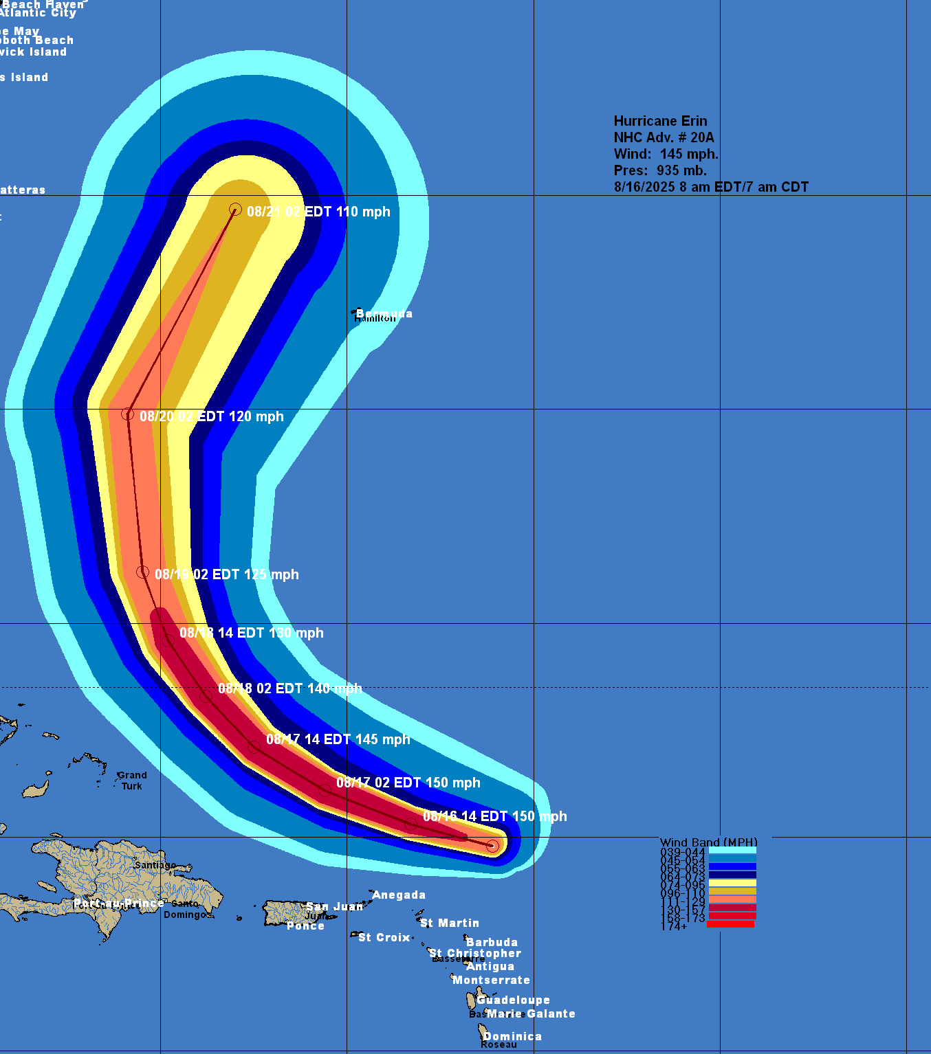
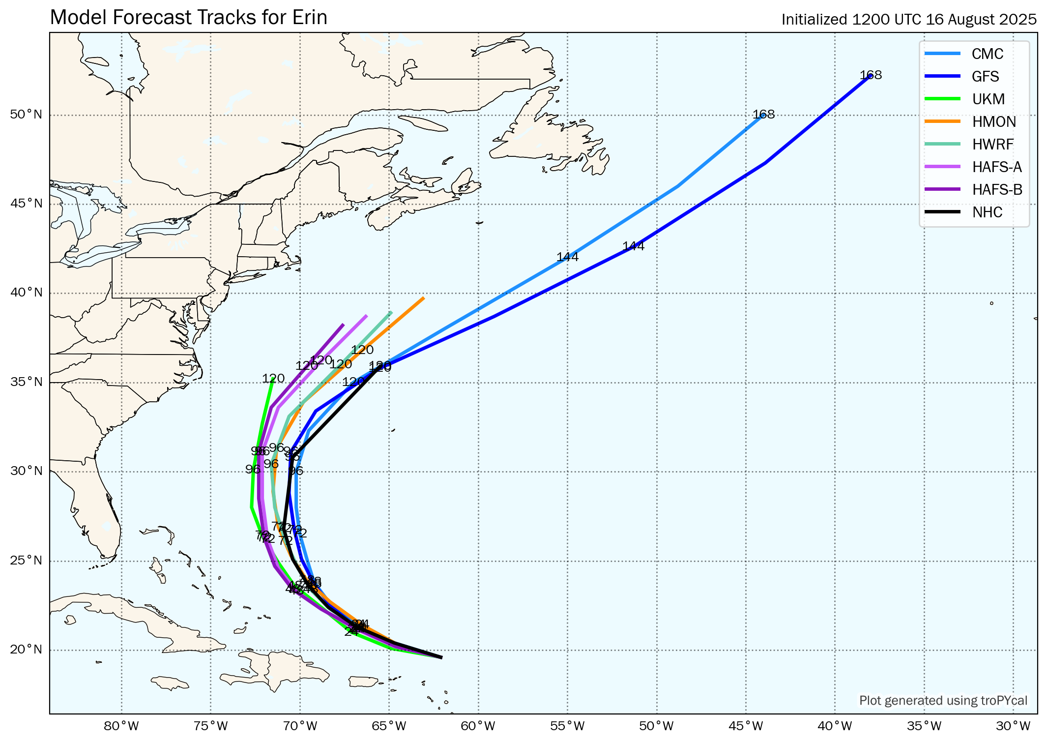
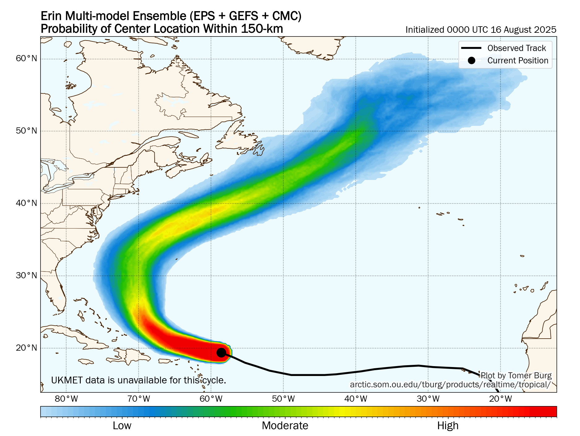
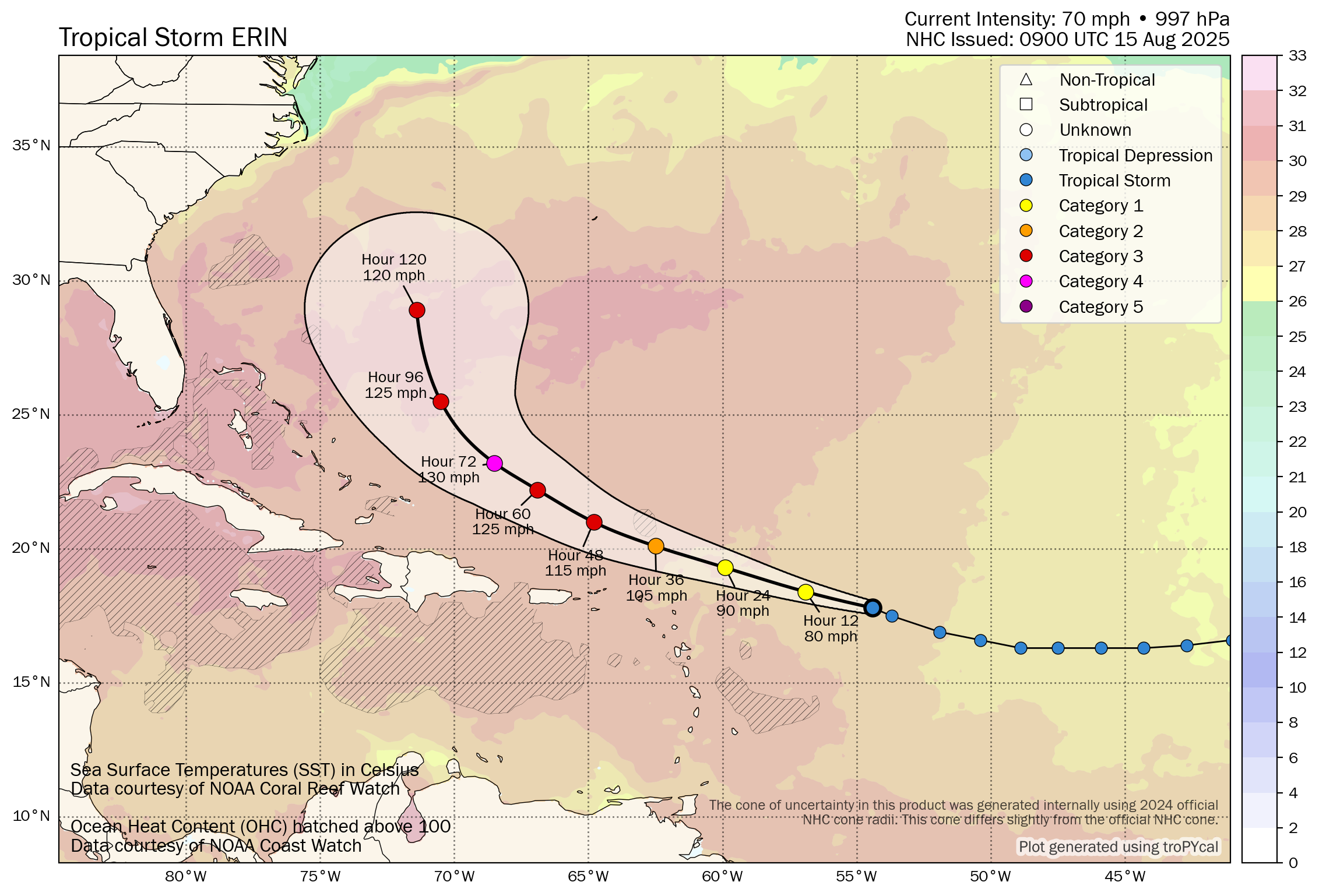
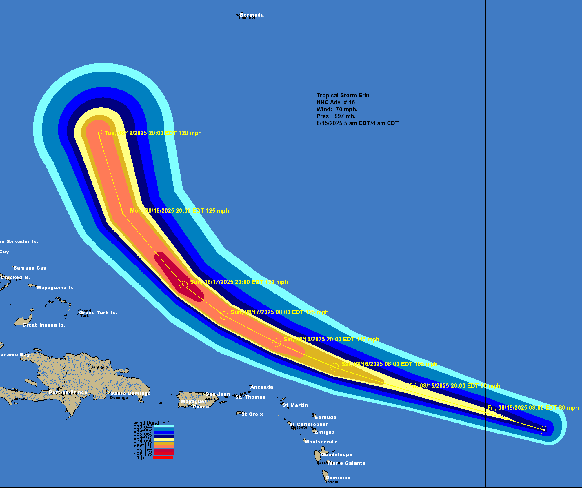
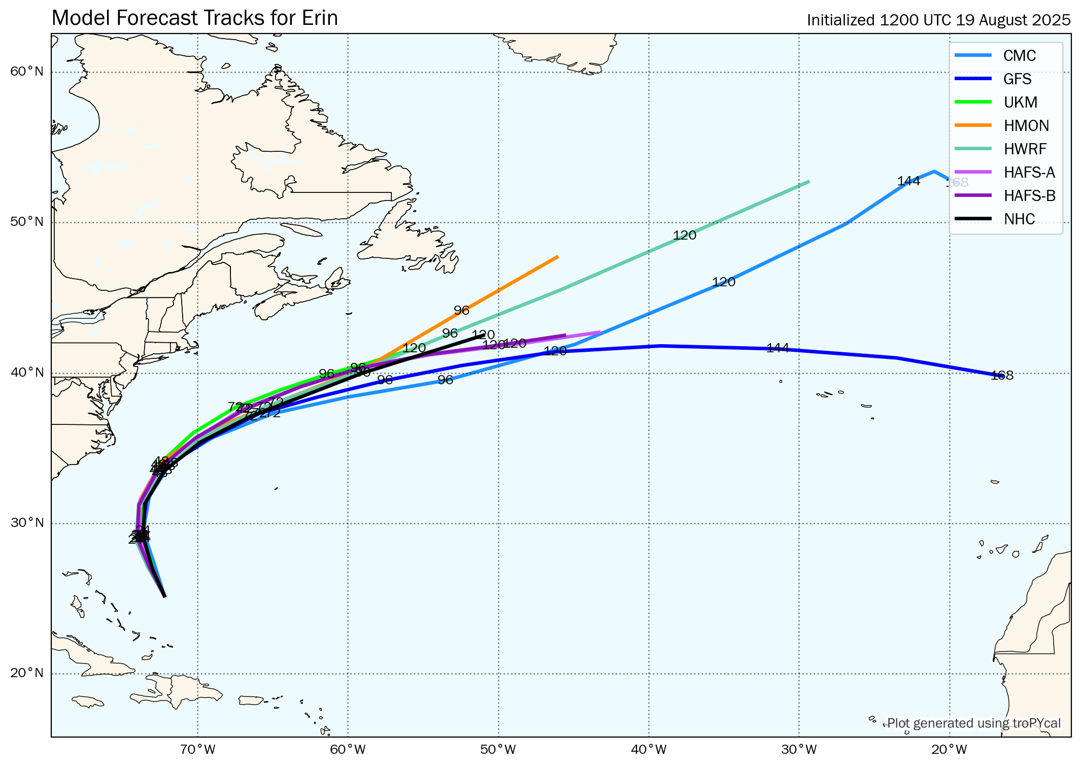
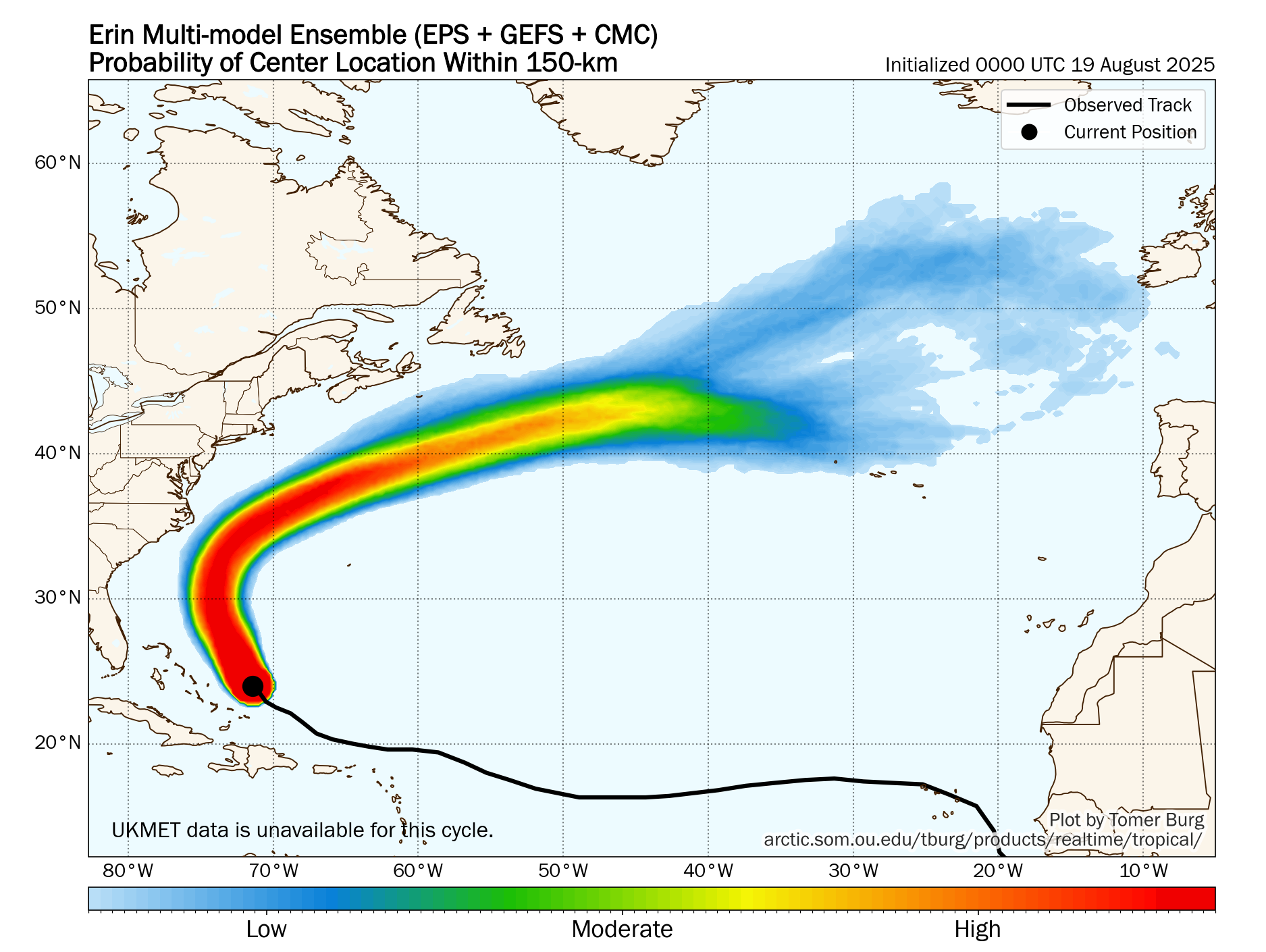
It seems likely now that Erin will continue heading on a northwestward track the rest of today and then turn towards the north during Wednesday. A turn to the northeast is then expected on Thursday. This will lead Erin to pass about 150-175 miles offshore of the North Carolina Outer Banks on Wednesday night into Thursday.
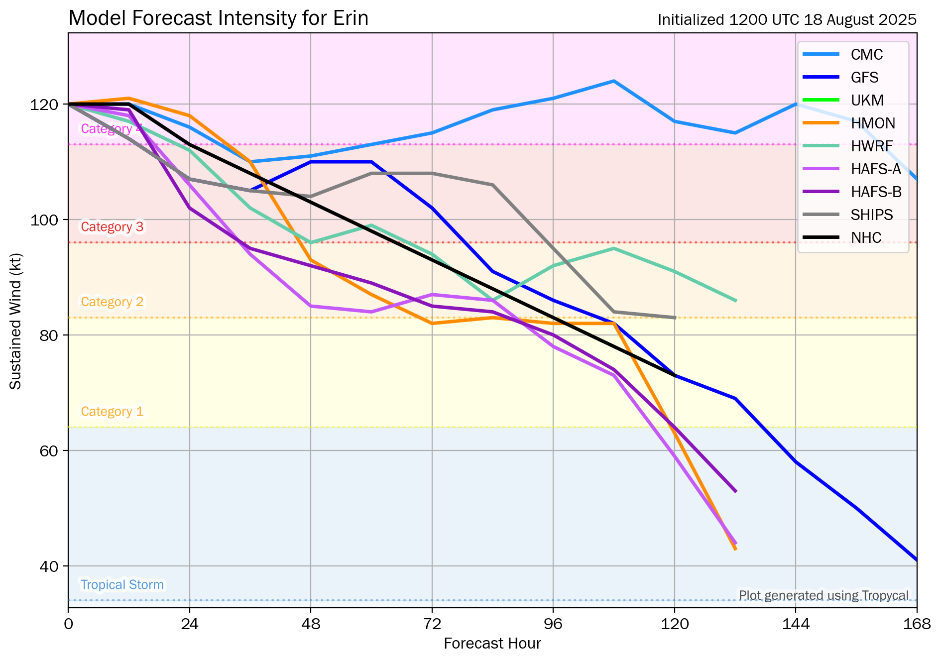
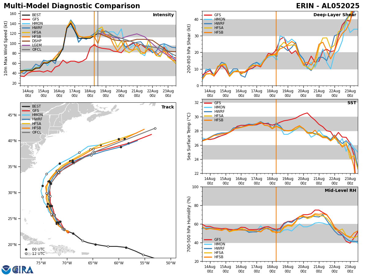
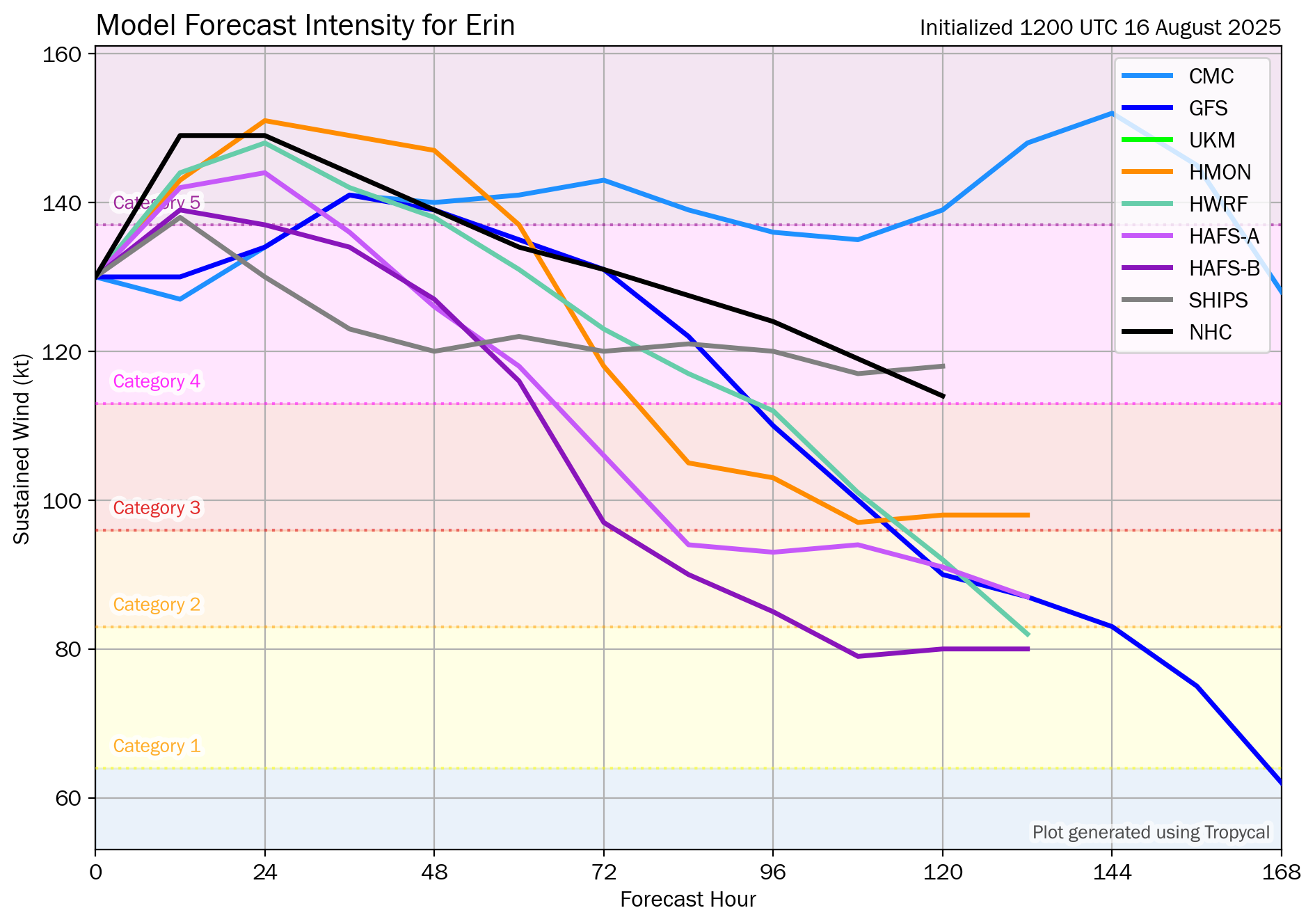
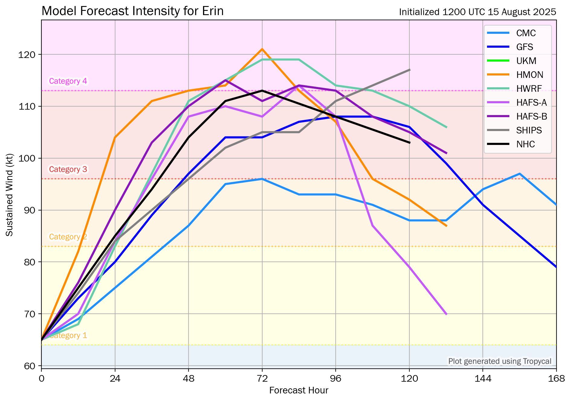
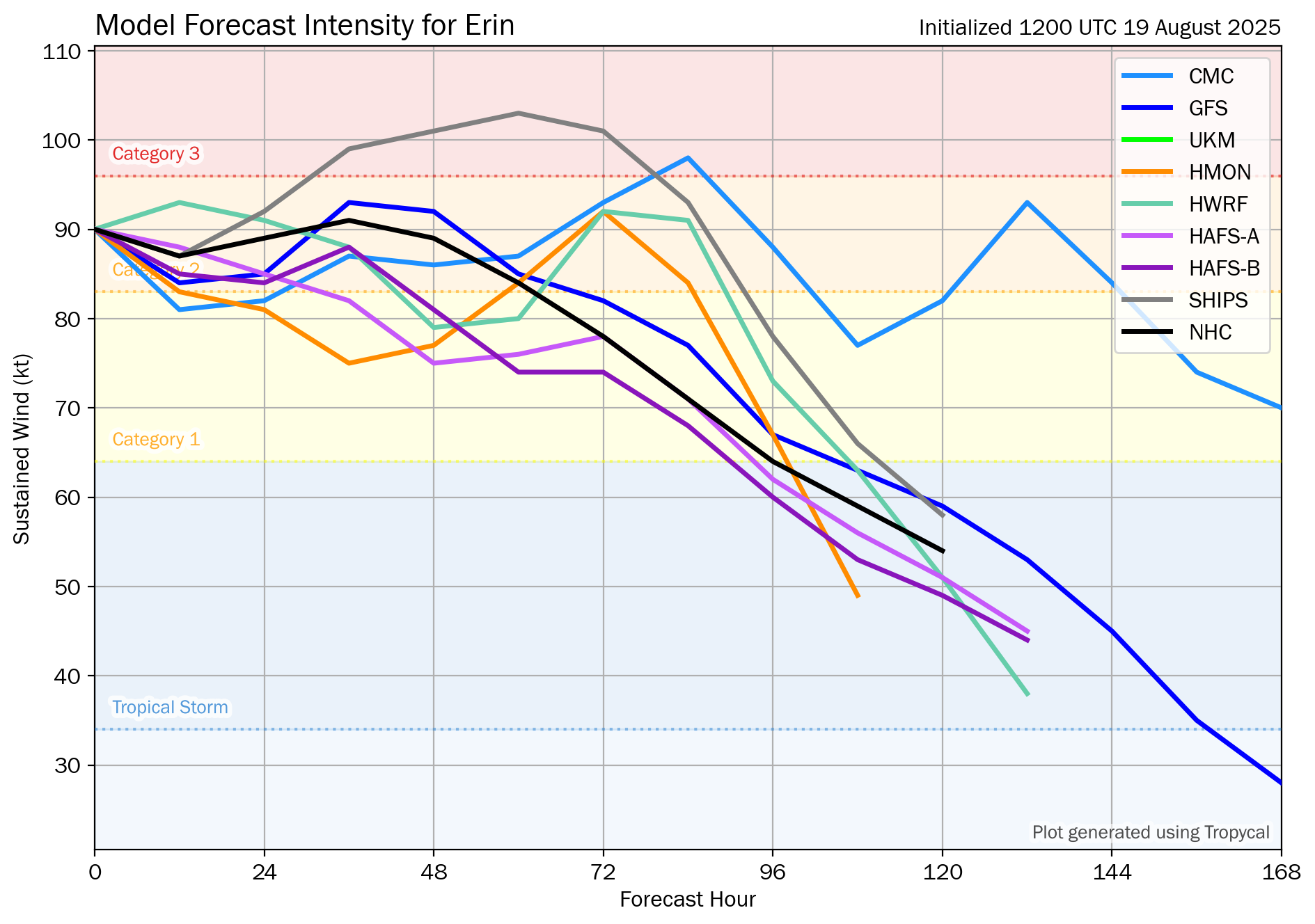
As for the forecast strength of Erin over the next few days – This is something that is a little more uncertain. The reason why is because given the way it looks right now with dry air wrapping into the storm on its western side, any new rounds of strengthening are going to take some time to complete.
It’s possible that there could be some strengthening for a time from late tonight through Wednesday into Thursday as Erin begins to accelerate to the north and then northeast. I highly doubt it will reach the strength it was just a couple of days ago, but some modest strengthening seems possible.
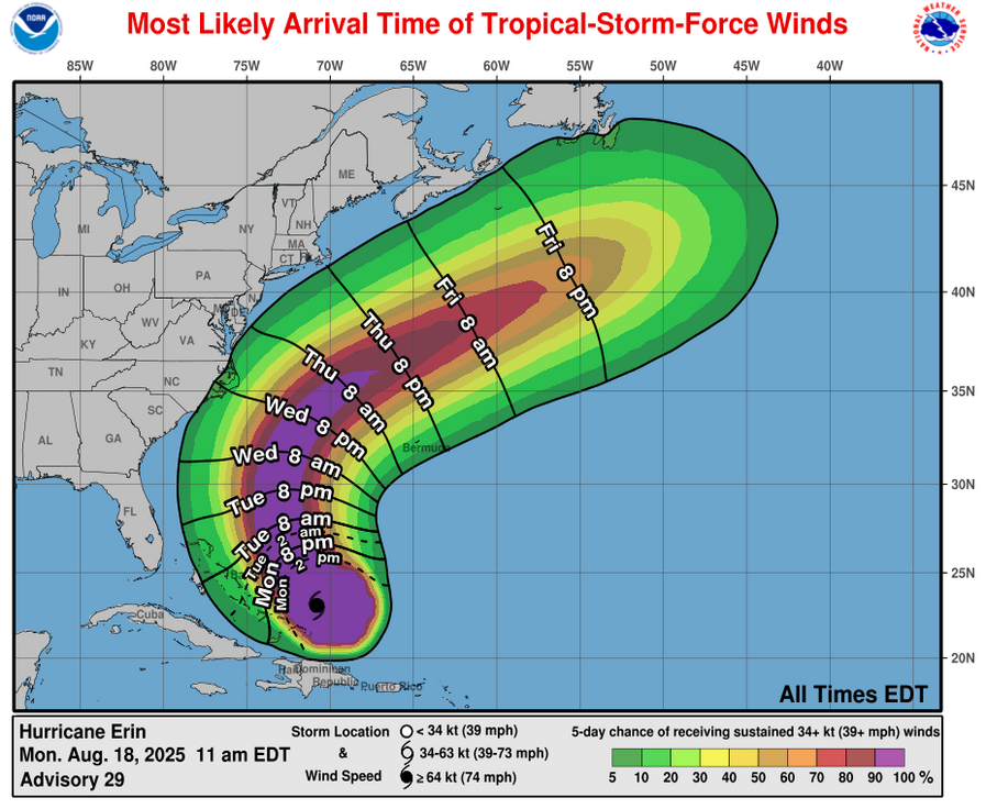
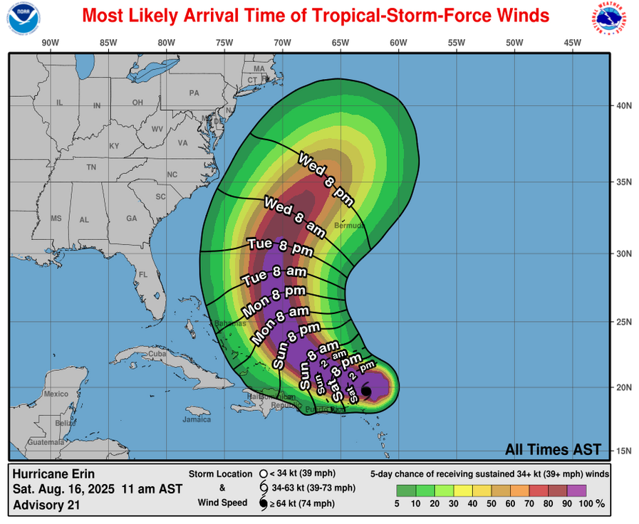
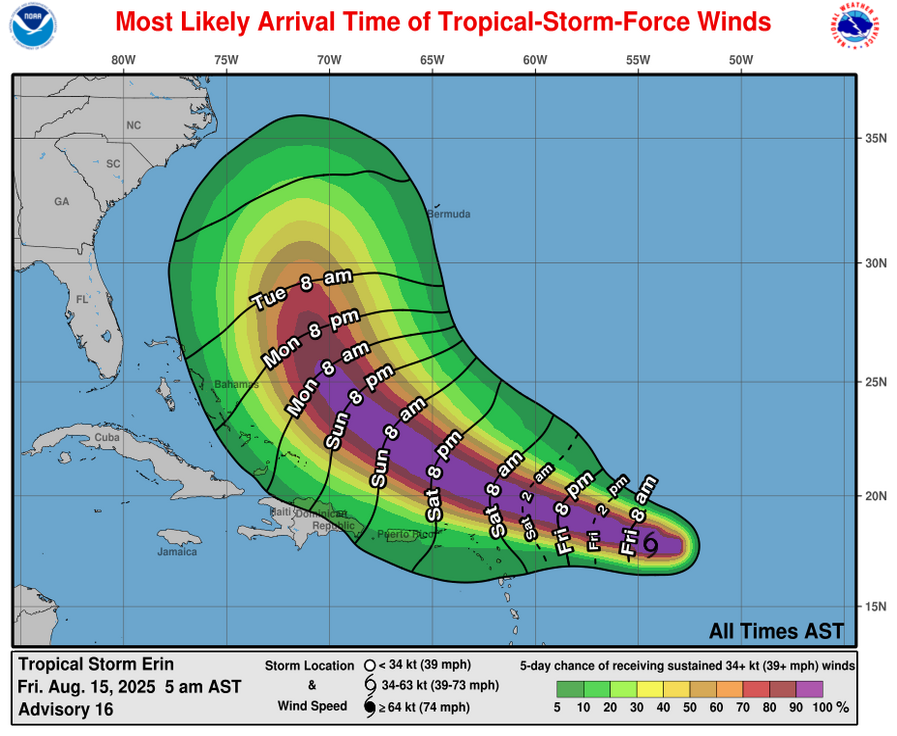
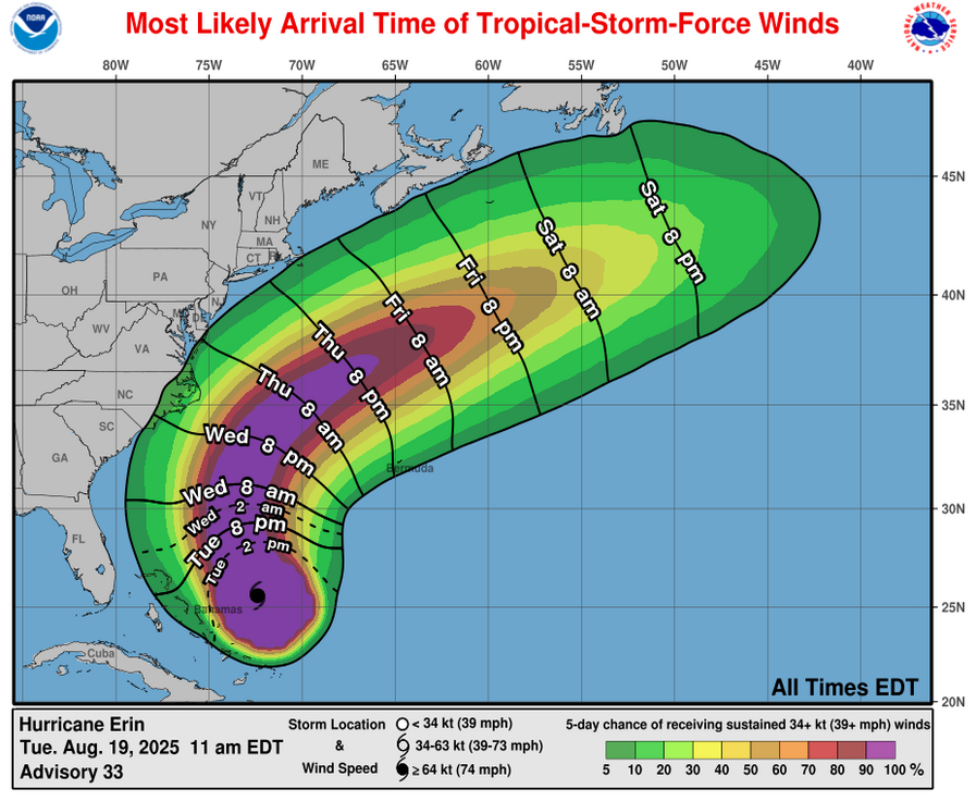
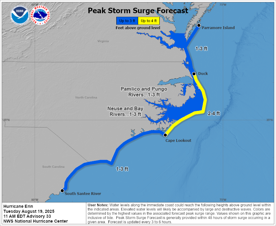
For The East Coast Of The United States & Particularly The North Carolina Outer Banks: Erin is pretty likely to pass close enough to the Outer Banks of North Carolina as we get into Wednesday and Thursday to bring the Outer Banks and Pamlico Sound tropical storm force winds with wind gusts of up to 50 mph possible and bands of heavy showers. Most of the tropical storm conditions can be expected to occur during Wednesday night and Thursday.
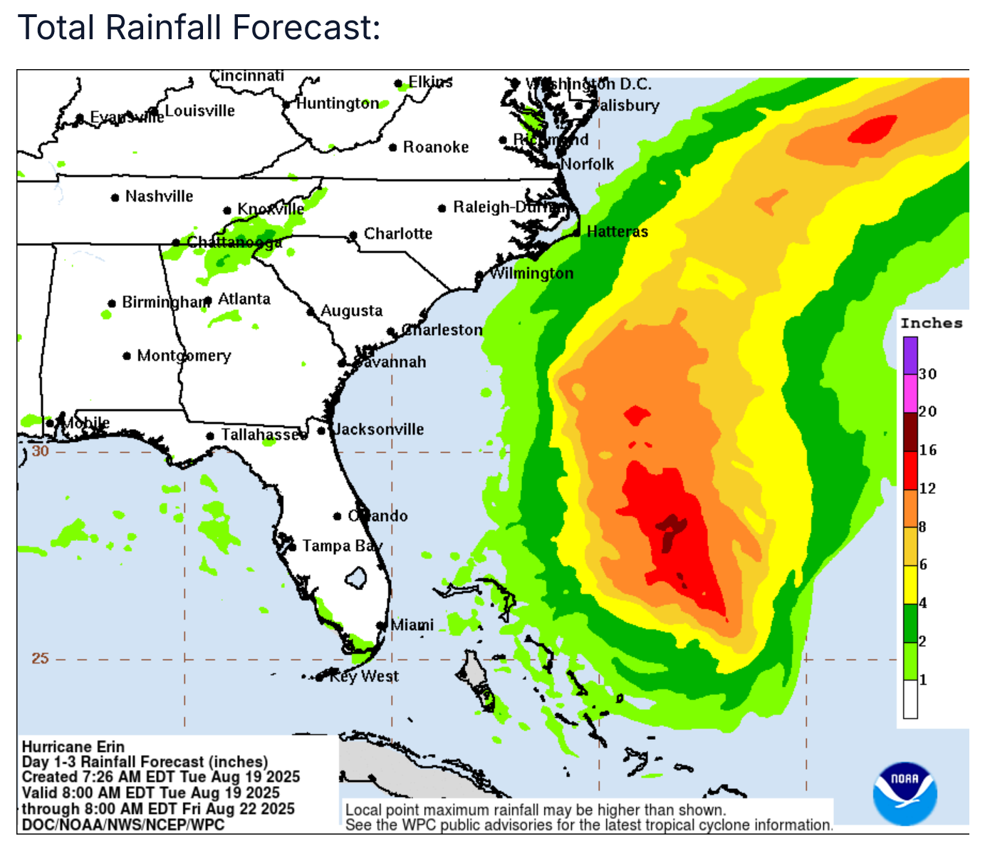
In addition to this, large waves, rip currents and moderate to major coastal flooding will significantly impact the Outer Banks and Pamlico Sound starting later today and continuing through Wednesday and Thursday. Extensive damage to the beaches is likely with Highway 12 likely going underwater by several feet. Additionally, soundside flooding looks likely on Thursday due to persistent northerly gusty winds.
Mandatory evacuations remain in effect for Zone A on Hatteras Island for both visitors and residents.
Elsewhere along the East Coast of the United States, a very serious threat of very large waves, extremely rough surf, extremely dangerous rip currents and the threat for some coastal flooding exists throughout the rest of this week. The worst days look to be today, Wednesday and Thursday along the Southeast and Mid-Atlantic coasts and the worst days along the Northeastern coast of the United States looks to be late Wednesday, Thursday, Friday and even Saturday. I cannot emphasize enough that the extremely rough surf and extremely dangerous rip current threat is going to make it deadly to go swimming & you may lose your life doing so.
Finally, it still looks fairly likely that Erin will pass far enough offshore of Cape Cod and Nantucket to not bring tropical storm conditions. That said, this is something that will be watched closely as there are some indications that suggest some tropical storm force winds may occur on Nantucket on Thursday night into Friday.
Forecast Impacts:
Wind:
Rainfall:
Storm Surge:
For Bermuda: It continues to look very likely that Erin will pass far enough west of Bermuda to not be a direct impact. The very large size of Erin could lead to some of the outer bands of rain to affect the island on Wednesday and Thursday.
For Atlantic Canada: Erin is very likely to pass well south of Nova Scotia and Newfoundland to not be a threat in terms of wind or rain. The main threat from Erin for Atlantic Canada looks to be very large waves, rough surf and rip currents late this week through this weekend.
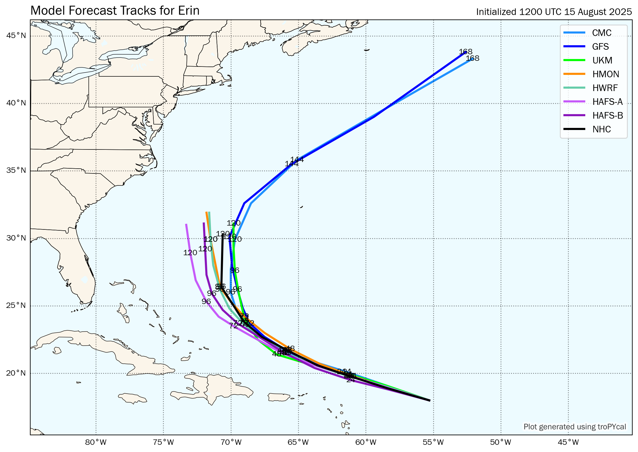
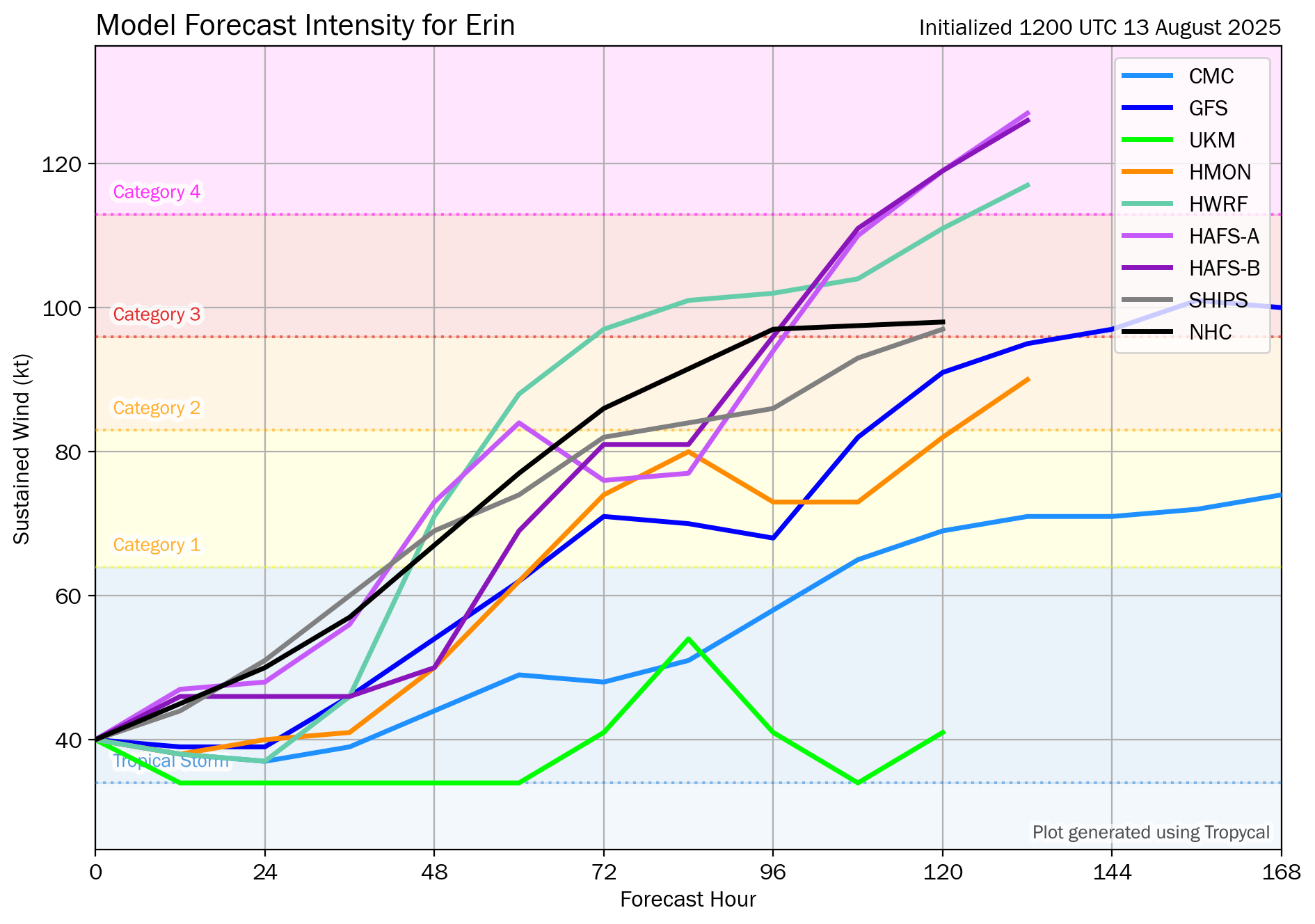
Model Track Forecast:
Satellite Imagery:
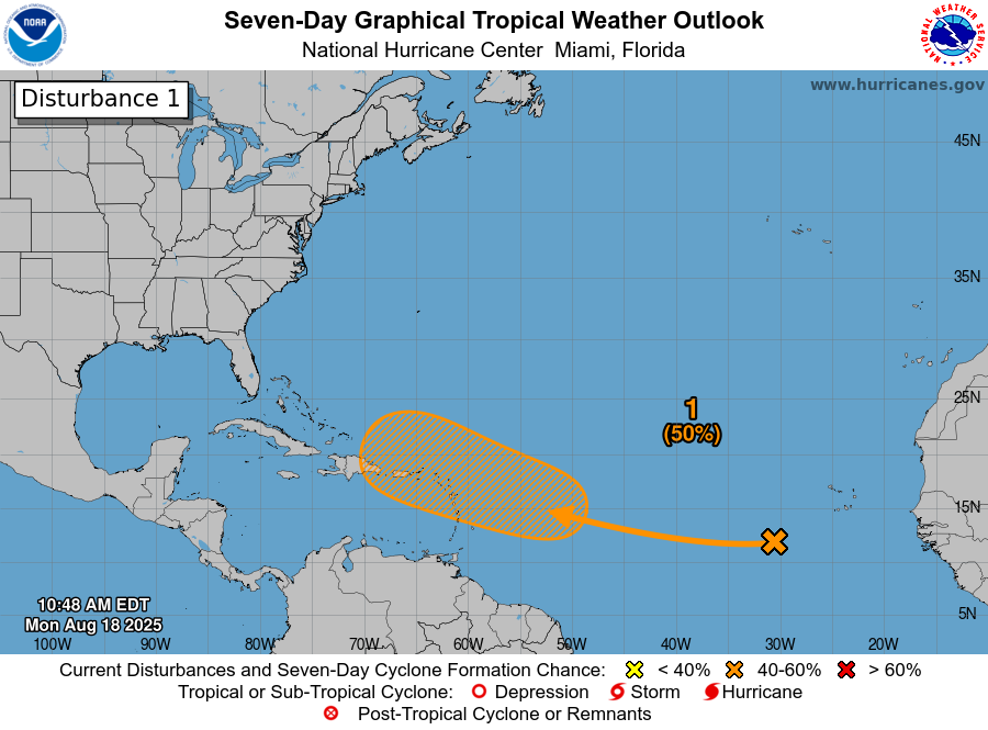
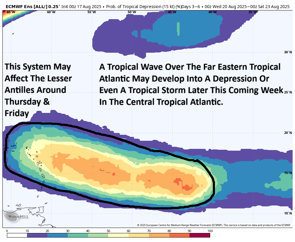
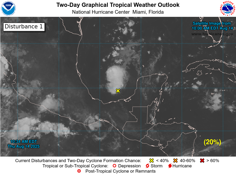
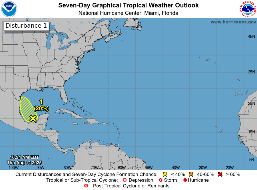
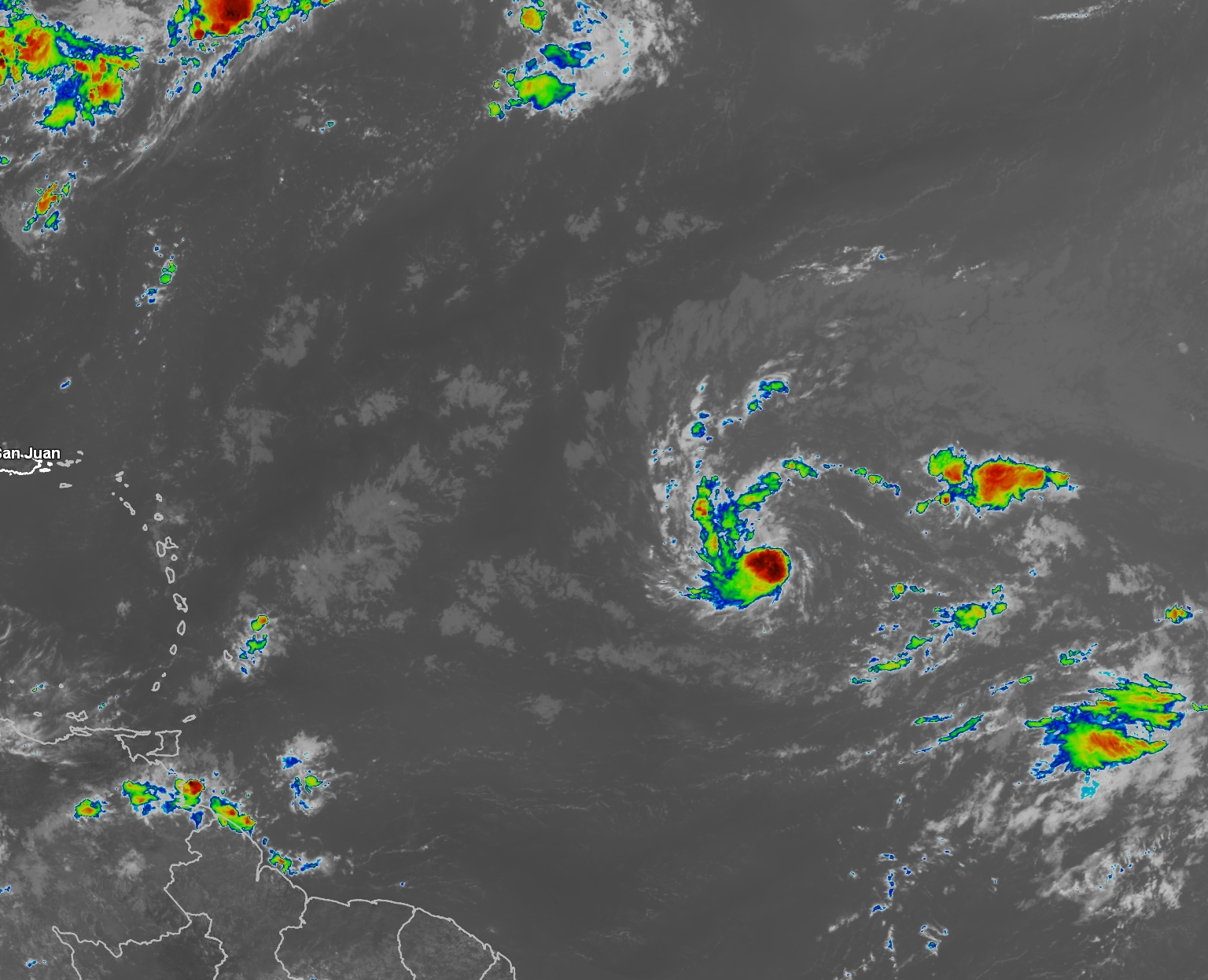
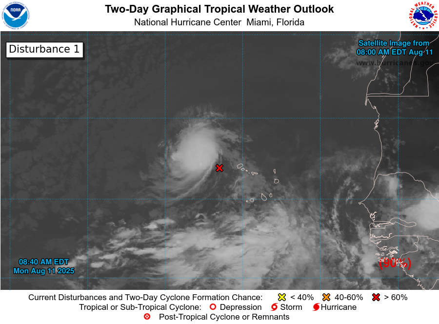
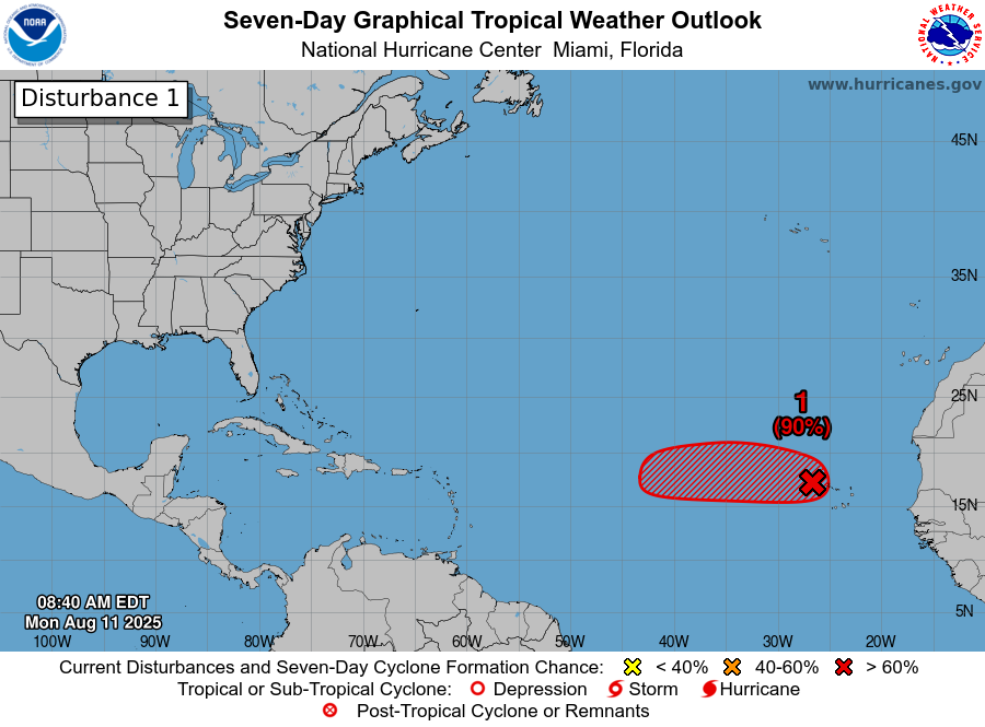
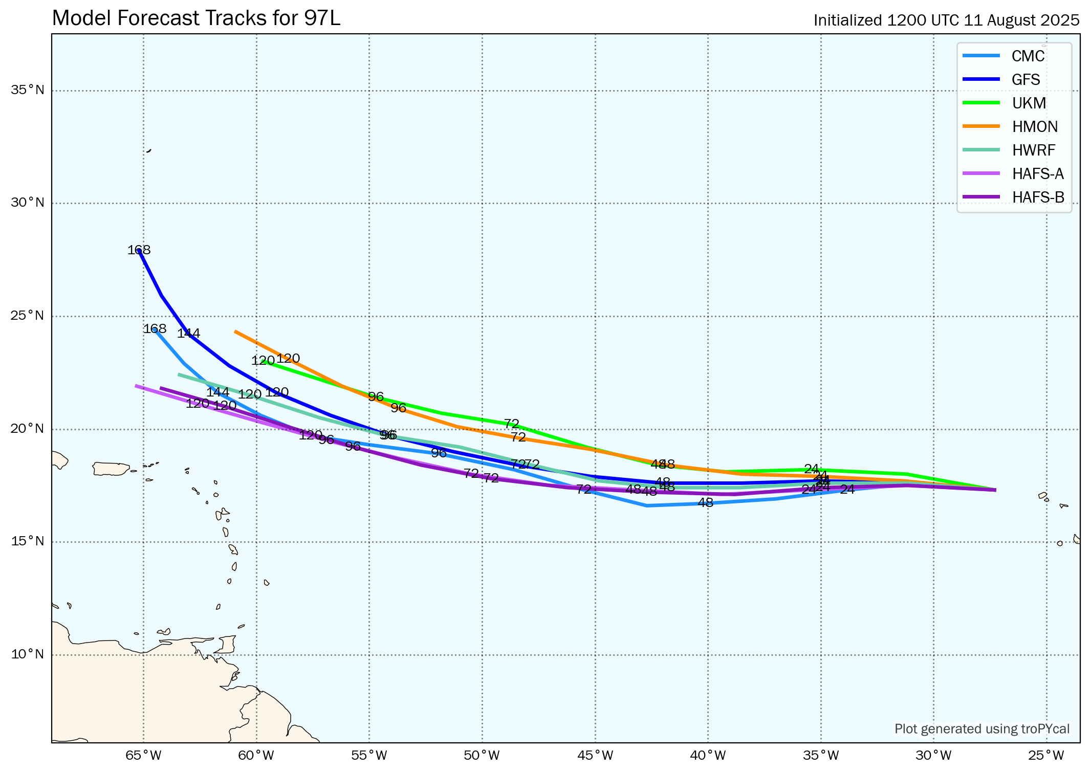
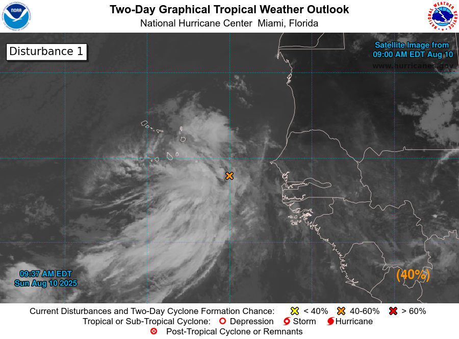
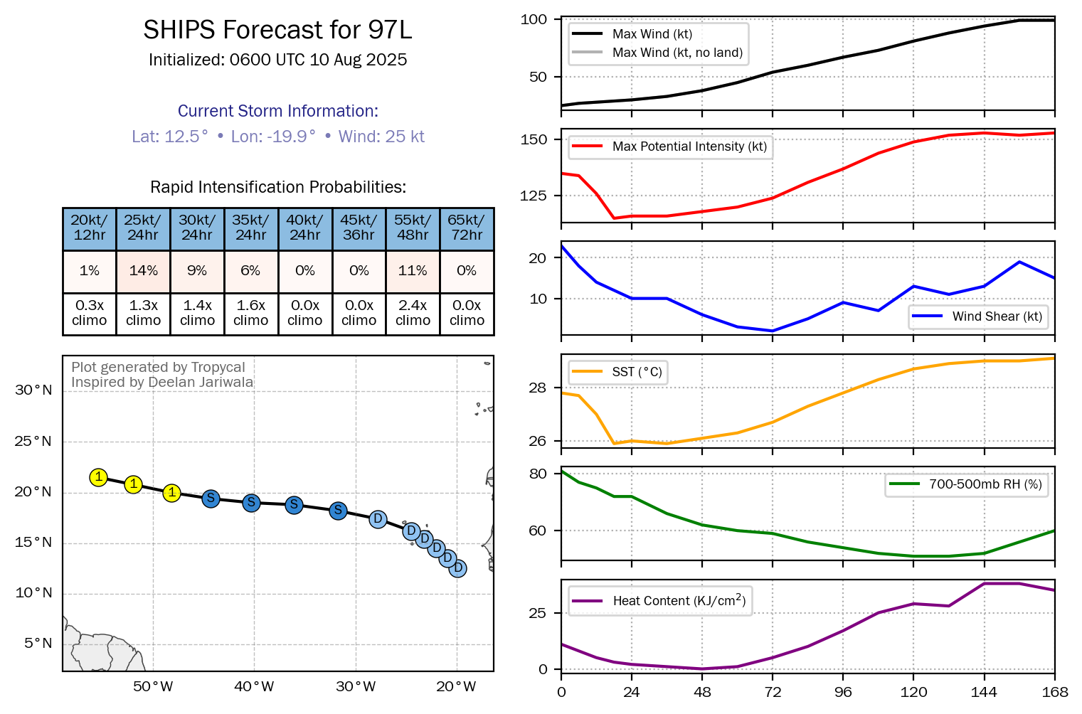
Tropical Wave Located Over The Central Tropical Atlantic & Invest 99-L Located Over The Eastern Tropical Atlantic: There are two tropical waves over the central and eastern tropical Atlantic. The wave over the central tropical Atlantic near about 45 West Longitude looks very disorganized and strung out. The new wave, now designated Invest 99-L, located behind this wave is located over the eastern tropical Atlantic near about 25 West Longitude looks far more impressive with deep convection noted with the wave.
It appears that Invest 99-L is likely to weaken as it encounters more unfavorable environmental conditions near the end of this week.
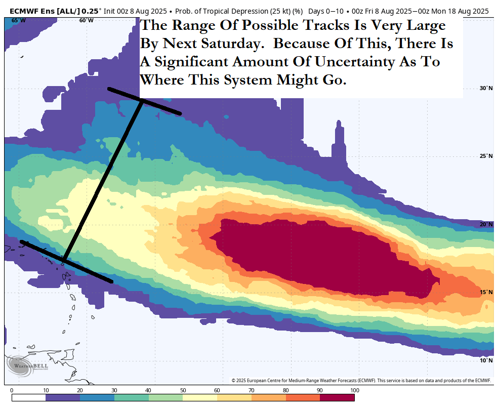
At the same time this is occurring, the wave located over the central tropical Atlantic is anticipated to become more organized as it approaches the Lesser Antilles. As it does this, it looks increasingly more likely that it will begin to be pulled into a large void left behind by Erin. This will cause this wave to turn northwestward as it reaches the Leeward Islands on Friday.
While there is a ribbon of favorable environmental conditions just east of the islands, it is quite narrow and because of this, I am not anticipating to see robust strengthening from the wave over the central Tropical Atlantic. This means that, at most, this wave could strengthen into a depression and maybe a low-end tropical storm by the time it reaches the Leeward Islands on Friday.
This means that those of you in the Leeward Islands and the Virgin Islands will probably see squally weather beginning on Thursday night and continuing through Friday. There is the possibility that there could be wind gusts of tropical storm force should this wave strengthen.
Looking beyond this, it appears that Erin will leave a large upper level trough in its wake & this should cause this wave to curve to the north and northeast into the open Atlantic after impacting the northeastern Caribbean. There are no guidance members that now show any sort of threat to the Bahamas, the United States or much of the Caribbean.
Now back to Invest 99-L, the wave that is located over the far eastern Tropical Atlantic – As I already mentioned, it seems quite possible that it will weaken and fall apart by later this week as it encounters a more unfavorable environment.
That said, even if it falls apart and stays weak, it’ll still head westward and may end up sneaking under the radar. Because of this, it’s probably going to eventually find itself in the Caribbean in about 10 days or so from now. It should be noted that none of the ensemble guidance show any sort of renewed organization or development from this system in the Caribbean, so more than likely this is nothing to worry about. That said, it is something that will be watched, just in case.
The next tropical weather discussion will be issued on Wednesday.