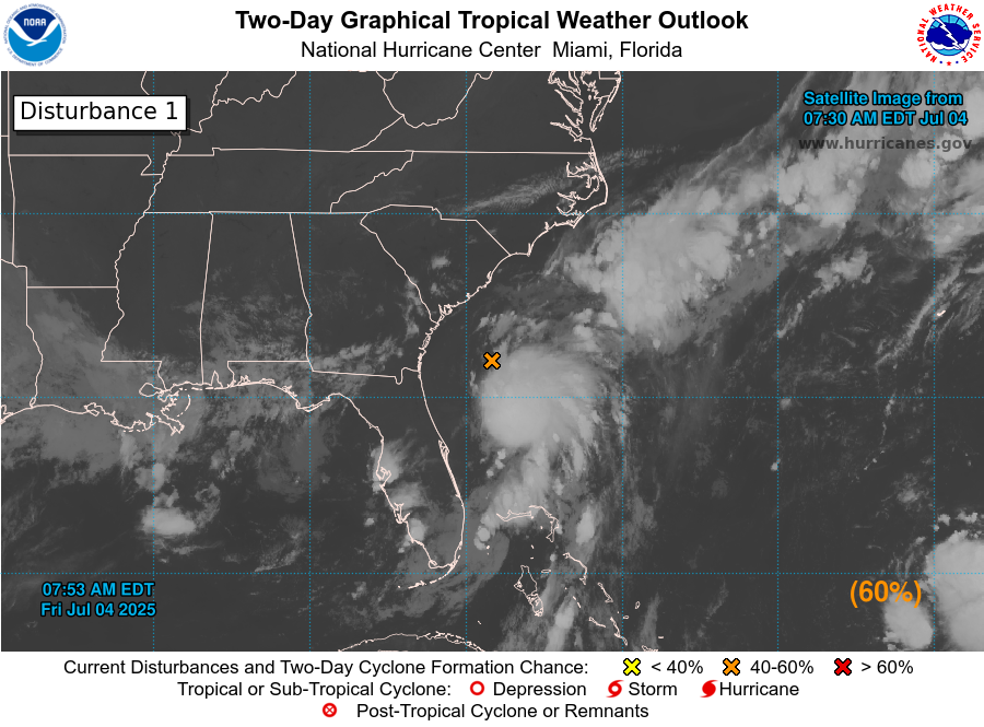
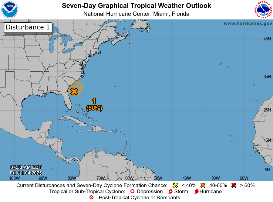
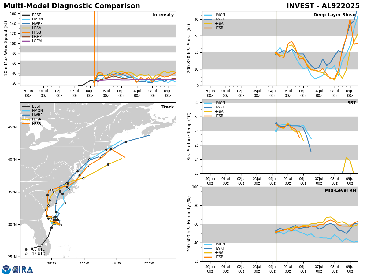
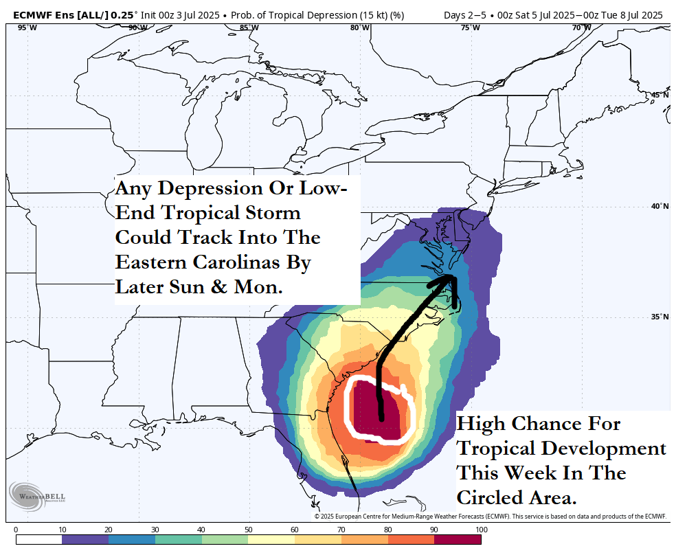
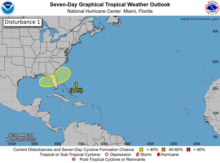
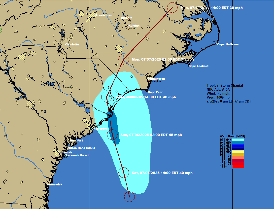
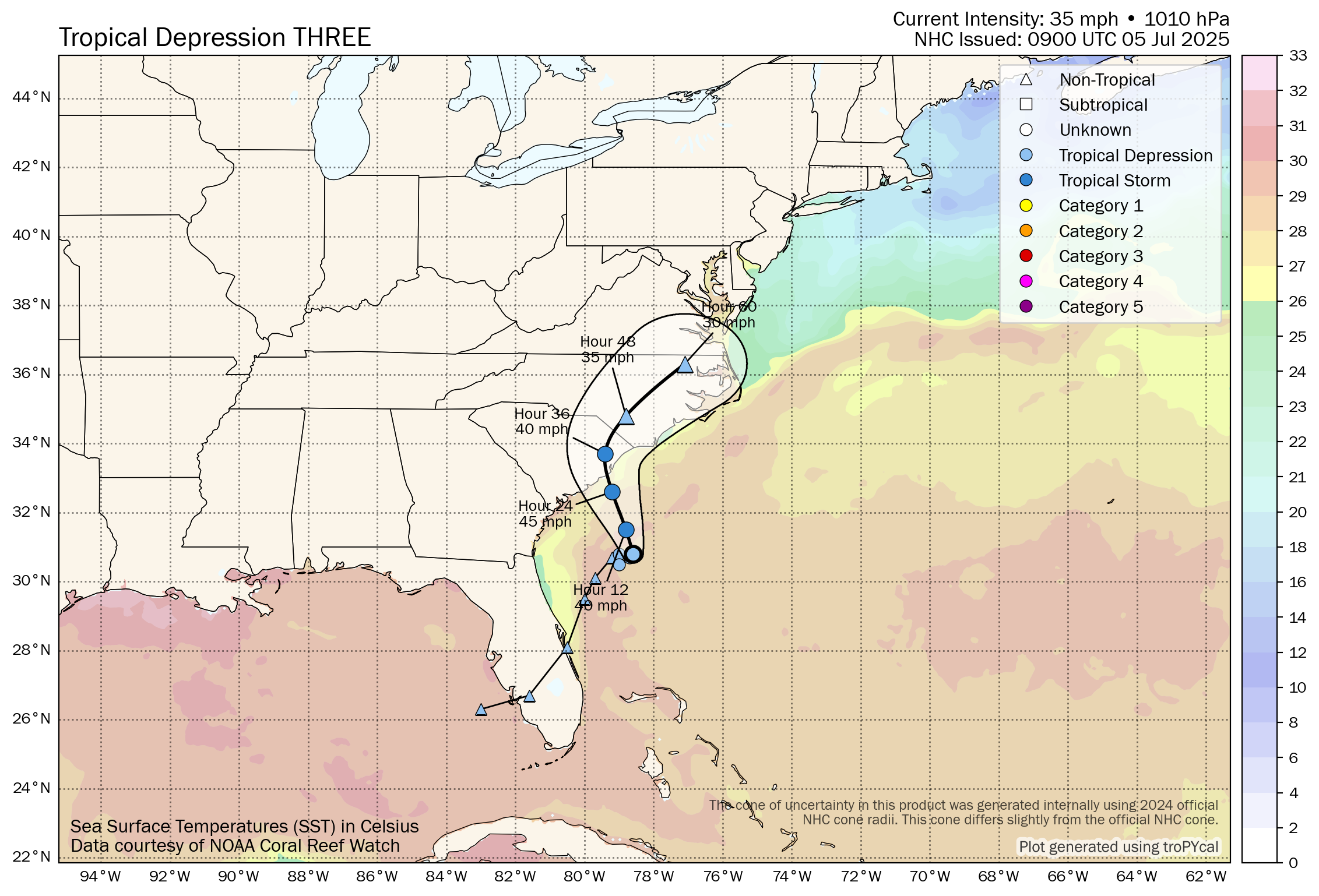
Tropical Storm Chantal: Tropical Depression #3 has strengthened into Tropical Storm Chantal this morning.
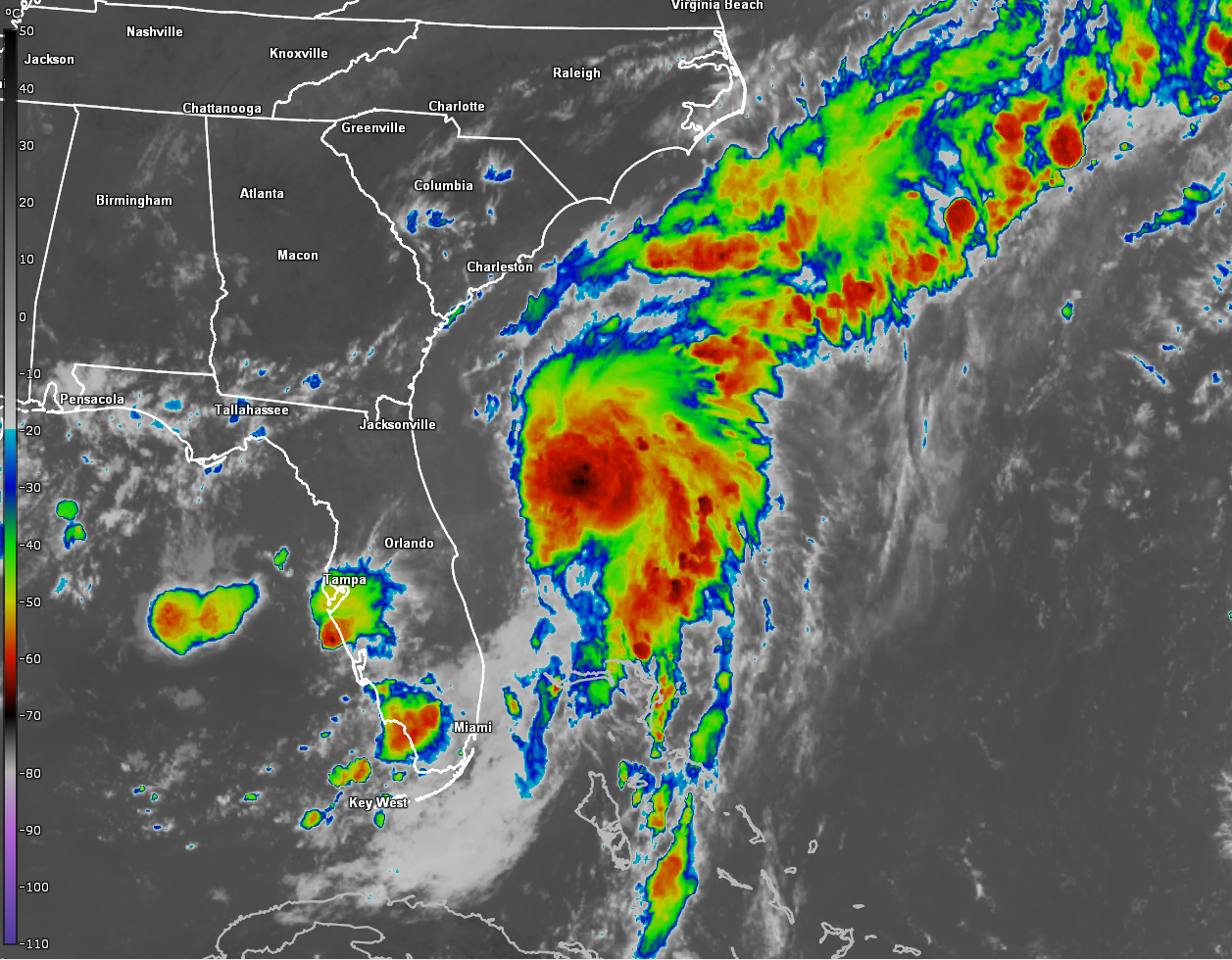
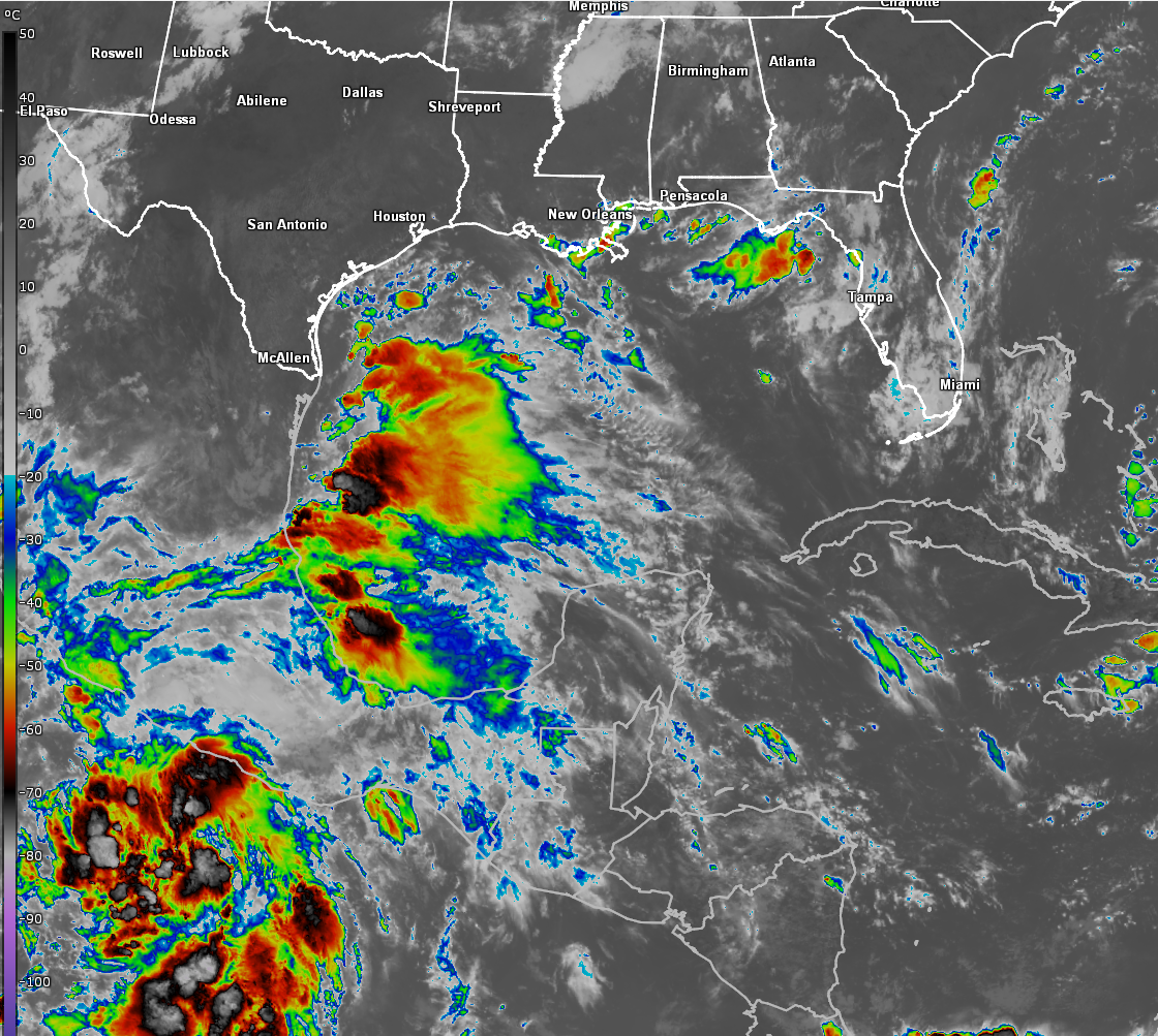
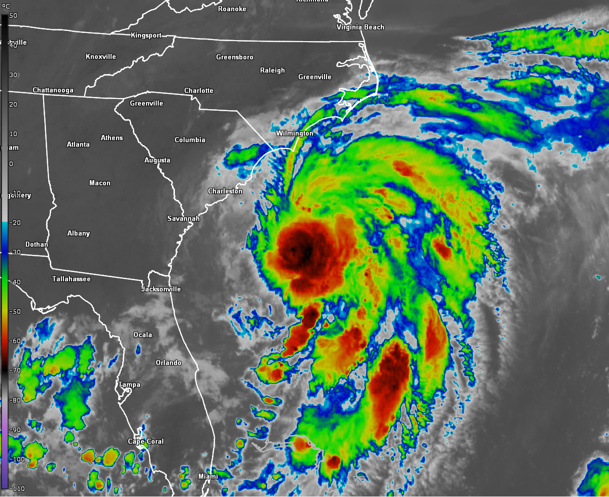
Satellite imagery and other weather analysis indicates that Chantal is much more organized this morning as compared to what it looked like yesterday. The center of Chantal is located on the western end of the deepest convection with most of the thunderstorm activity occurring to the east of the center. Bursts of new deep thunderstorm activity is occurring as I write this.
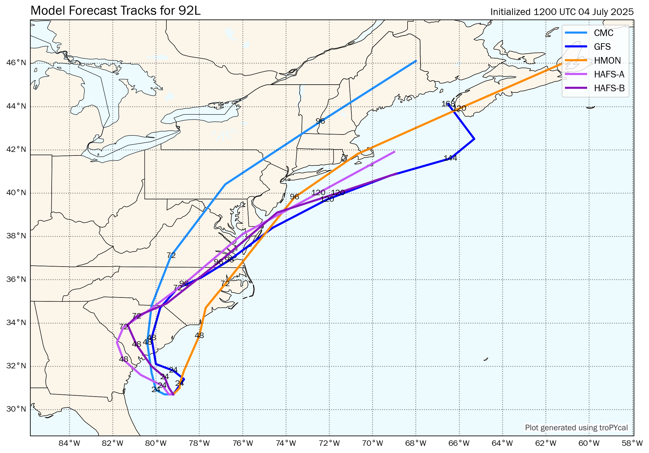
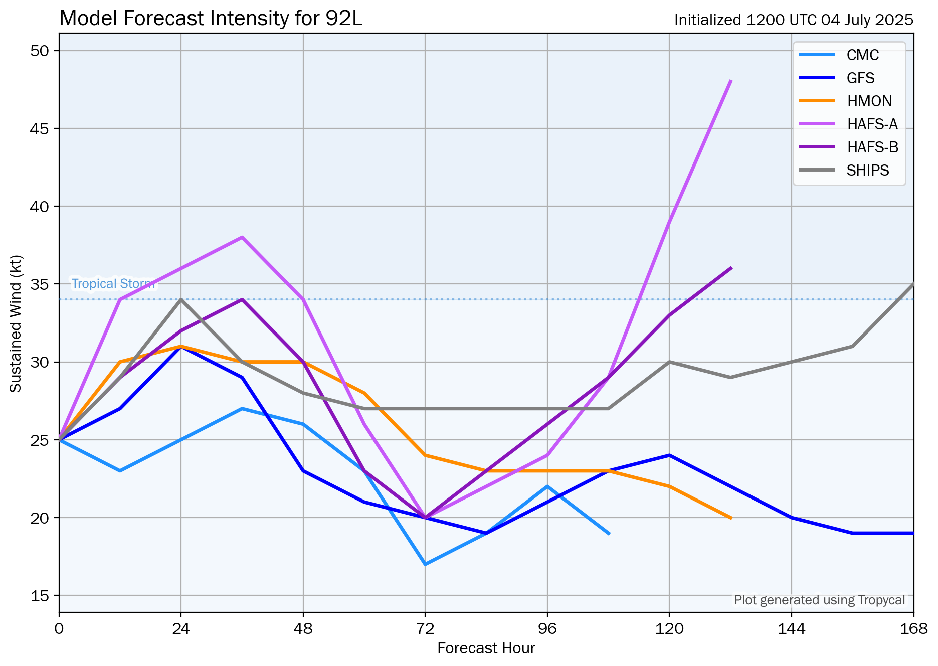
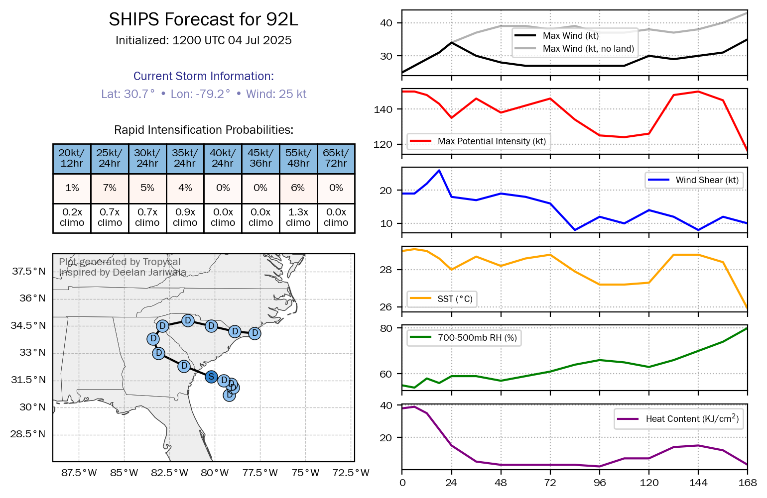
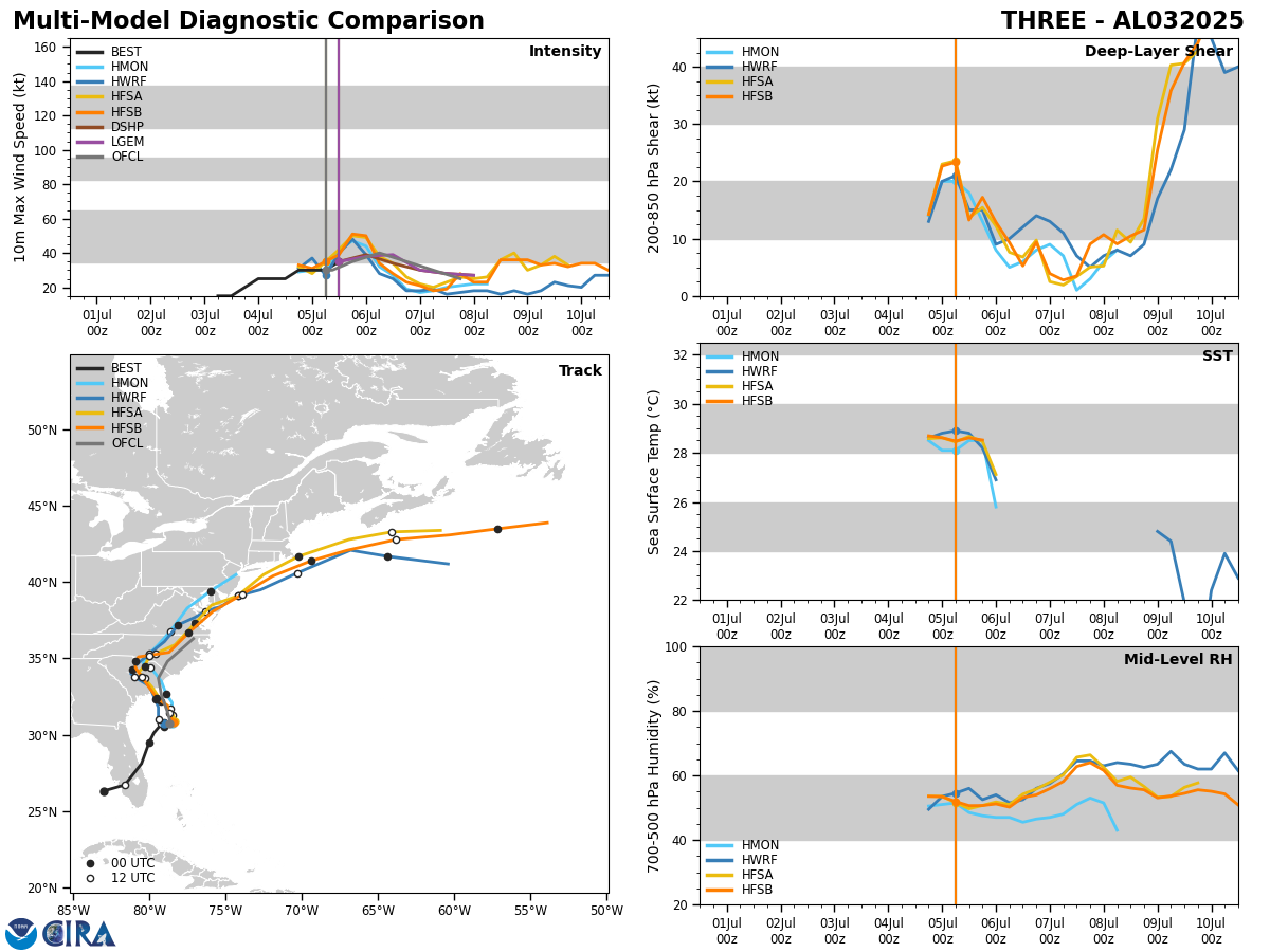
Analysis indicates that there is low amounts of wind shear occurring right over the center of Chantal and this means that the environmental conditions are favorable for some additional strengthening the rest of today. It would not surprise me at all to see Chantal peak at 55-60 mph before it comes onshore along the northeastern South Carolina coast by Sunday morning.
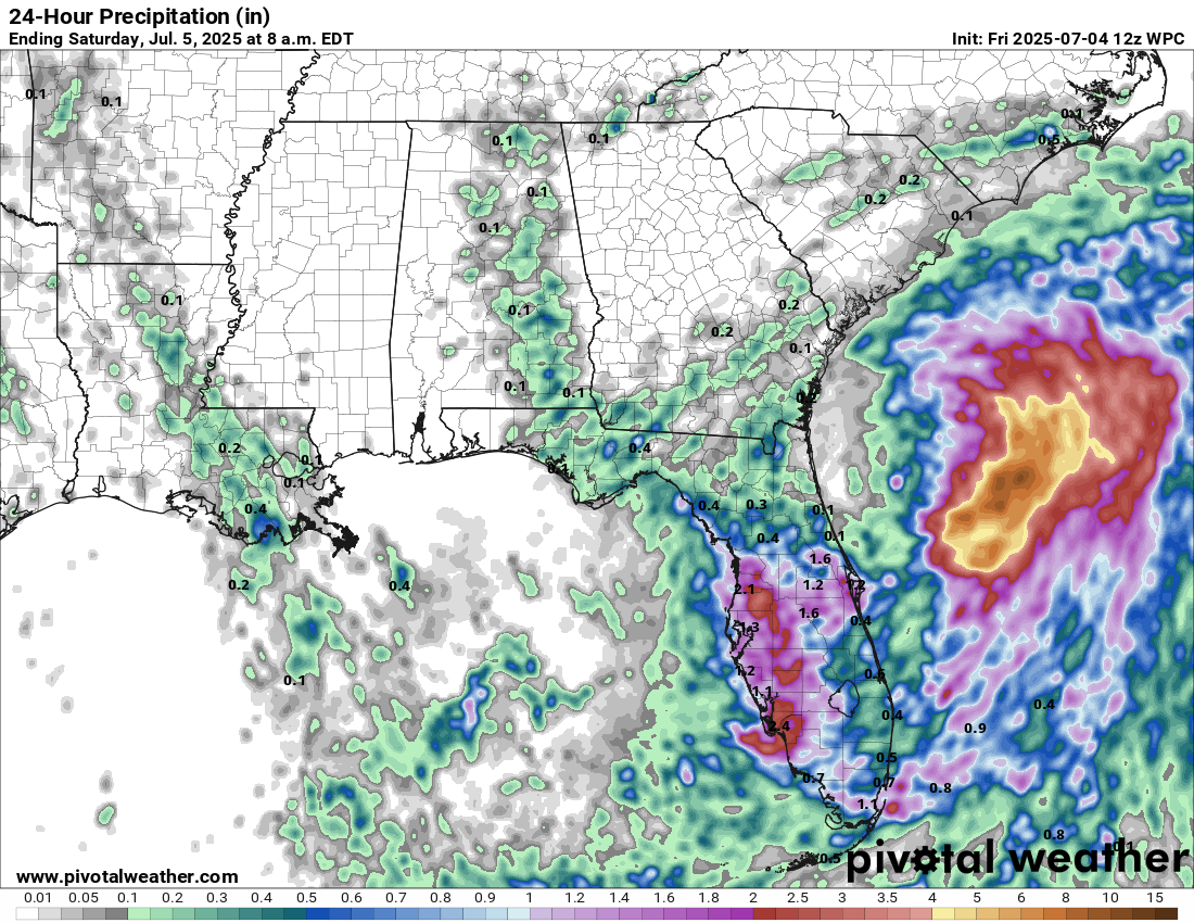
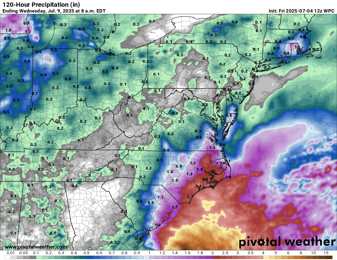
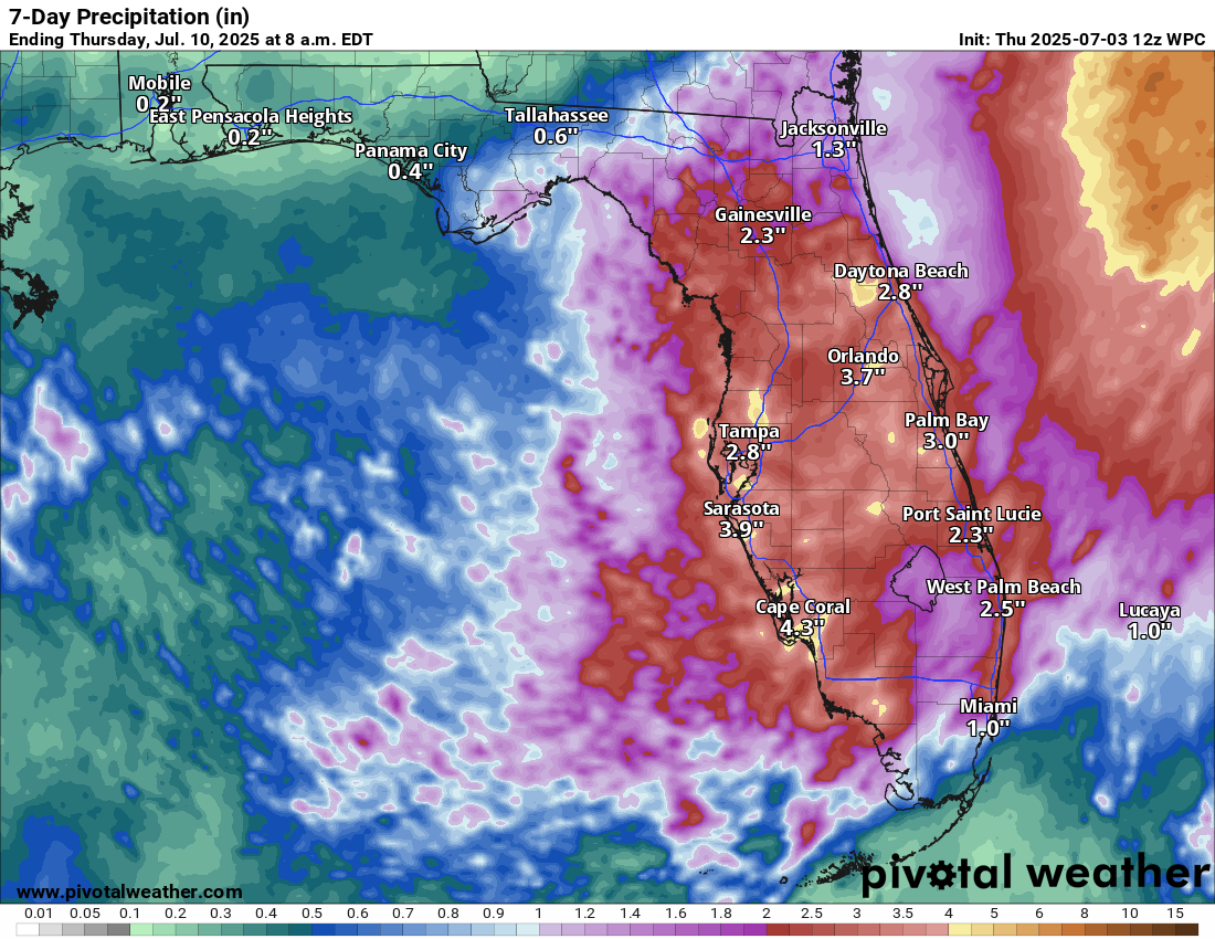
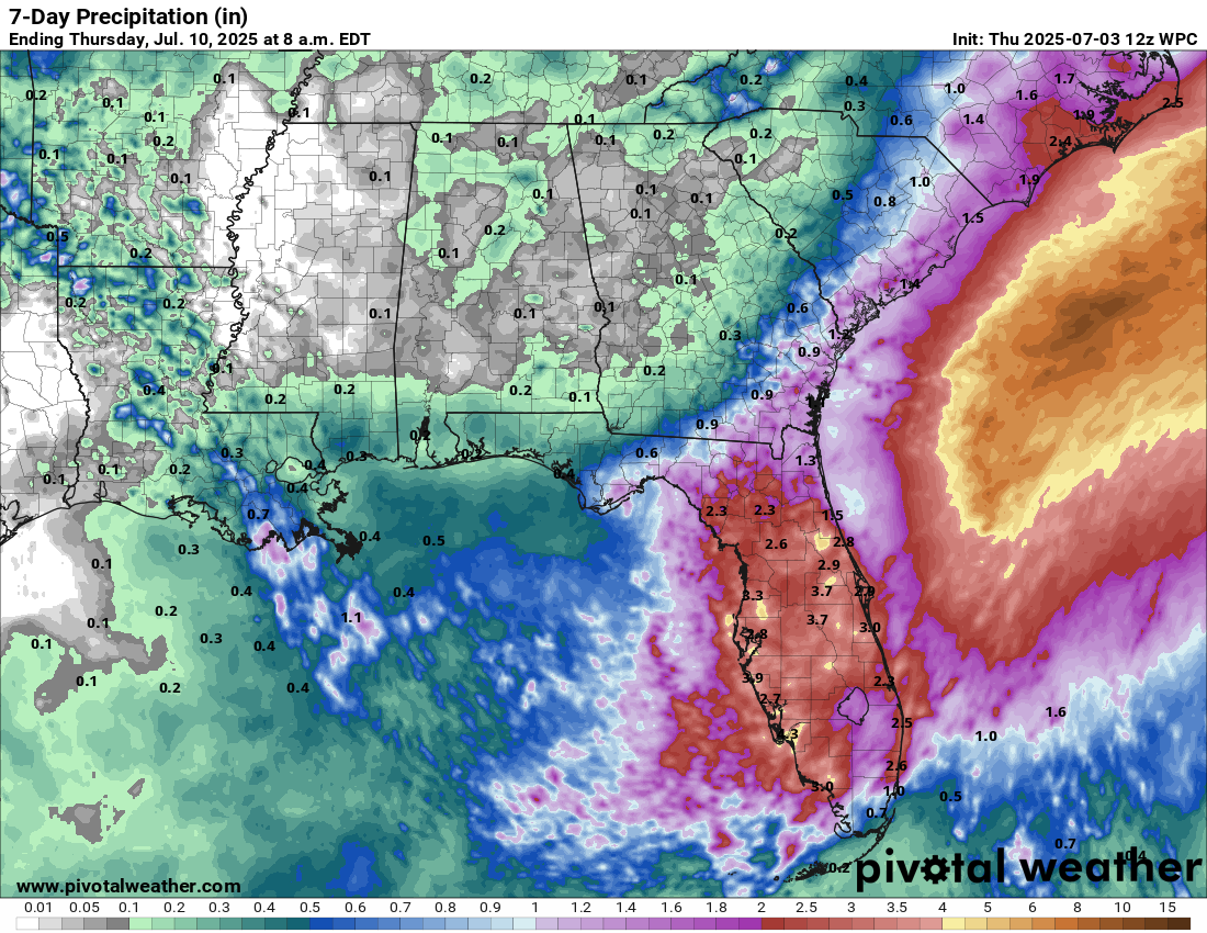
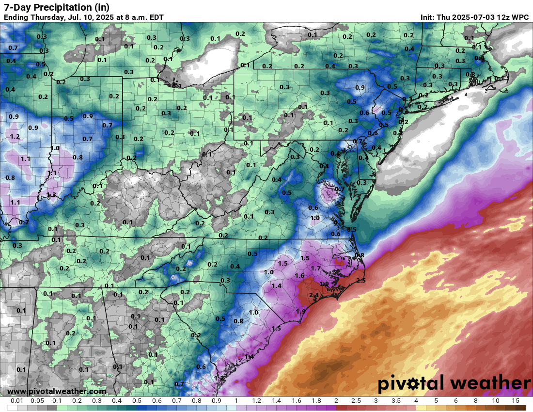
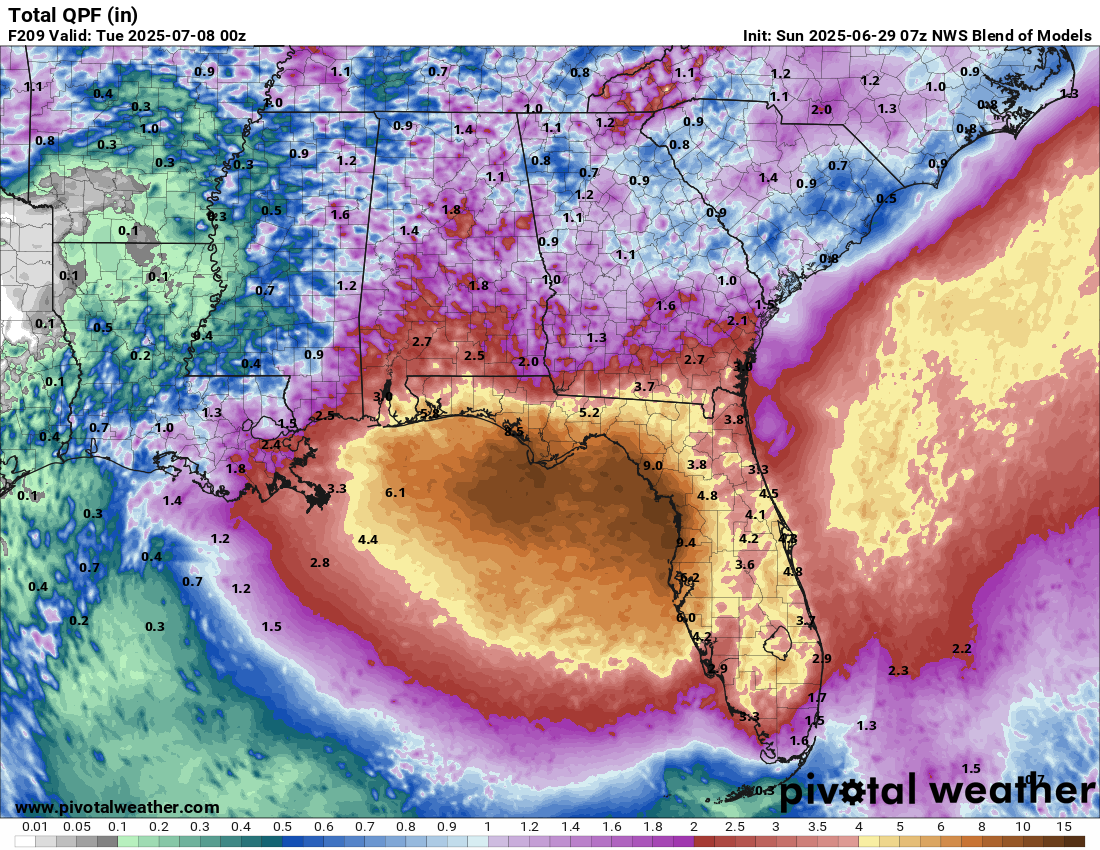
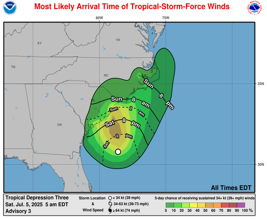
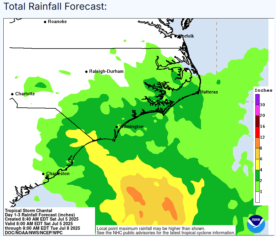
Squalls of heavy rain and gusty winds will likely begin affecting the South Carolina and North Carolina coasts by late this afternoon and certainly by tonight. These squalls will then continue through Sunday. Given that most of the squalls are located on the eastern side of the storm, the most robust squalls will likely to affect coastal areas of northeastern South Carolina and all of coastal southeastern and eastern North Carolina throughout tonight and Sunday. Wind gusts of up to 50-60 mph and rainfall totals of 3 to 6 inches can be expected in an area from about Myrtle Beach through all of coastal southeastern North Carolina to the southern parts of the outer banks of North Carolina.
Forecast Impacts:
Wind:
Rainfall:
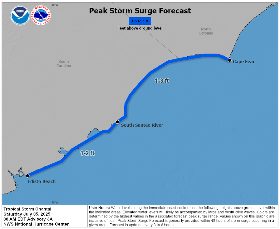
Storm Surge:
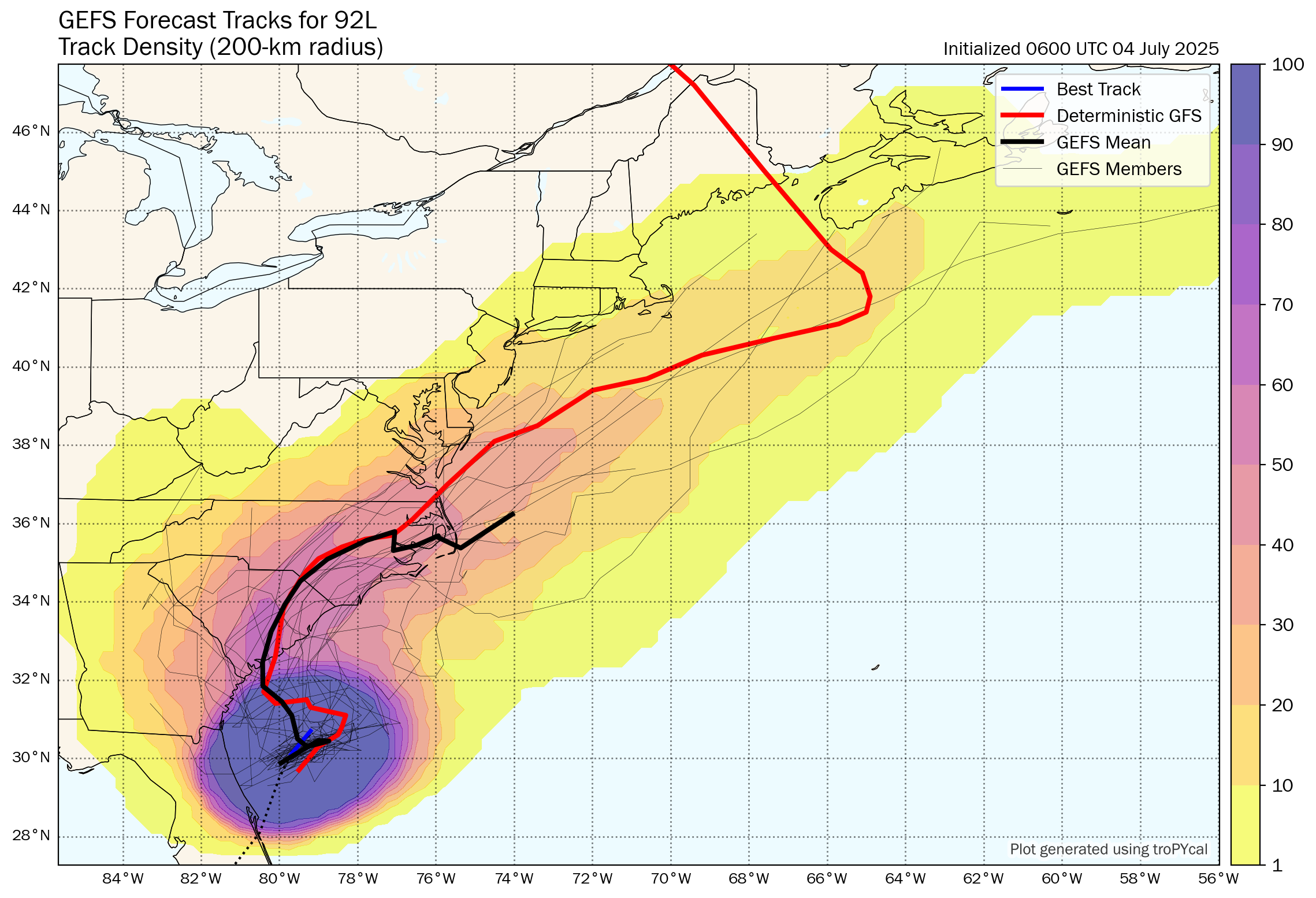
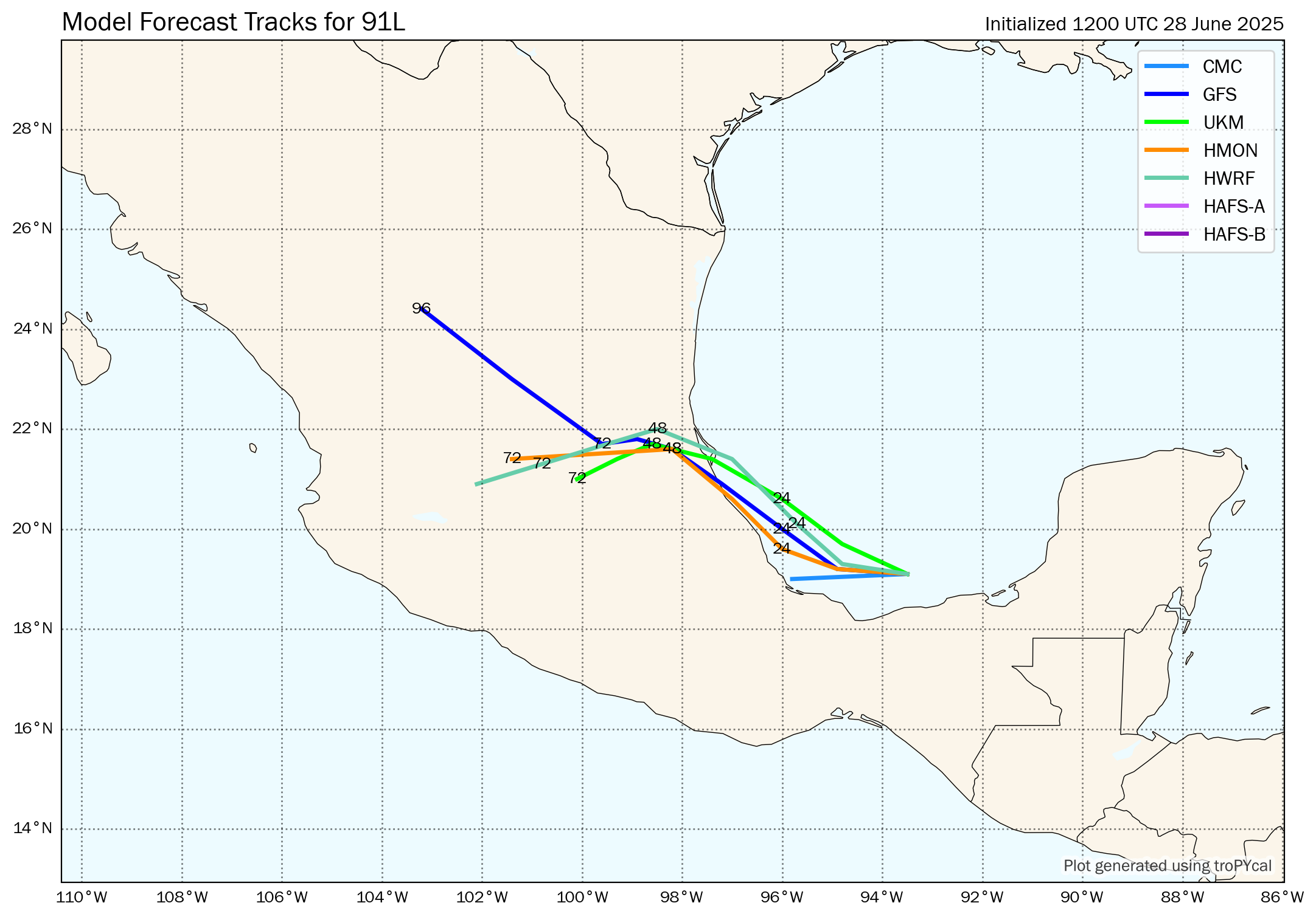
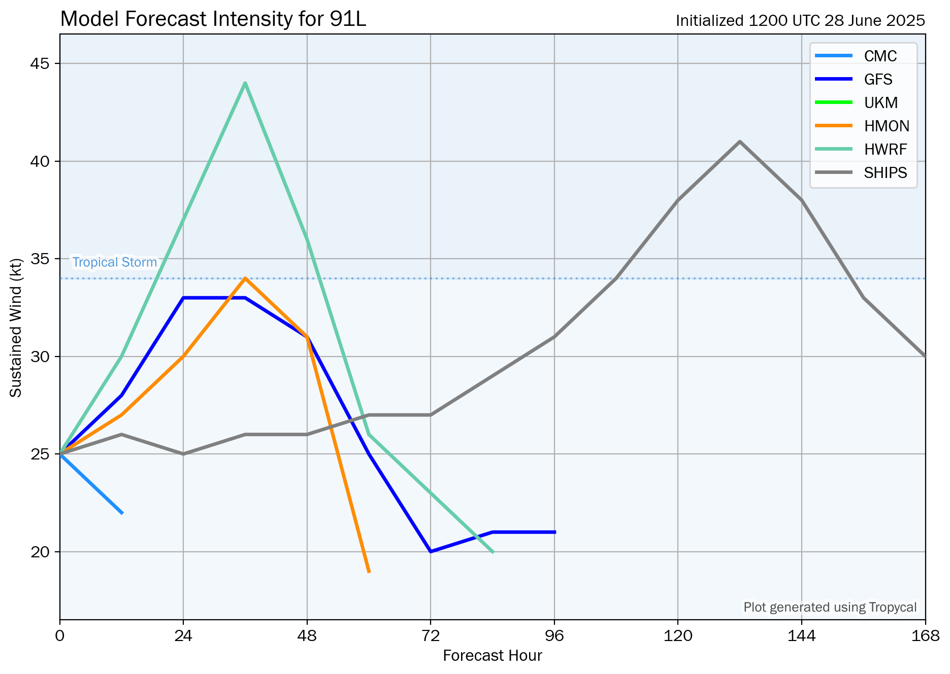
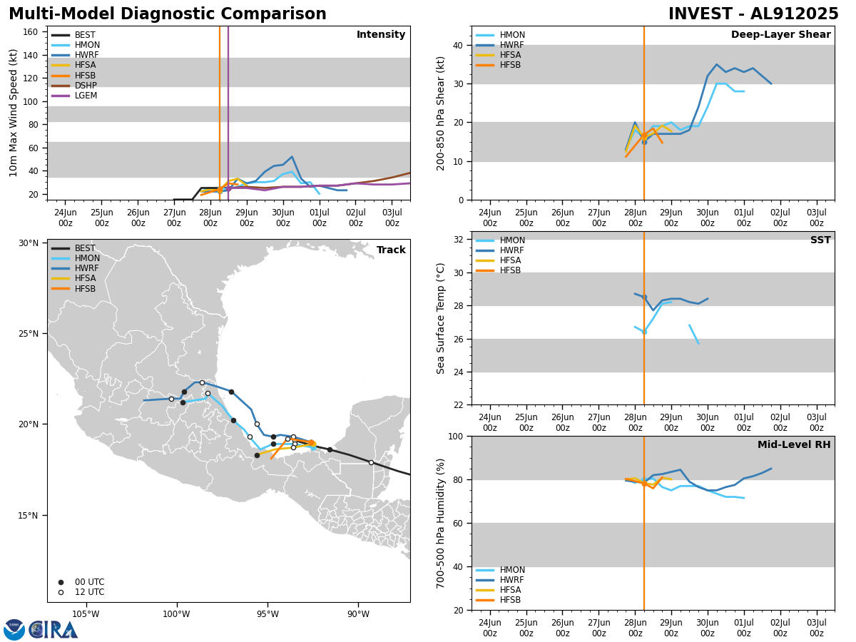
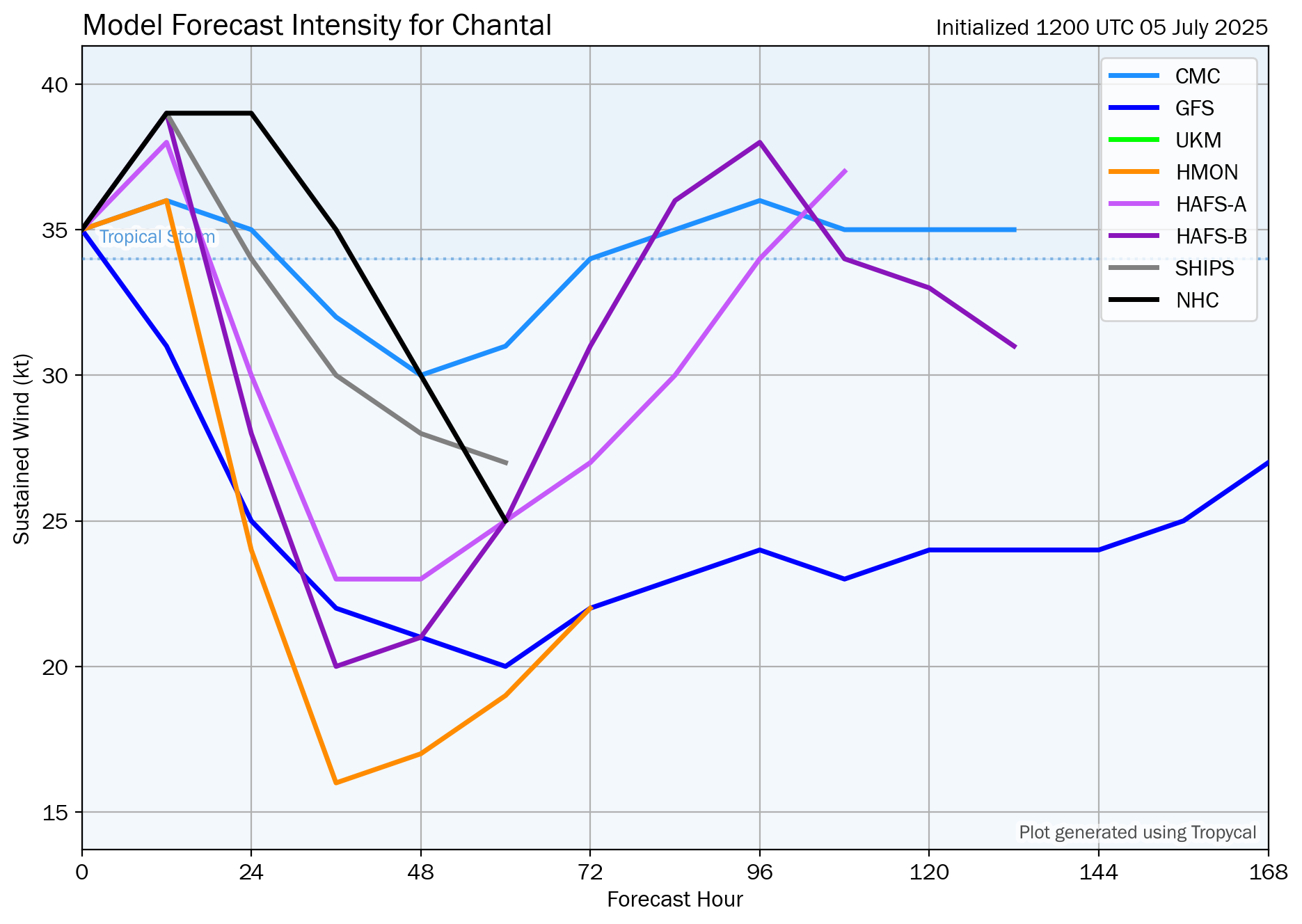
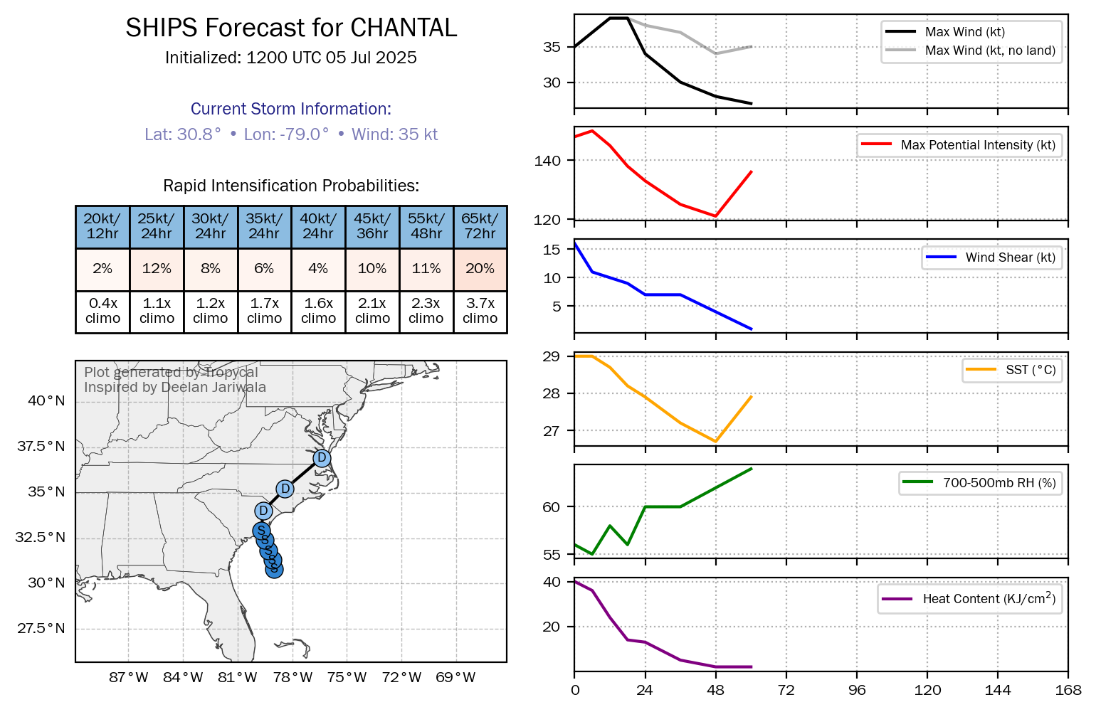
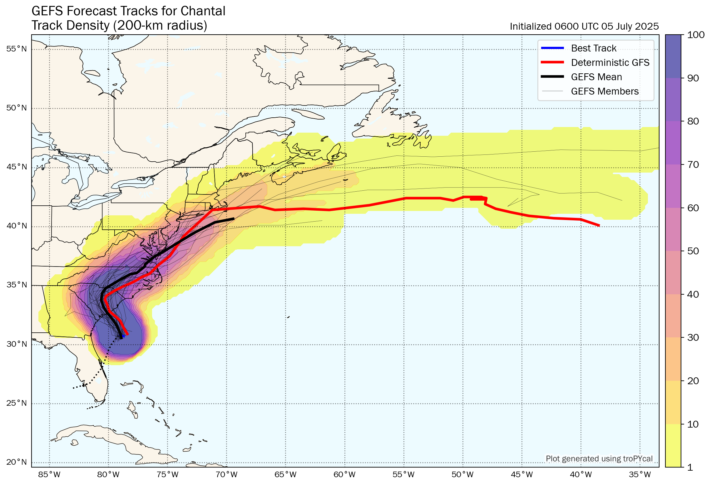
Model Track Forecast:

Satellite Imagery:
The next tropical weather discussion will be issued on Sunday.