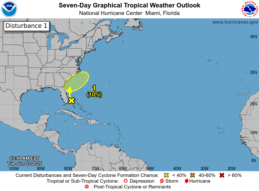
All is quiet across the Atlantic, Caribbean and the Gulf today and it is very likely that things will remain quiet through this weekend. In fact, tropical development probably will not be a concern right through next week across the entire Atlantic Basin.
One reason for the quietness across the Atlantic Basin are the very large outbreaks of Saharan dust that has been traversing across the Atlantic this week. This dust has helped to create a cap on the atmosphere leading to very little in the way of convection across the Atlantic, Caribbean and the Gulf.
Another very large area of Saharan dust is currently pushing its way across the central and eastern Tropical Atlantic. This Saharan dust should reach Puerto Rico, the Virgin Islands, the Lesser Antilles and the eastern Caribbean by about Monday and then progress into the Bahamas and the western and central Caribbean by the middle part of next week.
This Saharan dust is perfectly normal for this time of year and is usually something that does occur right through July.
One thing this Saharan dust will do is to keep things quiet across the Atlantic Basin right into next week. This Saharan dust will also probably put a cap on any widespread convection across much of the Atlantic Basin for the next few days.
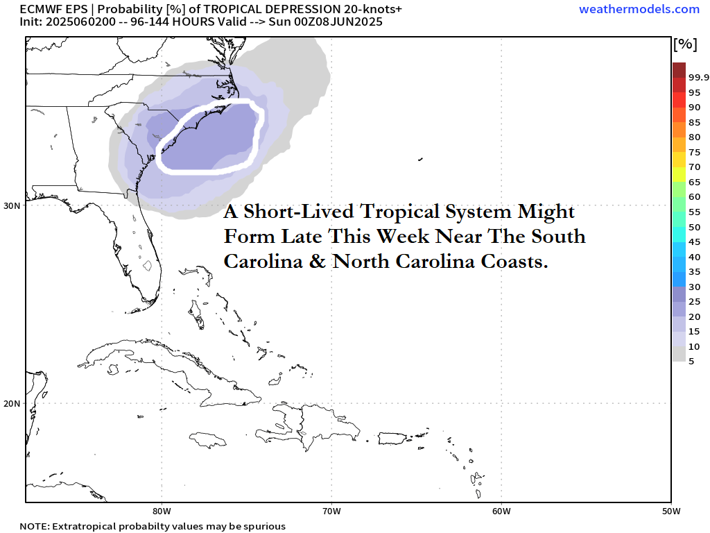
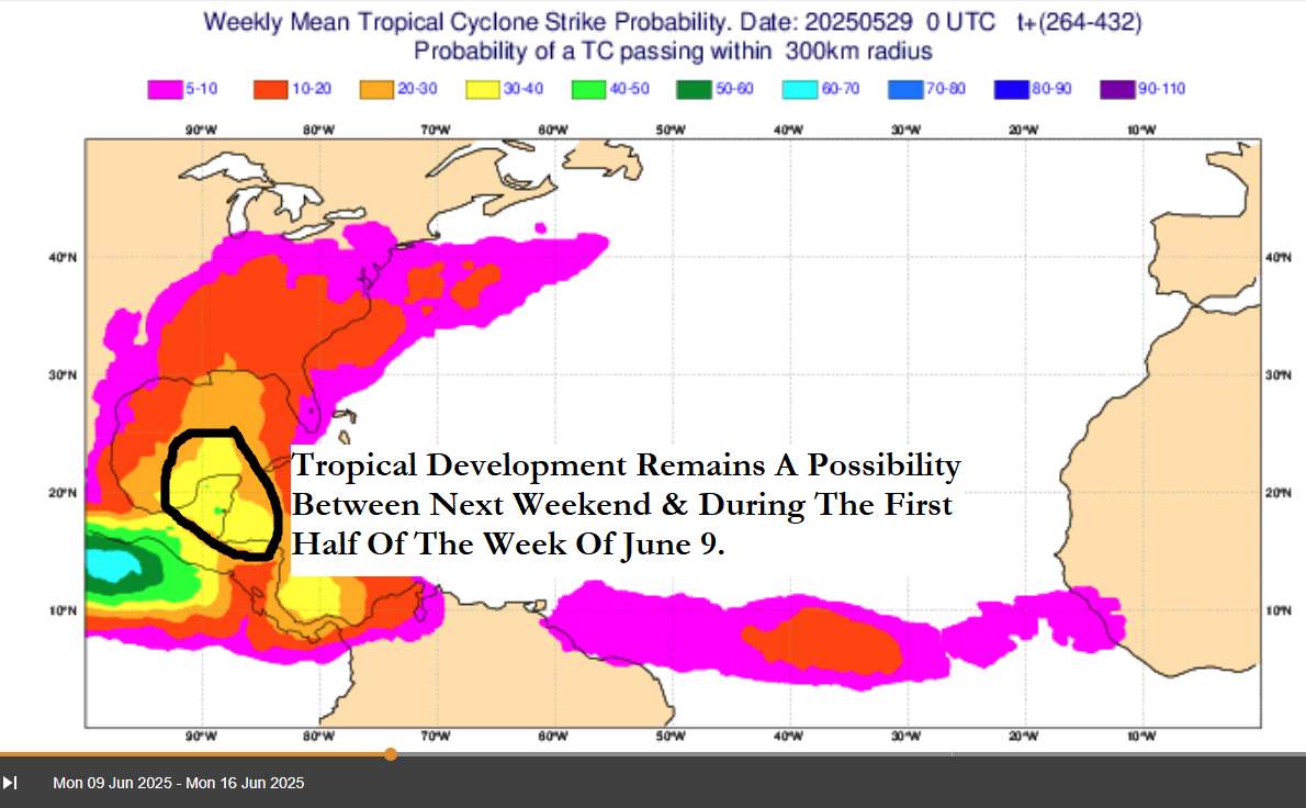
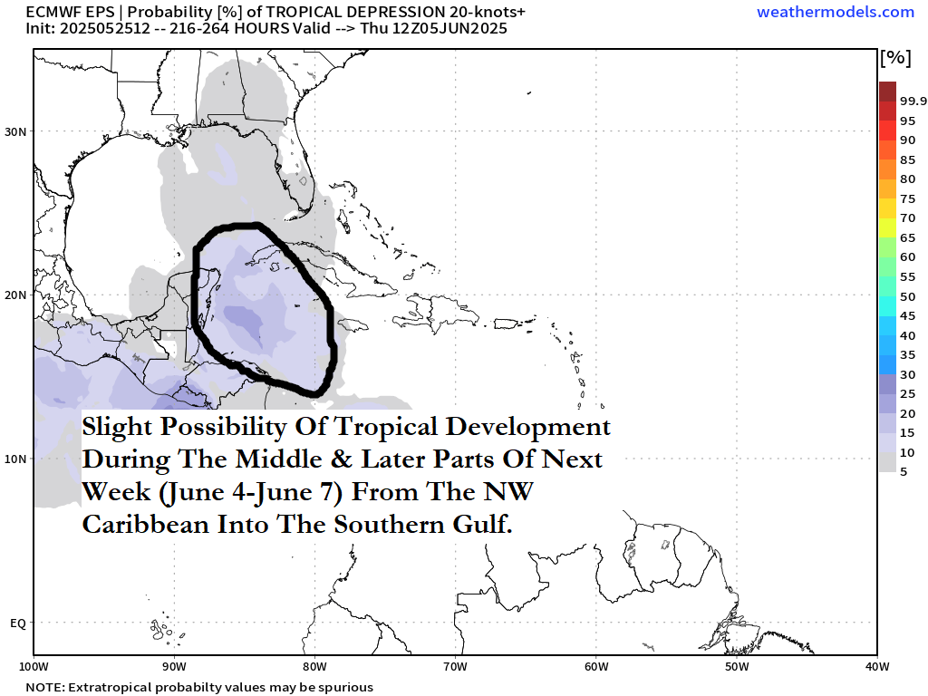
Looking even further out, it’s still possible that increasing amounts of storminess could occur across the western Caribbean, Central America and the southern Gulf starting around next weekend and continuing through the week of June 16.
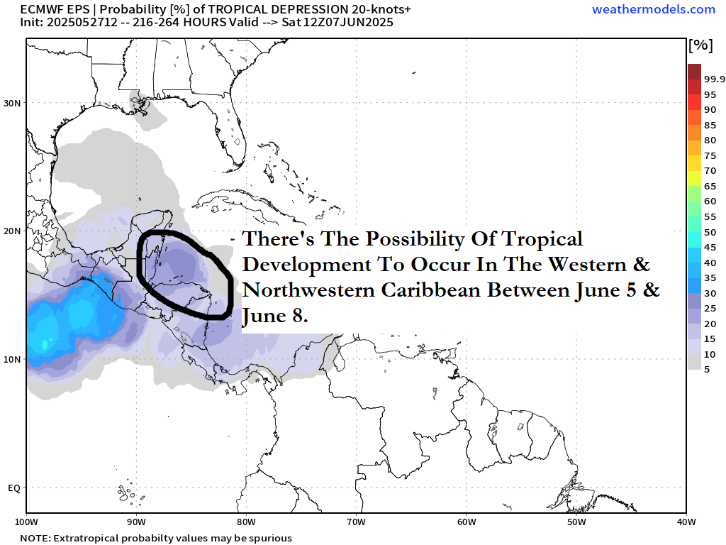
First off, ignore the GFS model and its forecasts of tropical storms and hurricanes in the 10 to 15 day time period. This is a known bias from the GFS model and unless other models agree with the other models, the forecasts from the GFS model should be ignored.
Looking at other data that is more accurate than the GFS model, it shows that most of the tropical development is likely to occur over the eastern Pacific over the next week or so. It does look like that some of the convection will seep over into the western Caribbean and the southern Gulf as we get into next weekend and beyond. It should also be noted that the European ensemble model guidance does show a 10-20 percent chance for tropical development to occur in the Bay of Campeche and the southwestern Gulf during the week of June 16.
It’s way too soon to really tell if western Caribbean and southern Gulf tropical development is going to be a growing concern or not.
One thing that is for sure is that all will be quiet across the Atlantic, Caribbean and the Gulf this weekend through next week.
The next tropical weather discussion will be issued on Monday.