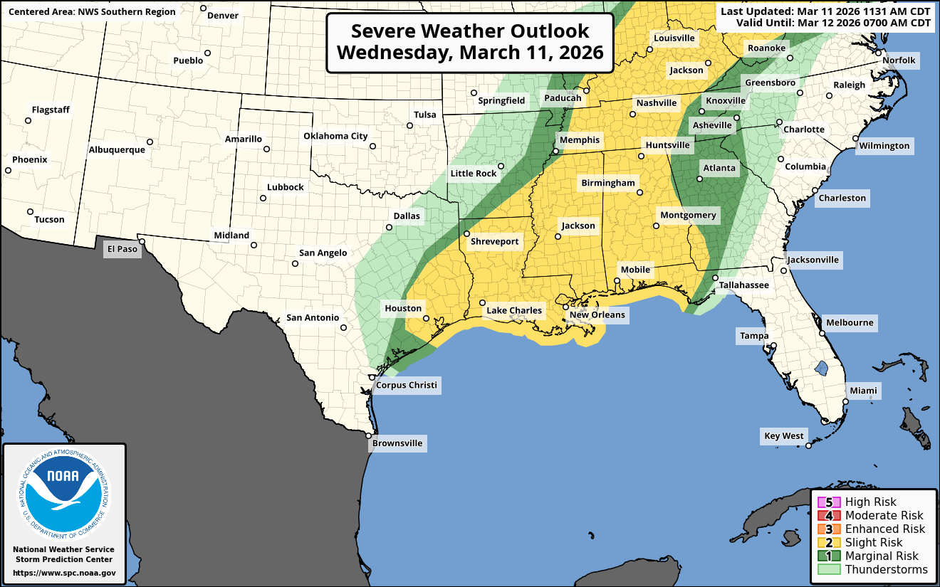
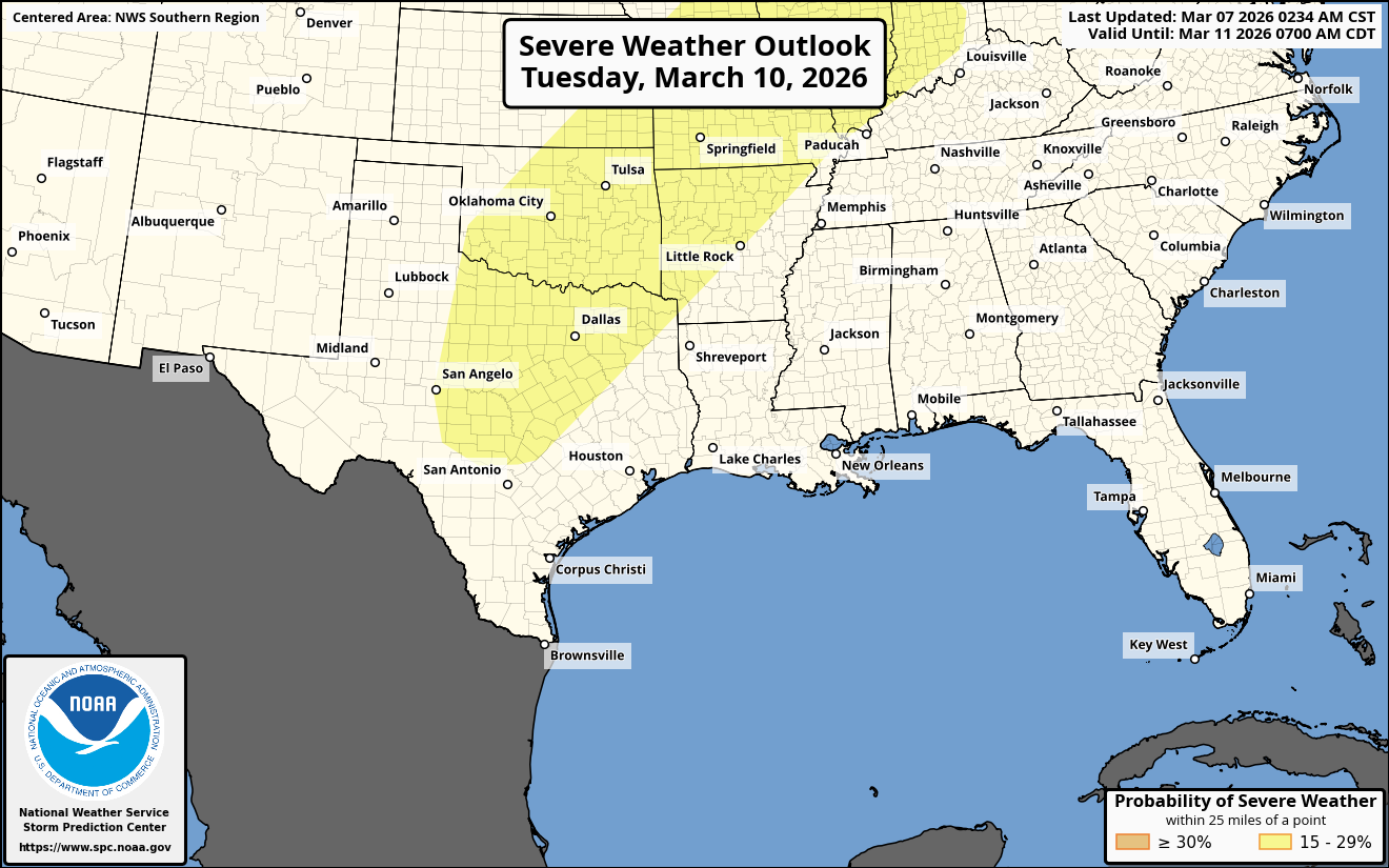
Late Sunday Afternoon & Sunday Night: Widespread severe weather with the threat for widespread damaging winds and tornadoes are expected late Sunday afternoon and Sunday night across a large area from northeast Texas to southwest Lower Michigan. The area of most concern looks to be across northern Louisiana, much of Arkansas, central and northern Mississippi, northwest Alabama, western and middle Tennessee, southeast Missouri, western Kentucky, southern Illinois and southern Indiana.
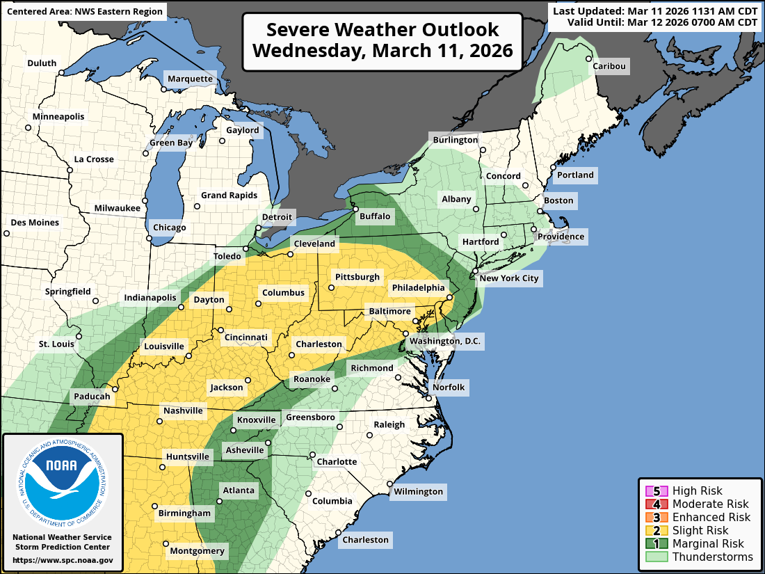
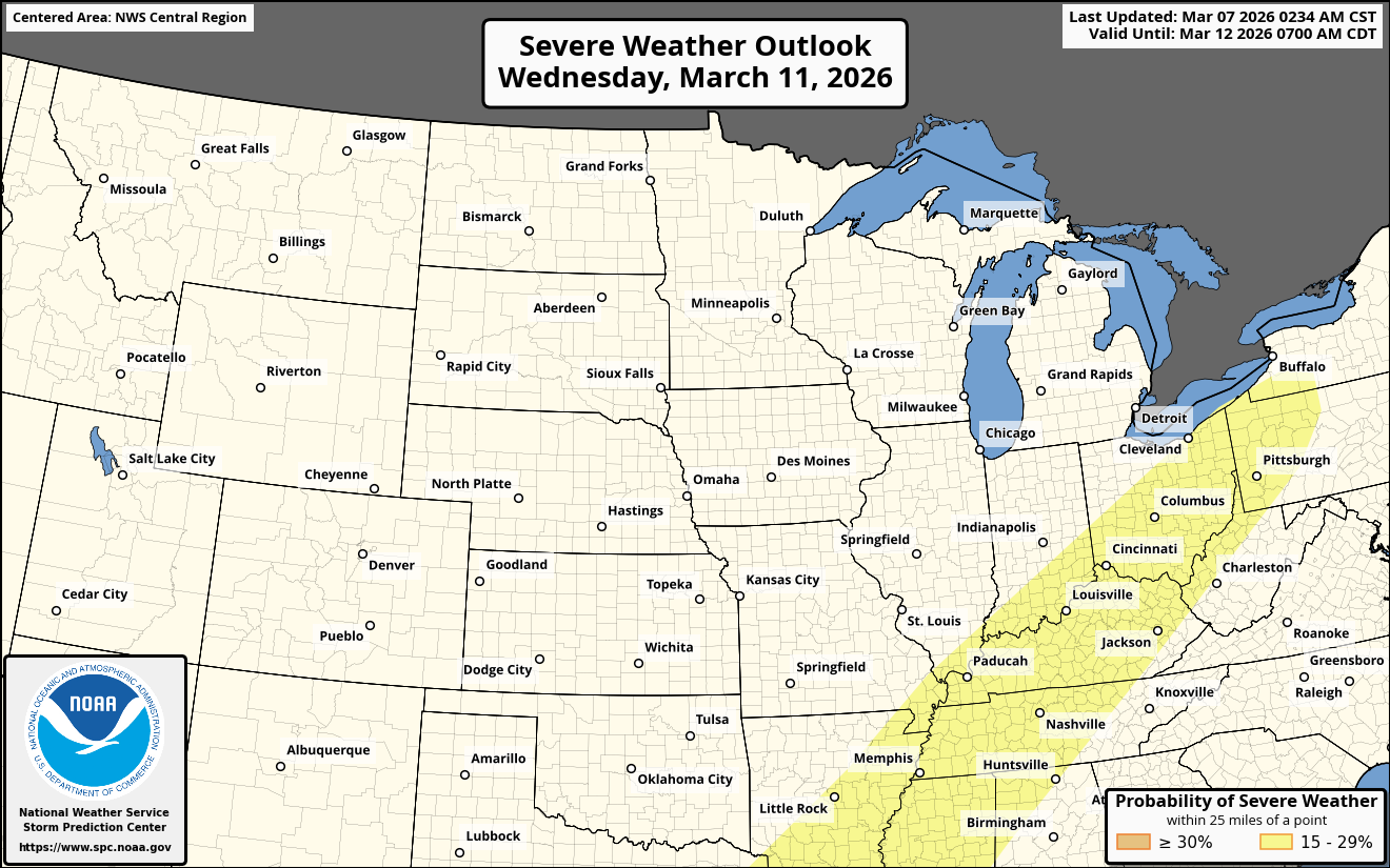
For The Ohio Valley – A very favorable environment for severe weather looks to exist across much of the Ohio Valley on Sunday and Sunday night.
It is anticipated that a powerful squall line containing 65-80 mph wind gusts will move from eastern Missouri, southern Illinois, western Kentucky and western Tennessee late Sunday afternoon into Sunday evening to across southern Indiana, western Ohio, central Kentucky and middle Tennessee during the overnight hours of Sunday night. Additionally, some embedded supercells may be found in and just ahead of the squall line leading to the threat for a few tornadoes.
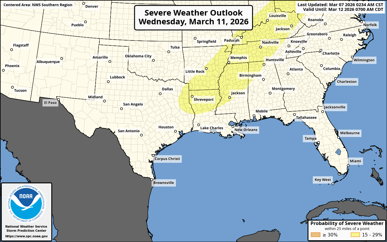
Louisiana Into Mississippi and Alabama – That squall line is likely to extend southwestward into Louisiana and eastern Texas during late Sunday afternoon. This squall line will push eastward into Mississippi and Alabama during the overnight hours of Sunday night.
The greatest instability and strongest shear which will help to foster widespread damaging winds and a few tornadoes looks to be found across central and northern Mississippi and northwestern Alabama between 9 pm CDT Sunday night and 6 am Monday morning.
Florida Panhandle & Coastal Alabama – Another area to watch will be along the Alabama coastline and across coastal parts of the Florida Panhandle during the predawn hours of Monday morning. It is possible that some supercell severe thunderstorms could push northward after about 3 am Monday morning into coastal Alabama and across the Florida Panhandle. If this occurs, then there could be a very real risk for a tornado threat across these areas just before sunrise Monday morning.
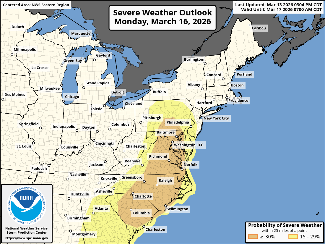
Monday: Significant severe weather with widespread damaging winds and a few tornadoes will be a threat on Monday from the Carolinas northward into the Mid-Atlantic states. It appears that there are going to be two areas to really watch:
The first area will be across the Carolinas into southeastern Virginia where supercell storms may pose a threat for tornadoes and damaging winds from mid and late afternoon Monday into the evening hours of Monday.
A second area to watch will be across northern Virginia, Maryland, Delaware and southern Pennsylvania where a powerful squall line could sweep through during the daytime hours of Monday. Widespread damaging winds of up to 75 mph in gusts and a few tornadoes will be a threat.