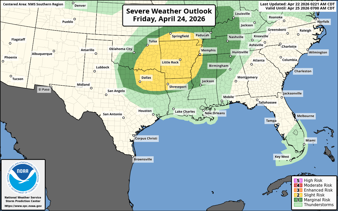
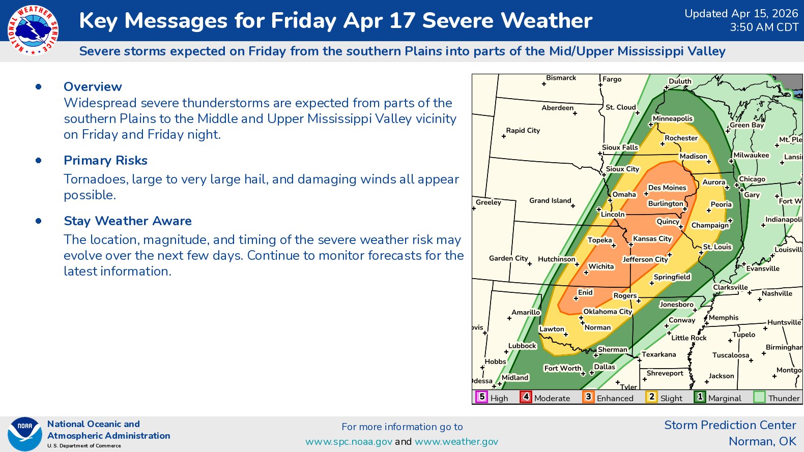
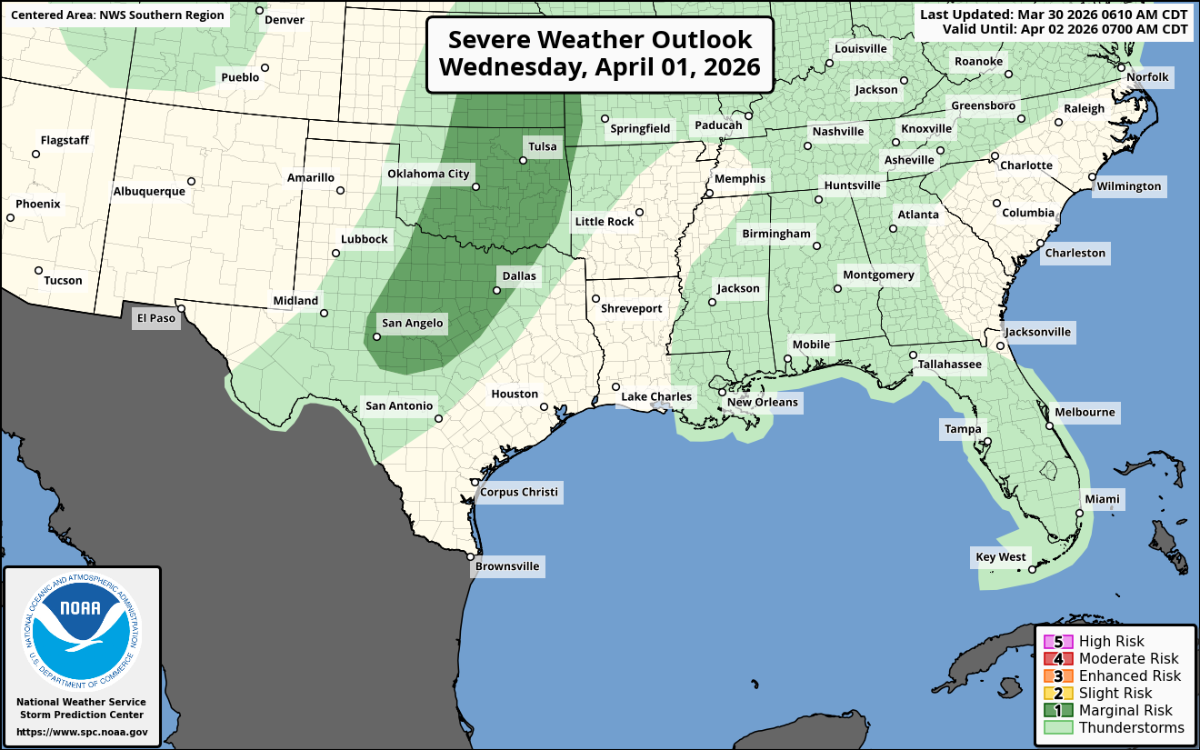
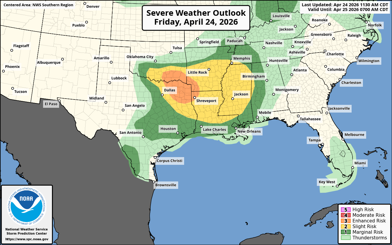
Summary: Severe thunderstorms look most probable later this afternoon through this evening from southern and eastern Oklahoma and northeast and eastern Texas eastward through the ArkLaTex into the lower Mississippi Valley. Large hail, damaging winds and a few tornadoes will be possible. The area of greatest threat for supercells with very large hail and tornadoes will be across the ArkLaTex region.
Details: A round of severe thunderstorms look to develop across southeastern Oklahoma, northeast Texas and across the ArkLaTex by about 4 to 6 pm CDT today. The environmental conditions around these storms will be favorable for supercells capable of producing very large hail and tornadoes.
Eventually these storms will evolve into a cluster of severe storms that push into southern Arkansas, northern Louisiana and western and central Mississippi during this evening into the overnight hours of tonight. A damaging wind threat will exist with this cluster of storms tonight.
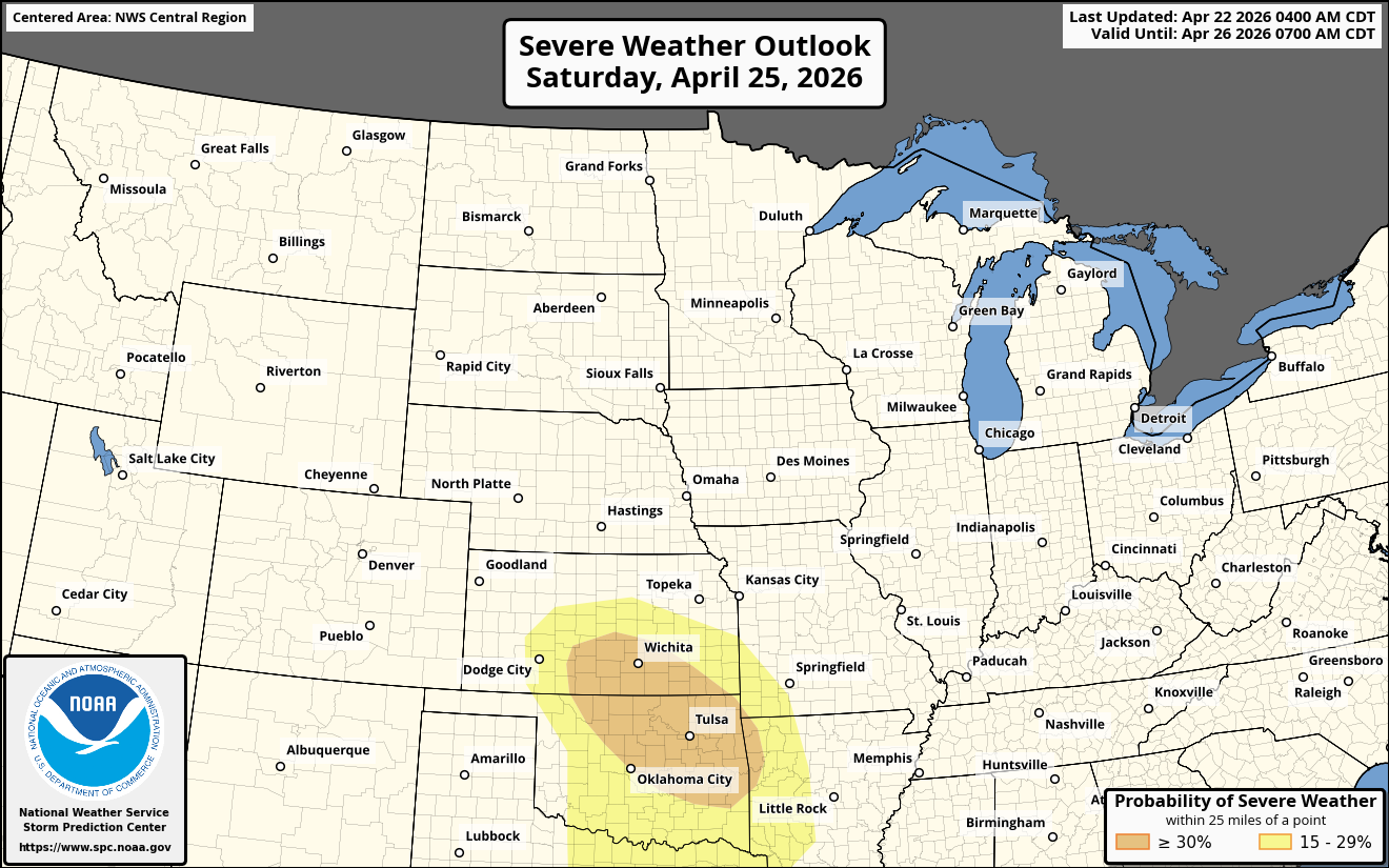
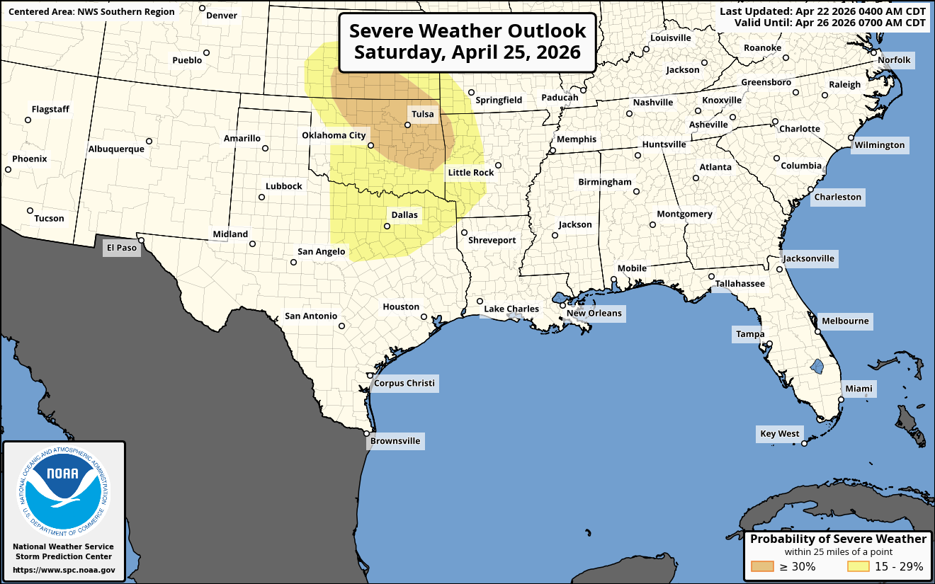
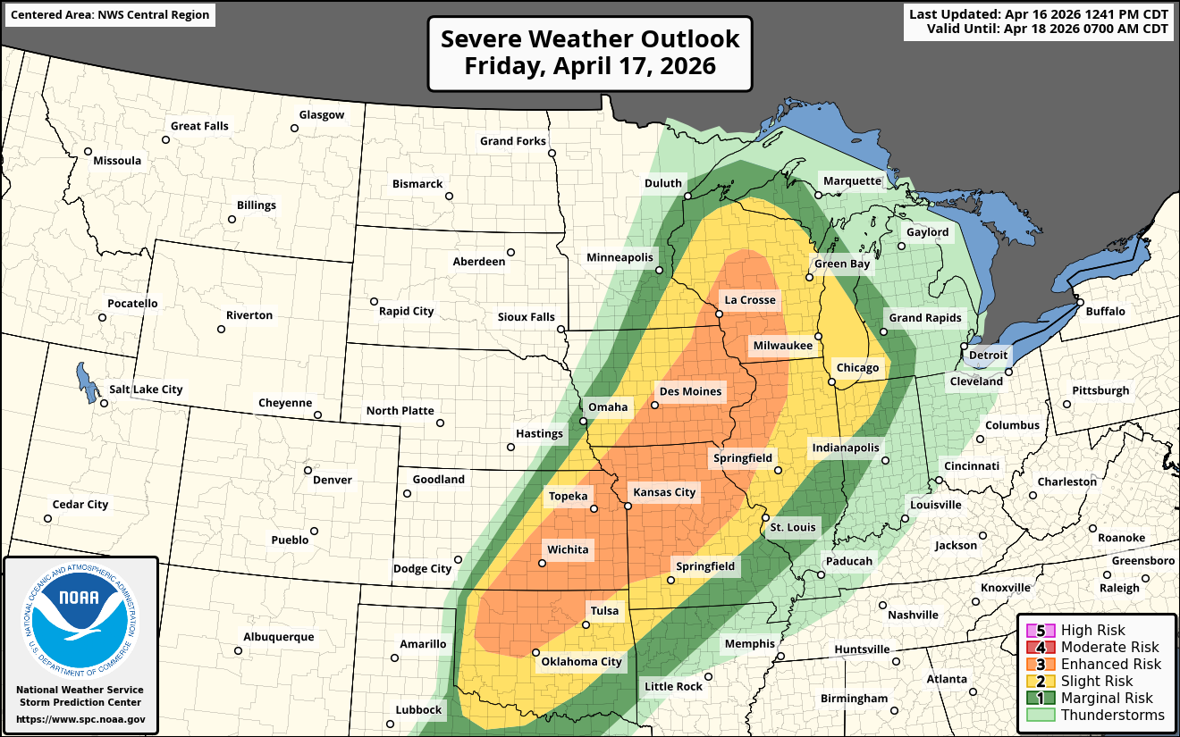
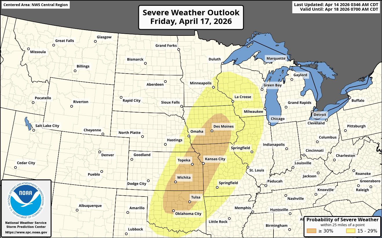
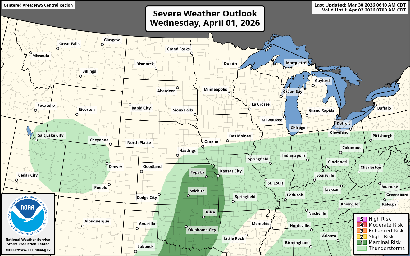
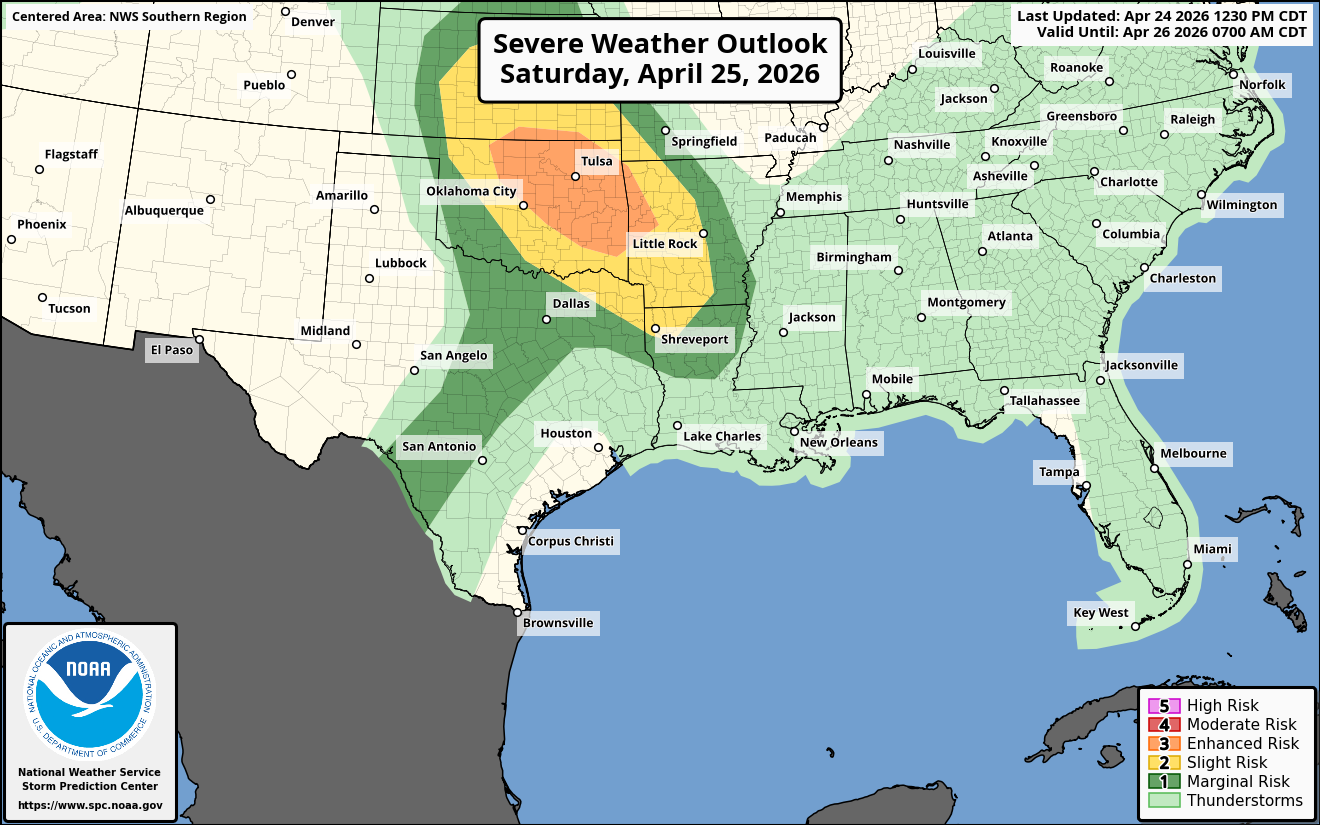
Turning To Saturday – It appears that the same areas as today will be prone to seeing severe storms Saturday afternoon and Saturday evening.
Severe thunderstorms that will have the potential to produce very large hail, damaging winds and tornadoes will be a threat across central and eastern Oklahoma and western Arkansas during Saturday afternoon and Saturday evening.
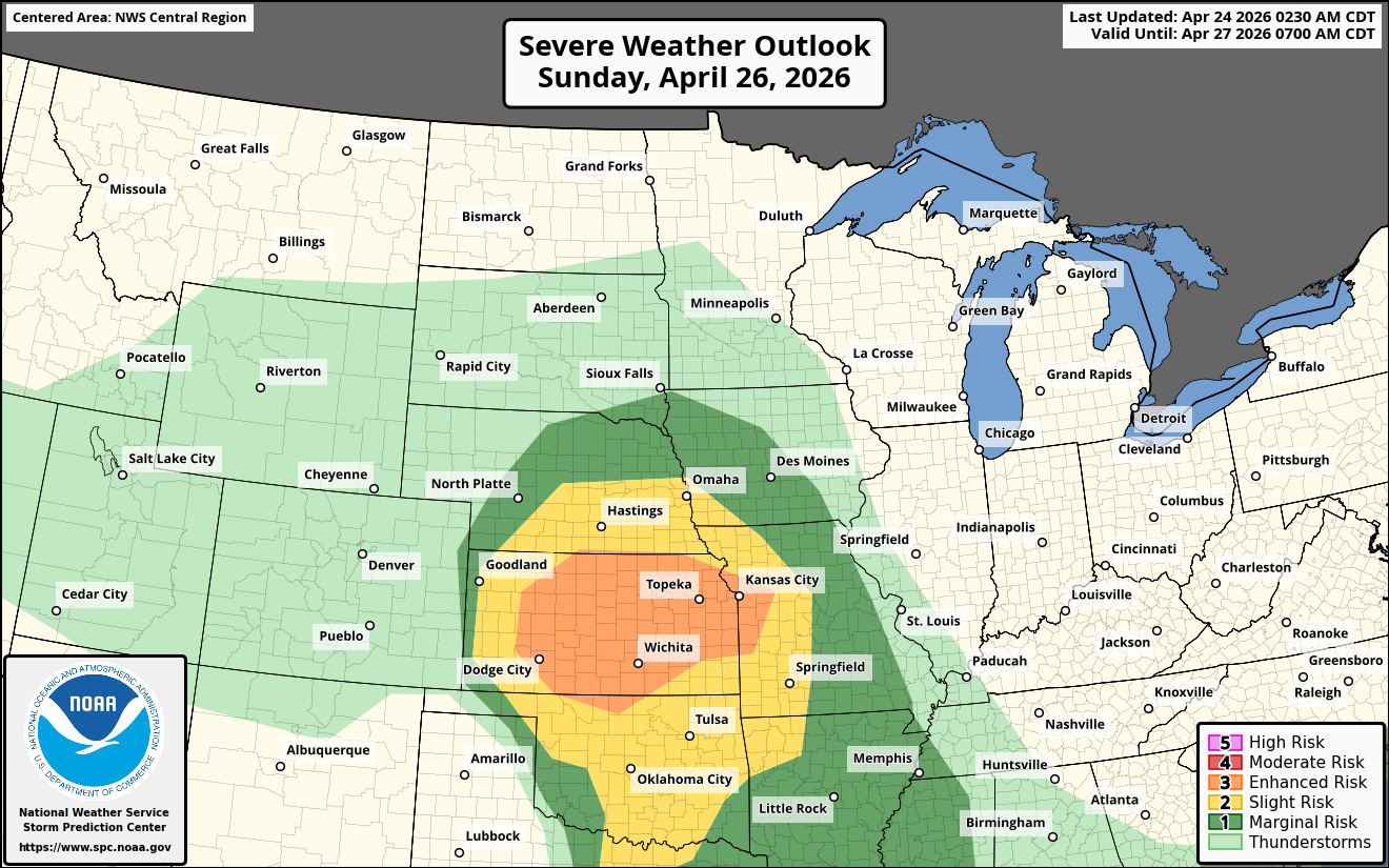
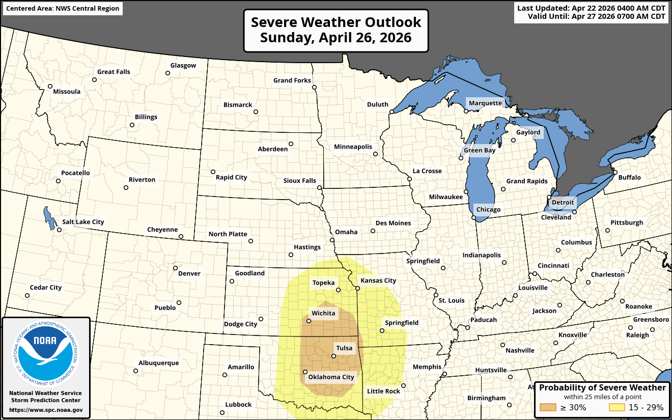
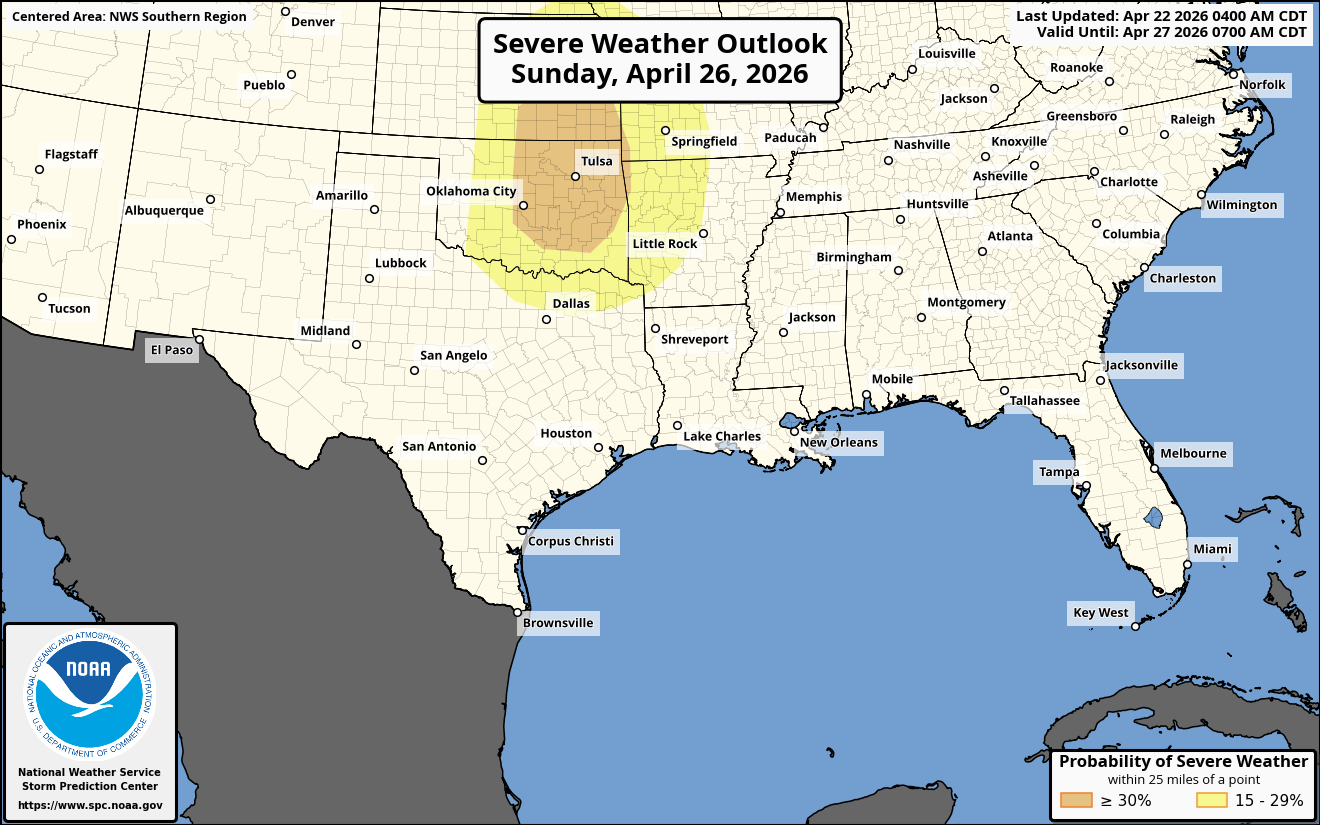
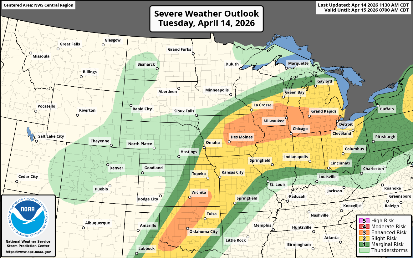
As For Sunday – Severe thunderstorms that will have the potential to produce large hail and tornadoes, some of which may be strong, may be a threat across a large part of Kansas into far northern Oklahoma and across western Missouri by very late Sunday afternoon and Sunday evening.