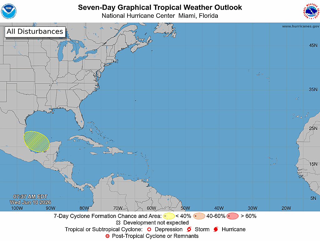
It appears that the energy and moisture from Tropical Storm Cristina, which is currently located in the eastern Pacific to the south of Guatemala and El Salvador, will cross Central America on Thursday into Friday. This energy and moisture will then push into the Bay of Campeche by late Friday and then head northwestward towards the coast of eastern and northeastern Mexico during this weekend. While it looks likely that a low pressure system and area of disturbed weather will be located in the Bay of Campeche this weekend, it seems unlikely that it’ll significantly develop due to unfavorable environmental conditions.
A look at the weather forecast guidance reveals that they do seem to point towards there being a window of opportunity for tropical development between Friday night and Sunday morning. In fact, the European ensemble model guidance does show a 60 percent chance for tropical development between Friday and Sunday in the Bay of Campeche and the western Gulf.
Additionally, it’s interesting to note that the Google Deep Mind ensemble model does seem to show the possibility of a more northerly track which would take this system to near the lower and middle Texas coast by early next week. In fact, there are a few ensemble members of Google’s Deep Mind that show development of this system into a tropical storm near the Texas and Louisiana coast by the middle part of next week. While this is a scenario that we should keep in the back of our minds, just in case, it is one that I think has a very low chance of occurring.
My Thinking Is That significant development is unlikely due to the combination of the relatively short time it’ll have over the Bay of Campeche and the western Gulf (36-48 hours) and the unfavorable environmental conditions due to wind shear.
That being said, there is the very real possibility that we could see this system strengthen into a tropical depression or even a low-end tropical storm on Saturday before it moves inland into eastern or northeastern Mexico on Sunday.
It should be mentioned again that the Bay of Campeche is notorious for spinning up quick tropical systems. The topography and the curved shape of the Bay of Campeche can help spin up tropical systems, even when none of the model guidance shows it. We’ve seen it happen many times before in the Bay of Campeche and it’s something to always watch when a disturbance moves into that area. This is one reason why I think that this system could very well spin up into a tropical depression or a low-end tropical storm before it moves inland into eastern or northeastern Mexico.
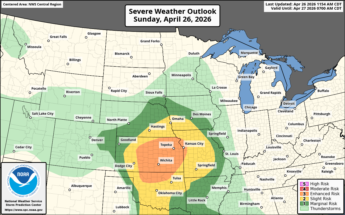
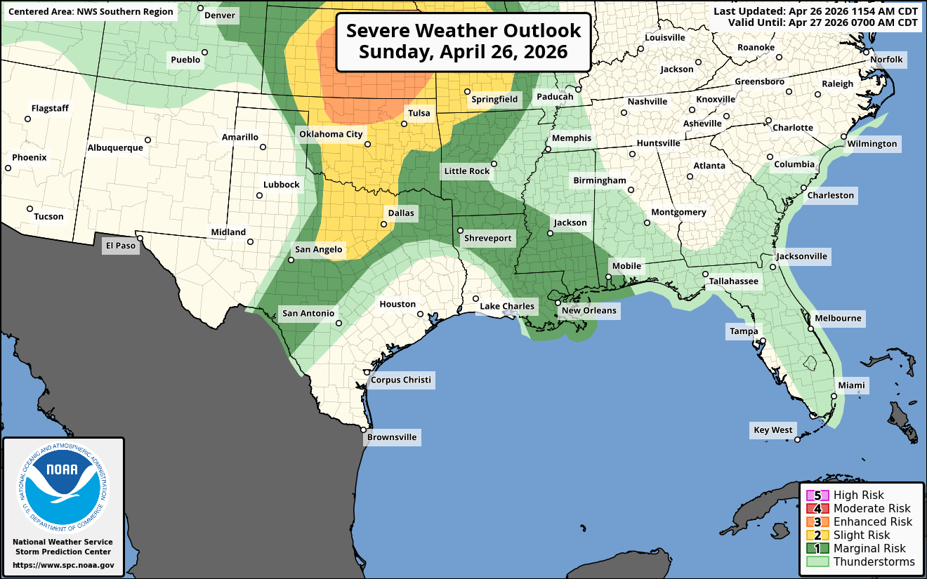
Whether this system develops or not, it will most definitely enhance the heavy rainfall potential over northeastern Mexico during this weekend and early next week. Locally heavy rainfall from the moisture of this system and already high moisture levels will affect areas near the Gulf Coast from Texas through Louisiana and Mississippi early next week. Also, areas across parts of North Texas, central and eastern Oklahoma and much of Arkansas may see heavy rain from the moisture feed of this system during early next week.
Finally – I wanted to mention that Colorado State University have lowered their forecast numbers for the 2026 Atlantic Hurricane Season. This is due to the expectation of widespread hostile and very unfavorable environmental conditions for tropical development across much of the Atlantic, Caribbean and Gulf.
They are now forecasting 11 named storms, 5 of those storms becoming hurricanes and 2 of those hurricanes becoming major hurricanes.
Additionally, they have identified the following analog years as being a close fit to this hurricane season. They are 1957, 1965, 1987, 1997, 2009 and 2015. Even though all of those years were quiet in terms of numbers, a few of them did have some very impactful hurricanes. They include 1957’s Hurricane Audrey, 1965’s Hurricane Betsy, 1997’s Hurricane Danny and 2015’s Hurricane Joaquin.
The takeaway from this is that the 2026 Atlantic Hurricane Season could very well become the “It only takes one hurricane” type season.
Because this season is likely to be very quiet (that’s obviously a very good thing), we are going to need your help a lot more in getting the word out about us here at Crown Weather. Word of mouth has always been a way for us to advertise Crown Weather & the products we offer.
Unfortunately, the “noise level” on social media has gotten ridiculously high & because of this, our messaging on what we offer at Crown Weather is almost always lost due to the algorithms social media uses to show posts. Hype always gets the likes and hits on social media & that’s something I refuse to do!!
I have always & will always give you a rational and measured weather update. That, unfortunately, no longer gets the views, clicks and likes on social media. This non-hype approach to forecasting has, in turn, hurt our business due to lack of new subscribers.
So, your help in helping advertise Crown Weather would be extremely appreciated.
Other ways you can help us include donations. Also, if you are a company or corporation & would like to help underwrite Crown Weather Services & fund our operations, please contact me.
To help us out using your credit card or debit card, please go to the following link –
https://buy.stripe.com/8x2fZiaU4f4UcgO3Uxfw40c.
To help us out using PayPal, please go to the following link –
https://www.paypal.com/paypalme/crownweather .
To help us out using Venmo, please go to the following link –
https://account.venmo.com/u/crownweather (if Venmo asks you to verify payment, the last 4 digits of my phone number is 0009).