CrownWeather-final logo
CrownWeather-final-logo-mobile
icon burger
  • CWS Plus
  • Who is Crown Weather
  • CWS Support Services
  • Log In

Crown Weather
Discussions

I Plan On Having The 2025 Hurricane Season Forecast Sent Out By Or Before March 31

Monday, March 10, 2025 5:49 pm by Rob Lightbown

I’ve been pretty busy the last few weeks researching and analyzing all of the factors and signals that go into making a hurricane season active or not active.

I’ll continue analyzing the data and then write up the 2025 hurricane season forecast over the next couple of weeks or so.

I plan on having the 2025 hurricane season sent out to you by or before Monday, March 31.

There are some things that I’ve found that I wanted to share with you concerning the 2025 hurricane season.

First, it appears that the overall season should be near to slightly above average in terms of activity. My current thinking is for a total of 16 named storms, 7 of those storms becoming hurricanes and about 3-4 of those hurricanes becoming major hurricanes. Overall net activity looks to be above average with about 144 percent of normal in terms of the amount of energy tropical systems exert on the Atlantic Basin.

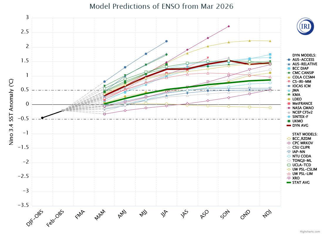
Second, it appears that the current weak La Nina conditions probably will warm a little to a neutral ENSO state during this summer into this autumn. Neutral ENSO conditions historically have led to overall above to very above average activity across the Atlantic Basin.

Finally, the most important aspect of any hurricane season is where any tropical storms or hurricanes make landfall. This is an area that we have exceled in forecasting for many past seasons. My initial analysis of the data seems to be pointing towards a couple of areas that could be of particular concern in terms of tropical storm or hurricane threats this season.

First Area is I think this could be a East Coast year with areas from the Florida Peninsula northward through the Carolinas, Mid-Atlantic States and Southern New England at risk of being impacted by at least one or two tropical storms or hurricanes this season.

A Second Area Of Concern might be along the western and central Gulf Coast from Texas & Louisiana eastward to southern Alabama. Data seems to be hinting that this may be an area to watch for a tropical storm or hurricane impact this season.

As for the Caribbean, current data suggests that there may be a lack of tropical activity across much of the Caribbean this season. In fact, very long range model guidance seems to be pointing towards below average to well below average rainfall across much of the Caribbean throughout this summer and autumn. One area that might be an exception may be across the far northeastern part of the Caribbean, including the far northern Leeward Islands, the Virgin Islands and Puerto Rico. This area of the Caribbean may be at least threatened by at least one or two tropical storms or hurricanes this season.

I’ll be analyzing the impact part of the forecast a lot more over the next couple of weeks. Because of this, there might be changes to the impact part of my forecast by the time I release the forecast at the end of this month.

Again, I should have the full 2025 hurricane season forecast sent out to you by or before Monday, March 31.

Filed Under: CWS Weather Discussions

A Review Of How The 2024 Atlantic Hurricane Season Matched Up To What I Forecasted Back In March

Saturday, November 30, 2024 3:04 pm by Rob Lightbown

The 2024 Hurricane Season officially ends today. In all, we ended up with 18 named storms, 11 of those storms becoming hurricanes and 5 of those hurricanes becoming major hurricanes. It was a hyperactive and very impactful hurricane season. The Accumulated Cyclone Energy index (ACE) was 161.7, which is certainly a hyperactive season.

The 2024 Atlantic hurricane season will certainly be remembered for the Appalachian flood disaster that Hurricane Helene brought. It will also be remembered by the serious impacts that Hurricane Milton brought to Florida shortly after Helene’s impact. I fully expect to see both Helene and Milton be retired as names in the post season. We cannot forget Beryl, which was a Caribbean Category 5 hurricane in early July.

The total damage from the 2024 Hurricane Season will likely exceed $150 billion in damages based on some reliable estimates I’ve seen.

How Did My Preseason Forecast Do? Back on March 13, I forecasted that the 2024 hurricane season would be an extraordinarily active hurricane season in terms of both number of storms and also in the amount of potential impacts across the Caribbean and along the US Coastline (especially the Gulf Coast). It did end up being an extremely impactful season, however, the number of storms fell short of what I forecasted.

This is what I forecasted back on March 13:
25 Named Storms (18 named storms, so I did not verify there).

12 Hurricanes (11 Hurricanes, so I pretty much verified).

6 Major Hurricanes (5 Major Hurricanes, so again, I pretty much verified).

Accumulated Cyclone Energy (ACE): 225 (161.7, which fell short of what I forecasted).

Our Forecast That I Sent Out In March:

The Actual 2024 Hurricane Season Activity:

The reason why I forecasted such a busy season back in March was due to the combination of extremely warm ocean waters, the expectation of La Nina conditions and a overall favorable look for development in the Atlantic. Much of this did verify. The big surprise was how quiet the period from mid-August to early September was. While it threw a monkey wrench into the forecast, the extremely active late season hurricane activity certainly made up for that quiet period.

Now, how did my impact forecast do? Back in March, I forecasted that I thought that the northwestern Caribbean, the northeastern Caribbean, the area from the Bahamas through the Florida Peninsula into the eastern Gulf of Mexico would be particularly at risk from hurricane activity during the 2024 season.

Overall, my forecasts of a very impactful season for the northwestern Caribbean, the eastern Gulf of Mexico and the Florida Peninsula verified very well. The activity over the northeastern Caribbean as well as across the Bahamas was much, much less than what I forecasted, which is, obviously, great news.

I did forecast a high risk for a tropical storm or hurricane impact across the northwestern and north-central Gulf Coast and we did have 2 hurricane landfalls, one on the middle and upper Texas coast and one in southeastern Louisiana.

I also did forecast a high risk of a tropical storm or hurricane impact along the coast from Georgia to the Mid-Atlantic States. This ended up not really verifying, although Debby did bring tropical storm conditions to the Georgia and South Carolina coastline.

From this point, I will shift my attention to monitoring the weather across the southern United States and the eastern United States. I’ll certainly be sending out updates over the next 6 months covering significant winter storms or significant severe weather events. I will also be starting to take a look at what the 2025 hurricane season may be like over the next few months and will send out my forecast probably during March or early April.

As always, THANK YOU for being a subscriber to Crown Weather Plus. Today is Small Business Saturday & Monday is Cyber-Monday. A gift of a Crown Weather Plus subscription to a loved one would both help my business and also keep your loved ones safe and well-informed about weather information. Go to https://crownweather.com/cws-plus/lifetime-subscription-special/ for the subscription sale we are running this weekend.

Additionally, any donations are always immensely appreciated and help us with the costs of running a very small business. Your subscriptions and other monetary support completely funds us as it is the only source of income we have. Any support in the way of subscriptions or donations are helping a very small business rather than a huge corporation. To donate, just go to our PayPal donation page at https://www.paypal.com/paypalme/crownweather .

Filed Under: CWS Weather Discussions

Sara Is Expected To Dissipate Over The Yucatan Peninsula, But The Remnants Of Sara Will Produce Heavy Rain & Thunderstorms From Louisiana To Florida Tuesday Through Wednesday

Sunday, November 17, 2024 3:36 pm by Rob Lightbown

Tropical Depression Sara: Since the hurricane season is now winding down and coming to an end – FINALLY – we will be only sending out 1 to 2 updates a week for the next couple of weeks.

Beyond this, starting December 1st, our weather updates will include information regarding any storms that are expected to bring significant severe weather or winter weather with a focus on the Deep South , the Gulf Coast & the Eastern United States.

Sara made landfall this morning along the coast of Belize and is quickly weakening. It is likely to dissipate over the Yucatan Peninsula tonight or during Monday.

The remnants of Sara are expected to be absorbed by an eastward moving frontal system as we get into Tuesday and Wednesday.

This means that numerous showers and thunderstorms with locally heavy rainfall will sweep across Louisiana on Monday night and then through much of Mississippi and Alabama during Tuesday.

These widespread showers and thunderstorms will also spread across the Florida Panhandle and through much of Georgia during Tuesday afternoon. Some of these thunderstorms will probably be on the severe side across southern Alabama, southern Georgia and across the Florida Panhandle.

During the day on Wednesday, a line of showers and thunderstorms will push across the Florida Peninsula bringing with it locally heavy rainfall and severe weather.

The frontal system and the remnants of Sara will push offshore of the US Southeast Coast during Wednesday evening.

The passage of that frontal system will usher in a cool and dry air mass that pushes across the entire Gulf of Mexico and into the northern Caribbean as we get into Thursday and Friday. The passage of this front will also be the catalyst to end the hurricane season once and for all.

The next tropical weather discussion will be issued on Friday Afternoon.

Filed Under: CWS Weather Discussions

Sara Is Expected To Continue To Produce Catastrophic Flooding & Mudslides Across Honduras & Belize

Friday, November 15, 2024 4:35 pm by Rob Lightbown

Tropical Storm Sara: Sara is going to continue to be a big time problem for Central America throughout this weekend with extremely high rainfall totals expected, especially over northern Honduras and across Belize where 10 to 20 inches of rain are expected. Local amounts of up to three feet of rain is expected across northern Honduras.

Right now, Sara is located near the north coast of Honduras and is still a tropical storm with 50 mph winds.

Sara is going to crawl in its forward speed as it moves from near the northern coast of Honduras to Belize by late Saturday night into Sunday. A track right across the Yucatan Peninsula is then likely to occur by later Sunday into part of Monday before whatever is left of the storm moves into the Bay of Campeche Monday afternoon.

All of this land interaction Sara is going to do over Central America is going to lead to extremely high rainfall totals for northern Honduras into Belize. Already, severe flooding is occurring over northern Honduras and another 10 to 20 inches of rain can be expected. This means that severe and catastrophic flooding is very likely across Honduras and Belize throughout this weekend.

We will have to see what shape Sara is in when it reaches the southwestern Gulf of Mexico early next week. I think that there will be very left of this system due to all of the land interaction it’ll do this weekend. Because of this, I could foresee a scenario where a highly sheared depression is swept up by a cold front that’ll be pushing across the Gulf of Mexico next week.

This means that I do not believe the track models that do show Sara remaining a tropical system & instead I do think that we will see a weakening and eventually a dissipating system over the Yucatan Peninsula this weekend.

The leftovers of Sara will merge with the eastward moving frontal system leading to the probability of a line of heavy rain with thunderstorms to push eastward along the northern Gulf Coast from Louisiana to the Florida Panhandle on Tuesday and then across the Florida Peninsula on Wednesday. Some of the thunderstorms will likely be severe.

The passage of that frontal system will usher in a cool and dry air mass that pushes across the entire Gulf of Mexico and into the northern Caribbean by late next week. The passage of this cold front will also finally end any further threats of tropical systems this year to the United States and probably even the Caribbean.

The next tropical weather discussion will be issued on Monday Afternoon. If there are any significant changes to the forecast of Sara this weekend, I will most definitely send out an update.

Filed Under: CWS Weather Discussions

Tropical Storm Sara Is Expected To Bring Catastrophic Levels Of Flooding To Honduras Next Few Days

Thursday, November 14, 2024 4:47 pm by Rob Lightbown

Tropical Storm Sara: There is good news and bad news when it comes to the future of Sara and its probable impacts.

The good news is that the potential impacts to Florida next week looks to be much less than previously thought.

This leads to the bad news which is it now appears that Sara will sit right over Central America for several days late this week and this weekend causing extremely high rainfall totals with catastrophic flash flooding and mudslides across Honduras, Belize and the Yucatan Peninsula. This interaction with Central America significantly lowers the impact to Florida.

Sara is currently approaching the coasts of northern Honduras and northeastern Nicaragua with winds of about 40 mph. The storm continues to track to the west and it’s likely that Sara will begin to move right along the northern coast of Honduras tonight. A stall near the northern coast of Honduras then looks to continue through Saturday before Sara moves inland into Belize and the Yucatan Peninsula on Sunday into Monday.

This further south track is going to mean that Sara will be spending the next few days over or very near land & all of this land interaction means much less of an impact to Florida next week.

This stall over northern Honduras means that an extreme flash flood event looks likely across northern Honduras from tonight right through this weekend. Rain totals of 1 to 2 feet with local amounts of up to 40 inches are likely leading to catastrophic amounts of flash flooding and mudslides across not only northern Honduras, but also across parts of Belize, El Salvador, eastern Guatemala, and parts of Nicaragua.

The reason why it appears Sara will interact with the land of Central America much more than previously thought is due to a stronger than expected high pressure ridge over the southeastern United States. This high pressure ridge has pushed Sara further south causing it to track over Central America over the next few days.

This westward and southward shift means that there might be very little left of Sara when it moves off of the Yucatan Peninsula and into the southern Gulf of Mexico on Monday night into Tuesday. This means that what’s left of Sara, whether a very broad depression or a weak frontal low pressure system will move northeastward across the Gulf of Mexico during Tuesday reaching Florida on Wednesday.

It now looks highly unlikely that Sara will be a strong hurricane hitting South Florida and in fact, it probably will not even be a hurricane. Instead, it’s possible that Sara might hold on to tropical storm strength by the time it reaches Florida on Wednesday. More than likely though, I think we’re now looking at this system being a non-tropical low pressure system that’s attaching itself to a frontal system passing over Central and North Florida Wednesday.

The main impacts for North & Central Florida will probably be some much needed rainfall during the middle parts of next week along with the possibility of some severe weather.

That said, I will still be watching Sara very closely, in case things change. For now though, the risks to Florida are much lower than they were yesterday.

Model Track Forecast:

Satellite Imagery:

The next tropical weather discussion will be issued on Thursday Afternoon.

Filed Under: CWS Weather Discussions

Potential Tropical Cyclone #19 Likely To Develop Into Sara Very Soon & Become A Hurricane; Honduras & Nicaragua Could Be At Particular Threat From This Likely Hurricane & Is Something That Belize, The Yucatan Peninsula & Florida Needs To Monitor Extremely Closely

Wednesday, November 13, 2024 5:49 pm by Rob Lightbown

Potential Tropical Cyclone #19: The area of disturbed weather that was Invest 99-L seems to be organizing enough so that the National Hurricane Center thinks it will be a hurricane by the time it reaches Honduras and Nicaragua. Because of this, they have “upgraded” it to Potential Tropical Cyclone #19 and Hurricane Watches and Tropical Storm Watches are in effect for the north coast of Honduras and northeastern parts of Nicaragua.

Satellite imagery as of late this afternoon reveals that PTC 19 is producing plenty of deep thunderstorm activity, however, it has not yet developed a concentrated low-level circulation. I do think that this will change over the next 12-24 hours so that by Thursday afternoon and Thursday night we’ll probably see it become a tropical depression and then strengthen into Tropical Storm Sara sometime on Friday. This system is expected to head westward towards Honduras and likely will reach the north coast of Honduras by later Friday and remain nearly stalled near the north coast of Honduras throughout this coming weekend.

This slow-down and stall near the north coast of Honduras comes with a ton of uncertainty. Potential Tropical Cyclone 19 will be stuck in-between an upper level trough over the western Atlantic and a high pressure ridge located just to its northwest. This will cause this system to move very slowly near Honduras, but the question is will the center of the storm be over land or will it remain over the very warm waters just offshore of Central America. This difference is very important because if it stays just offshore of Central America, then we’re probably looking at a very powerful hurricane in the northwestern Caribbean this weekend. On the other hand, if the center of PTC 19 pushes into Honduras this weekend, then the intensity of the storm will be much lower.

This track near Central America could go either way and what happens this weekend will make a huge difference to impacts to Belize, the Yucatan Peninsula & Florida.

Either way, PTC 19/Sara is likely to produce a major rain event across Honduras with rain totals of 15 to 25 inches with locally higher amounts likely, especially over northern Honduras. Impacts in the way of wind, rain and surge is also probable across Belize and the eastern Yucatan Peninsula as we get into Sunday and Monday.

Turning To Next Week – As I already mentioned, what sort of impacts Florida sees from PTC 19/Sara is going to depend on where exactly the system stalls. The weather pattern next week is expected to consist of an upper level trough and cold front that’s likely to pick PTC 19/Sara up and send it to the north and then northeast across the southern and eastern Gulf of Mexico.

While this system poses NO threat at all to those of you in Texas, Louisiana, Mississippi and Alabama, PTC 19/Sara does pose a threat to Florida and especially South Florida and the Keys next week. How big the threat is to Florida will depend on where PTC 19/Sara stalls this weekend.

On one hand, if this storm stalls just offshore of the north coast of Honduras and strengthens into a significant hurricane, it’ll likely move further north and east leading to a major hurricane threat to the west coast of Florida, especially from Tampa and points south around Tuesday and Wednesday.

On the other hand, if PTC 19/Sara ends up stalling near the coast of Honduras or slightly inland over northern Honduras, it would end up being much weaker when it comes north and northeastward out of the northwestern Caribbean. In this scenario, we’d probably see a much weaker system at perhaps tropical storm strength that’s absorbed by that cold front as it crosses the Florida Peninsula. This would be, by far, the much better scenario obviously.

One thing that we do have on our side is climatology. A hurricane impact in Florida during the third week of November is extremely rare and a major hurricane impact in late November in Florida is non-existent. Because of this, I do have some skepticism that a hurricane will impact Florida next week and there’s a decent shot that land interaction with Central America might lessen the eventual impacts to Florida. In fact, I do think that there are better odds that the impacts across Florida from PTC 19/Sara will end up being very much like a strong Autumn storm that brings perhaps tropical storm conditions with heavy rain the main threat.

That Said – The better outcome of this system being barely a tropical storm by the time it reaches Florida IS NOT a guarantee. In fact, if you are in Central and South Florida and the Florida Keys, I would plan on a Category 1 or 2 hurricane impact around Tuesday and Wednesday of next week. A stronger hurricane than this is certainly possible for South & Central Florida should this system remain completely over water & not interact much, if it all with land.

Bottom Line Is That unfortunately, the track and strength forecast of PTC 19/Sara for next week is extremely uncertain and because of this I urge those of you on the West Coast of Florida, as well as those of you in Central & South Florida & the Keys to closely monitor the progress of PTC 19/Sara.

Even though the calendar says mid-November, the weather pattern right now is acting like it’s mid-October. Because of this, I would treat this system as if it might be like a October hurricane threat to Florida & start making some preliminary preparations, just in case.

Also, if you are in Honduras or have family or friends in Honduras, know what’s coming in terms of this storm. Major catastrophic flooding events can be extraordinarily disastrous in Central America & unfortunately, this storm might bring that sort of flooding.

Model Track Forecast:

Satellite Imagery:

The next tropical weather discussion will be issued on Wednesday Afternoon.

Filed Under: CWS Weather Discussions

Rafael Is Expected To Weaken As It Heads Westward Across The Gulf Of Mexico With No Threat To The US Gulf Coast

Thursday, November 7, 2024 5:18 pm by Rob Lightbown

Hurricane Rafael: Rafael seems to have strengthened in the southeastern Gulf of Mexico this afternoon and is currently a 105 mph Category 2 hurricane. Because of how organized the hurricane looks, it will likely hang on to its strength throughout tonight and into much of Friday.

Weakening of the storm then looks to occur beginning on Saturday as it begins to encounter a more hostile environment.

In addition to weakening by this weekend, Rafael is expected to move to the west across the Gulf of Mexico throughout this weekend. While it is pretty normal for a storm to track westward across the Gulf of Mexico, it is almost unheard of during the month of November. Most Gulf of Mexico storms in November track northward or northeastward and because of this, Rafael will be a very unusual storm in that aspect.

In fact, only Hurricane Jeanne in 1980 tracked westward over the Gulf of Mexico during November and followed a very similar track to Rafael.

Even though it may look pretty ominous that Rafael will be tracking westward towards the Western Gulf this weekend, I want to stress that this storm will significantly weaken and probably even completely fall apart before it reaches Texas or Mexico. At this point, I deem this system no threat to Mexico or Texas. So great news there!!

The next tropical weather discussion will be issued on Friday Afternoon.

Filed Under: CWS Weather Discussions

Major Hurricane Rafael Expected To Cross Western Cuba This Evening Before Moving Into The Gulf Of Mexico Where It Will Weaken

Wednesday, November 6, 2024 4:00 pm by Rob Lightbown

Major Hurricane Rafael: Rafael has been strengthening at a fairly quick rate since last night and is now a Category 3 hurricane. It is expected to pass over western Cuba over the next several hours where it will produce over 100-120 mph wind gusts, a storm surge of 8 to 10 feet and heavy rainfall.

Now there have been significant changes to the forecast track of Rafael once it pushes into the Gulf of Mexico late tonight and during Thursday. The good news is that the changes to the track forecast have significantly decreased any impacts from Rafael on the US Gulf Coast.

The latest model guidance are now pointing towards a scenario that shows a stronger than expected high pressure ridge over the Deep South. Because of this, this high pressure ridge will suppress the storm and keep it over the southern Gulf of Mexico where it’ll head westward and then even southwestward from Friday through this weekend. In fact, it’s now possible that Rafael may head for the coast of eastern Mexico between Tampico and Veracuz late this weekend where it could make landfall as a tropical storm early next week.

So, it now looks very likely that Rafael will not be any threat to the US Gulf Coast. The Florida Keys will continue to see stormy weather from Rafael tonight into Thursday with wind gusts of up to 45 mph, bands of heavy rain and thunderstorms expected.


Elsewhere Across The Atlantic, Caribbean & Gulf Of Mexico: First up, I am still keeping an eye on a trough of low pressure that’s located to the east-northeast of the Leeward Islands. This system is expected to head westward and potentially develop a surface low pressure near the northern Leeward Islands later tonight or during Thursday. It is possible that a short-lived depression could form from this system near Puerto Rico and Hispaniola during Friday. Even if that occurs, it should be torn apart by dry air and shear with it dissipating by the time it reaches the southeastern Bahamas this weekend.

In addition to that system, I’m also going to be watching the Caribbean once again next week where tropical development may once again occur. The catalyst of this possible development looks to be a tropical wave that’s now approaching the Windward Islands. This tropical wave may find itself in a favorable environment for development during next week once it reaches the central and western Caribbean and it is something that’ll need to be watched closely.

The model guidance have been on and off with showing actual development and for now there is no real consistency in the guidance. That said, those of you with interests in the western and central Caribbean, including Cuba, Hispaniola, the Cayman Islands, Jamaica and even Puerto Rico should keep close tabs on this possible development.

The next tropical weather discussion will be issued on Thursday Afternoon.

Filed Under: CWS Weather Discussions

Rafael Very Near Hurricane Strength & Is Expected To Bring Hurricane Conditions To The Cayman Islands & Western Cuba Tonight Into Wednesday Before It Heads Into The Gulf Of Mexico

Tuesday, November 5, 2024 6:10 pm by Rob Lightbown

Tropical Storm Rafael: Rafael has been getting better organized throughout today and will likely be a hurricane shortly.

It is expected that Rafael will head on a northwesterly path taking it across the Cayman Islands tonight and then over western Cuba around midday on Wednesday. A track into the southeastern Gulf of Mexico is then expected by later Wednesday night and Thursday. It is also expected that Rafael will strengthen quite quickly over the next couple of days due to a favorable environment. This means that Rafael will likely be a hurricane within the next few hours and then will probably peak at at least Category 2 strength during Wednesday and Thursday. It is not out of the question that this storm could peak at Category 3 intensity at some point during Wednesday and Thursday.

Forecast Impacts For The Cayman Islands & Western Cuba: Hurricane conditions with wind gusts of up to 80-100 mph can be expected throughout tonight across the Cayman Islands. Additionally, very rough surf and dangerous waves as well as rain totals of 4 to 8 inches can be expected tonight across the Cayman Islands.

Hurricane conditions with wind gusts of over 100 mph is then expected across western Cuba and the Isle of Youth throughout the day on Wednesday. In addition to this, a 4 to 6 foot storm surge, very rough surf and dangerous waves can be expected throughout Wednesday. Finally, 4 to 8 inches of rainfall can be expected across western Cuba tonight through Wednesday.

Forecast Impacts For The Florida Keys: Even though Rafael is expected to pass well west of the Florida Keys on Wednesday night into Thursday, it is still expected to bring tropical storm conditions, a storm surge of up to 3 feet and upwards of 4 to 8 inches of rainfall across the lower and middle Florida Keys during Wednesday and Wednesday night.

Once Rafael reaches the Gulf of Mexico starting later Thursday and Friday, it is expected to head on a more west-northwest track as a high pressure ridge over the southeastern United States guides the storm in this direction. Also, a combination of strong wind shear and dry air will cause Rafael to begin to weaken starting on Friday with this weakening continuing through this weekend.

As for a potential track, there are a couple of possible track scenarios – The first is that Rafael could head northward towards the Louisiana and Mississippi coastlines as barely a tropical storm and more likely a weakening tropical depression this weekend. The second is that Rafael may head towards the western Gulf of Mexico and wind down into a remnant dissipating system before it even reaches the Texas or Mexico coast.

In either scenario, little or no impact in terms of strong winds or surge are expected from Rafael along the Gulf Coast. Rain looks to be the most widespread impact from whatever is left of Rafael. Rain in the form of squalls can be expected along the northern Gulf Coast this weekend with this rain spreading up along the Appalachian Mountains this weekend into early next week. Rain totals of up to 2 to 4 inches are possible which could lead to some localized flood problems.

Model Track Forecast:

Satellite Imagery:

The next tropical weather discussion will be issued on Wednesday Afternoon.

Filed Under: CWS Weather Discussions

Rafael Is Very Likely To Be A Hurricane Impact To Jamaica, The Cayman Islands & Western Cuba Over The Next Couple Of Days Before Heading Into The Gulf Of Mexico Later This Week

Monday, November 4, 2024 4:24 pm by Rob Lightbown

Tropical Storm Rafael: Reports from reconnaissance aircraft as well as data from satellite imagery indicate that our system in the south-central Caribbean is coming together rather quickly today. In fact, the most recent data from reconnaissance aircraft reveals that they have found a central barometric pressure of 997 millibars and 45 mph maximum winds. Because of this, it is now a tropical storm and has been named Rafael. Also, it seems that an eye wall seems to be forming and because of this, don’t be surprised to see Rafael quickly strengthen into a hurricane as we get into tonight and Tuesday.

It is expected that Rafael will turn more to the northwest and strengthen as we get into Tuesday. Because of this, Rafael will pass very close to Jamaica as an upper end tropical storm during the day on Tuesday and then head right over the Cayman Islands as a hurricane on Tuesday night. All interests in Jamaica and the Cayman Islands should be ready for heavy rain and some very gusty winds

Rafael is then expected to move right over western Cuba on Wednesday and enter the southeastern Gulf of Mexico on Wednesday night as a hurricane. It should be noted that the environmental conditions are expected to be favorable for strengthening for the next 2 to 3 days or so and because of this, I fully expect Rafael to peak as a Category 2 hurricane in the southeastern Gulf of Mexico by Thursday.

Even though Rafael will be a hurricane in the southeastern Gulf of Mexico on Wednesday night and Thursday, there is zero chance that it will reach land as a hurricane and in fact, it may not even be a tropical storm when it reaches land this weekend.

The reason why is because a frontal system is expected to push into the Deep South late this week causing Rafael to slow way down in forward speed as it heads northwestward into the northern Gulf of Mexico by about Friday and Saturday. This slowdown in forward speed will be accompanied by dramatic weakening of the storm. Even though the water temperatures of the Gulf of Mexico are still very capable of sustaining a hurricane, it is expected that some very dry air will be pulled into the storm from that frontal system. Also, there is expected to be some very strong westerly wind shear over the northern Gulf of Mexico. The combination of the dry air and strong wind shear will cause Rafael will weaken substantially by Friday and Saturday as it gets into the northern Gulf of Mexico.

Even if Rafael makes landfall on the central Gulf Coast this weekend, it may not be a tropical storm by that point.

Expected Impacts To Jamaica, The Cayman Islands & Western Cuba: Jamaica is likely to be affected by tropical storm conditions tonight through Tuesday with wind gusts of up to 65 mph expected.

As for the Cayman Islands, hurricane conditions can be expected starting on Tuesday afternoon and continuing through Tuesday night. Wind gusts of up to 80-90 mph can be expected across the Caymans.

Western Cuba is also expected to see hurricane conditions with wind gusts of up to 100 mph during Wednesday.

In addition to the strong winds, heavy rainfall is also expected to be an issue across Jamaica, the Cayman Islands and western Cuba over the next couple of days with 5 to 10 inches of rainfall expected. Flooding and mudslides are likely.

Possible Impacts To The US Gulf Coast: As I already mentioned, a direct hurricane impact on the US Gulf Coast looks very unlikely due to the expectation of strong wind shear and lots of dry air knocking the storm down as it heads northwestward across the Gulf of Mexico later this week.

Still, some squalls of heavy rain and tropical storm force wind gusts are expected across the lower and middle Florida Keys starting on Wednesday afternoon and continuing through Wednesday night and Thursday.

Further north, there is a very low chance that parts of the Louisiana and Mississippi coasts may see tropical storm force winds this weekend. More likely though is that heavy rainfall could be an issue across the Deep South this weekend.

Bottom line is that the risk for a direct hurricane impact on the Gulf Coast is extremely low. That said, all interests along the northern Gulf Coast should still keep close tabs on the progress of this storm, just in case.

Model Track Forecast:

Satellite Imagery:

The next tropical weather discussion will be issued on Tuesday Afternoon.

Filed Under: CWS Weather Discussions

  • « Previous Page
  • 1
  • 2
  • 3
  • 4
  • …
  • 10
  • Next Page »

© 2025. Website Developed by AnoLogix. Privacy | Legal | Terms of Use