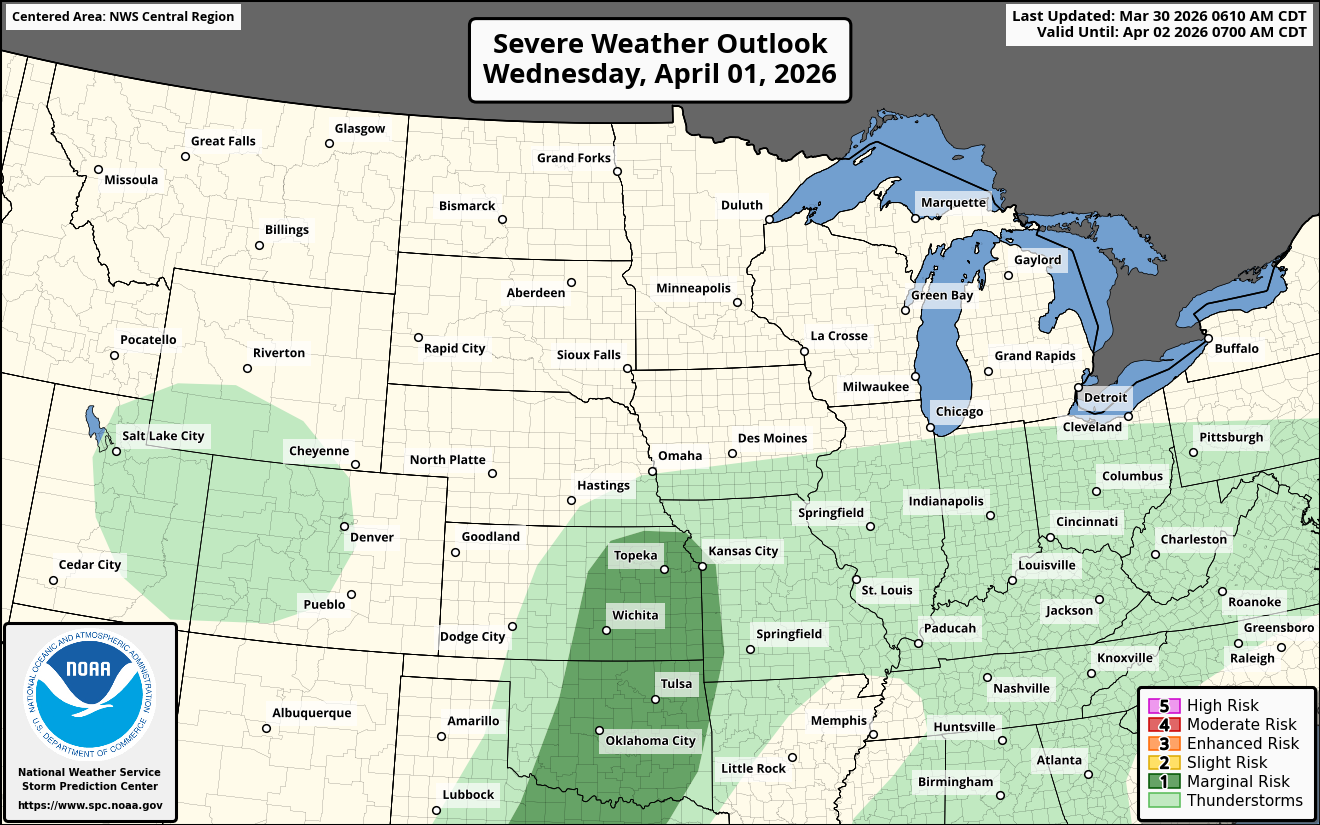
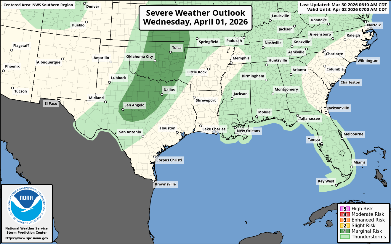
It appears that we are about to go through a very active severe weather pattern that starts on Thursday and Friday and lasts through this weekend. The areas most at risk for severe weather look to be from the central and southern Plains states through the lower Mississippi Valley into parts of the southeastern US.
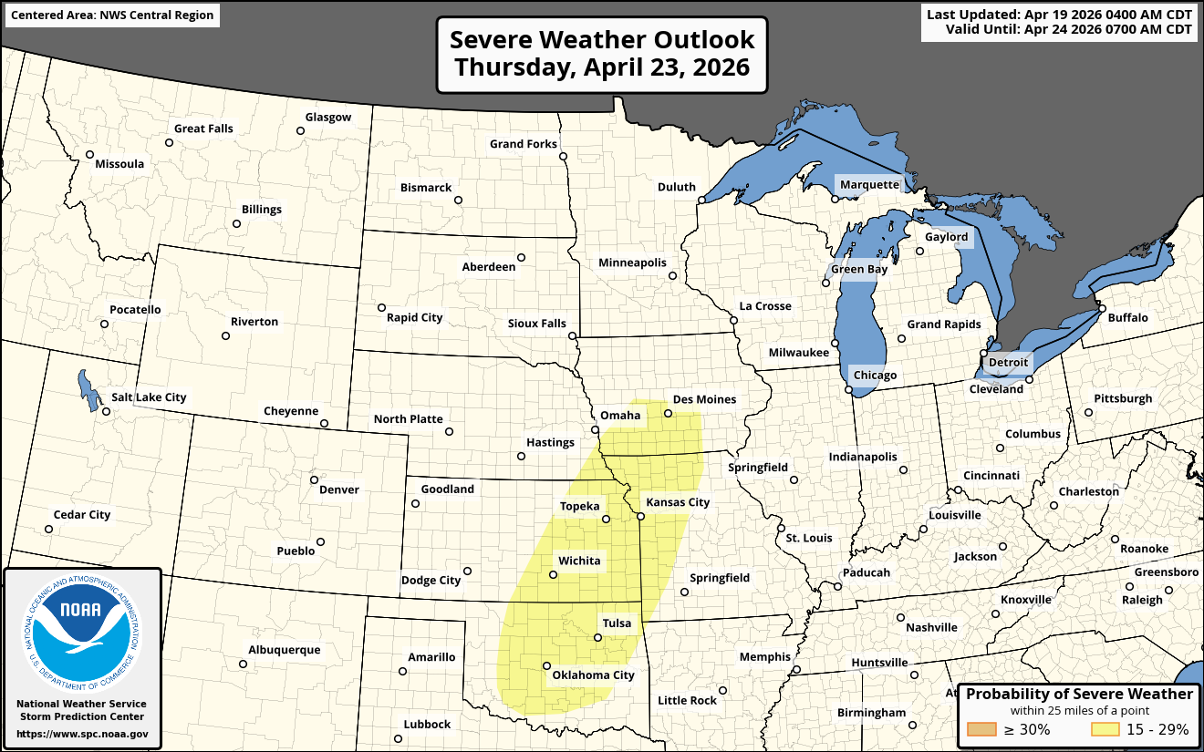
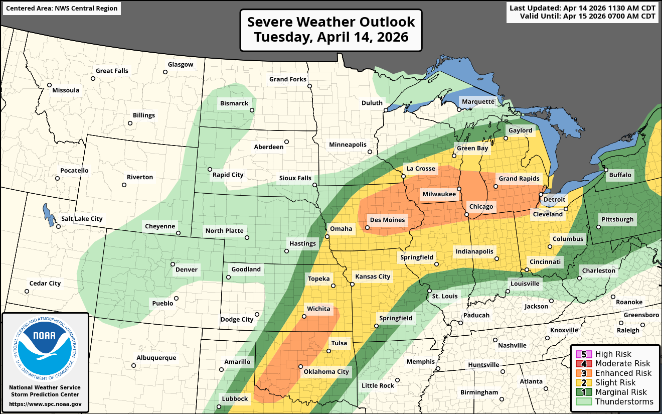
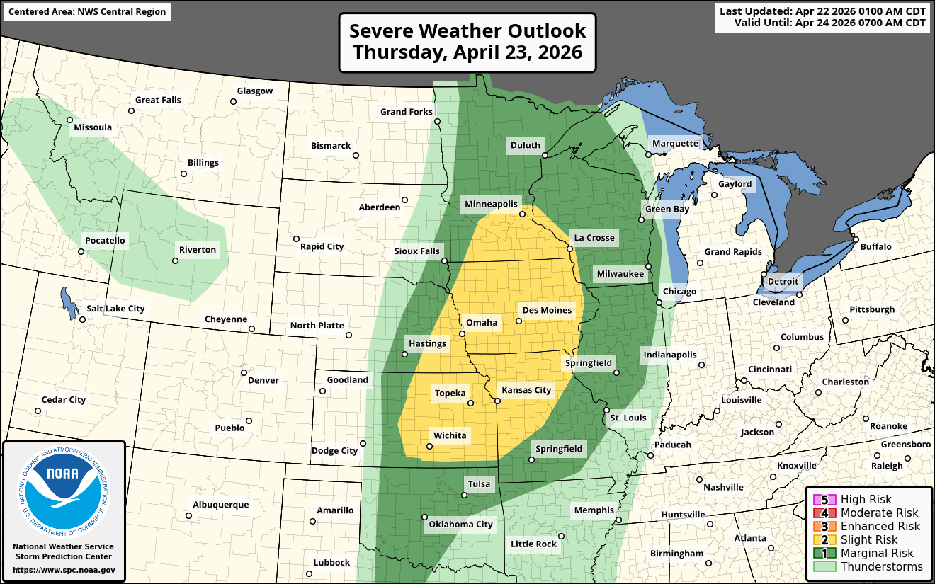
Thursday – Severe thunderstorms look most possible Thursday afternoon into Thursday night across southern and eastern Kansas, western and northern Missouri, eastern Nebraska, much of Iowa and southern Minnesota.
These severe storms should begin to develop by mid-afternoon Thursday across the area from southern and eastern Kansas northeastward to Iowa and southern Minnesota. These storms will take the form of supercells and clusters of severe storms & very large hail looks to be the main threat. Additionally, a couple of tornadoes will also be possible during the mid and late afternoon hours of Thursday.
These storms should then evolve into a squall line that has a damaging wind threat across central and northern Missouri, much of Iowa and southern Minnesota by Thursday evening.
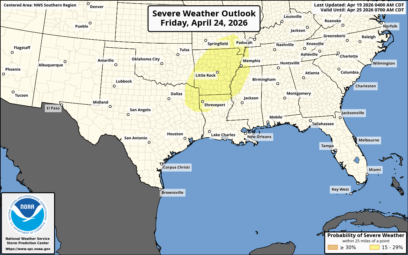
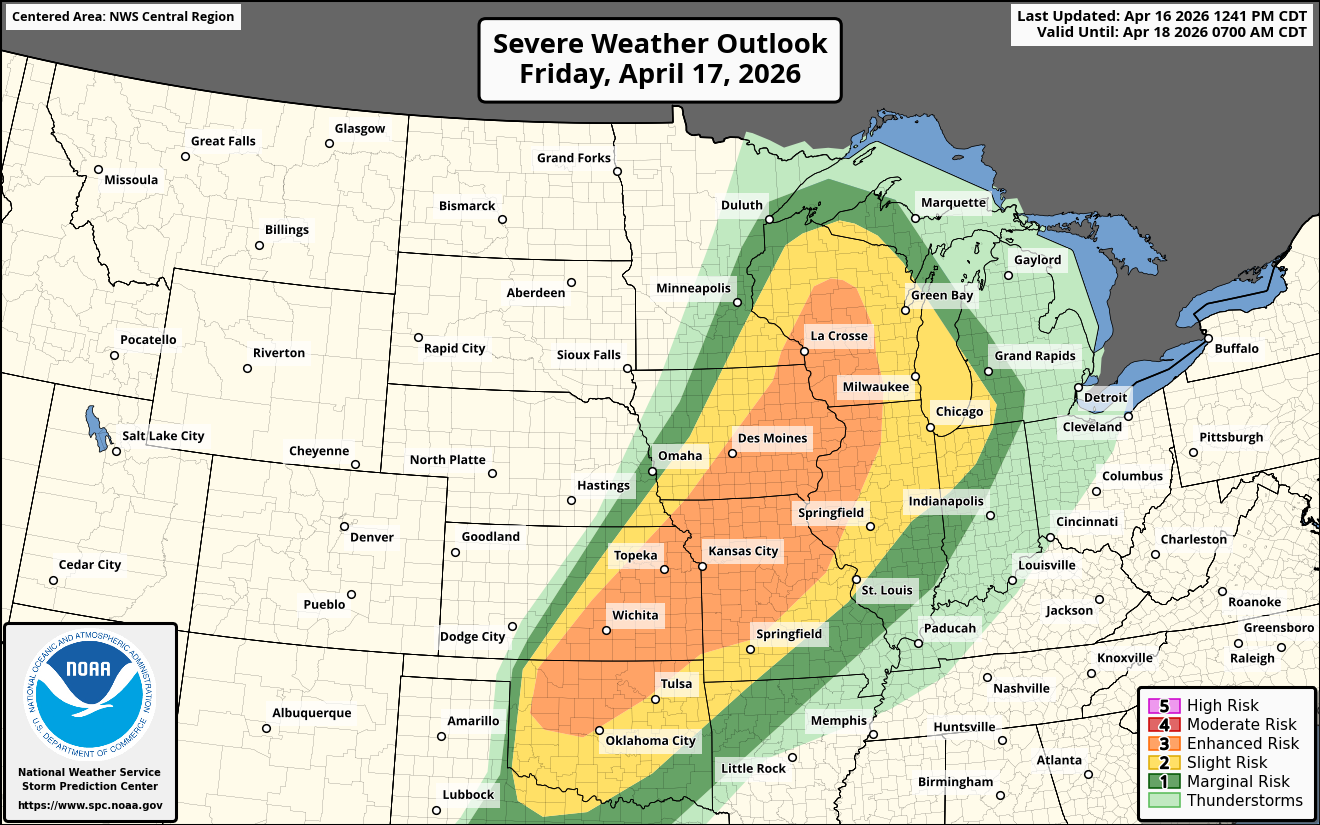
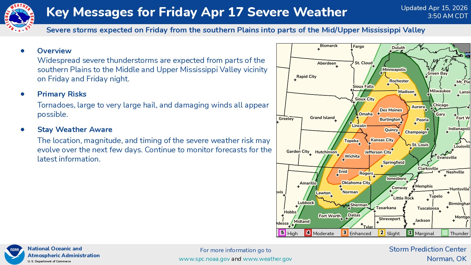
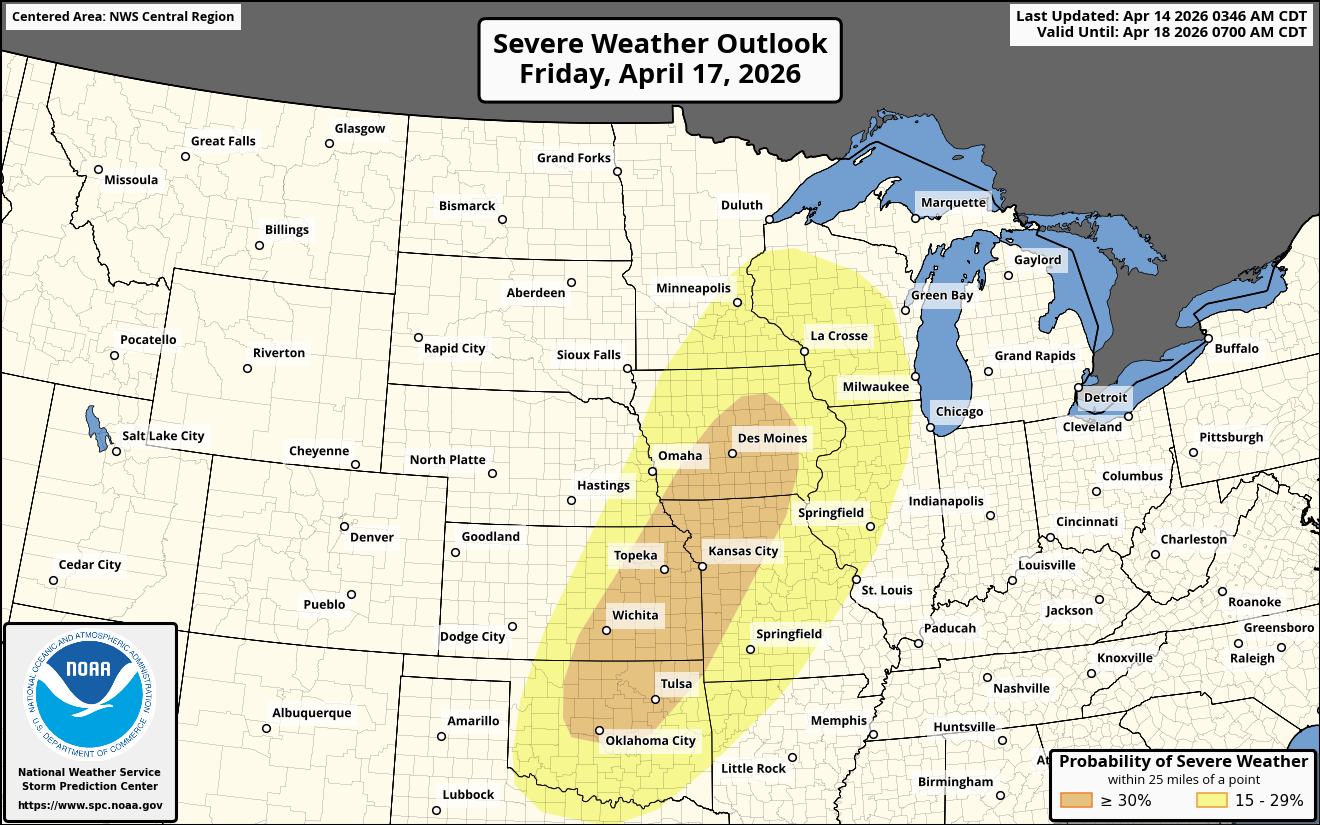
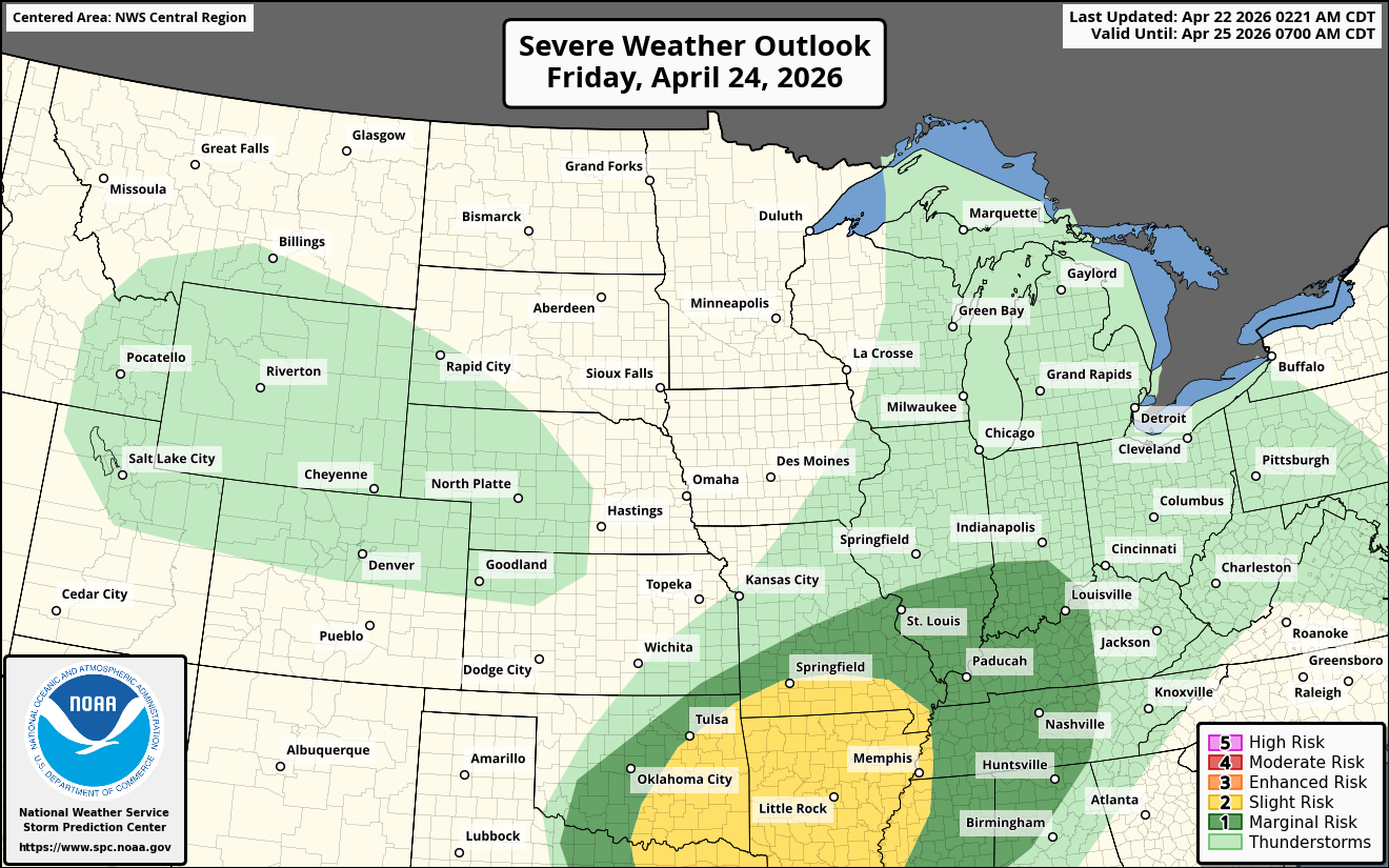
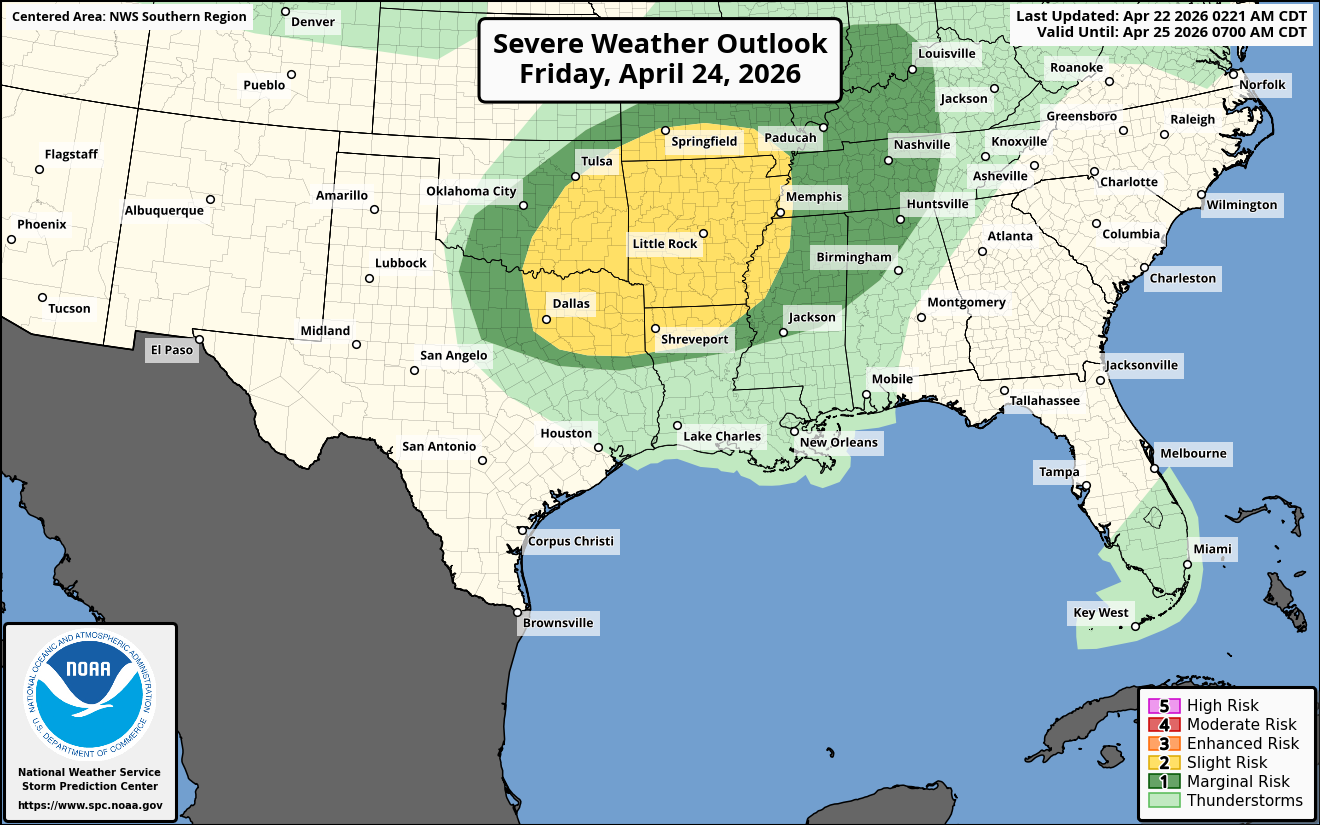
Friday – Severe thunderstorms will be a threat across eastern Oklahoma, northeast Texas, southern Missouri, much of Arkansas and northern Louisiana during Friday afternoon and Friday evening.
It appears that a frontal boundary that lies along I-40 will be the main trigger for severe storms during Friday afternoon. The air mass just to the south of this frontal boundary will be very unstable and because of this, the main threat from severe storms will be large hail and damaging winds.
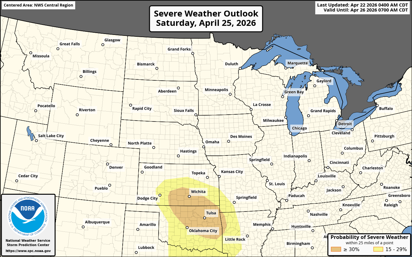
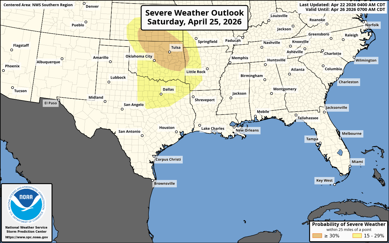
Saturday – Severe thunderstorms look to potentially develop by late Saturday afternoon and early Saturday evening across the southern Plains states. The air mass is expected to be very unstable & the low-level wind shear should support supercell storms.
Tornadoes, large hail and strong winds look to be a threat across southern Kansas, central and eastern Oklahoma and north Texas by late Saturday afternoon. These storms will evolve into a squall line that will bring a damaging wind threat across far eastern Oklahoma, western Arkansas and northeast Texas during Saturday evening.
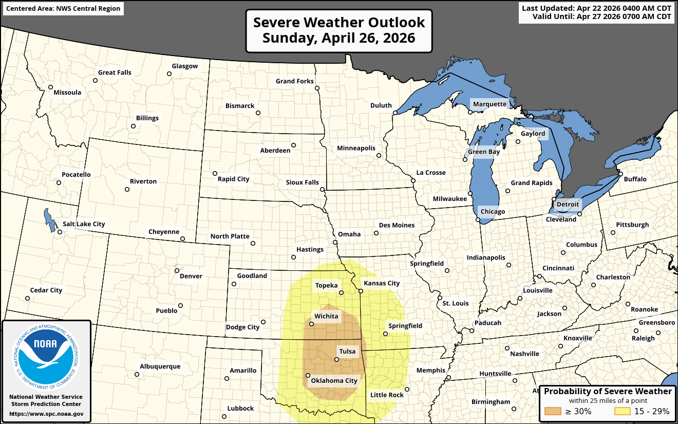
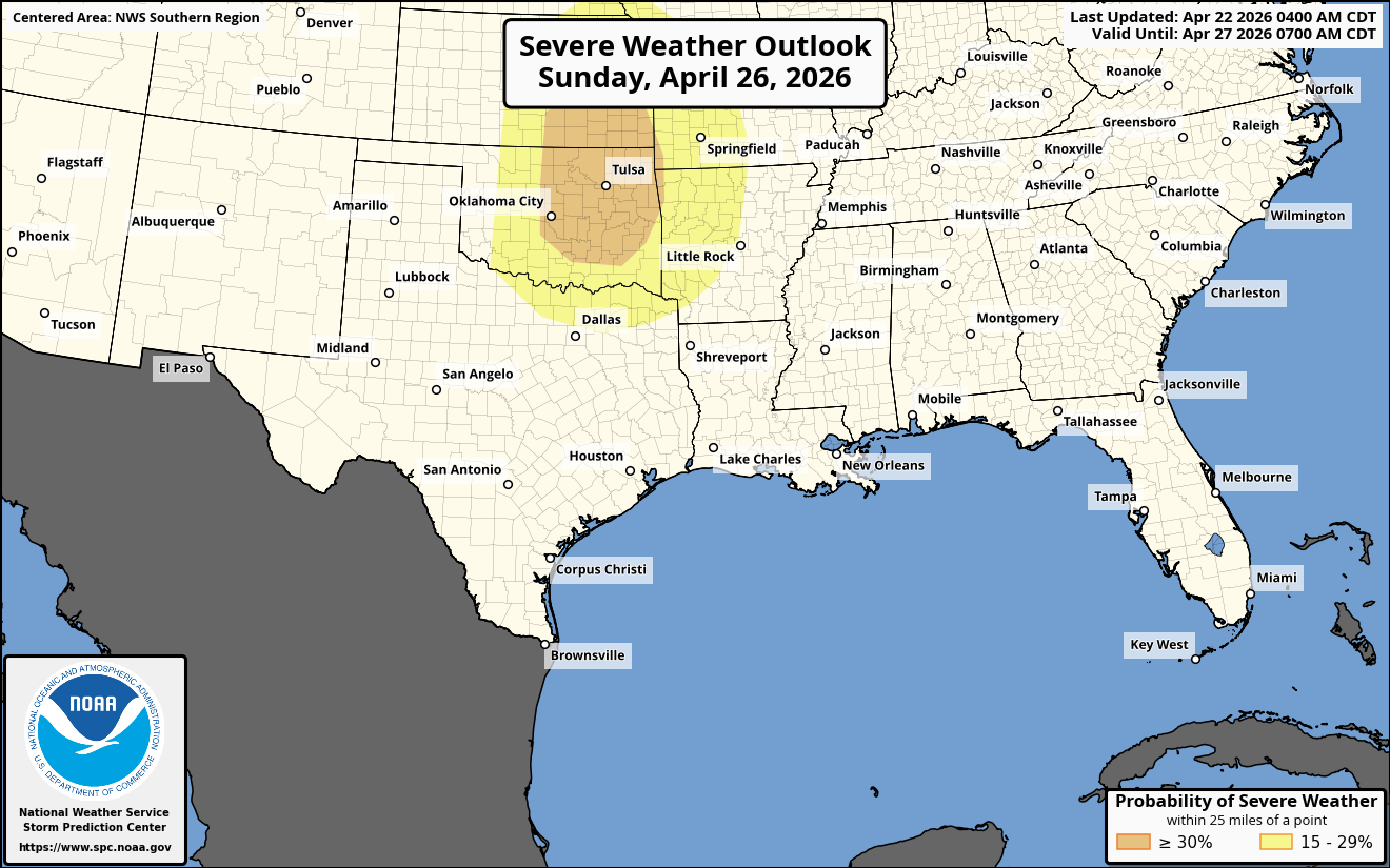
Sunday – The southern Plains states will once again be the focus area for severe storms during late Sunday afternoon and Sunday evening. Tornadoes, large hail and damaging winds will all be a threat.
The air mass across the southern Plains states is expected to be very unstable with strong low-level wind shear to the east of a sharp dryline. This volatile atmosphere will lead to the possibility of a high-end severe weather threat across central and eastern Kansas, central and eastern Oklahoma, north Texas, western Arkansas and western Missouri during late Sunday afternoon and Sunday evening.
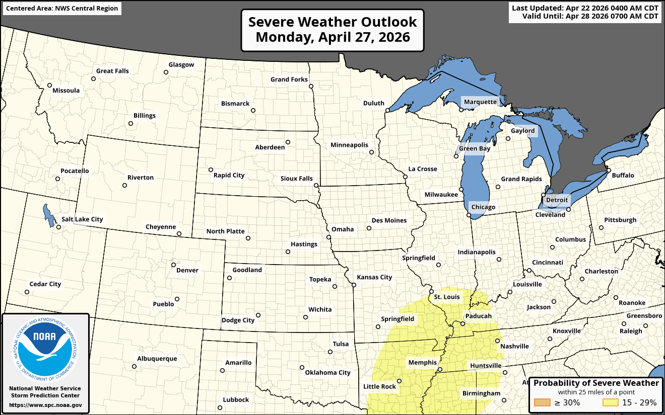
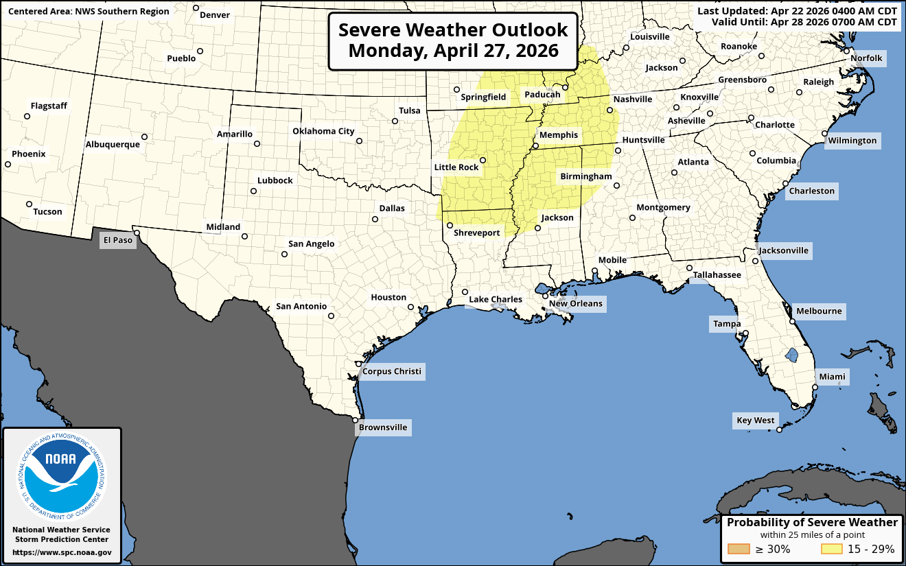
Monday – The severe weather threat looks to shift into the lower Mississippi Valley during Monday afternoon and Monday evening. Severe storms may develop along and ahead of an eastward moving cold front.
The air mass to the east of this front will be quite unstable with strong amounts of low-level wind shear. This means that the storms that do form over the lower Mississippi Valley will be supercells capable of producing tornadoes, large hail and damaging winds during Monday afternoon and Monday evening. It should be pointed out that Monday afternoon and Monday evening could be a high-end severe weather event.