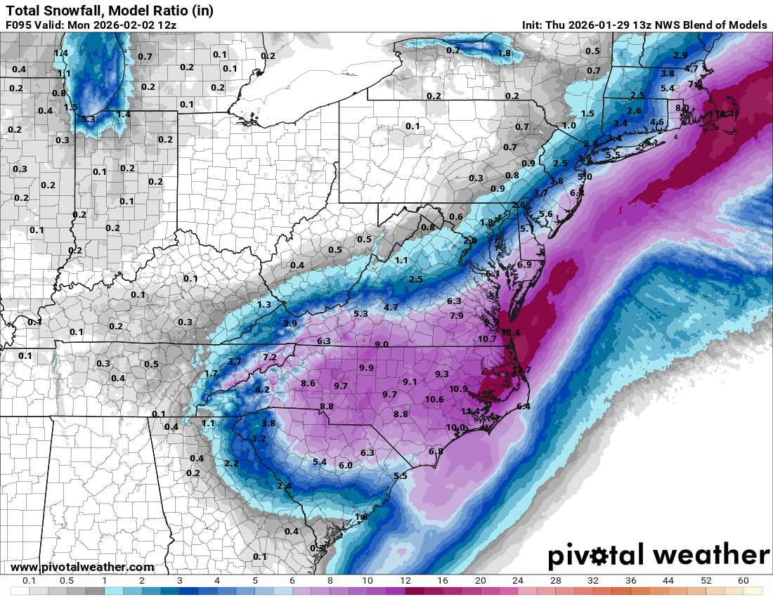
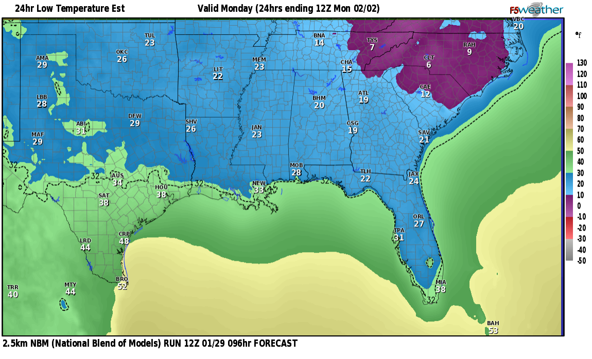
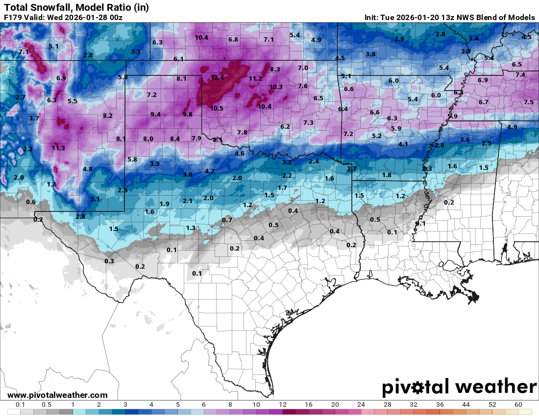
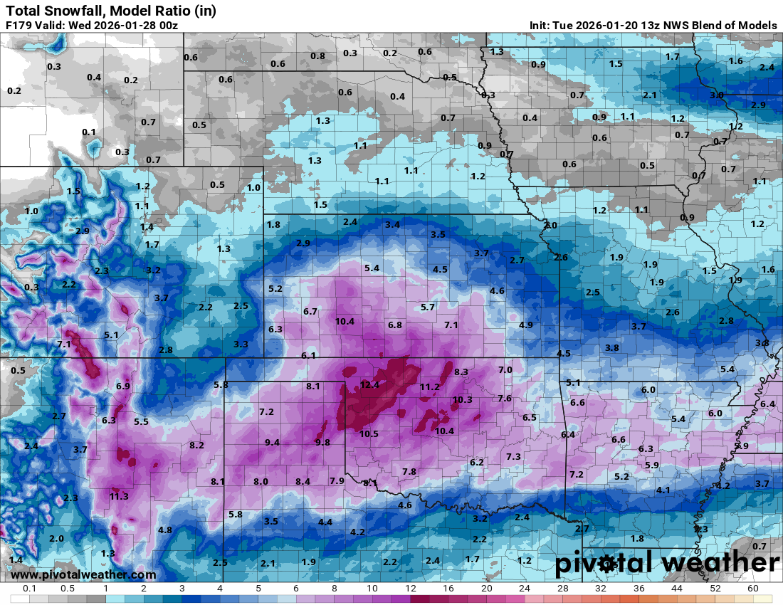
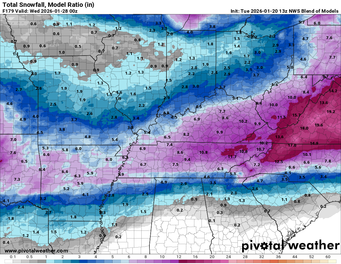
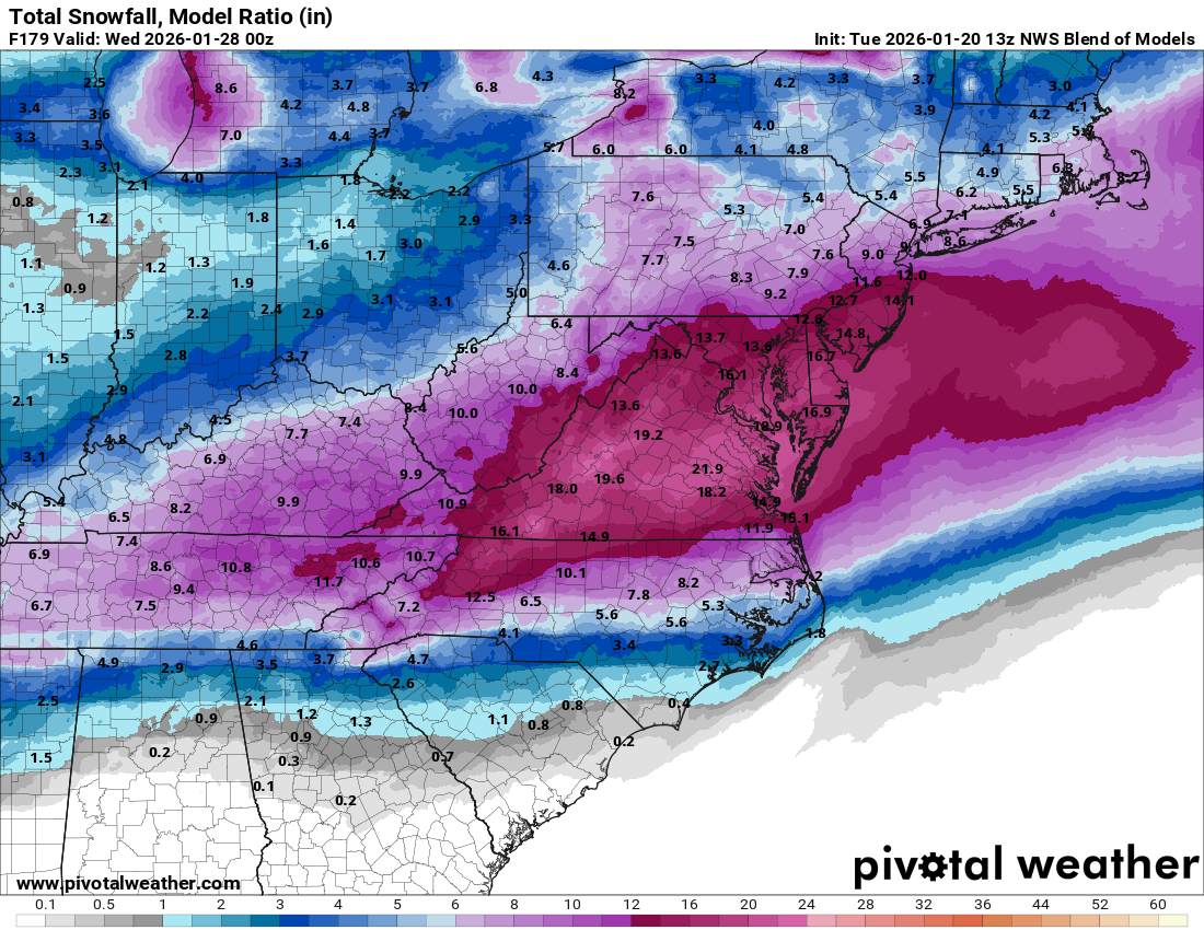
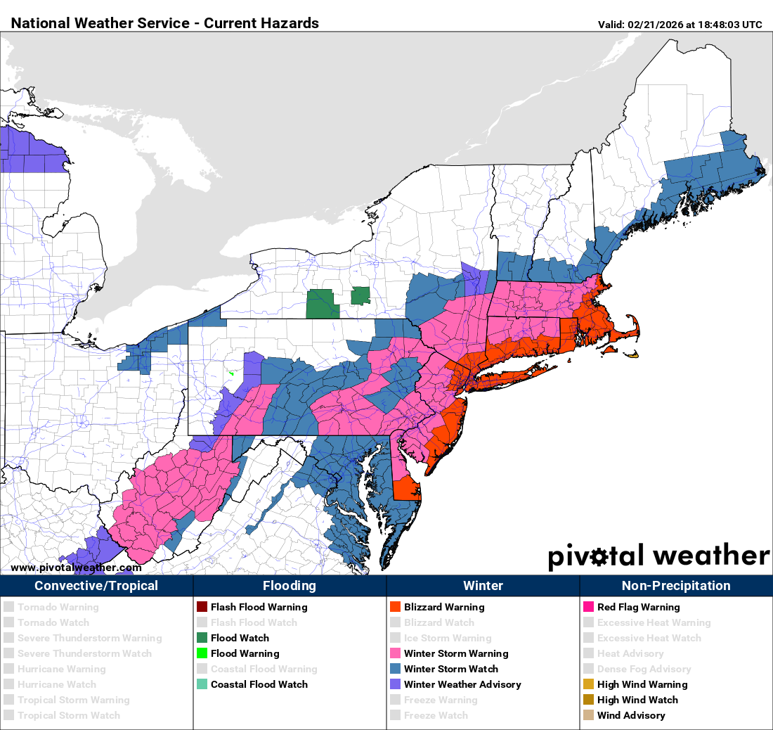
A high impact major winter storm is expected to impact the Mid-Atlantic states and Southern New England beginning Sunday afternoon and lasting through all day Monday. Blizzard conditions, heavy snow and coastal flooding are all expected with this storm.
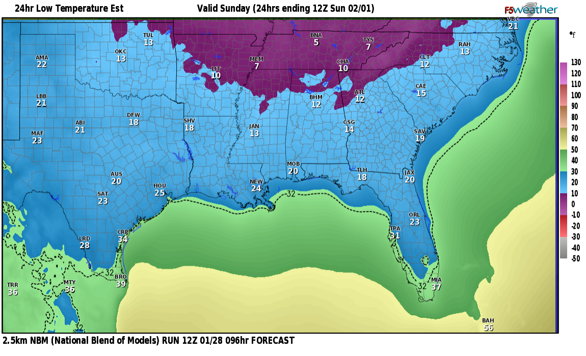
The snow is expected to first overspread the Mid-Atlantic states during the day on Sunday with heavy snow expected during Sunday afternoon and Sunday night. In addition, it is expected that the low pressure system which will bring the heavy snow and blizzard conditions will rapidly strengthen off of the Mid-Atlantic coast during Sunday afternoon and Sunday night. Because of this, expect north to northeast winds to gust up to 50-70 mph from Long Island and the Jersey shore southward into parts of the Delmarva during Sunday afternoon and Sunday night.
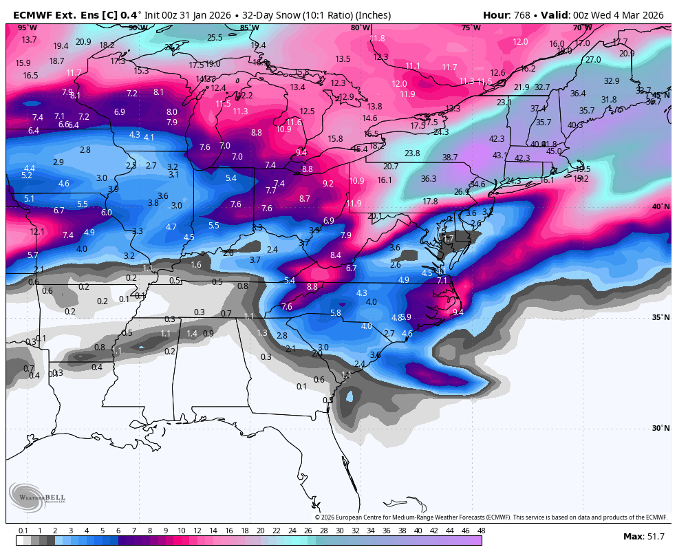
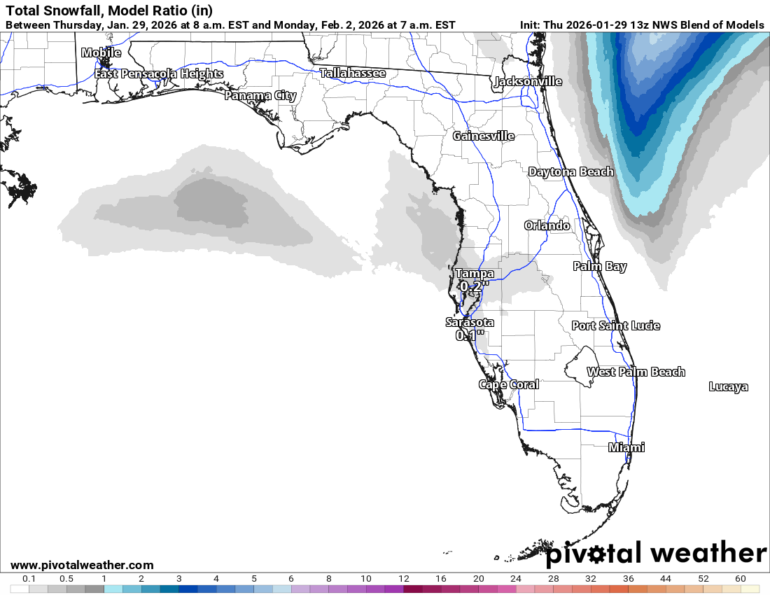
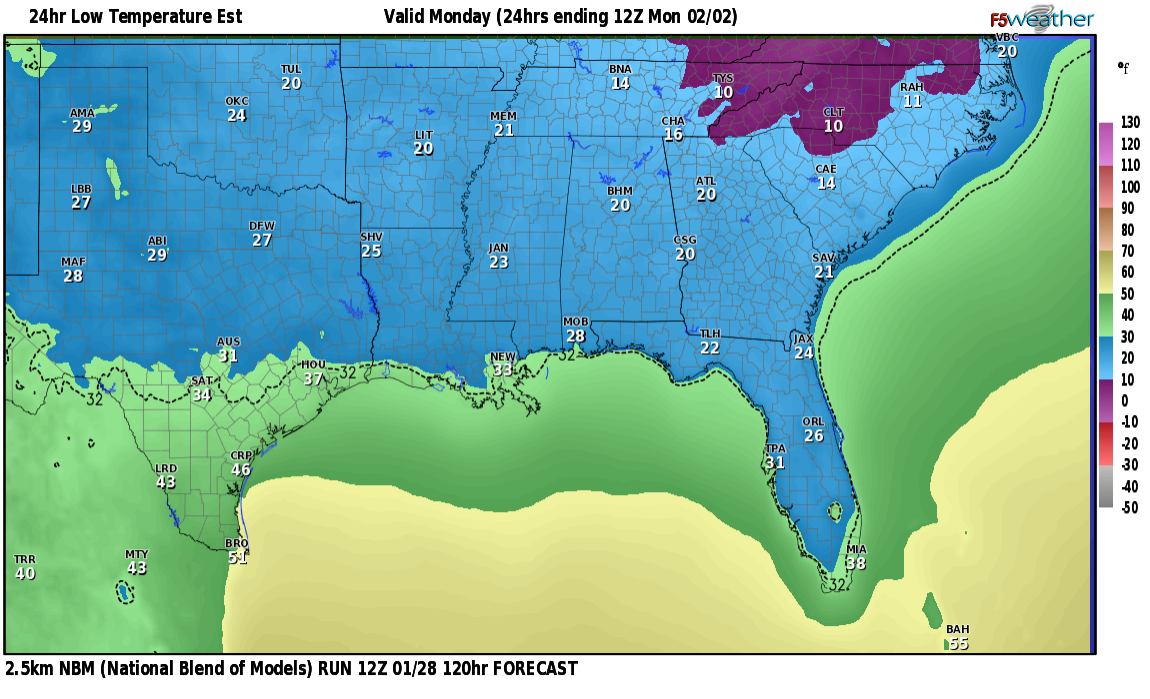
Heavy snow is then expected to spread into Southern New England during Sunday night and continue through all day Monday. Strong north to northeast winds gusting up to 70 mph along the coast & up to 40-50 mph inland will produce blizzard conditions across a large part of Southern New England during late Sunday night and all day Monday.
In addition to the heavy snow and blizzard conditions, moderate coastal flooding is expected from the Delaware and Jersey shores northward through Long Island and Southern New England.
Bottom line is that this is expected to be a high impact winter storm from Delaware and New Jersey northward through Long Island and Southern New England.
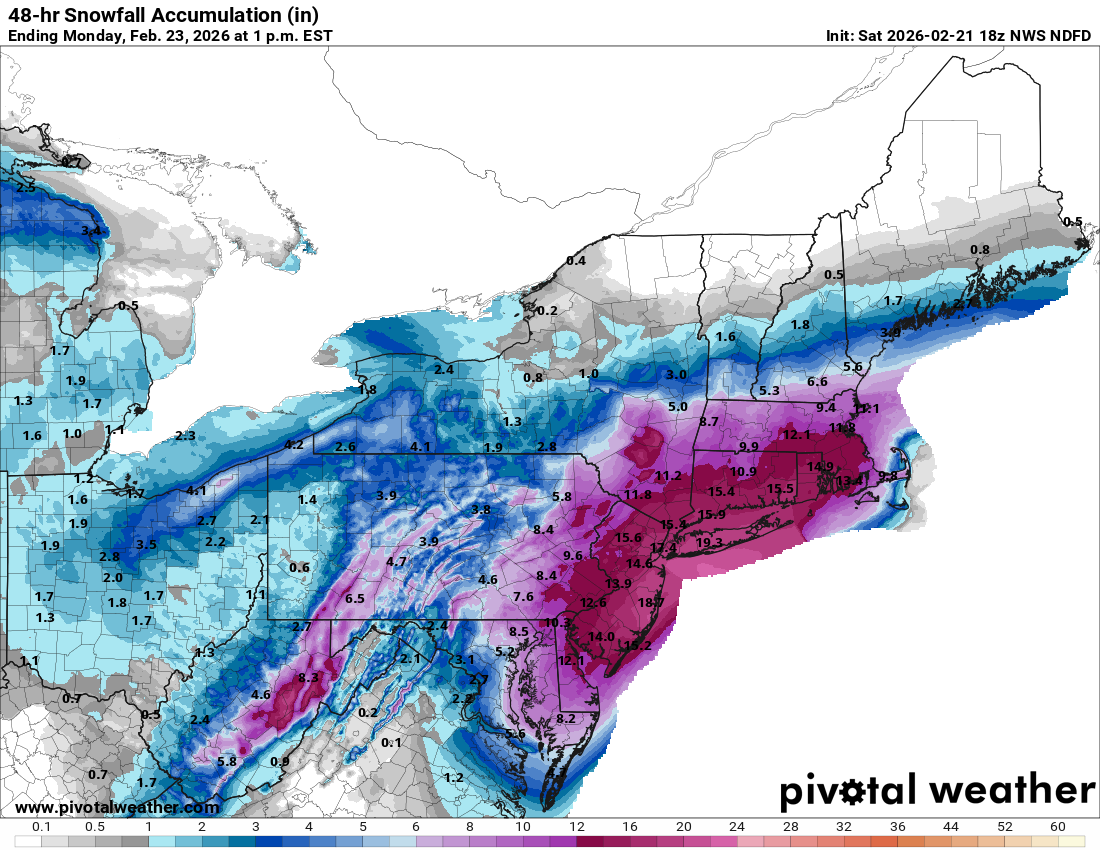
Finally, I did want to mention that this winter storm is expected to impact me here in Sturbridge, Mass. I’m forecasting 12 to 16 inches of snow accumulation along with blizzard conditions during Sunday night and all day Monday. In fact, it’s not out of the question that the snow totals here may end up closer to 18 or 20 inches depending on whether any very heavy snow bands set up over me.