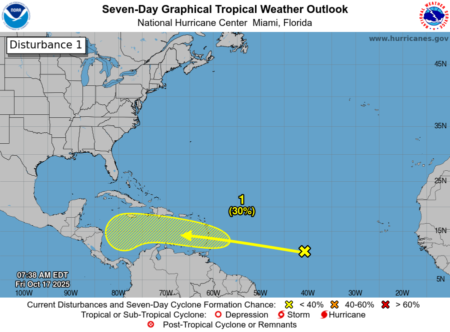
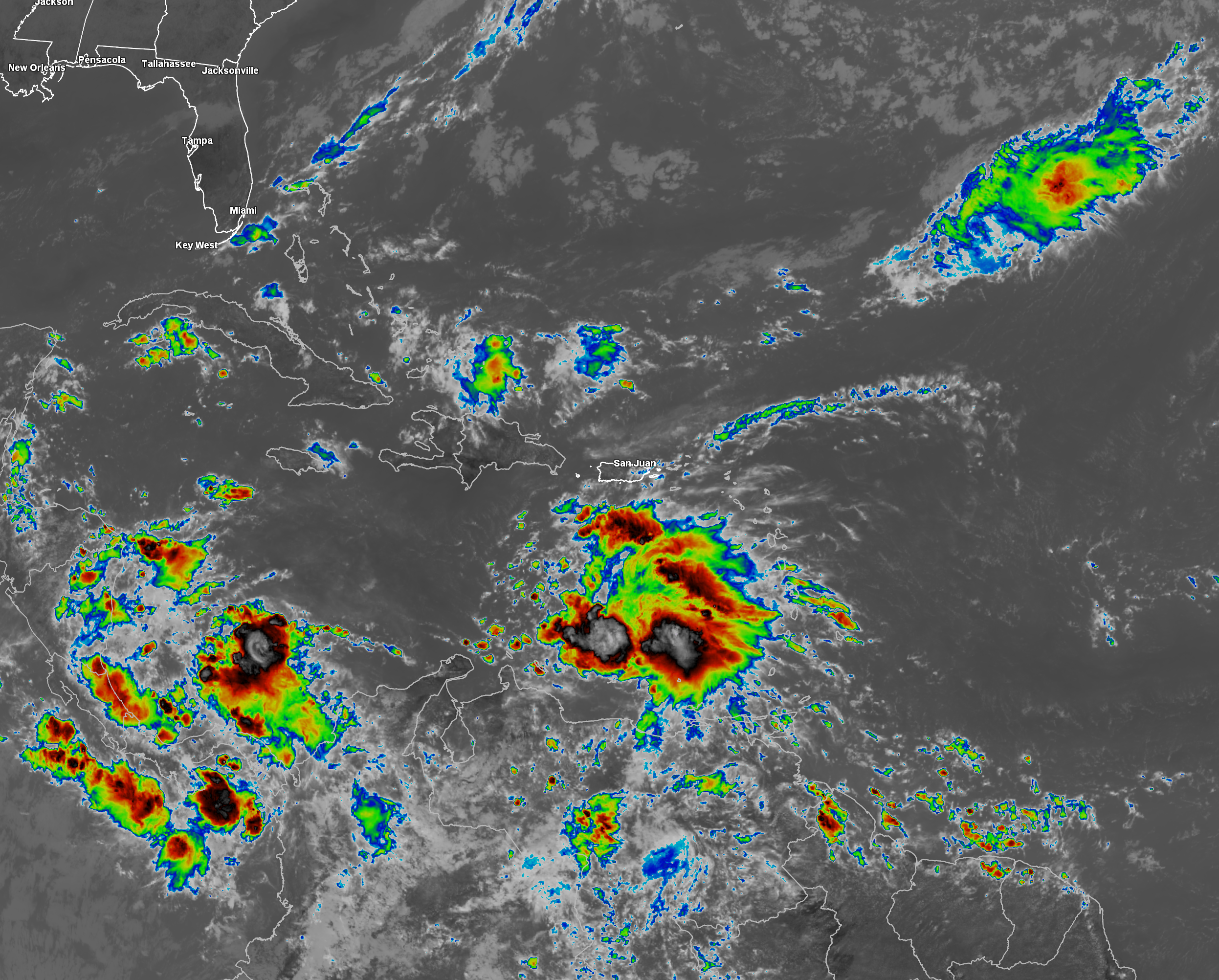
Invest 98-L Located Over The Eastern Caribbean: Invest 98-L is a robust tropical disturbance today & is producing a concentrated area of convection across the eastern Caribbean. While Invest 98-L is robust, it is also not yet organized as any sort of a center is located on the western edge of the deep convection. Also, Invest 98-L is being affected by westerly wind shear of up to 40 knots & these strong wind shear values will certainly cause it to not develop very quickly over the next day or two.
How quickly Invest 98-L organizes, develops and strengthens is going to be important in determining where it will ultimately go. If this system organizes and strengthens quickly over the next few days, it would probably turn towards Hispaniola more quickly and not get into the western Caribbean at all. On the other hand, slower organization over the next few days could mean it will push into the western Caribbean and take its time in turning to the north and northeast.
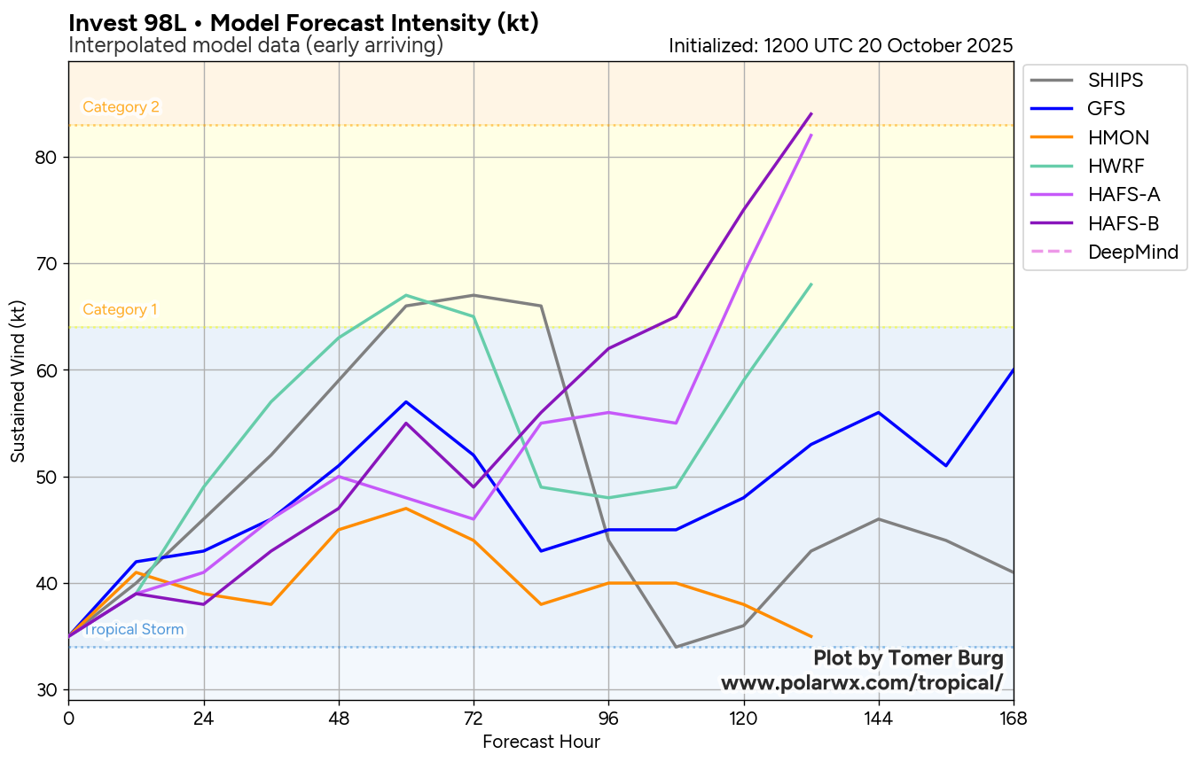
All-in-all, I do think that we’ll probably see Invest 98-L organize over the next couple of days, especially once it reaches the central Caribbean & slows down in forward speed. Because of this, I do think that we will likely see Invest 98-L become Tropical Storm Melissa by Wednesday or so.
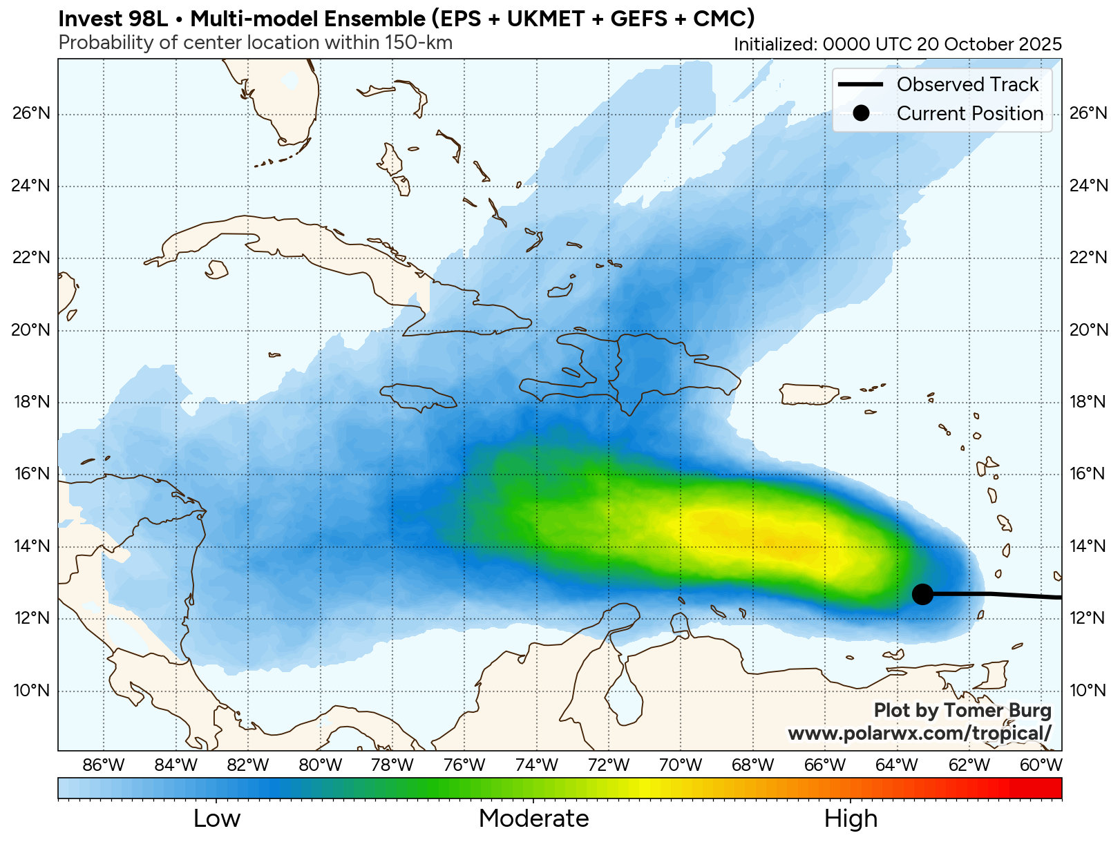
Where this systems goes and how strong it becomes after it reaches the central Caribbean is still uncertain. The reason why is because Invest 98-L is expected to get caught up in an environment of conflicting steering currents.
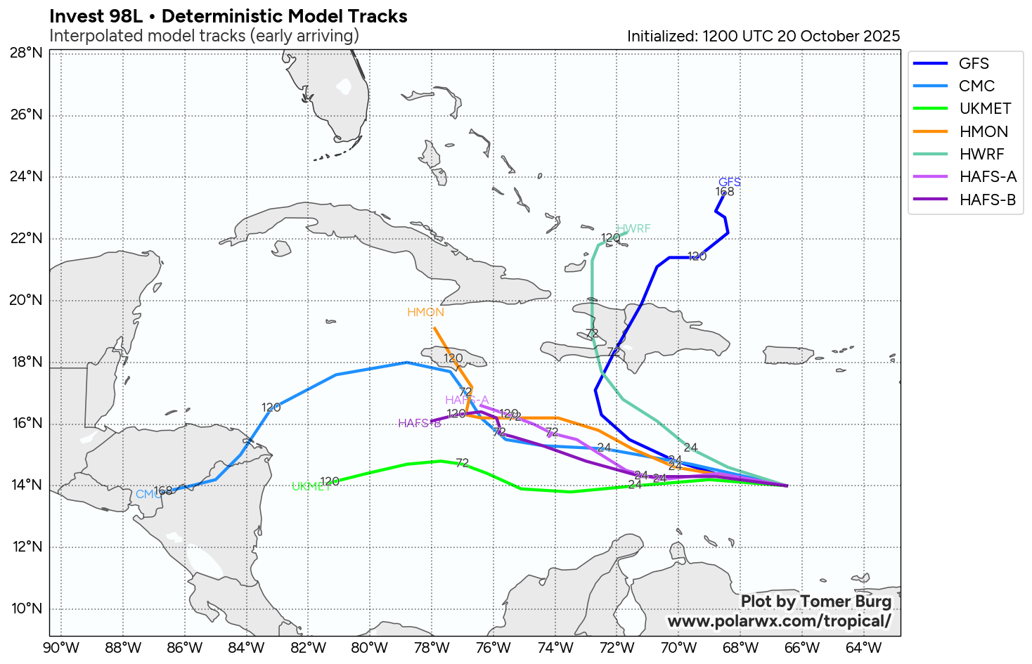
There seems to be two potential track scenarios with Invest 98-L depending on how much it develops and strengthens.
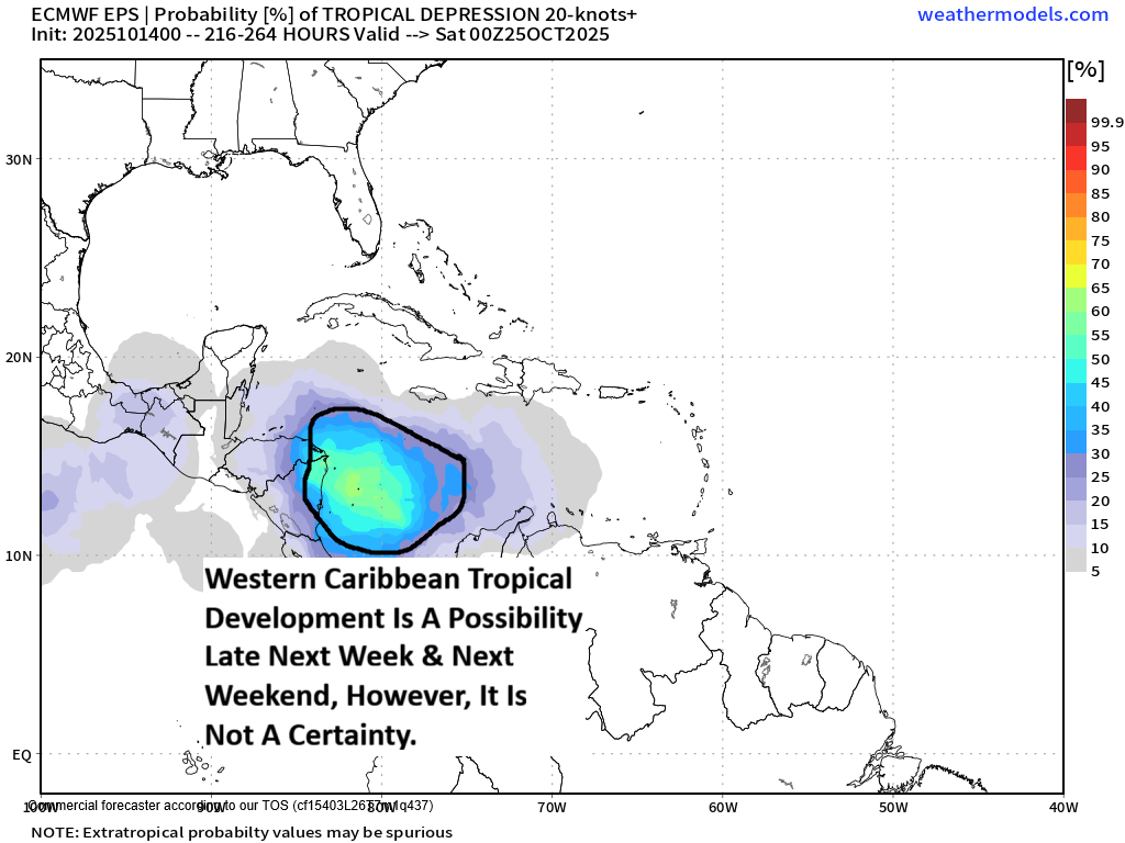
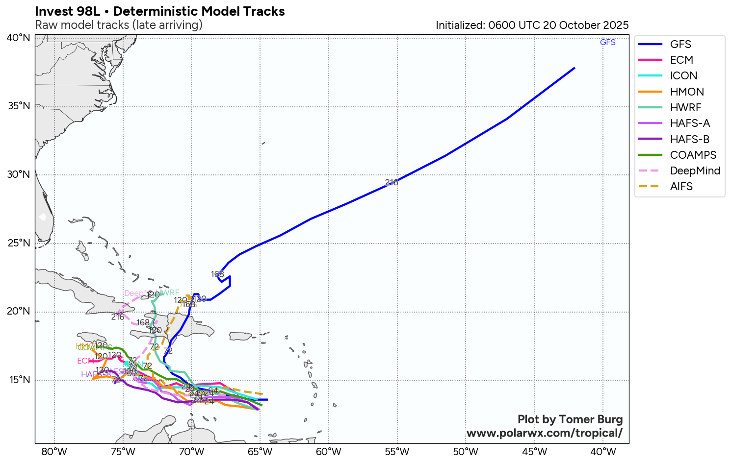
The first track scenario is for Invest 98-L/Melissa to wait to strengthen & because of this move westward this week & reach the western Caribbean by this weekend where it then strengthens significantly. In this first scenario, Invest 98-L/Melissa then sits in the western Caribbean throughout this weekend through the first half of next week & become a major hurricane before it is yanked northeastward across Cuba and the Bahamas late next week. This is what model guidance such as the European model and the Canadian model seems to be suggesting. Also there has been a shift towards this scenario by the most recent run of the Google Deep Mind AI ensemble guidance.
The second track scenario is for Invest 98-L to strengthen significantly in the next day or two which leads to a quick turn to the north and northeast over the central Caribbean. This leads to this system to move right over Hispaniola late this week and then stall just north of Hispaniola near the southeastern Bahamas before its yanked out into the open Atlantic next week. The GFS model has been very consistent in forecasting this particular scenario.
Here Are My Thoughts: As I mentioned earlier in this discussion, I do think that it is very likely that Invest 98-L will organize and strengthen and become Tropical Storm Melissa by Wednesday when it reaches the central Caribbean.
While I think that a slower organizing and strengthening system that does move into the western Caribbean late this week and this weekend is definitely very much on the table, I do think that we’ll more likely see steady organizing and strengthening. Because of this, I do think that Invest 98-L/Melissa will eventually be pulled northward towards central and eastern Cuba and Haiti late this weekend or early next week & then towards the Bahamas next week.
I think that the quick turn to the north may end up being incorrect & I also think that the slower meandering system in the western Caribbean may also be incorrect. Because of this, I think that we’ll see an outcome that’s somewhere in the middle of the two scenarios I outlined earlier in this discussion.
That being said, all options are still on table in terms of where this system will track. I just think the quick exit over Hispaniola is the most incorrect one & I’m leaning much more towards the idea of a system that heads for the west-central Caribbean or even the western Caribbean.
Without a doubt, Invest 98-L/Melissa is a definite concern for everyone in the central and western Caribbean, including Honduras, Nicaragua, the Cayman Islands, Cuba, Jamaica, Haiti and the Dominican Republic. Because of this, if you live in the Caribbean or are traveling there, you really should keep a very close eye on the progress of Invest 98-L/Melissa throughout the coming days.
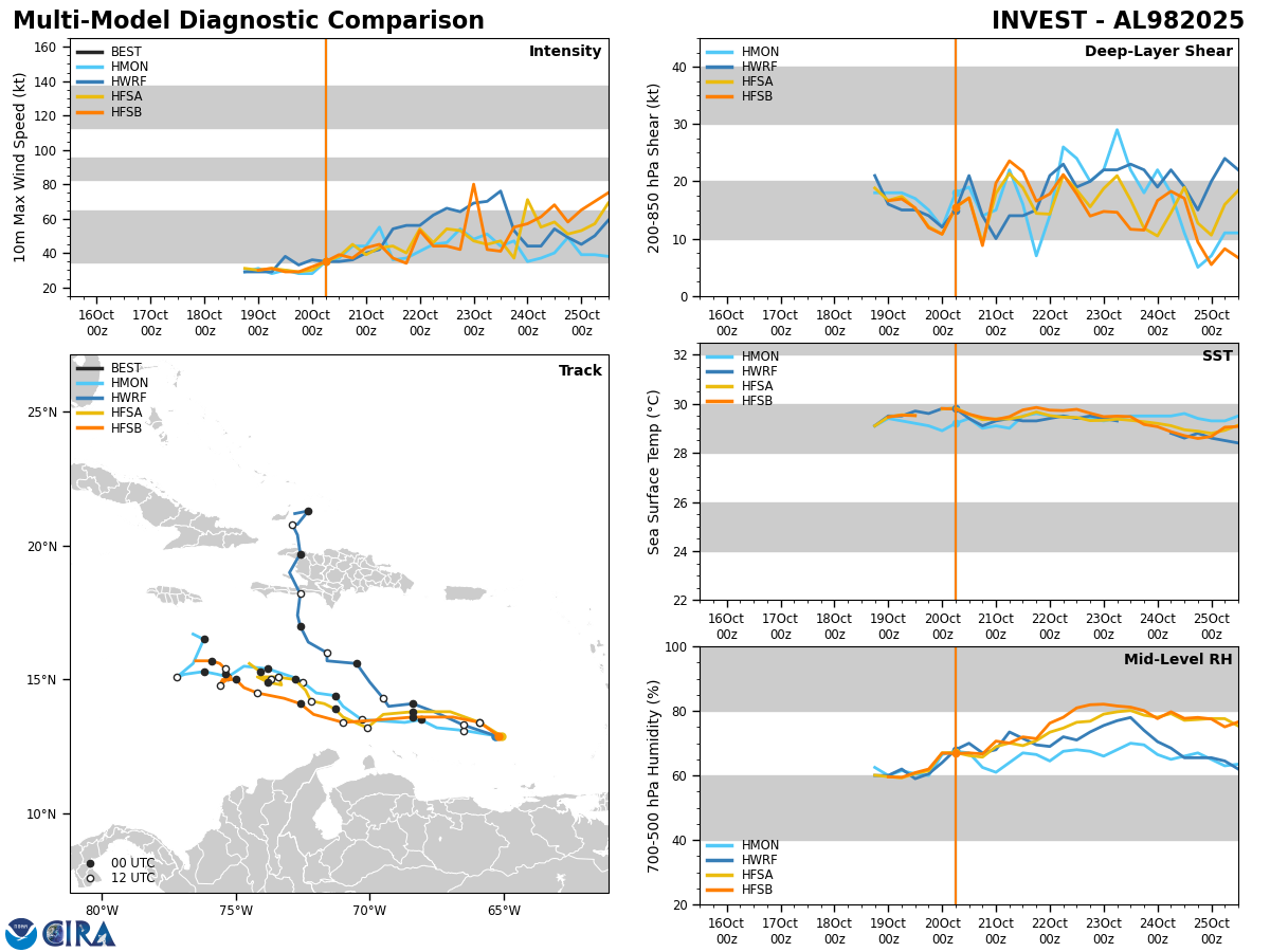
Model Track Forecast:
Satellite Imagery:
The next tropical weather discussion will be issued on Tuesday.