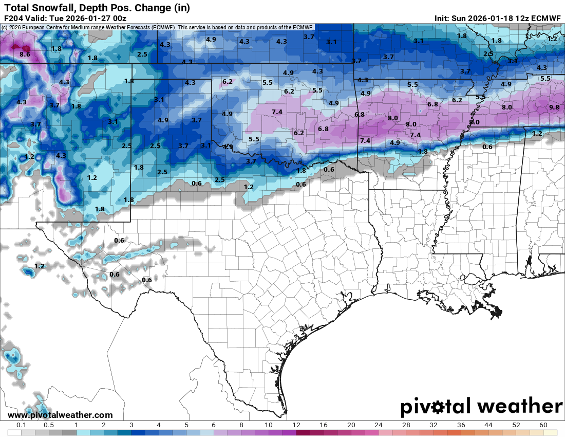
All indications are pointing towards the increasing likelihood of a high impact winter storm that’ll impact parts of the Southern and Southeastern United States, as well as across the Mid-Atlantic states this weekend. The consistency in the various model guidance in showing this could end up being a destructive ice storm for the I-20 corridor and upwards of 3 to 6 inches of snow across the Tennessee Valley. In addition, this storm could very well bring 1 to 2 feet of snow to parts of the Mid-Atlantic states, including Washington, DC, Baltimore and Philadelphia.
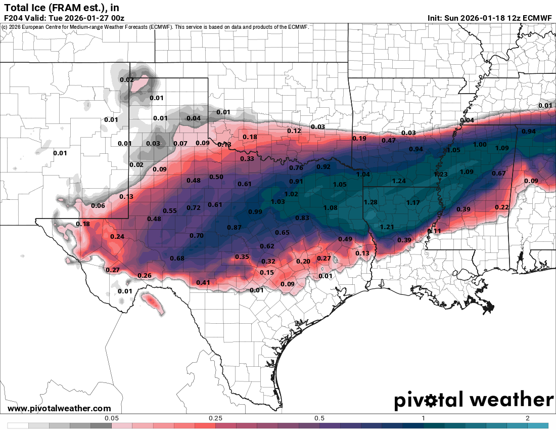
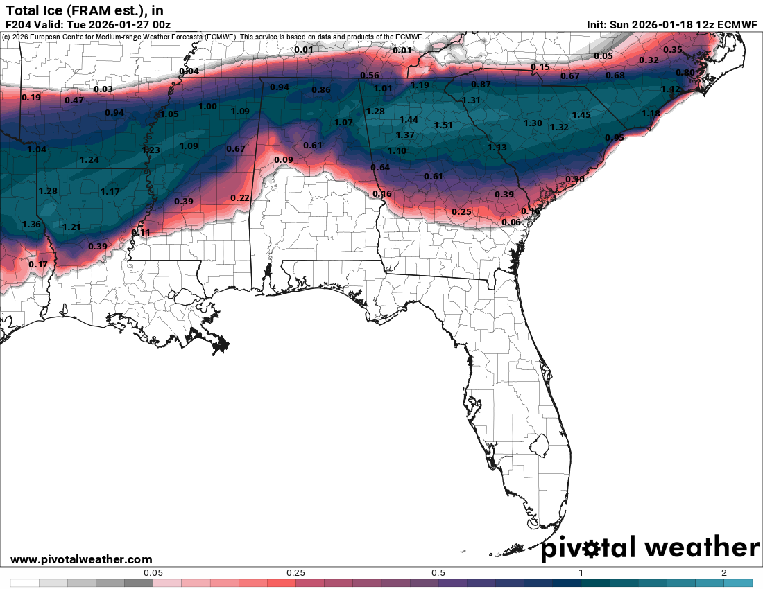
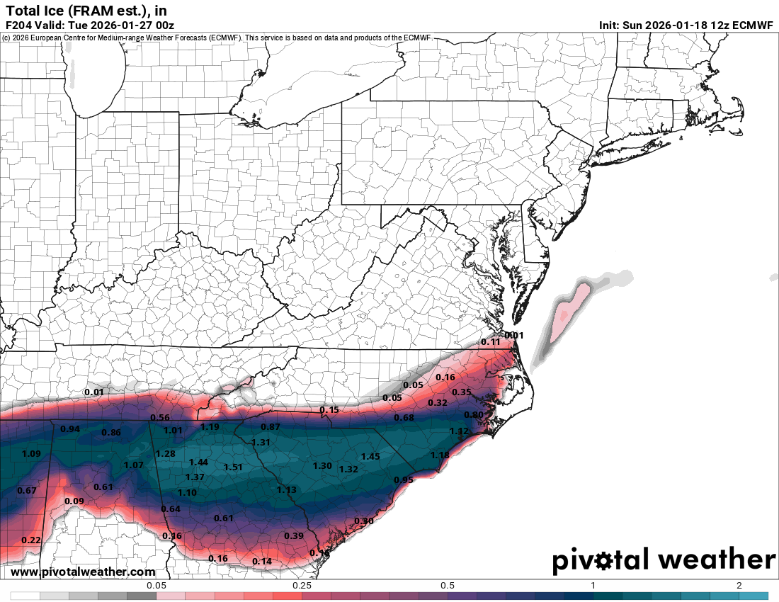
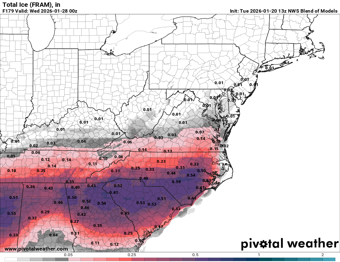
The most worrying part of this weekend’s winter storm is going to be the potential for a very destructive ice storm along the I-20 corridor, including Dallas, Shreveport and Atlanta. Given the data that I’m looking at right now, this could end up being a very high-impact ice storm leading to the crippling of travel, major power outages and widespread tree damage. Those of you in the areas from Dallas through Shreveport, Atlanta to Charlotte need to prepare the same way as you would for a hurricane. This includes buying non-perishable food, water, gas, and charge devices. It wouldn’t be a bad idea to trim those vulnerable tree limbs close to your home. You can absolutely forget about travel anywhere near and north of I-20. Be aware that some ice impacts could occur as far south as I-10 in southeastern Texas and western Louisiana, but the huge ice impacts will occur the closer you get to I-20.
This entire storm looks start over the Deep South as early as late Friday night and continue throughout Saturday and Saturday night before slowly winding down on Sunday.
Across the Mid-Atlantic states, this storm looks to begin on Saturday morning and continue throughout Saturday afternoon, Saturday night and Sunday. This storm will then slowly wind down on Sunday night and Monday.
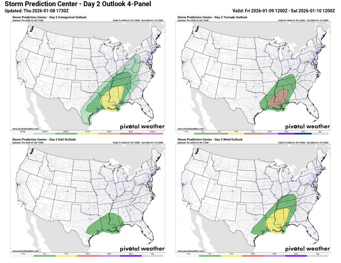
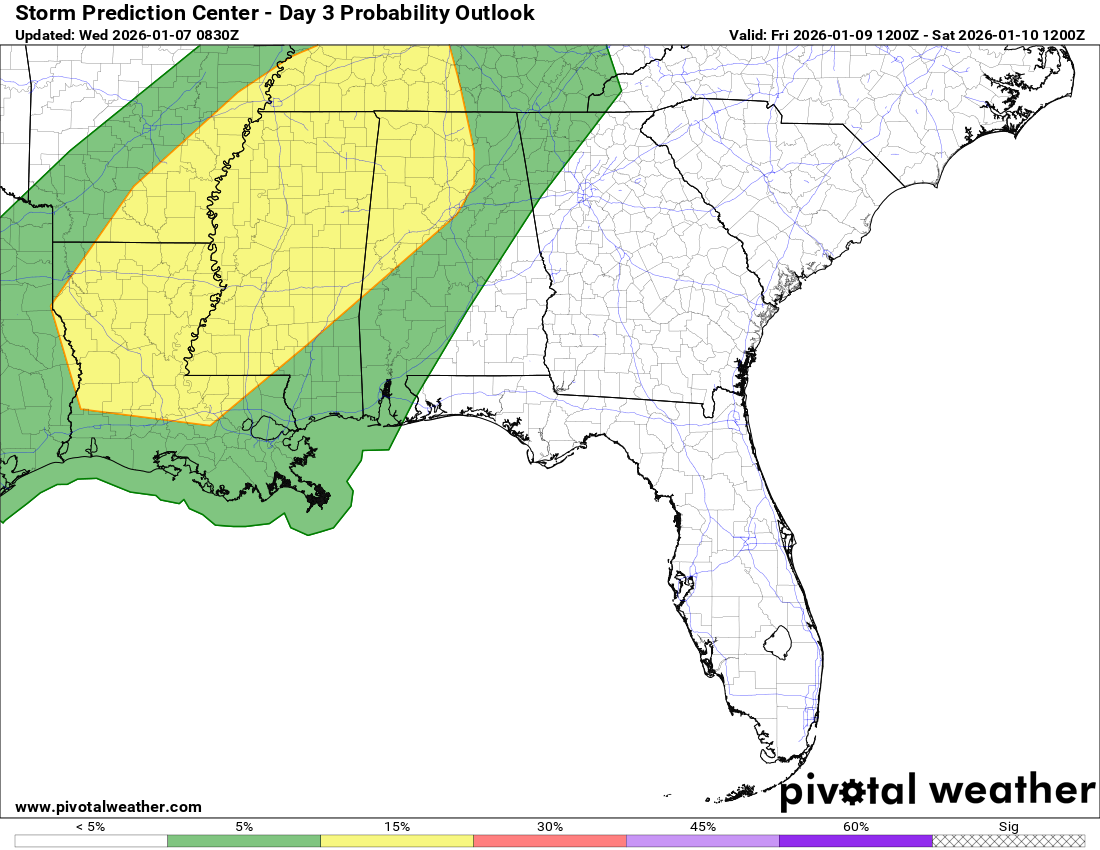
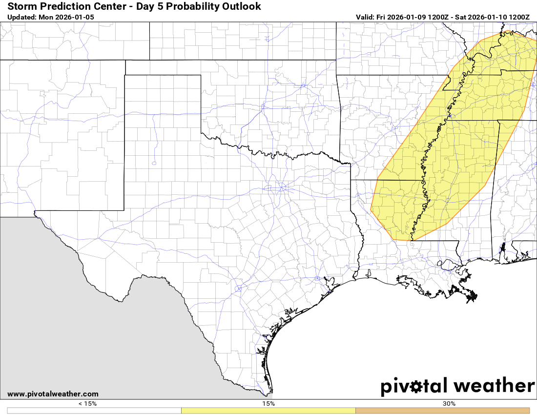
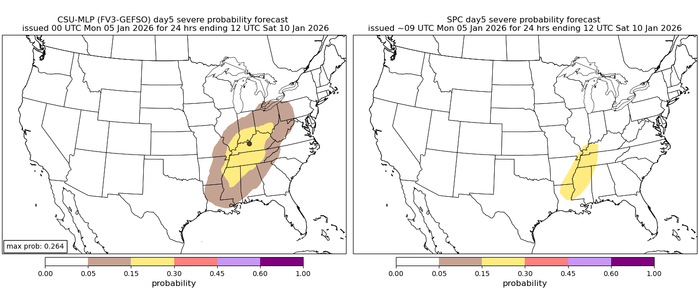
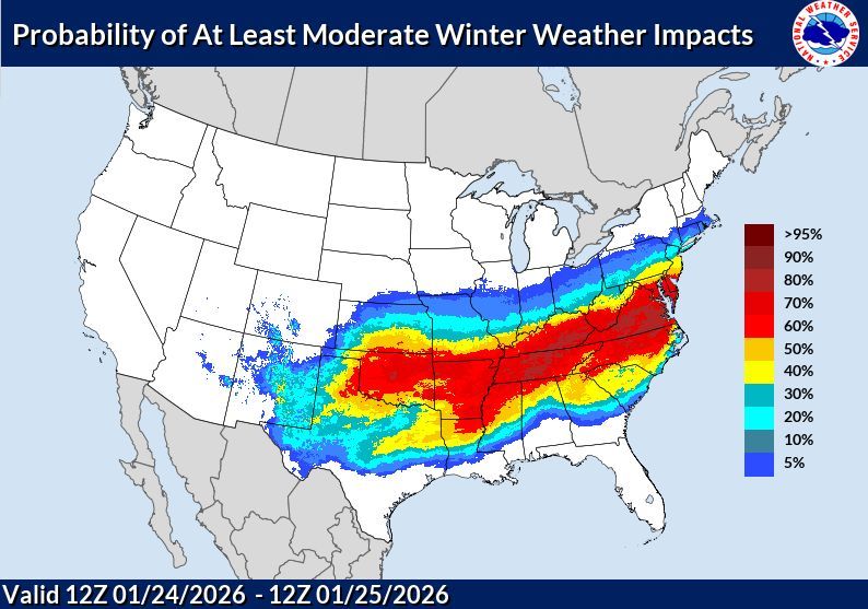
Forecast Winter Weather Impacts This Weekend (Travel IS NOT Recommended In Areas In Yellow & Red):
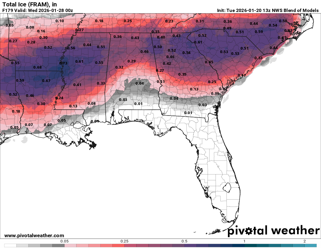
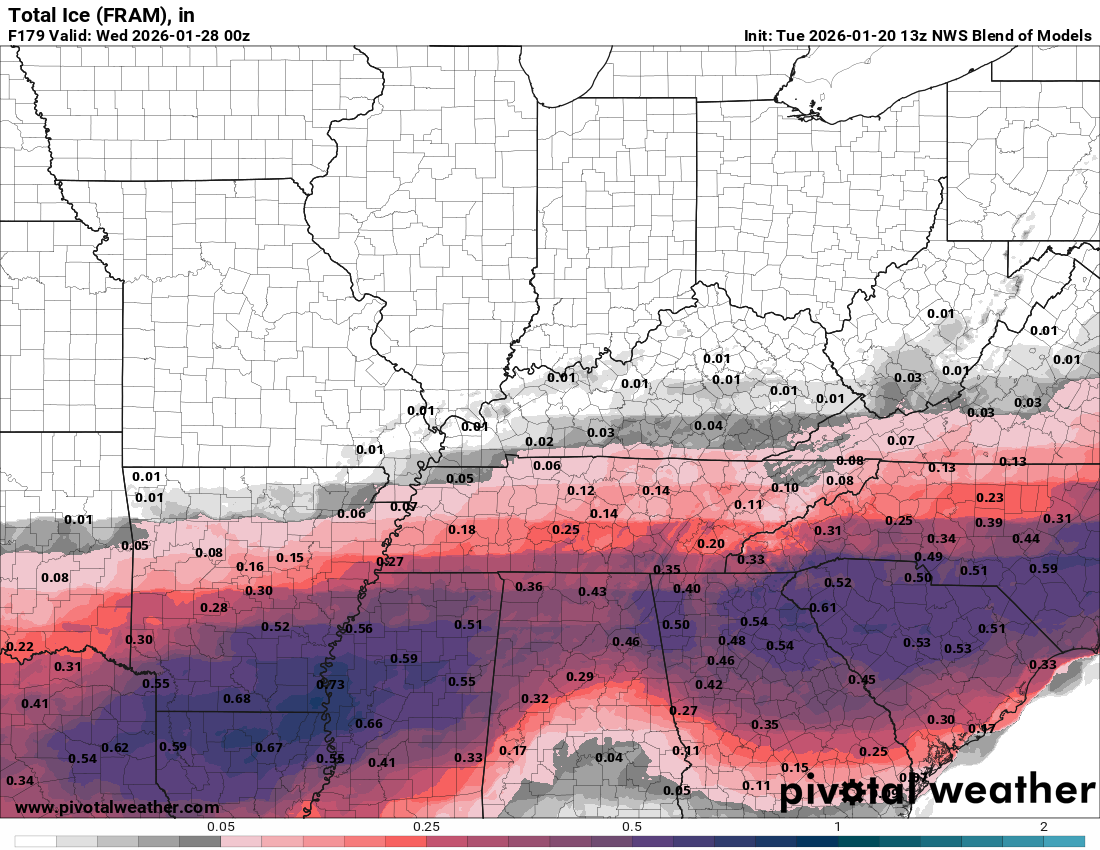
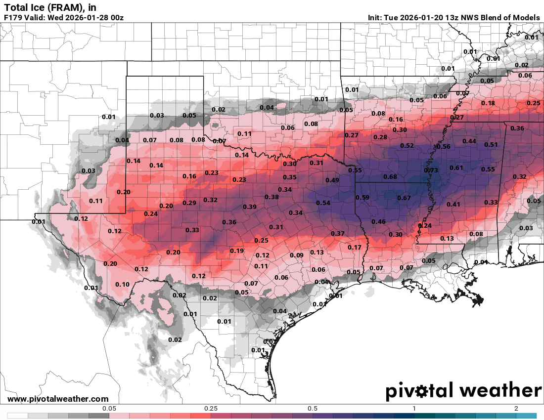
Forecast Ice Accumulations For This Weekend:
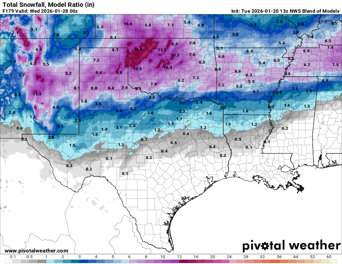
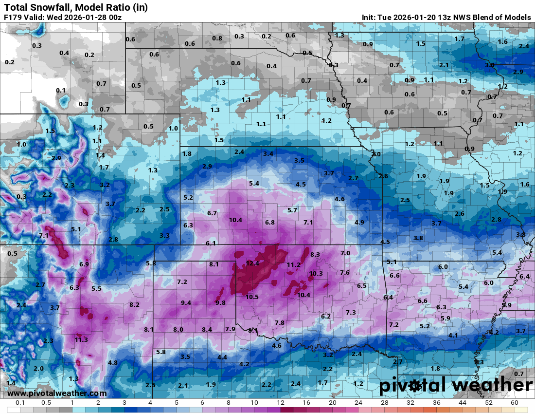
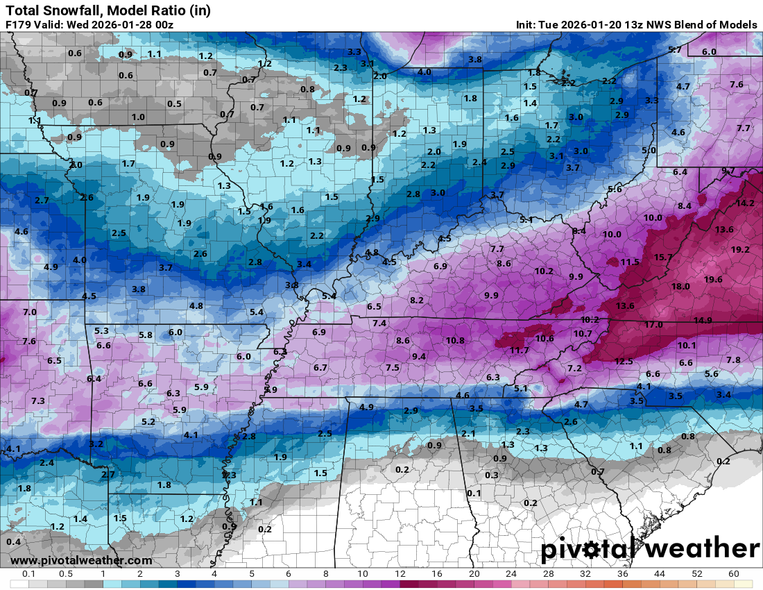
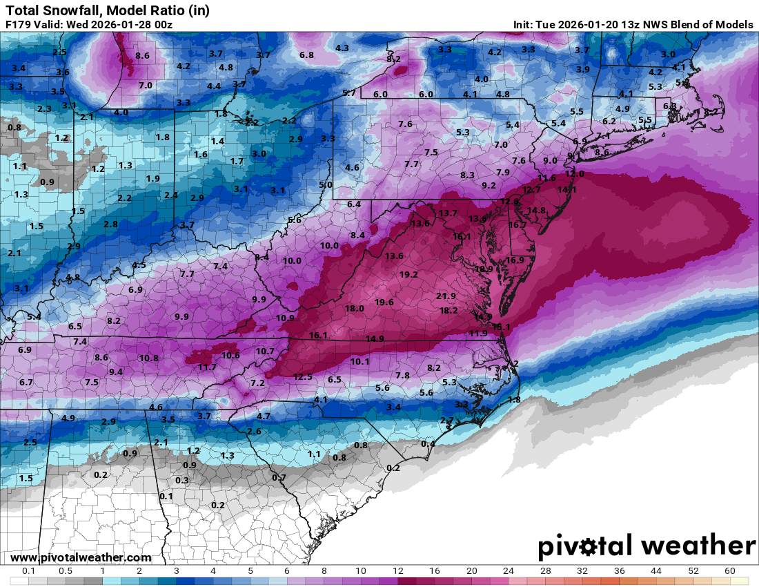
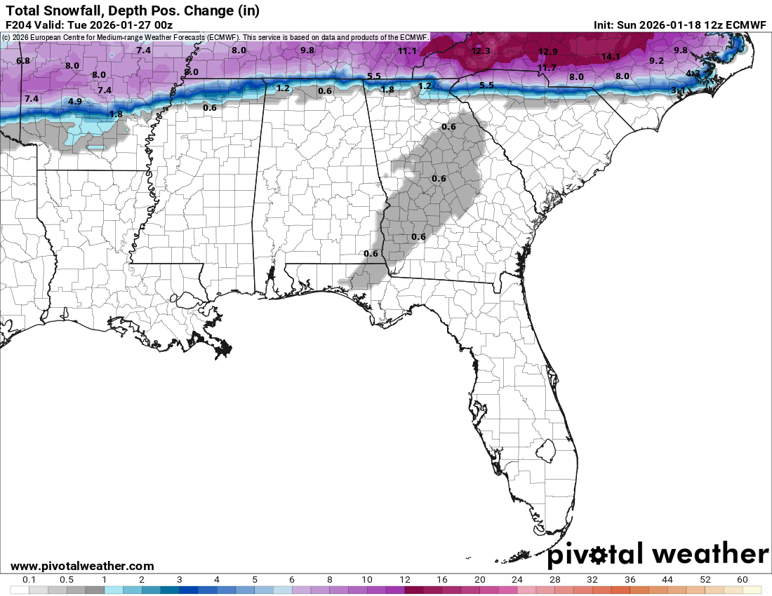
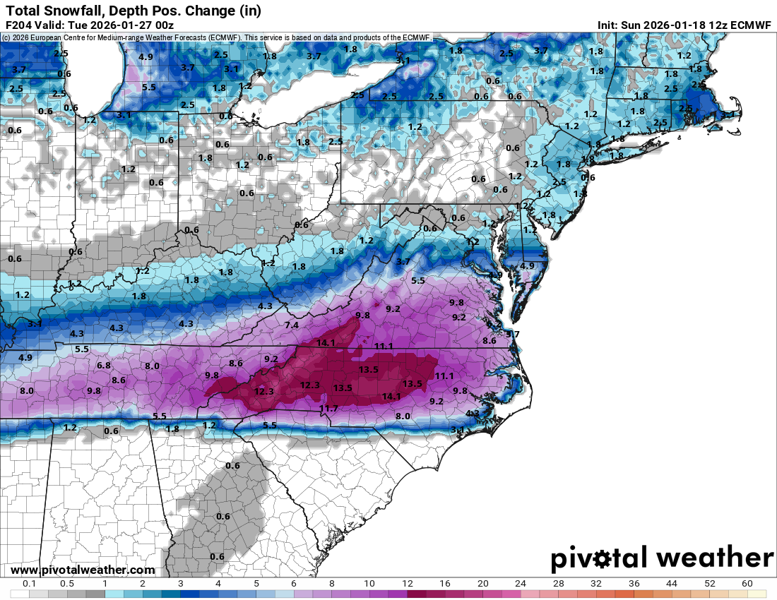
Forecast Snow Amounts This Weekend: