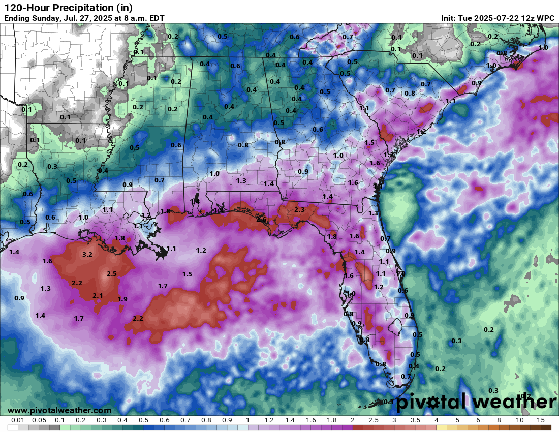
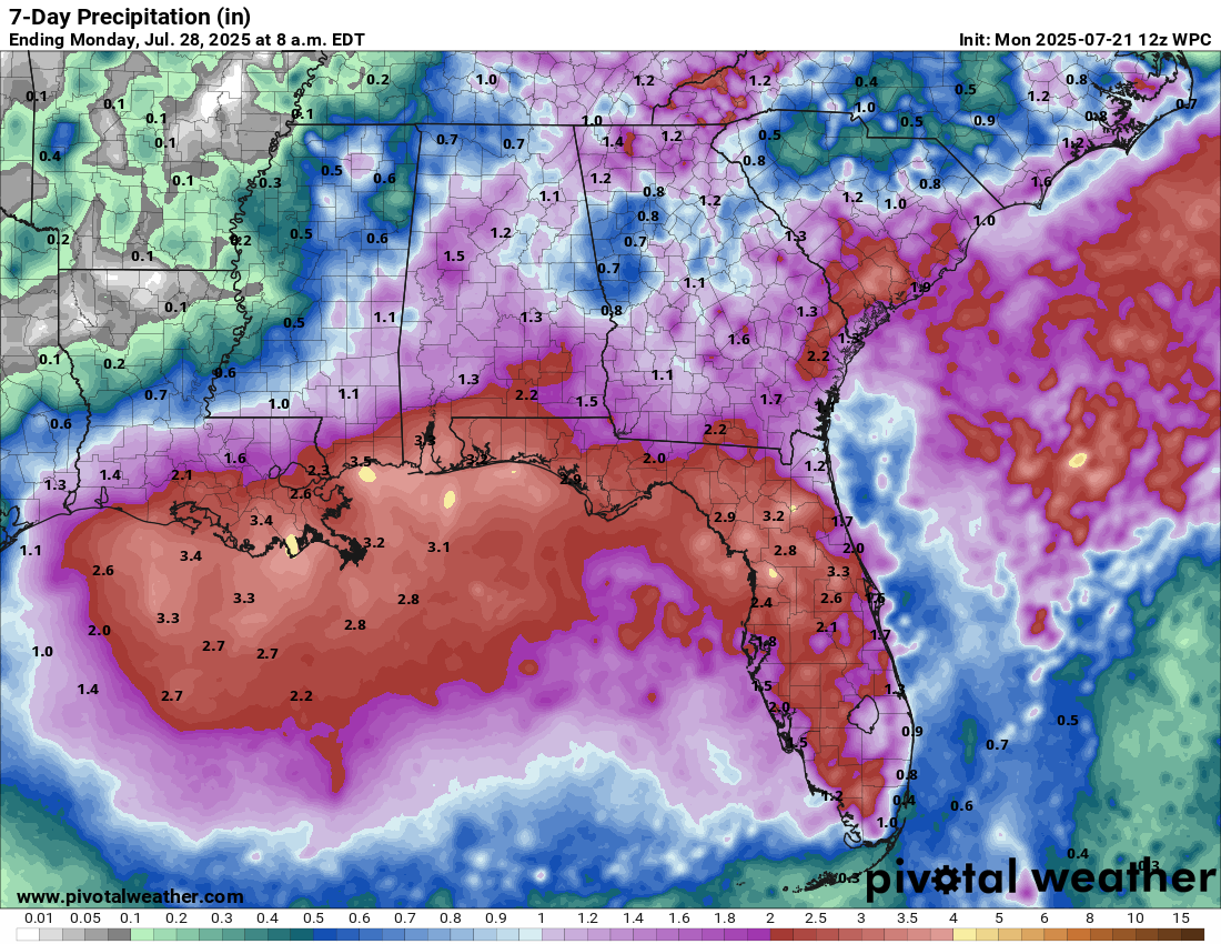
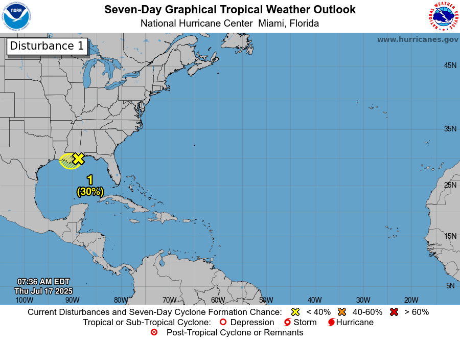
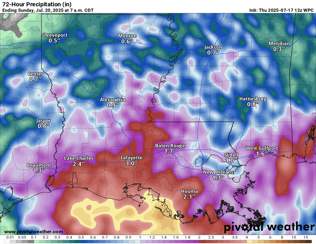
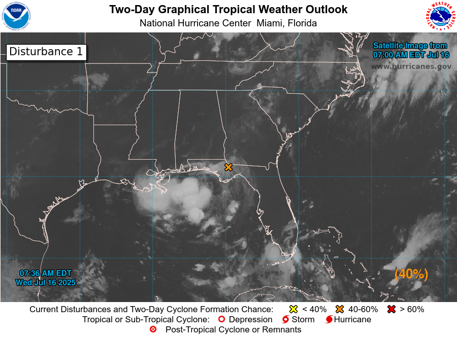
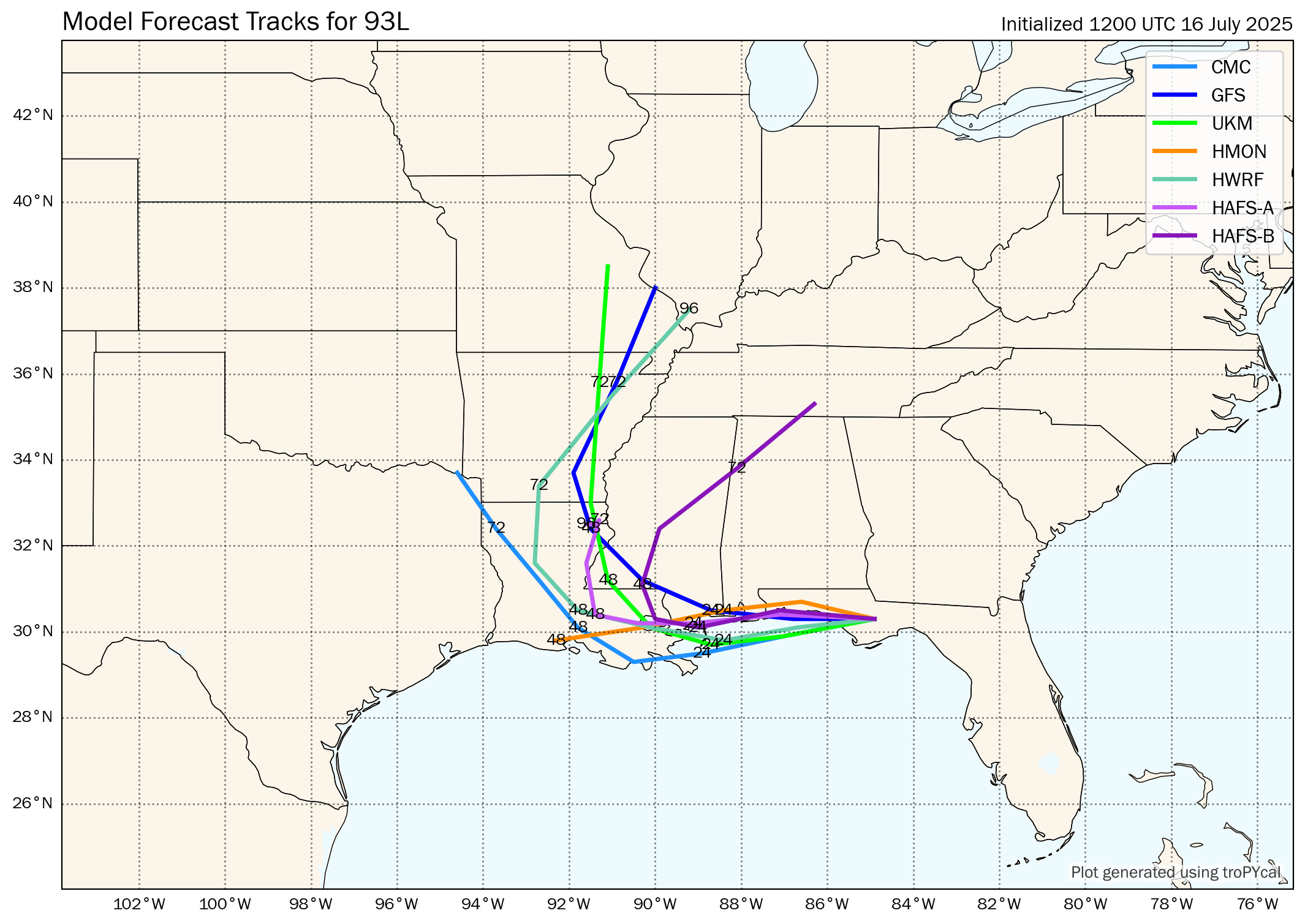
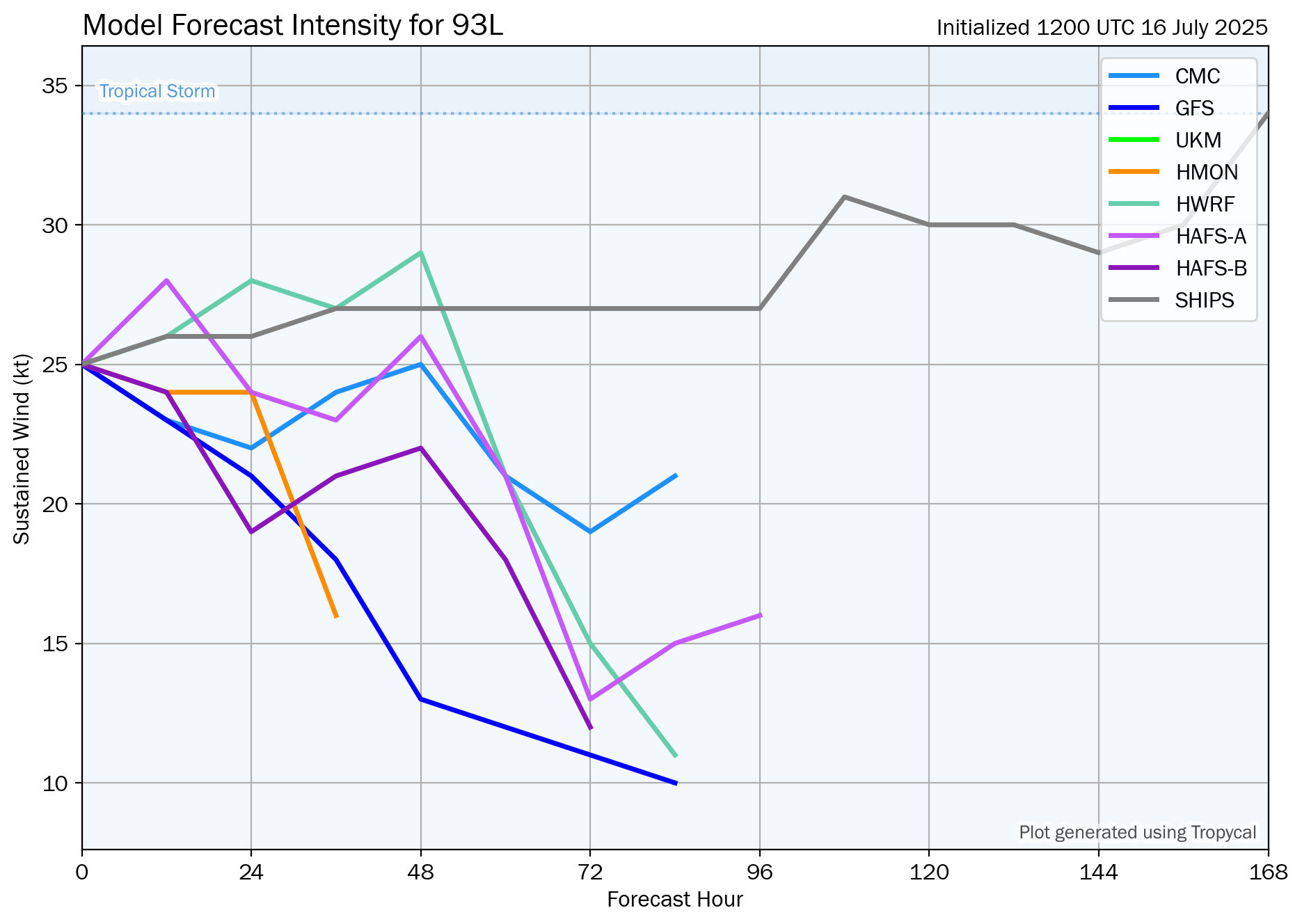
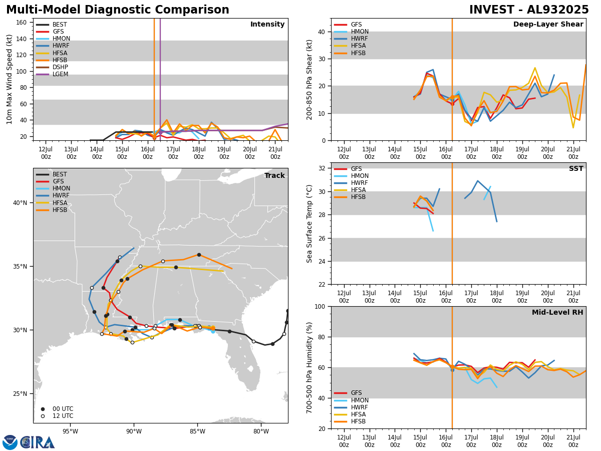
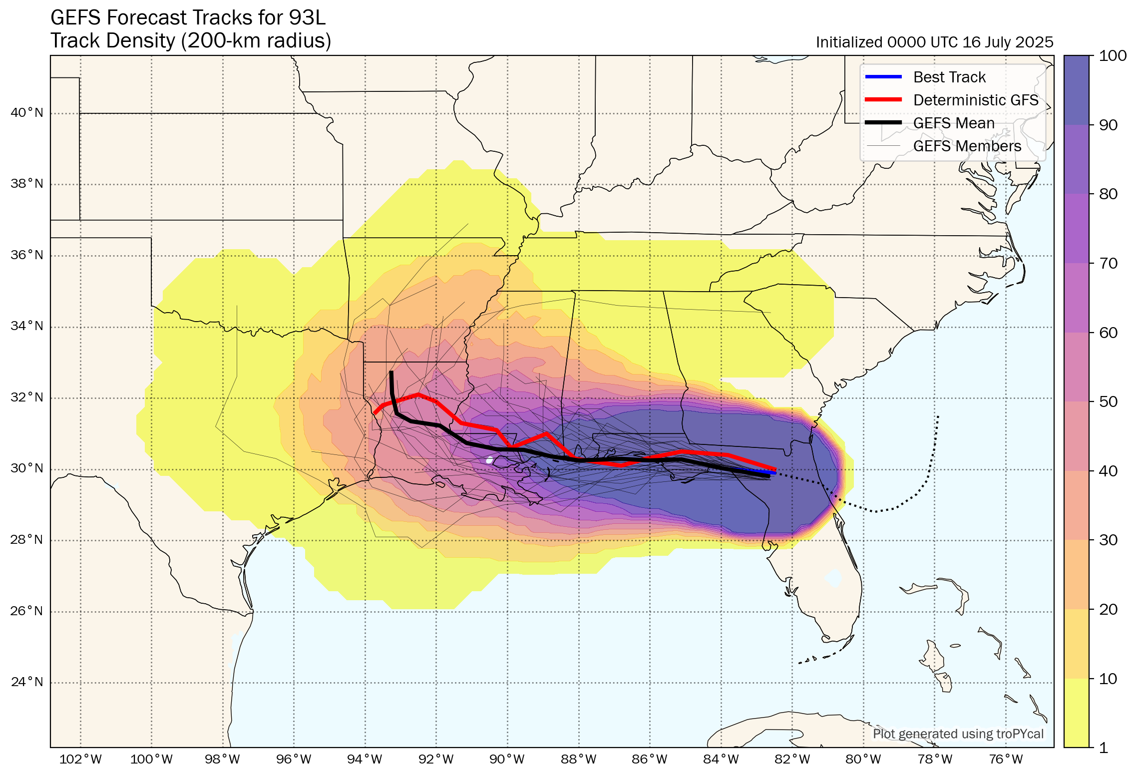
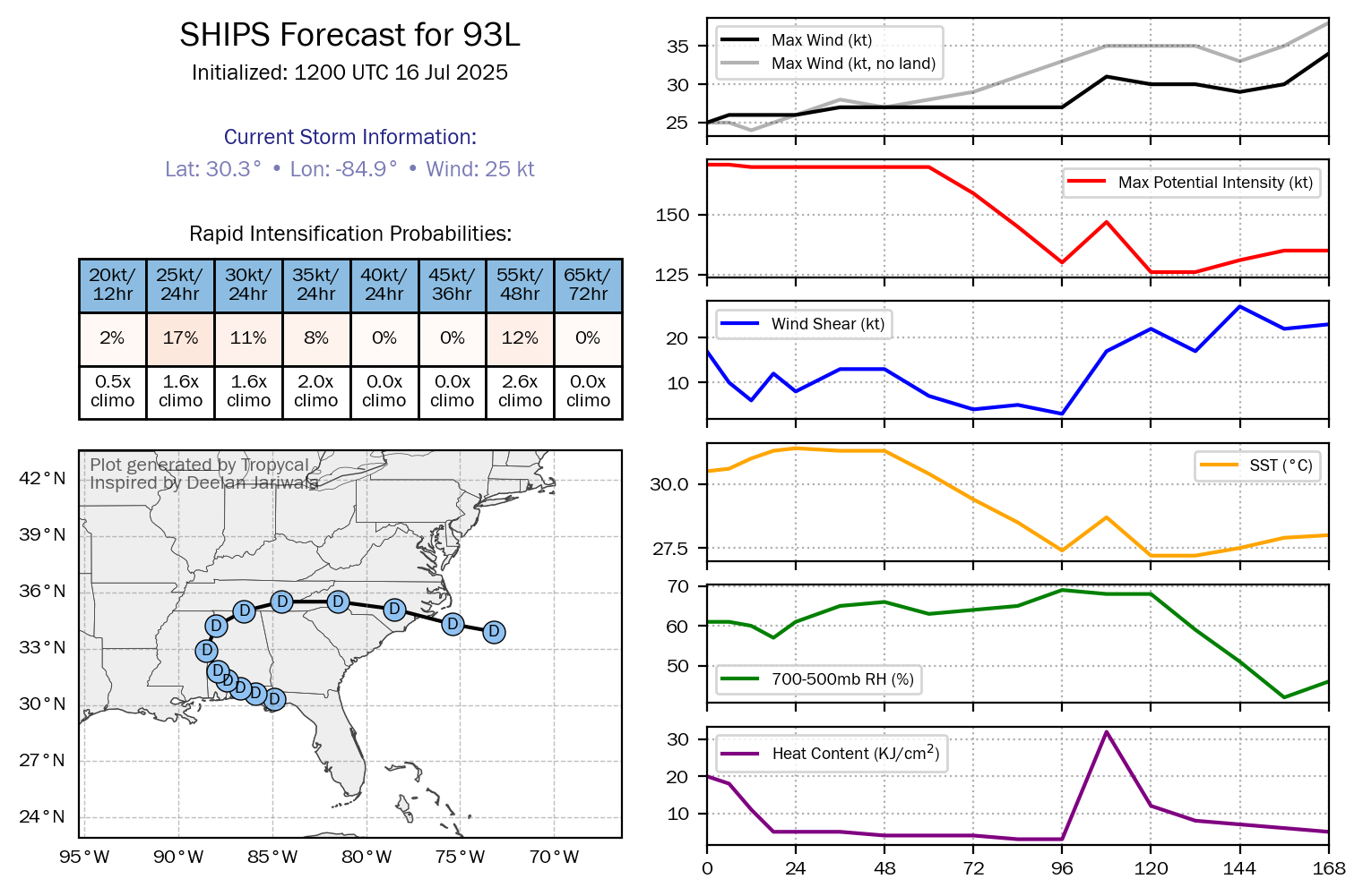
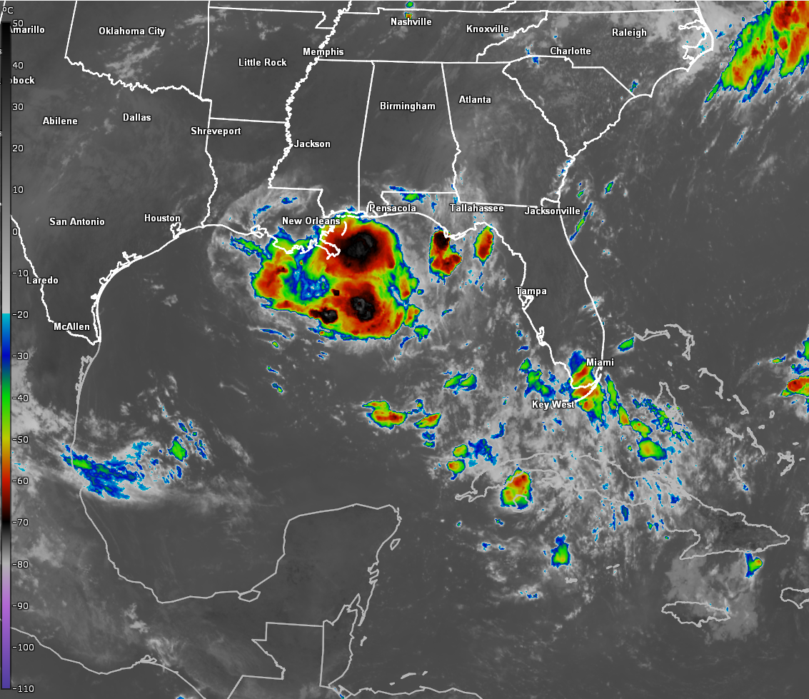
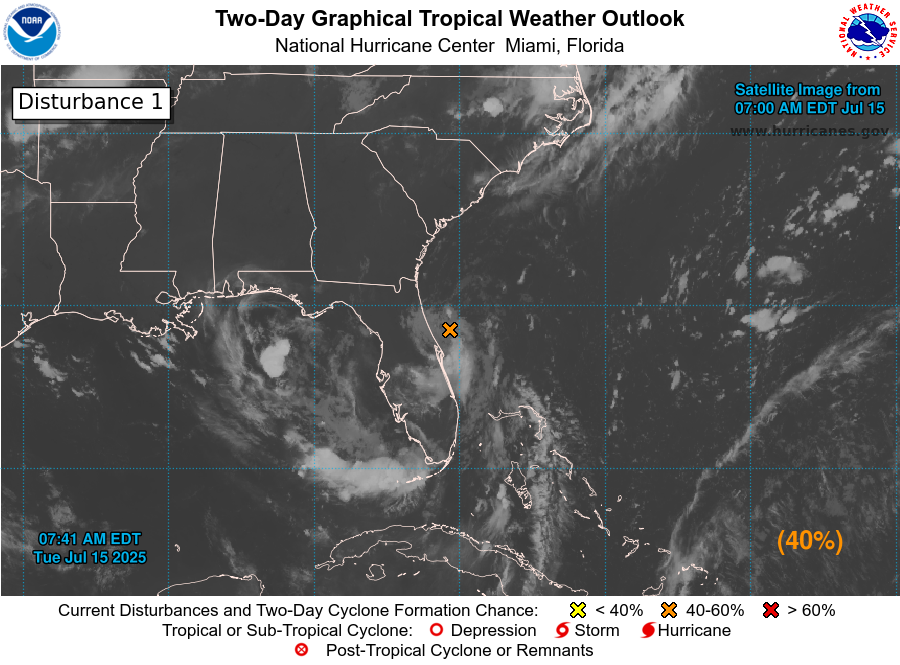
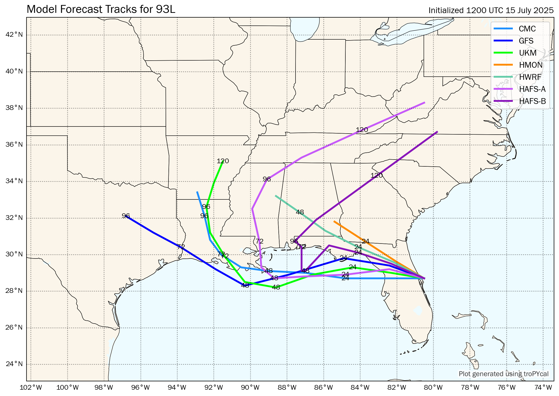
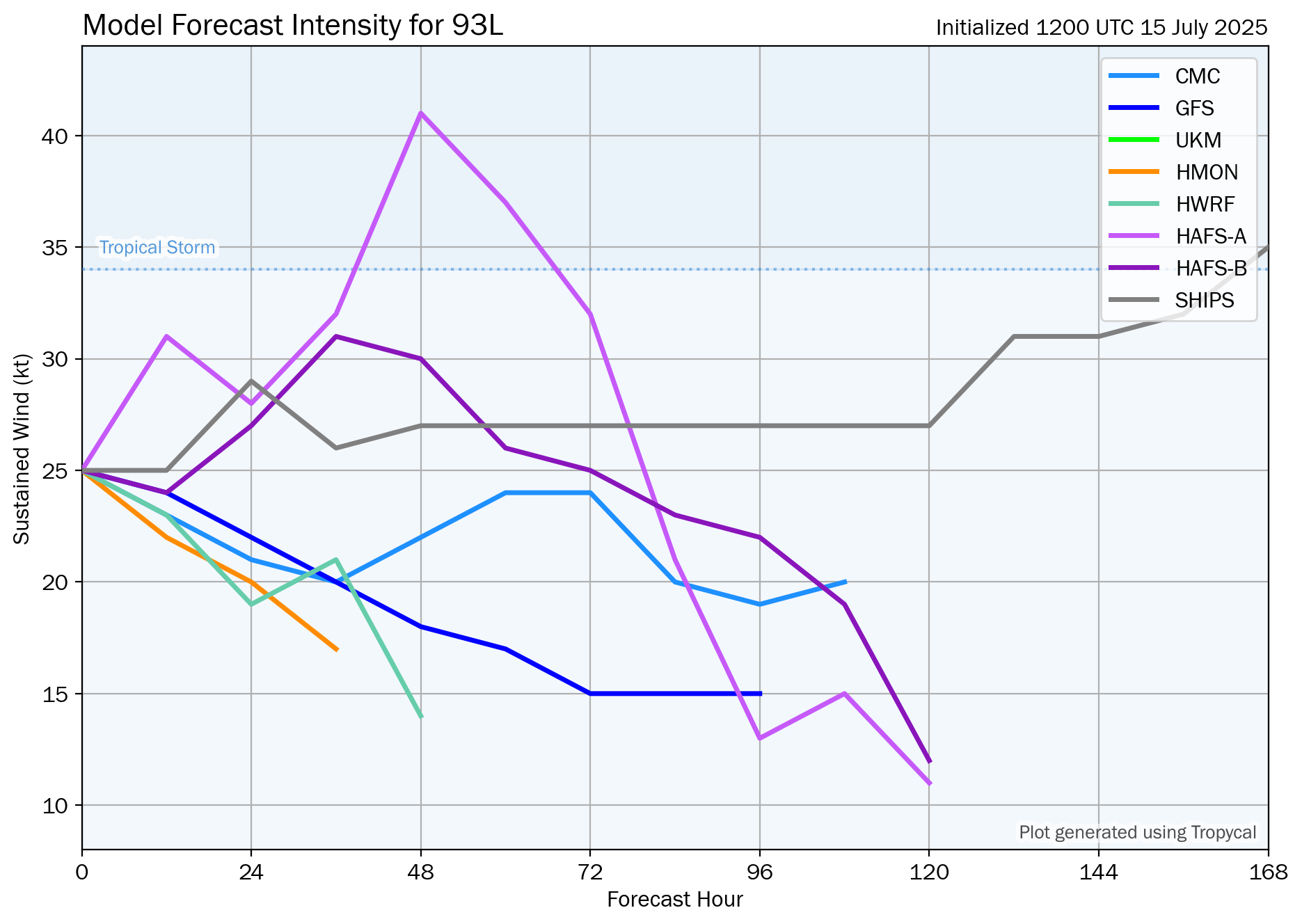
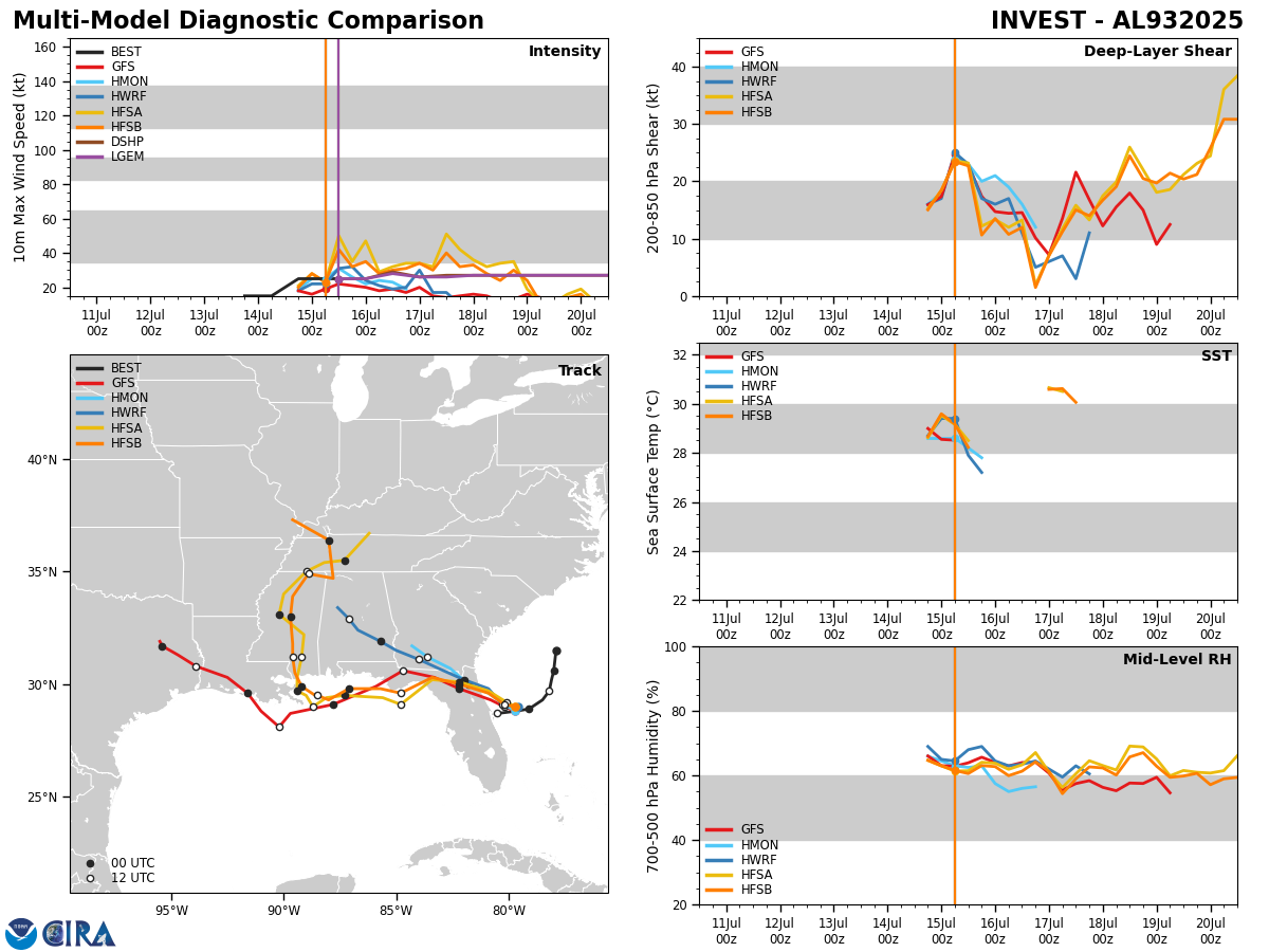
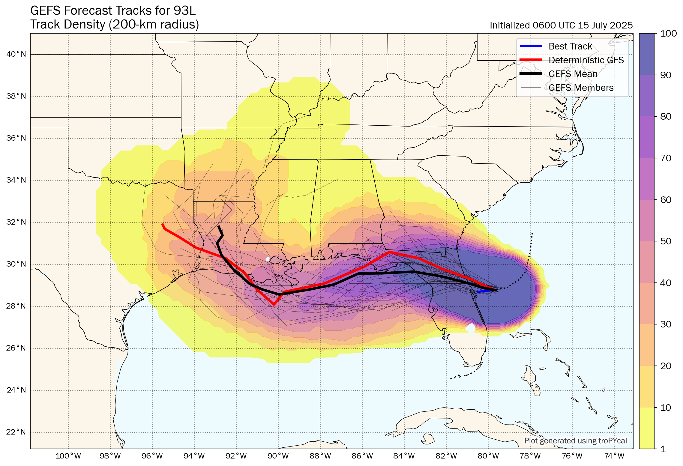
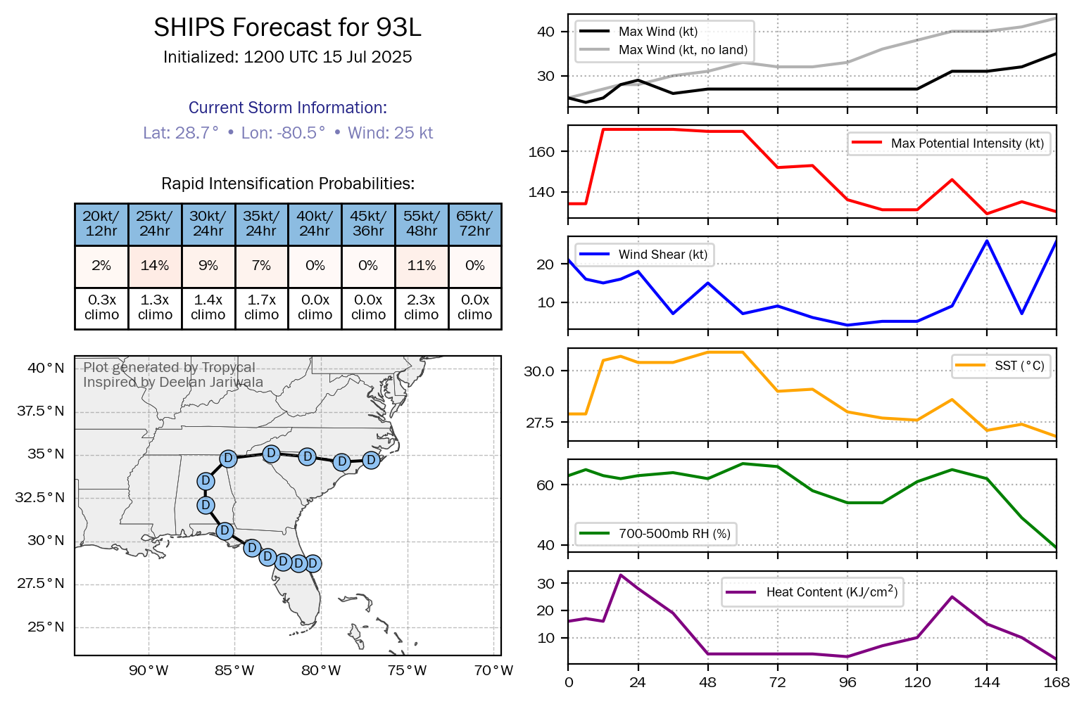
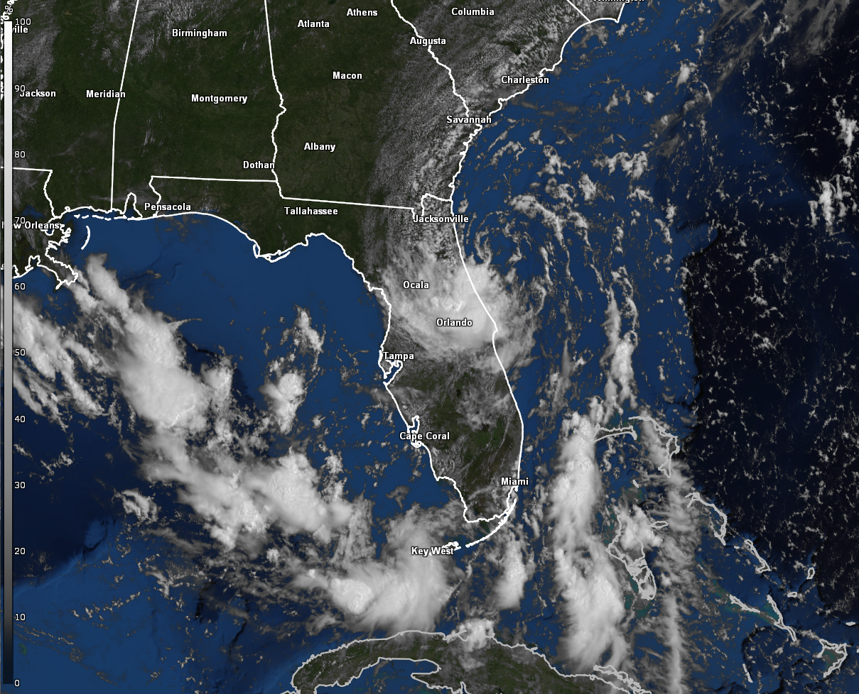
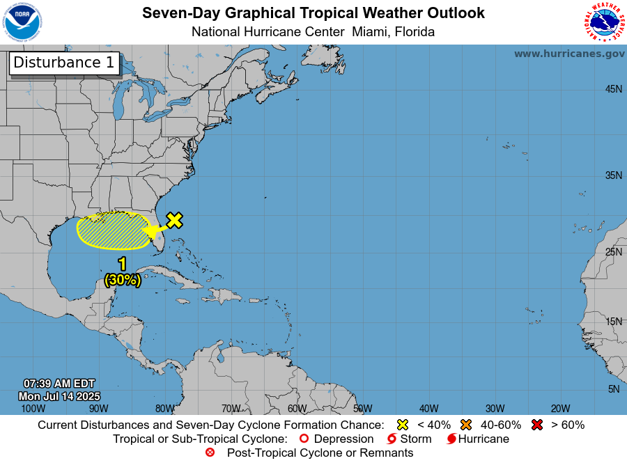
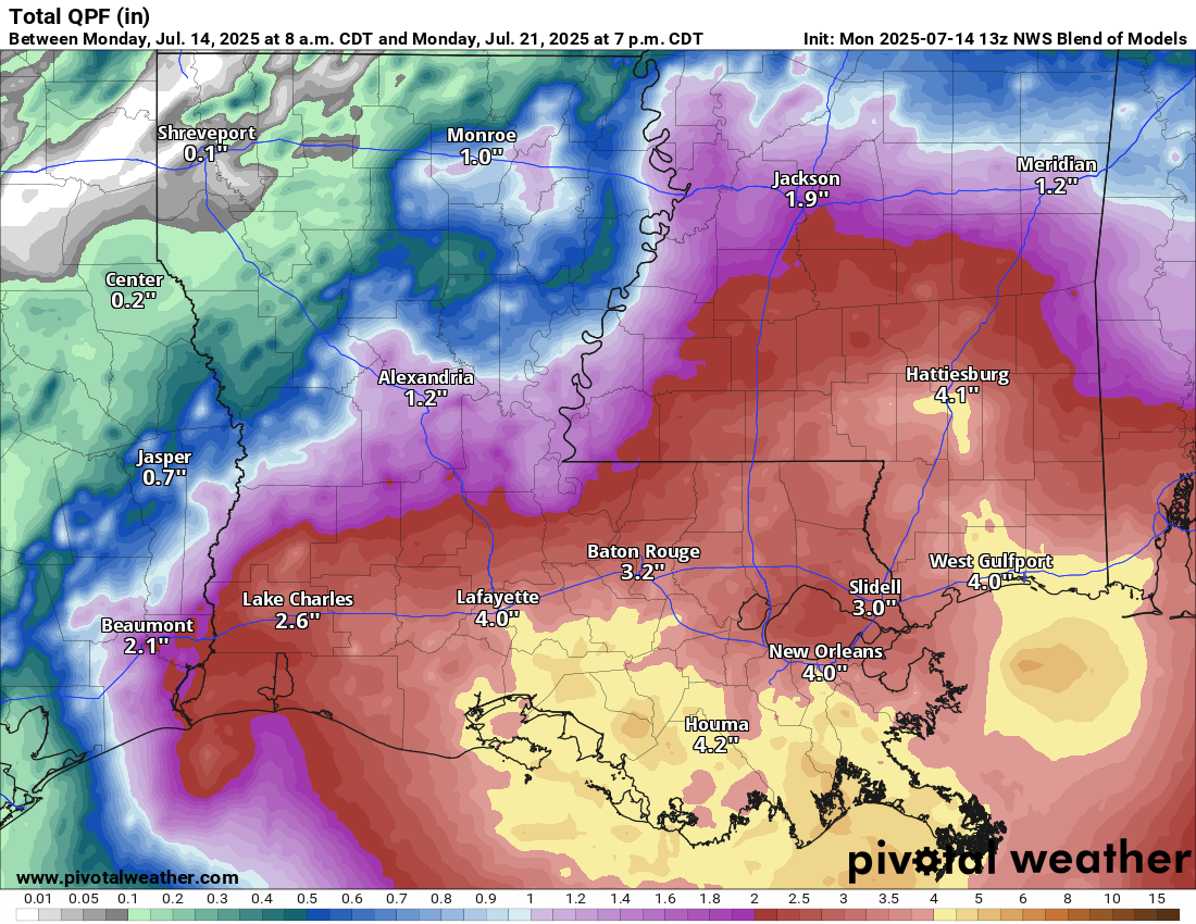
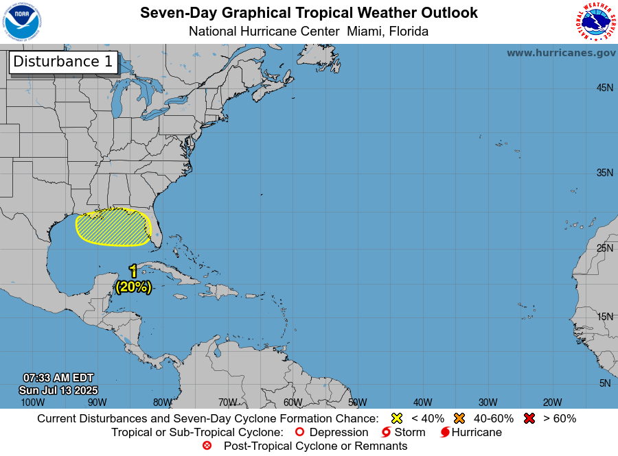
Area Of Low Pressure Over The Northern Gulf: Satellite imagery and analysis of weather data indicated that there is a disorganized area of low pressure located over the north-central Gulf. This low pressure system is producing some very disorganized areas of showers and thunderstorms from the north-central Gulf into the northeastern Gulf.
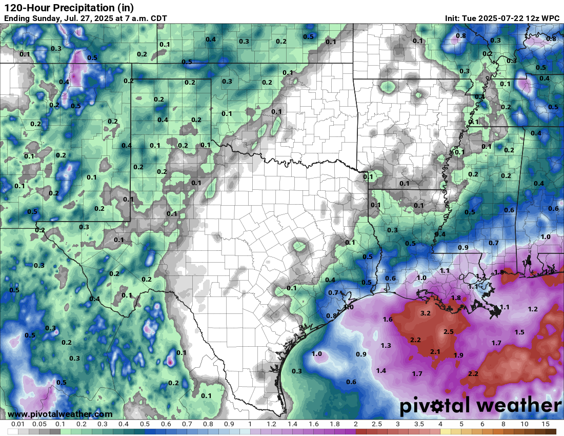
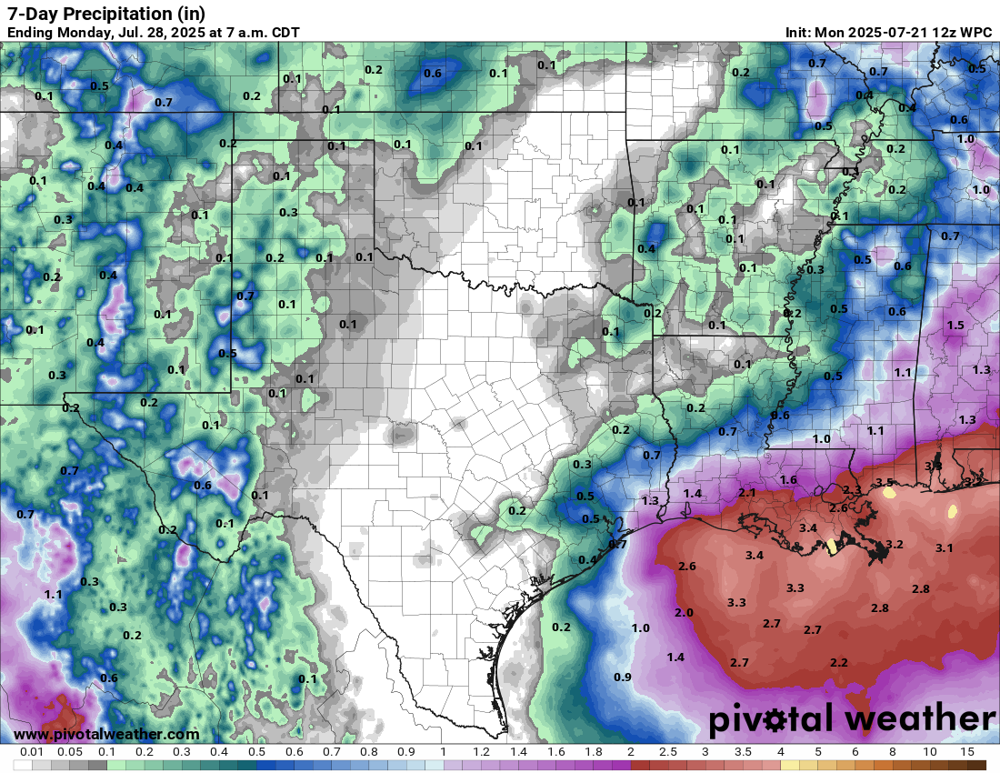
While the conditions are largely unfavorable for development due to strong wind shear and land interaction, it’s possible that this low pressure system may find itself in a slightly more favorable environment on Friday when it’s approaching the upper Texas coast. If that does occur, then we may see some increase in organization of the low pressure system before it moves inland into the upper Texas coast later Friday night and Saturday morning.
All-in-all though, the chances for development are nearly nil.
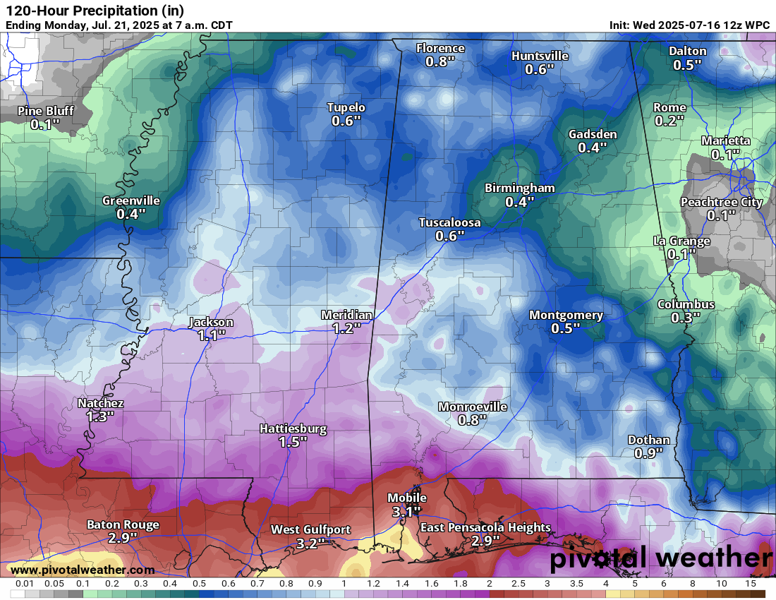
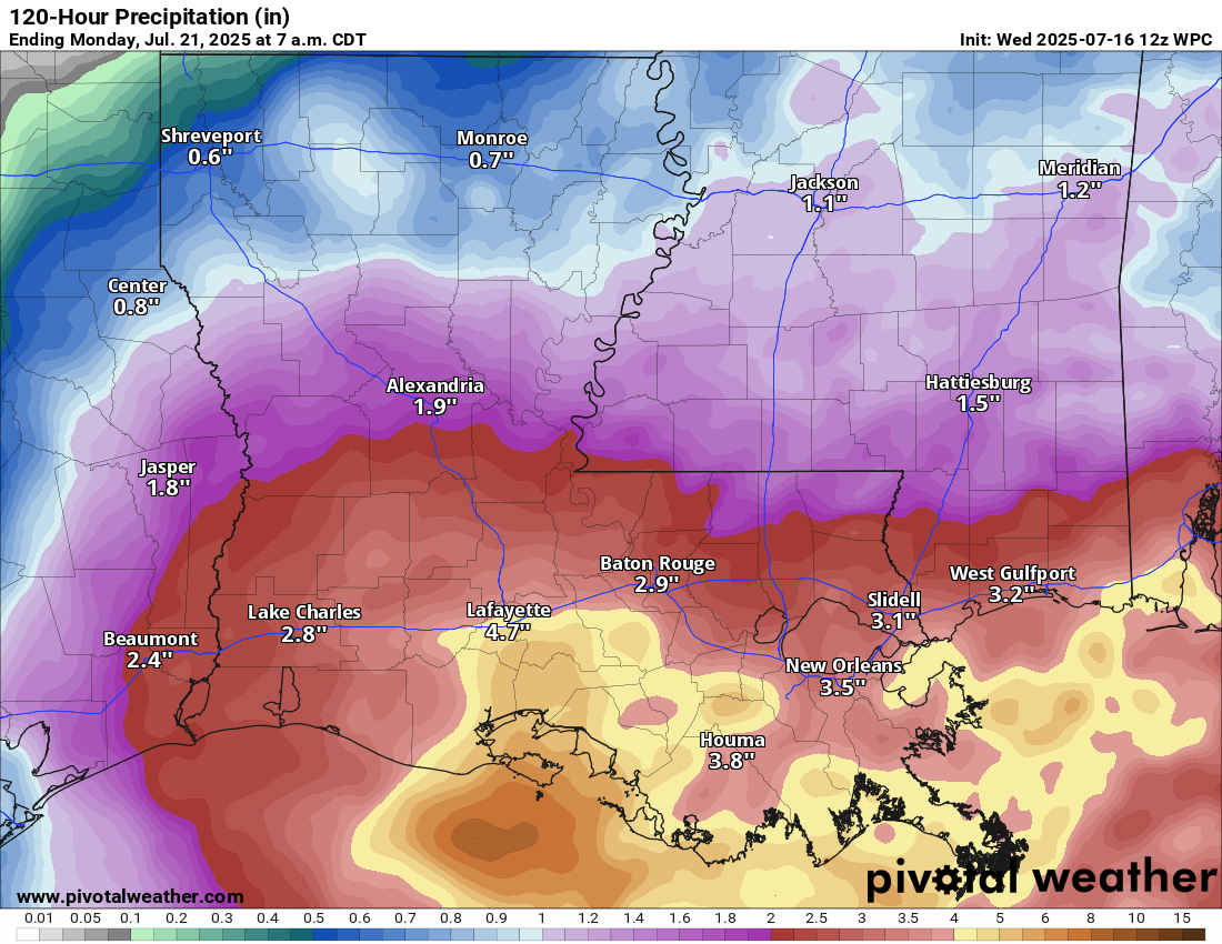
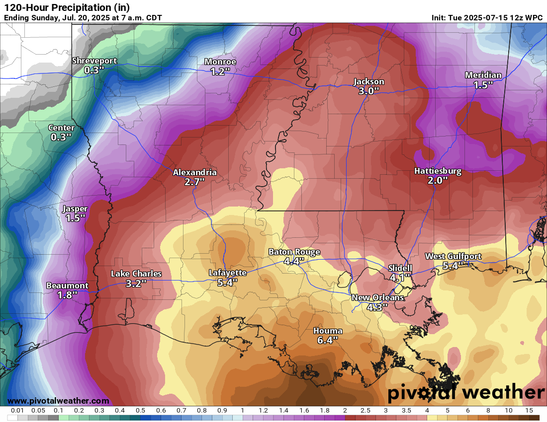
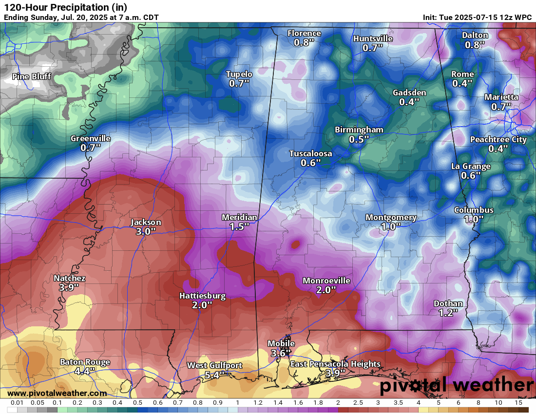
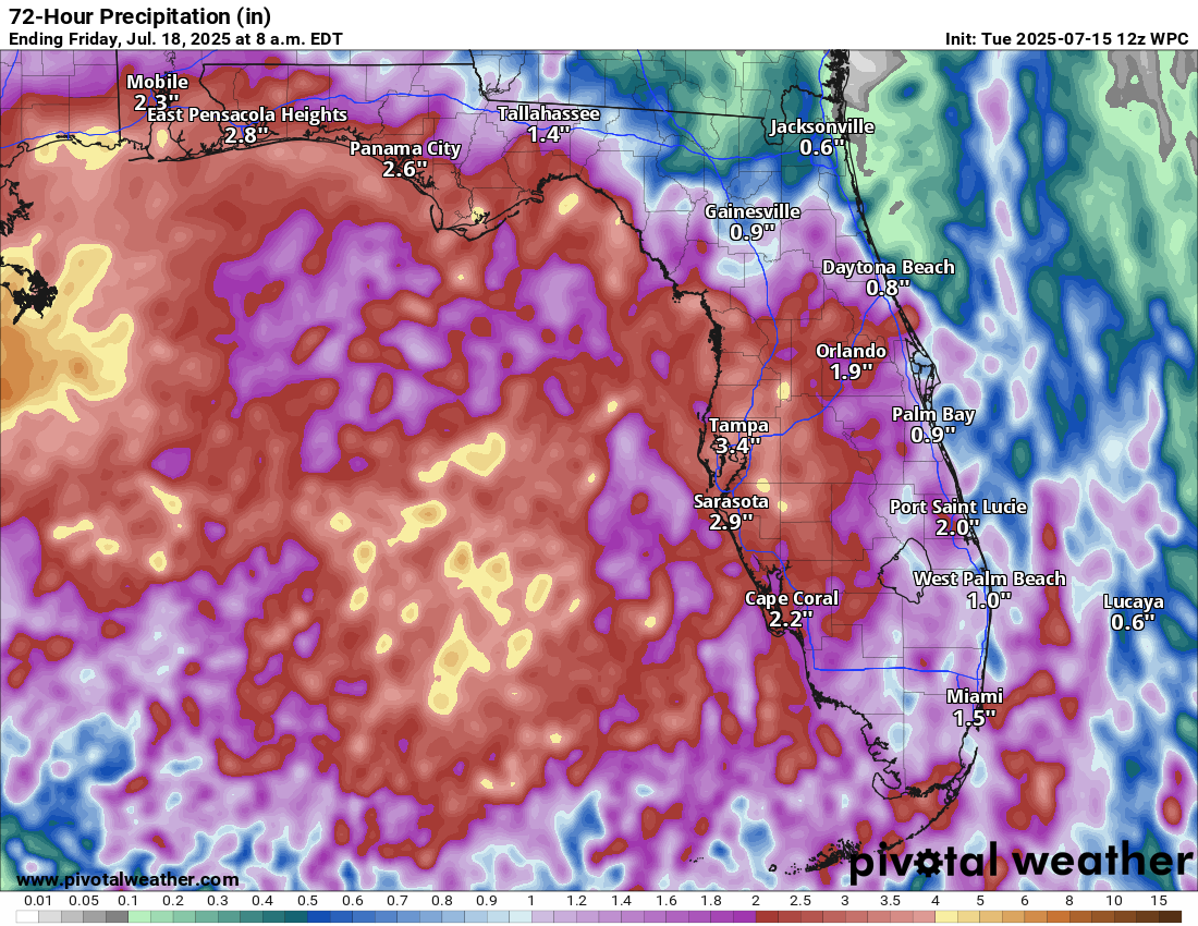
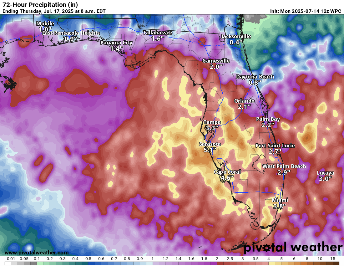
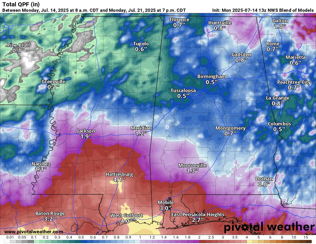
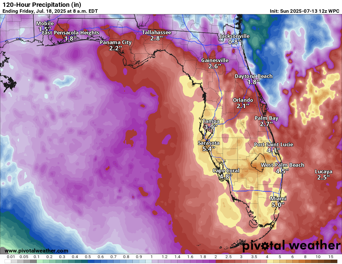
What this low pressure system will do is produce periods of heavy rainfall across much of the northern and northeastern Gulf coast throughout today that lasts into part of Friday. This locally heavy rainfall will then affect the upper Texas coast during Friday and Saturday.
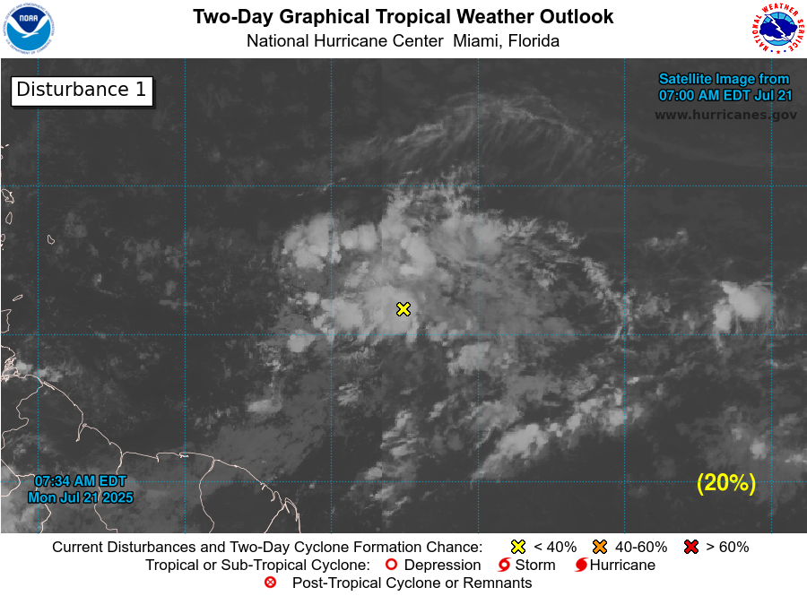
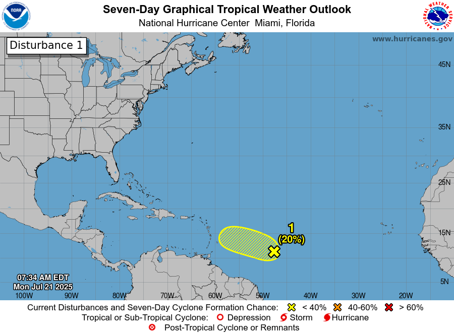
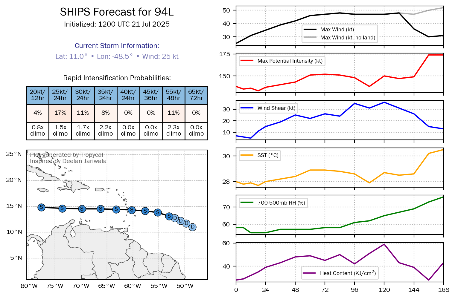
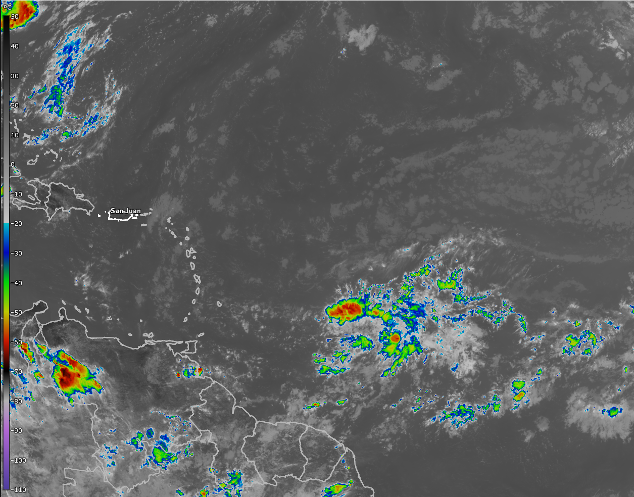
Tropical Wave Activity Across The Central & Eastern Tropical Atlantic: Robust tropical wave activity continues across the central and eastern Tropical Atlantic with a new wave pushing off of the coast of Africa every 2-4 days or so.
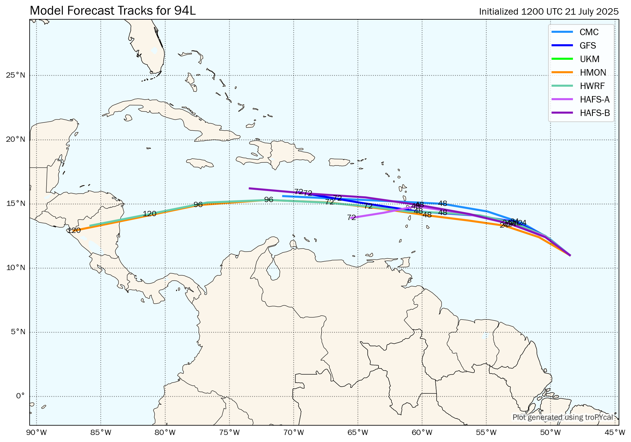
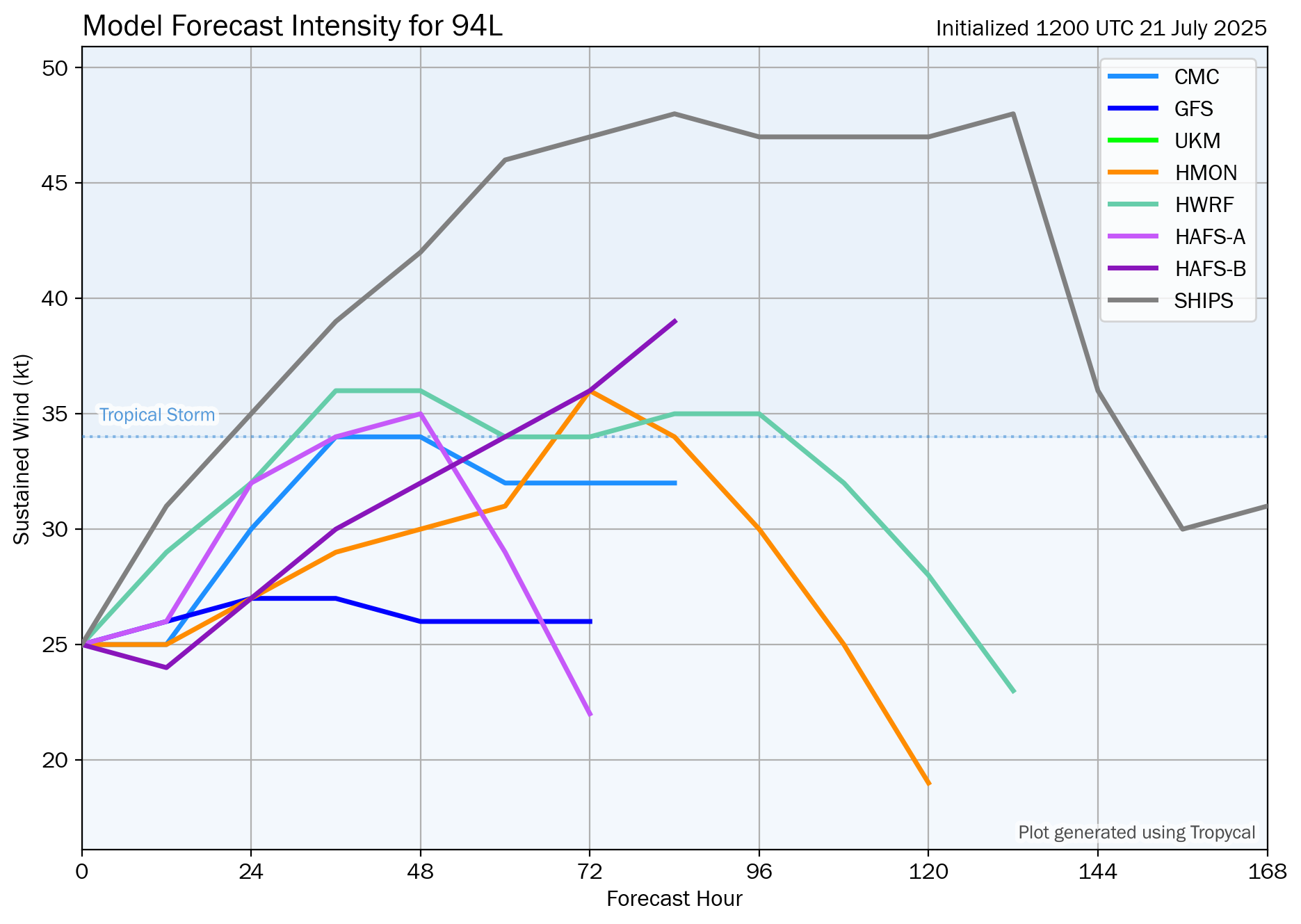
One tropical wave now located over the eastern Tropical Atlantic near 35 West Longitude is producing some very limited thunderstorm activity. That said, this wave is producing some decent low and mid-level spin, even though it’s somewhat elongated. Also, analysis of wind shear values indicates that the conditions are favorable for development. Because of this, some slight development of this wave is quite possible as it heads westward reaching the Lesser Antilles early next week. Overall though, I’m not expecting any sort of robust development from this particular wave, but it will bring a round of squally weather to the Lesser Antilles early next week.
The model guidance is more interested in forecasting development of a tropical wave that’s still located over west-central Africa. This wave is expected to push off of the coast of Africa into the far eastern Tropical Atlantic late this weekend and early next week. While the GFS ensemble model guidance isn’t very interested in forecasting development of this wave, the European ensemble model guidance is fairly aggressive in forecasting development. In fact, the European ensemble model guidance shows at least a 50 percent chance for tropical development in the east-central Tropical Atlantic during the first half of next week. Guidance like the European ensemble model then shows weakening of this wave as it approaches the Lesser Antilles late next week and next week. That said, it does indicate the wave to remain very robust right into the Lesser Antilles.
I also wanted to mention that the Google Deep Mind AI model is showing the wave that we’ll be watching next week to potentially develop in the southwestern North Atlantic during the week of August 4. This has support of the longer range European ensemble model guidance as it shows development chances to increase just offshore of the Carolina and Georgia coastline during the early part of the week of August 4.
All-in-all, I do think that the tropical wave that’s still over west-central Africa is a very strong candidate for tropical development next week as it heads westward across the eastern and central Tropical Atlantic. Those of you in the Lesser Antilles should keep an eye on the progress of this particular wave.
The next tropical weather discussion will be issued on Friday.