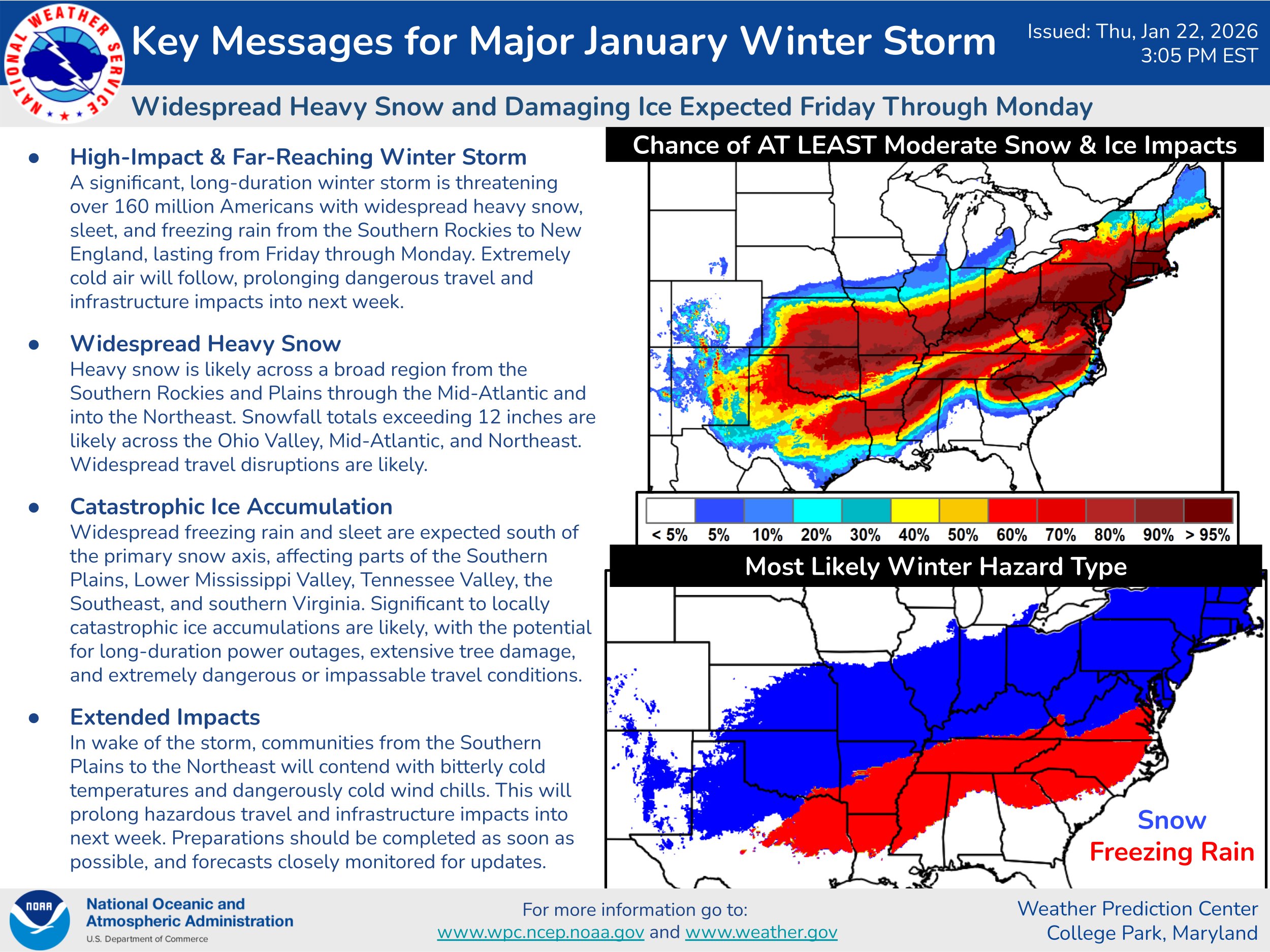
Before I get into the severe weather threat during the second half of this week, I need a HUGE favor from you. I’m really hoping you might be able to send any sort of support over my way. It would be appreciated more than you will ever know.
We are now OVER DRAFTED & have ZERO money in our checking account. This is because of the tremendous difficulty we continue to have to pay bills.
So, I am really, really hoping you can help us out using your credit card or you can use PayPal or Venmo to support our work. If you are a business or corporation and would like to invest in us, it would be immensely appreciated.
To help us out using your credit card or debit card, please go to the following link https://buy.stripe.com/8x2fZiaU4f4UcgO3Uxfw40c .
To help us out using PayPal, please go to the following link – https://www.paypal.com/paypalme/crownweather .
To help us out using Venmo, please go to the following link – https://account.venmo.com/u/crownweather (if Venmo asks you to verify payment, the last 4 digits of my phone number is 0009).
On behalf of Crown Weather Services, I would like to extend my heartfelt thank you for all of your support. It is appreciated more than you will ever know.
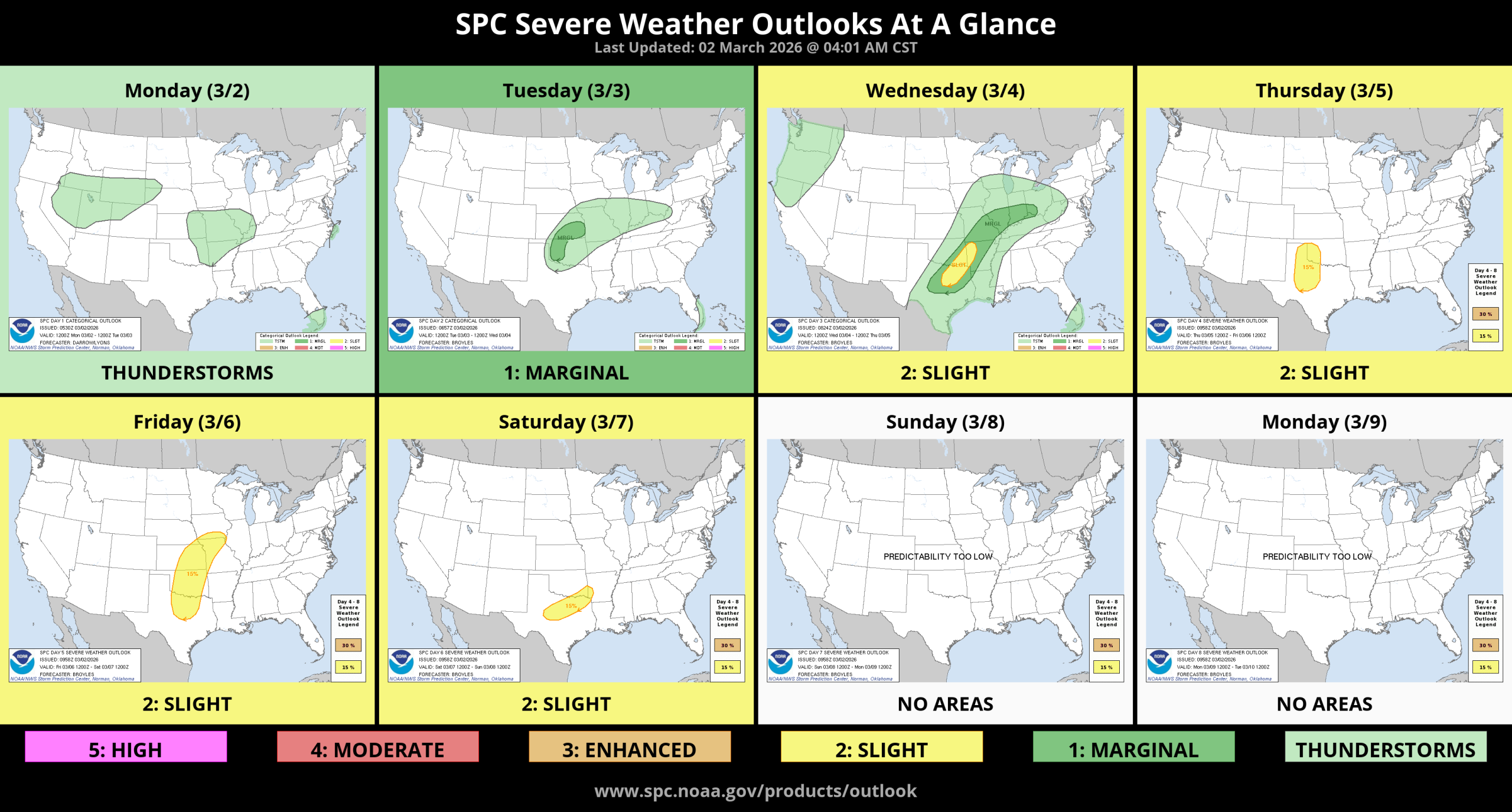
Now, for the latest discussion on the increase in severe weather chances:
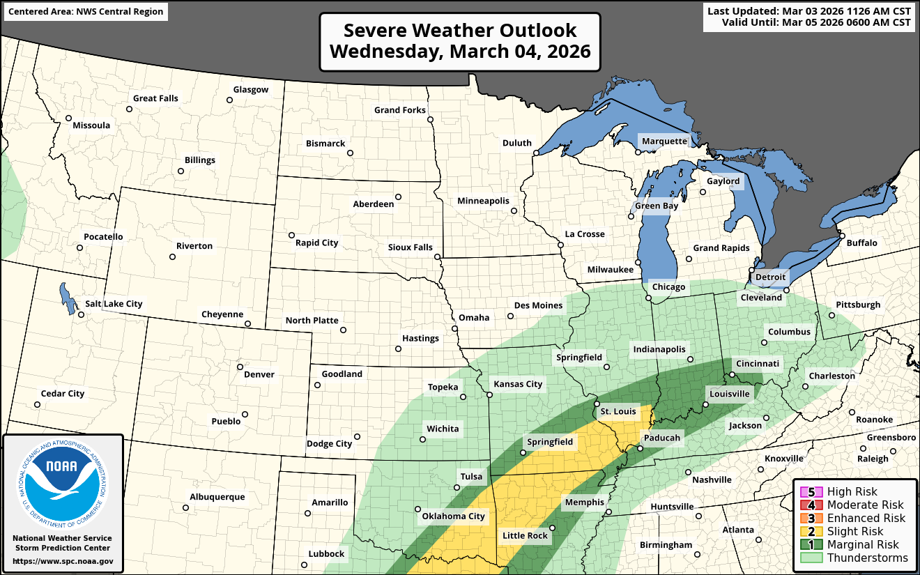
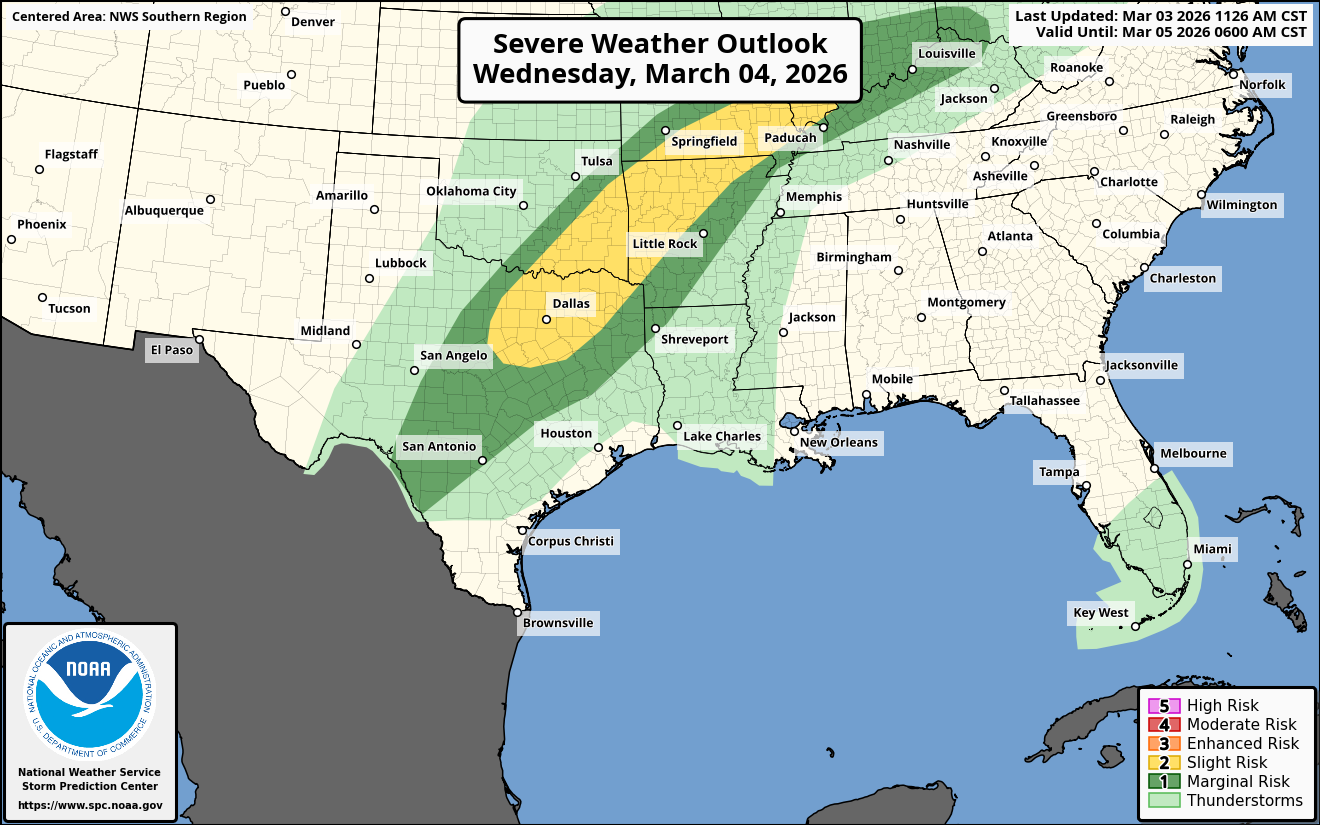
As I mentioned yesterday, the severe weather threat will be on the increase during the second half of this week. A majority of the severe weather from Wednesday and beyond will be centered across the southern and even central Plains states.
Wednesday – Some severe weather is expected during Wednesday afternoon and Wednesday evening across north-central and northeast Texas, southeast Oklahoma and western Arkansas. Hail and damaging winds will be the main threat.
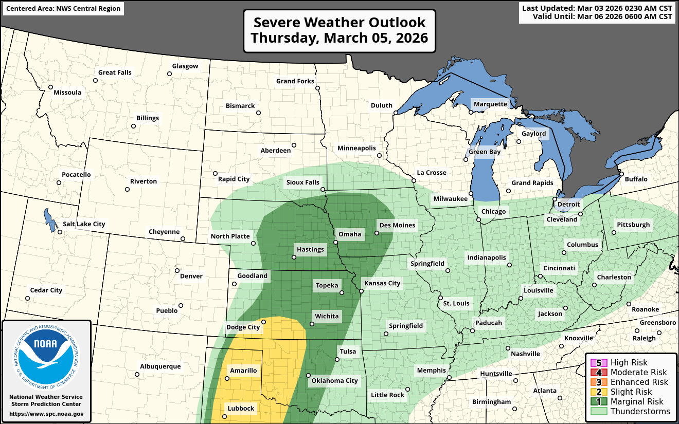
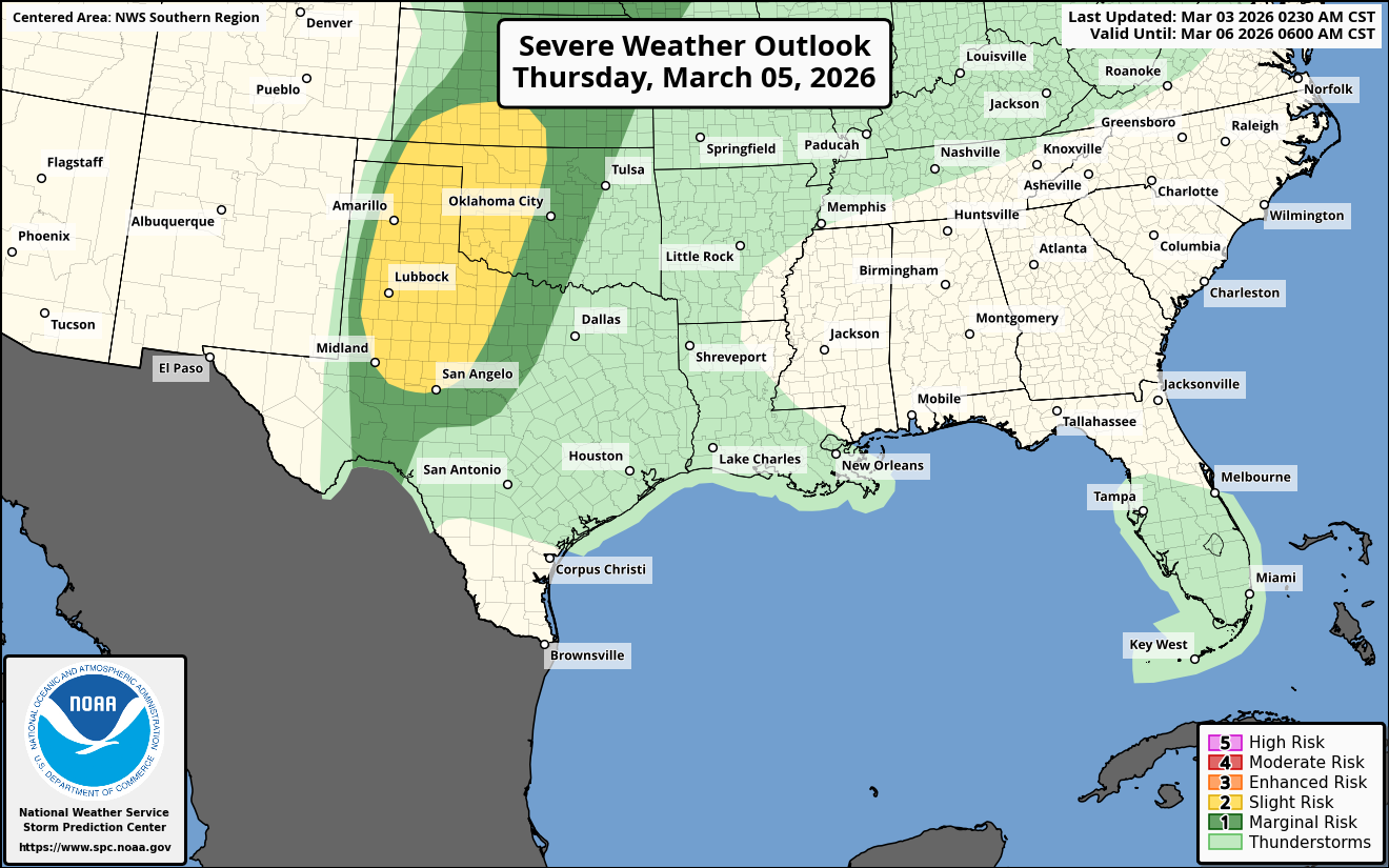
Thursday – An upper level weather disturbance is expected to eject eastward from the southwestern United States during Thursday. Unstable air out ahead of this weather disturbance will lead to an environment that’s favorable for severe weather across the western parts of the southern Plains states.
Severe storms with a risk of damaging winds, hail and a couple of tornadoes are possible Thursday afternoon and Thursday evening across the Texas and Oklahoma Panhandles, northwest Texas, western Oklahoma and southwest Kansas.
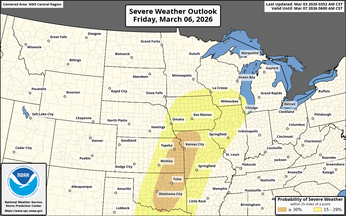
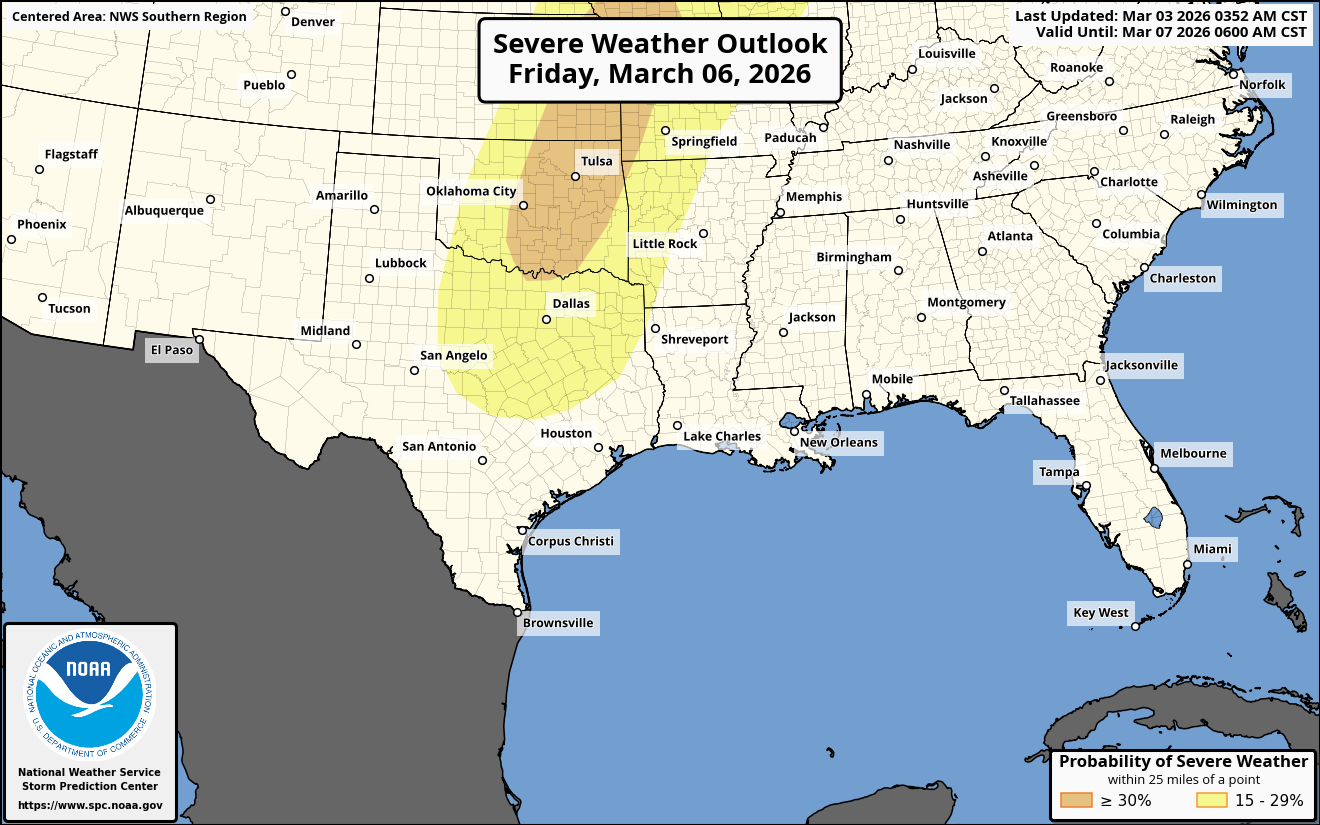
Friday – Friday has the potential to be a significant severe day across the central and southern Plains states. A strong upper-level weather disturbance is expected to push northeastward into the central High Plains states during the day on Friday. Out ahead of this weather disturbance, the atmosphere will be humid and unstable across much of the central and southern Plains states.
This means that severe storms that could produce tornadoes, hail and damaging winds will be a threat across north Texas, much of central and eastern Oklahoma, western Arkansas, central and eastern Kansas, much of Missouri, eastern Nebraska and much of Iowa.
Friday’s severe weather risk does need to be watched closely as it could be quite significant.
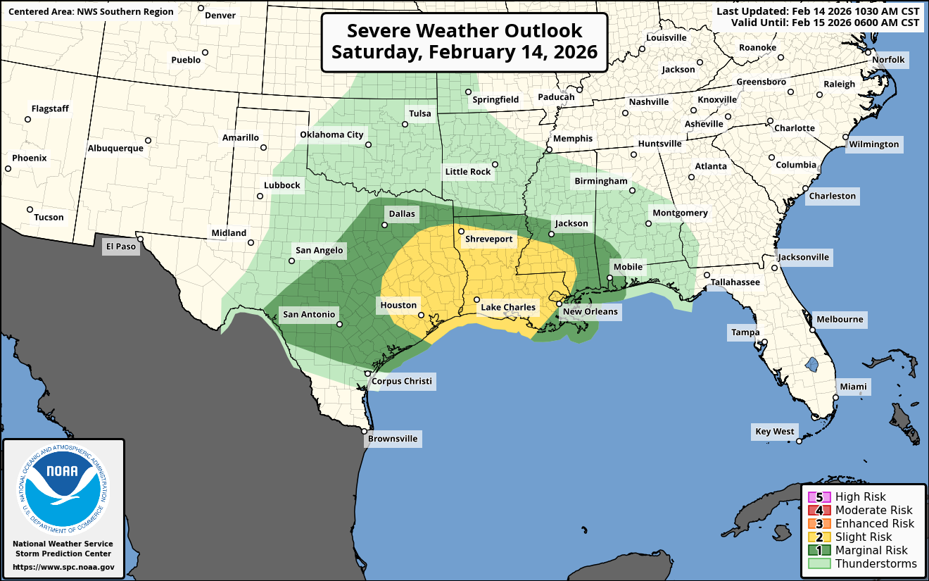
This Weekend – On Saturday, a cold front is expected to push southward into the area from the southern Plains states through the middle Mississippi Valley and the Ohio Valley.
To the south of this cold front, some isolated severe weather looks possible during Saturday afternoon and Saturday evening from the Ark-La-Tex northeastward to the Ohio Valley.
On Sunday, a stationary frontal boundary will be in place from the southern Plains through the Ozarks to the southern Appalachians. Some very isolated severe weather is possible during Sunday afternoon to the south of this front from the lower Mississippi Valley through the Deep South.
Early Next Week: The severe weather risk may really ramp up again by Tuesday as a new upper level disturbance is expected to move into the southern Plains by then. If this occurs, then a new round of significant severe weather could occur during Tuesday afternoon and Tuesday evening across the southern and central Plains states. Something to definitely watch.