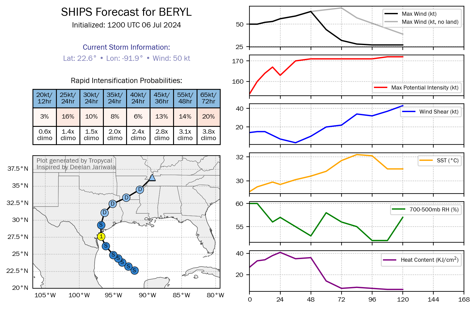
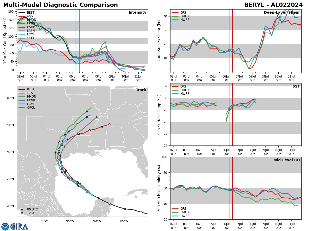
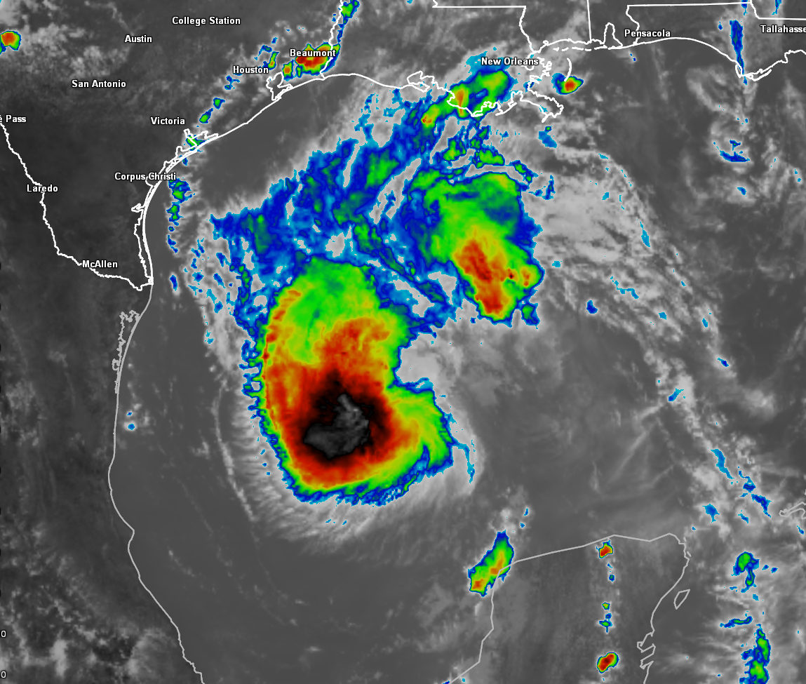
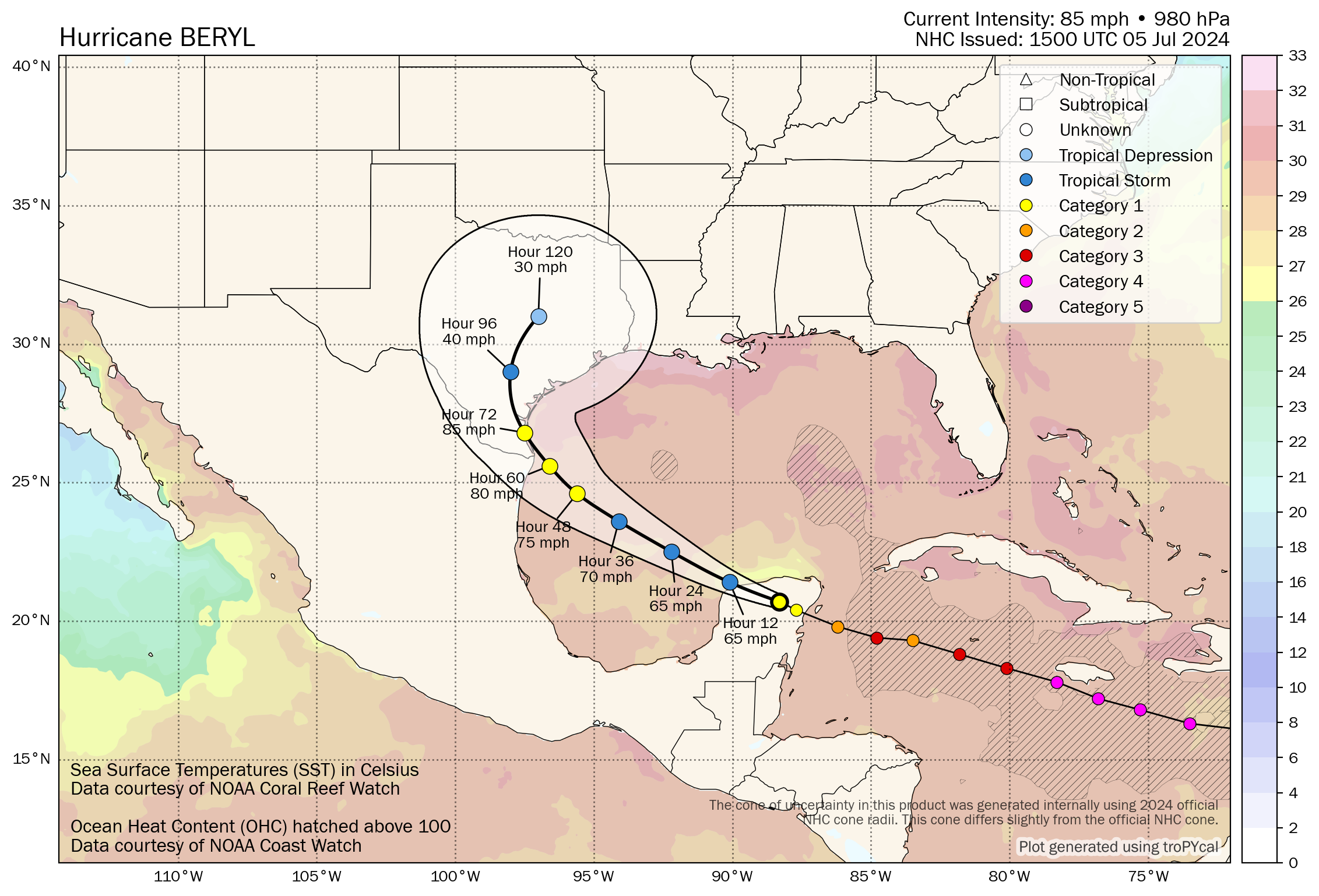
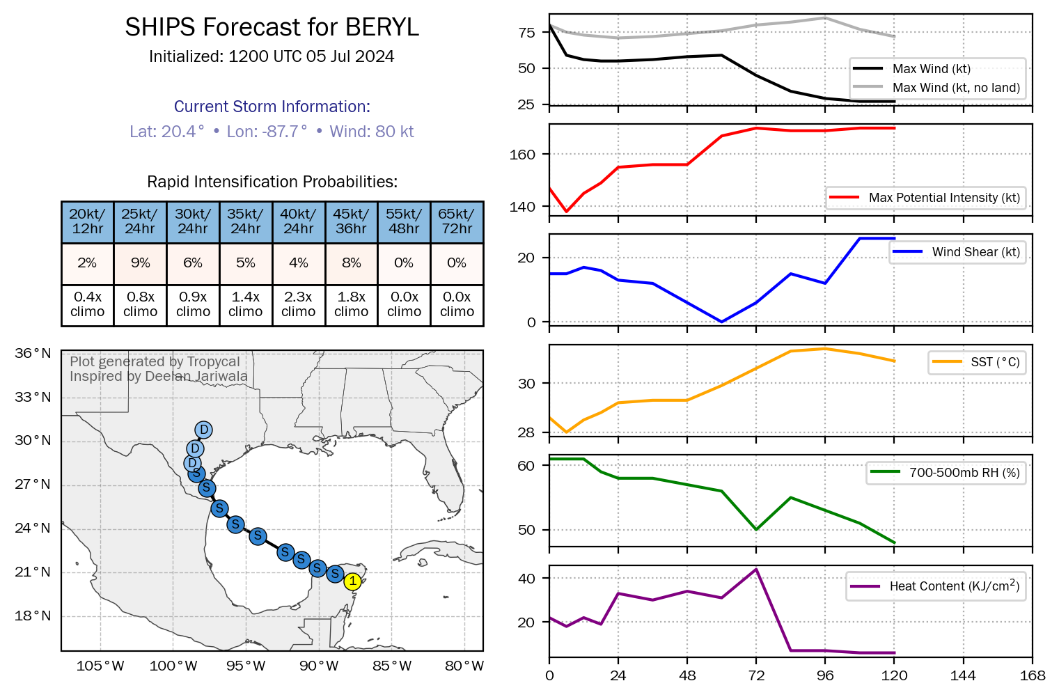
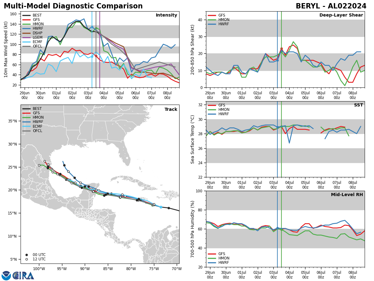
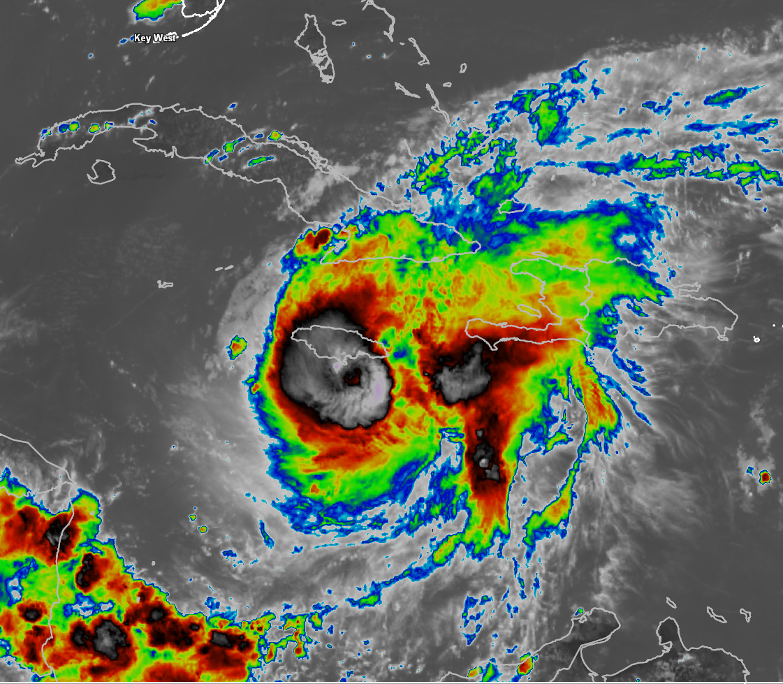
Tropical Storm Beryl: Overall, there aren’t a whole lot of changes to the forecast I sent out earlier today concerning Beryl. Satellite imagery at the time of this writing shows that the southern and eastern sides of the circulation of Beryl are nearly void of convection. Deep convection seems to be constantly trying to fire on the northern and western sides of Beryl. I think this disheveled look has to do with the 15 knots of wind shear which is likely pushing drier air into the circulation. As long as dry air is being pushed into Beryl by the wind shear, then we will likely not see any wholesale changes in terms of strengthening.
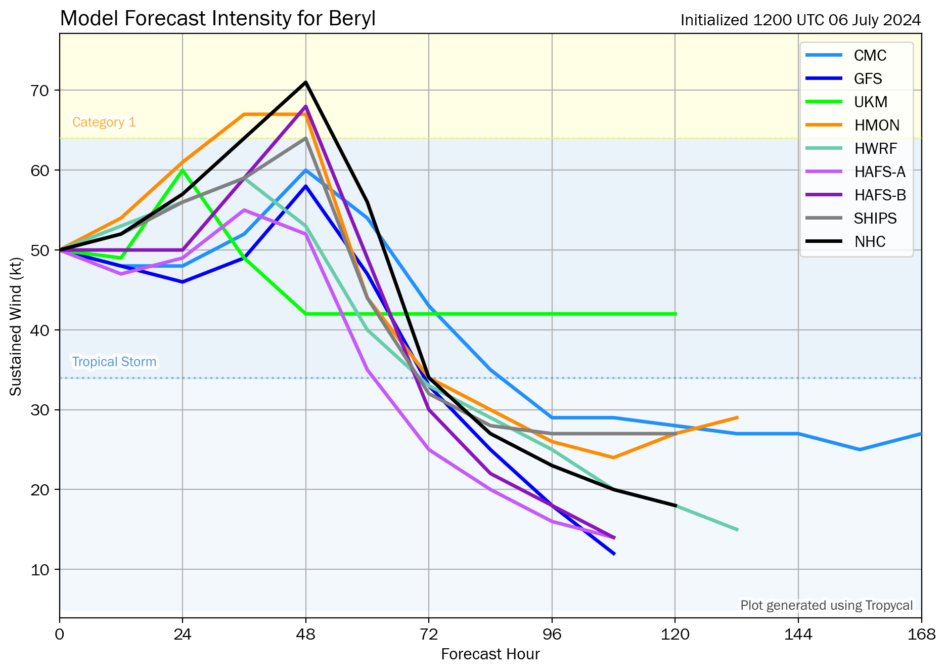
It is expected that the wind shear over Beryl will decrease to less than 10 knots by Sunday morning and may decrease further to less than 5 knots by Sunday afternoon and remain at 5 knots or less right into Sunday night. This light wind shear environment combined with the very warm waters of the Gulf will probably help to moisten up the atmosphere around Beryl leading to strengthening to commence during the day on Sunday. In fact, it still looks likely that a round of rapid strengthening could occur during Sunday night into the first part of Monday morning as Beryl approaches the Texas coast for a landfall near Matagorda Bay.
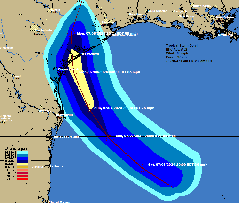
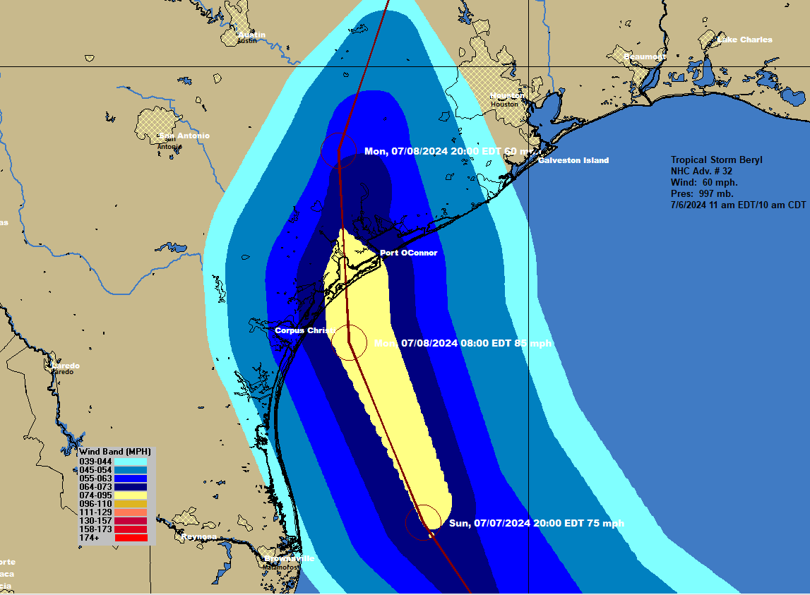
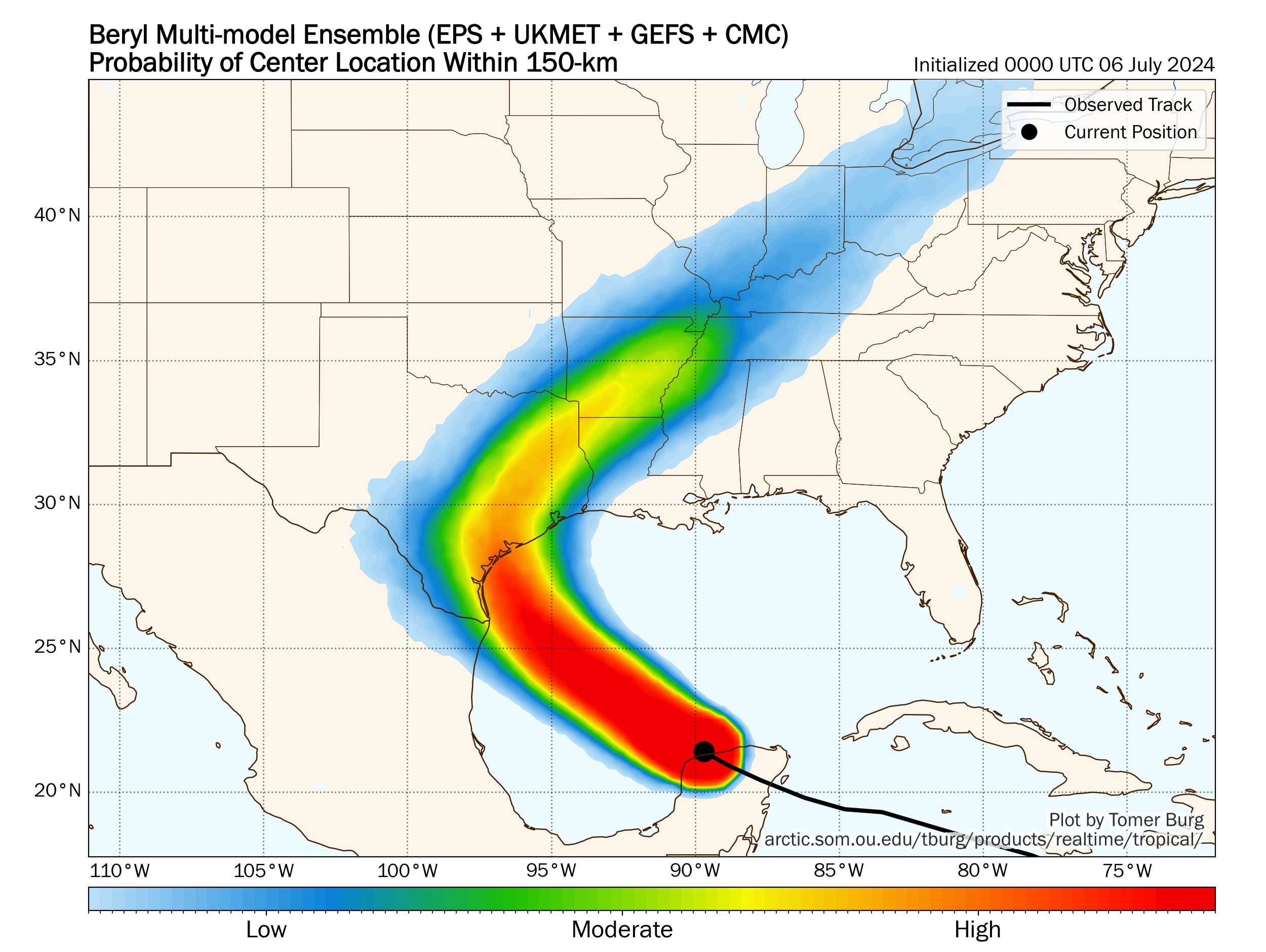
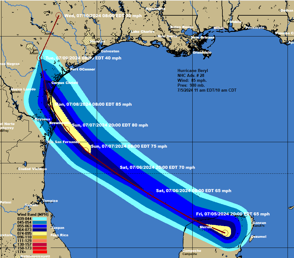
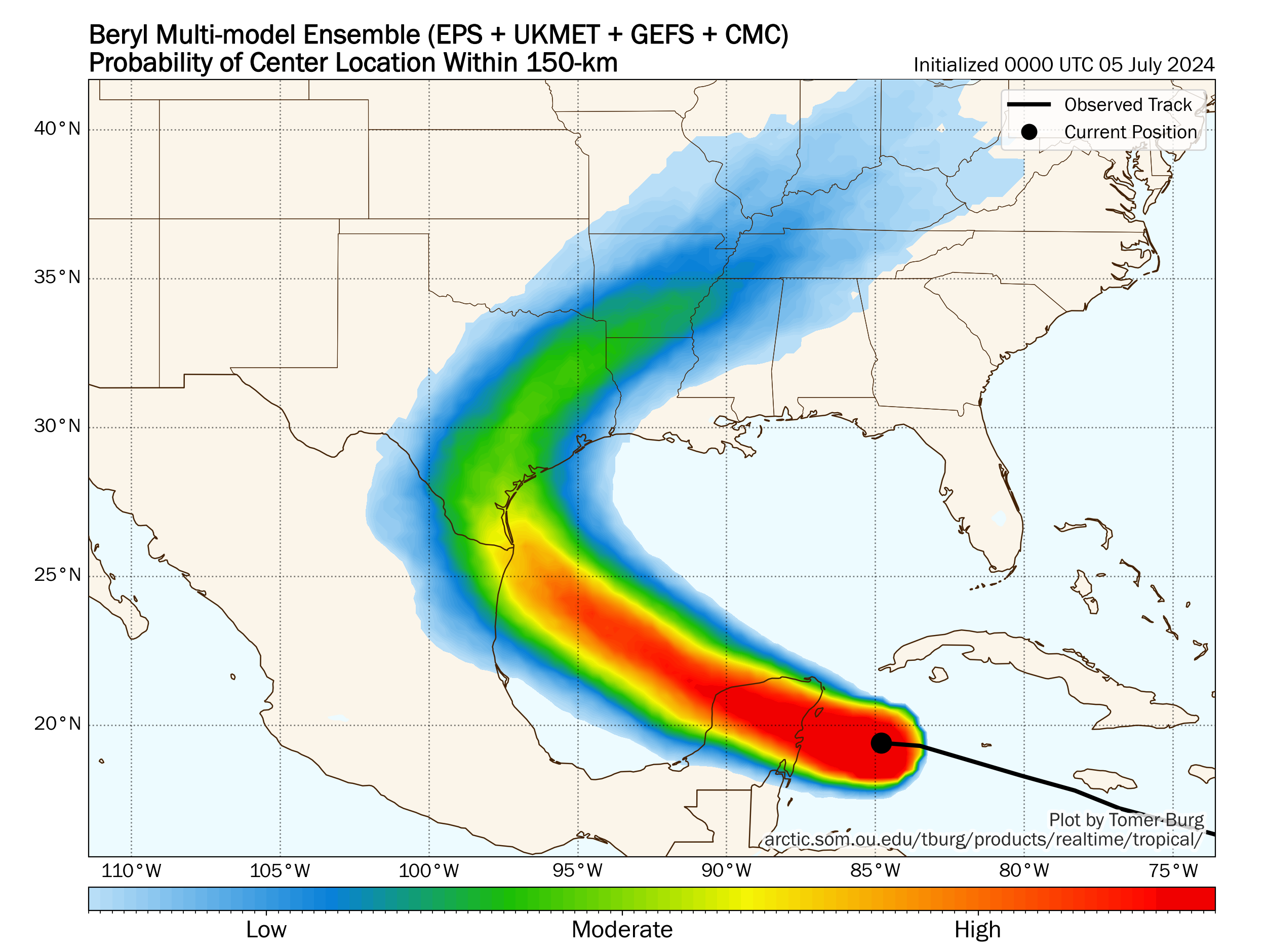
My Thinking As Of Saturday Night At 11:30 pm EDT/10:30 pm Is For Beryl to cross the Texas coast somewhere between Matagorda Island and Freeport as a Category 2 hurricane with about 100 mph maximum winds during Monday morning. This sort of track would lead to tropical storm conditions to occur across the entire Houston and Galveston areas and hurricane conditions to occur from Freeport and Sargent southwestward through Matagorda Bay and Matagorda Island.
As I already mentioned, I do think that Beryl could undergo a round of rapid strengthening during Sunday night into the first part of Monday morning as it’s making landfall. This will, obviously, make for a pretty nasty storm as strengthening storms at landfall can easily mix down the stronger winds from aloft right to the ground.
Here Are My Latest Expected Impacts From Beryl For Those Of You Along The Texas Coast:
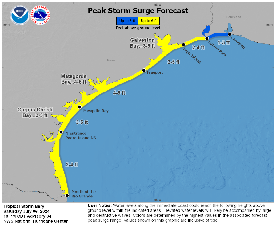
For Those Of You Along The Lower & Middle Texas Coast, Including Corpus Christi: Tropical storm force winds with the very real possibility of hurricane force winds can be expected during Sunday night into much of the day on Monday. The worst part of the storm looks to be from about sunrise Monday morning until about midday Monday. In addition, a storm surge of up to 3 to 5 feet above ground level can be expected as well as rain totals of 3 to 6 inches during Sunday night and Monday.
My recommendation is that you should have your hurricane preparations done by sunset Sunday. Also, follow all guidance and evacuation orders from local officials.
For Those Of You In Matagorda Bay, Including Port Lavaca & Port O’Connor: Hurricane conditions with the potential for wind gusts of well over 100 mph can be expected during the worst part of the storm, which looks to be from sunrise Monday morning until about midday Monday. Before that though, tropical storm force winds are likely to overspread Matagorda Bay during Sunday evening with worsening weather conditions expected throughout the late night hours of Sunday night through sunrise Monday morning.
In addition to this, a storm surge of 3 to 5 feet above ground level and rain totals of 8 to 12 inches can be expected during Sunday night and Monday.
All hurricane preparations need to be done by sunset Sunday. Also, follow all guidance and evacuation orders from local officials.
For Those Of You In Galveston & Houston: Tropical storm force winds are expected to overspread the Houston-Galvestion area during Sunday evening and then continue through the late night hours of Sunday night into much of the day on Monday. The worst part of this storm looks to be from about sunrise Monday morning until midday Monday when wind gusts of up to 70-75 mph can be expected.
In addition, a storm surge of 2 to 4 feet above ground level and rain totals of 4 to 8 inches can be expected during late Sunday night and all day Monday.
The Houston-Galveston area will be on the very dirty side of this storm with very poor weather conditions expected throughout Sunday night and Monday.
My recommendation is that you should be prepared for some very gusty winds during the day on Monday, along with flood issues from the heavy rain and the storm surge. Follow all guidance and any evacuation orders from local officials.
For The Upper Texas Coast & Southwestern Louisiana, Including Port Arthur, Beaumont and Lake Charles: This looks to be mainly a rain event for the upper Texas coast and across southwestern Louisiana. This rain looks to occur throughout the day on Monday with rain totals of 3 to 5 inches expected.
Elsewhere, Beryl will probably also bring heavy rain and flash flood concerns all the way up into areas of North & Northeast Texas that are east of I-35 and east of Dallas during Monday into Tuesday.


Another update on Beryl will be posted sometime between late morning Sunday and early afternoon Sunday.