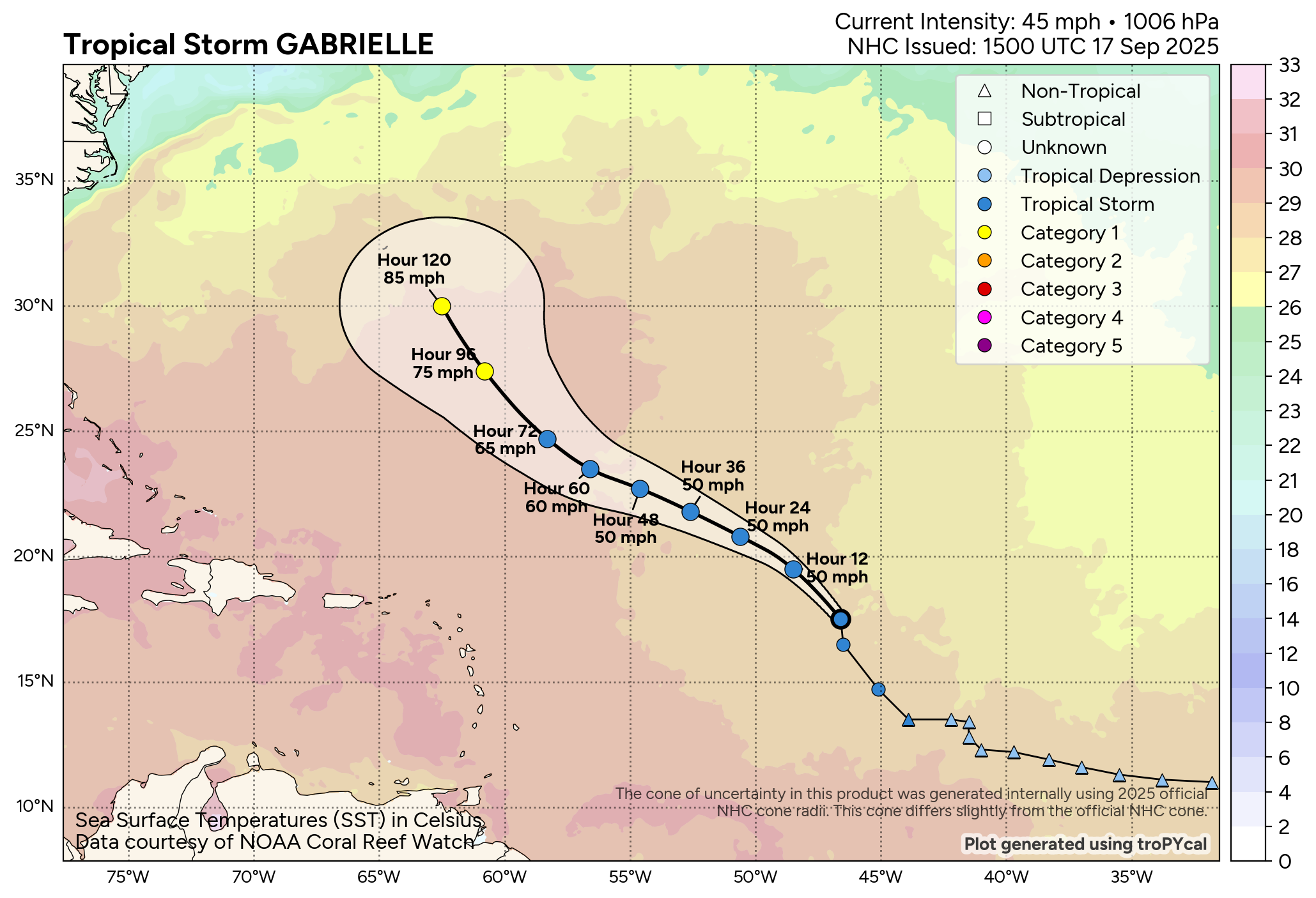
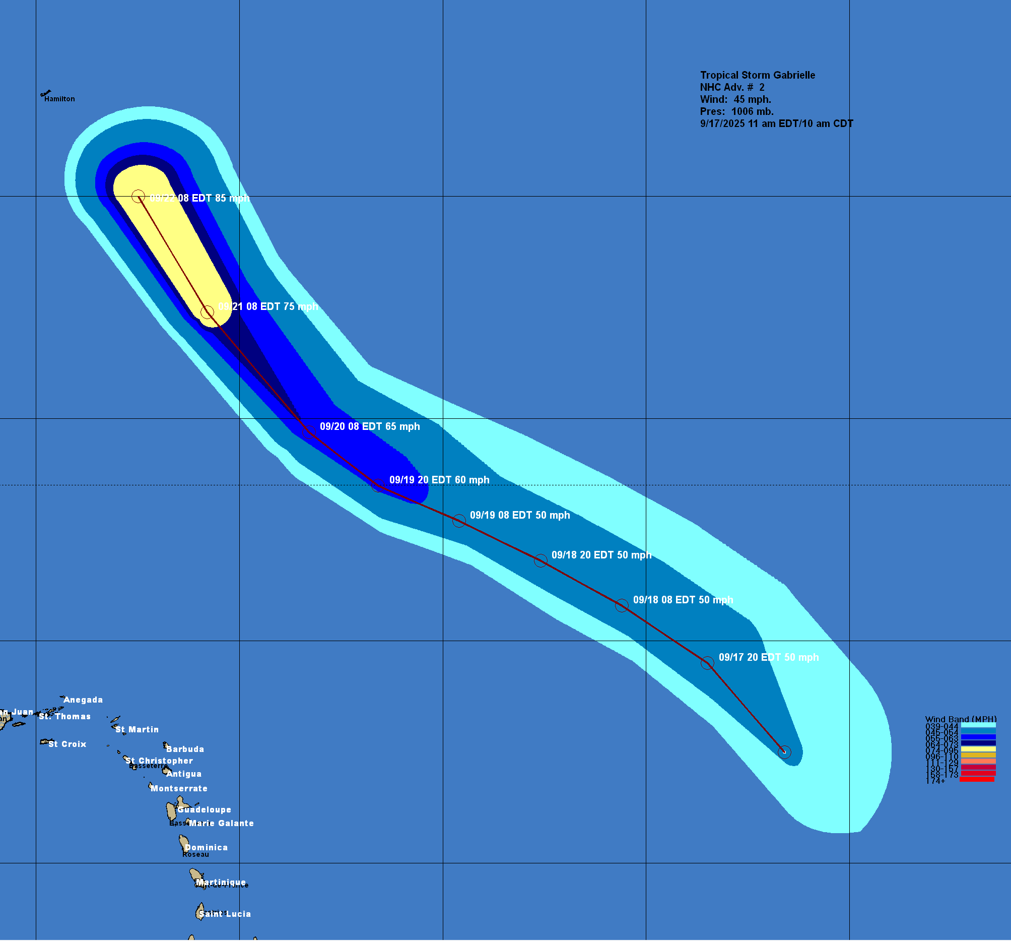
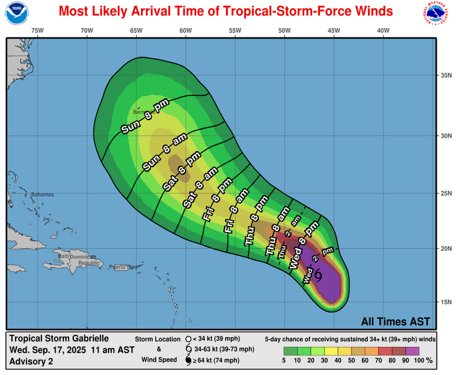
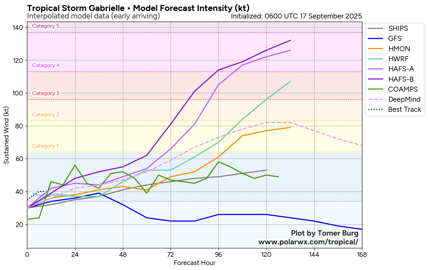
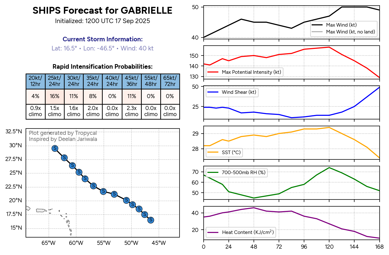
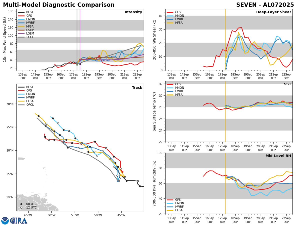
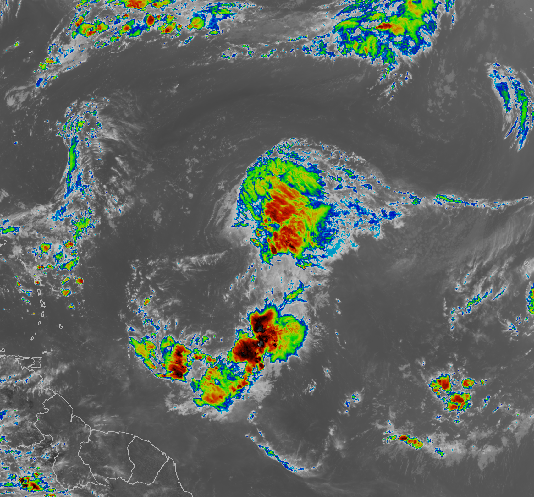
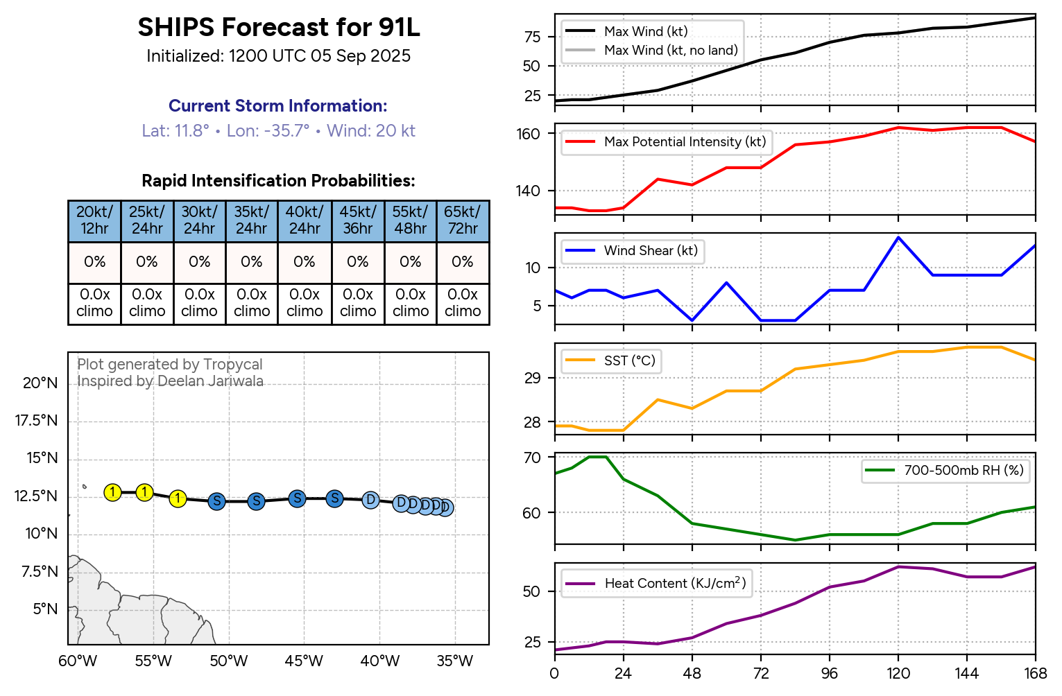
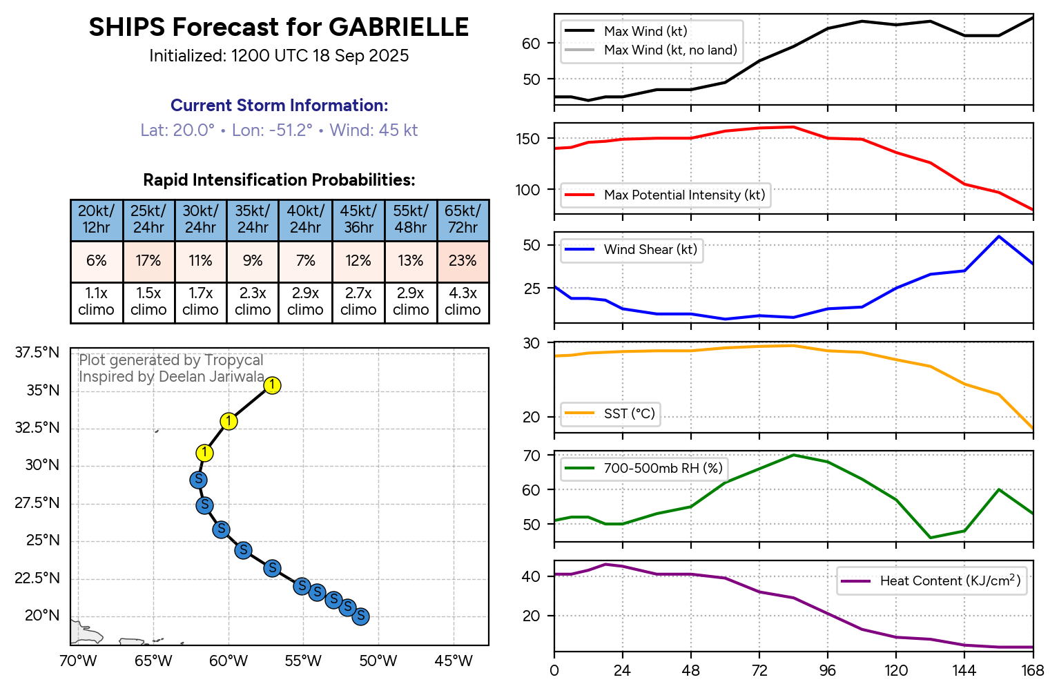
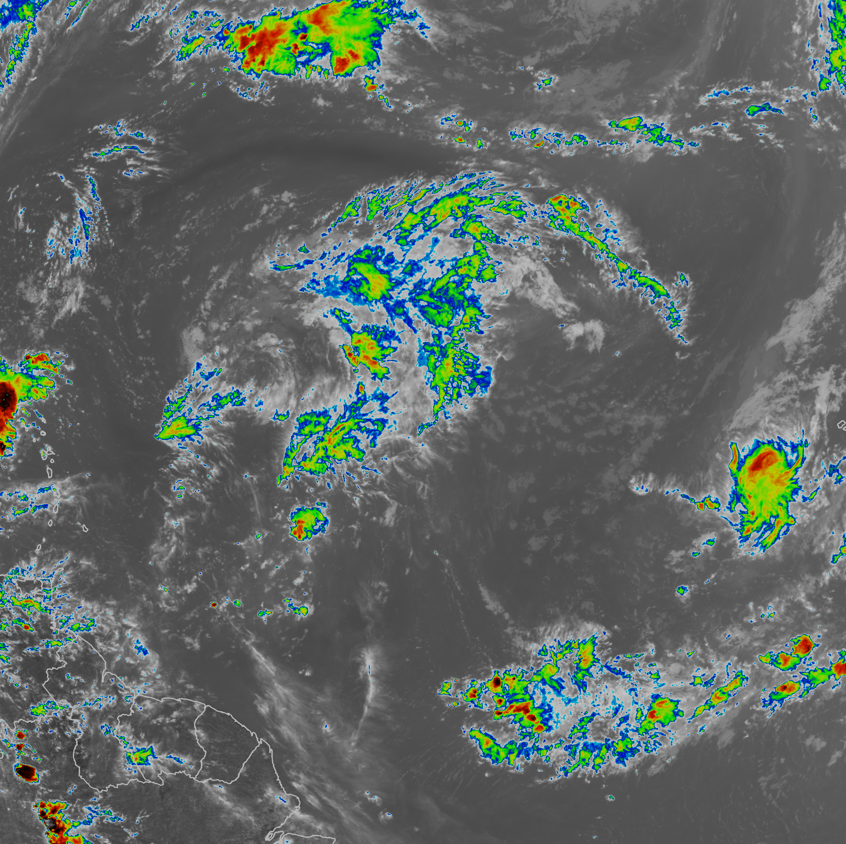
Tropical Storm Gabrielle: Gabrielle is on life support today as satellite imagery shows little or no deep convection near the center of circulation. It seems that a series of upper-level low pressure systems are imparting dry air and westerly wind shear onto Gabrielle. In fact, it looks likely that this system will continue to struggle mightily over the next couple of days or so & it’s pretty likely that Gabrielle will be downgraded to a depression at some point over the next couple of days.
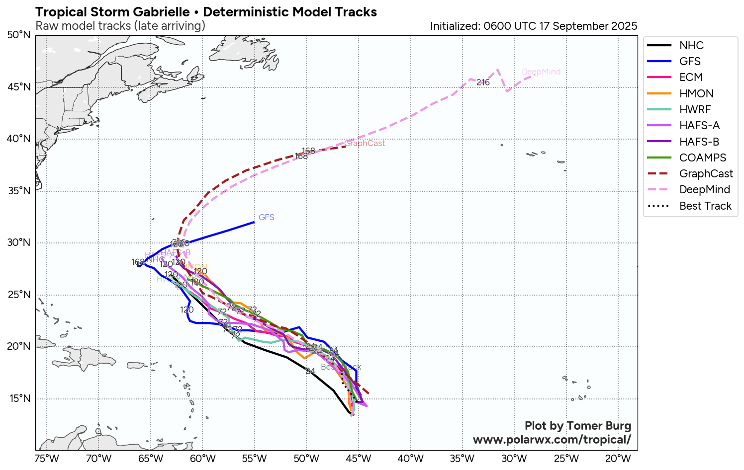
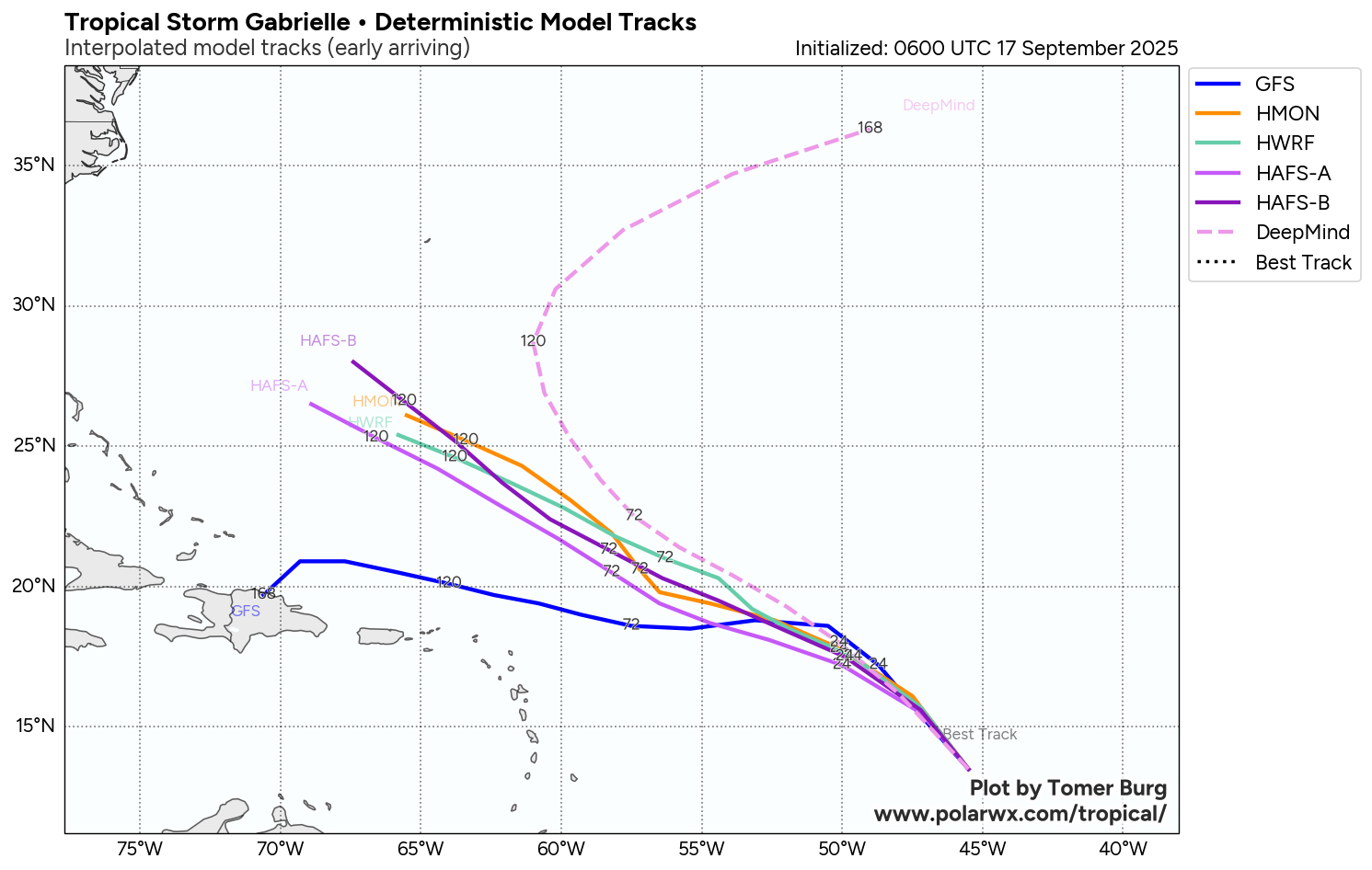
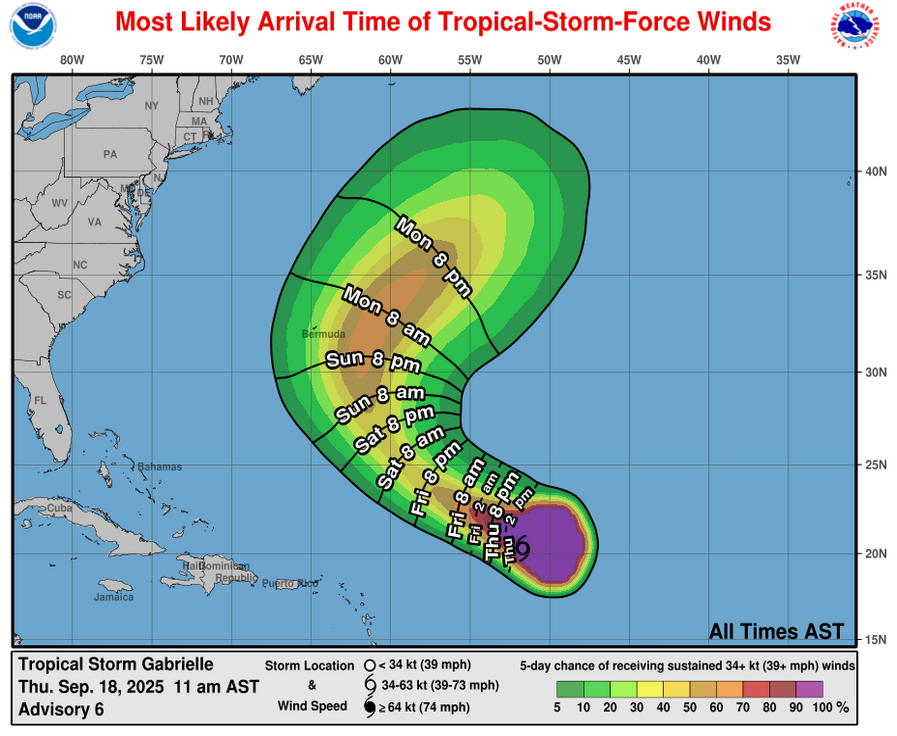
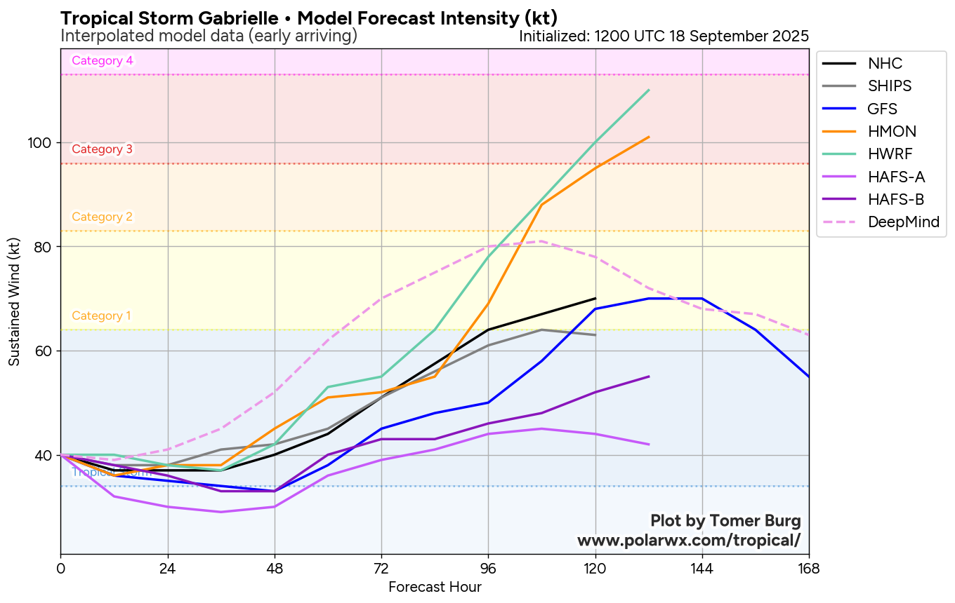
Looking beyond this, the environmental conditions are forecast to become more favorable for strengthening at some point this weekend. These more favorable conditions should lead to Gabrielle strengthening and then probably passing to the east of Bermuda around the early part of next week. That being said, some of the model guidance do still show Gabrielle moving very close to or right over the island & this is something that needs to be watched.
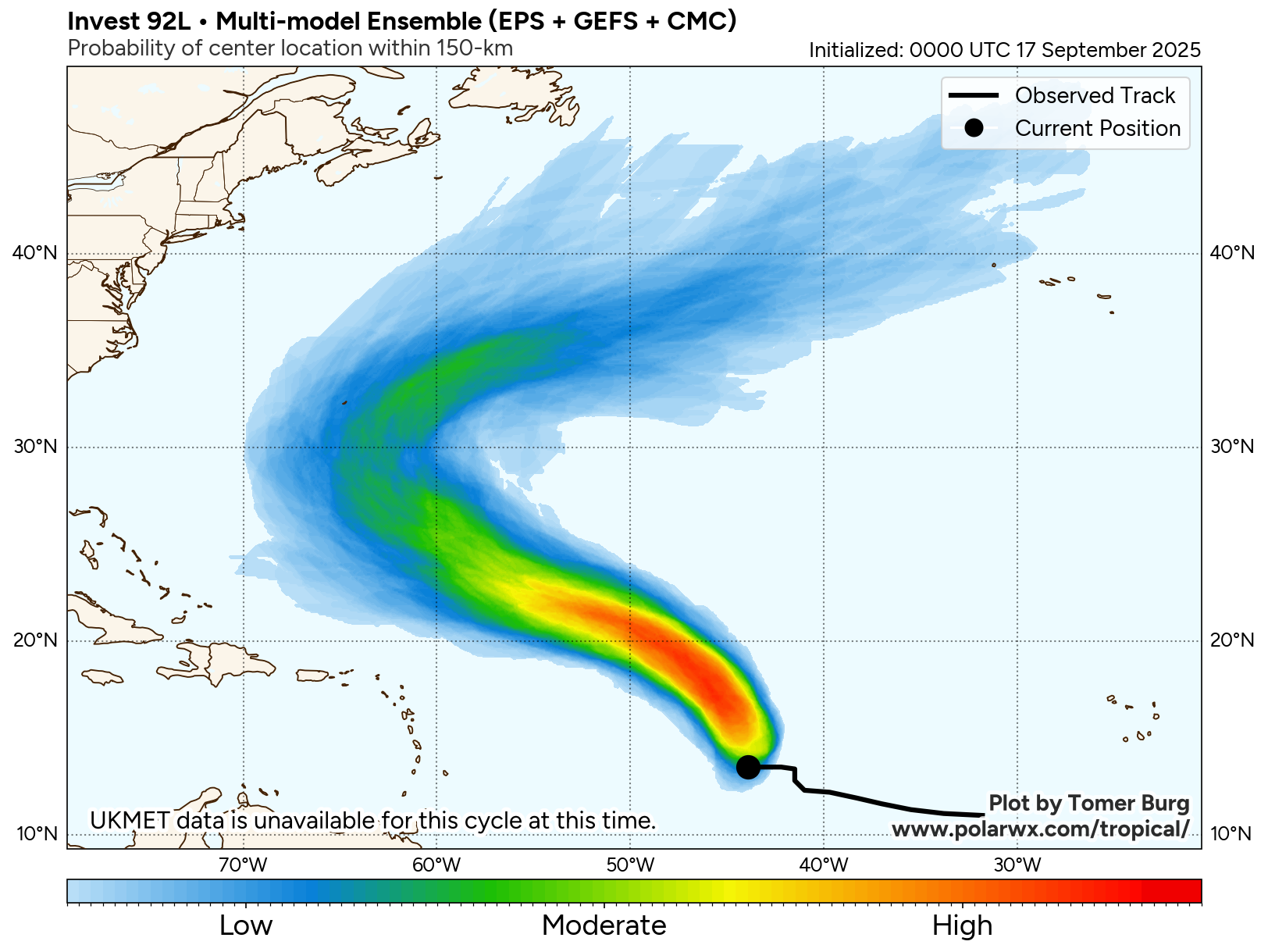
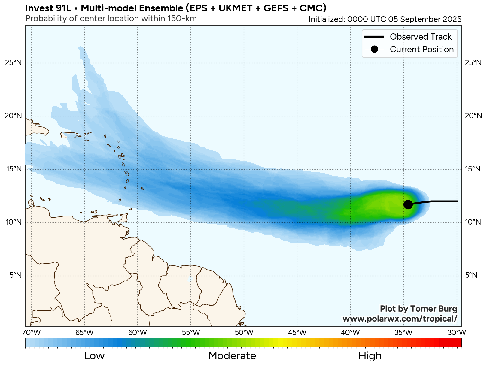
It is highly likely that Gabrielle will not be a threat to the Caribbean Islands and will turn into the Atlantic well before reaching the Bahamas and the United States.
As for Bermuda – As I just mentioned, those of you on the island of Bermuda will want to keep a close eye on the forecasts surrounding Gabrielle. While most model guidance do suggest a path that keeps it east of Bermuda, the very disorganized and weak state of the storm suggests that there is quite a bit of uncertainty as to where a new center may ultimately form. Because of this, I would keep a close eye on this storm, in case it does impact you early next week.
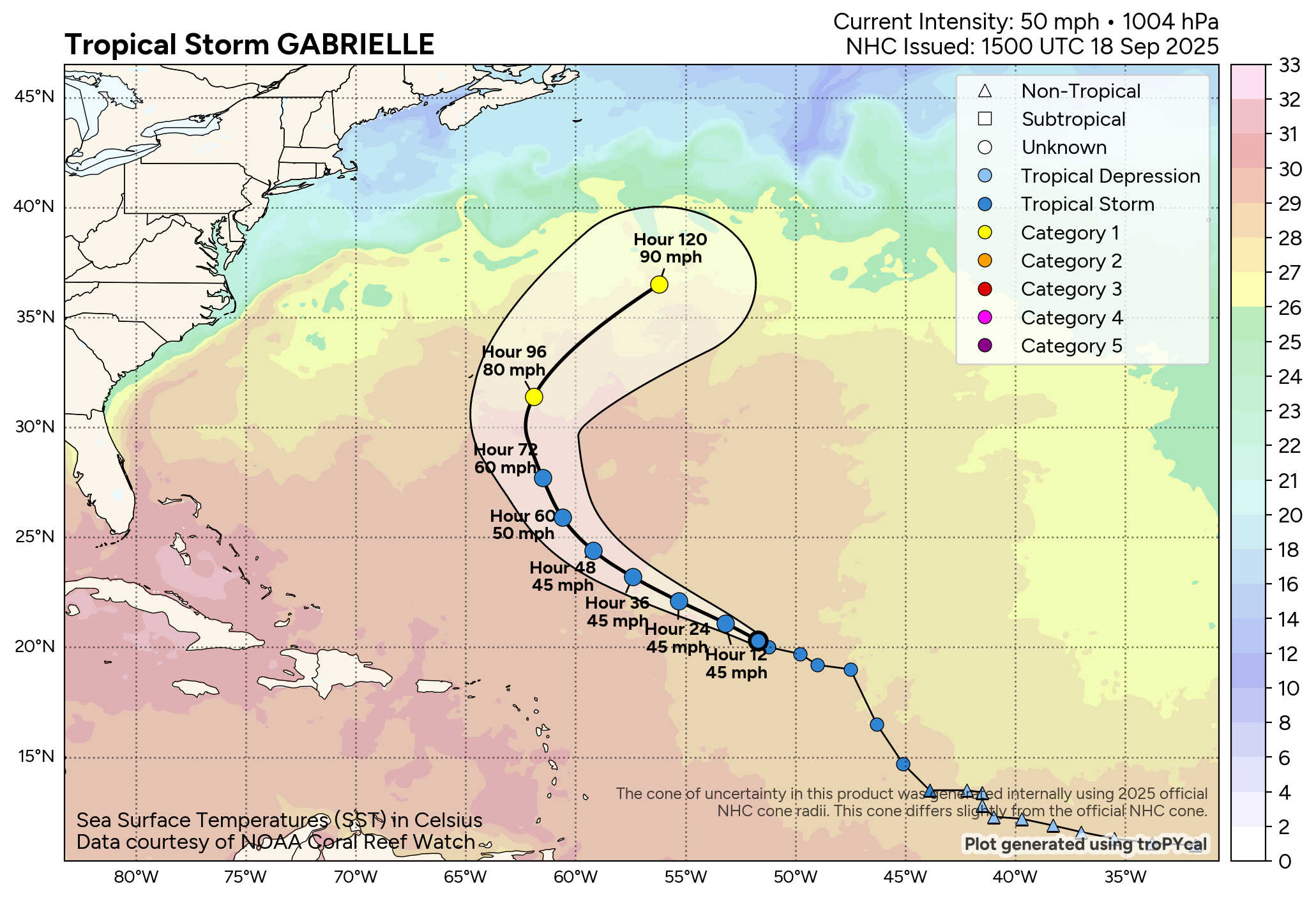
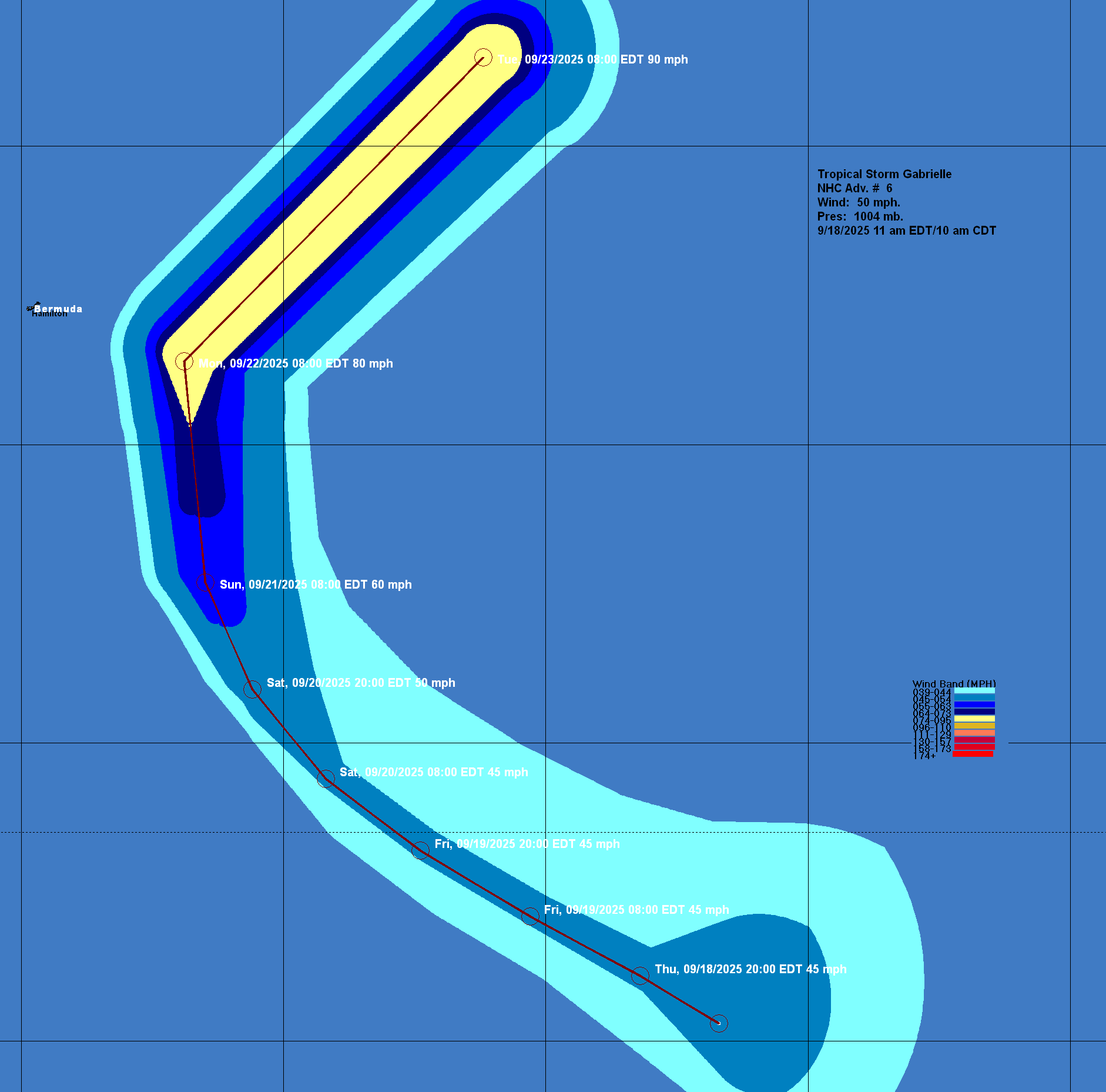
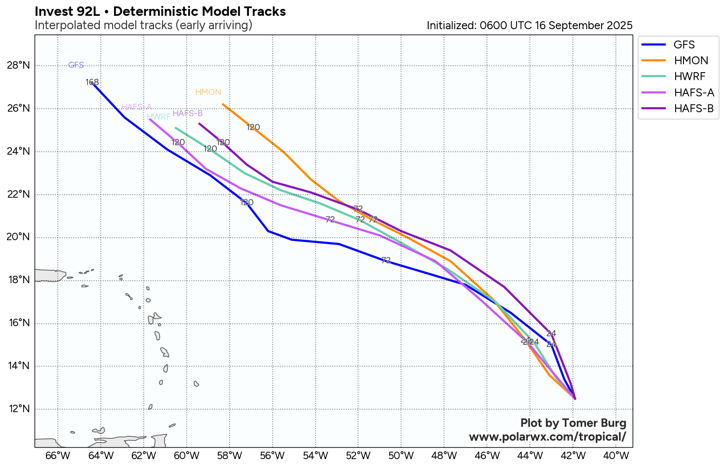
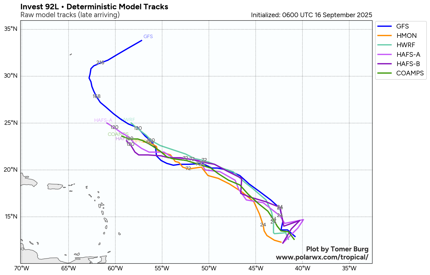
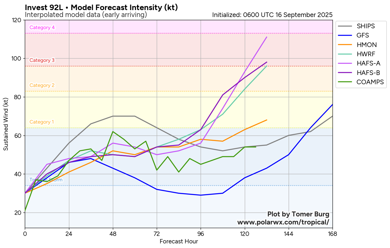
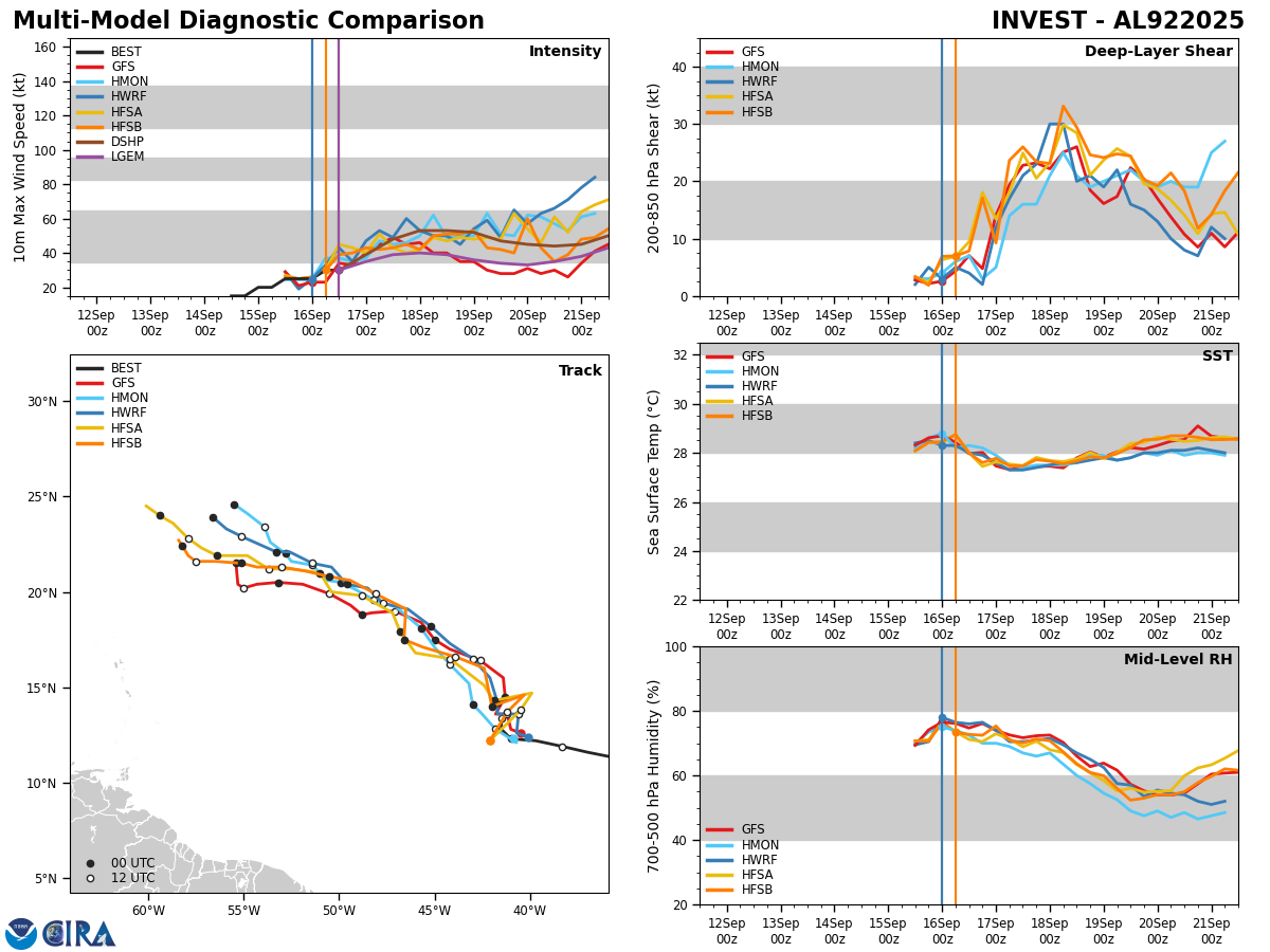
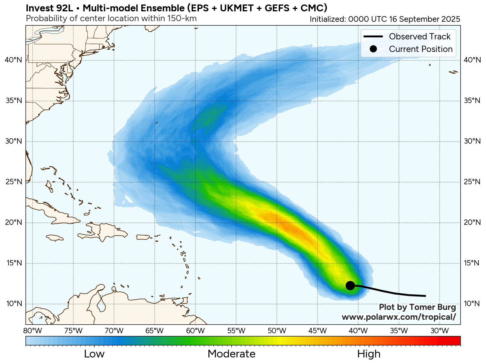
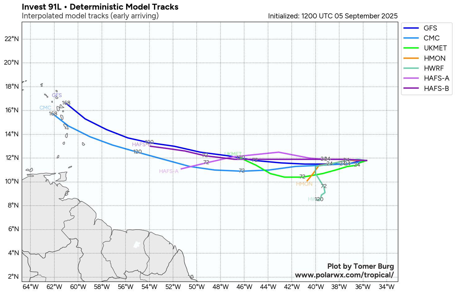
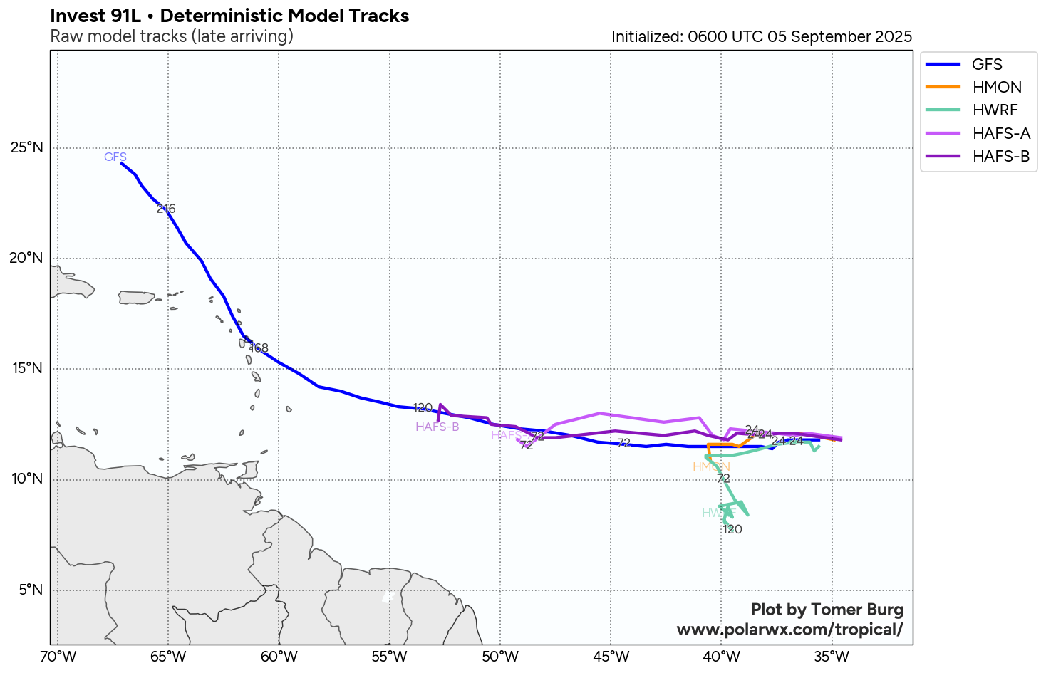
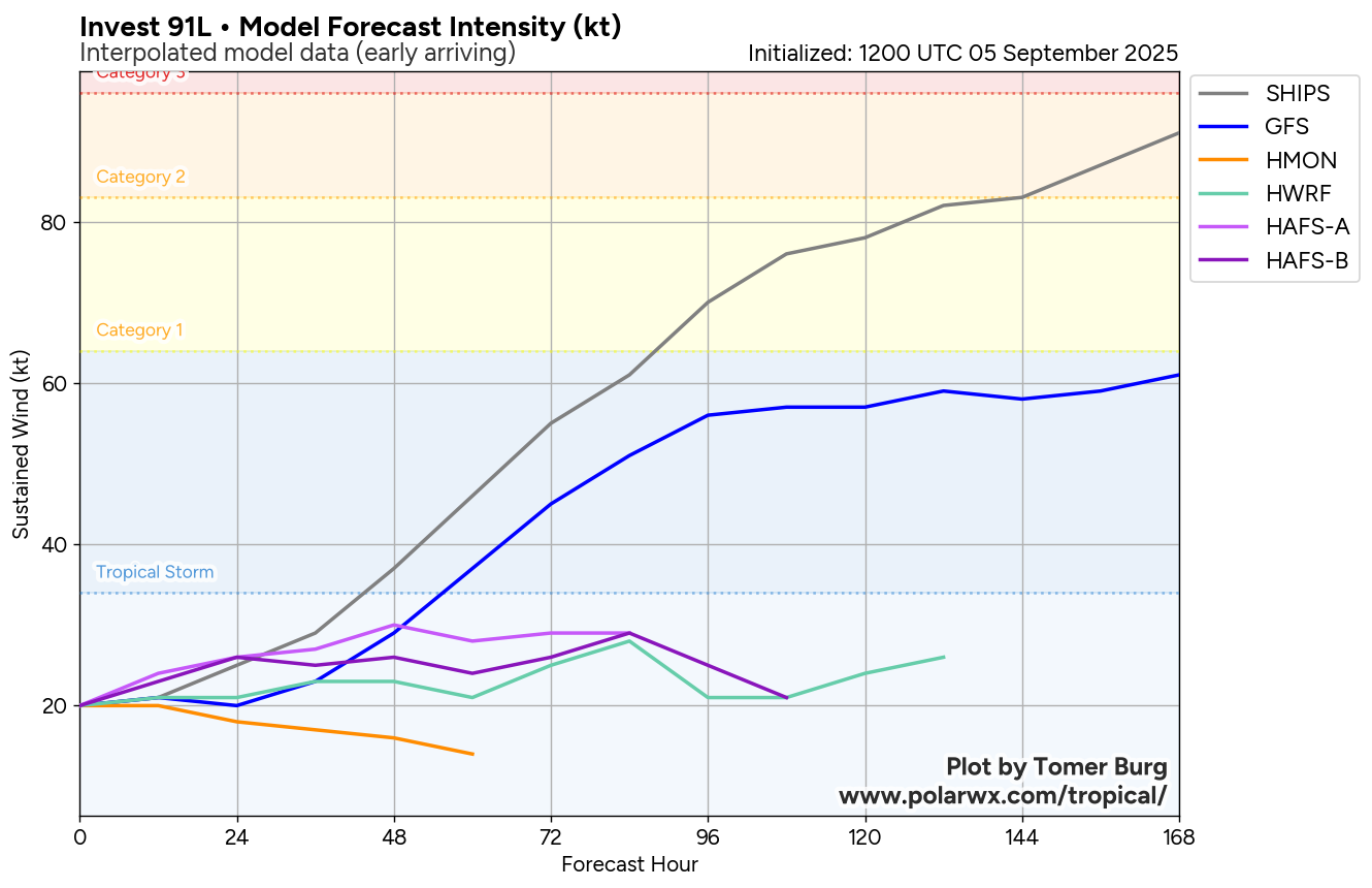
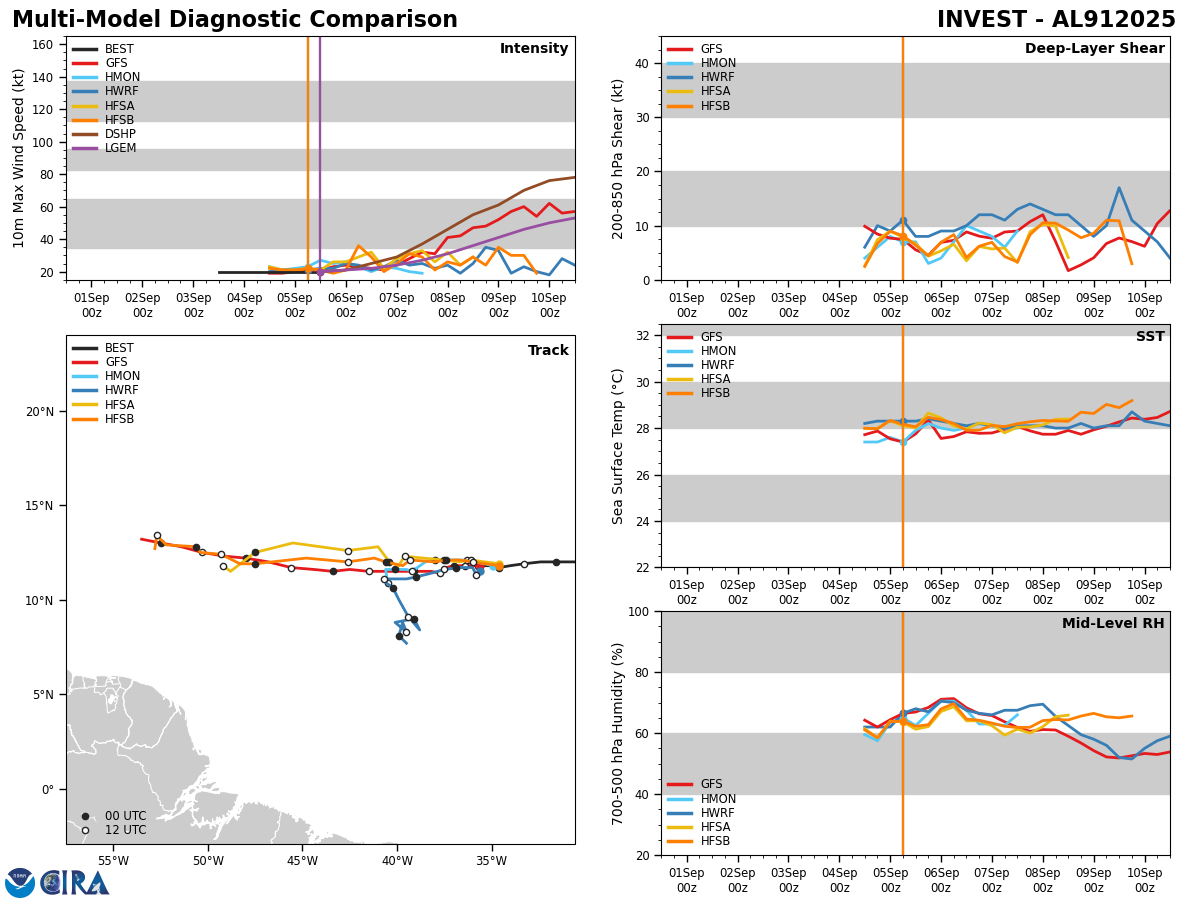
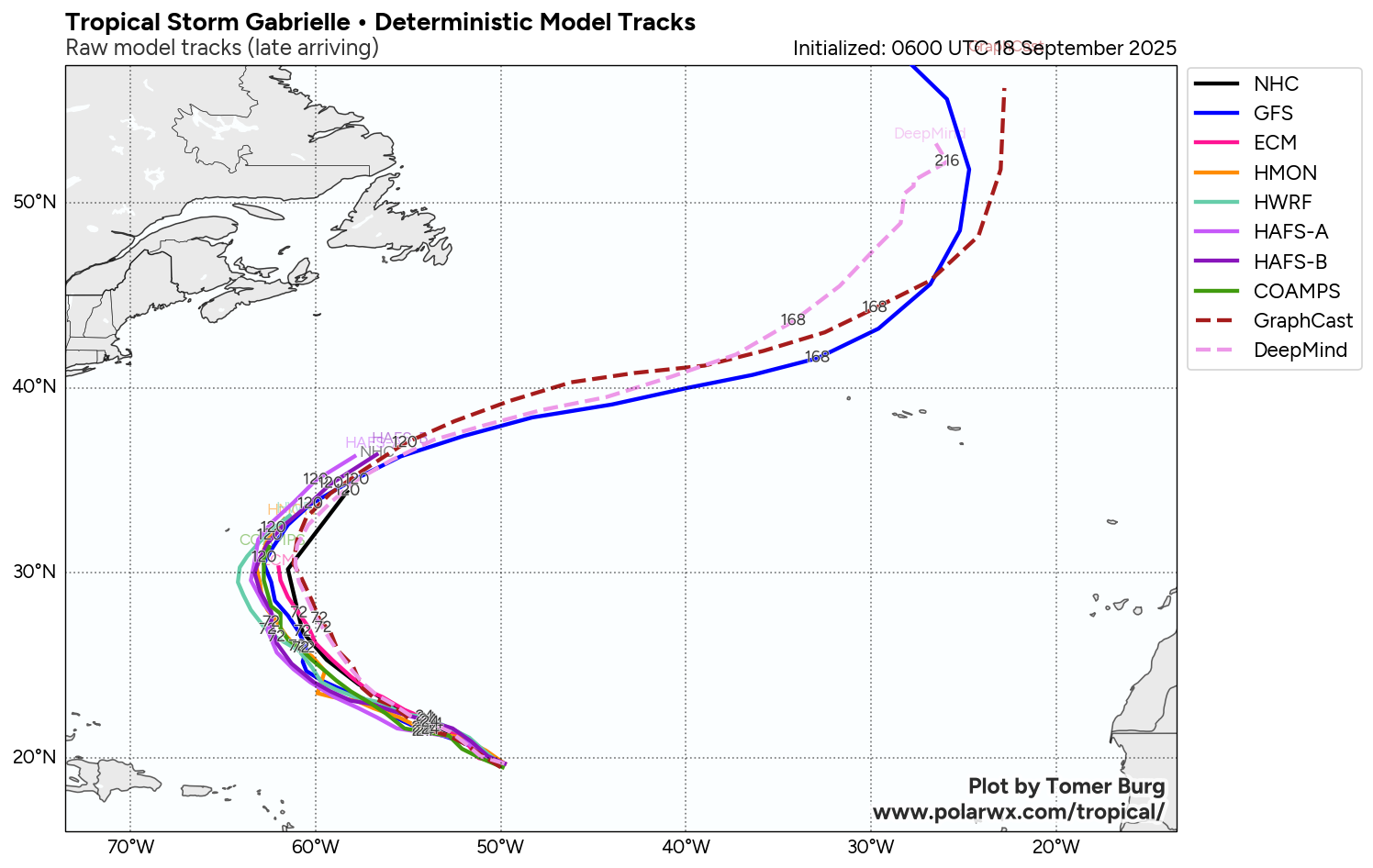
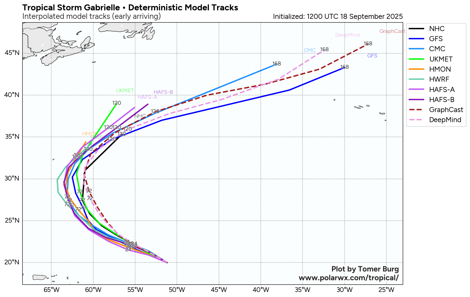
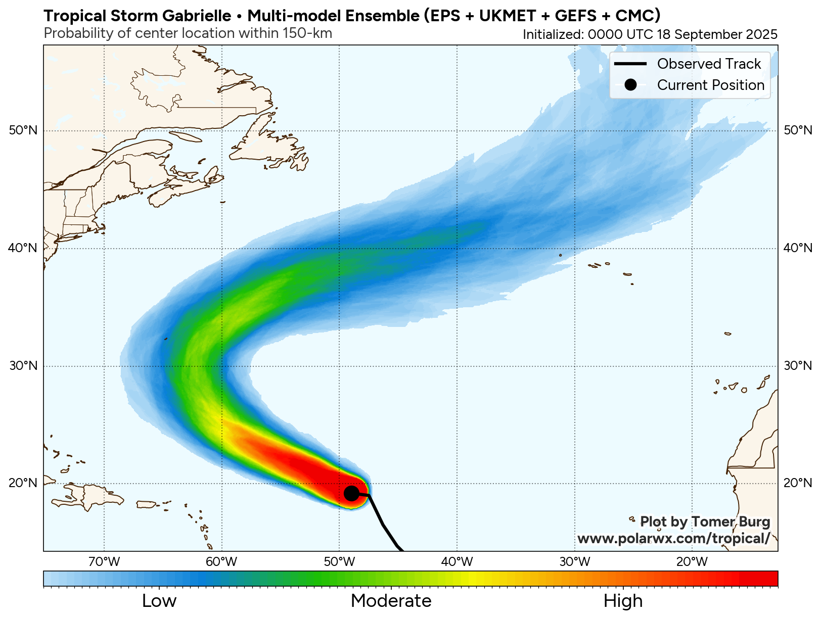
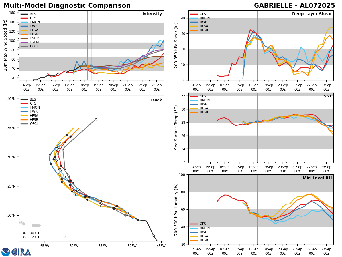
Model Track Forecast:
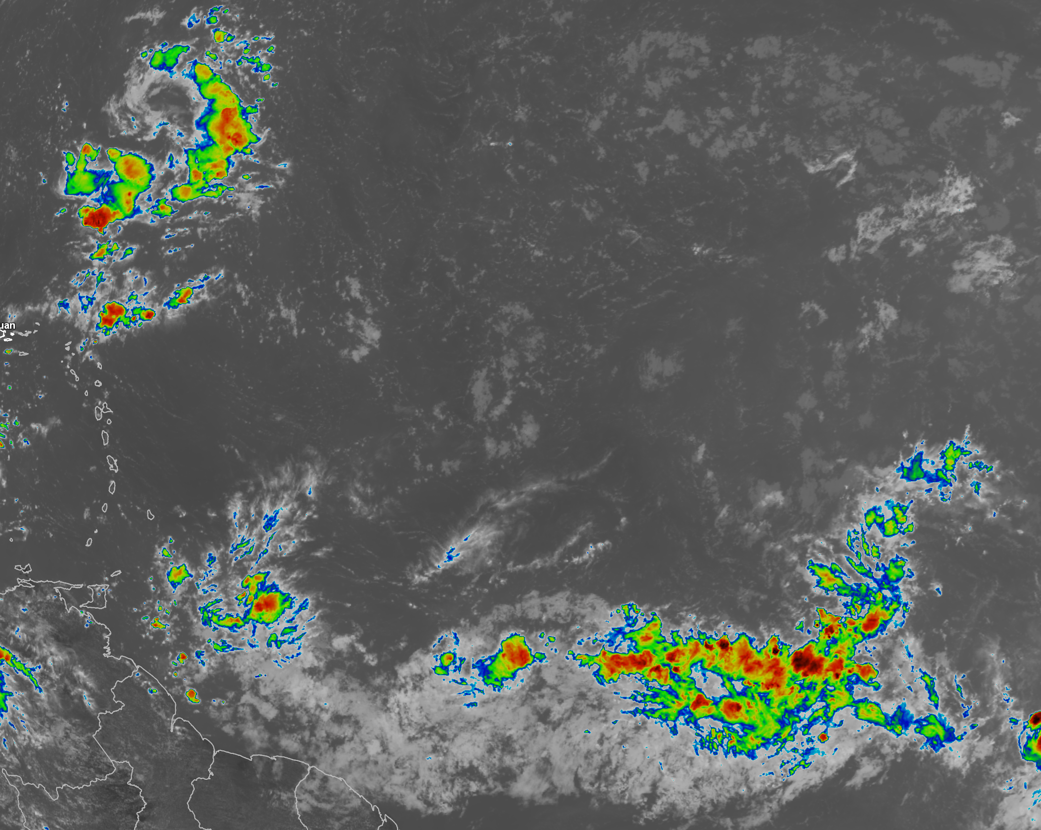
Satellite Imagery:
Elsewhere Across The Atlantic, Caribbean & Gulf: Satellite imagery, weather analysis and radar data indicates that the combination of a tropical wave and an upper-level trough of low pressure is bringing heavy showers and thunderstorms to both the British and US Virgin Islands, as well as to eastern parts of Puerto Rico. Flooding has already been reported in parts of the Virgin Islands.
It is expected that these heavy showers and thunderstorms will continue to affect Puerto Rico and the Virgin Islands through tonight before these inclement conditions spread into Hispaniola and the southeastern Bahamas tonight and Friday. Be aware that flash flooding and mud slides will certainly be a hazard through Friday.
No tropical development is expected with either the tropical wave or the upper level trough.
As I have mentioned in previous discussions, we might have to really start watching the western Caribbean and the Bay of Campeche as soon as late next week and next weekend.
The Google Deep Mind AI model is particularly very aggressive in forecasting tropical development to occur in the western Caribbean around next Saturday. Most of the ensemble members of the Google AI model then forecasts anything that develops to head into the Gulf of Mexico during the first half of the week of September 29. I’m still pretty skeptical on completely believing this model as it is still very new & hasn’t really been test driven a whole lot this season.
Looking at the other ensemble model guidance, the GFS ensemble model guidance does show a few members that develop a tropical system in the northwestern Caribbean around late next weekend. Those members that show development actually increase around October 1 across the Bay of Campeche and the southern Gulf.
As for the European ensemble model guidance, it seems that about 20-30 percent of its members forecast development in the western Caribbean next weekend. It should be noted that, much like the GFS ensemble guidance, the number of members that show development increase dramatically around October 1 in the southern Gulf.
My take on this is that I do think that the area from the western Caribbean through the Bay of Campeche and the southern Gulf will definitely need to be watched closely for possible tropical development during the week of September 29. I think that the Google AI model might be too quick in showing development & I’m leaning more on the side of the conventional models that show the development occurring between September 29 and October 1. Either way, this is something to certainly keep an eye on.
The next tropical weather discussion will be issued on Friday.