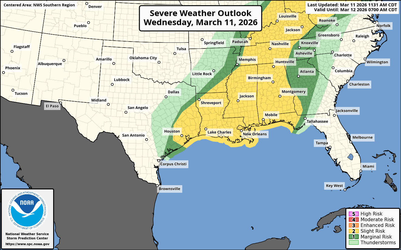
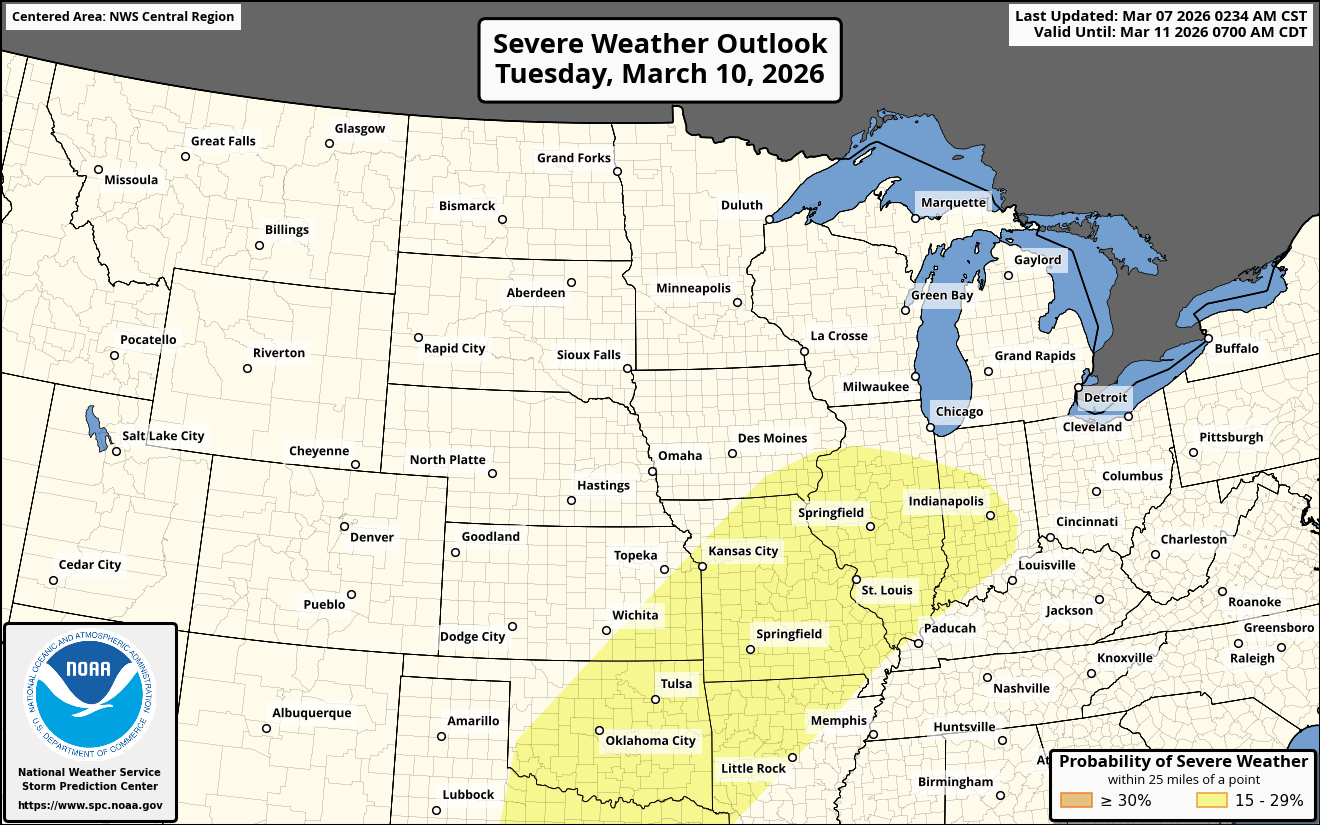
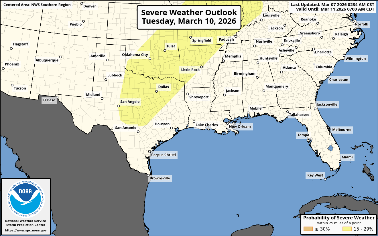
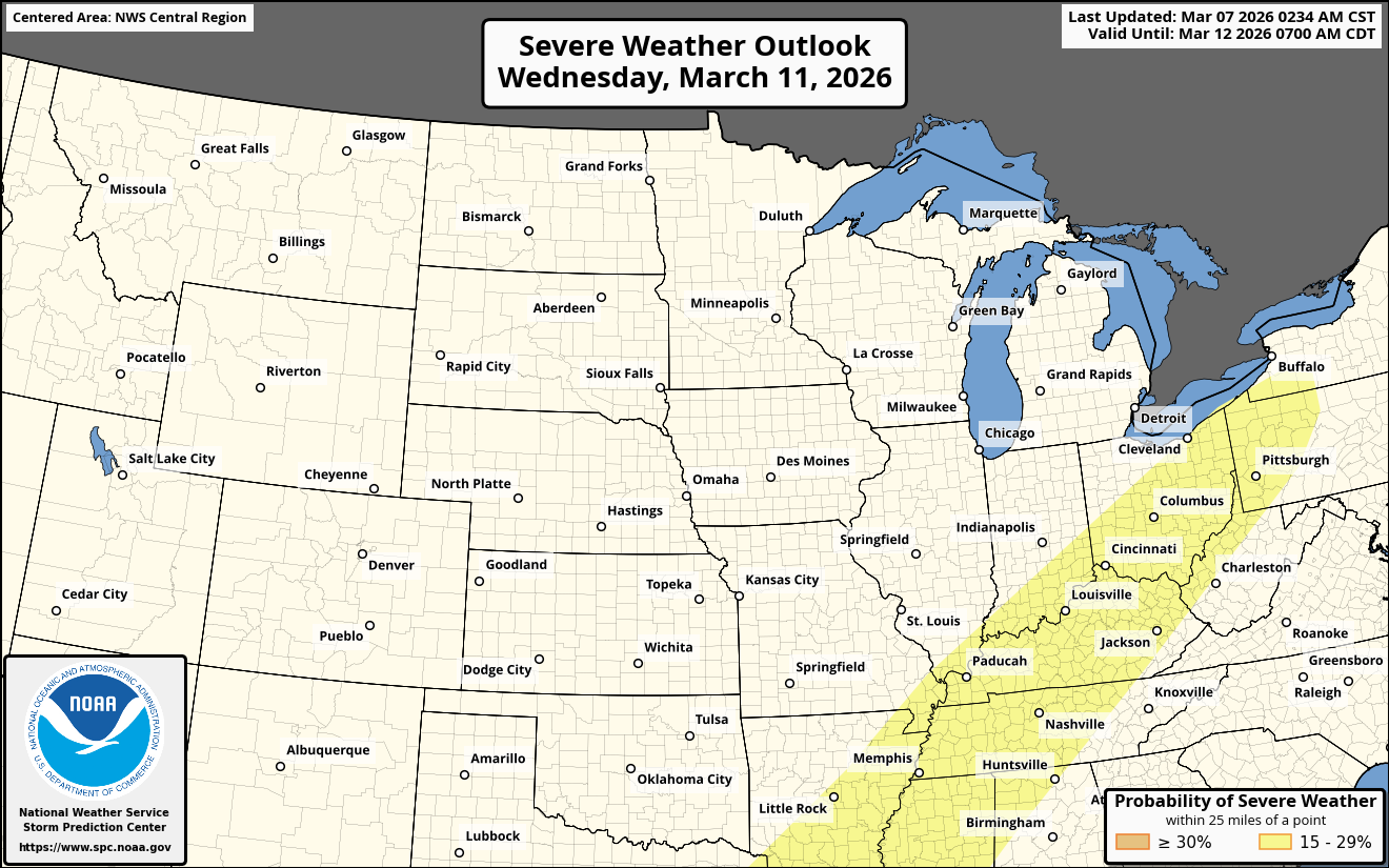
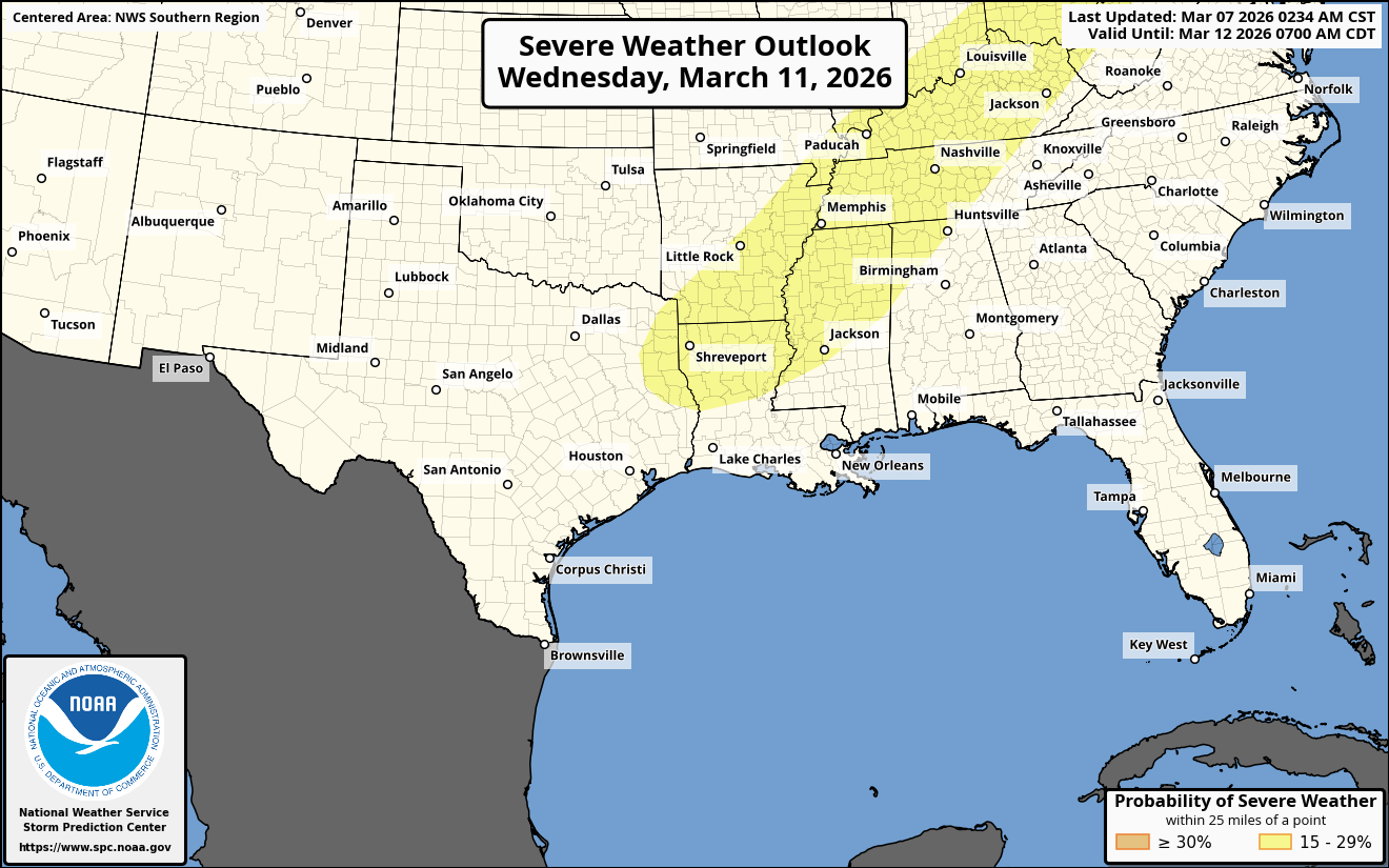
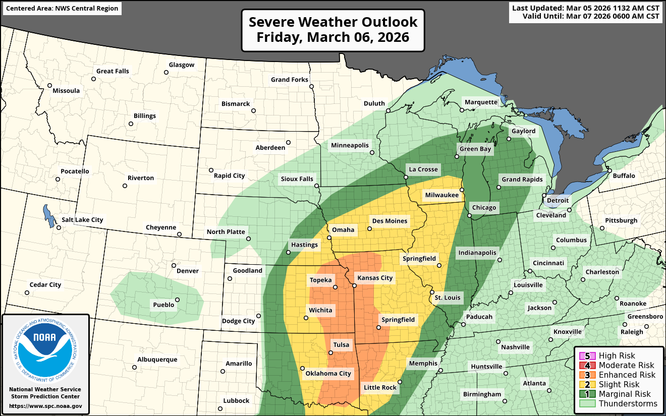
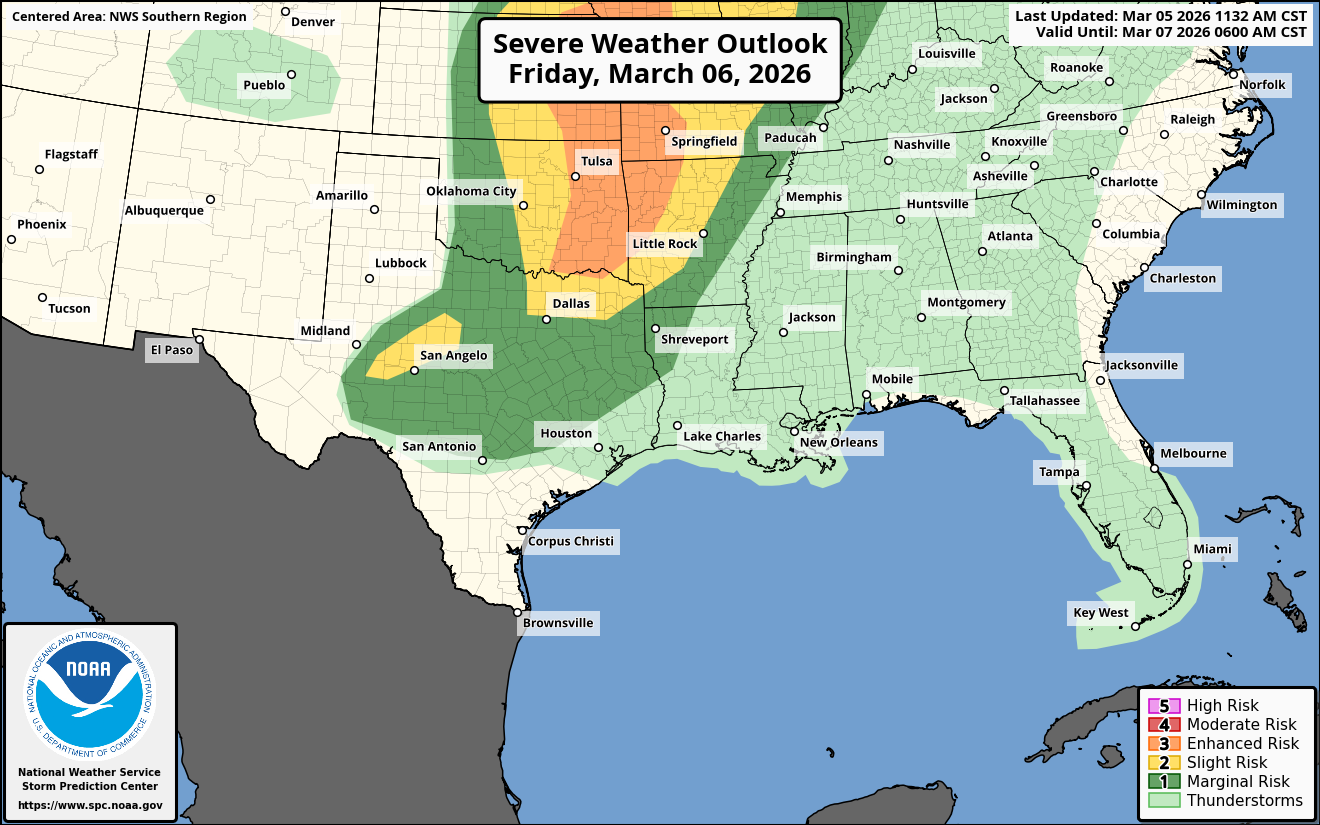
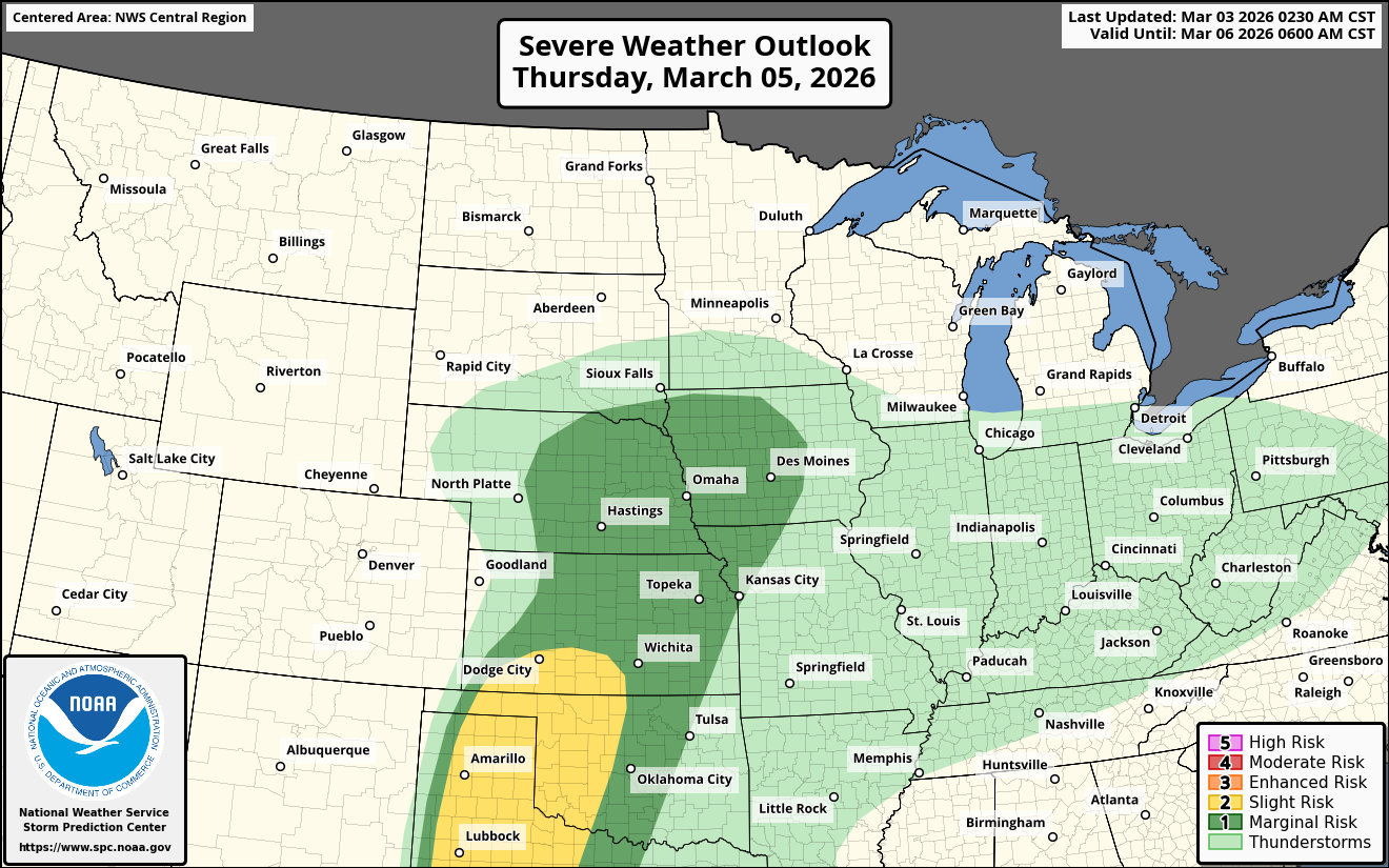
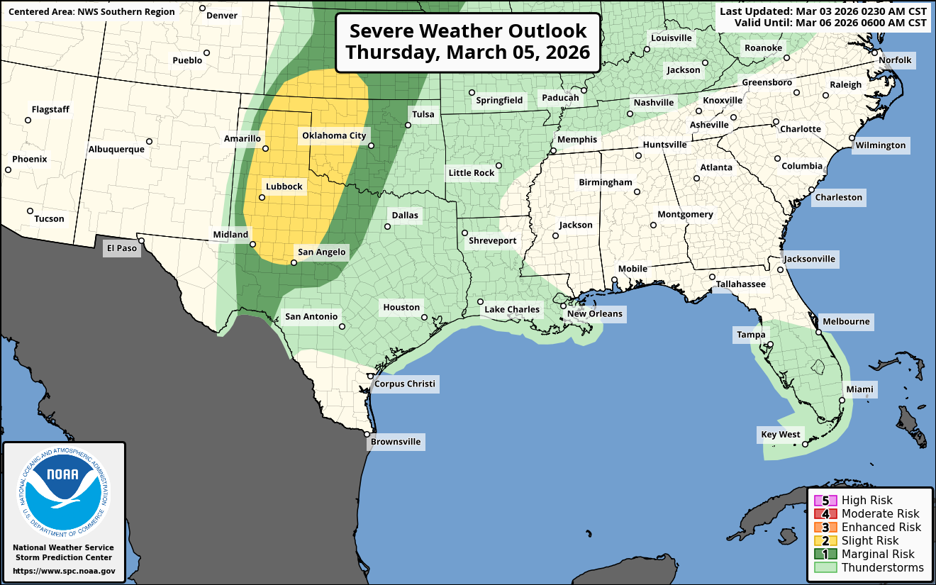
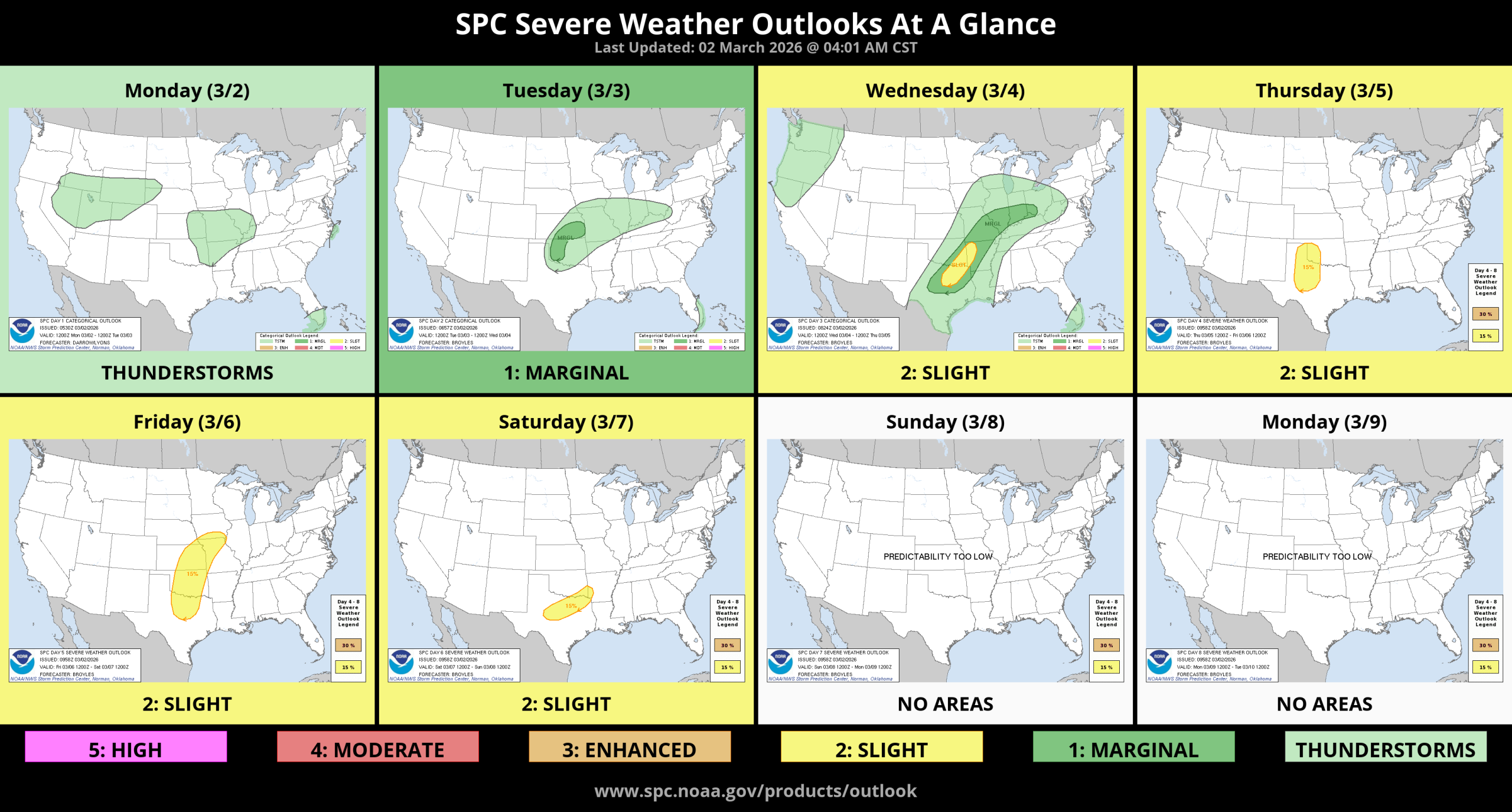
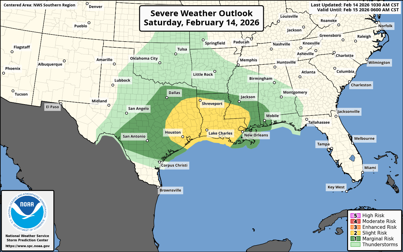
Summary: Severe weather is expected throughout this afternoon into tonight across a large area from the ArkLaTex and the northern Gulf coast northward through the lower Mississippi Valley, the Ohio Valley and the Mid-Atlantic states.
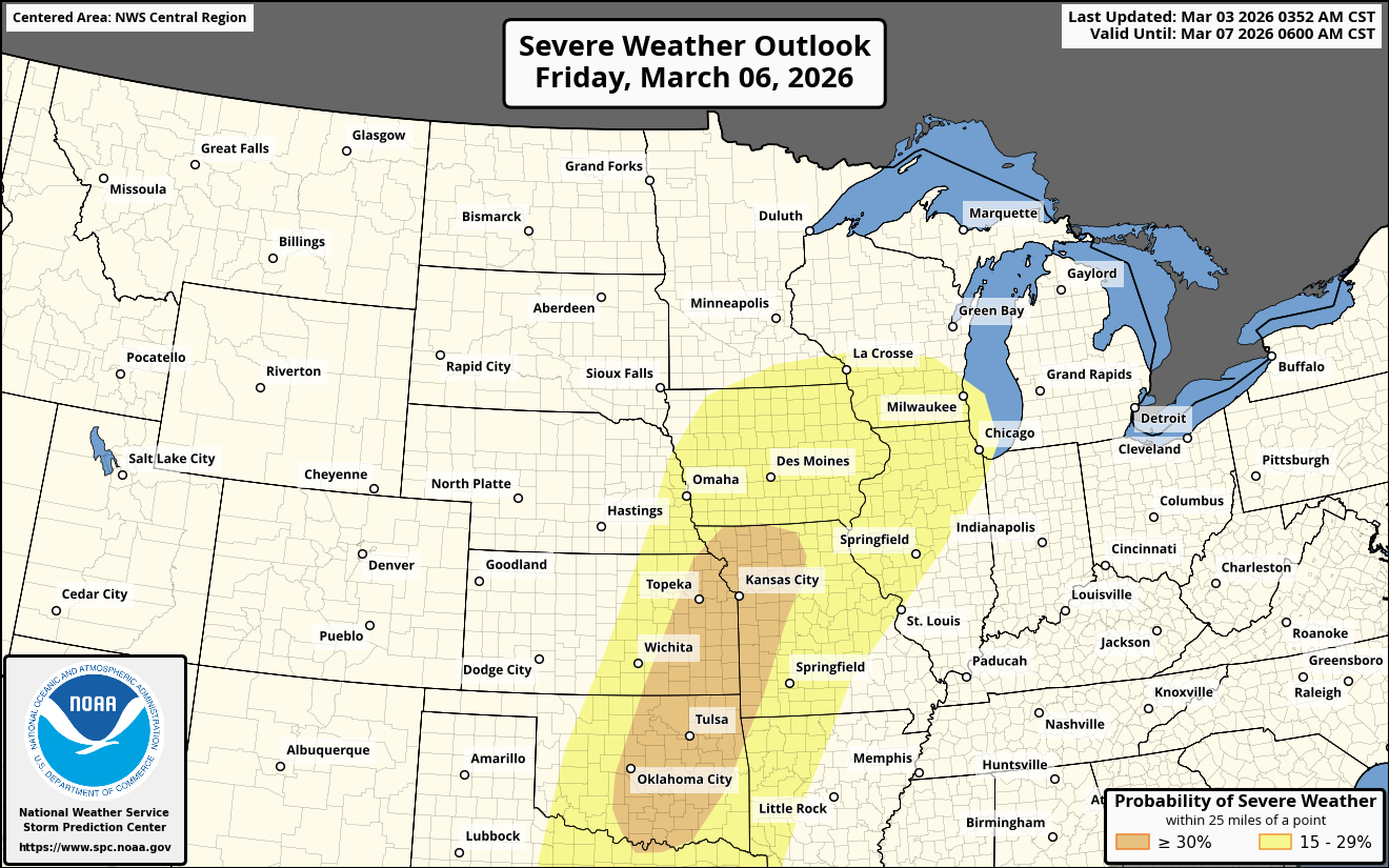
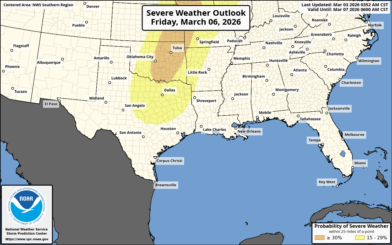
Details: First for the Ohio Valley and the Mid-Atlantic states – Strong to severe thunderstorms are expected to continue throughout this afternoon across areas from eastern and southern Ohio and much of Pennsylvania southward through Kentucky, West Virginia, northern Virginia and Maryland. A few tornadoes and damaging winds will be a threat with these storms.
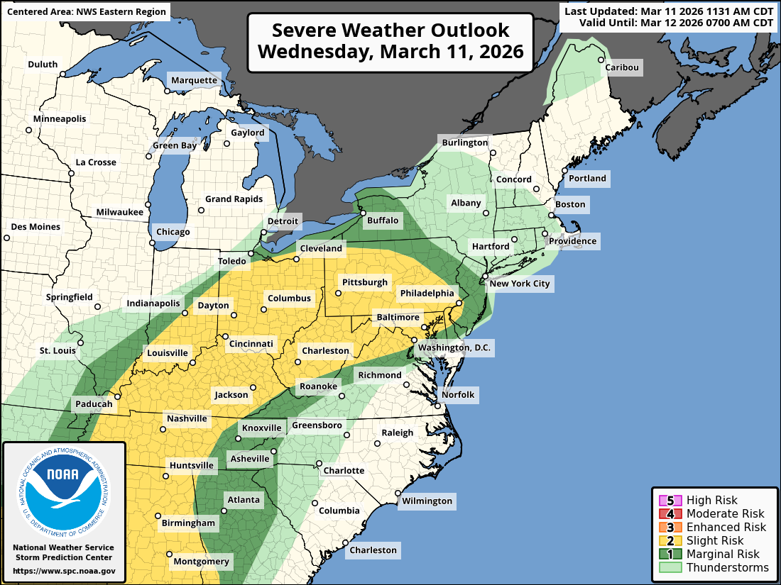
For Southeast Texas, Louisiana, Mississippi, Alabama & Tennessee – Thunderstorms are currently occurring east and southeastern Texas. These storms are expected to continue pushing eastward into Louisiana, Mississippi and Alabama during this afternoon and tonight.
The atmosphere out ahead of these storms is fairly unstable and strongly sheared. Because of this, a few tornadoes and damaging winds will be a threat with these storms as they push eastward during this afternoon and tonight.