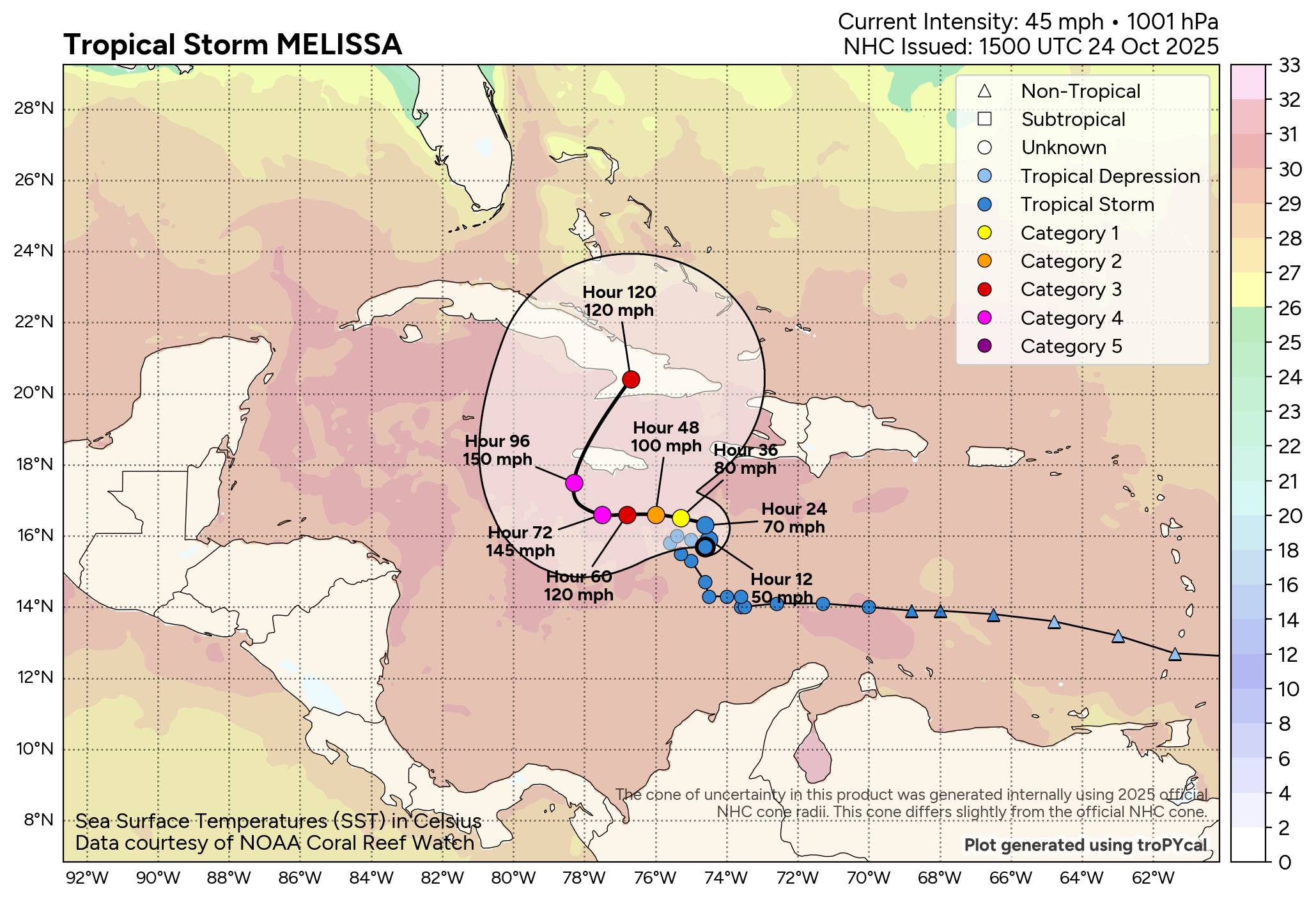
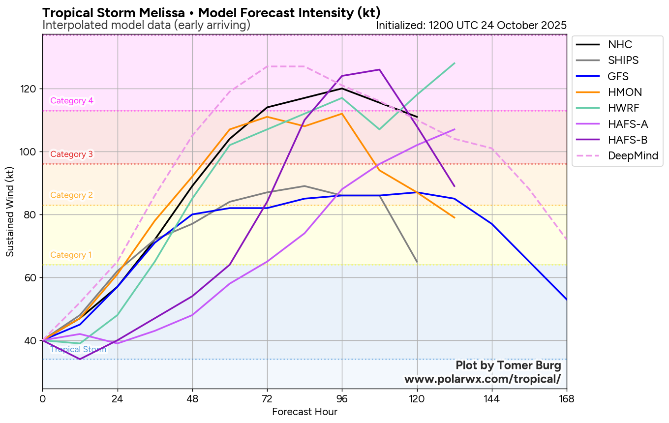
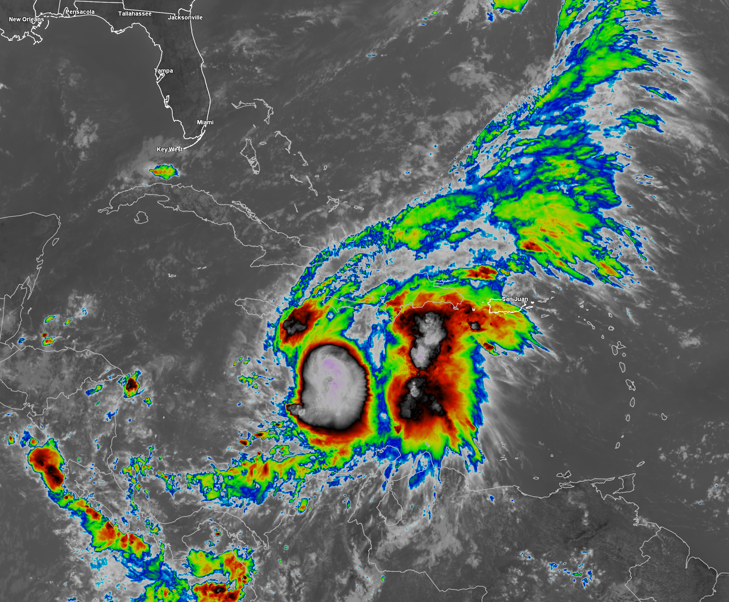
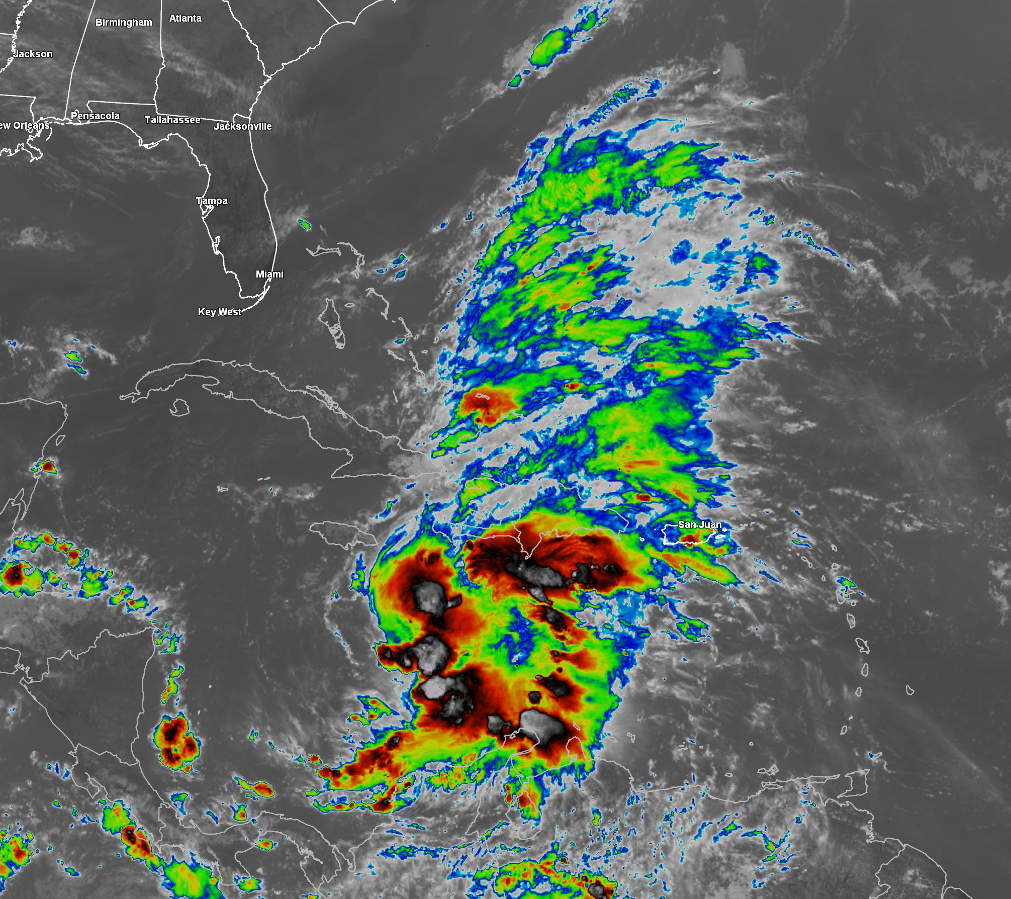
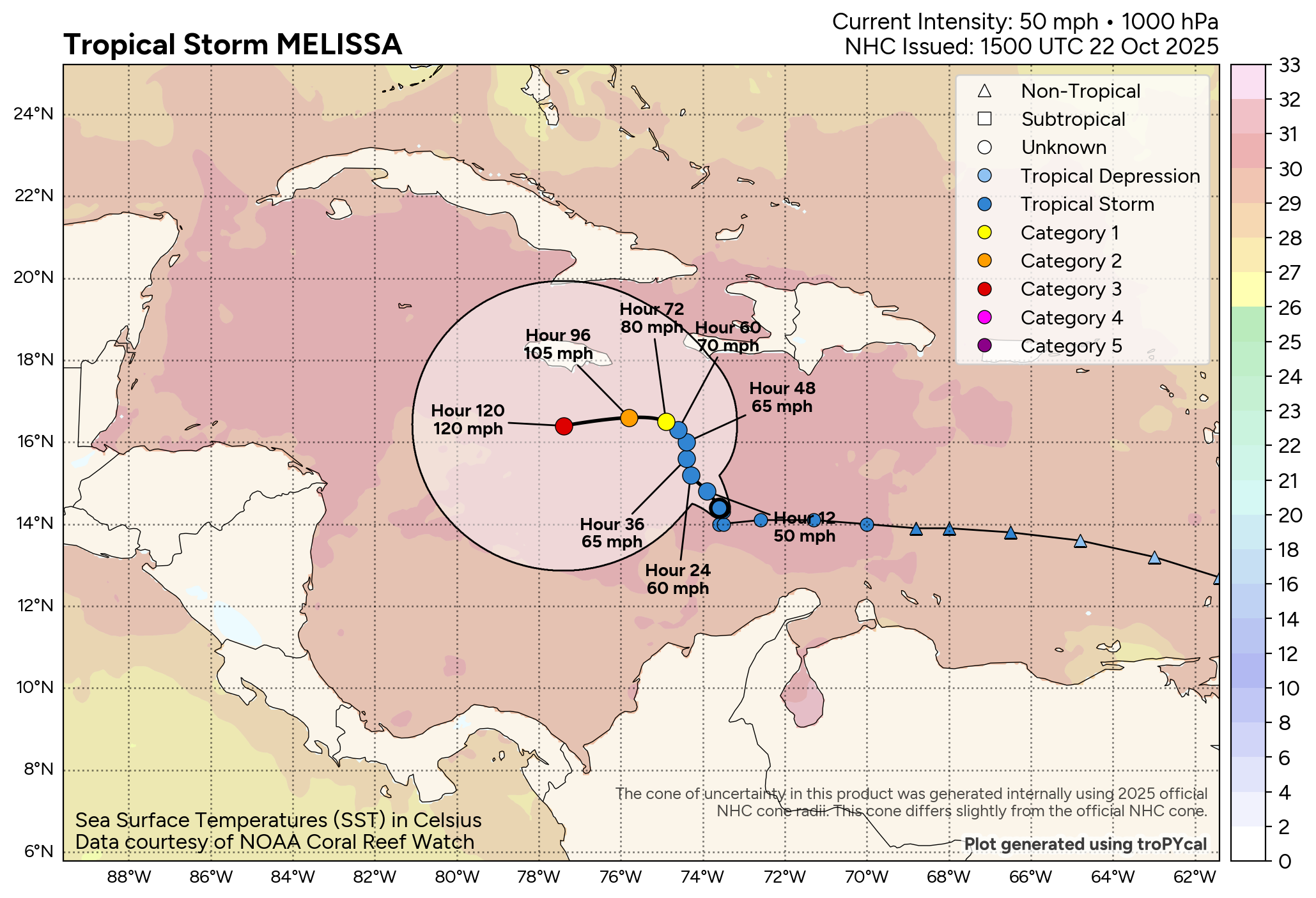
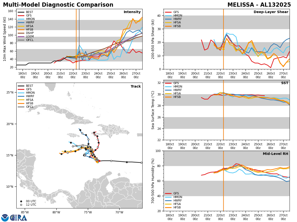
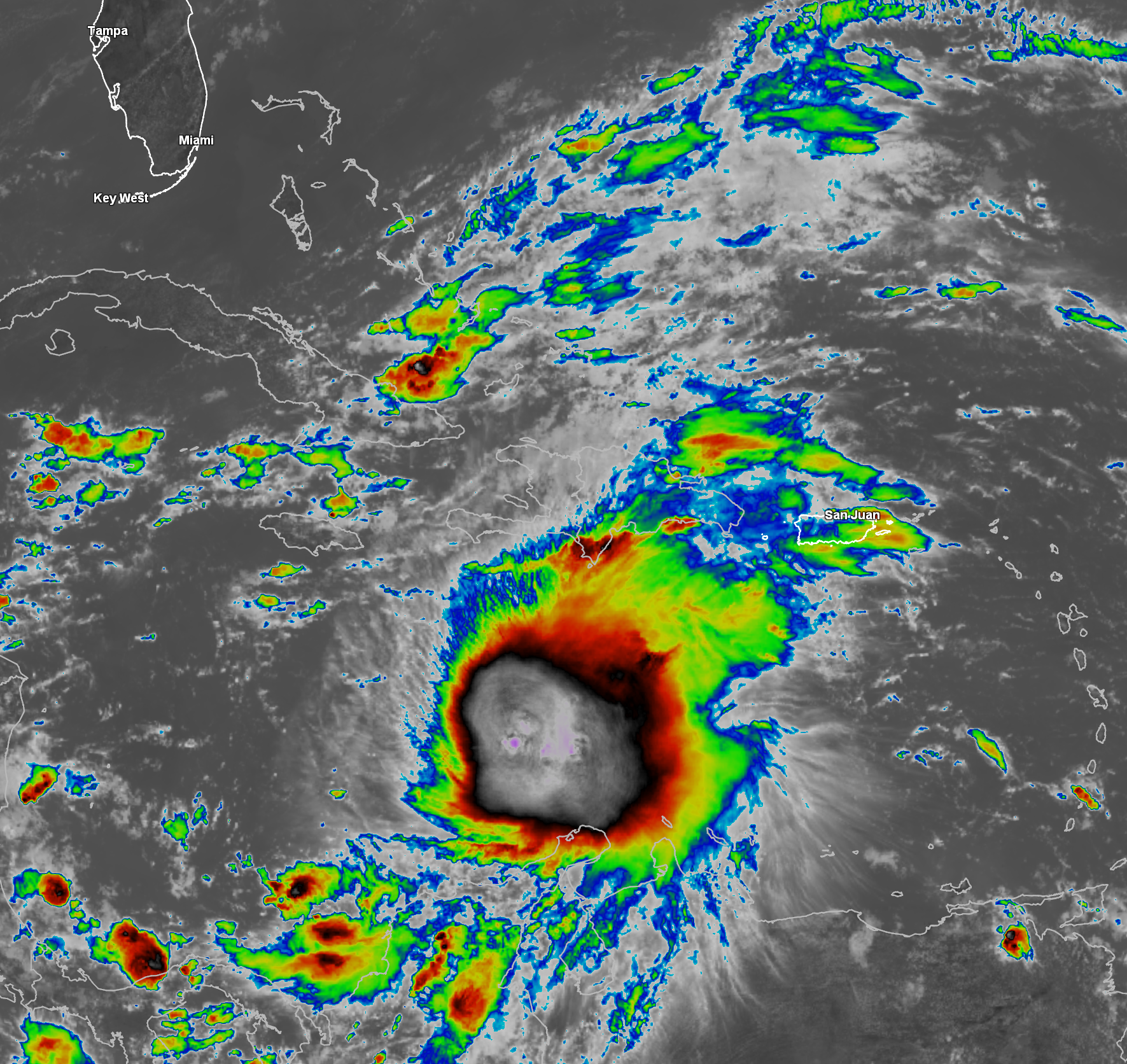
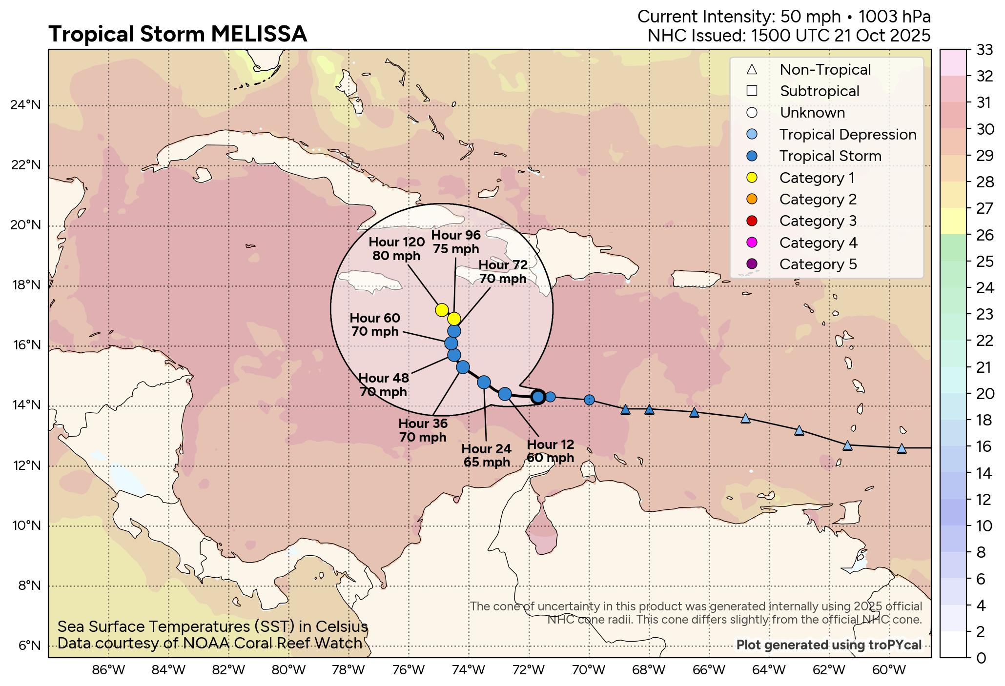
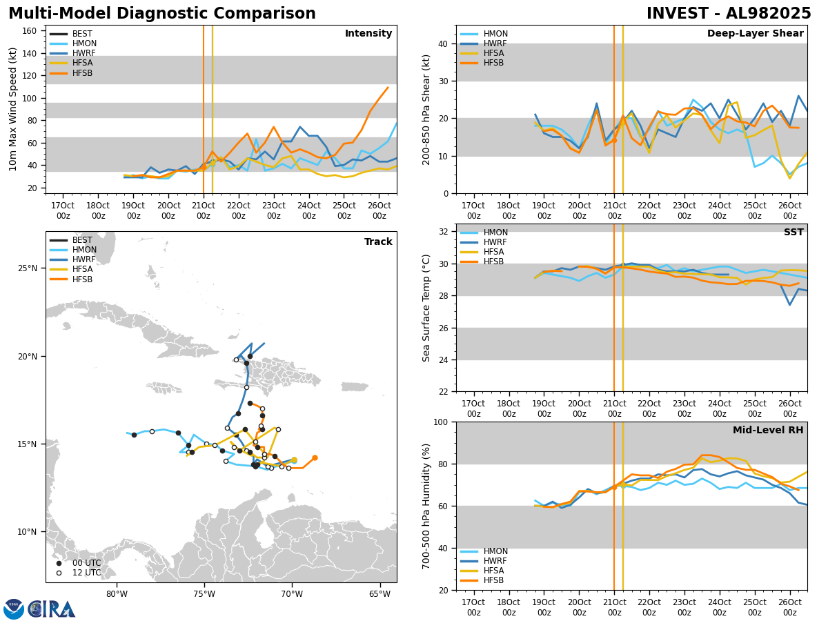
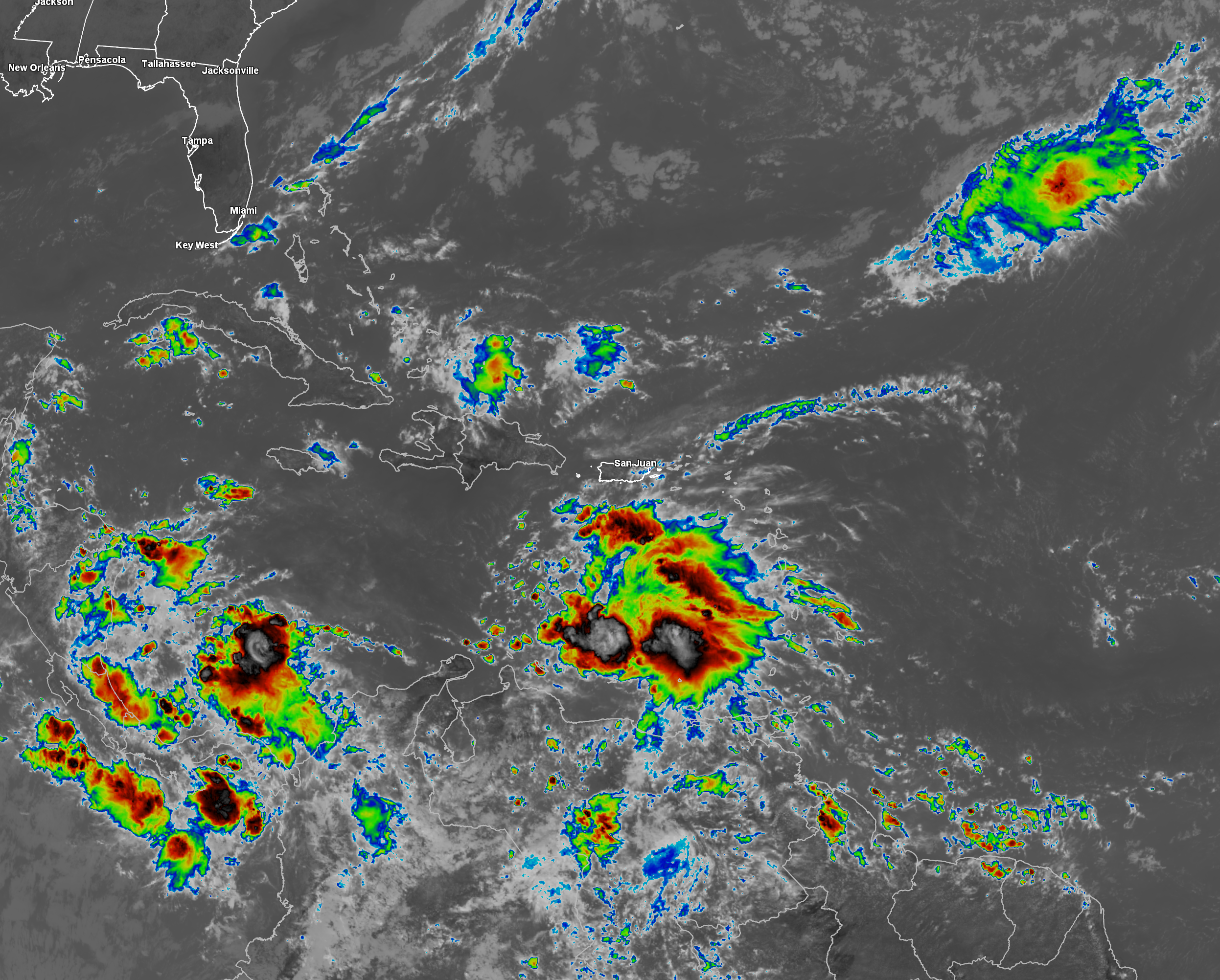
Reconnaissance aircraft are currently investigating Melissa this evening and have found that the storm is now strengthening. Latest reports reveal that the central barometric pressure with Melissa has fallen to 991 to 993 millibars, which is a drop of 4 millibars from early this afternoon.
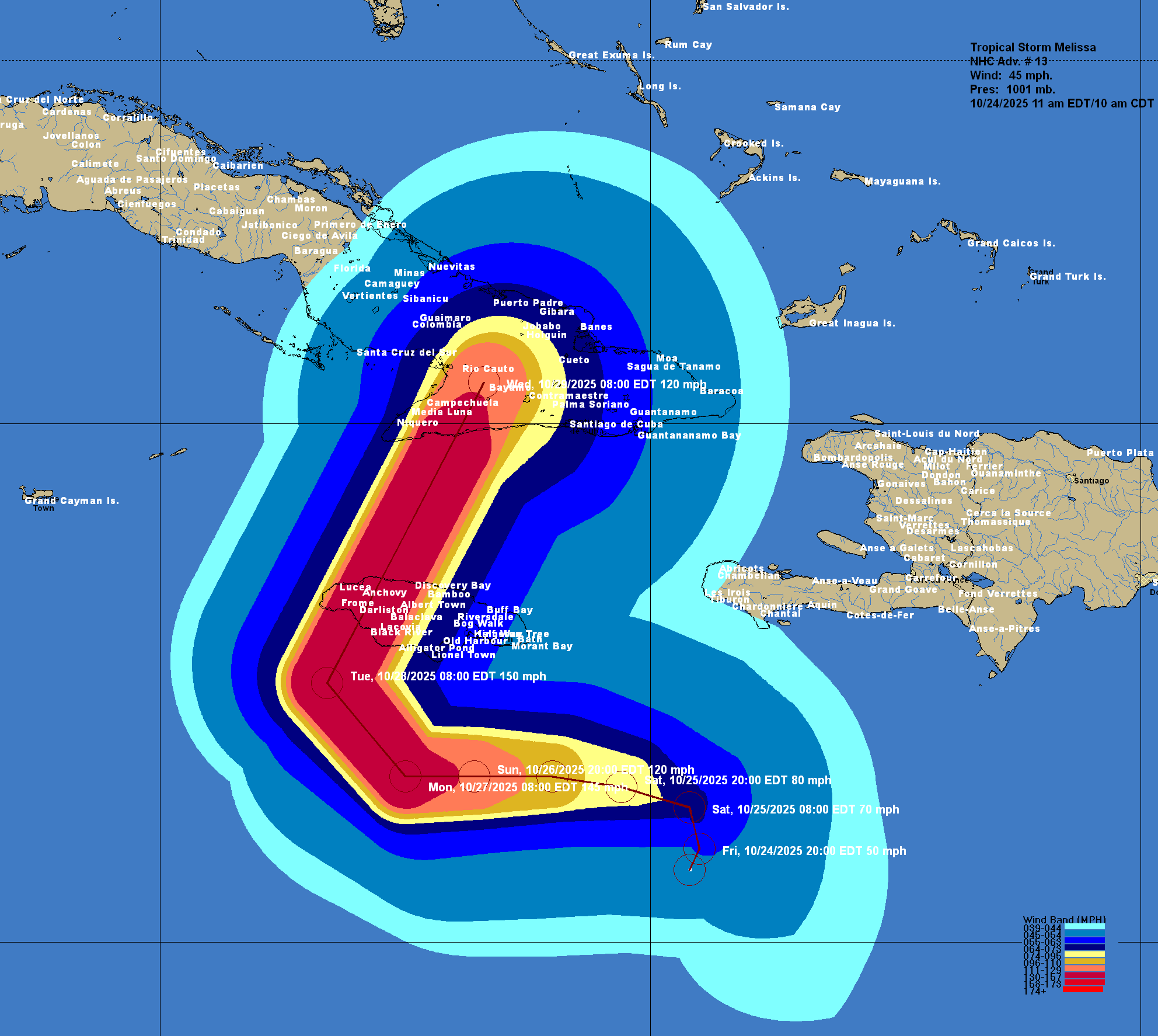
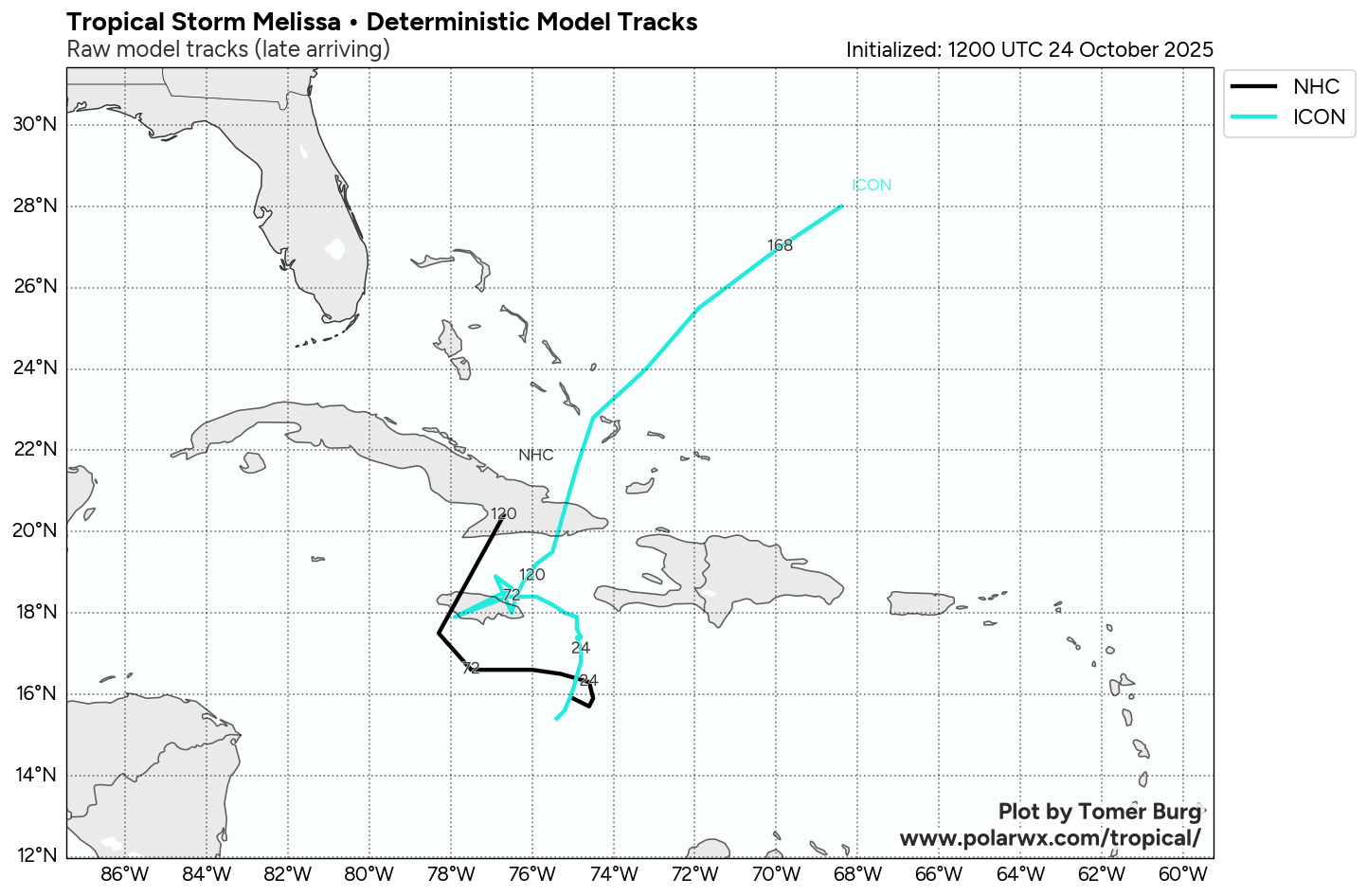
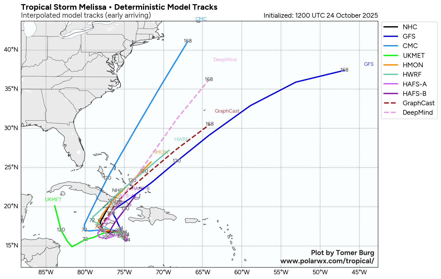
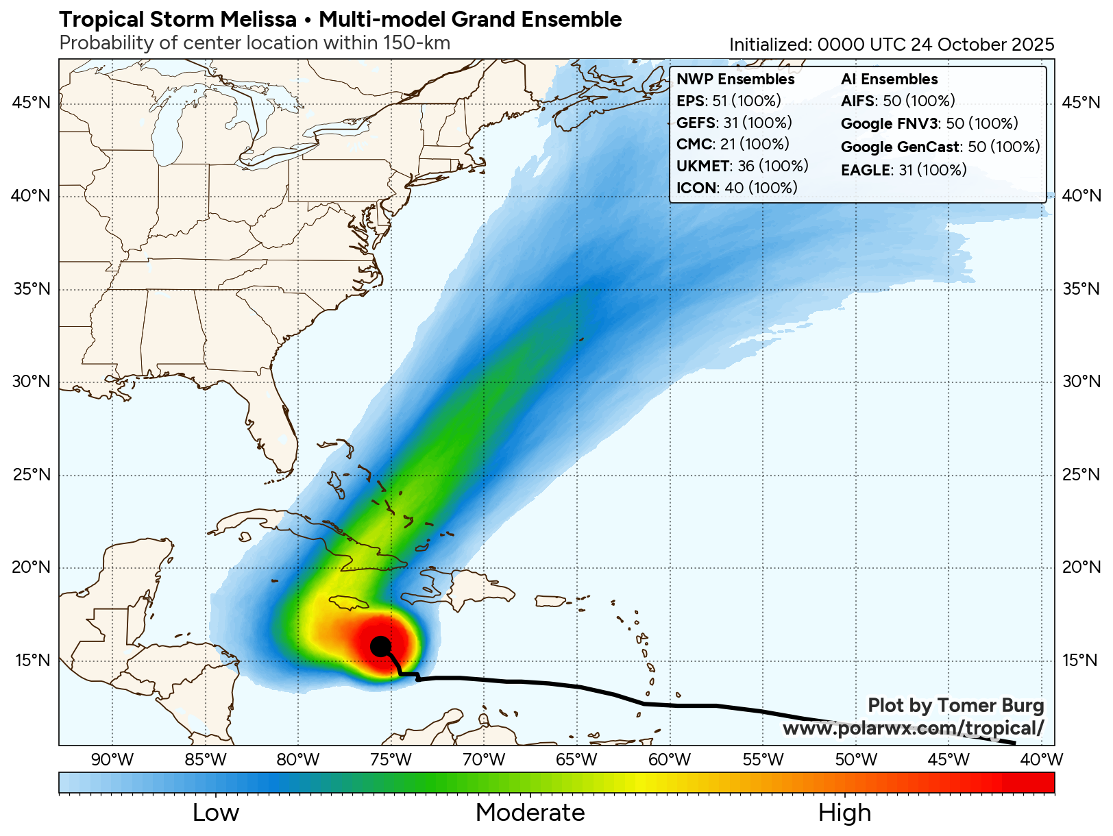
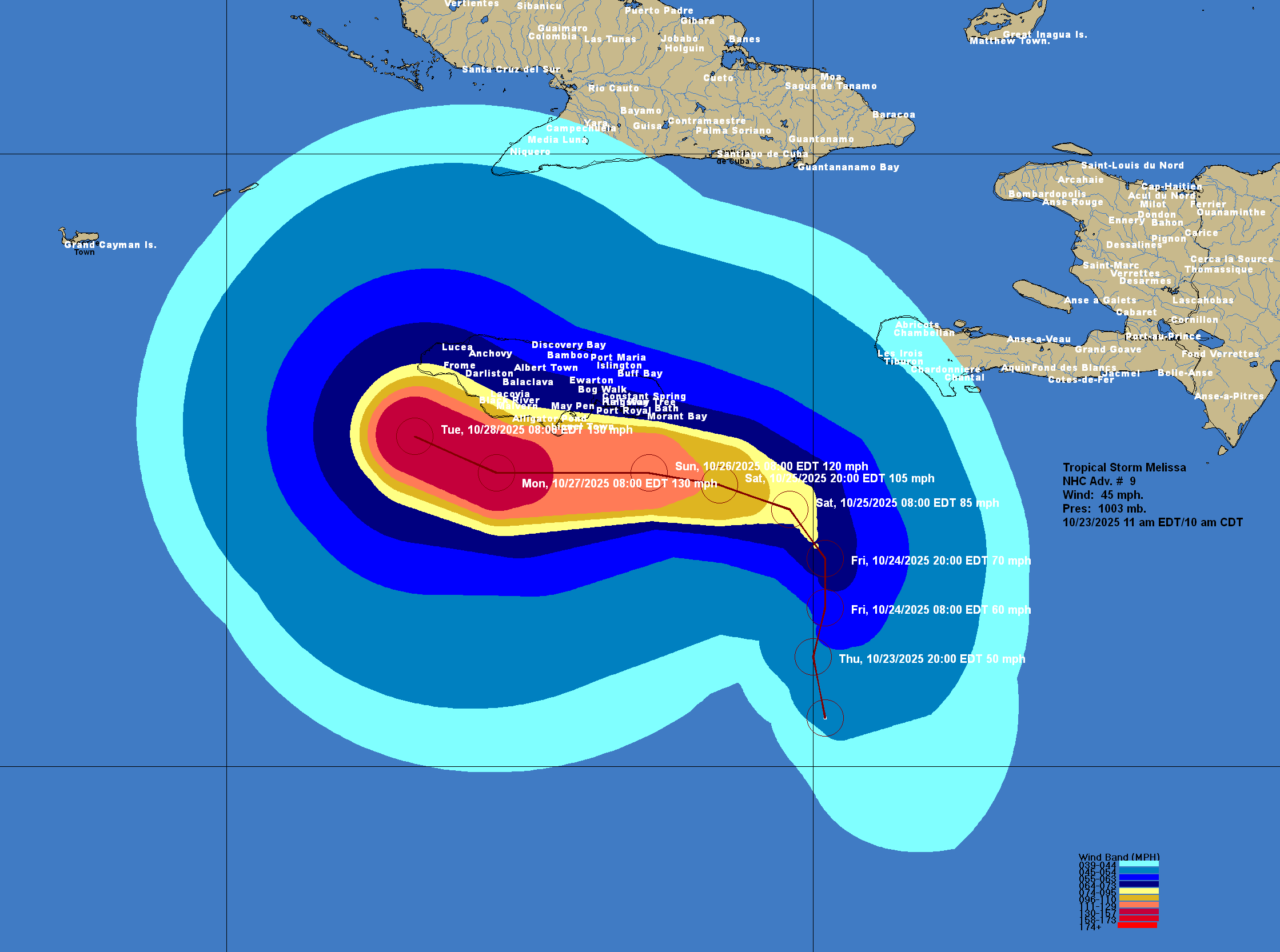
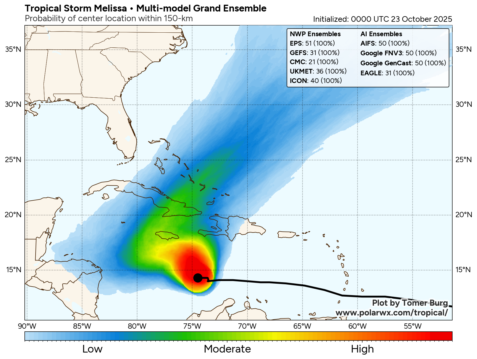
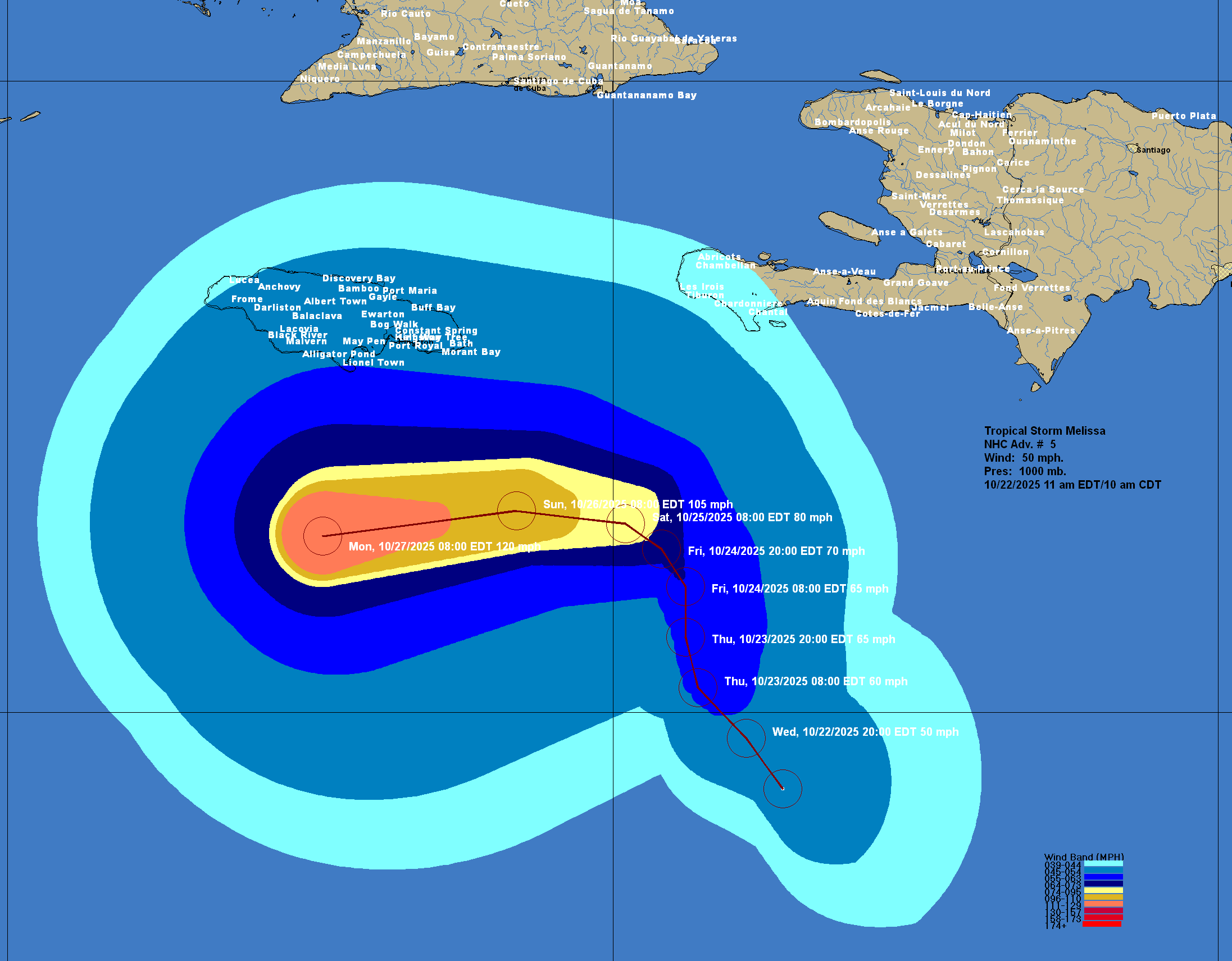
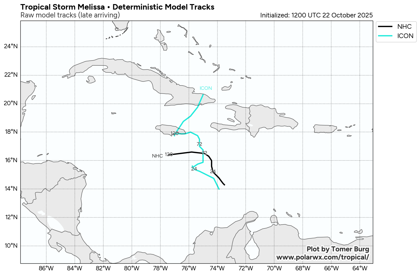
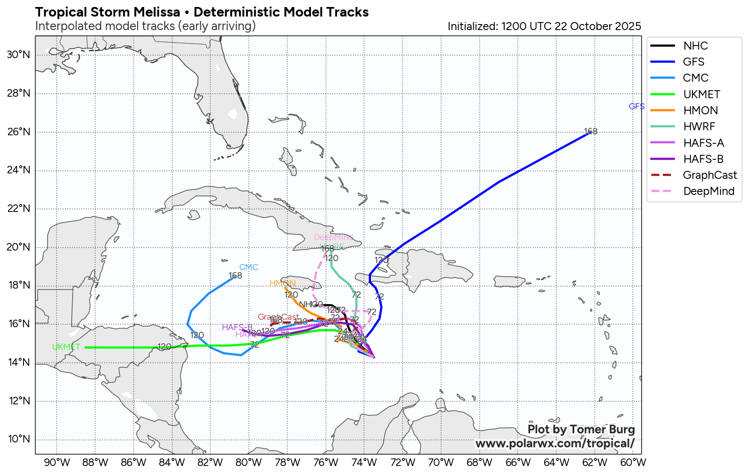
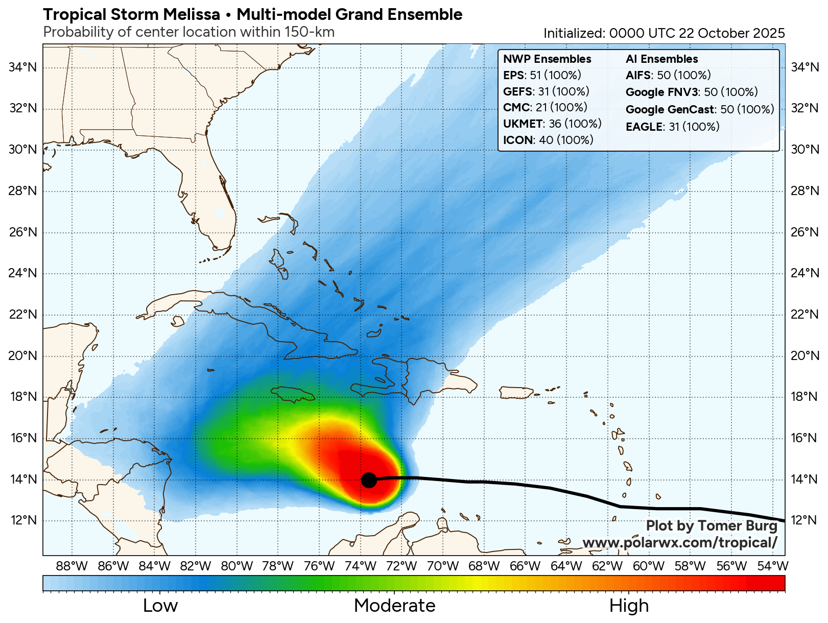
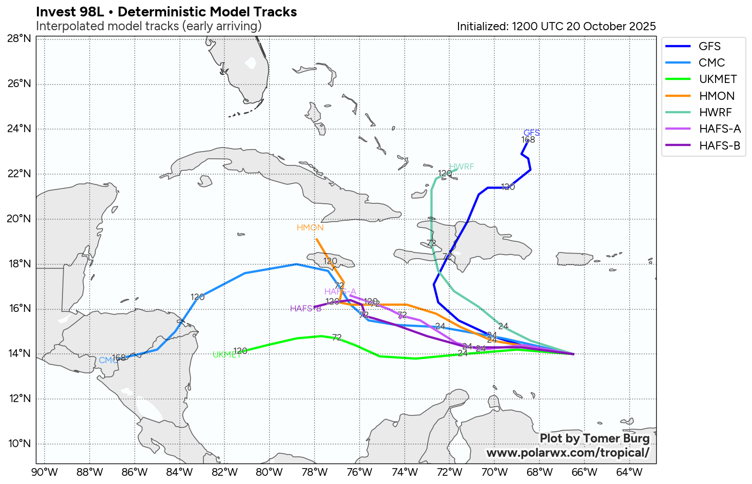
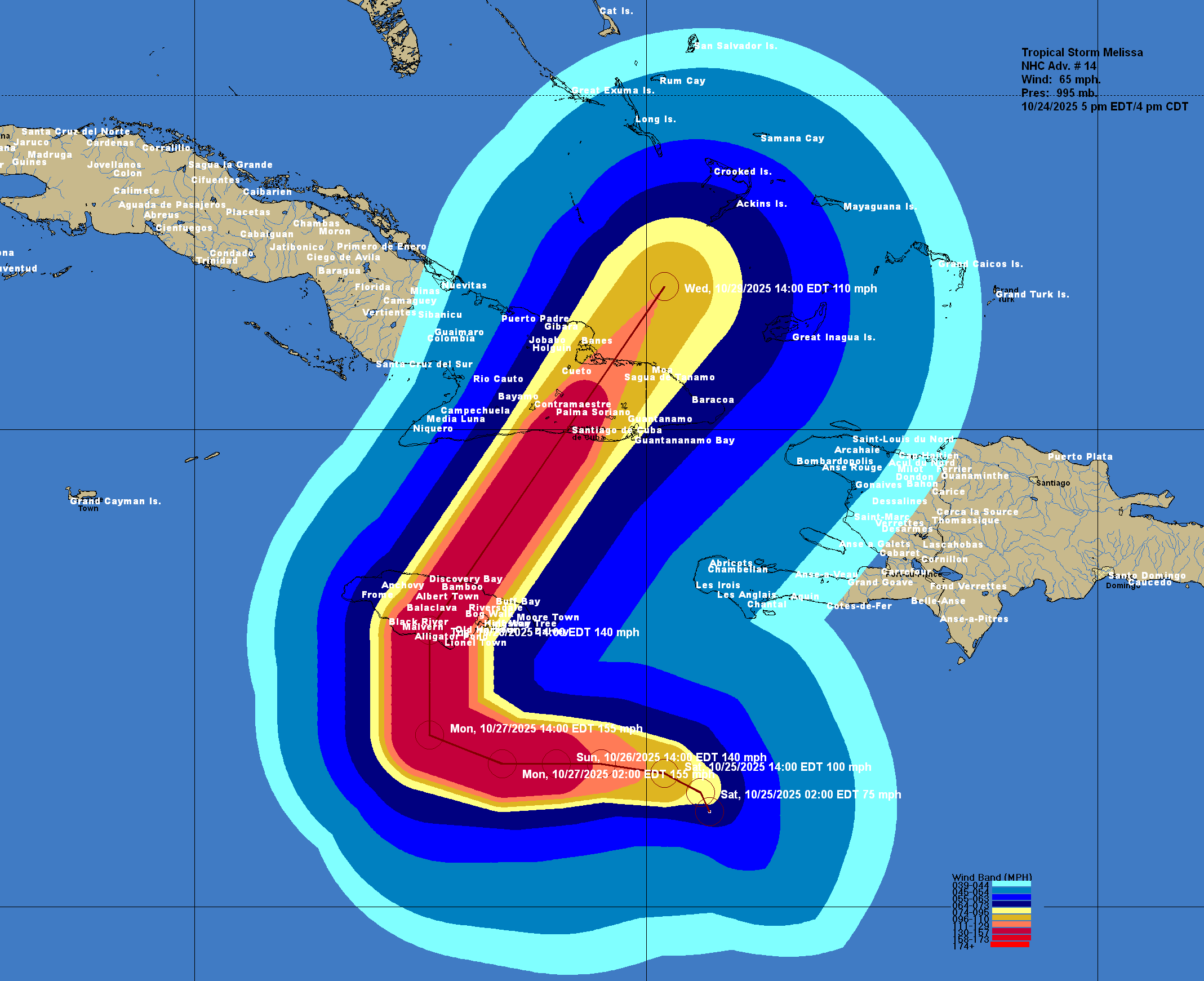
The main reason why I am sending out this update is to warn those of you on the island of Jamaica that a Category 4 or even Category 5 impact is very possible for you. Model guidance are now clustering around a scenario that includes a direct hit in Jamaica. Those of you in Jamaica & if you know someone that is on the island should be prepared for a very major to catastrophic hit in terms of extremely strong winds & catastrophic flooding.
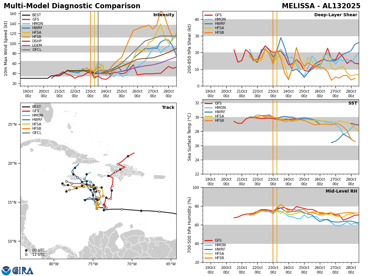
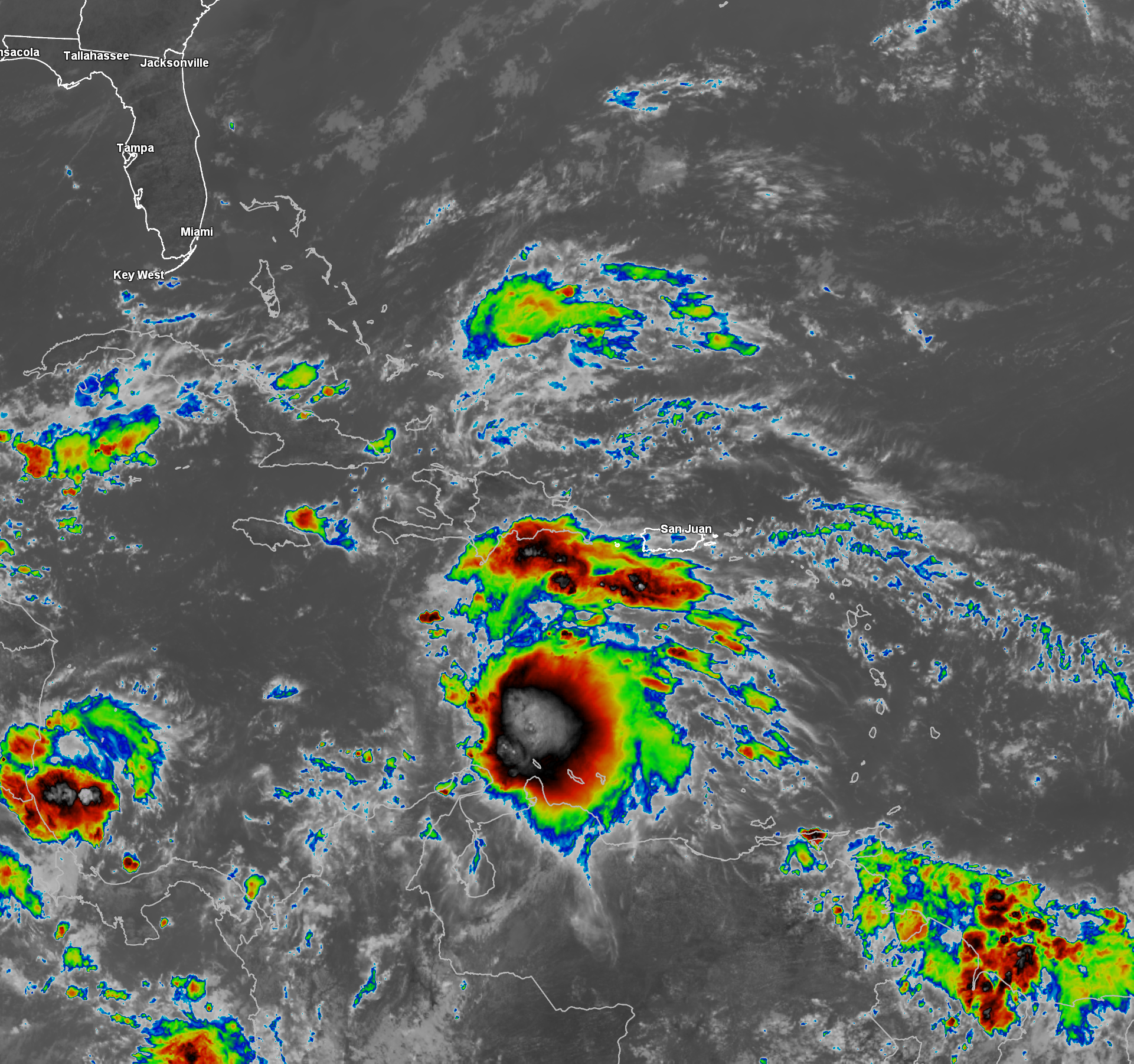
Back to what Melissa is currently doing – After struggling with strong westerly wind shear for several days, Melissa is now finding itself in an environment of lower wind shear & this has allowed the storm to begin to align vertically & now steadily strengthen.
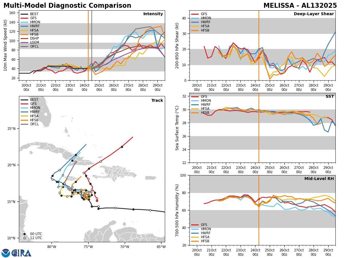
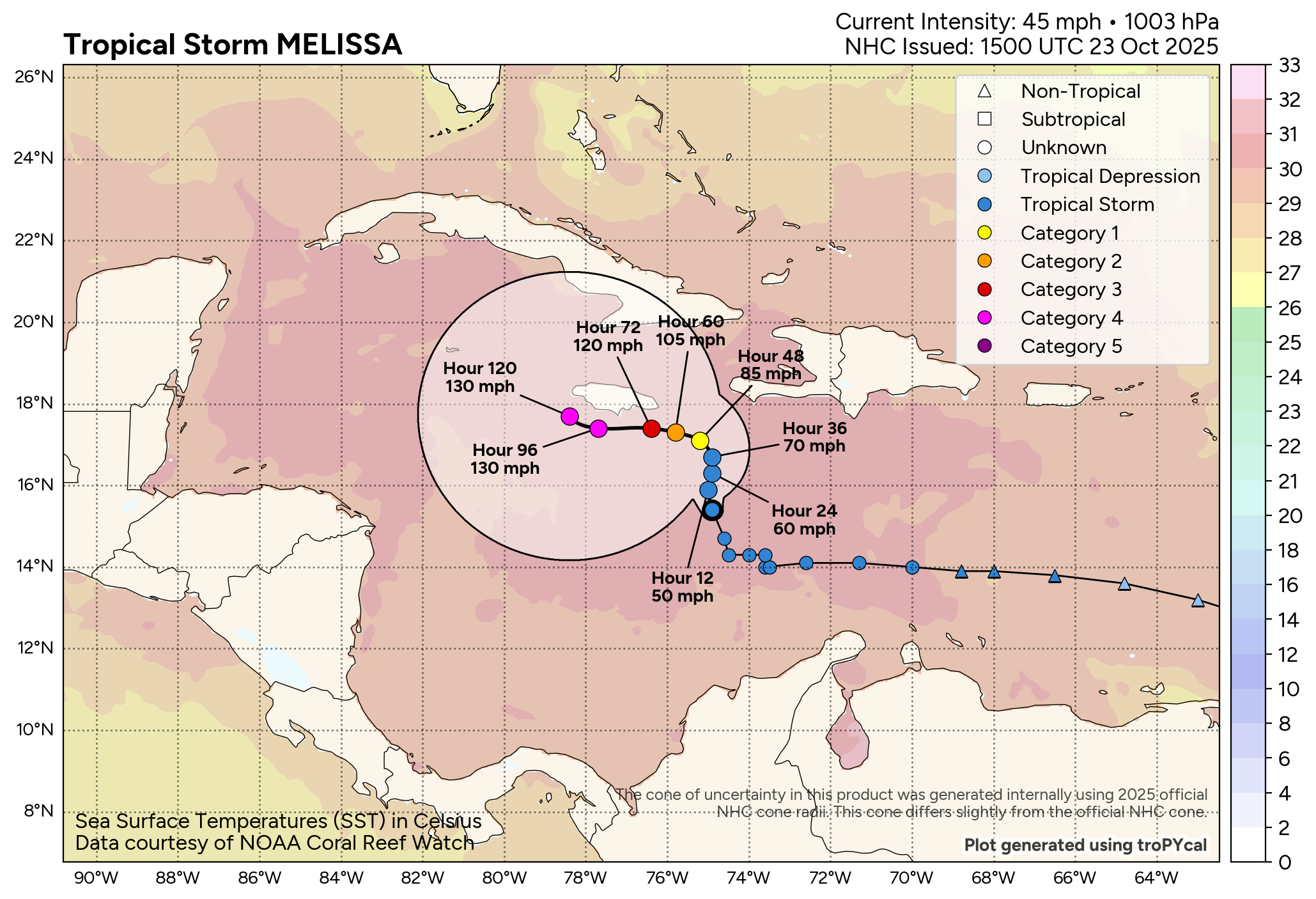
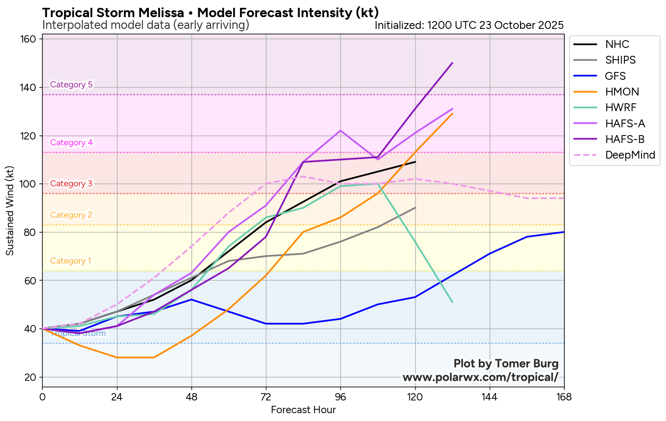
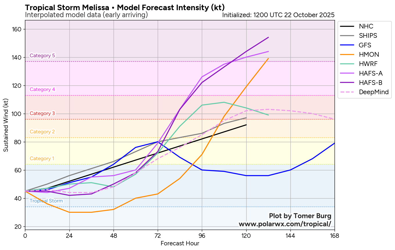
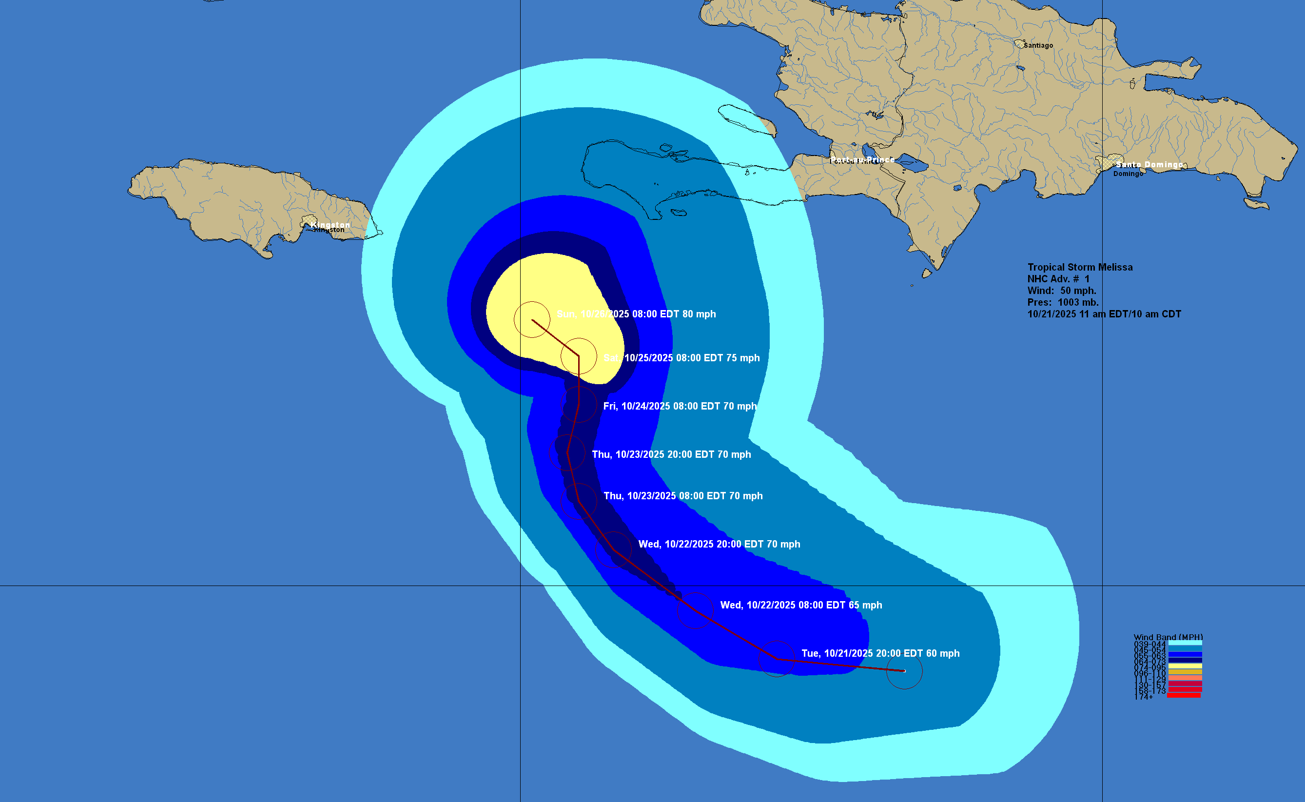
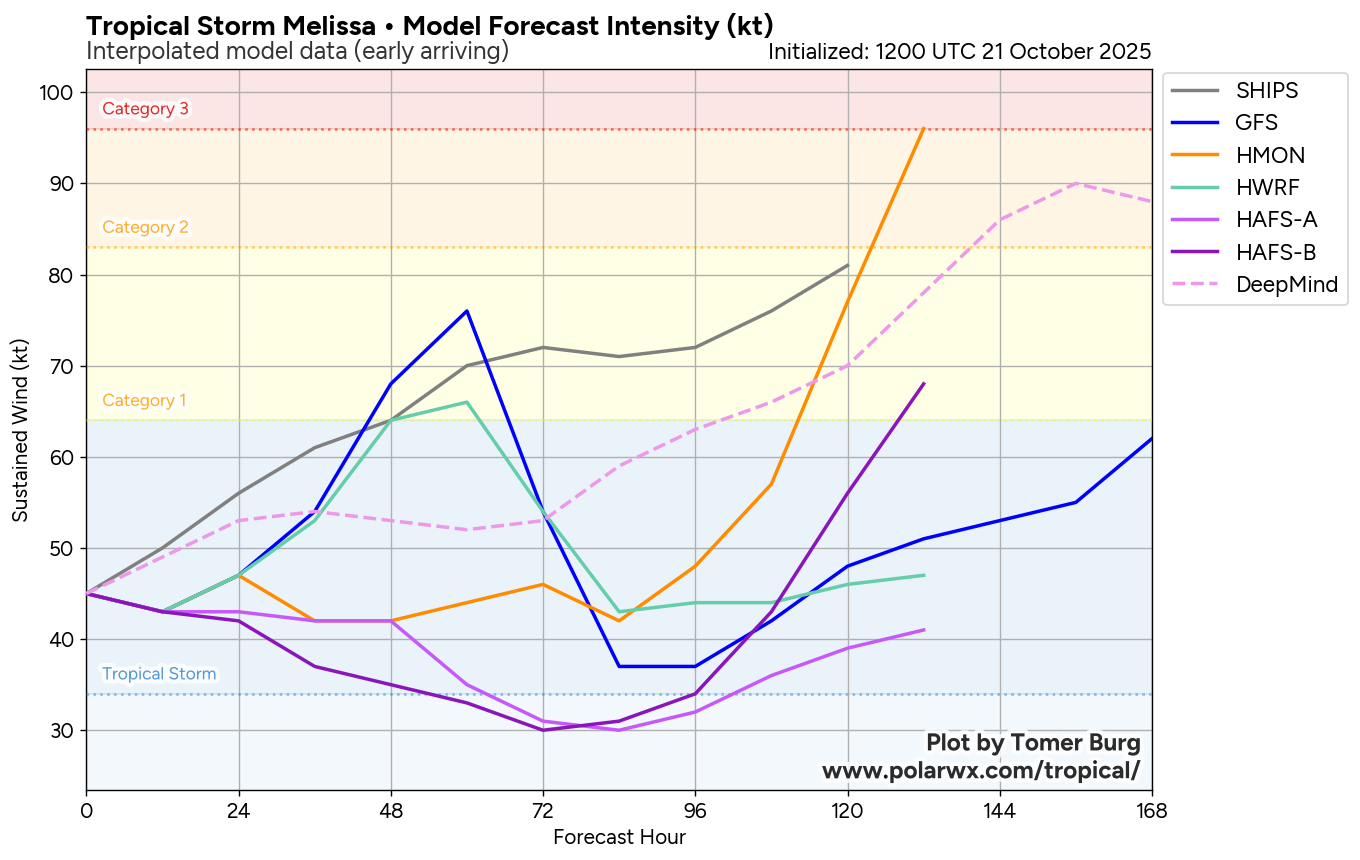
It is now looking very likely that we will see Melissa strengthen rapidly this weekend & it seems more likely that it will be a very major hurricane of perhaps Category 4 to even Category 5 strength as we get into Sunday and Monday when it’s tracking to the south of Jamaica.
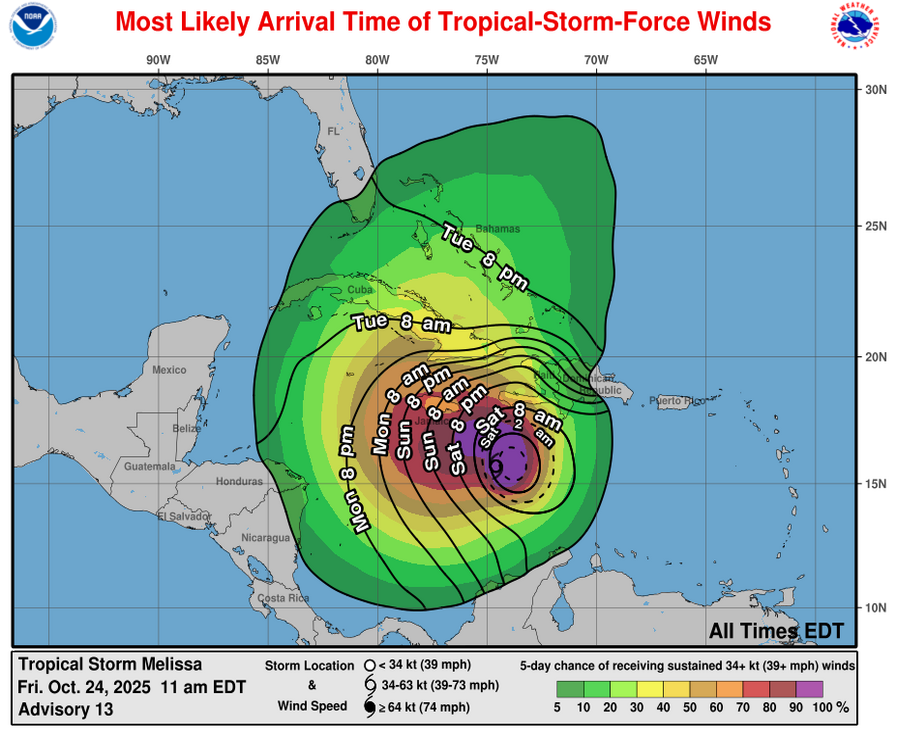
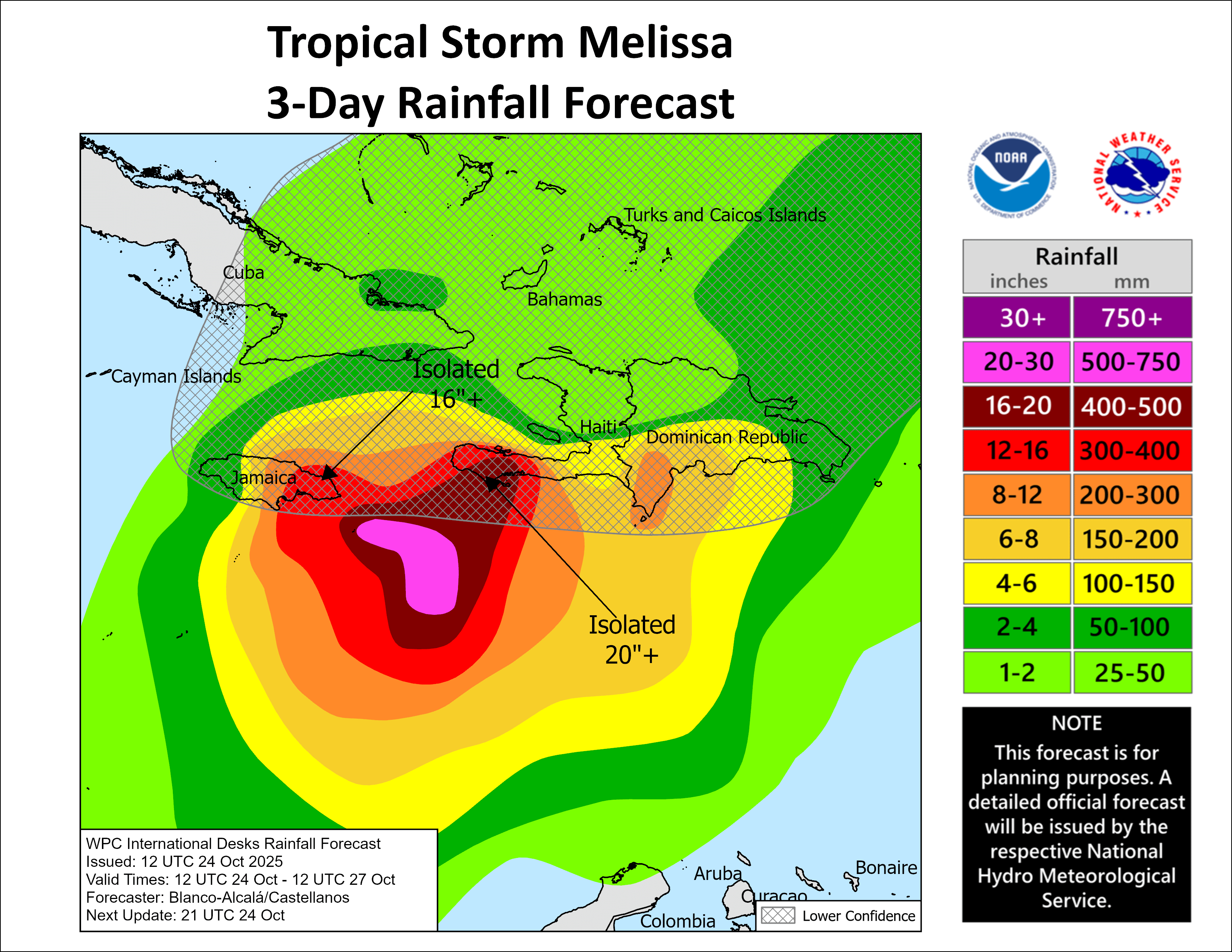
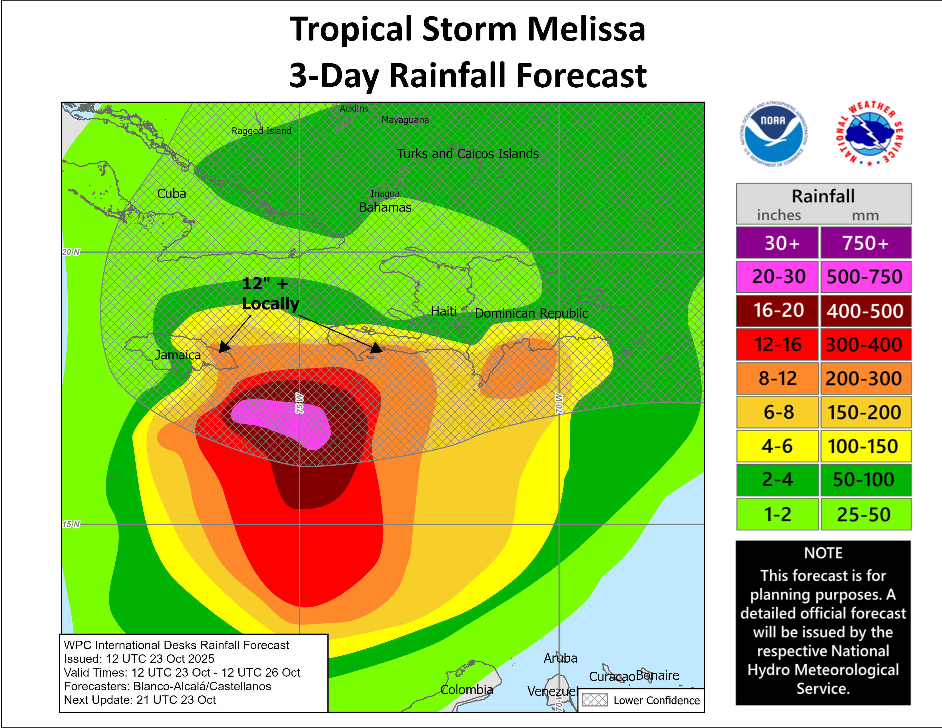
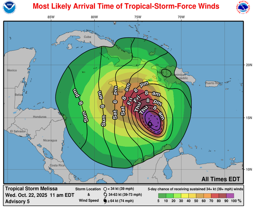
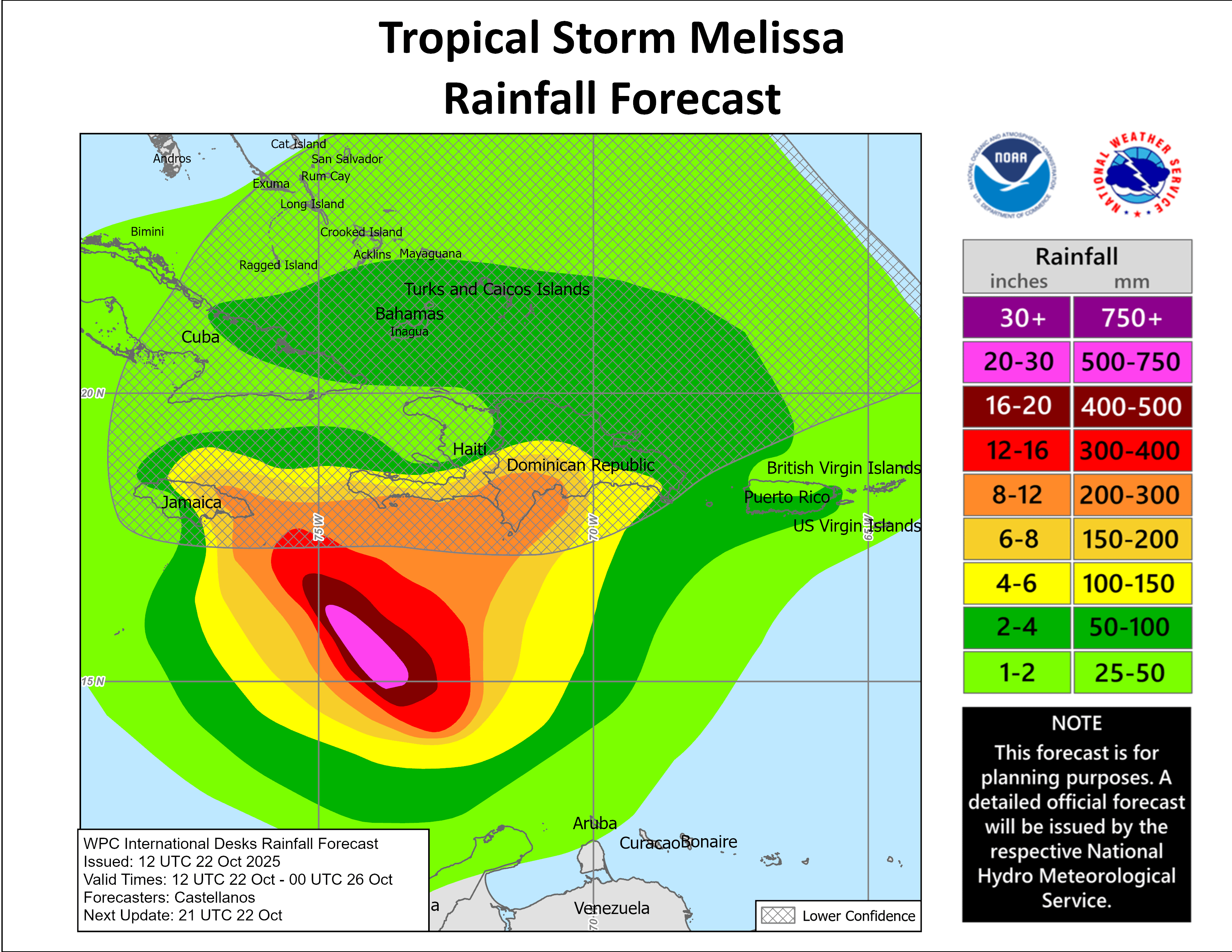
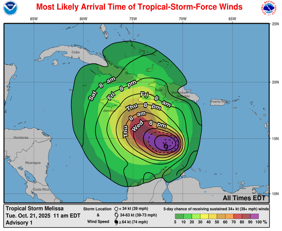
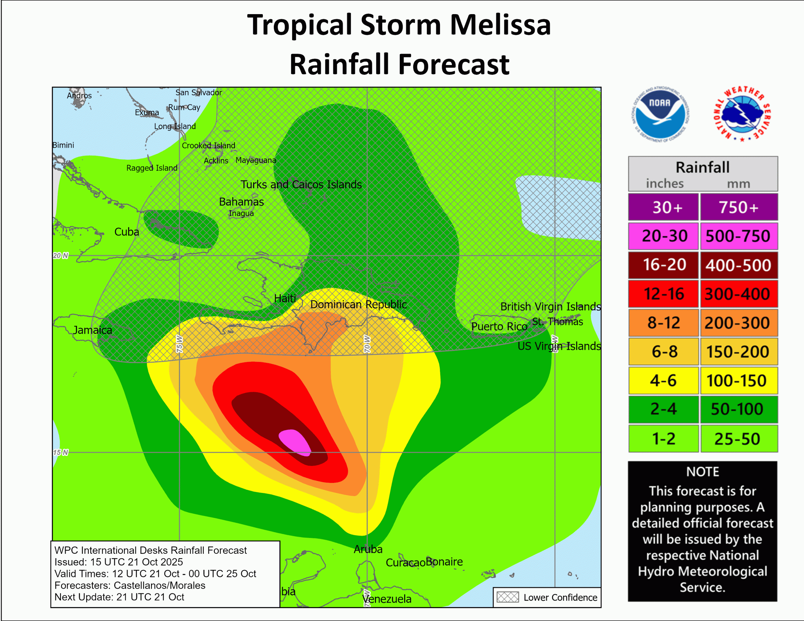
For Those Of You On The Island Of Jamaica – This is looking like this is going to be a prolonged hurricane hit that lasts between 72 and 96 consecutive hours. Yes, this means that there will be extremely heavy rainfall & tropical storm to hurricane-force winds on the islands for 3 to possibly 4 days straight! Rainfall totals on the order of 20 to 30 inches or more can be expected over a 4 day period & this is likely to lead to catastrophic flooding.
Even more concerning is that there is the potential for the core of the hurricane, which could contain Category 4 to even Category 5 winds to move directly over the island during the day on Tuesday as Melissa is pulled to the northeast & ultimately out of the Caribbean.
The impacts from Melissa in terms of both major hurricane conditions and catastrophic flooding could be one of Jamaica’s most destructive hurricanes.
Once again, if you are on the island of Jamaica, I implore you to take this hurricane extremely seriously. If you have friends or relatives on the island, please tell them to take this hurricane extremely seriously. Make absolutely sure that you are in a very sturdy and safe building & be aware that you will be in that shelter for upwards of 4 to 5 days straight.
The next full update on Melissa will be sent out around midday tomorrow (Saturday). Shorter updates on Melissa will be sent out as needed.