It is looking our quiet time period across the Atlantic, Caribbean and Gulf of Mexico is drawing short & we’re about one to two weeks away from entering a very active period of tropical activity across the Atlantic, Caribbean and Gulf of Mexico.
Tropical Wave Over The Far Eastern Tropical Atlantic Near The Coast Of Africa: There is a tropical wave that has just pushed off of the coast of Africa and is sitting over the far eastern tropical Atlantic that does need to be watched closely as it heads westward. It should be noted that development, if any, will be very slow to occur. The reason for this is that it’s going to have to contend with some very dry air that’ll likely suppress thunderstorm development as it heads westward across the eastern and central tropical Atlantic over the next several days.
By later next week, this tropical wave is anticipated to be located near the southeastern Bahamas where the atmosphere is expected to be potentially more favorable for development and this is when I think we’re going to have to keep very close tabs on this particular tropical wave.
At this point, only the European model and its ensemble members are the only model guidance that have been forecasting eventual development from this tropical wave. It should be noted that even the European model has backed off on forecasting development of this wave. The other model guidance, including the GFS model and the Canadian model are currently showing no development at all from this particular tropical wave.
My Take Is That I think that the environmental conditions are still a bit too hostile out across the Atlantic Basin and we probably will not see tropical development from this particular tropical wave for at least the next 5 to 7 days or so.
It’s possible that we may need to watch for tropical development of this particular tropical wave once it reaches the southwestern North Atlantic near the Bahamas late next week into next weekend (period from August 1-4). This is the type of hurricane season that we will need to watch all disturbances and waves for development, especially when the background environmental conditions become more favorable for development. That said, I do think that the development chances are still low.
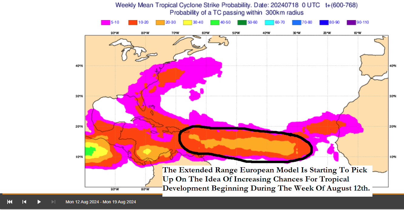
A Period Of Very Active Tropical Activity Is Only 1 To 2 Weeks Away From Beginning: The sinking, dry, dusty air that’s plagued the Atlantic throughout much of this month is about to come to an abrupt end as a large area of rising air and much more favorable conditions for tropical development is about to enter the Atlantic.
All indications are that we should transition into the much more favorable conditions for tropical development with the area of rising air during the first week of August. If that wasn’t enough, it also looks the overall wind shear pattern will become very favorable for development across much of the Atlantic by the week of August 5th leading to an environment that will allow tropical systems to develop and strengthen into tropical storms and hurricanes.
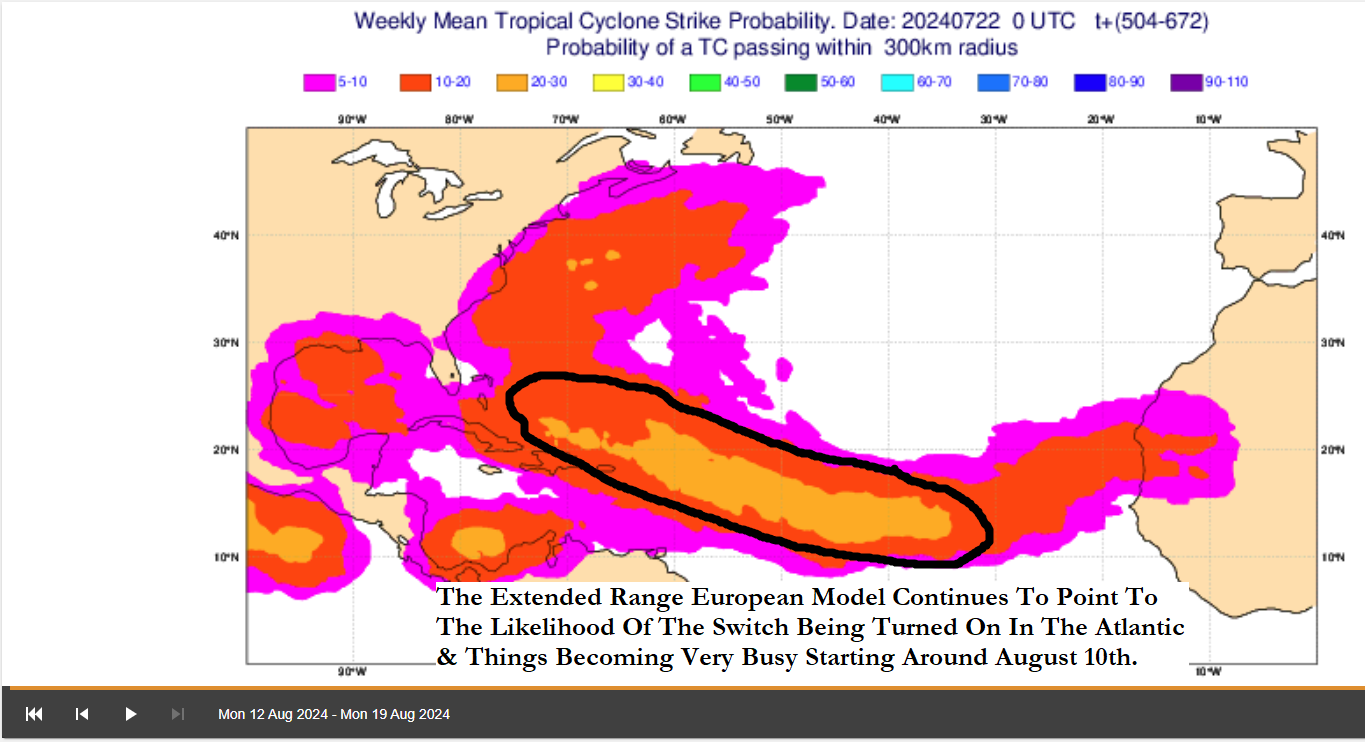
I do still think that the overall switch in the Atlantic will be flipped back on around August 10th and once that happens, it’s going to get extremely busy very quickly.
The Bottom Line Remains The Same & That Is That even though we are in a brief quiet period across the Atlantic, it is extremely likely that we will see a drastic and dramatic switch into an active to very active tropical weather pattern right around August 10th. Once this happens, things will be very primed and very ready for a very, very busy time across the Atlantic, Caribbean and Gulf of Mexico that will last from about August 10 right through the rest of August, all of September and all of October.
The next tropical weather discussion will be issued on Saturday.