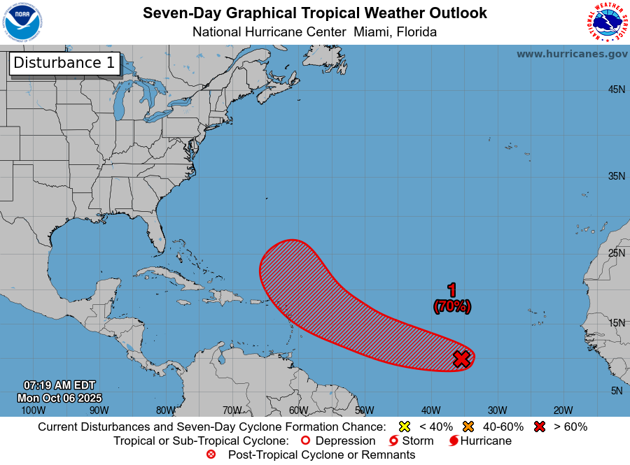
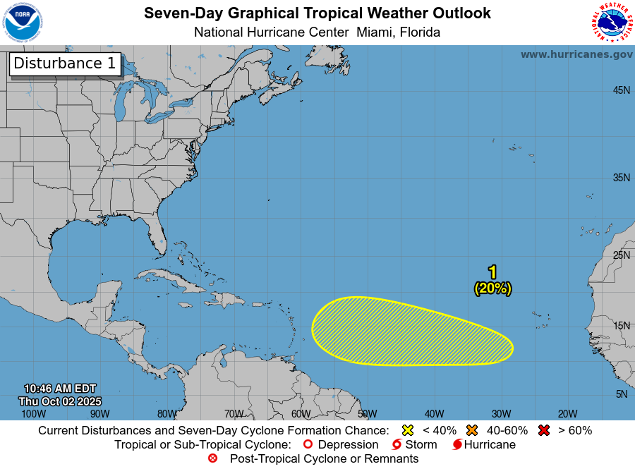
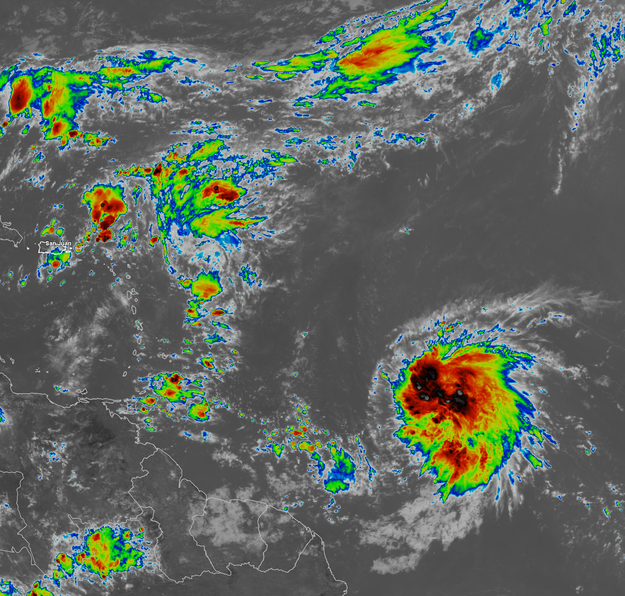
Tropical Storm Jerry: The disturbance over the central Tropical Atlantic that has been labeled Invest 95-L has become much better organized today with increasing amounts of concentrated convection near a low-level center. Additionally, satellite derived wind data reveals a closed circulation and winds of up to 45 mph. Because of this, the National Hurricane Center has upgraded this system to Tropical Storm Jerry.
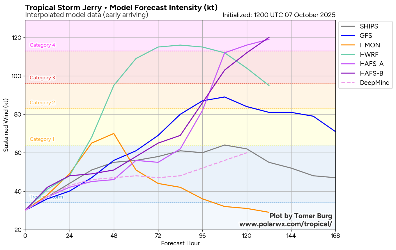
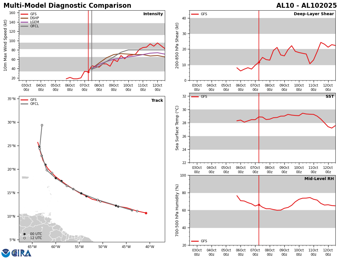
A look at the latest model guidance reveals that Jerry will probably strengthen over the next couple of days & it could be a hurricane by the time it tracks very close to the northern Leeward Islands late Thursday into Friday.
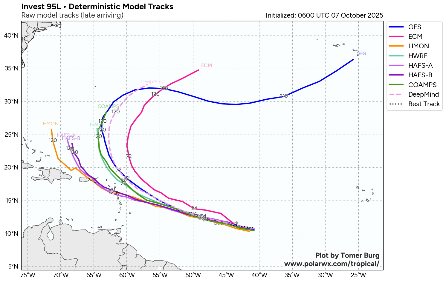
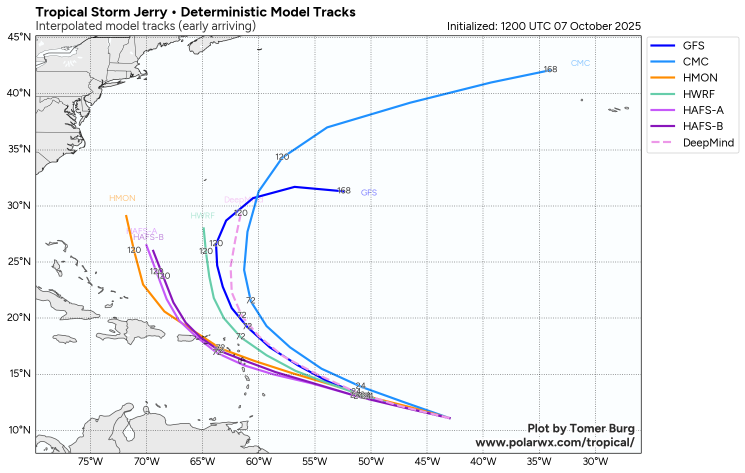
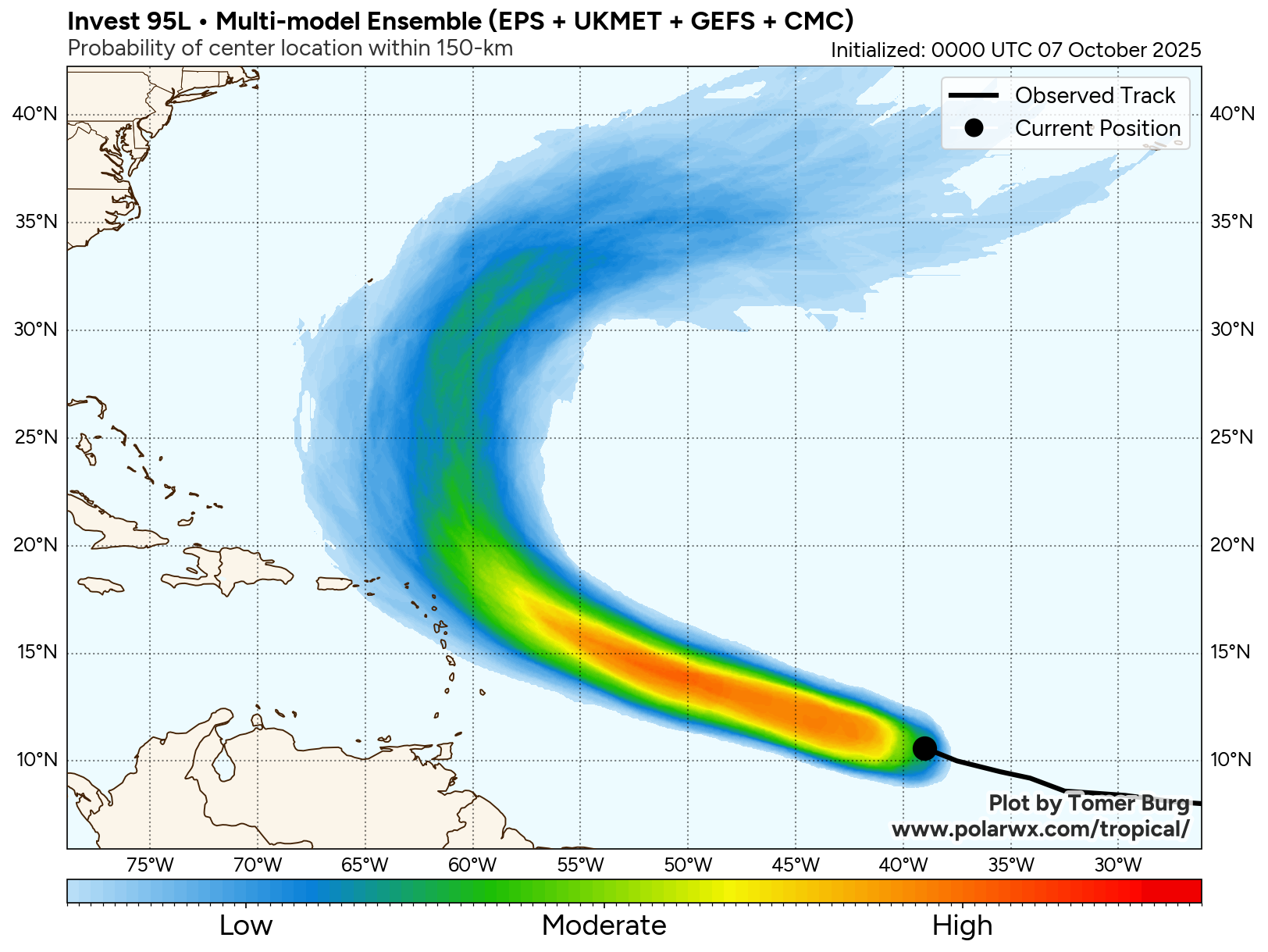
The track model guidance are a little eyebrow raising as some of the guidance have trended back towards a path that takes Jerry very, very close to the far northern Leeward Islands. In fact, the Google Deep Mind AI model guidance now shows a track that puts the northern Leeward Islands in line for a direct impact from Jerry Thursday afternoon and Thursday night.
Other track model guidance, including the consensus guidance, still show a path that takes Jerry north of the islands. That said, there is enough uncertainty now in the forecast that says those of you in the Leeward Islands and particularly the northern Leeward need to keep very, very close watch on the forecasts of Jerry. It isn’t going to take a whole lot of a shift in the consensus forecast track to put tropical storm and even hurricane conditions right over the northern Leeward Islands from Antigua and Barbuda northward through Anguilla and St. Martin starting sometime on Thursday and continuing into Friday.
As for the Virgin Islands and Puerto Rico – It appears that the outer rain bands from Jerry will affect the Virgin Islands and Puerto Rico with squally weather likely starting on Friday and lasting into this weekend.
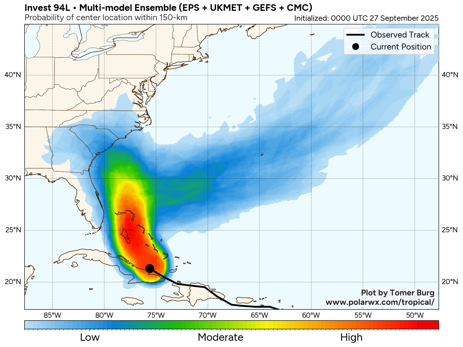
One thing that is for sure is Jerry will not be a problem at all for the Bahamas or the United States as a strong cold front pushing offshore of the East Coast on Wednesday will kick Jerry out into the open Atlantic.

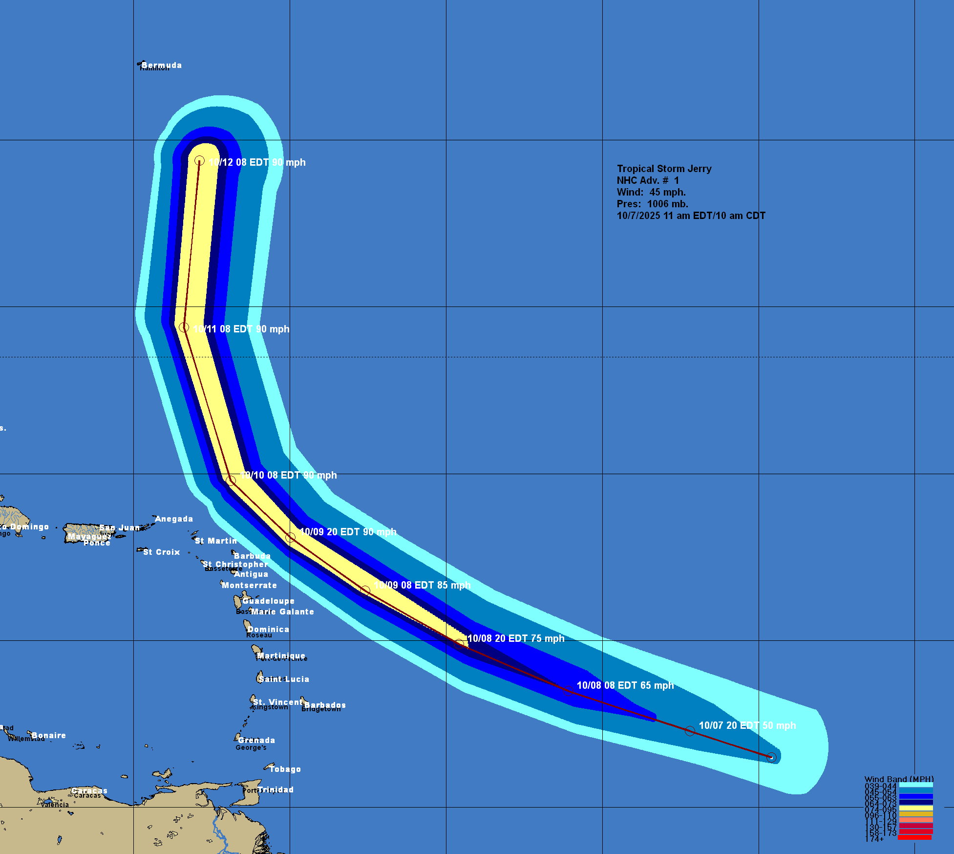

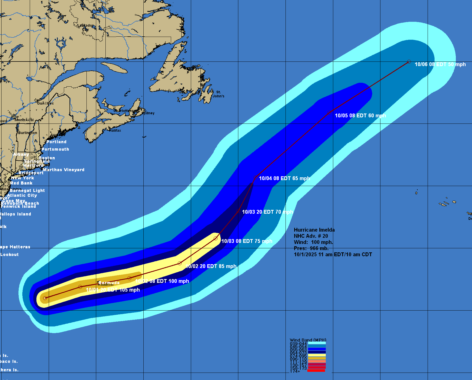
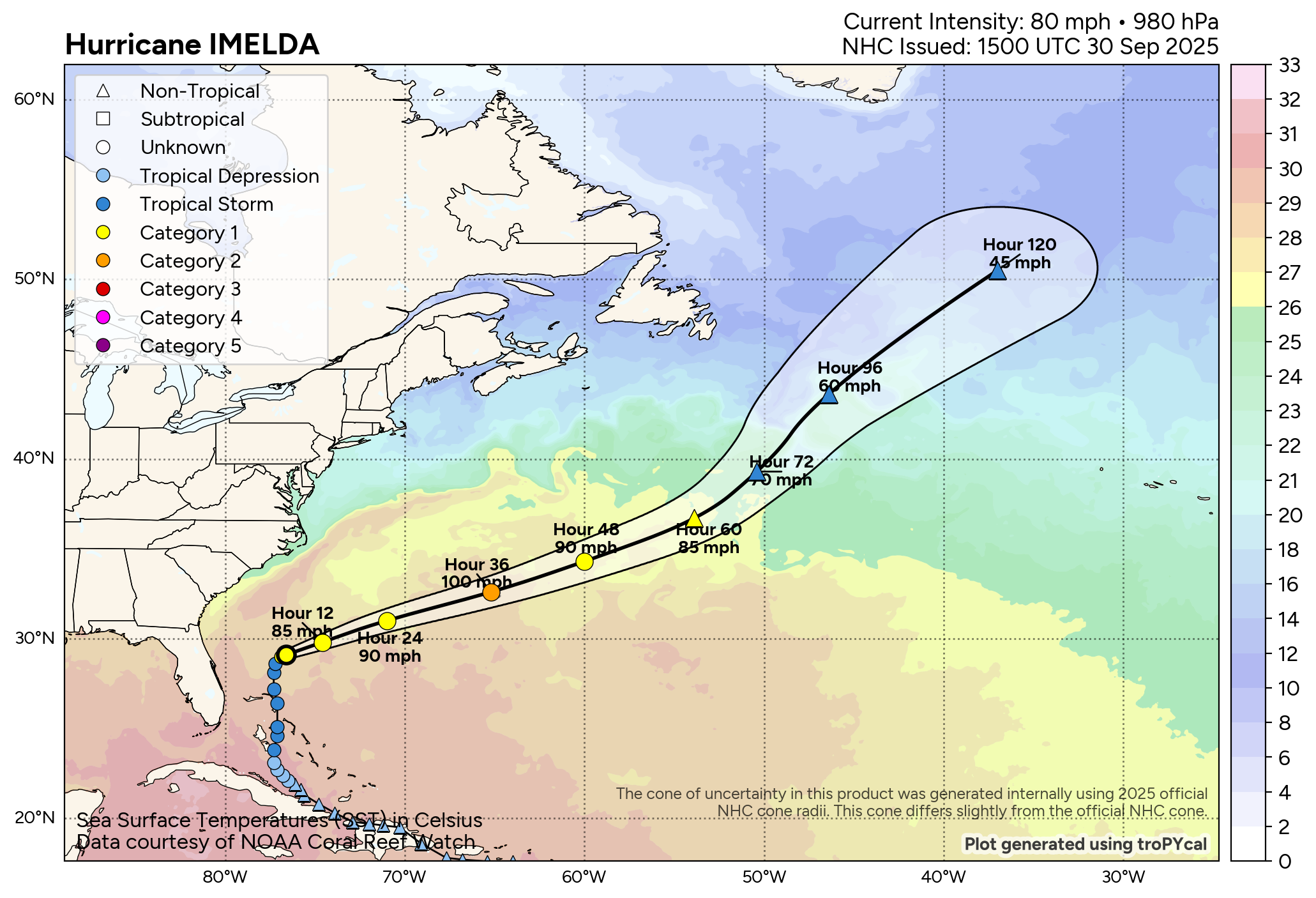
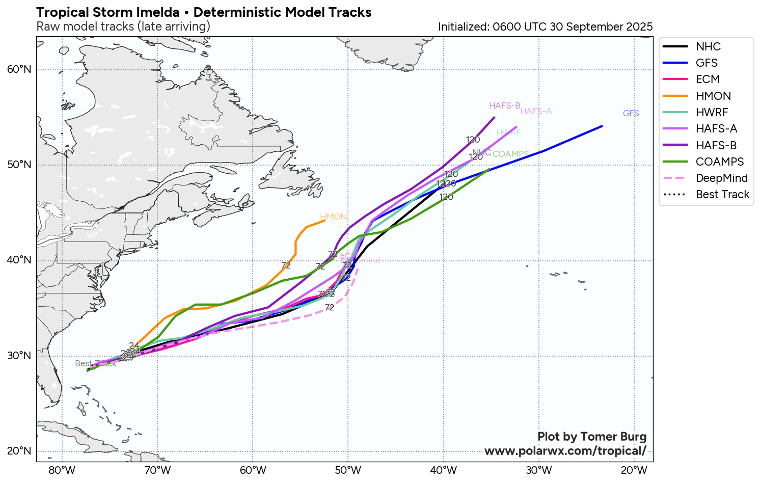
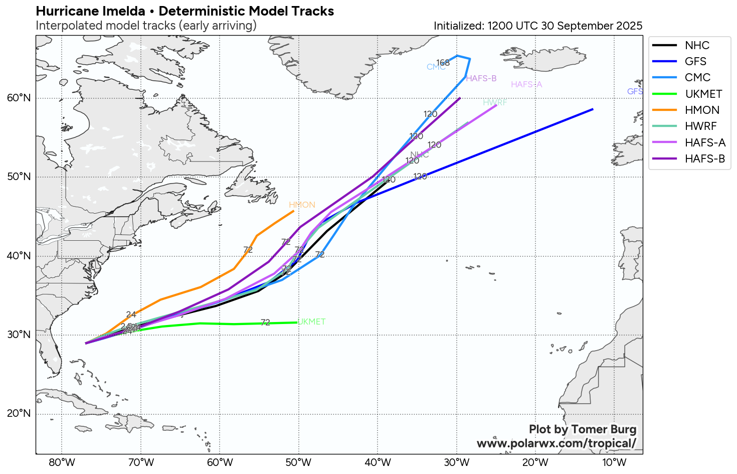
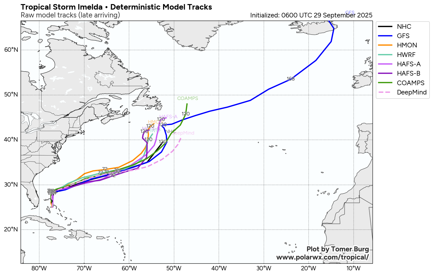
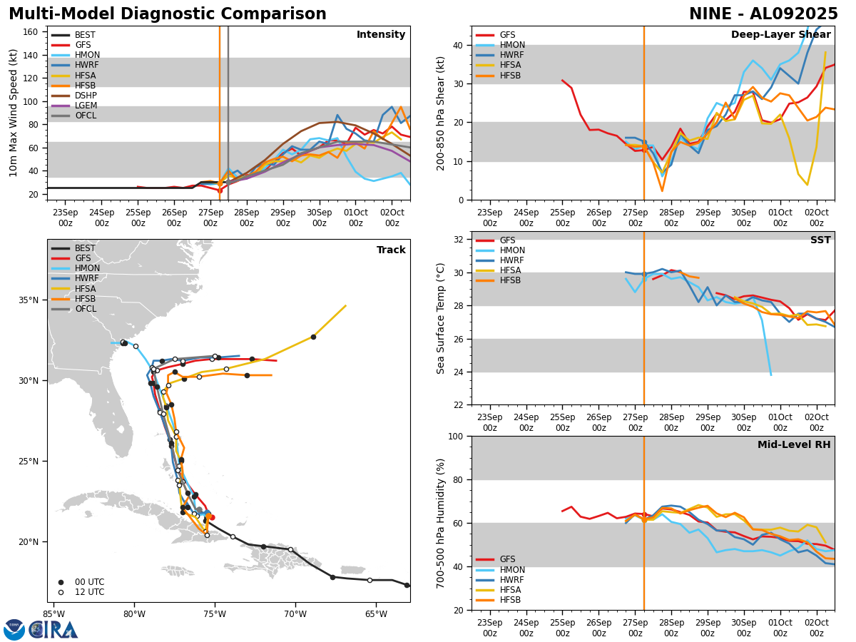
Model Track Forecast:
Satellite Imagery:
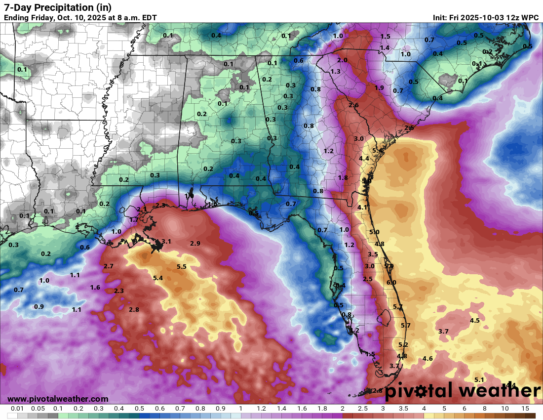
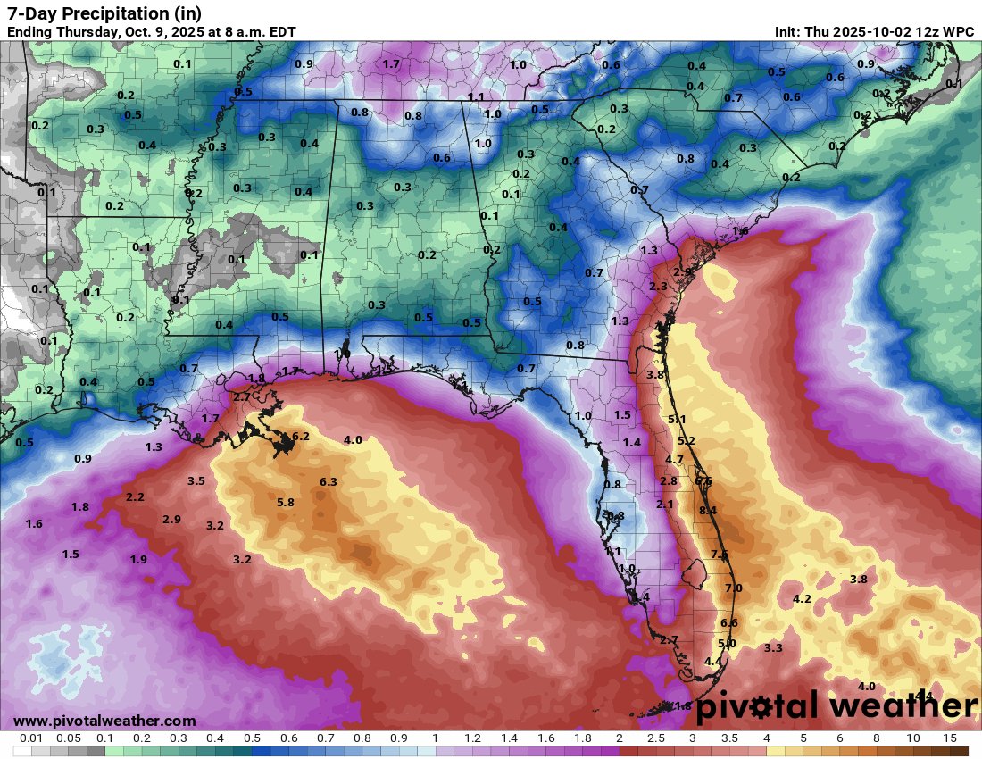
Weekend Storm System Along The Carolinas & Mid-Atlantic Is Quite Likely: It continues to look rather likely that a storm system will take shape near the coast of the Carolinas by Friday night and Saturday and then move very slowly along the coastlines of the Carolinas and the Mid-Atlantic states throughout this weekend into early next week. This storm has the very real potential to bring heavy rain, gusty onshore winds, rough surf and coastal flooding in the coastal Carolinas and along the Mid-Atlantic coastline.
While it is very likely that this low pressure system will start out as non-tropical in nature, it is possible that it could try to transform into a sub-tropical storm during this weekend, especially if it slowly moves over the waters of the Gulf Stream. This is something that’ll definitely be watched closely.
The impacts from this storm system will be the same, whether it’s a non-tropical or a sub-tropical storm. These impacts will include the coastal Carolinas and the Mid-Atlantic states being hit very hard this weekend by bands of heavy rain, gusty onshore winds gusting up to 50 mph, very rough surf and coastal flooding.
There is quite a bit of uncertainty as to how far north this storm system may move early next week. Some guidance show a far enough north track so that areas from New York City through Long Island and into Southern New England would be impacted by heavy rain, gusty winds and rough surf early next week. Other guidance show no such northward track & keeps all of impacts in the Carolinas and the Mid-Atlantic states as high pressure shields New England from any impacts.
I will continue to keep a close eye on this storm system & will have more updates in the days to come.
The next tropical weather discussion will be issued on Wednesday.