A major storm storm will impact much the central and eastern United States throughout the rest of today through Monday. This storm will bring a blizzard to parts of the upper Midwest and significant severe weather from the Mississippi & Ohio Valleys eastward to the Mid-Atlantic states and the Carolinas.
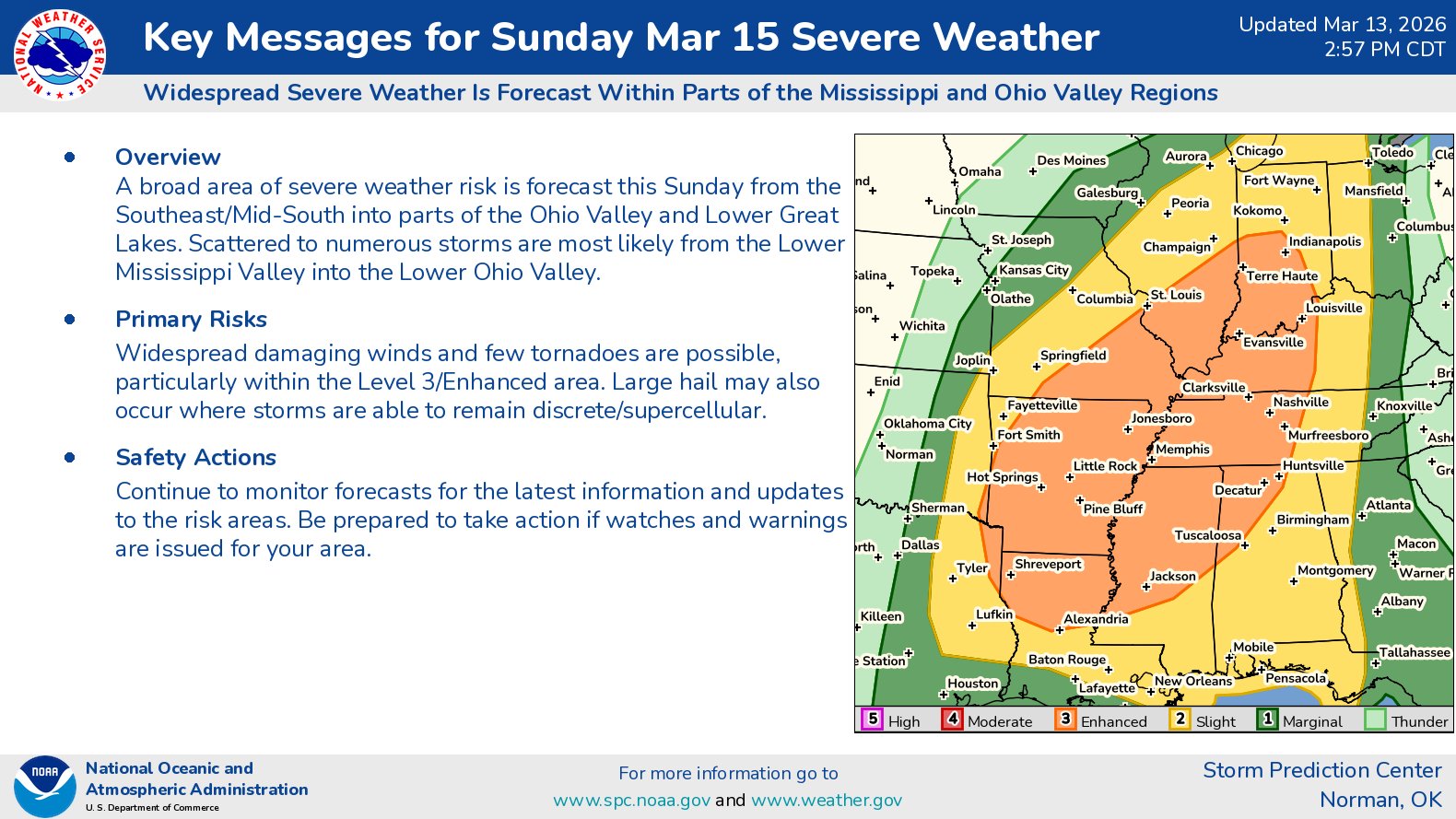
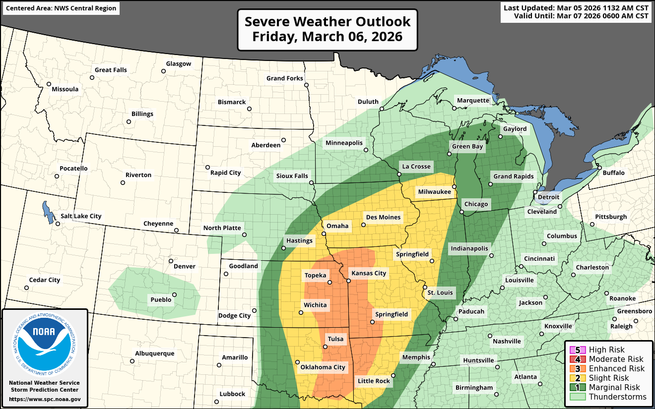
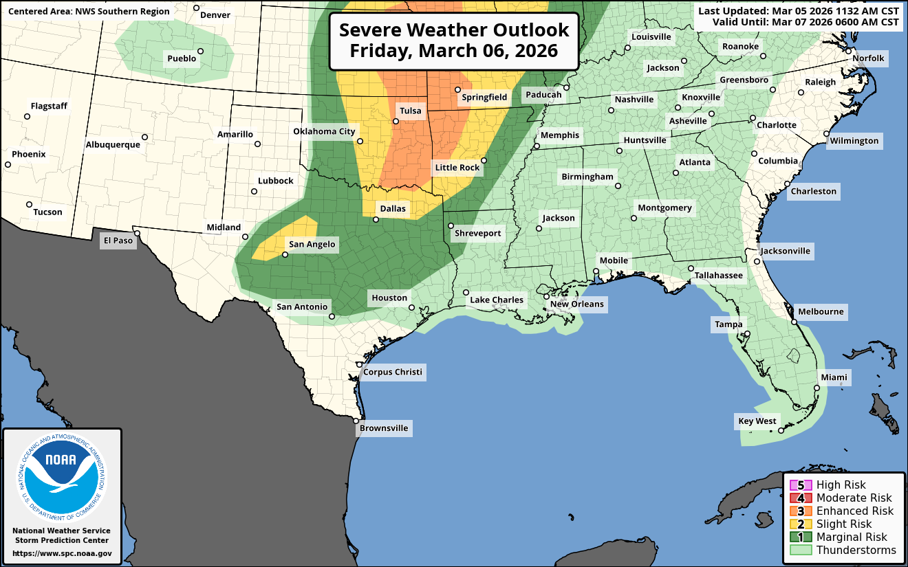
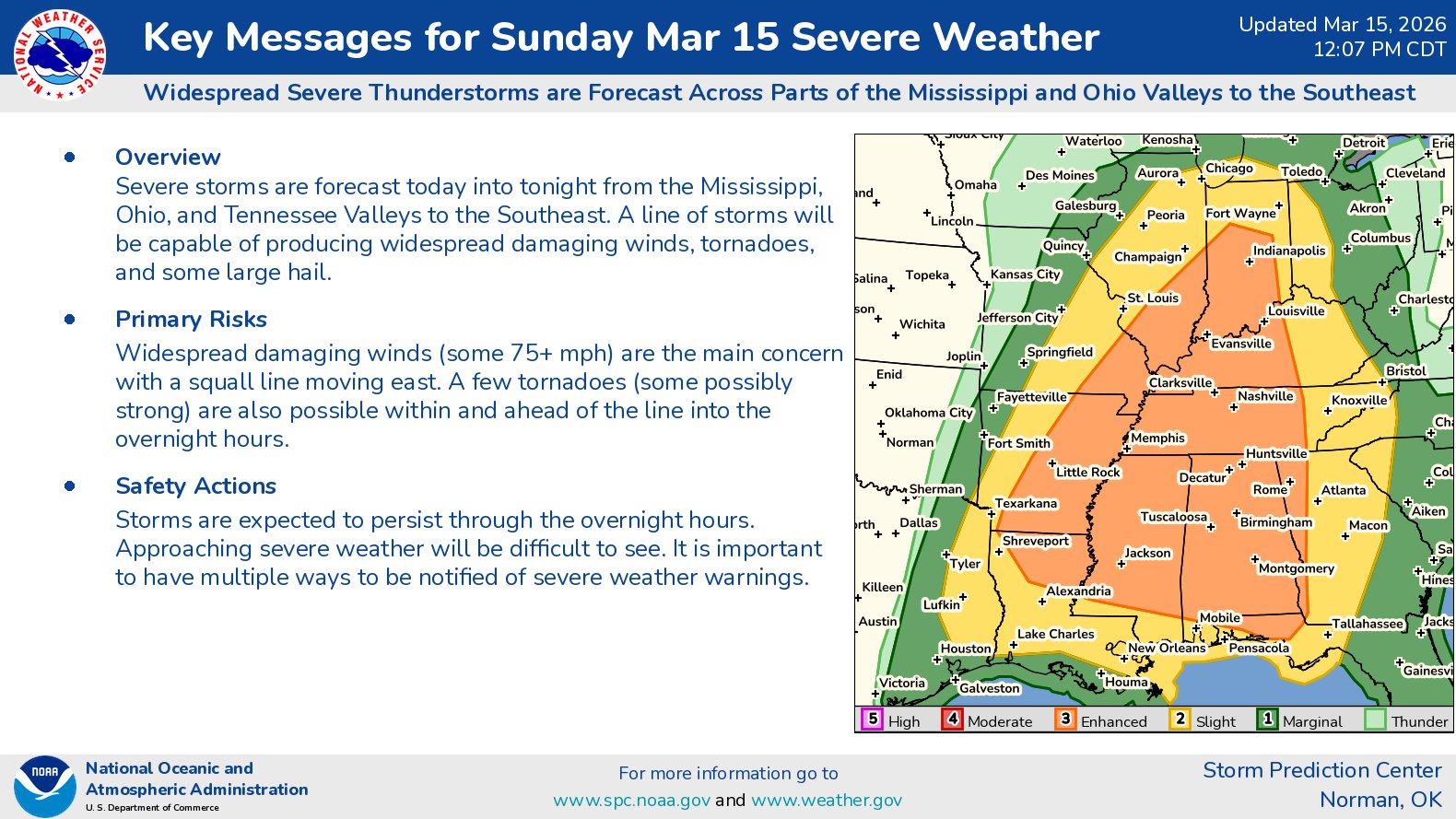
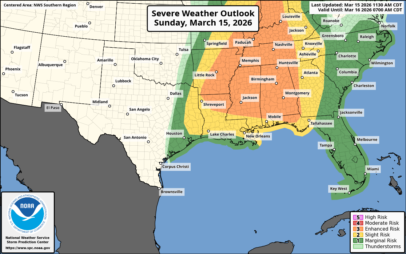
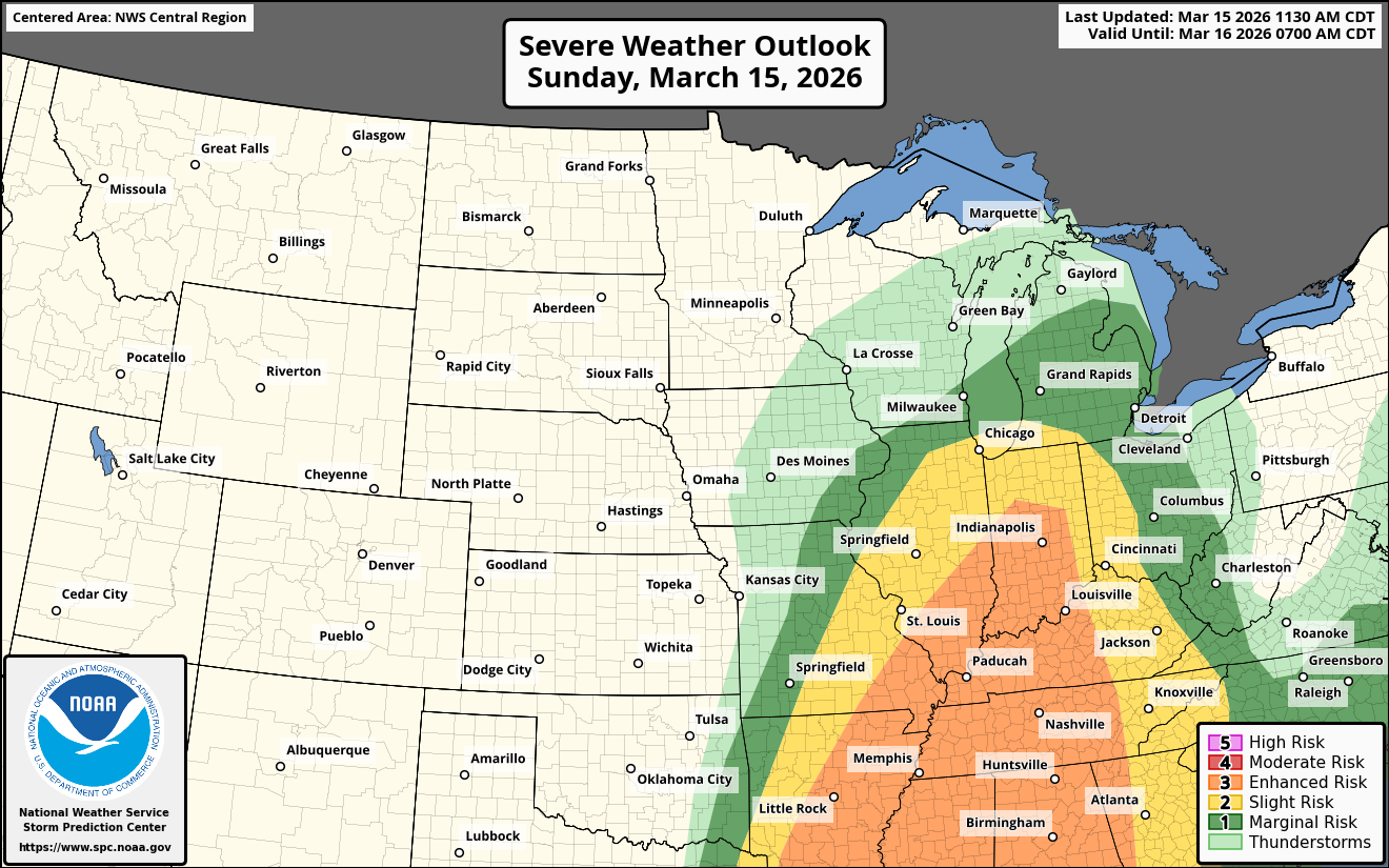
Significant Severe Weather This Afternoon Into Tonight: Widespread severe weather with damaging winds and embedded tornadoes are expected as an intense squall line sweeps eastward across much of the lower and middle Mississippi Valley during this afternoon and this evening. Some strong tornadoes are a possibility across parts of the lower Ohio Valley into the Tennessee Valley and near the northern Gulf Coast. Widespread damaging winds and tornadoes will likely persist during tonight across the Ohio Valley southward into Mississippi, Alabama and Georgia.
A squall line is expected to develop by mid to late afternoon today and strengthen this evening as it moves quickly to the east across southeastern Missouri, Arkansas and Louisiana into the middle and lower Mississippi Valley and the lower Ohio Valley. Widespread damaging winds with gusts of up to 60-80 mph are expected with this squall line. Additionally, embedded tornadoes are expected within the squall line as it pushes eastward.
Supercell severe thunderstorms may develop out ahead of the main squall line from western Kentucky and western Tennessee into eastern Arkansas, northern Louisiana and Mississippi during late this afternoon and this evening. Any supercells that do form could produce strong tornadoes.
During the overnight hours of tonight, that squall line will push across the lower Ohio Valley and the Tennessee Valley into Mississippi, Alabama and western Georgia. Widespread damaging winds of up to 60-80 mph in gusts and embedded tornadoes will be a threat.
Finally, there is also a threat for supercells to push onshore across southeastern Alabama, the Florida Panhandle and southwestern Georgia from well after midnight tonight into Monday morning. Should this occur, there would be a threat for strong tornadoes.
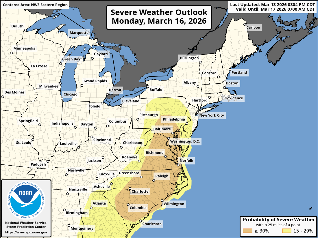
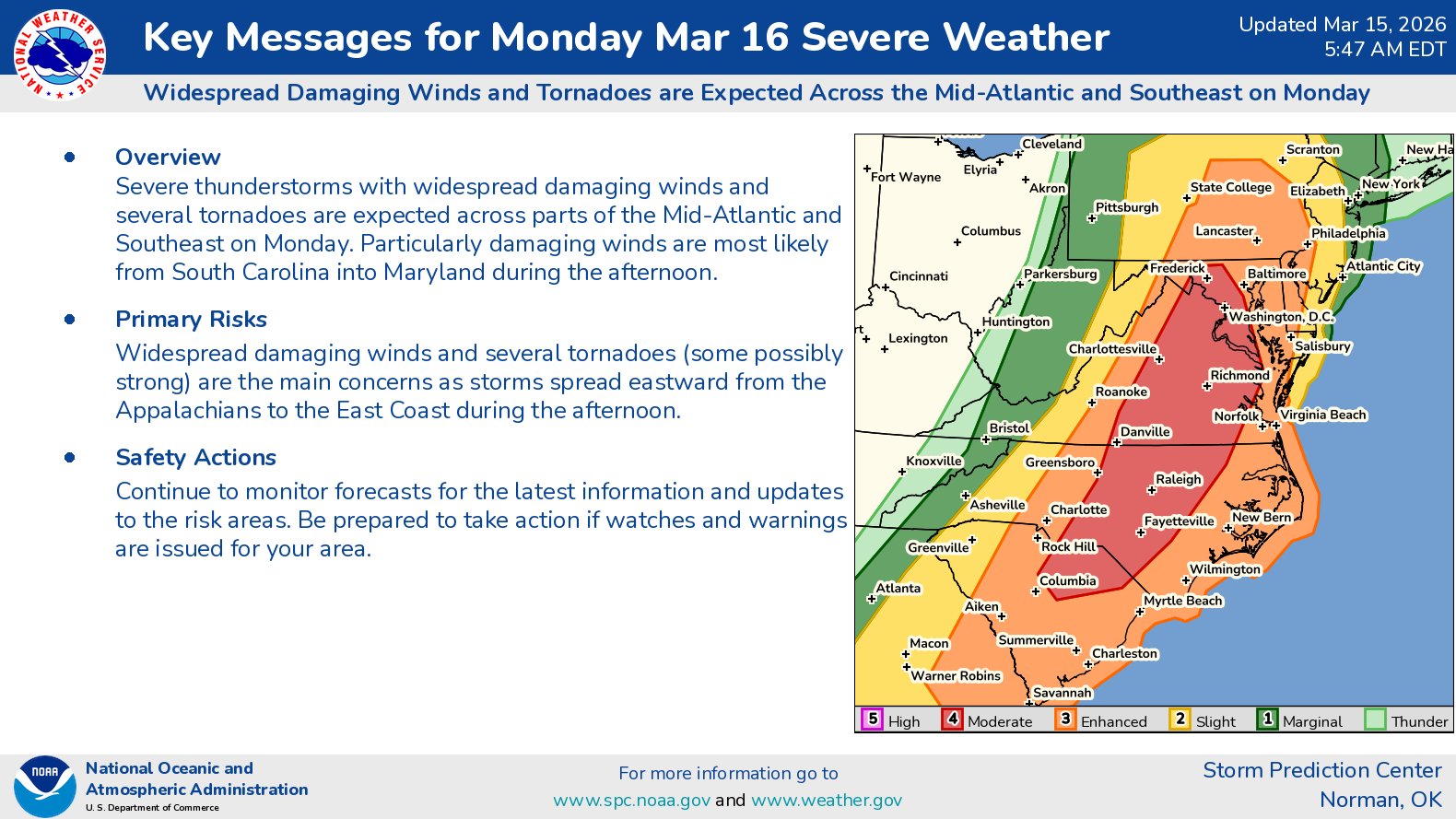
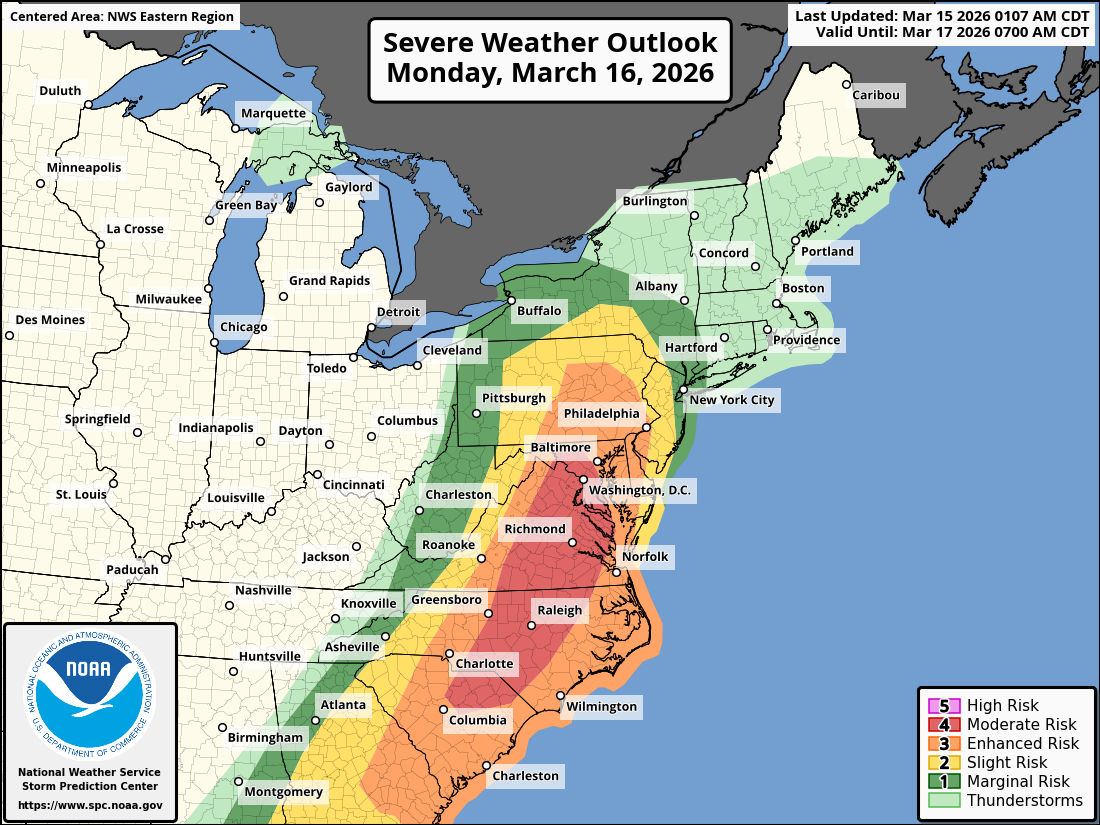
Significant Severe Weather On Monday From The Carolinas To The Mid-Atlantic States: A widespread severe weather outbreak is expected on Monday from the Carolinas northward to the Mid-Atlantic States. Tornadoes, some strong, and widespread damaging winds will be a threat during Monday afternoon in an area from the Carolinas northward through Virginia, Maryland and southern Pennsylvania.
A squall line is expected to push into the Carolinas and the Mid-Atlantic states during the afternoon hours of Monday. Widespread damaging winds with up to 60-80 mph gusts and tornadoes, some strong in intensity, will be a definite threat with this squall line.
The area of most concern Monday afternoon for strong tornadoes will be across northeast South Carolina, central and parts of eastern North Carolina, central, eastern and northern Virginia, much of Maryland and far southern and southeastern Pennsylvania. It should be noted that these severe storms will be moving fast (in excess of 50 mph) and because of this, long tracked tornadoes will be a possibility.
A Blizzard Across Parts Of Wisconsin & The Upper Peninsula Of Michigan Through Monday: A blizzard is raging on the northern side of this major storm system. This blizzard is expected to bury northern parts of Wisconsin and much of the Upper Peninsula of Michigan with 1 to 2 feet-plus of snow. In fact, parts of the Upper Peninsula of Michigan may end up with upwards of 30 inches or more of snow with this storm.
In addition to the heavy snow, blizzard conditions are expected across the Upper Peninsula of Michigan, northern Wisconsin, southern Minnesota, much of Iowa and eastern South Dakota. While the snow totals over Minnesota, Iowa and eastern South Dakota will be much lower, the winds likely will be stronger & will lead to near zero visibility in blowing snow causing blizzard conditions.