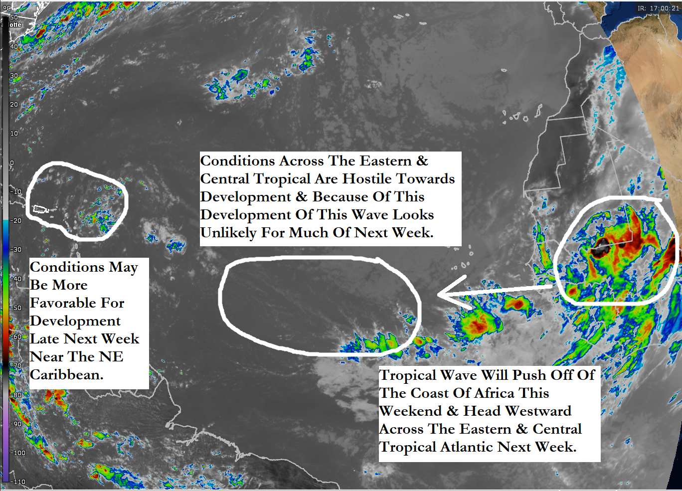
A Tropical Wave Now Moving Off Of The Coast Of Africa Is One To Really Watch Next Week: Satellite imagery and weather analysis reveals that there is a tropical wave that is about to push off of the coast of Africa into the far eastern Atlantic. Satellite loops indicates that there is already some spin occurring with the wave. Also, analysis reveals that the amount of wind shear over the eastern tropical Atlantic is low enough to support development.
A large majority of the model guidance are latching onto this particular tropical wave as being one that could not only significantly develop, but also threaten the northeastern Caribbean in about a week from now and then possibly threaten the US coastline in about 10-14 days from now. More on that in a bit.
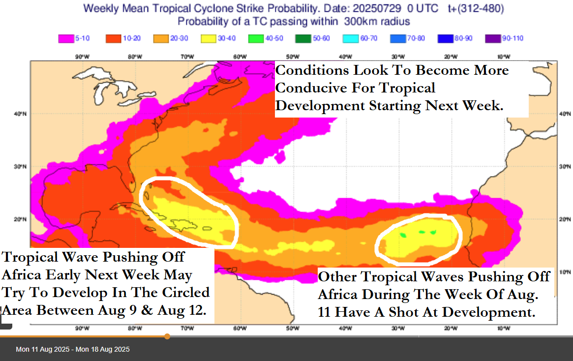
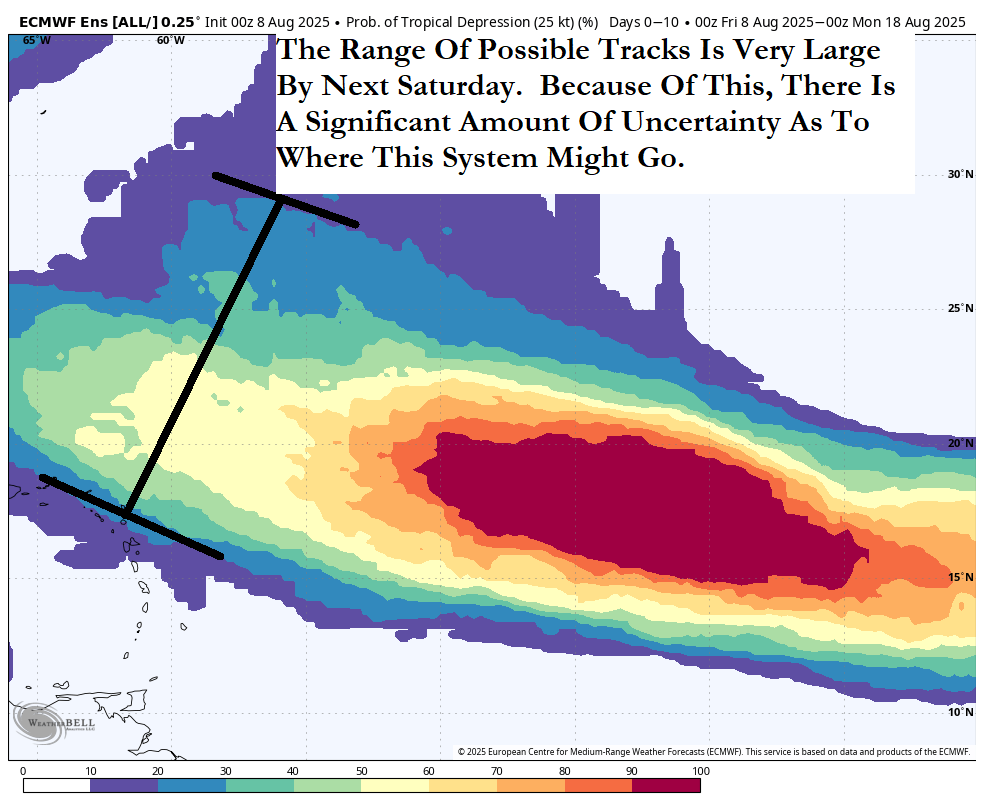
Before I get into discussing the model guidance, I want to point out that we are still a few days away from anything even forming. I do think that development will be very slow to occur for a while as overall environmental conditions across the eastern and central tropical Atlantic are marginally favorable for development. This means that any small deviations on where or when this system consolidates and forms can have huge implications on where it will eventually track and how strong it could be. This means that you should take any model guidance for a 10-plus day forecast with a pound of salt.
As for the model guidance – First, I don’t really look at the operational models for a forecast this far out because their exact forecasts for a 10-14 day forecast can change many, many times and any one solution should not be trusted. Instead, I like to look at the ensemble model guidance for a 7-14 day forecast as it gives you a range of possible solutions.
The GFS ensemble model guidance seems to suggest that we should see a west-northwesterly track over the next week putting this system anywhere from over the northeastern Caribbean to north of the Caribbean by about next Saturday. From there, the GFS ensemble members diverge on their forecasts with some showing a turn to the northwest while other members seem to forecast a generally westward track. This leads to many different outcomes from a curve northward taking this system towards Bermuda by about August 18 to a system that continues to track into the Bahamas by August 18 followed by a threat or impact to the East Coast of the United States by about August 20.
As for the European ensemble model guidance, it also suggests a track that either leads to this system tracking over or to the north of the northeastern Caribbean by next Saturday. That said, it should be pointed out that the majority of the ensemble members do show this system just missing the northeastern Caribbean to the north. From there, the European ensemble model members diverge a lot with some showing a turn to the north towards Bermuda while others seem to show a northwestward track towards the Carolinas, the Mid-Atlantic coast and New England by about August 20. There are other members that show a track towards the Bahamas and the southeastern coast of the United States between August 18 and 20.
Here Are My Thoughts: While I do think that this tropical wave definitely needs to be watched extremely closely next week as it heads across the eastern and central tropical Atlantic, I am not ringing the alarm bells for anyone. Beware of the social media hype on this system & don’t believe it. No one or no model knows exactly where this system is going to end up going.
I do think that this wave will struggle for a while as it heads west-northwestward across the eastern and central tropical Atlantic over the next several days. This is due to marginally favorable ocean water temperatures. This should change by the time this wave reaches about 55 West Longitude around Thursday when it should start developing due to more favorable conditions.
Additionally, I think there is the possibility that this system could be a tropical storm by the time it reaches about 60 West Longitude. Given the ensemble range, it’s possible that it could be either right over the northeastern Caribbean or located just north of the northeastern Caribbean when it reaches the 60 West Longitude line around next Saturday.
Beyond this, I’ll be honest with you and say that I have no idea at all where exactly this system will end up tracking. Guidance seems to hint that there may be a weakness in the high pressure ridge steering this system & if this occurs, it could mean a turn to the northwest and north. It’s unknown of how sharp this turn might be & that’ll be extremely important. A really sharp turn to the north would lead to this system heading out into the open Atlantic & perhaps threatening Bermuda. On the other hand, a much more gradual turn to the northwest would lead to this system potentially threatening the Bahamas and then a large part of the East Coast of the United States.
Bottom line is that the environmental conditions look very favorable for development and then strengthening of a tropical system & because of this, I am going to be keeping very close tabs on this particular tropical wave. Just know that this wave is nothing to be overly concerned about or worried about, for now.
Elsewhere Across The Atlantic, This Is What Else We’re Watching:
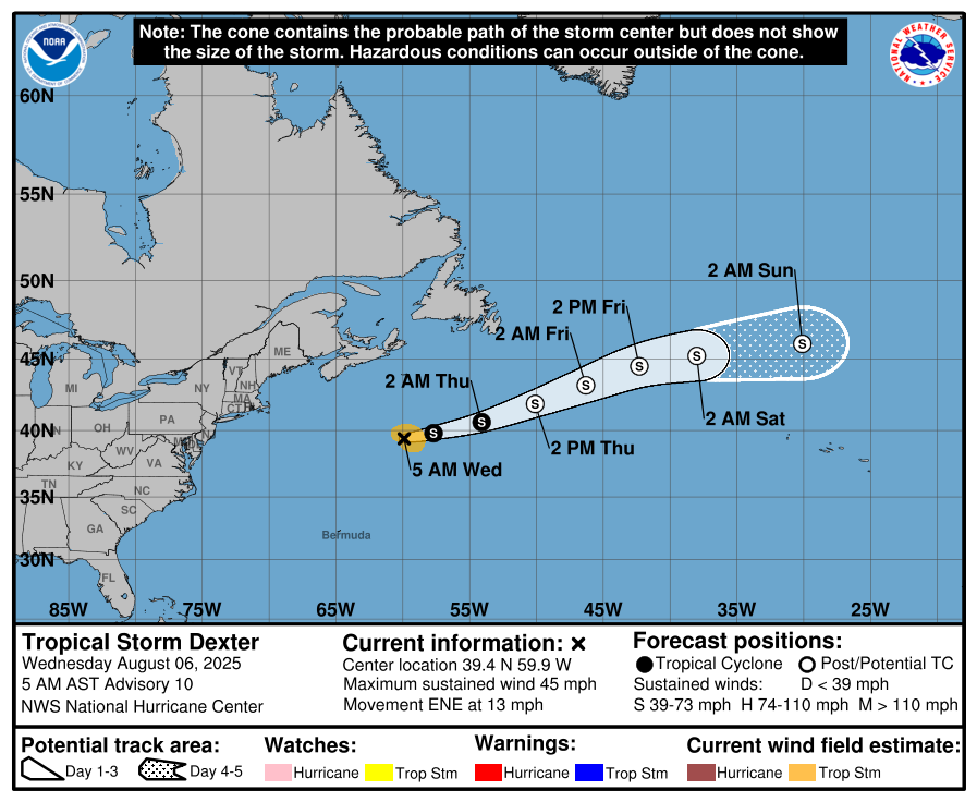
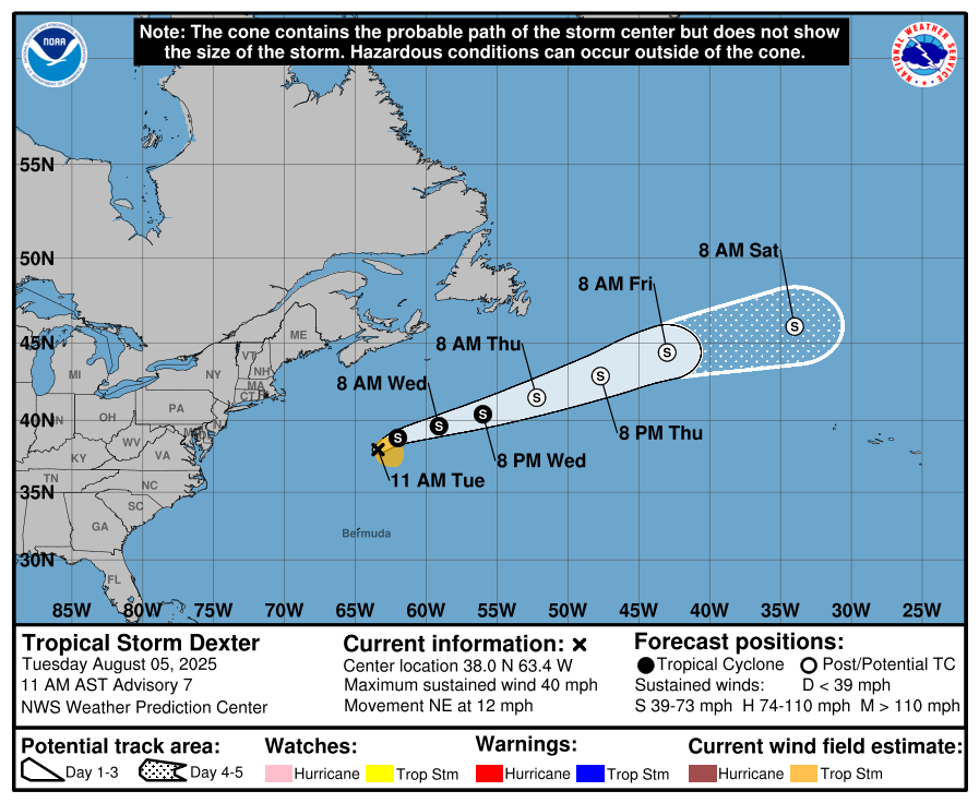
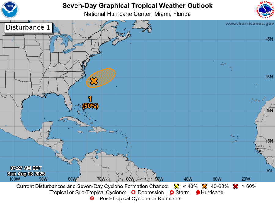
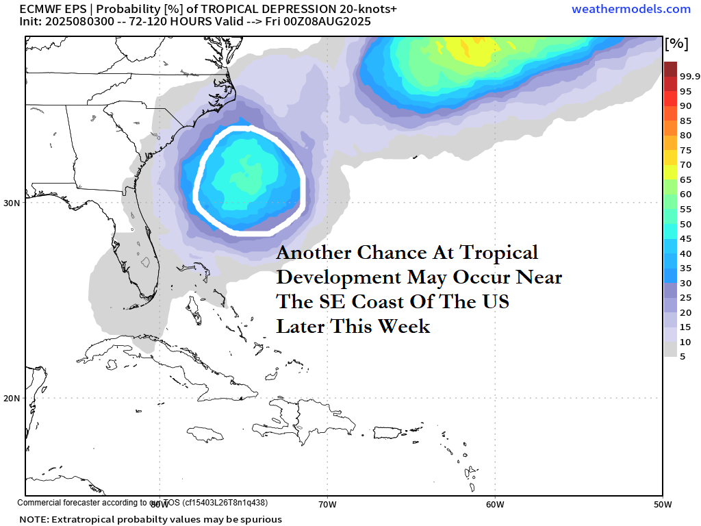
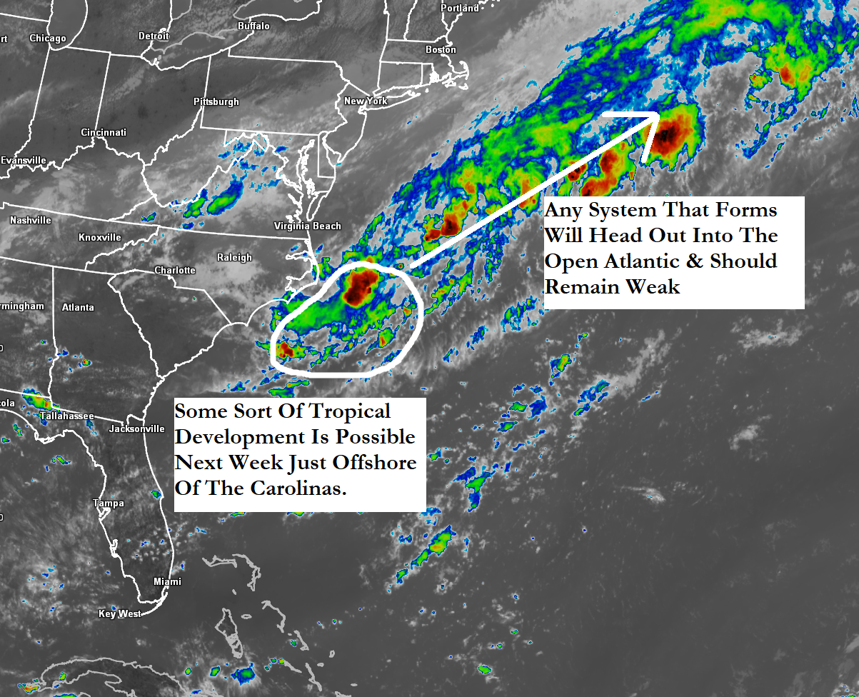
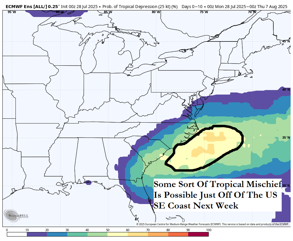
Low Pressure Off Of The North Carolina Coast: It appears that a low pressure system located between the coast of North Carolina and Bermuda probably will not develop at all. It is expected that this low pressure system will head in a northeastward direction into the open Atlantic this weekend where it’ll merge with a frontal boundary.
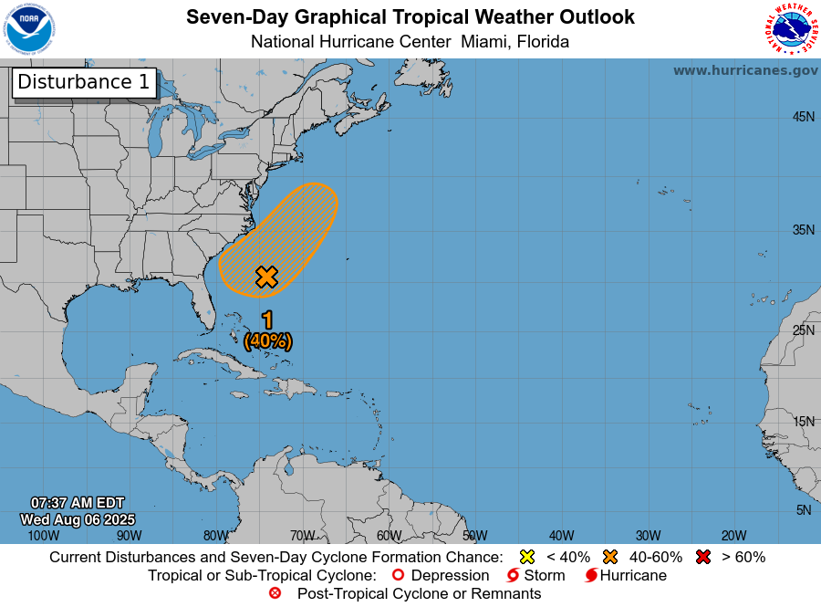
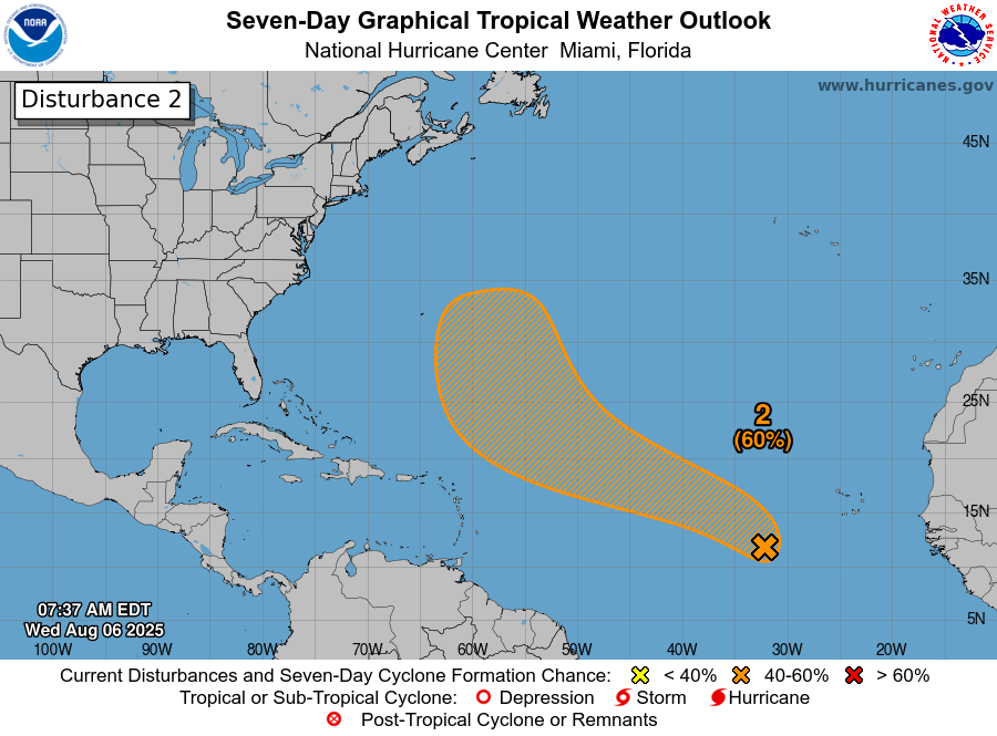
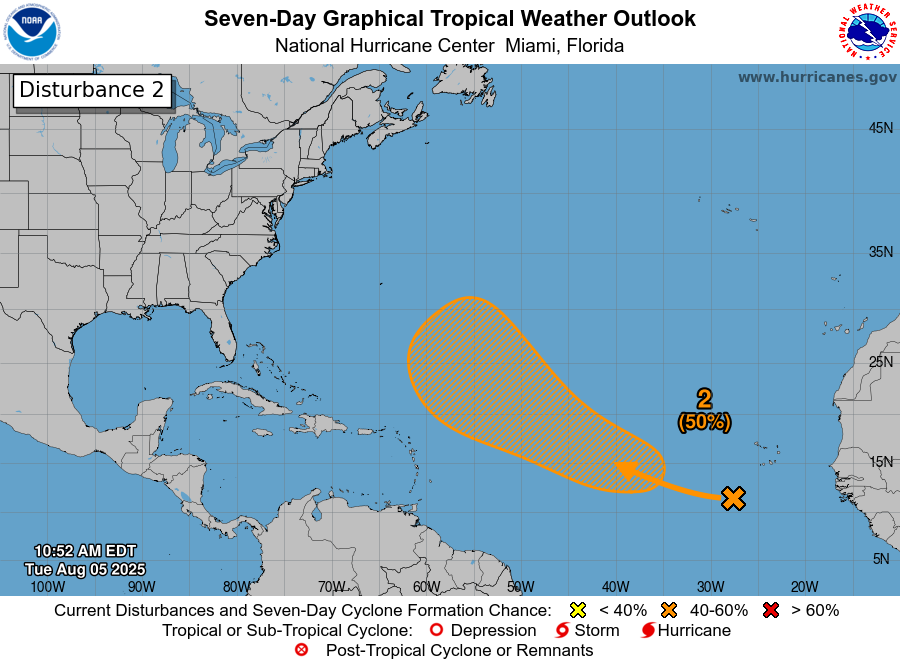
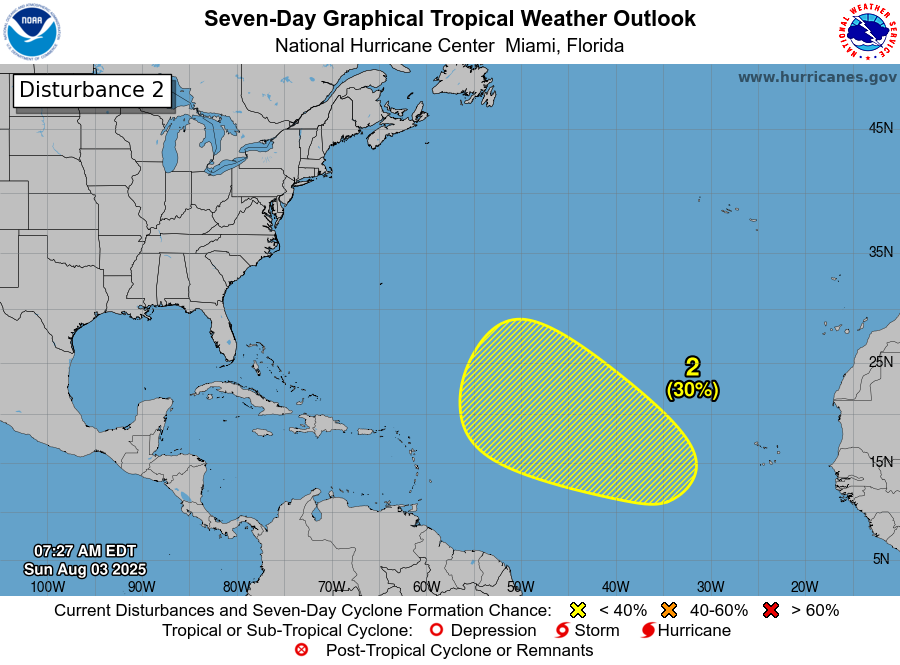
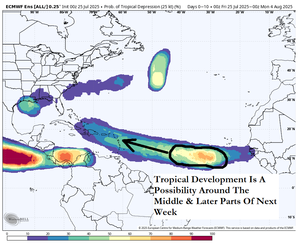
Invest 96-L Located Over The Central Tropical Atlantic: It appears that Invest 96-L is struggling to produce convection over the central Tropical Atlantic near about 41 West Longitude. I do think that Invest 96-L will continue to struggle to develop this weekend as it begins a turn to the northwest and north. This will keep this system out over the open Atlantic with no threat to anyone.
It’s possible that Invest 96-L will find itself in a more favorable environment for development by the first half of next week as it tracks well east of Bermuda & this is when it might develop into a depression or a tropical storm.
In any case, Invest 96-L, whether it develops or not, will turn out into the open Atlantic well before it gets near Bermuda.
The next tropical weather discussion will be issued on Monday.