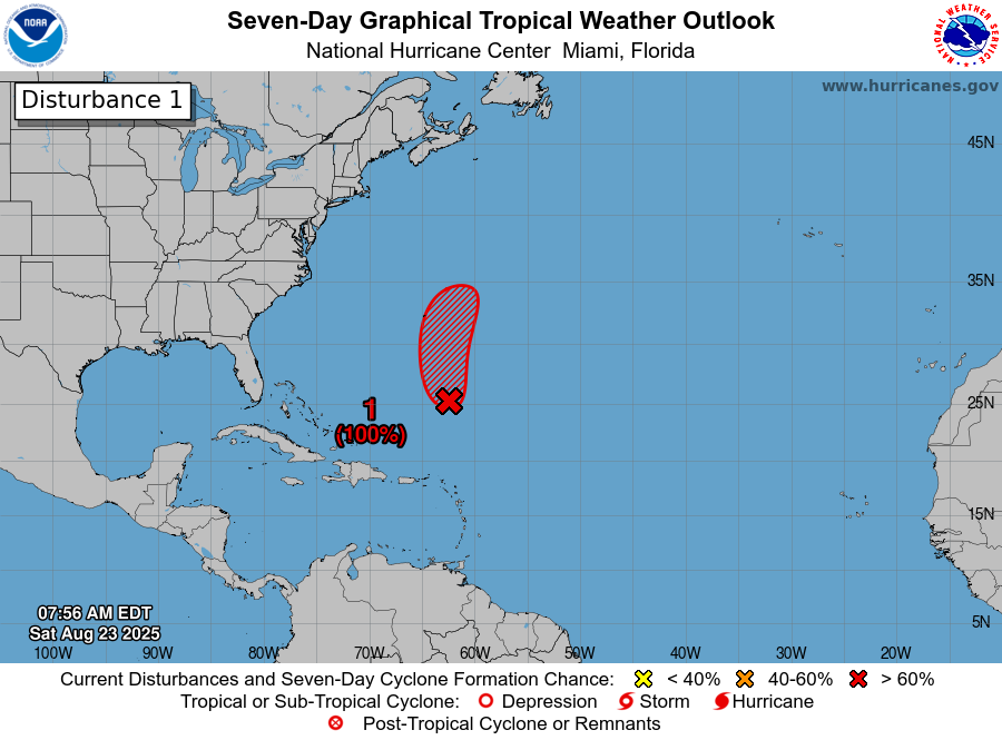
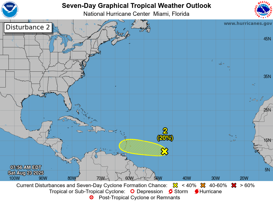
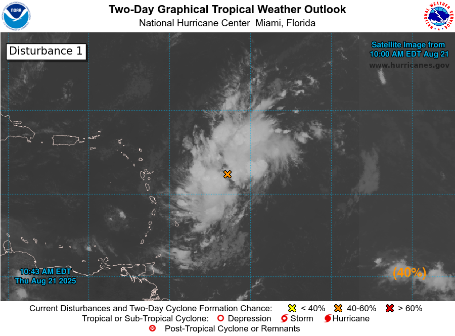
Tropical Wave Located Along The West Coast Of Africa: Even though the tropical Atlantic is very quiet for the peak of hurricane, I am keeping a very close eye on a tropical wave that has just left the coast of Africa. Buckle in because I think that we are going to be tracking this wave for many days to come & I also think that it is a wave that does need to be watched extremely closely.
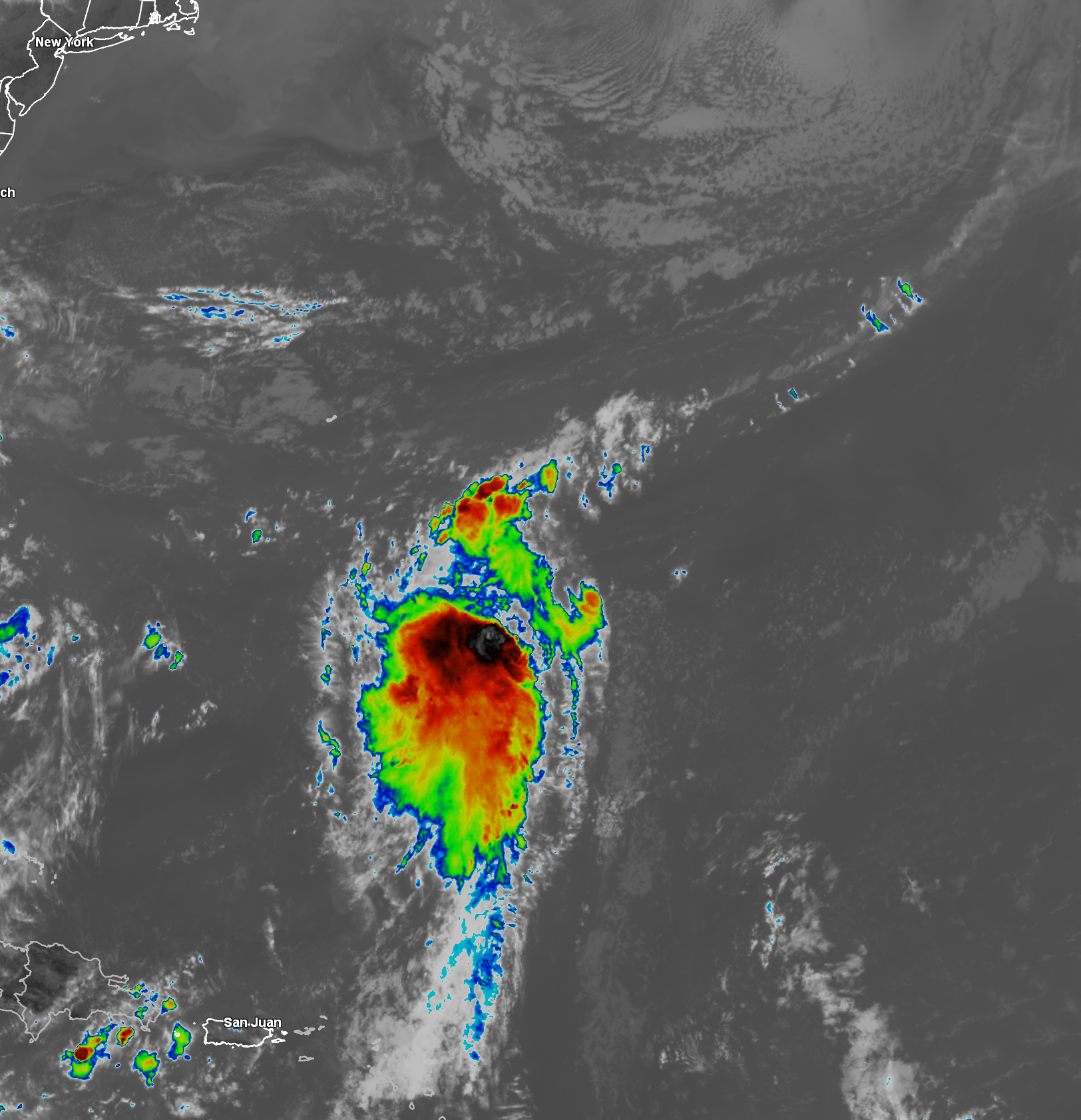
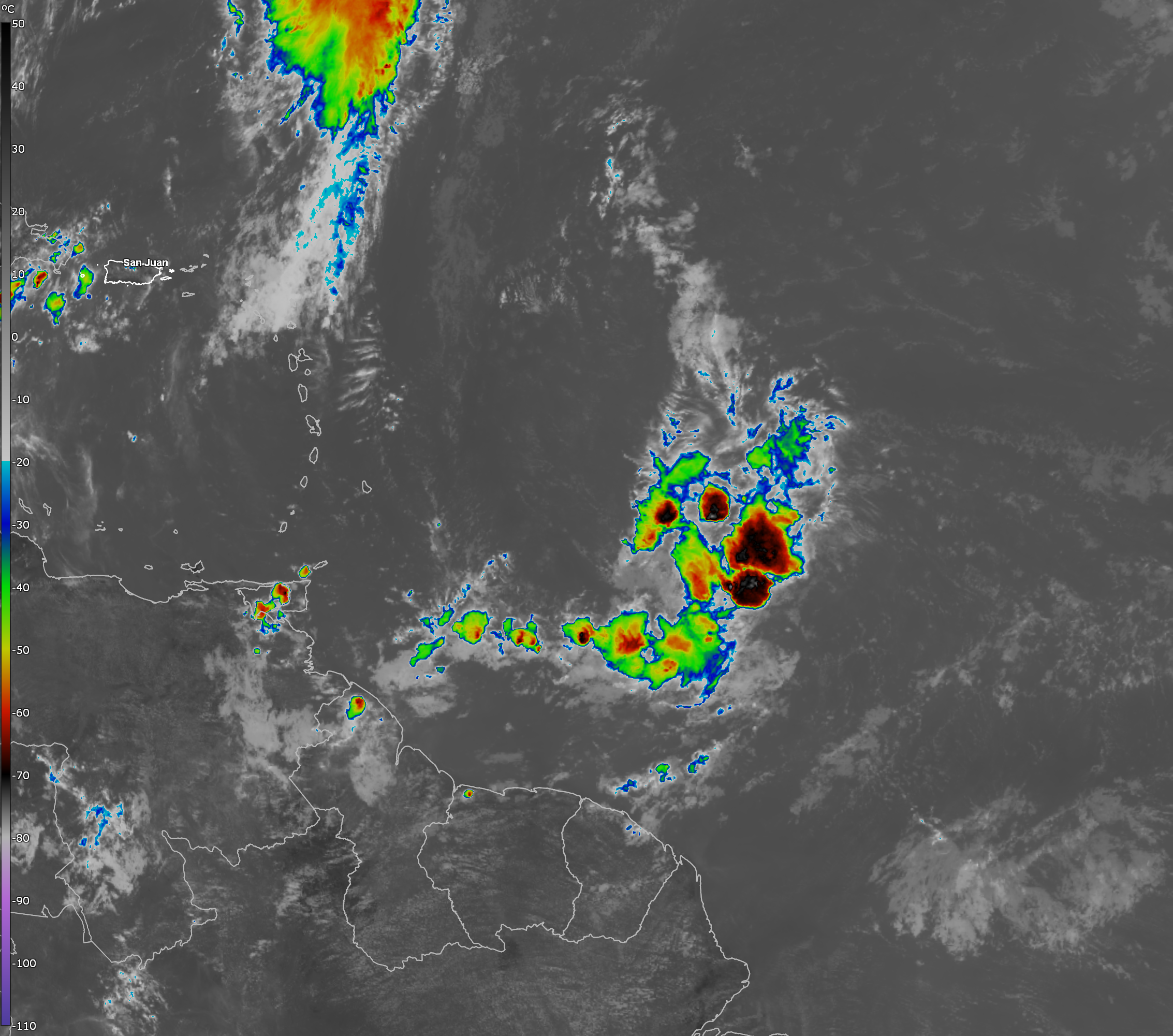
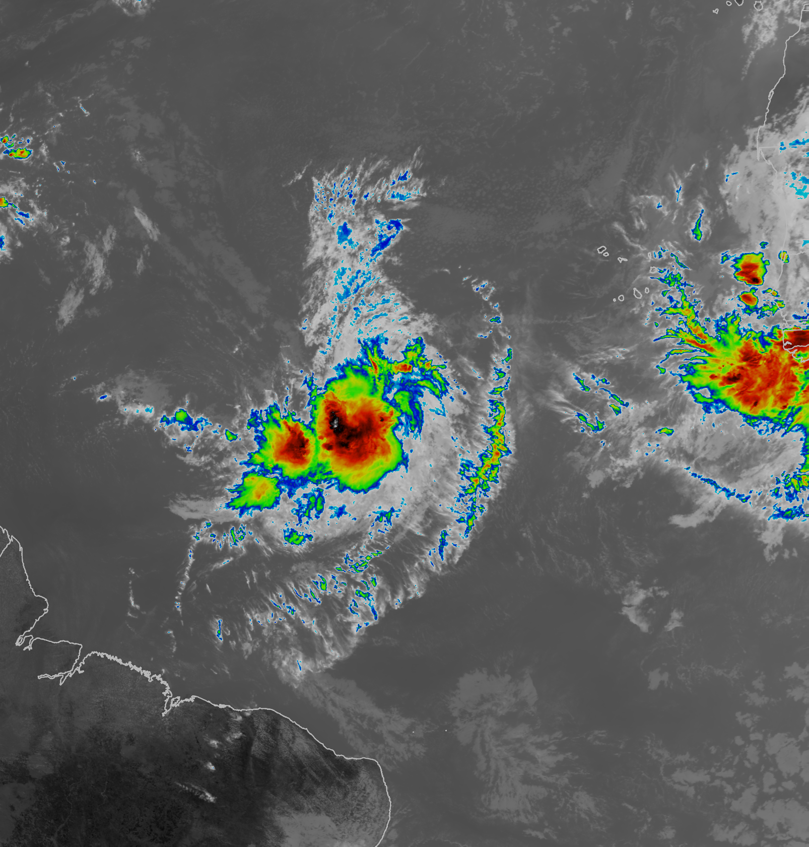
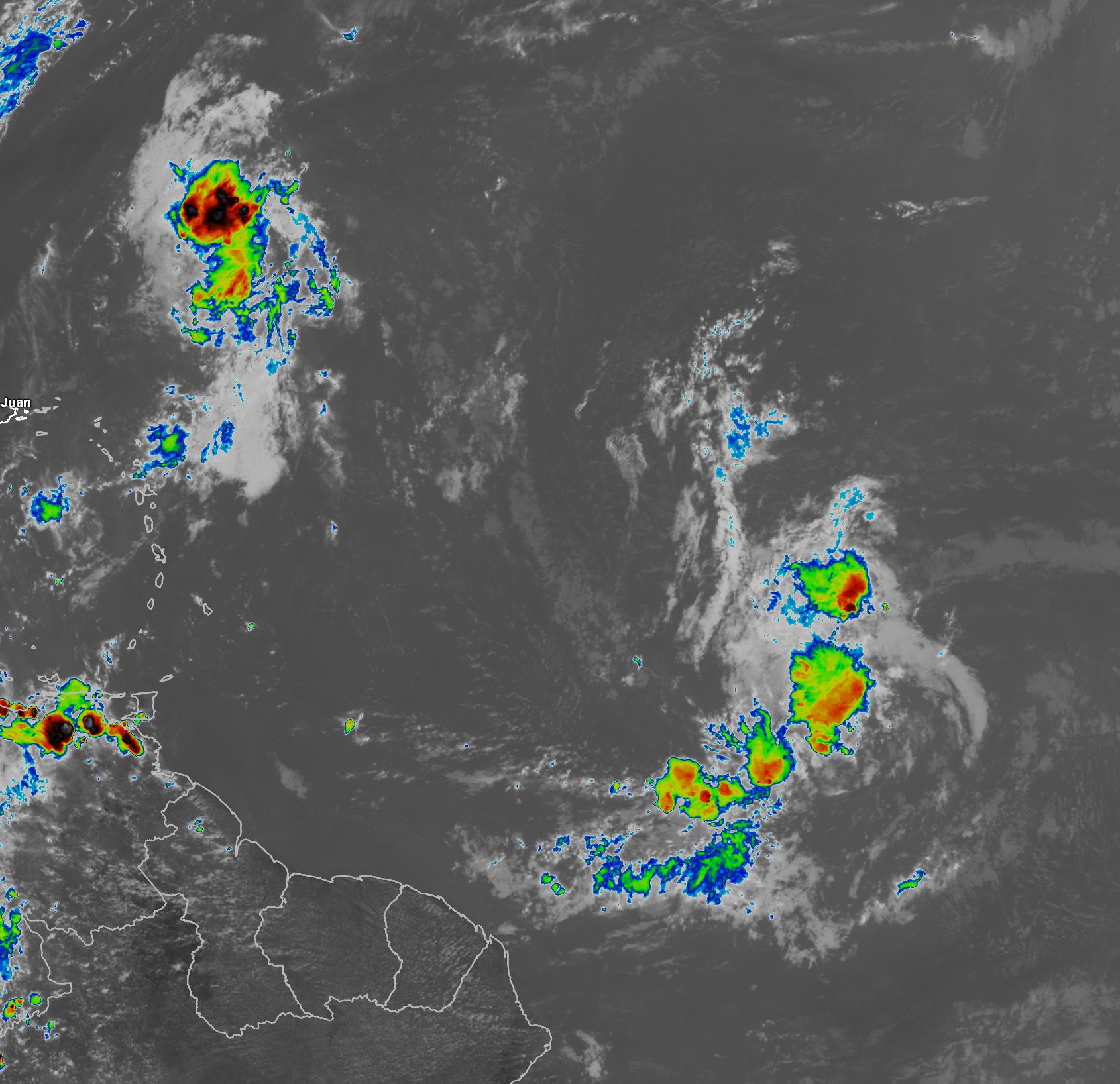
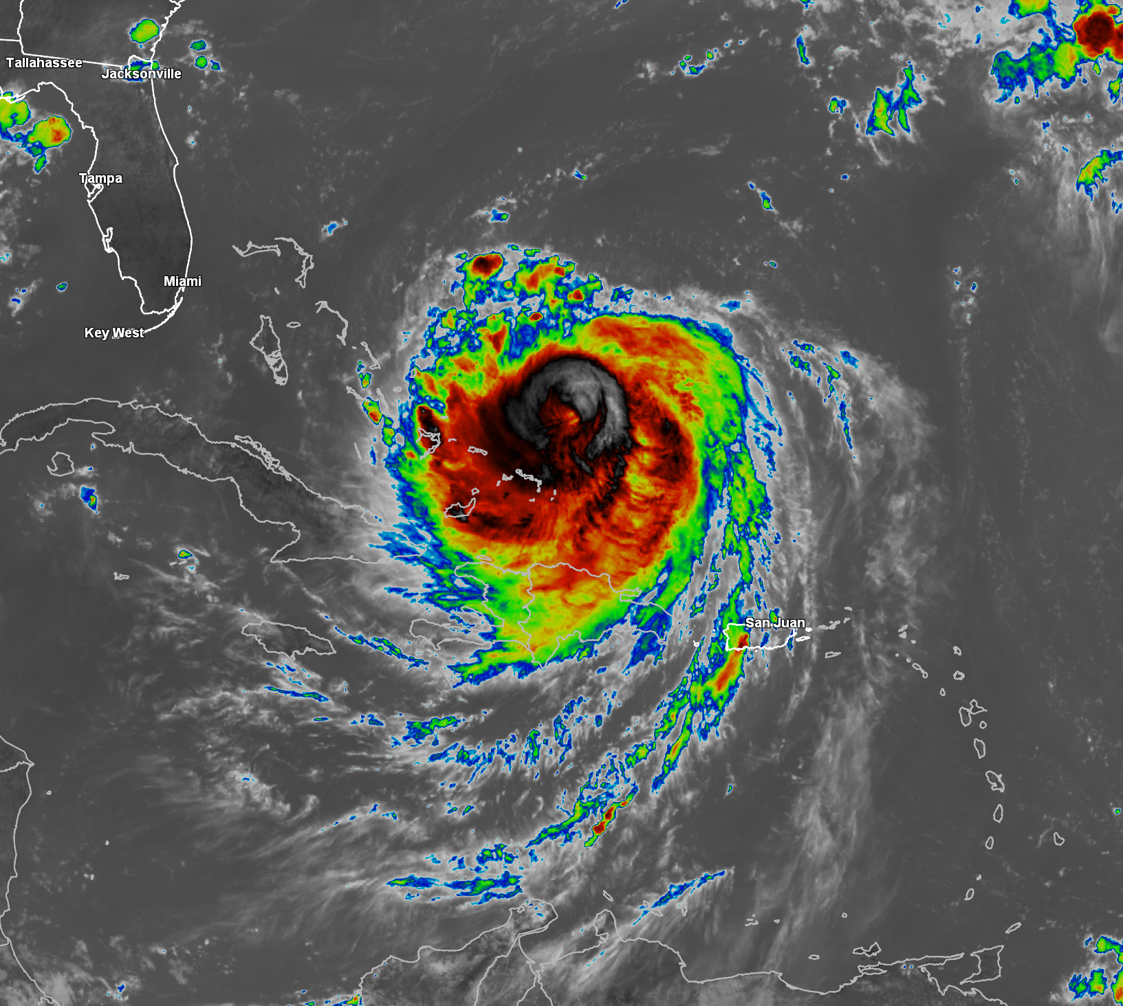
Satellite imagery today reveals that this wave is producing some disorganized convection with part of the convection now over the far eastern Atlantic and other parts of the convection still over far western Africa. This wave should fully immerse itself over the far eastern tropical Atlantic by Monday.
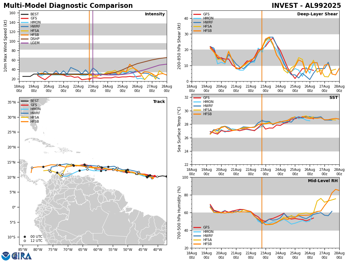
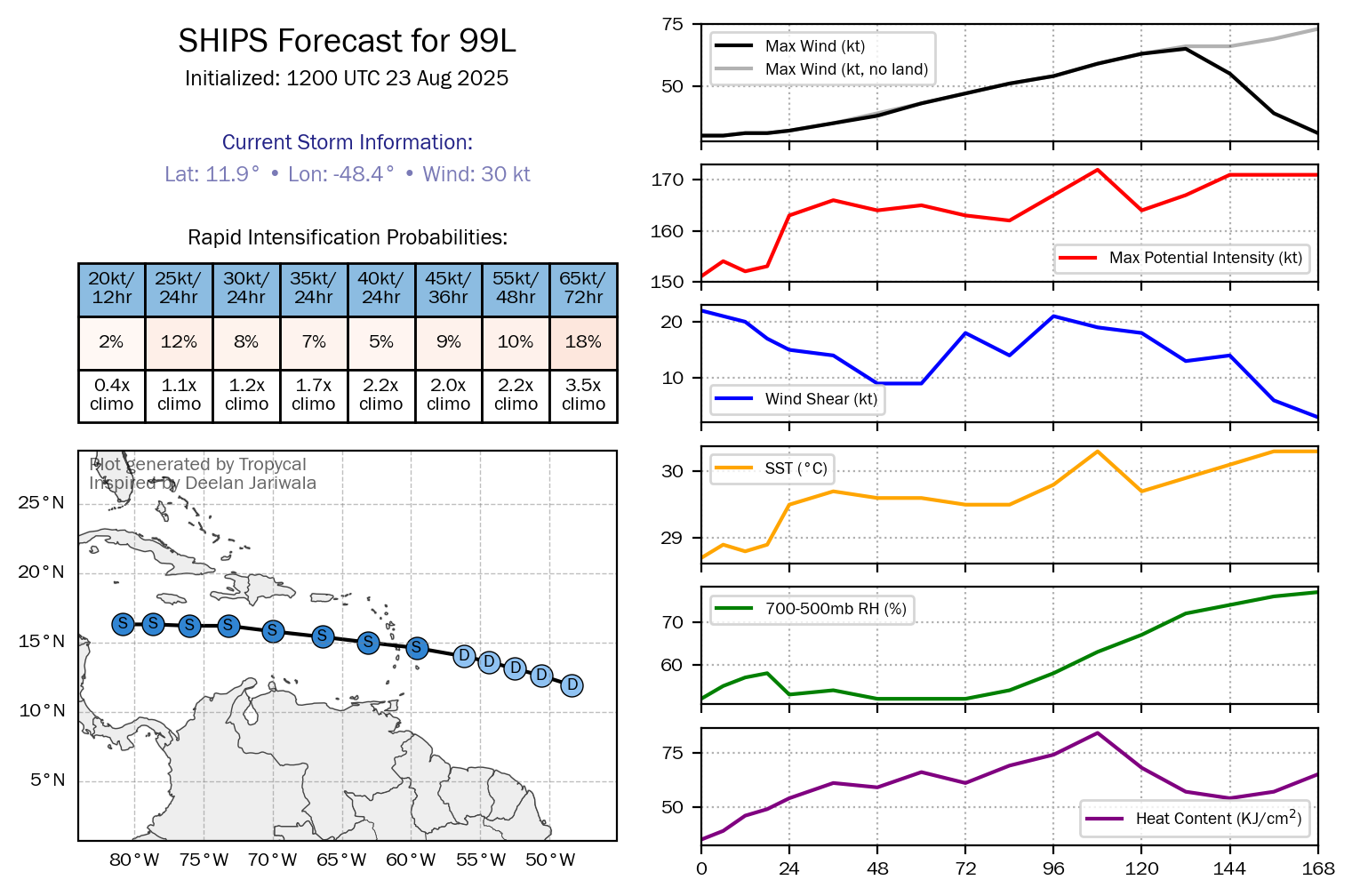
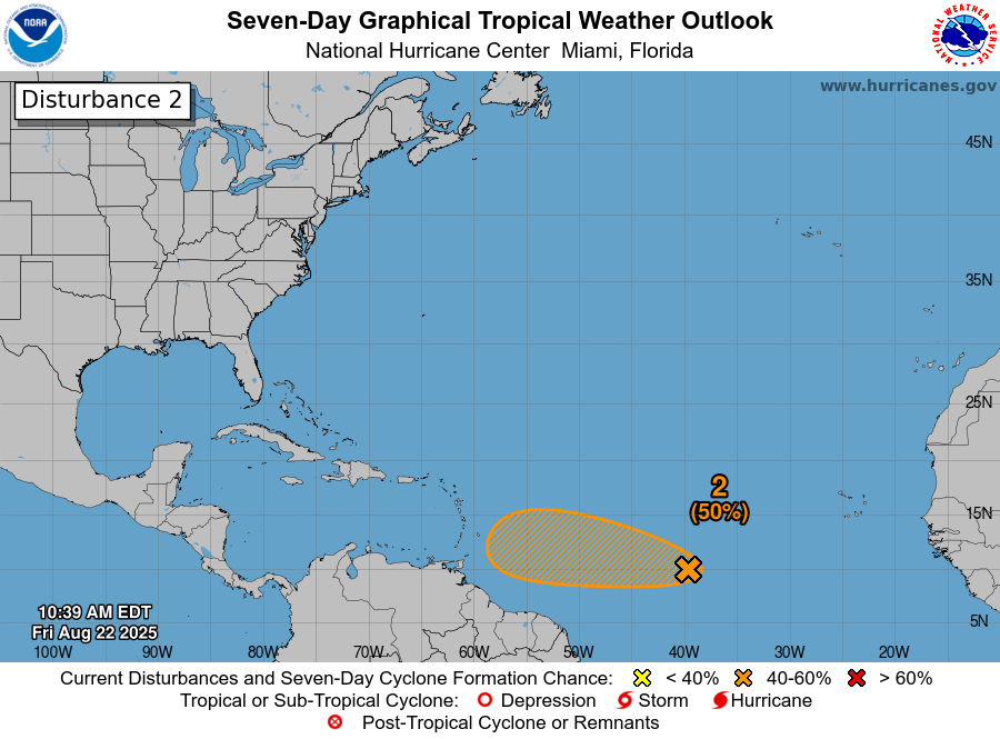
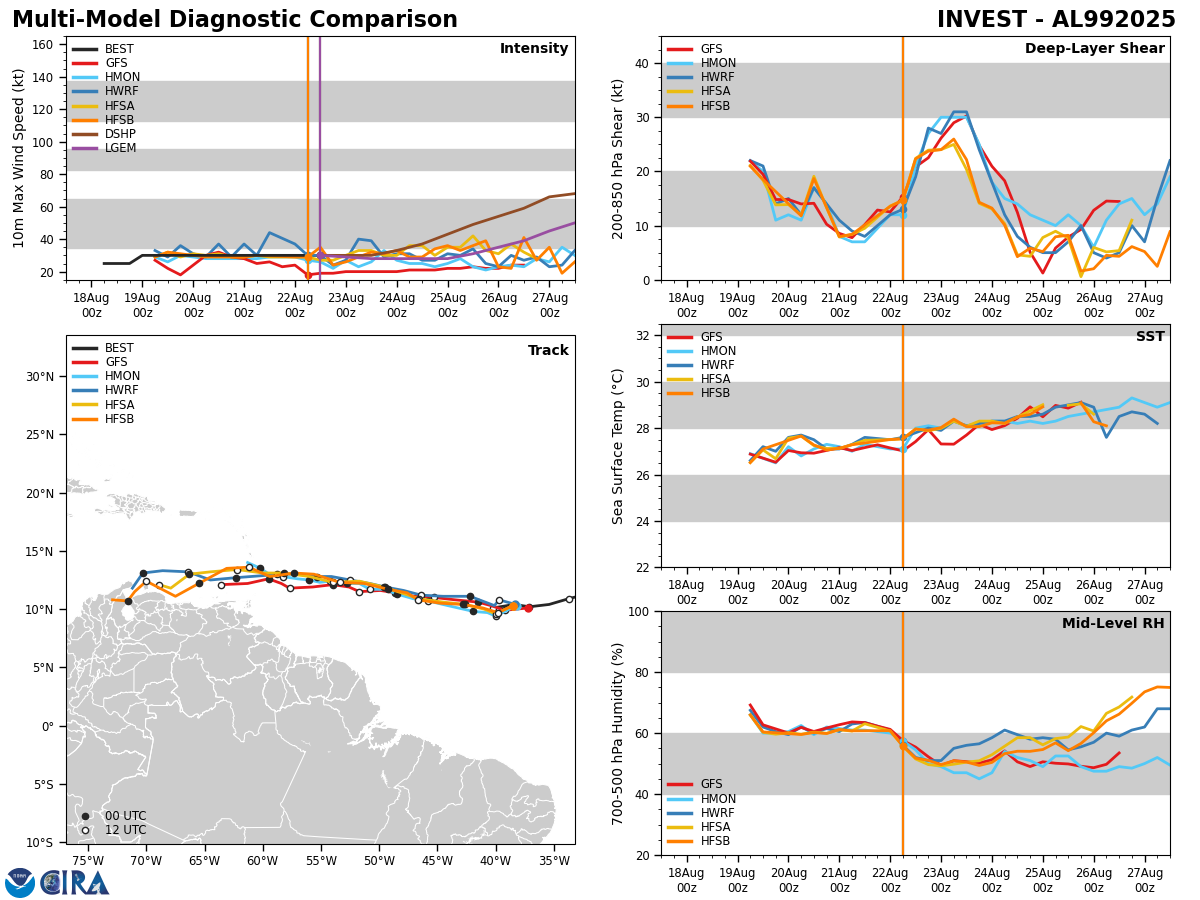
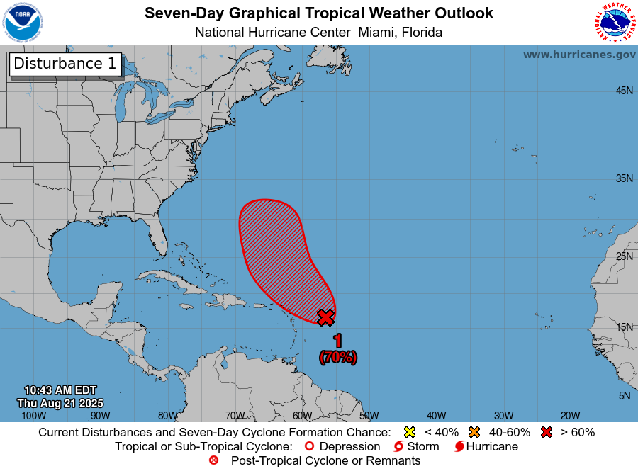
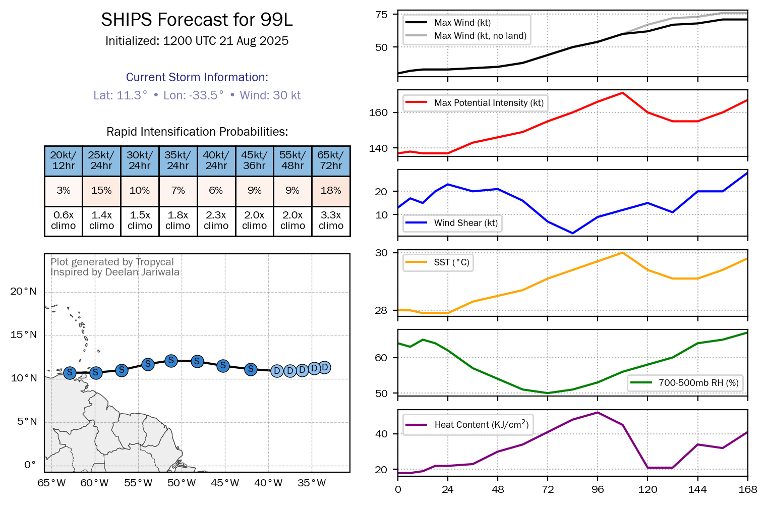
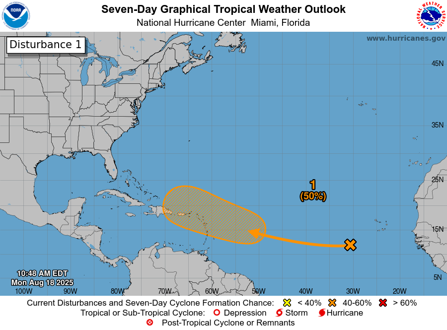
It is expected that this wave will head westward across the eastern tropical Atlantic over the next few days reaching the central tropical Atlantic by the very end of this coming week. Analysis of environmental conditions ahead of this wave reveals that the wind shear values are favorable for at least slow development this coming week. This means that I don’t think this wave is going away anytime soon. Also, the steering winds across the eastern and central tropical Atlantic should guide this wave in a general westerly direction across the eastern and then the central tropical Atlantic throughout this upcoming week.
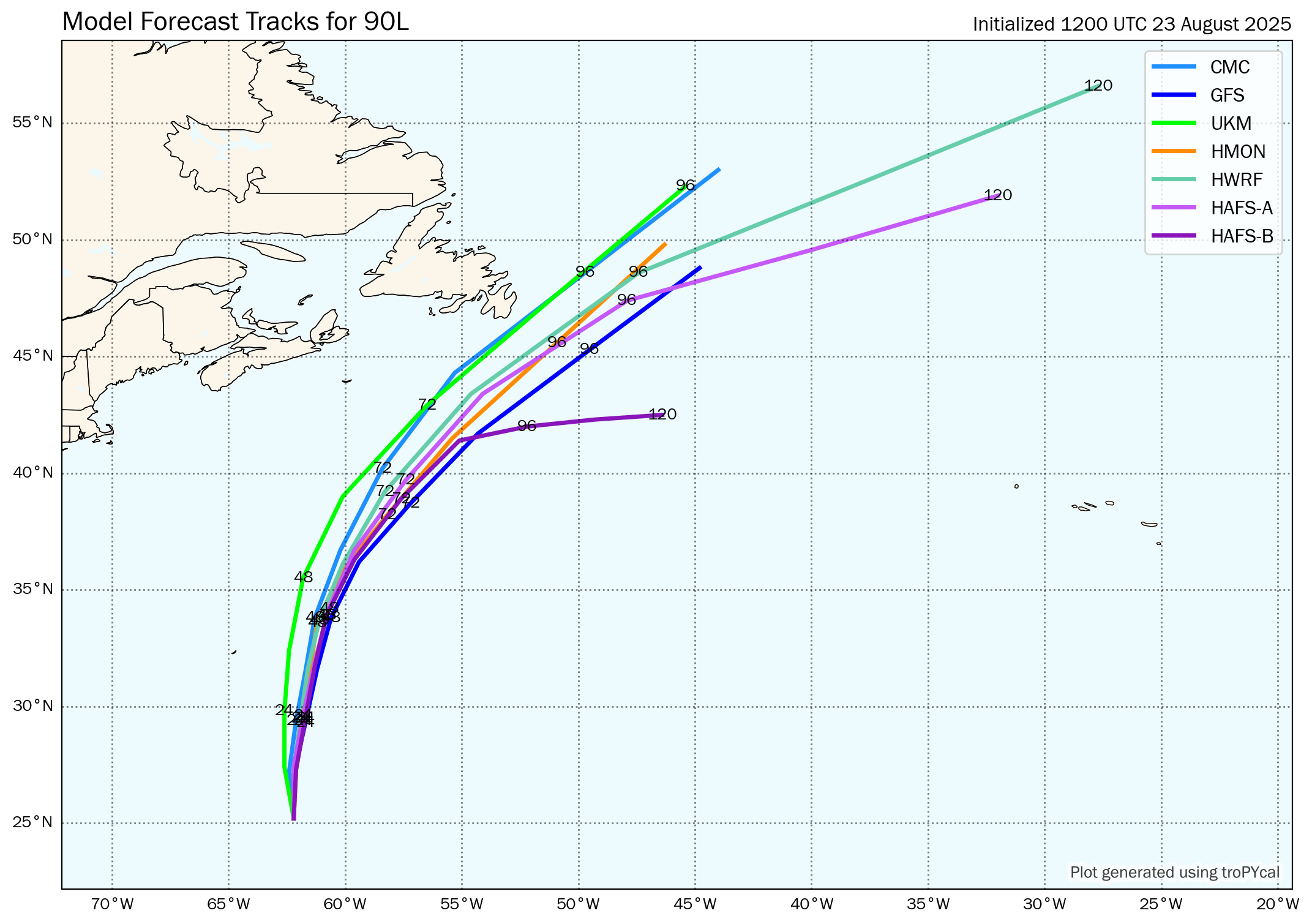
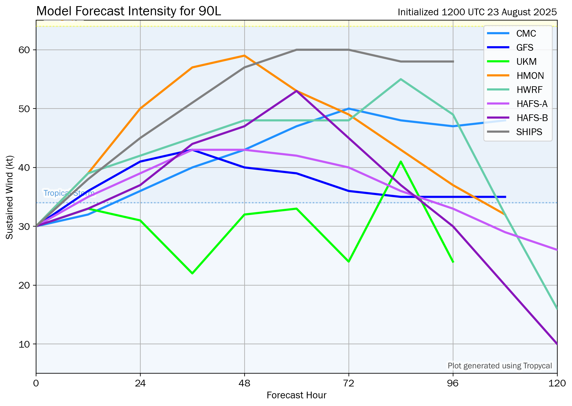
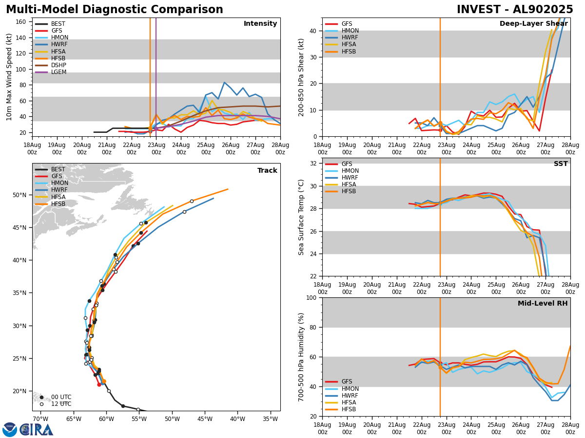
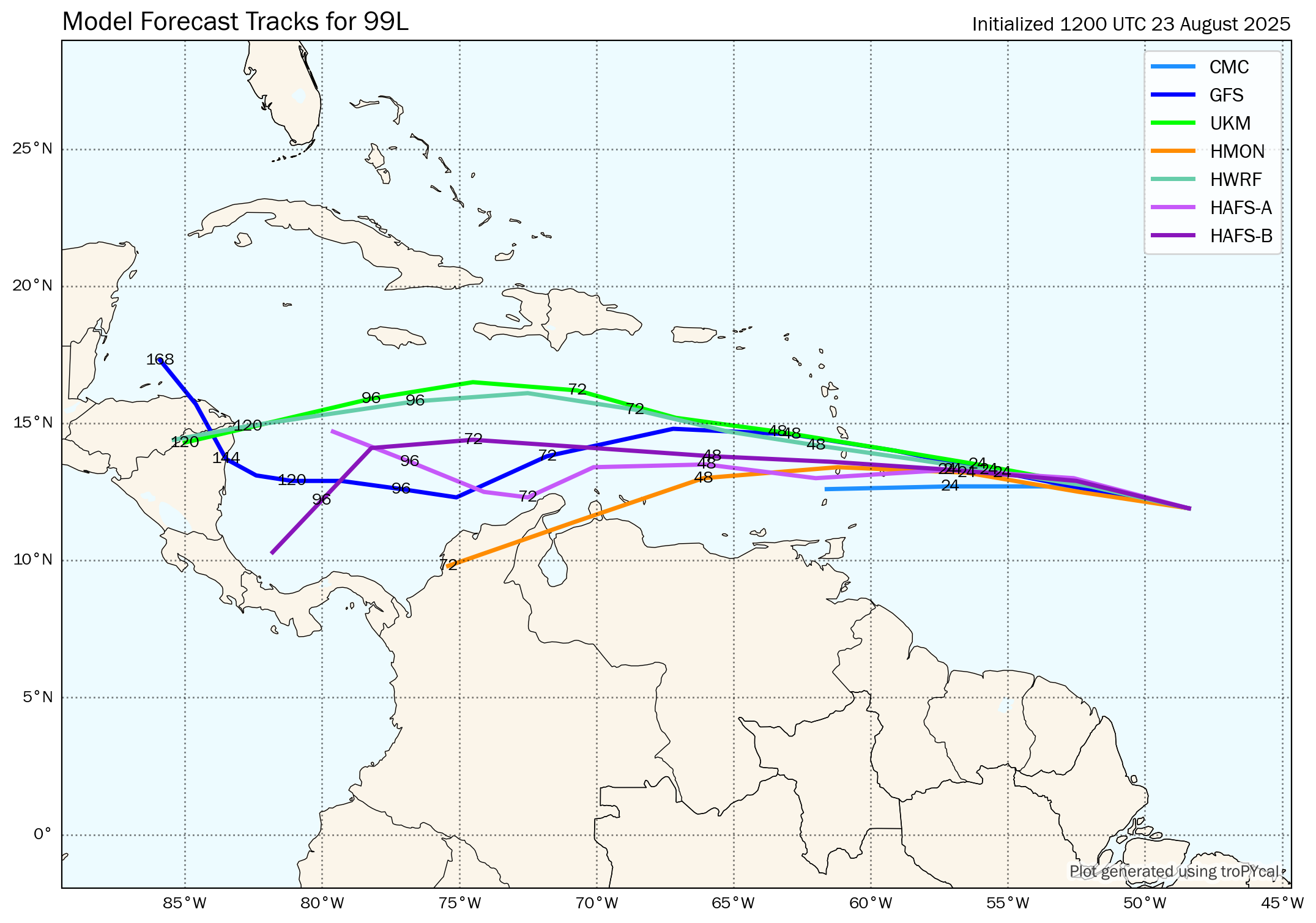
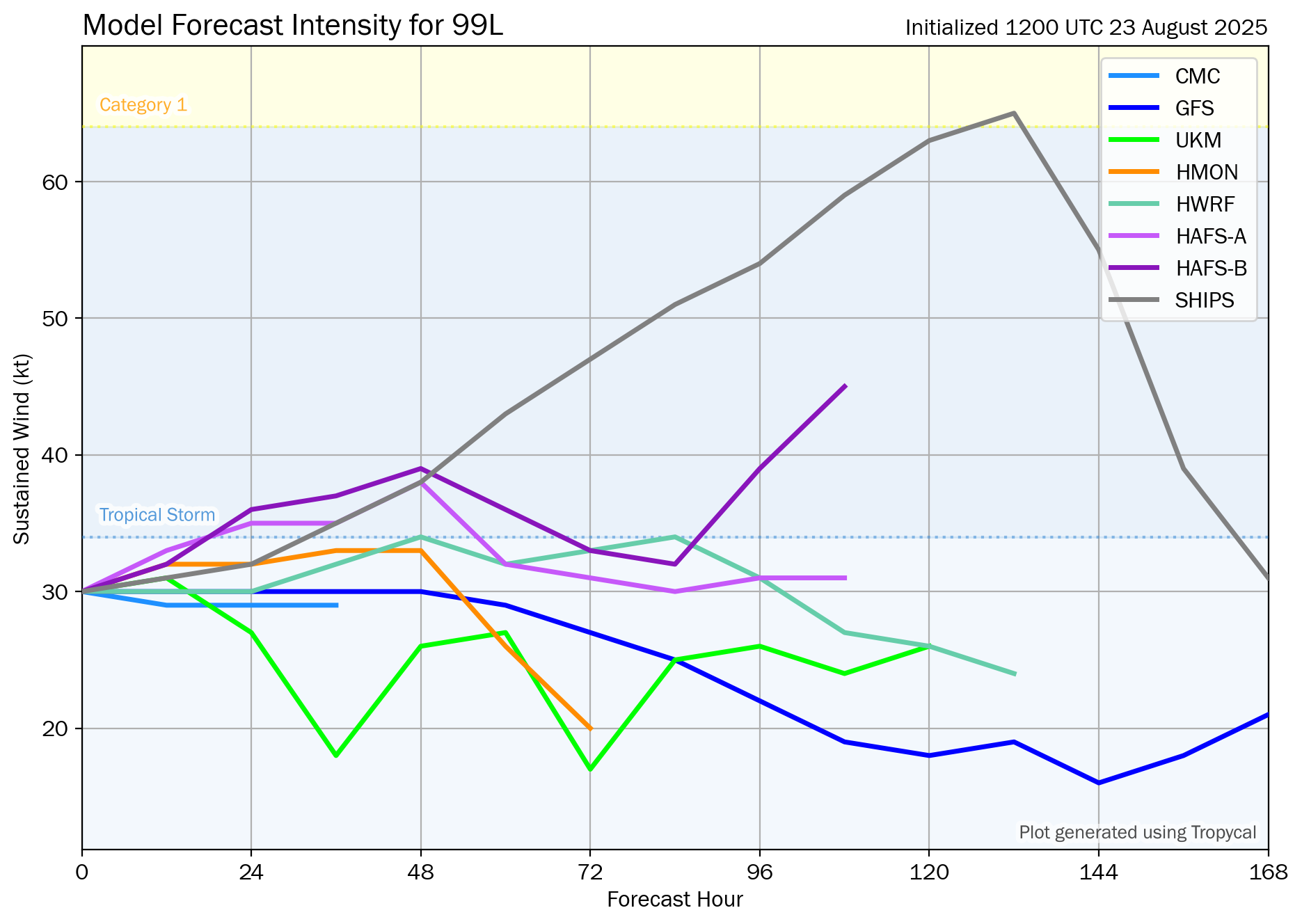
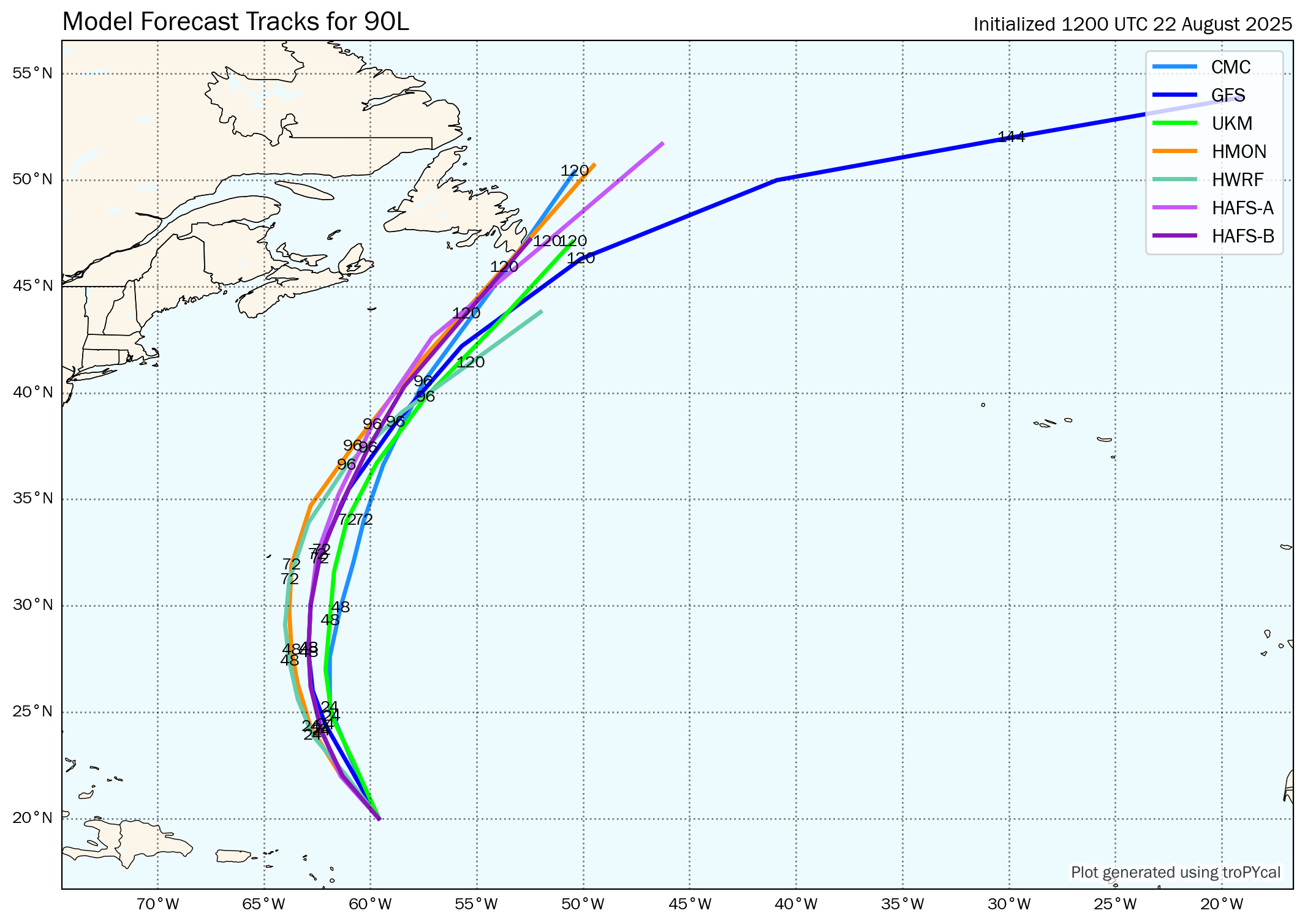
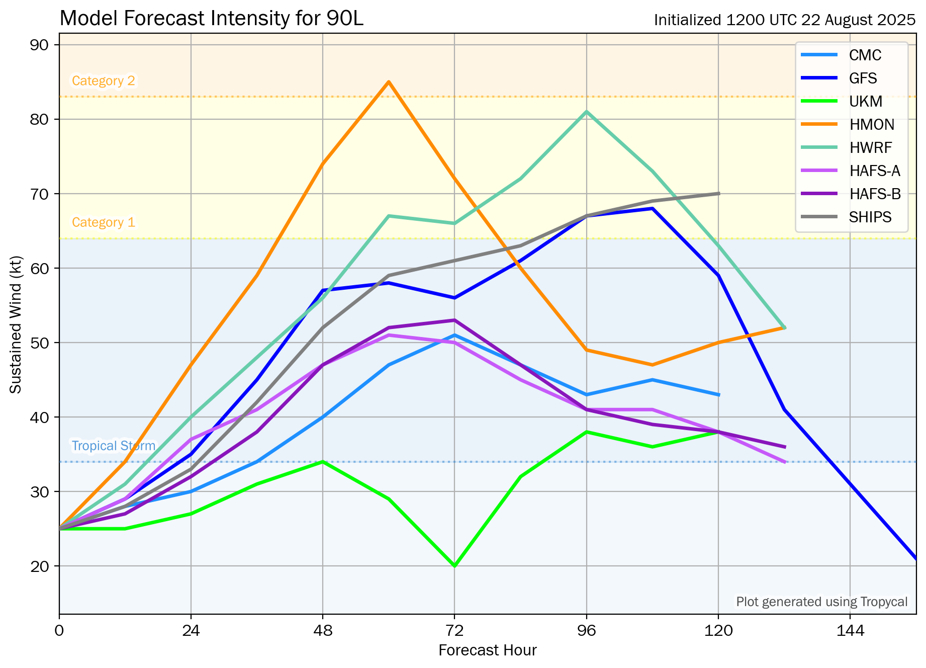
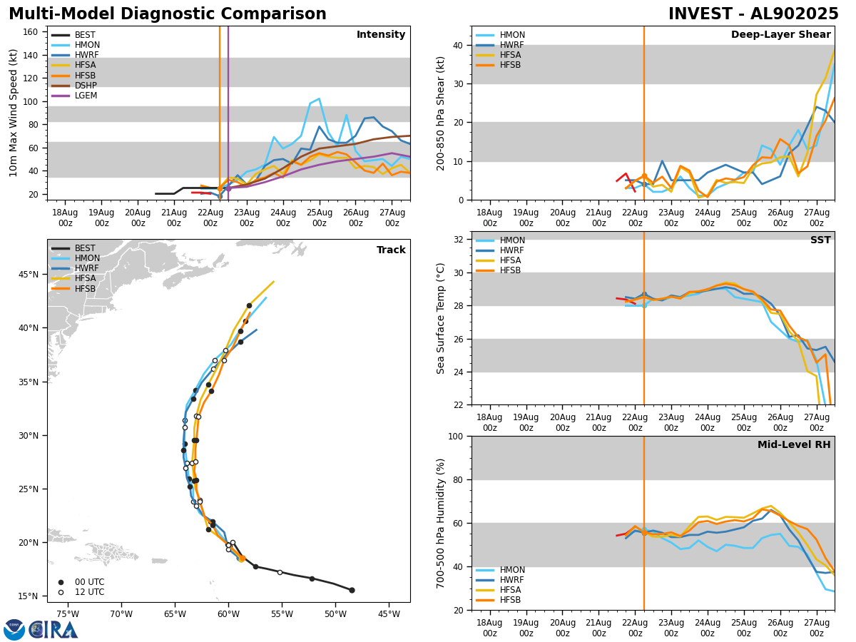
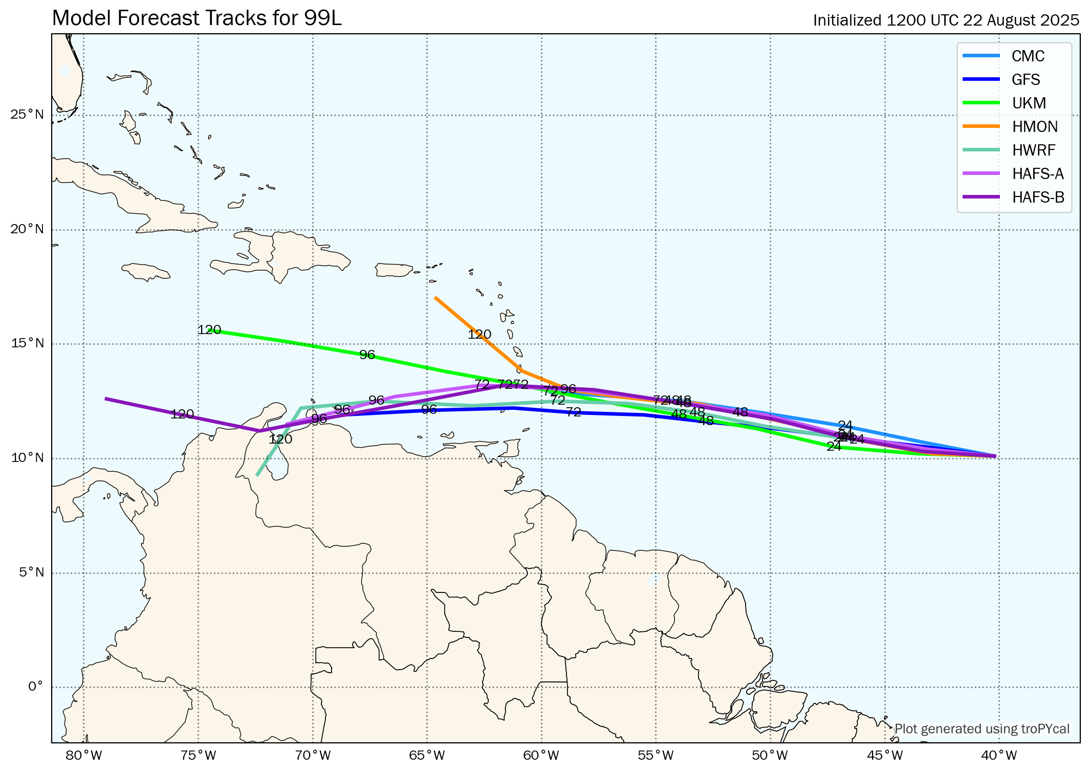
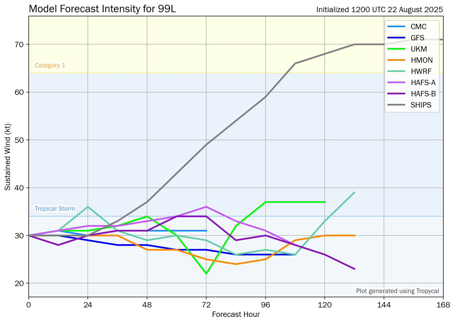
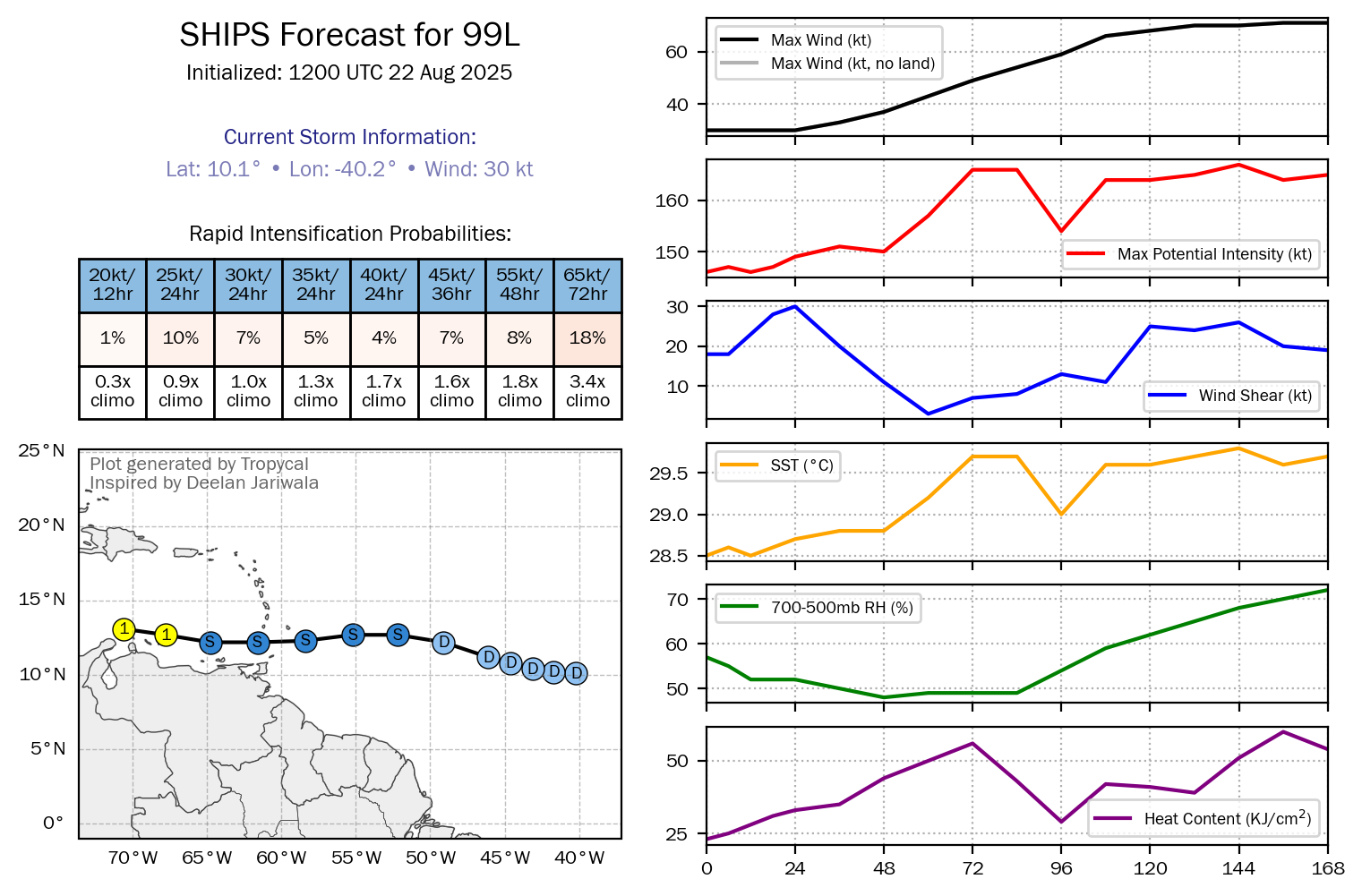
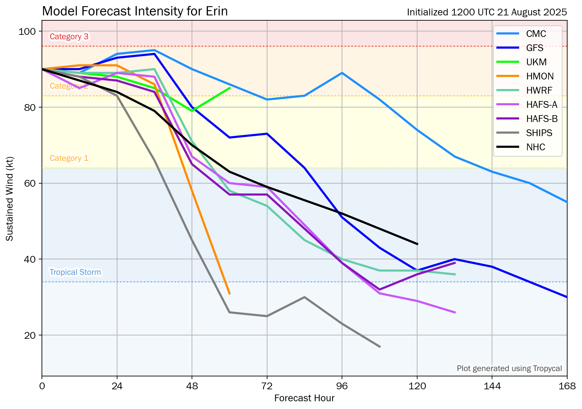
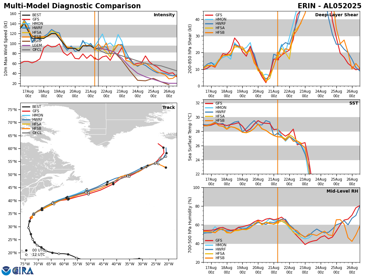
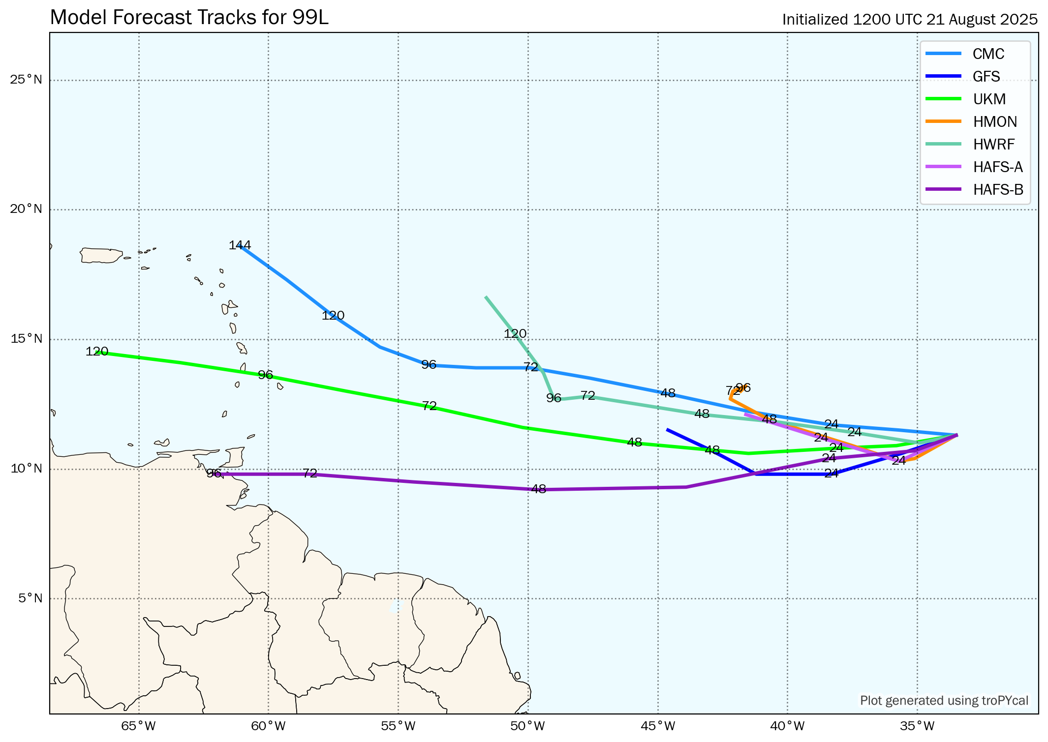
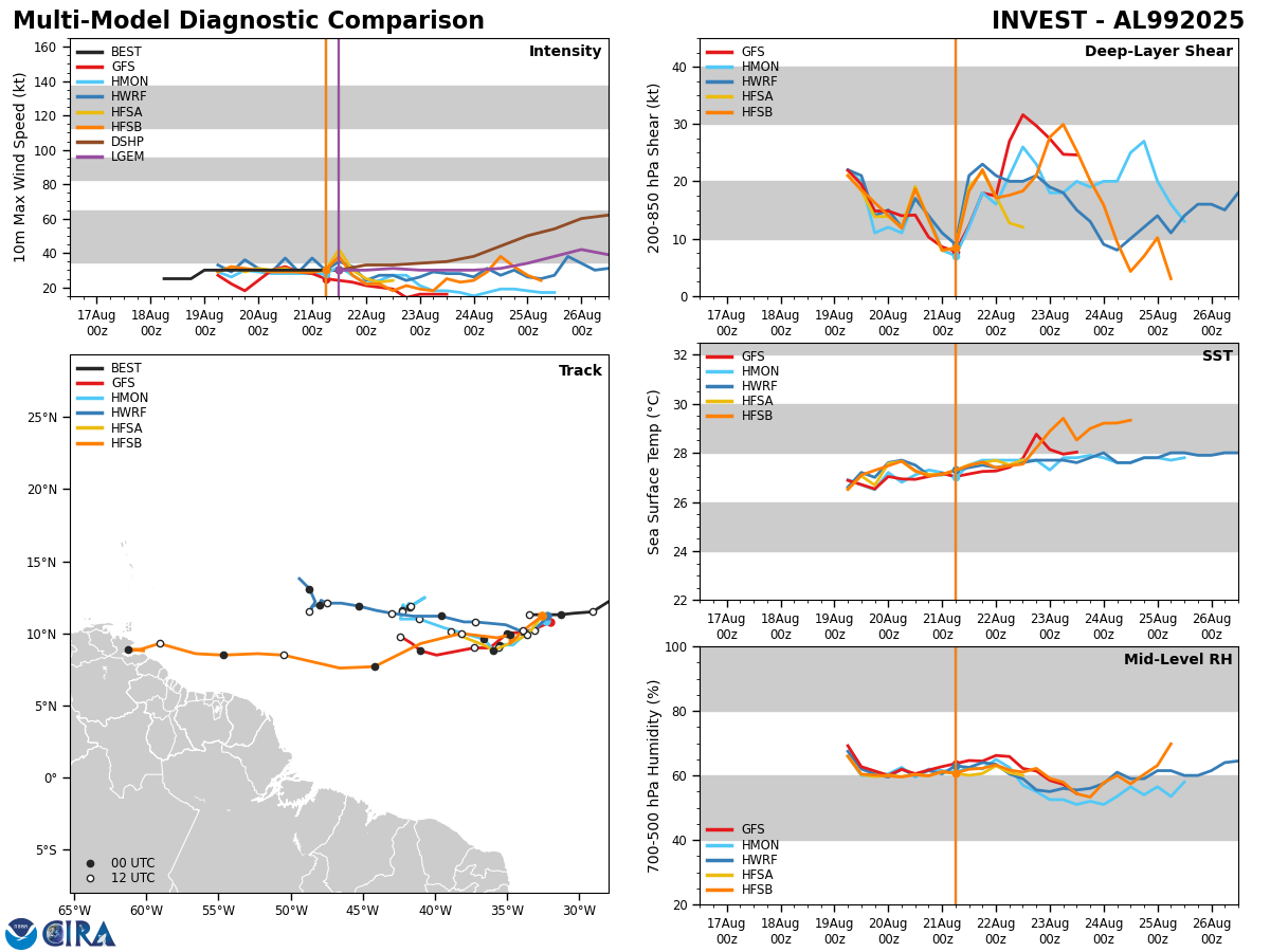
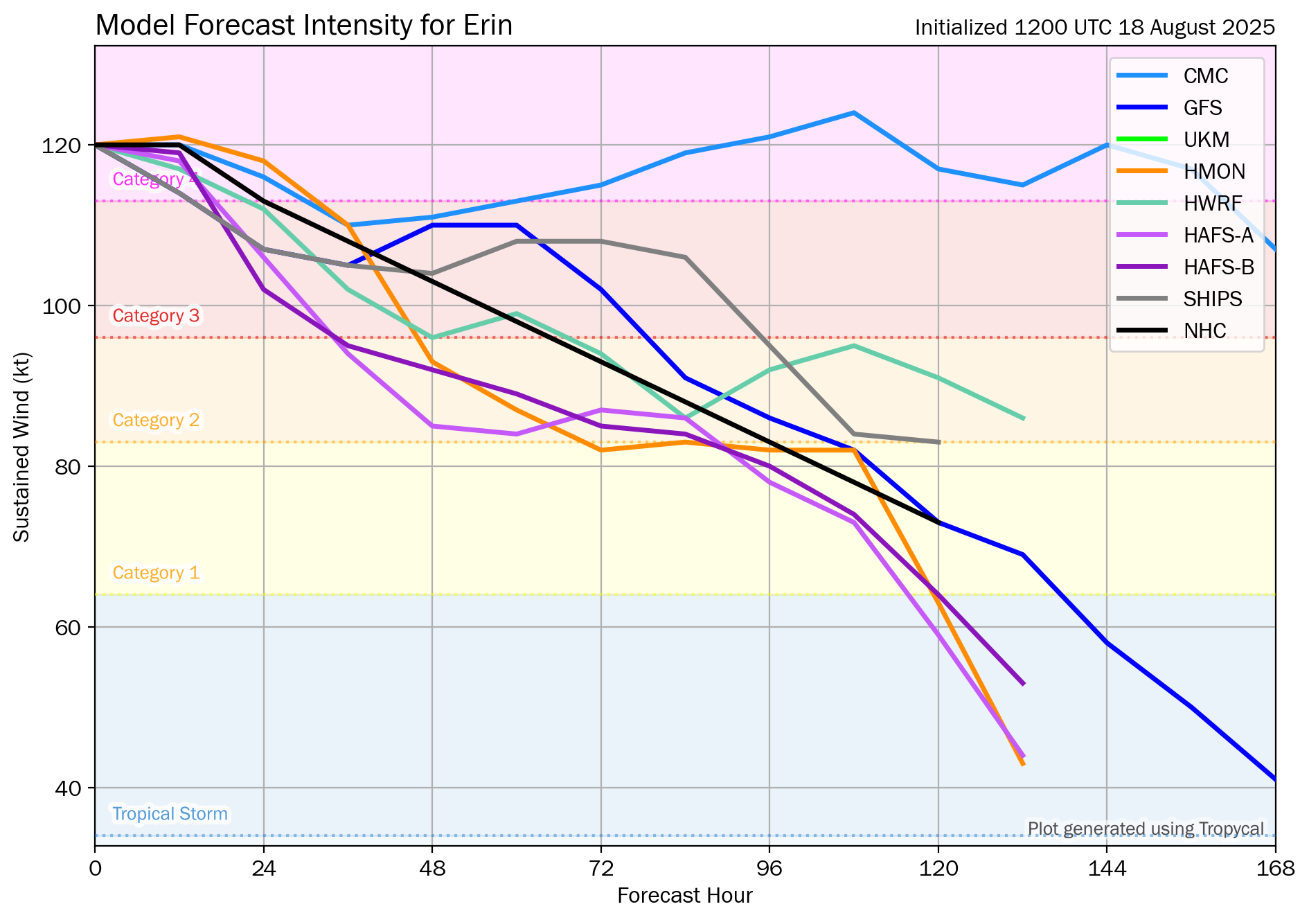
A look at the latest model guidance forecasts reveals that there are trends in all of the model guidance that suggest this wave will eventually develop and at some point may become a hurricane. The guidance, however, disagrees wildly on where this wave may eventually go & how strong it might get.
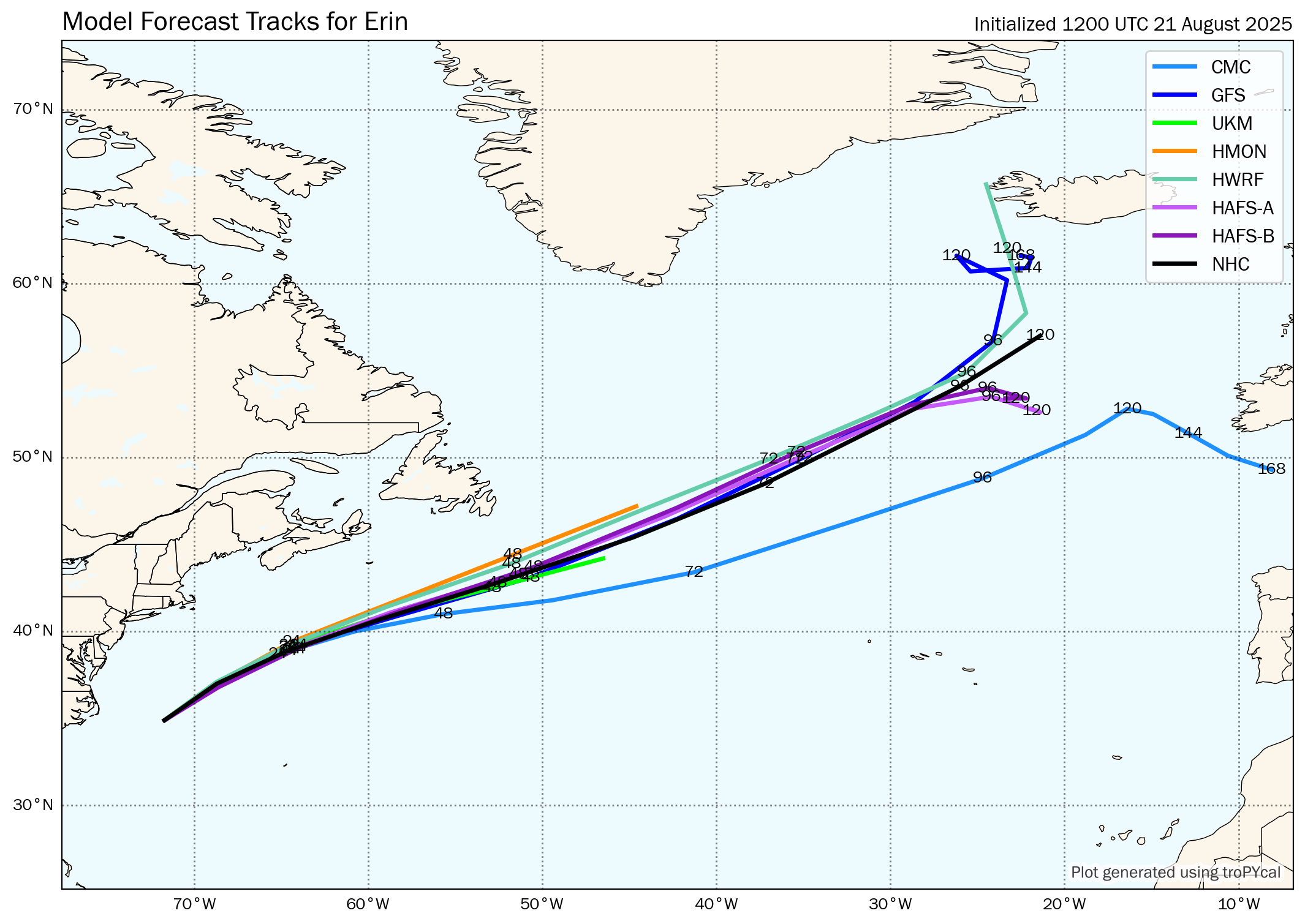
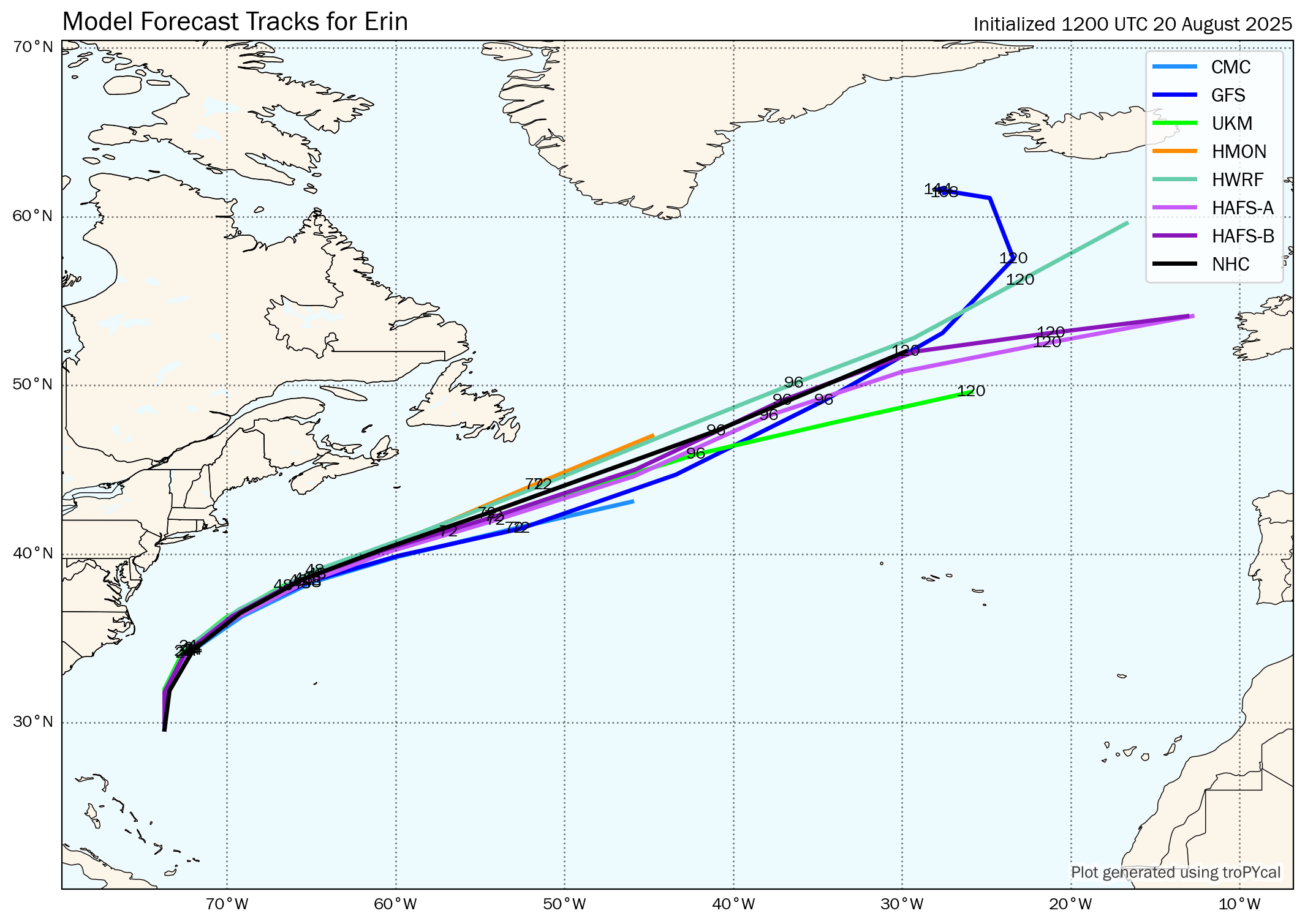
The GFS model forecasts pretty quick strengthening by late this week when this wave is still over the eastern Atlantic. This leads to a forecast of this system turning out into the open Atlantic well before it reaches the eastern Caribbean. In fact, the GFS model forecasts this turn to occur at around 45 West Longitude. One thing to note about the GFS model is that it has a notorious bias of turning storms to the north too quickly and in the end, these storms end up tracking much further west than what the GFS model showed.
The Canadian model shows slower development throughout this upcoming week as this wave heads westward. The Canadian model does suggest this wave might gain just enough latitude to keep it to the north and east of the northeastern Caribbean in about 10-12 days from now.
The European model also suggests slow development from this wave and in fact, really doesn’t forecast it to significantly strengthen until it’s passing just north of the Lesser Antilles next Wednesday (September 10). Ultimately, the European model forecasts this wave to be a strong hurricane that passes just east of Bermuda around September 14.
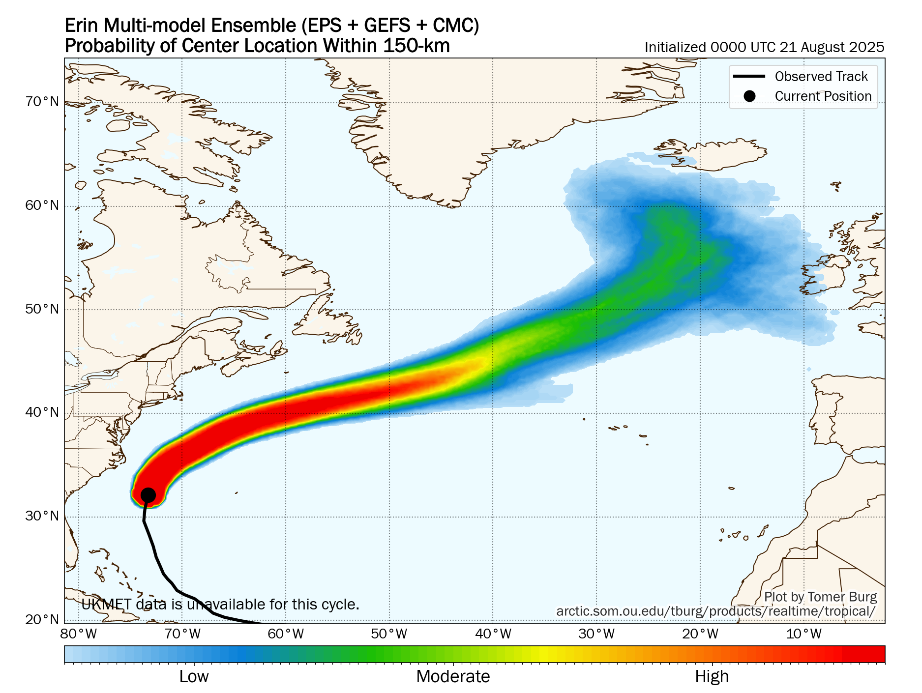
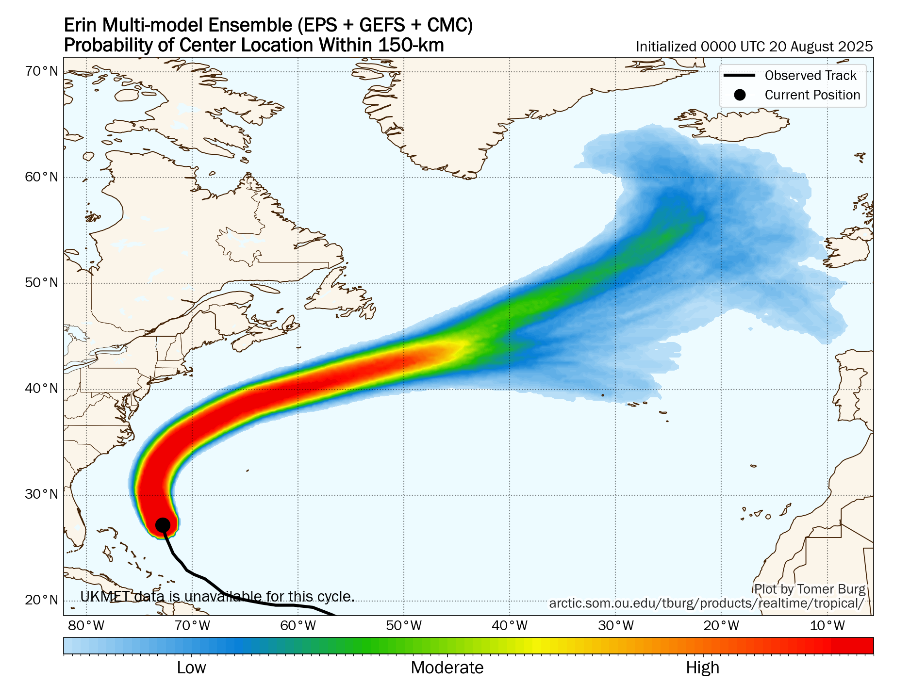
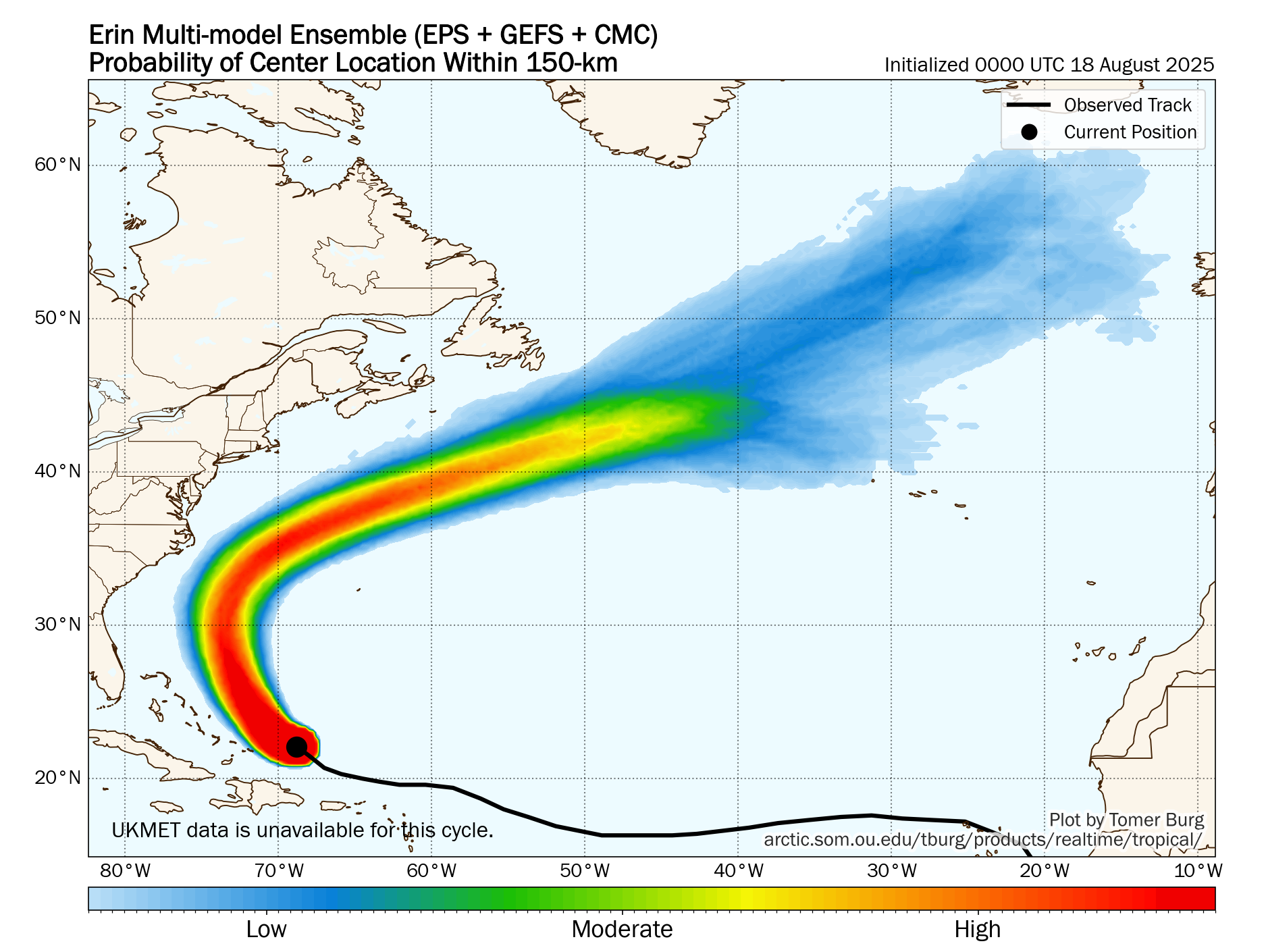
As for the ensemble guidance – The GFS ensemble model guidance seems to be clustering on most members showing an eventual track that takes this system north of the Lesser Antilles in about 10 days from now. That said, there are a few members that do forecast an impact on the northeastern Caribbean in about 10-11 days from now.
The European ensemble model guidance looks a lot more aggressive and much further west in terms of a potential track of this wave. It seems that about half of the members that show an impact to the northeastern Caribbean in about 8-10 days from now. The other half of the members of the European ensembles show a track that keeps this system to the north of the Lesser Antilles.
Here Are My Thoughts: As I mentioned at the start of this discussion, I do think that we are going to be watching and tracking this wave for quite a while. In fact, we are still at least 8-10 days away from this wave affecting the eastern and northeastern Caribbean, if it does at all.
I do think that we are probably going to see very slow development of this wave throughout this upcoming week. This is due to the fact that the conditions across the eastern Tropical Atlantic are marginally favorable for development.
The weather pattern this upcoming week across the Atlantic is going to consist of a large upper level trough centered along about 50 West Longitude. This means that this wave will be impacted by strong shear at times, limiting development throughout this upcoming week. Once this wave passes about 55 West Longitude or so, it’ll begin to move into a much more favorable environment, but this will not happen for about another week from now.
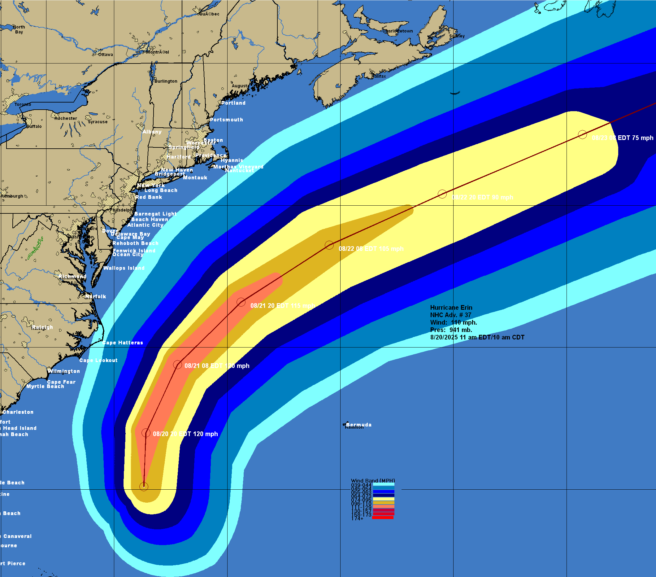
My takeaway when looking at the data is that I think that we’re looking at a wave that may be able to stay pretty far south in latitude. Because of this, there’s the very real potential for this wave to travel fairly far to the west & potentially be more of a threat than Erin ever was. Also, the conditions across the eastern and central tropical Atlantic aren’t all that favorable for development and because of this, this wave should stay weak & not be influenced as much by that trough leading to more of a westward track than definitely what the GFS model suggests and even what the European model suggests.
For now though, this wave poses no threat to any land throughout this upcoming week. It’s possible that this system could become some sort of a threat to the islands of the northeastern Caribbean in about 7-9 days from now. That said, there is more than plenty of time to keep an eye on this system.
Could this system eventually threaten or impact areas further west towards the Bahamas, Florida & the US East Coast? It’s possible, but it’s obviously way, way too soon to even start looking that far out.
I will be keeping a very close eye on the progress of this wave, no matter what it does. Many more updates on this wave will be posted in the coming days.
The next tropical weather discussion will be issued on Monday.