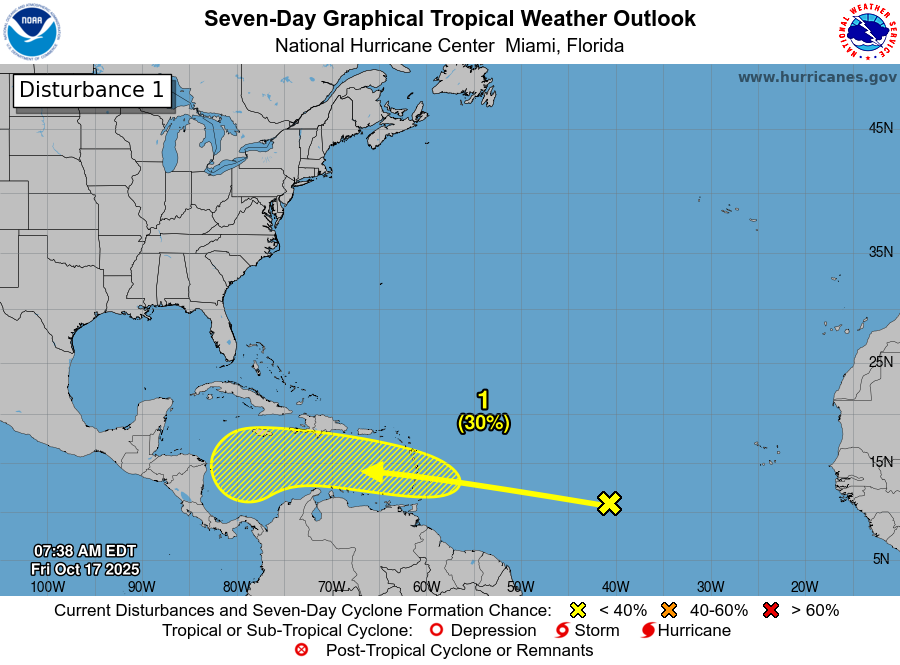
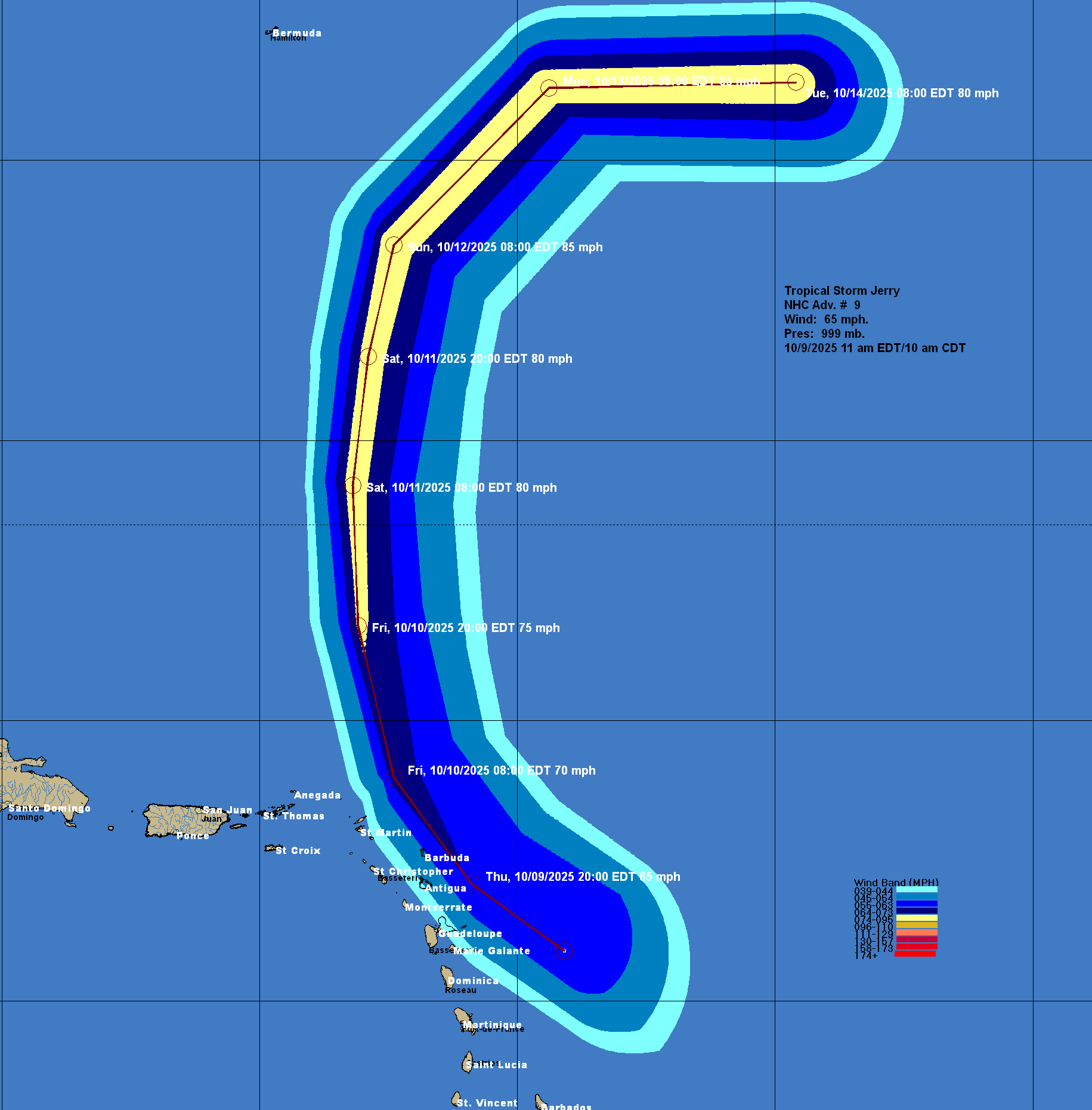
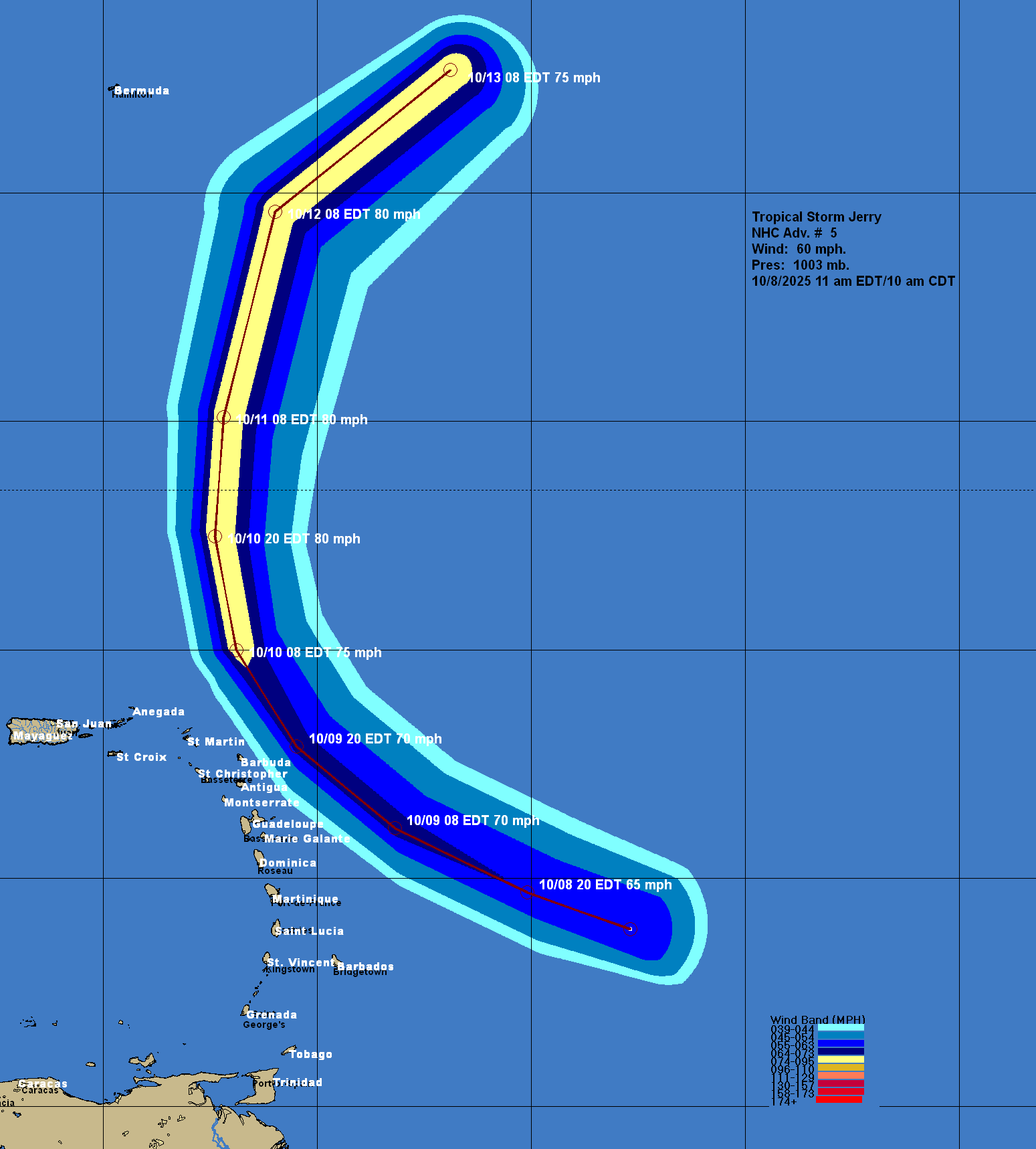
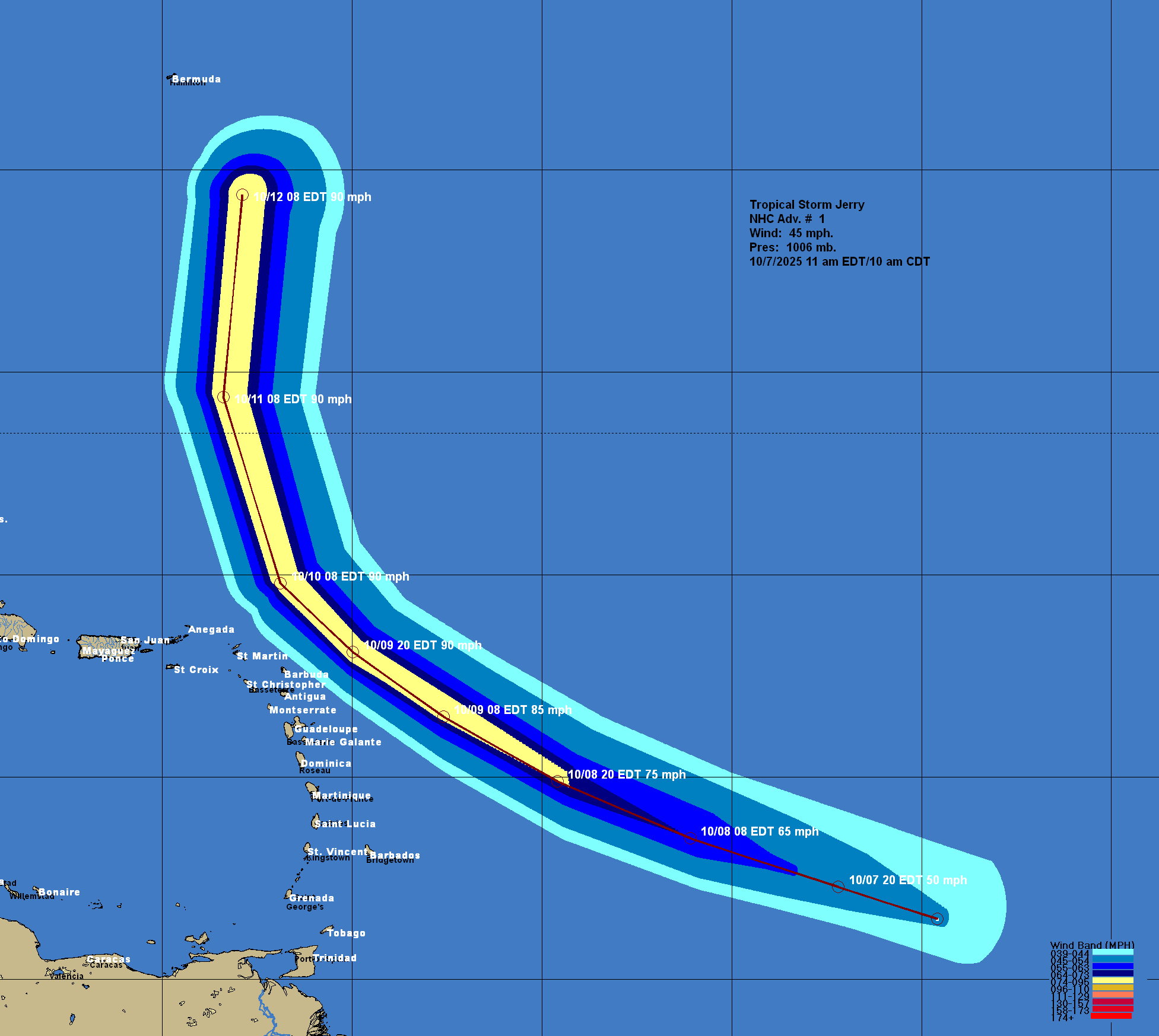
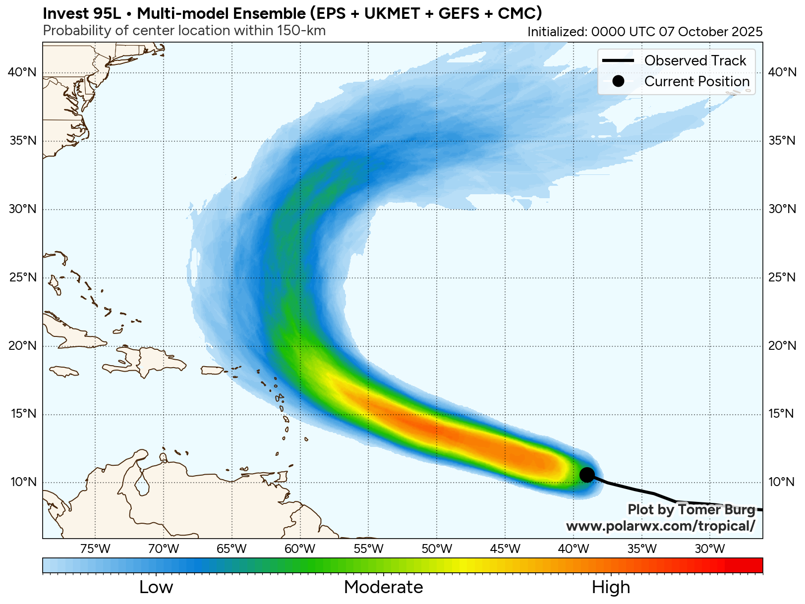
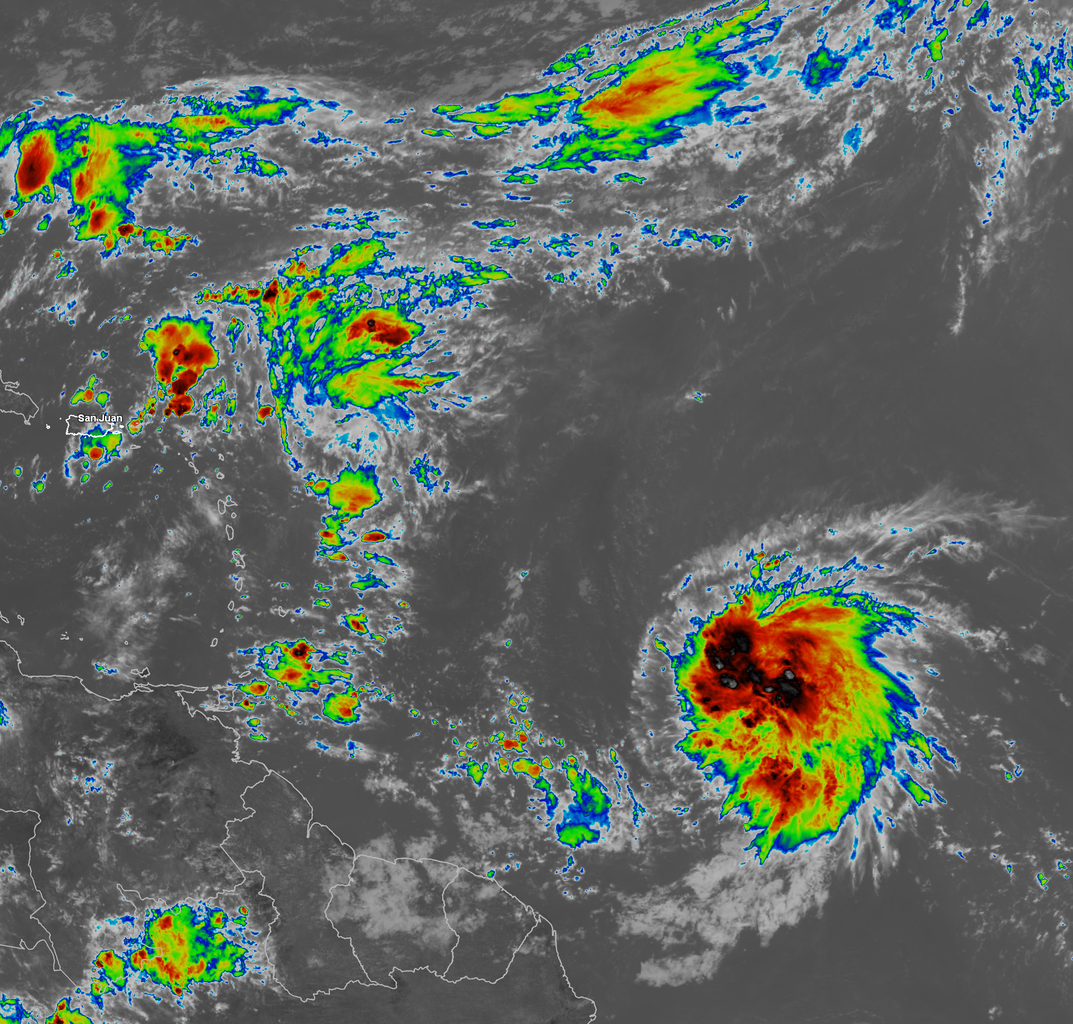
I continue to track a robust tropical wave that’s located over the Tropical Atlantic about 800 miles or so to the east of the Windward Islands or near 49 West Longitude. This wave is producing a large area of convection that stretches from about 47 West Longitude westward to near the Windward Islands.
I do still think that it’s very possible that this wave will develop into our next named tropical storm once it’s in the Caribbean during next week. This wave looks to enter the Caribbean by Sunday night into Monday.
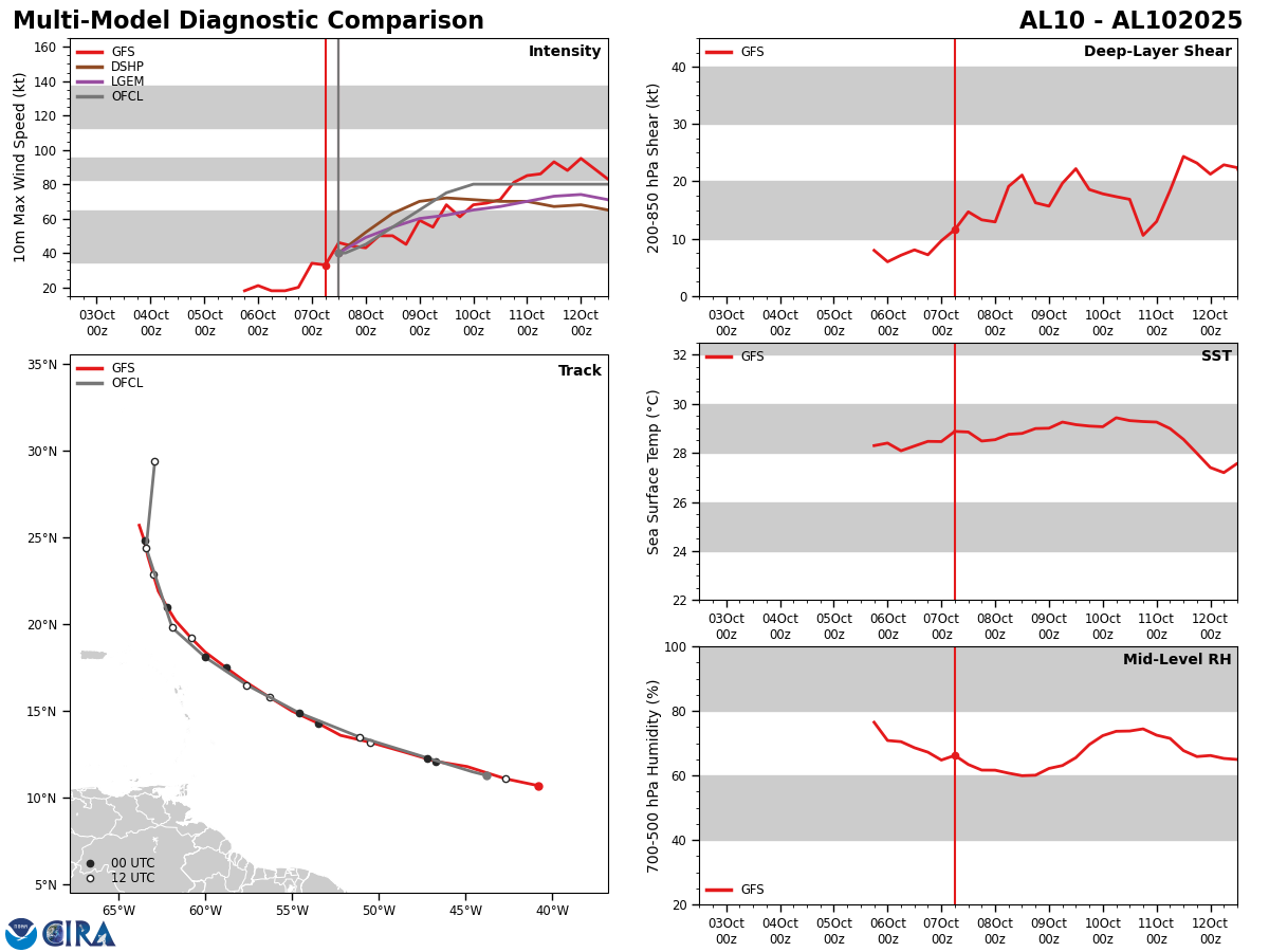
Analysis of the environmental conditions reveals that the wind shear values around this wave are currently unfavorable for development. It should be noted though that the wind shear values in the Caribbean are very favorable for development & because of this, I do think that this system may very well develop once it’s in the Caribbean.
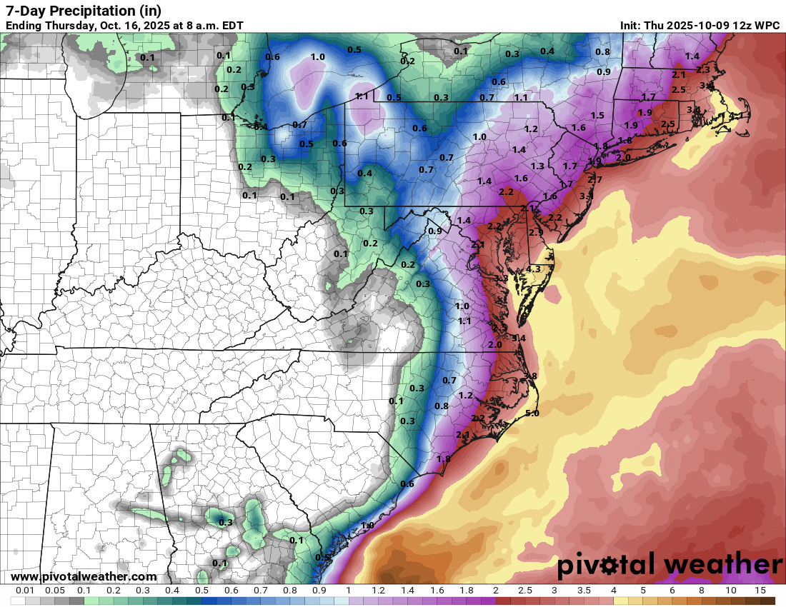
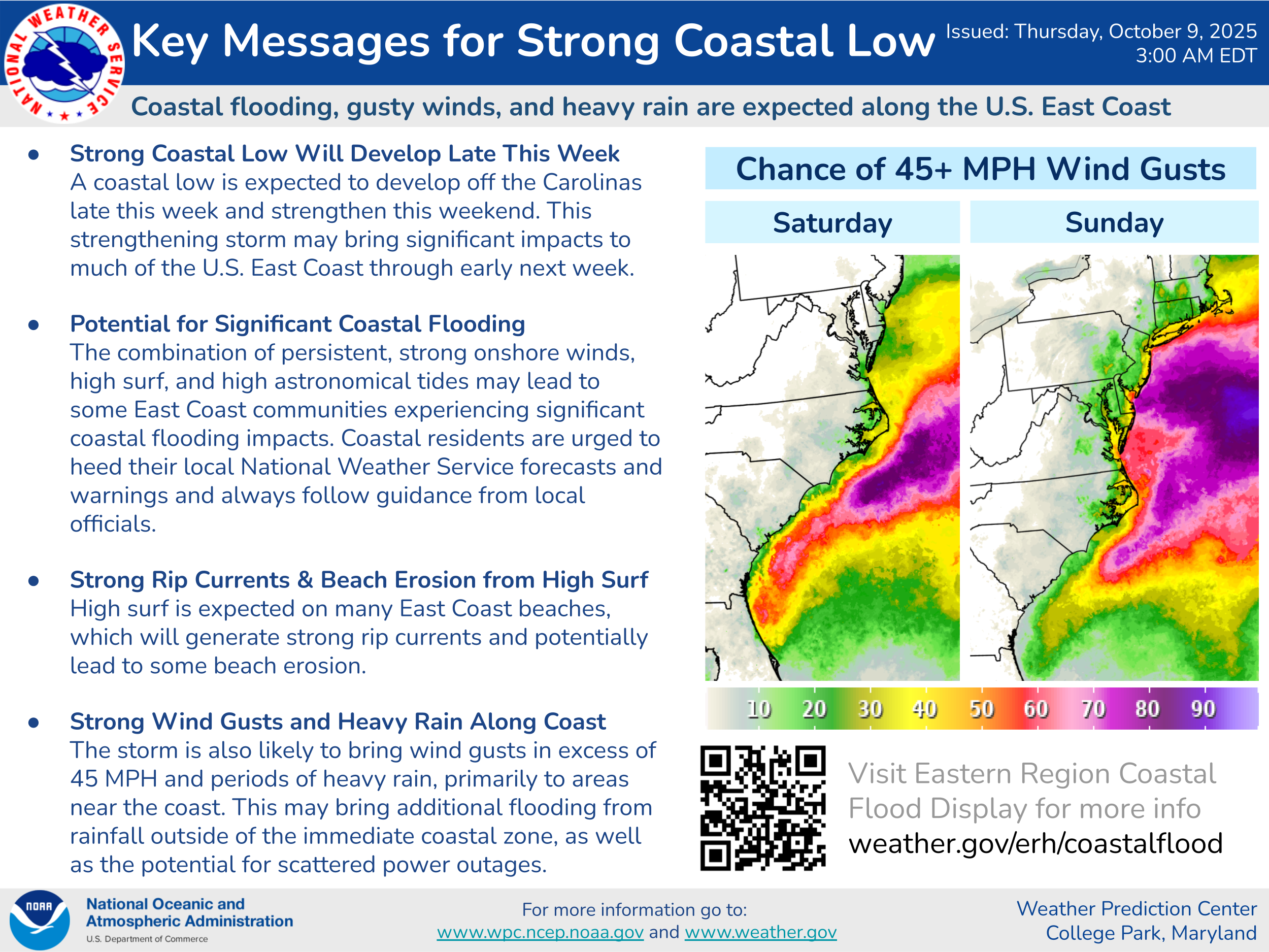
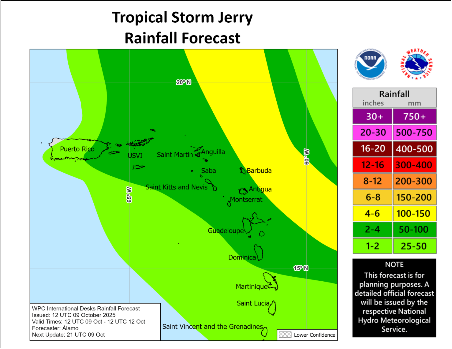
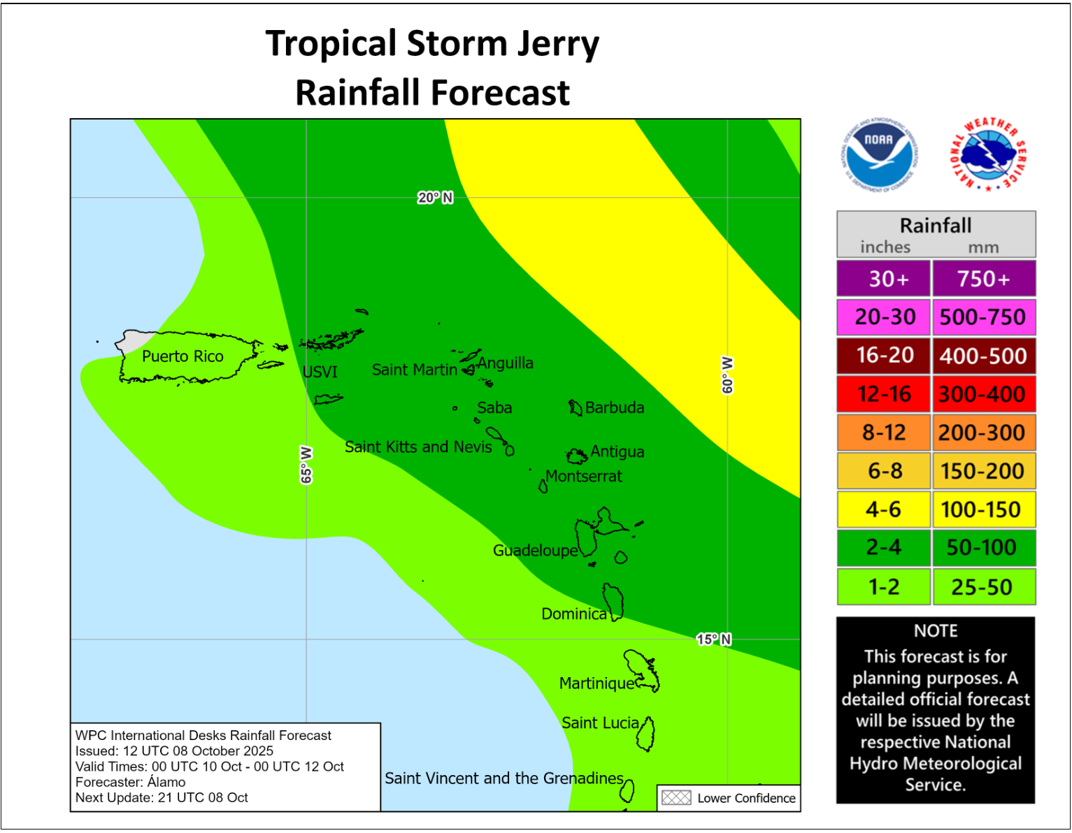
One thing that this tropical wave will do is bring squally weather, including heavy rain & gusty winds, to the Windward Islands starting as soon as this afternoon and continuing through Sunday and Monday.
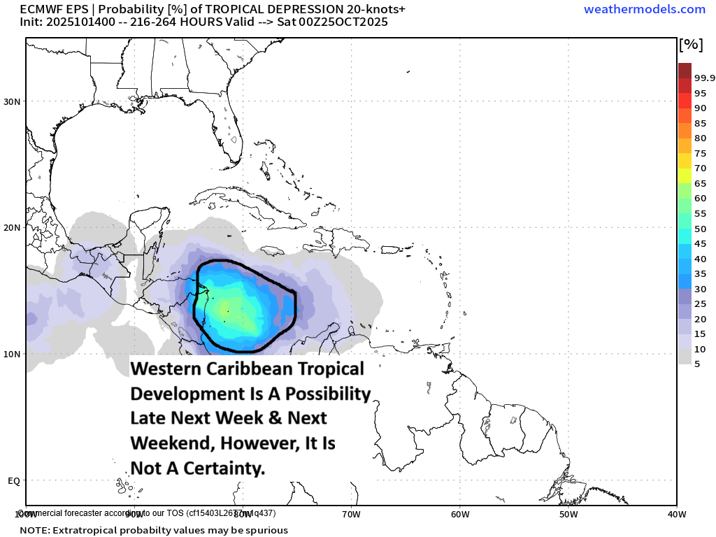
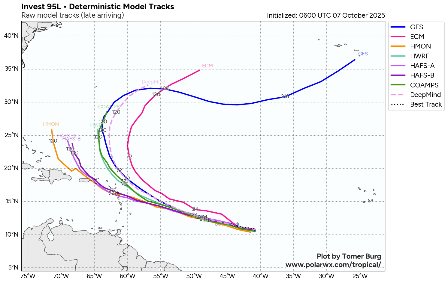
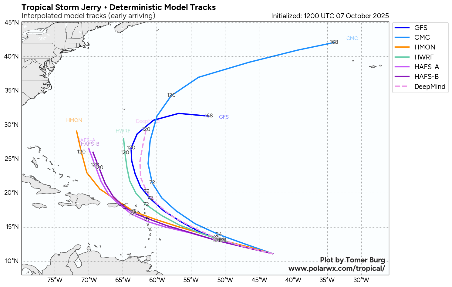
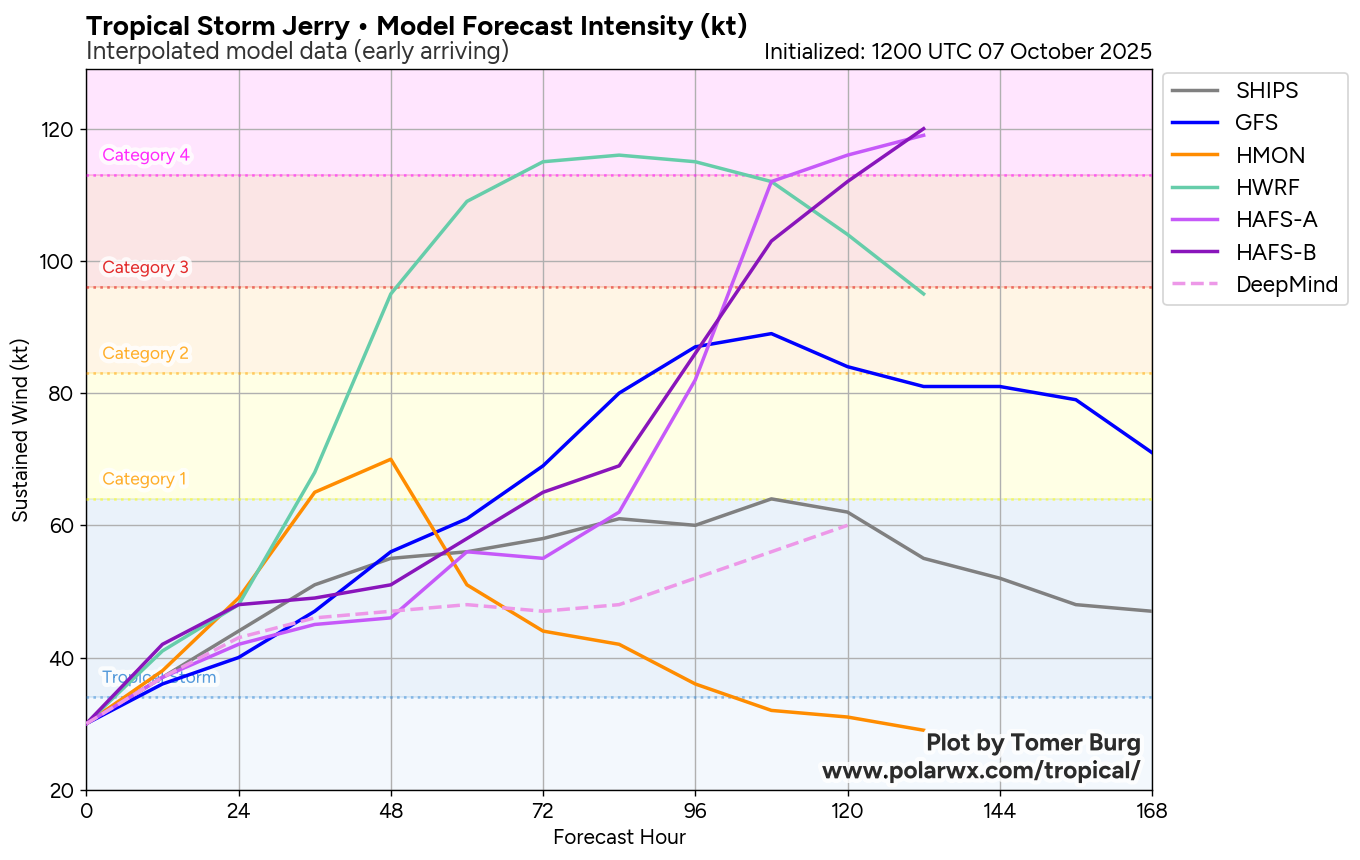
There is very high amounts of uncertainty as to where this system might go and how strong it becomes once it’s in the Caribbean. Unfortunately, the model guidance is of little use in trying to figure this out as they all disagree with each other.
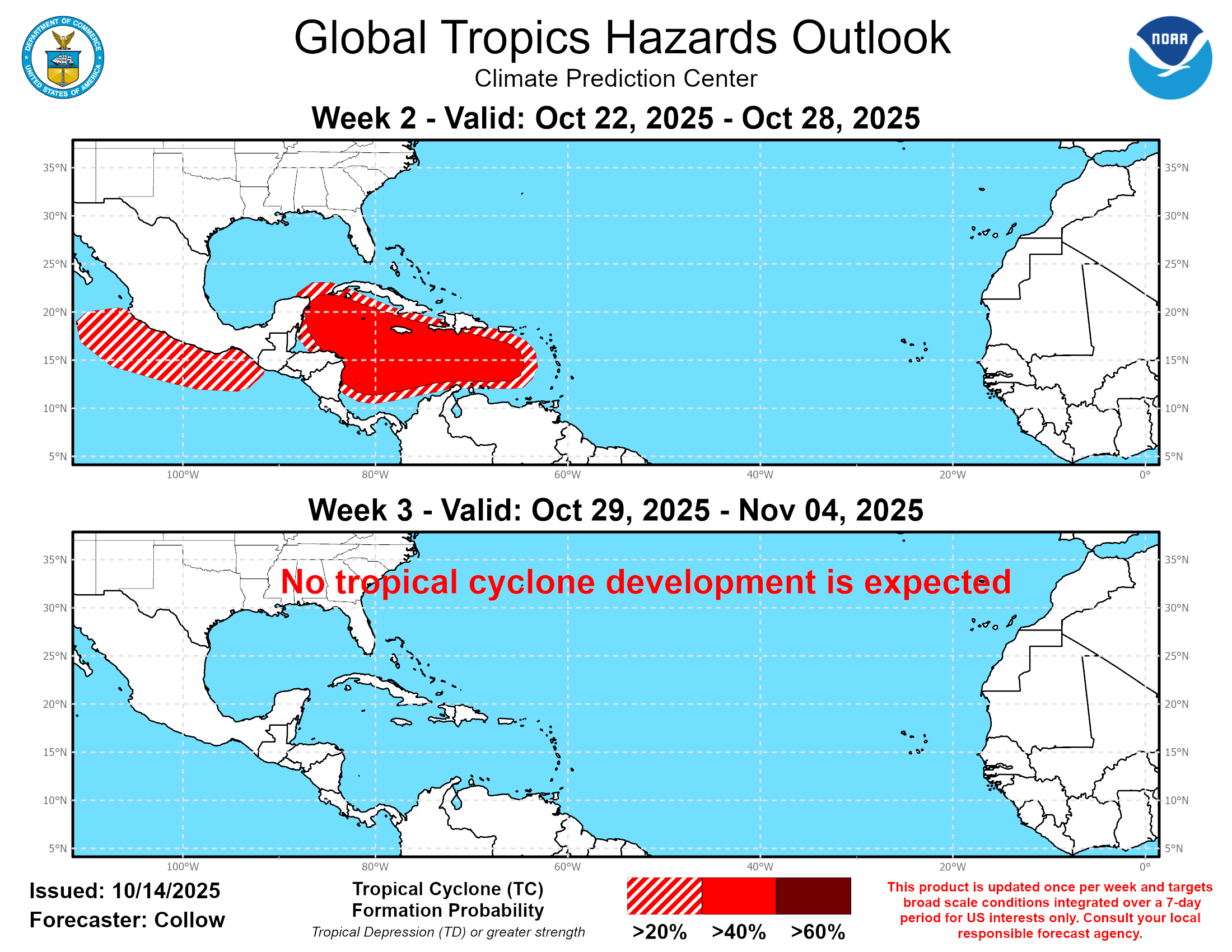
The GFS ensemble model guidance members are clustered in two scenarios. One cluster shows development occurring over the central Caribbean just south of Hispaniola during the middle and later parts of next week with a track that takes this system north and then northeastward across eastern Cuba, Hispaniola and the southeastern Bahamas. The second cluster of ensemble members show development occurring in the southwestern Caribbean instead with a scenario that keeps anything that forms there stuck in the western Caribbean for many days.
A look at the European ensemble model guidance shows that most of its members showing any development to occur in the southwestern Caribbean during the second half of next week. Most of the members that show development point to a scenario where this system crawls to the northwest near the coast of Nicaragua and Honduras by next weekend.
The most recent run of the Google Deep Mind AI model is a hot mess of possible track scenarios. While most members point to any development occurring in the central Caribbean later next week, they then diverge wildly on possible tracks. Some members show a quick exit to the northeast towards Hispaniola and Puerto Rico. Other members forecast a scenario of a track to the west-southwest towards Central America. Yet other members show a scenario where this system just sits and spins over the central Caribbean for many days.
My Thinking Is That while I do think that the development of a tropical storm and very possibly a hurricane will probably occur in the area around the central Caribbean during the second half of next week, I really have no idea of where it might go. This means that all options are on the table right now.
October tropical systems in the Caribbean can be extraordinarily difficult to forecast & in the past, we’ve seen everything from a nearly stalled system in the western Caribbean to a system that tracks from west to east across the Caribbean.
Because of this, if you live in the Caribbean or are traveling there, you really should keep a very close eye on the progress of this system. This includes those of you in the Virgin Islands, Puerto Rico, the Dominican Republic, Haiti, Cuba, the Cayman Islands, Jamaica, the Yucatan Peninsula, Belize & all of Central America.

The next tropical weather discussion will be issued on Monday.