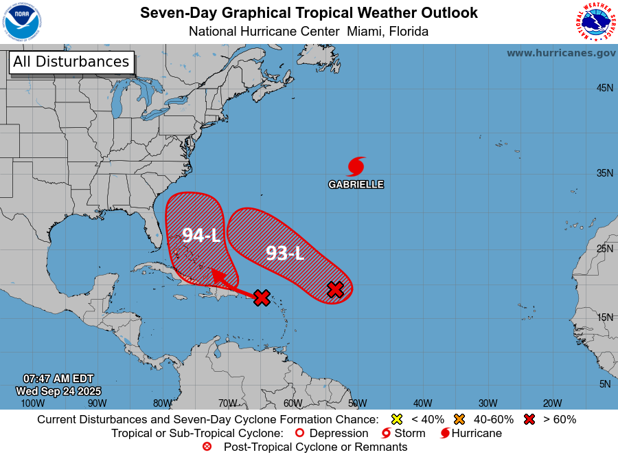
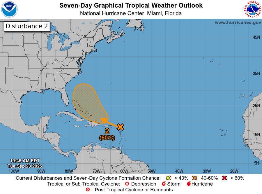
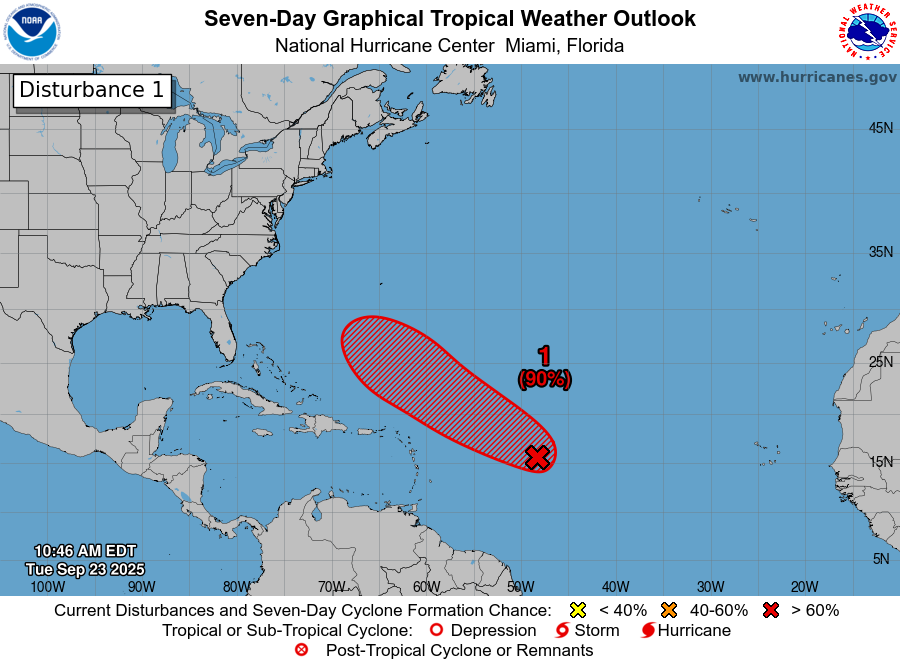
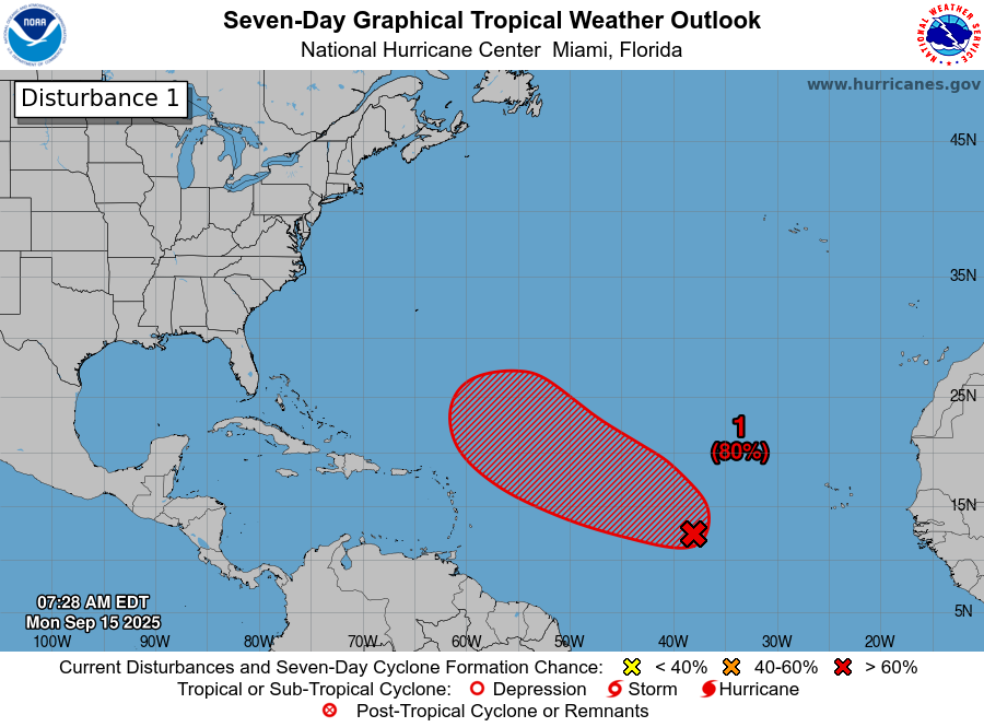
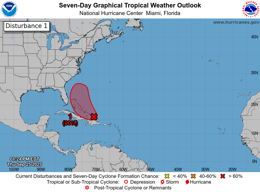
Invest 94-L (Future Imelda): First things first, I do think that Invest 94-L (future Imelda) is a potential very real threat to areas from northeast Florida and coastal Georgia through the Carolinas and into southeastern Virginia sometime early next week. That being said, there is still a ton of uncertainty as to how strong this system will become and where it will ultimately track. Invest 94-L is definitely a system that needs to be watched extremely closely.
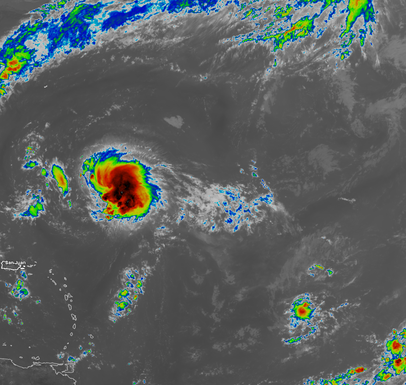
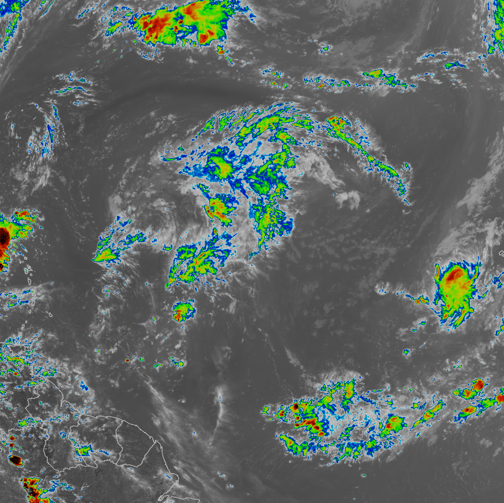
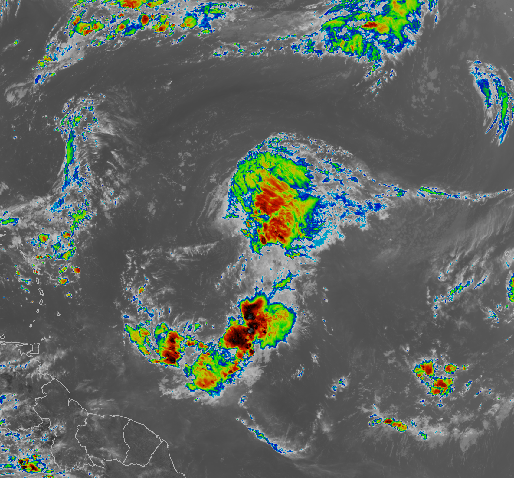
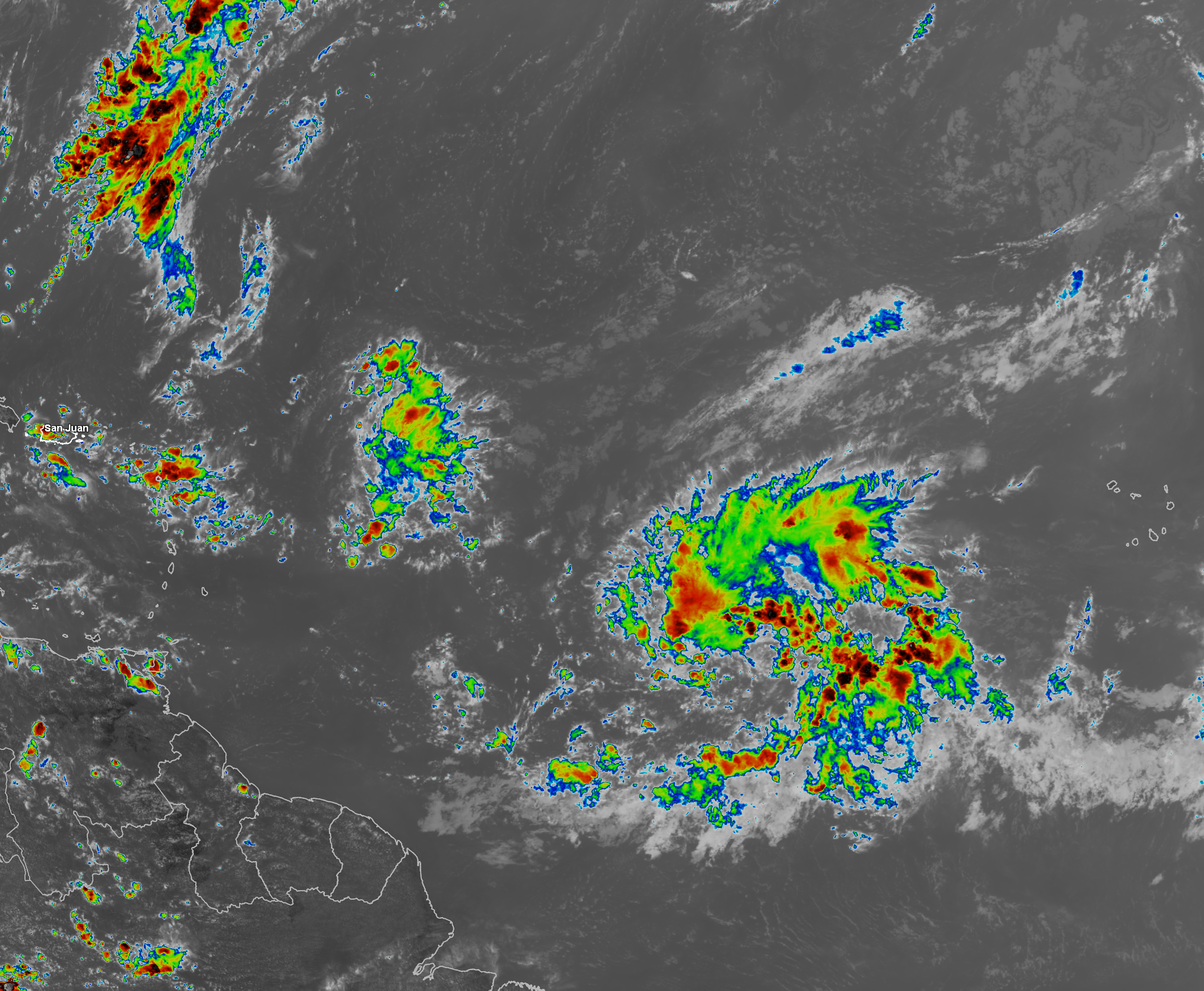
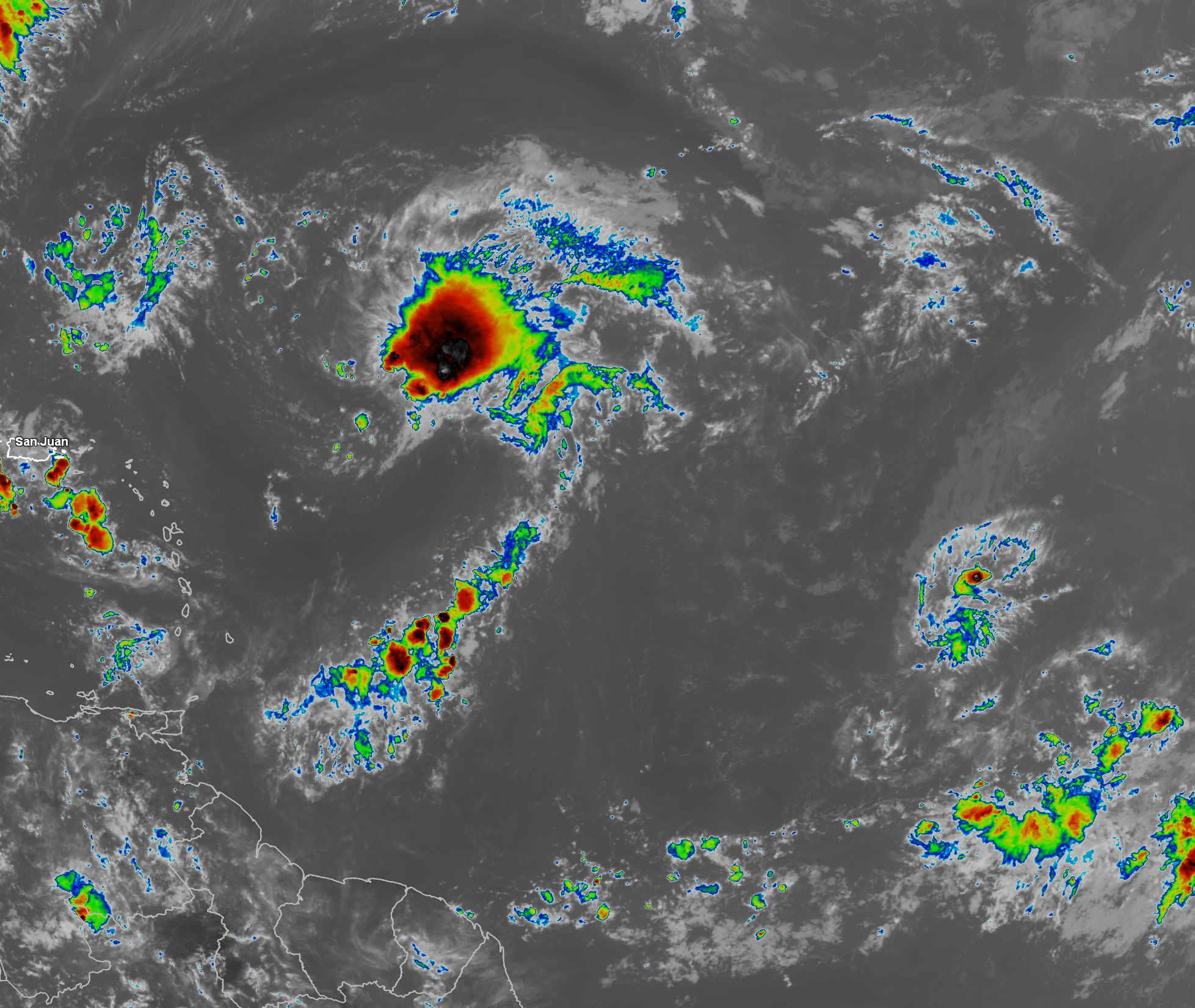
Satellite imagery and weather analysis reveals that Invest 94-L is still disorganized with most of the thunderstorms being blown to the south by northerly wind shear. Any center that is trying to form seems to be located of any center that might be trying to form. The actual center looks to be located near the north coast of of the Dominican Republic with most of the convection occurring just to the south of the Dominican Republic.
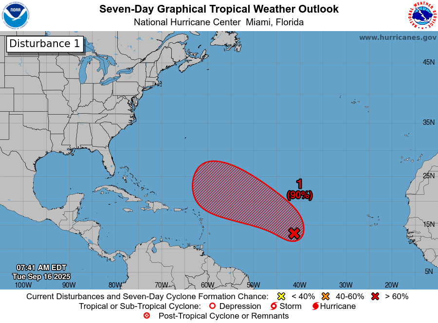
It is anticipated that Invest 94-L will move into the southeastern Bahamas by Friday and then push into the central and northern Bahamas during Saturday and Saturday night. The environmental conditions look more favorable for Invest 94-L to develop in the Bahamas and because of this, I do think that we’ll see it become a depression sometime this weekend as it pushes northwestward through the Bahamas.
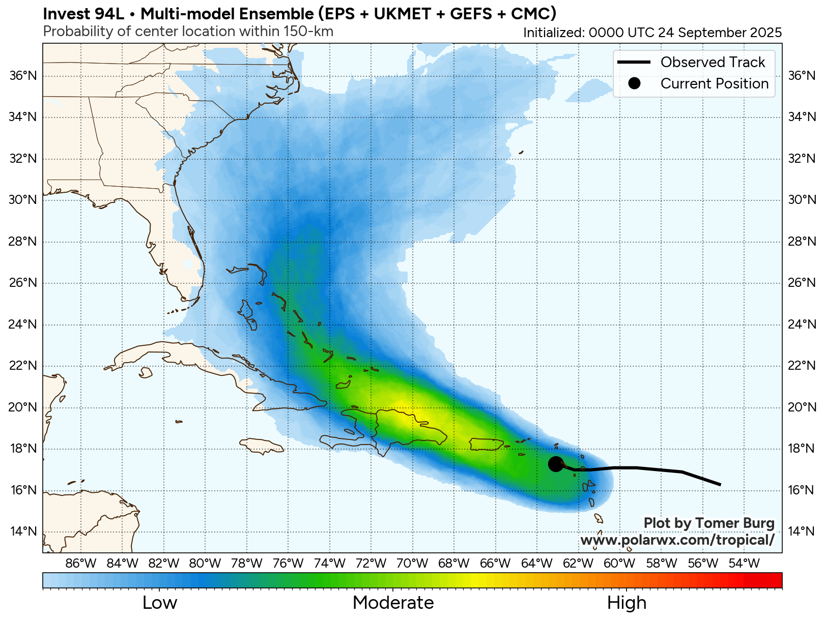
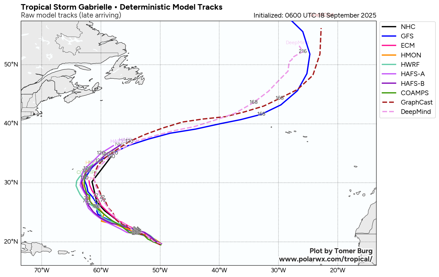
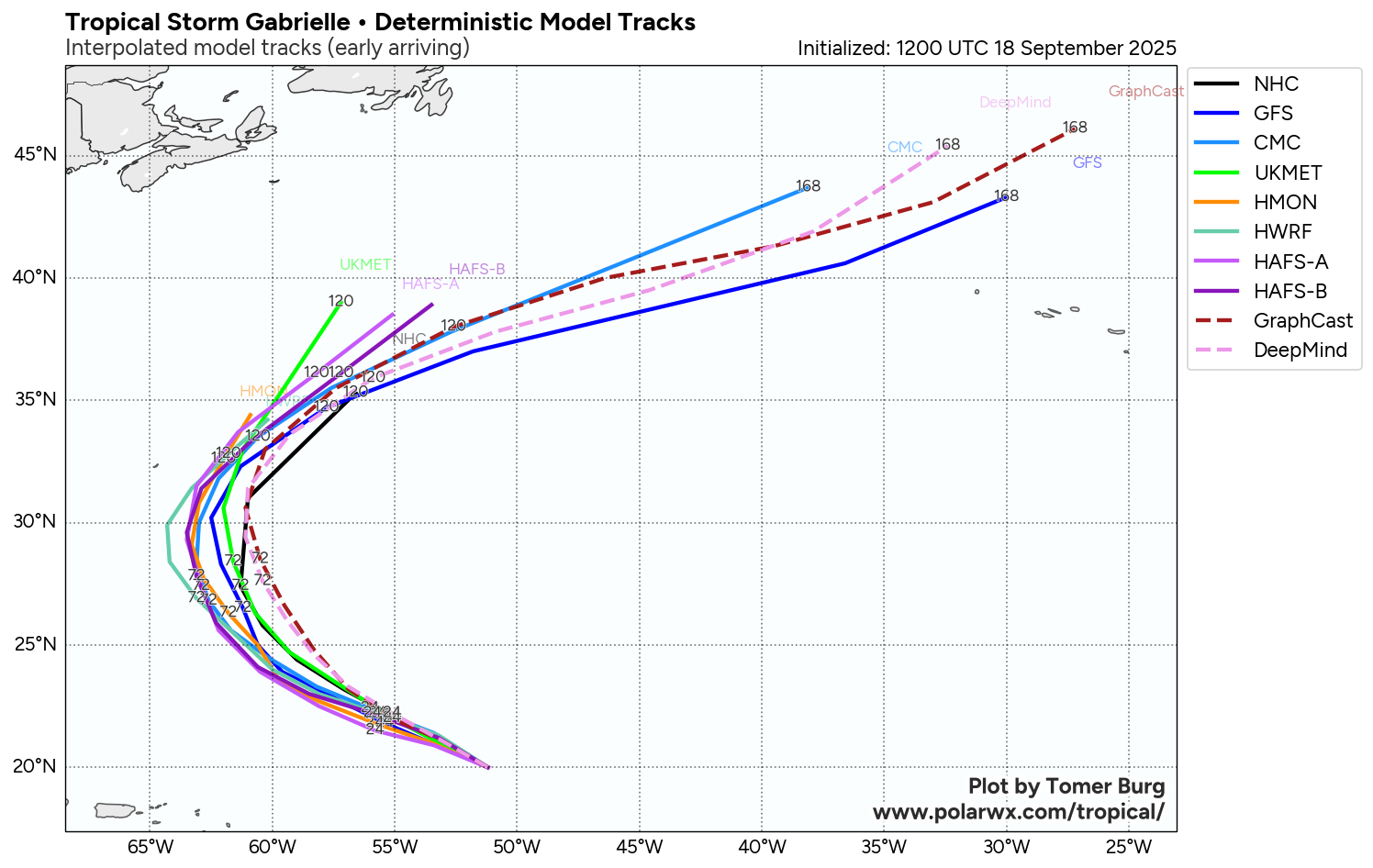
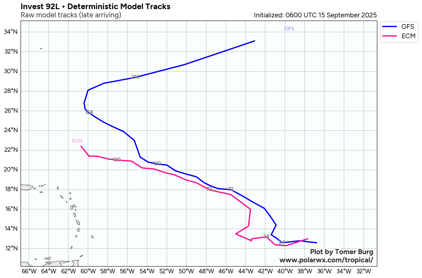
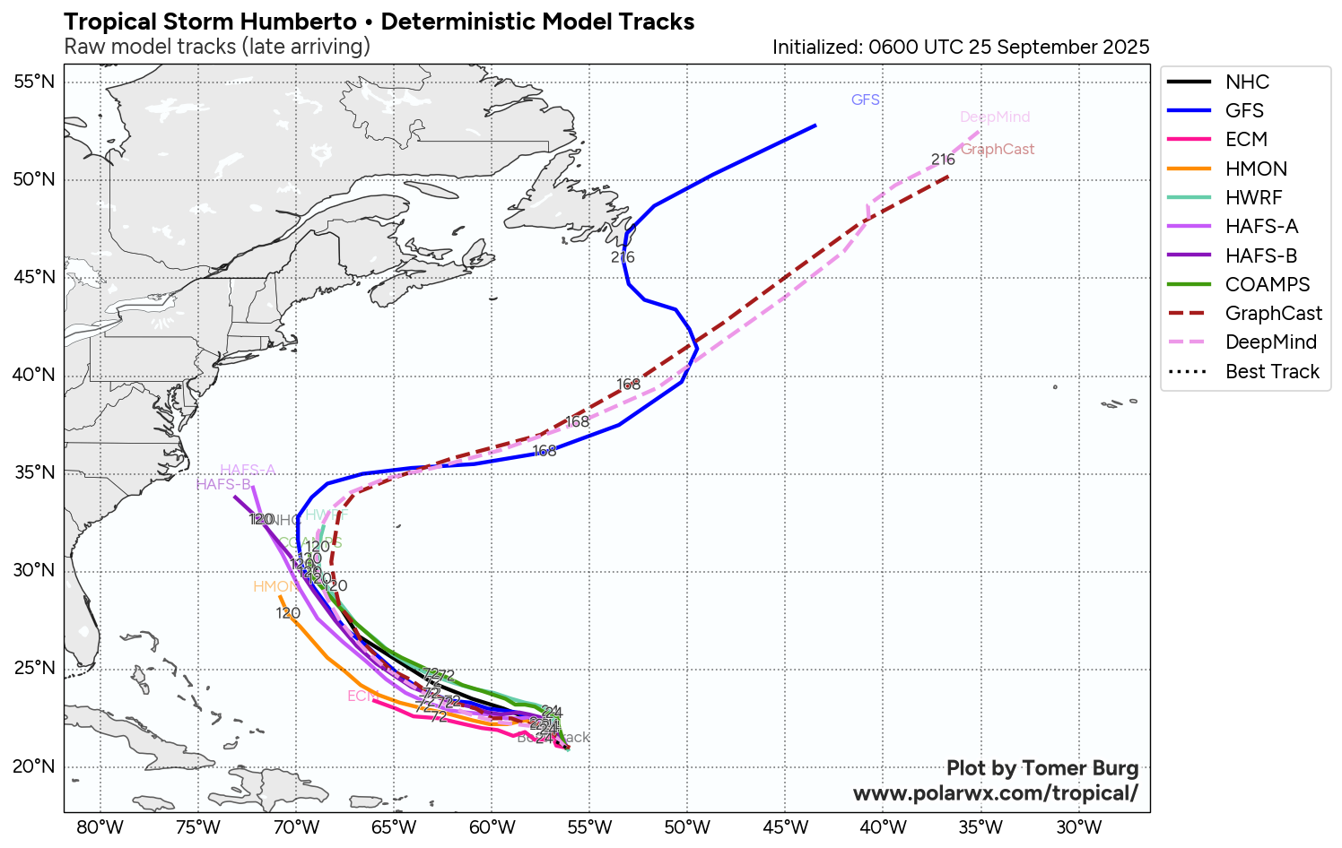
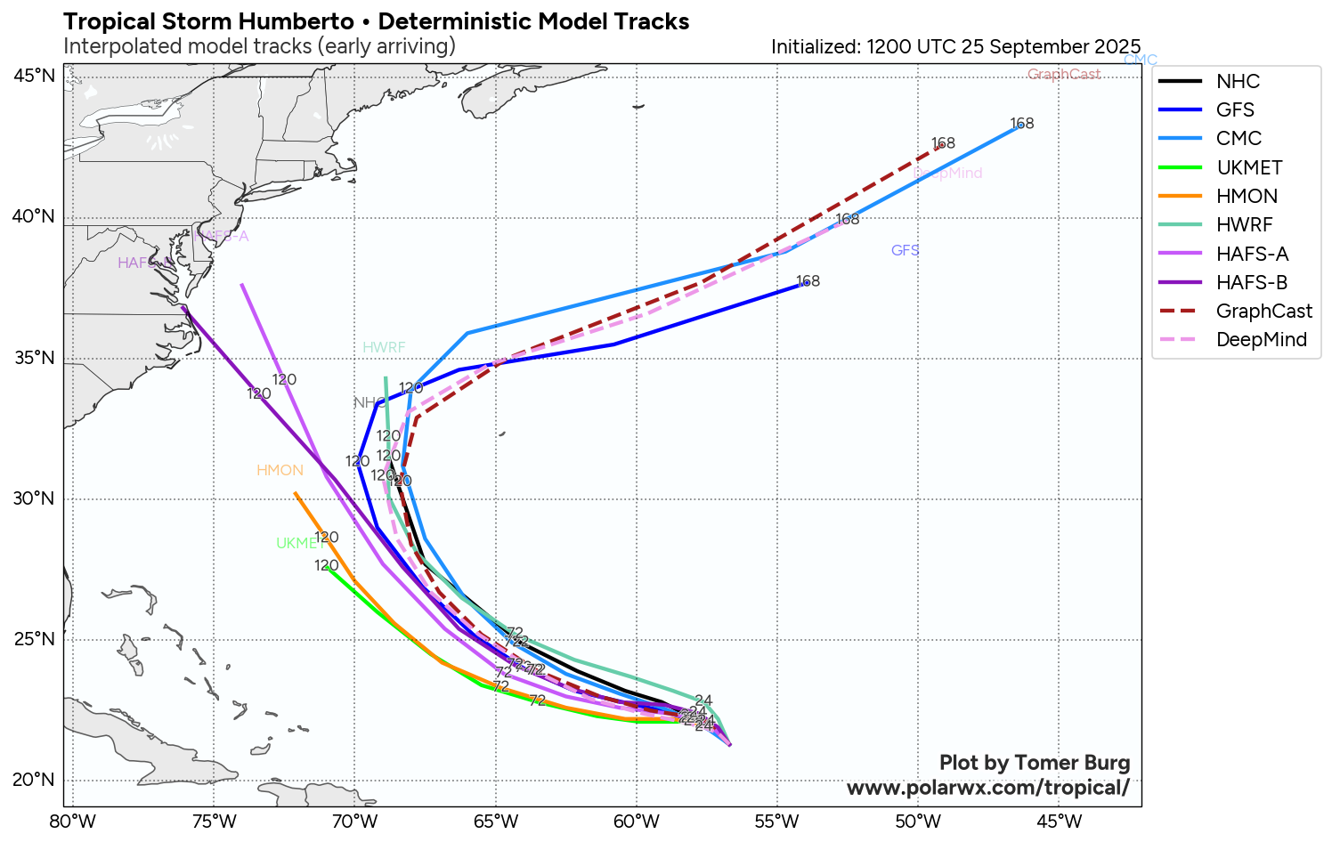
A look at the latest model guidance reveals that there has been a trend over the last 24 hours for Humberto, which is located to the east of Invest 94-L, to move slower & for Invest 94-L to move quicker in forward speed. This has led to a forecast increased distance between these two systems leading to them having less influence on each other. The reason for these changes in the model guidance is due to a trend towards a stronger upper level high pressure system over Humberto leading it to strengthen quicker & move slower in forward speed.
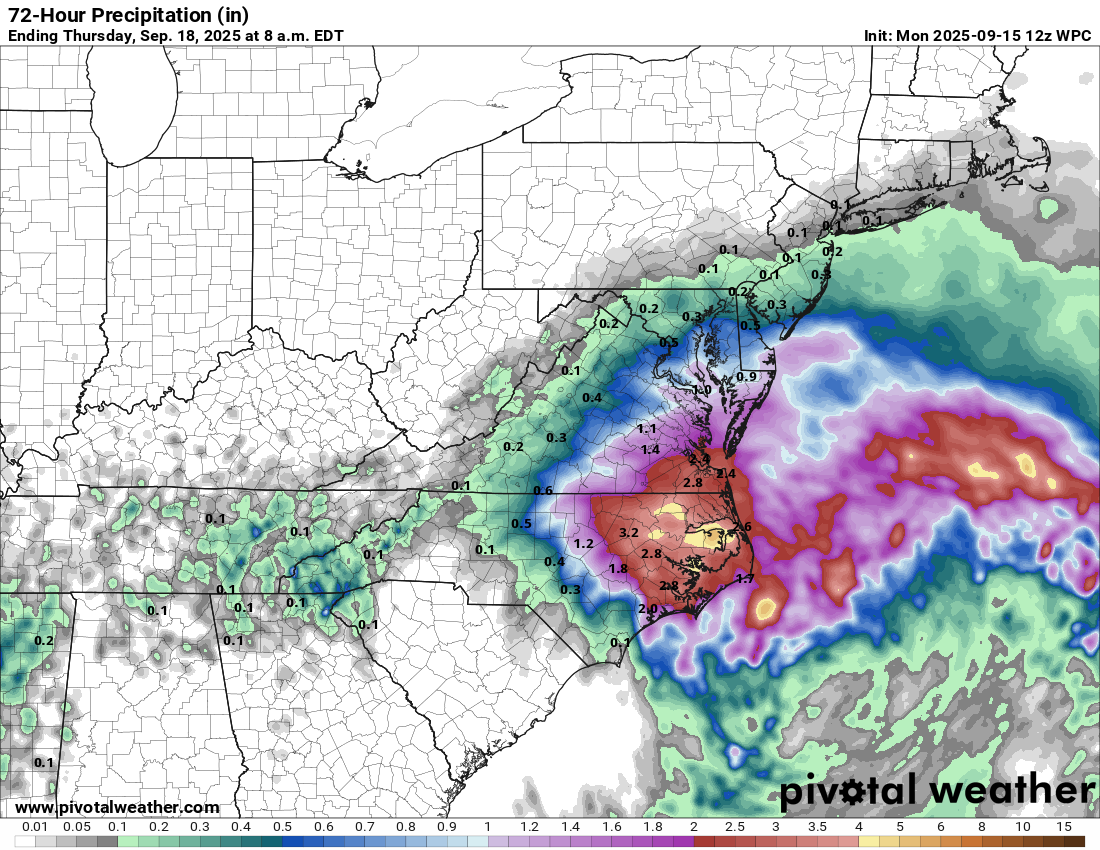
This increased separation between these two systems gives Invest 94-L (future Imelda) more of an opportunity to strengthen without being affected by Humberto. It also leads to Invest 94-L to potentially be influenced more by the upper level low pressure system over the Southeastern United States. The consequence is for Invest 94-L to be pulled right into the Southeastern coast of the United States between northeast Florida and southeastern Virginia early next week rather than be booted away from the coast and out into the open Atlantic.
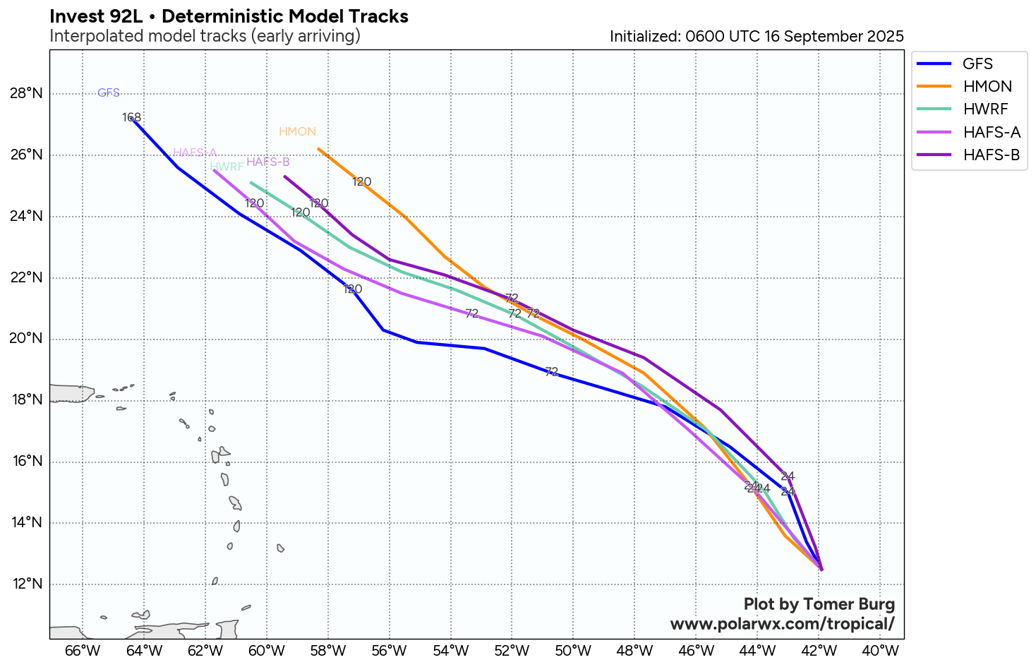
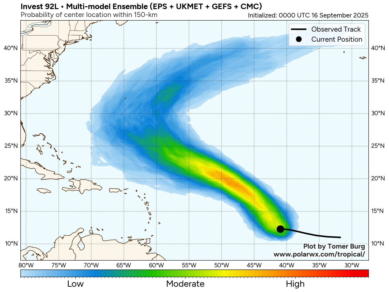
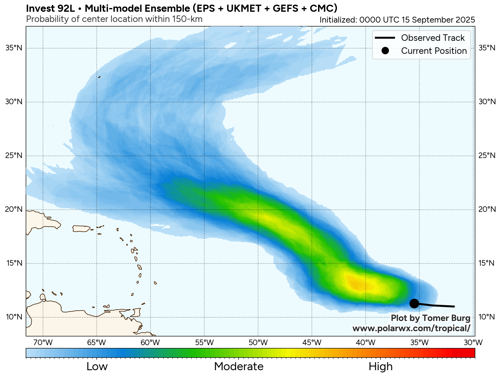
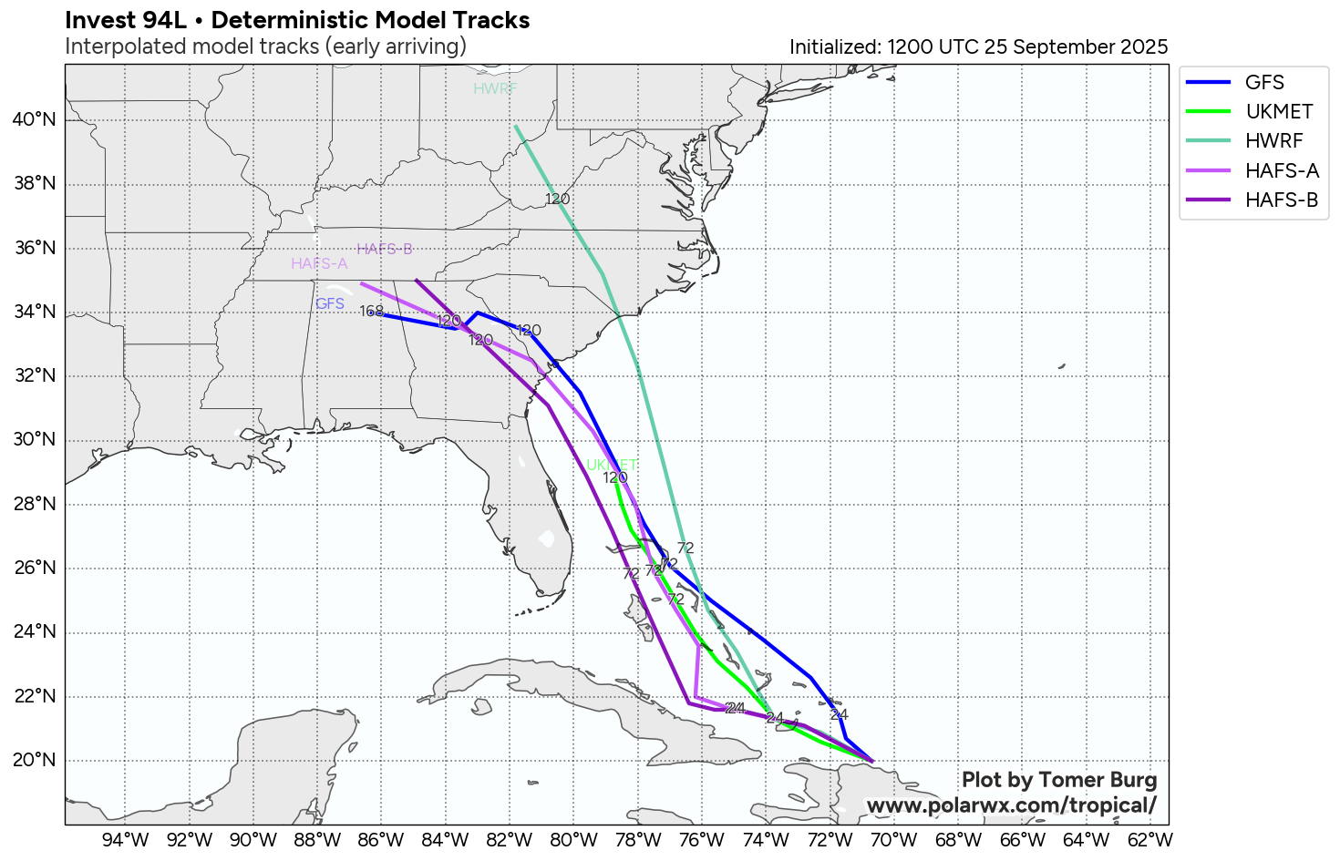
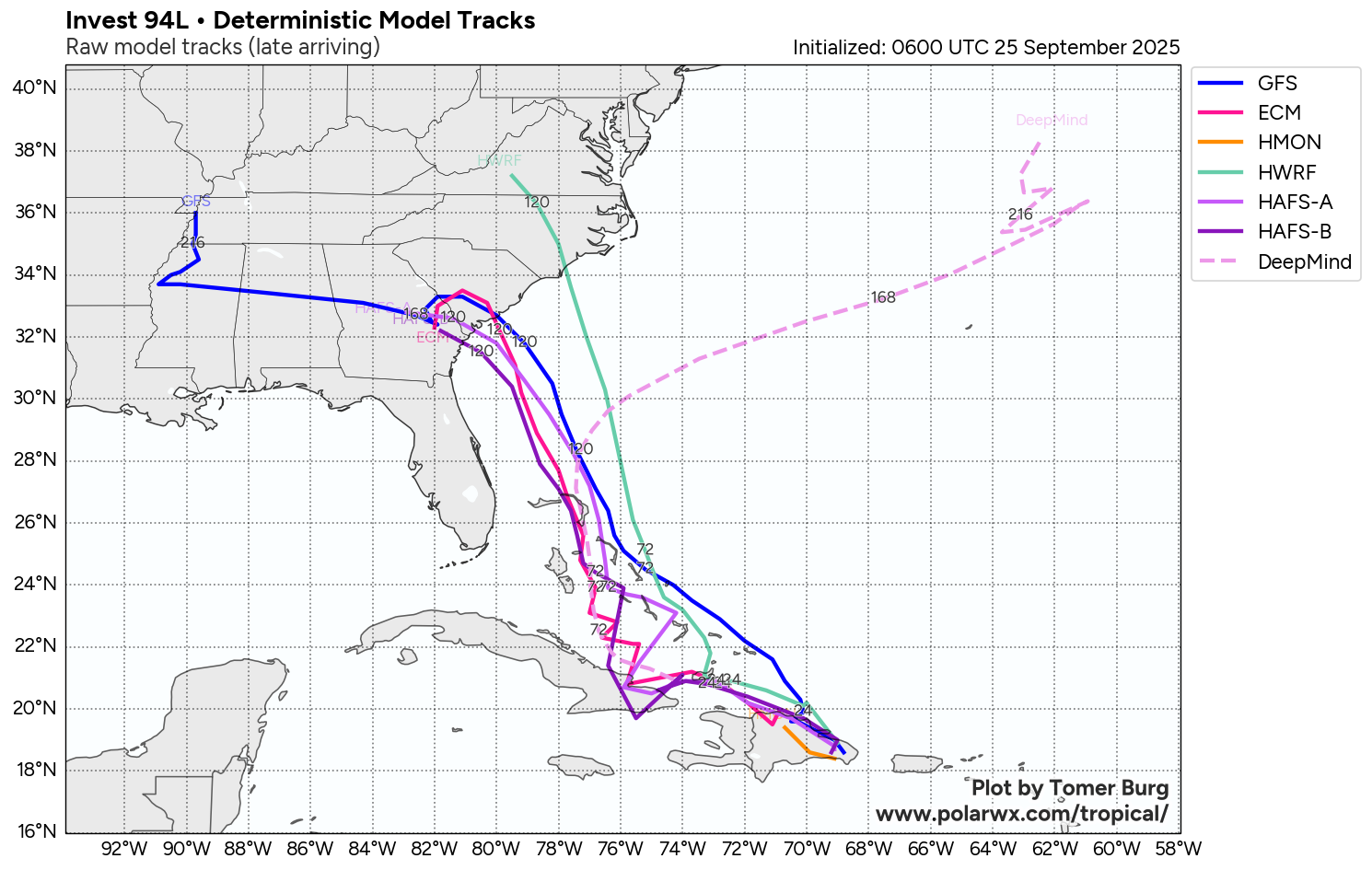
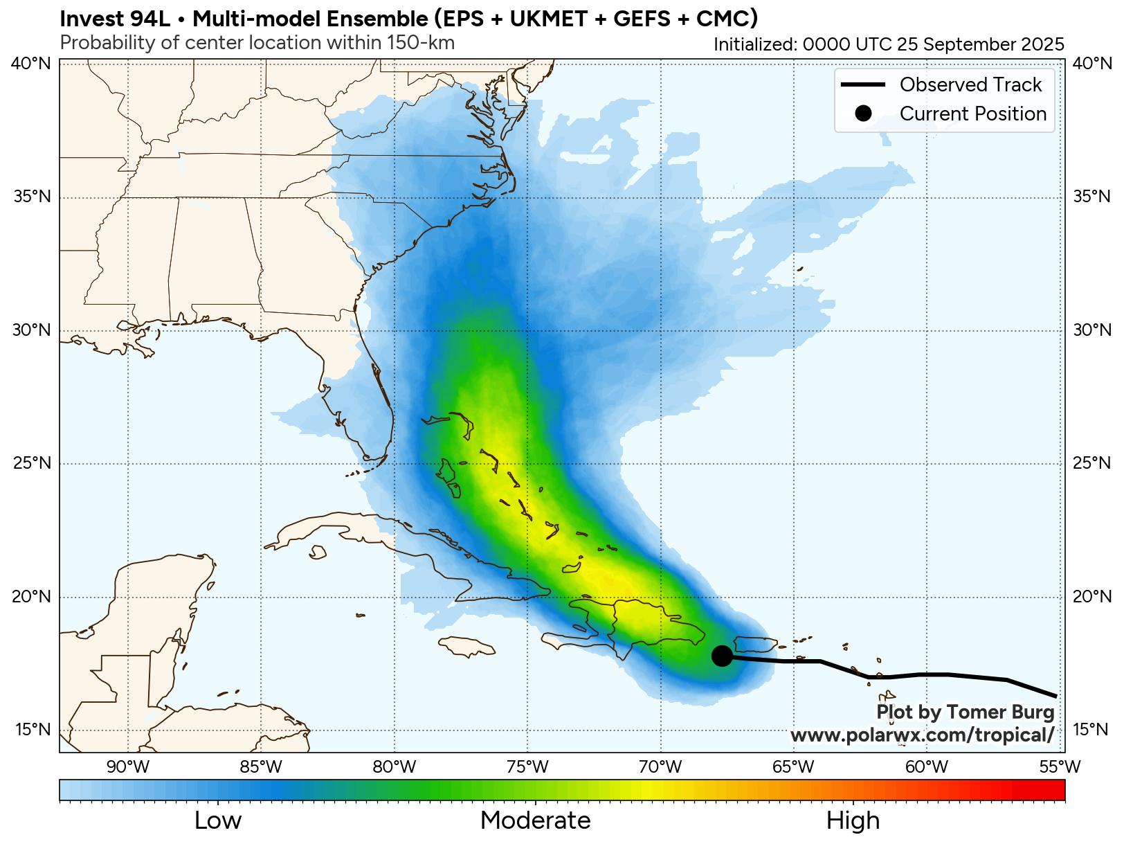
Both the most recent GFS ensemble and European ensemble model guidance have a large number of members that show a track that takes Invest 94-L right into eastern South Carolina and eastern North Carolina sometime between Monday and Wednesday of next week. That said, there are some members of both ensembles that show a track towards coastal Georgia and coastal South Carolina while other members still do show a track that still keeps it just offshore of the Southeast coast of the US.
The Google Deep Mind AI ensemble model members are split with some showing a landfall somewhere between northeast Florida and coastal South Carolina around Monday or Tuesday & other members that show a sharp turn to the northeast and has this system going out into the open Atlantic.
All-in-all though, the model guidance have definitely trended towards a higher threat to the Southeast coast of the United States during the early part of next week.
Here Are My Thoughts: As I have mentioned a few times already, I do think that the odds of Invest 94-L directly impacting some part of the Southeast coast of the US are increasing & everyone from northeast Florida through the Carolinas to southeastern and eastern Virginia need to watch this system extremely closely.
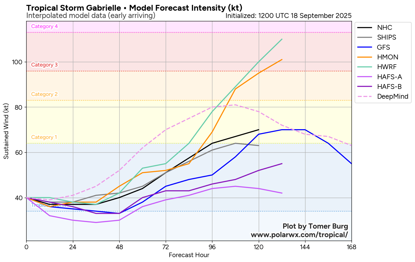
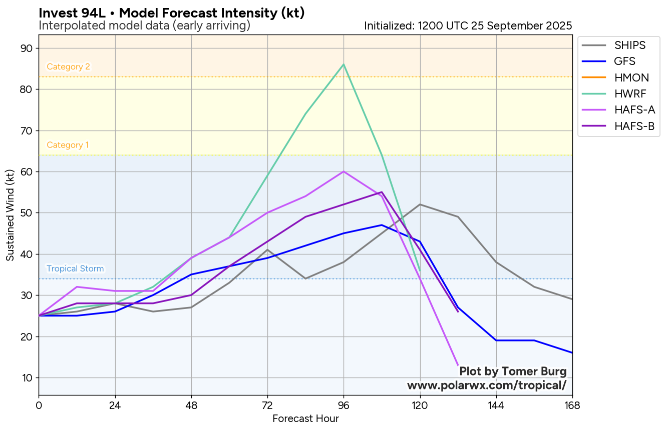
In looking at all of the data today, my take is that I think that this system will become a depression by this weekend in the Bahamas and then strengthen into a tropical storm shortly after that. From there, additional strengthening into a hurricane looks quite plausible especially when its approaching the coastline on Monday & crosses the Gulf Stream.
I do think the area of highest threat right now of a landfall and direct hit from this system looks to be along the South Carolina coast into southeastern North Carolina late Monday or early Tuesday as a hurricane of perhaps Category 1 or Category 2 strength.
Now, is this a guaranteed forecast?? Absolutely not!! There are a lot of moving parts with the forecast of this system, including how quickly Humberto strengthens, Humberto’s forward speed, how strong the upper level high pressure system is & the evolution of the upper-level low pressure system over the Southeast United States.
It seems clear though that Invest 94-L is very likely to develop & become a tropical storm and then a hurricane. It also seems as if this system is a threat to the Southeastern coast of the US & especially the Carolinas.
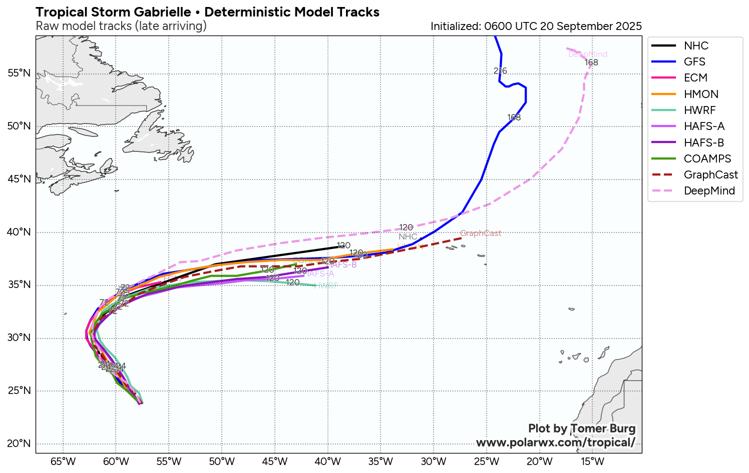
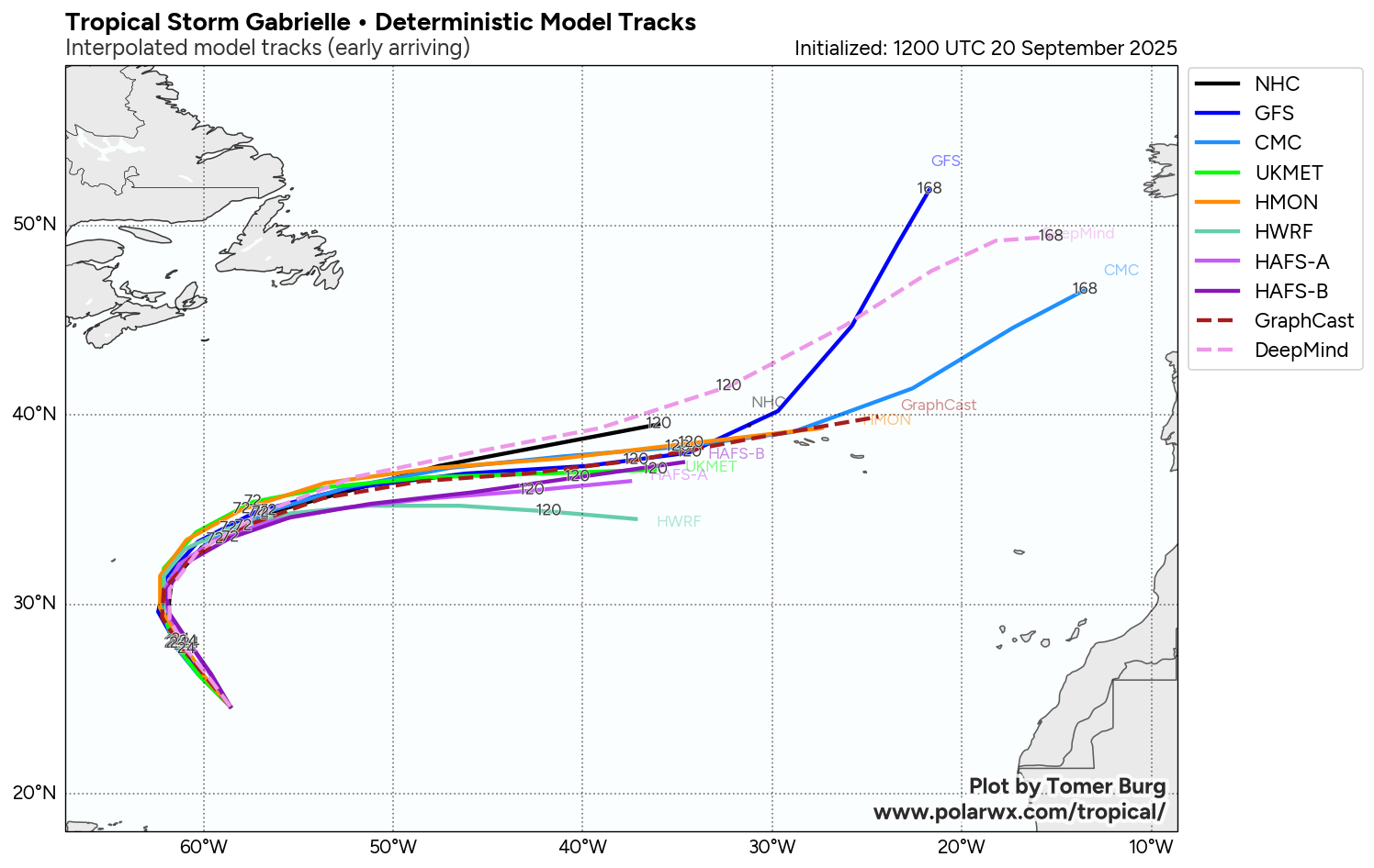
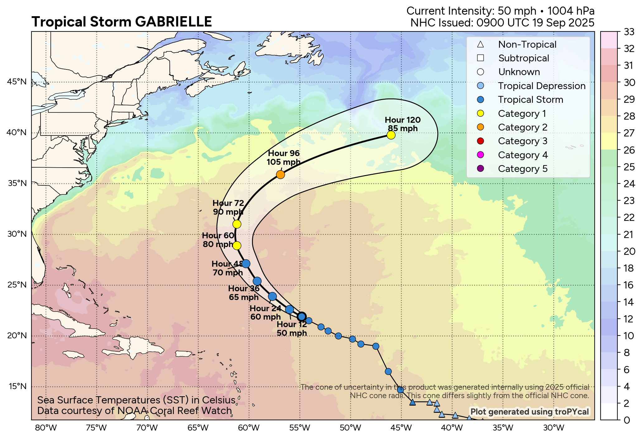
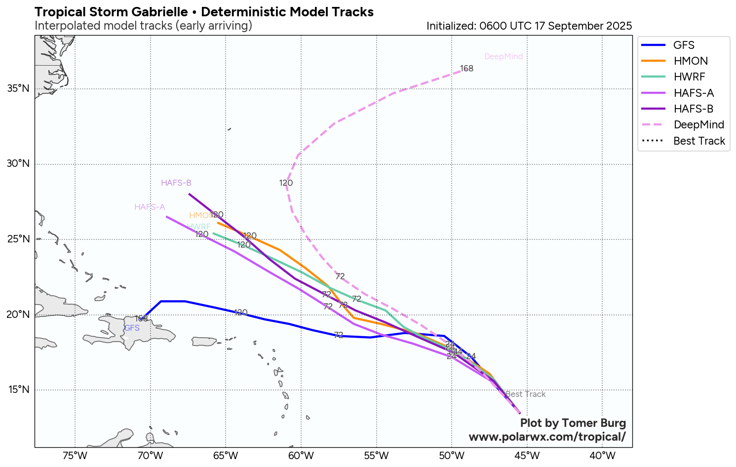
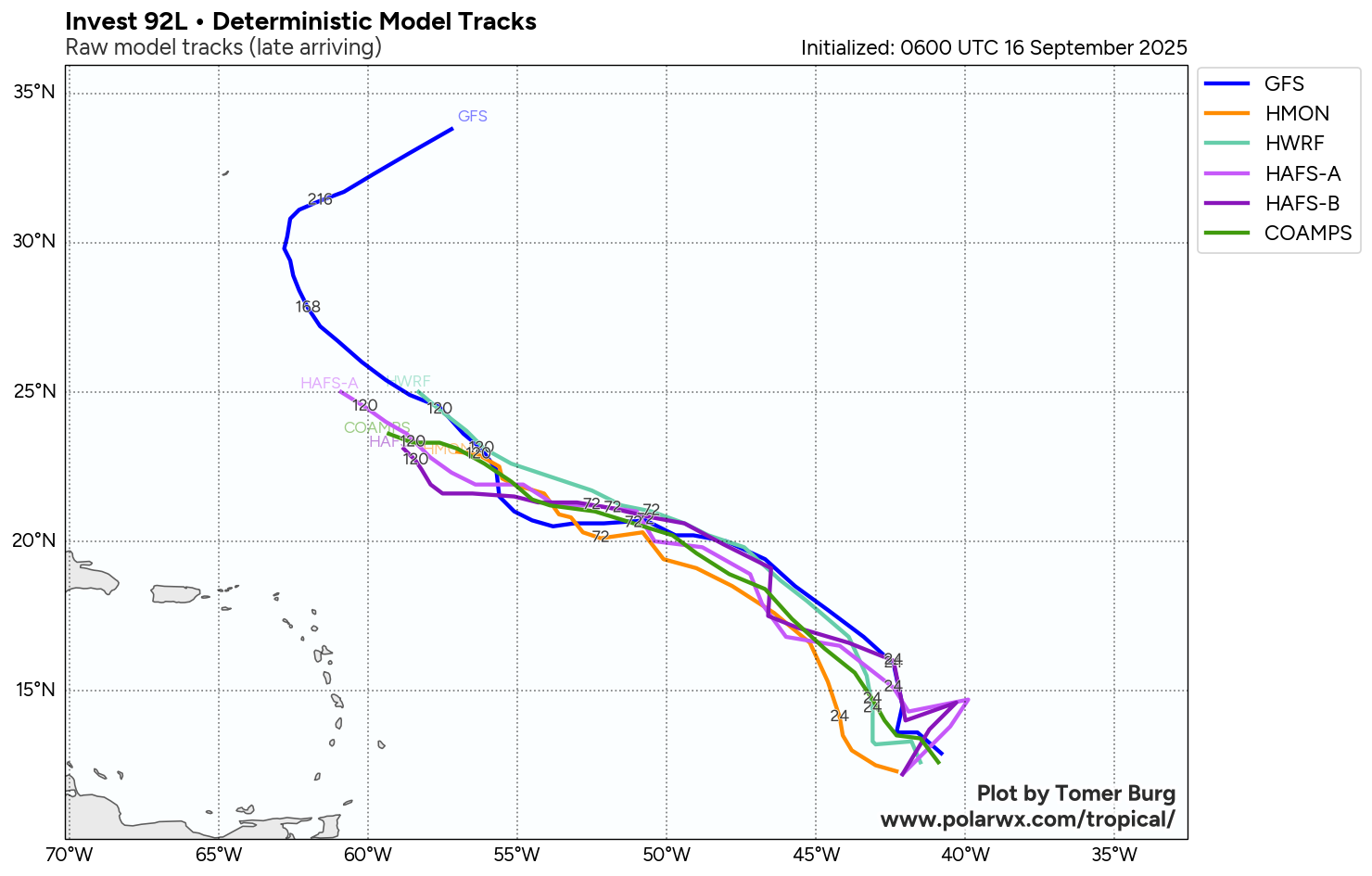
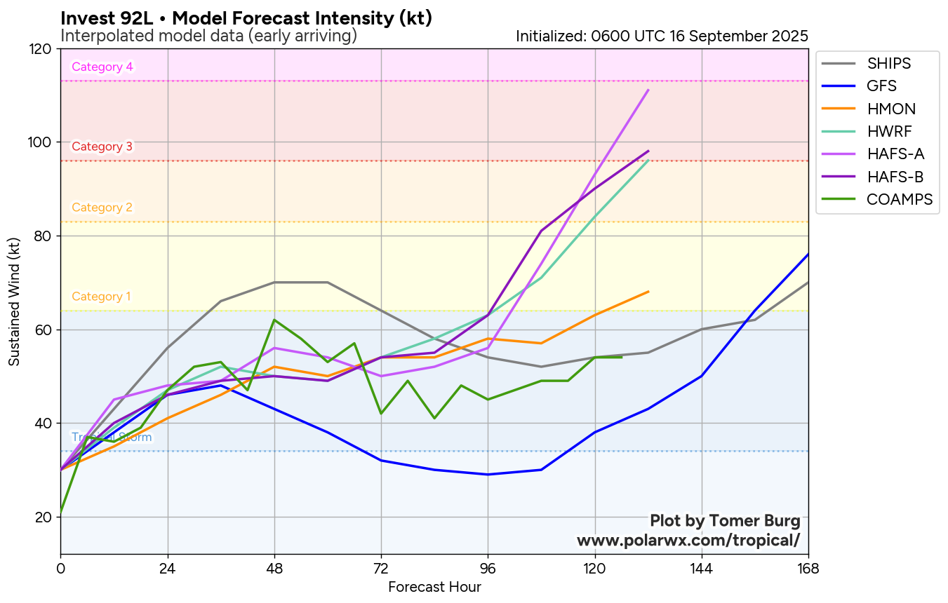
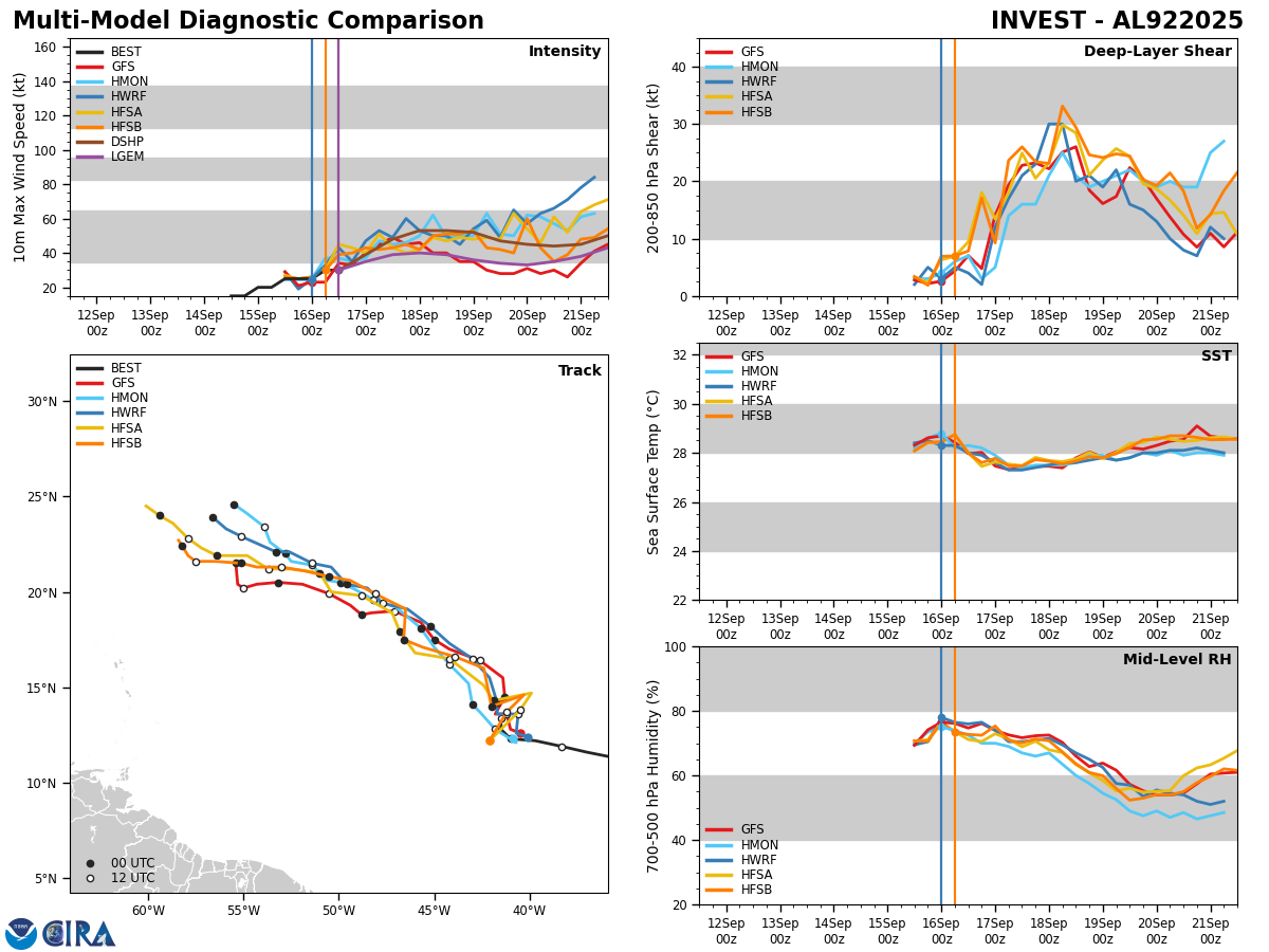
Model Track Forecast:

Satellite Imagery:

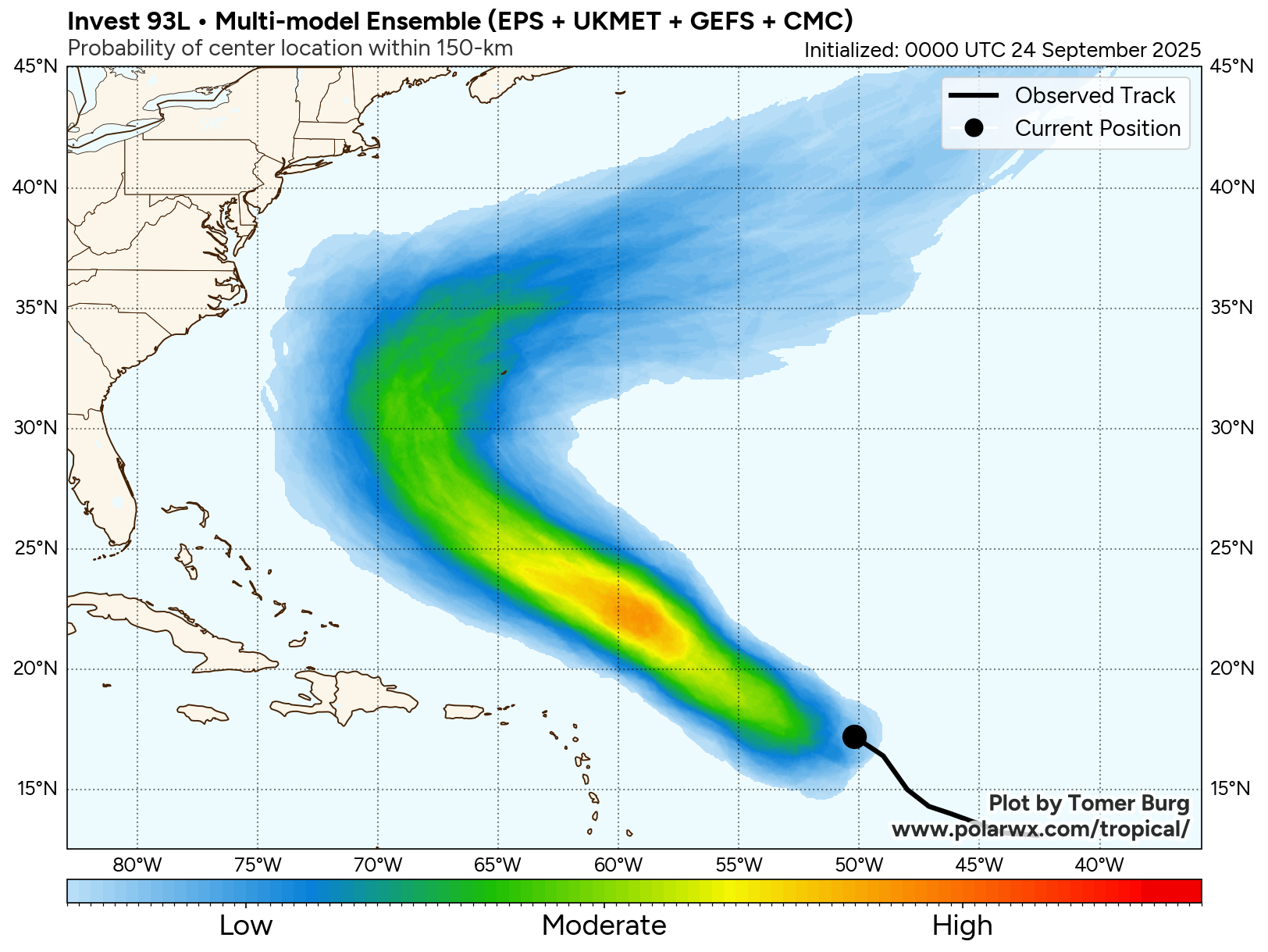
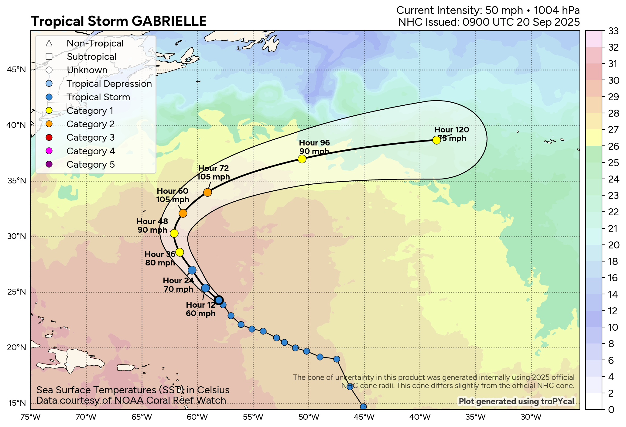
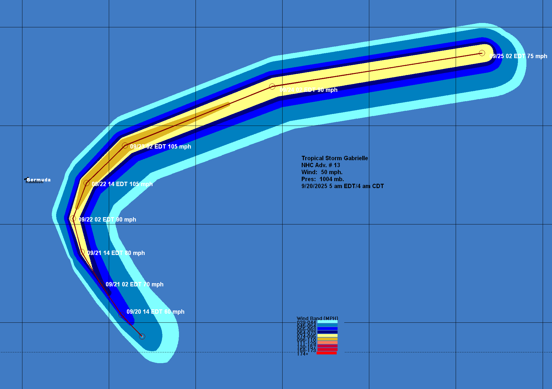
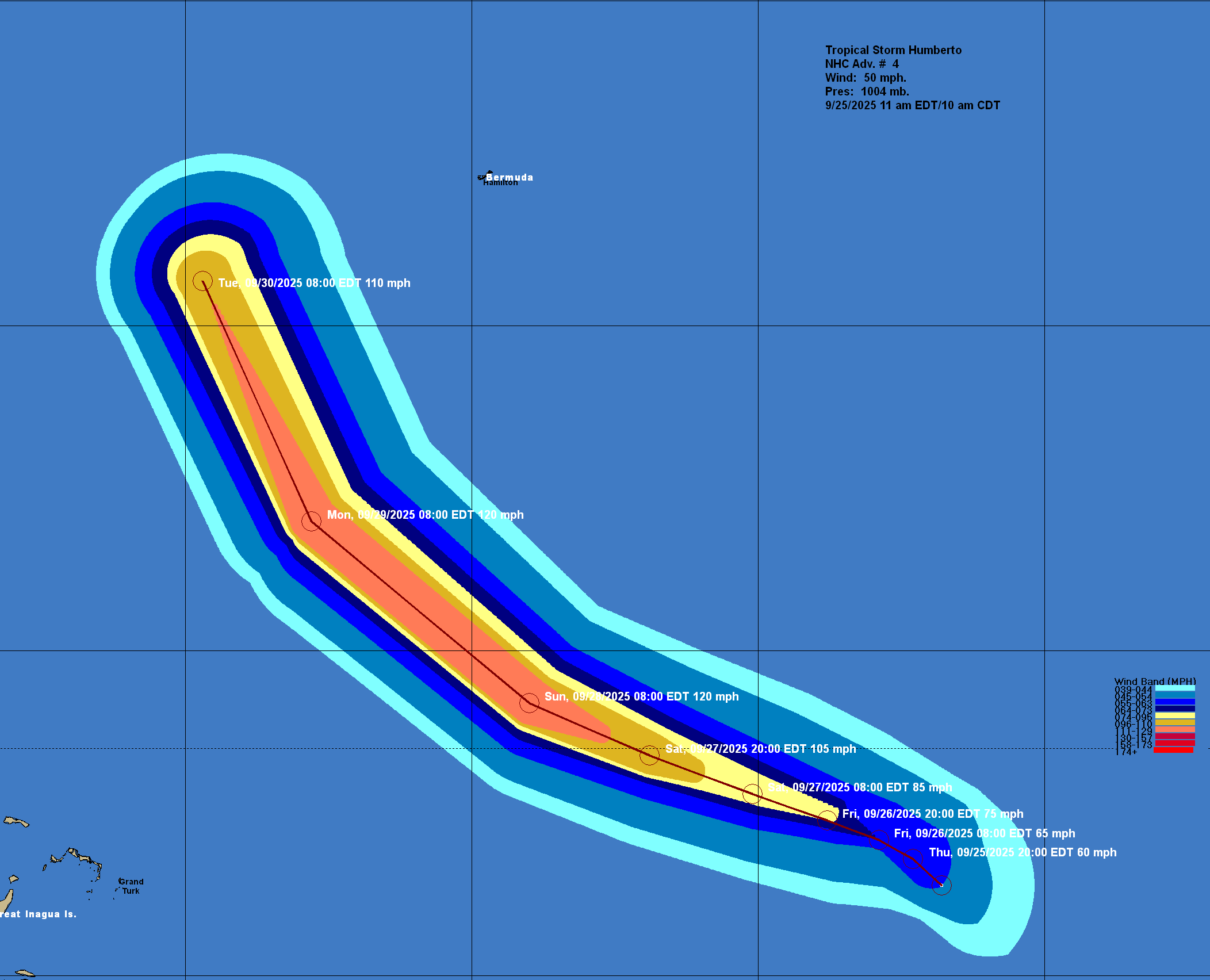
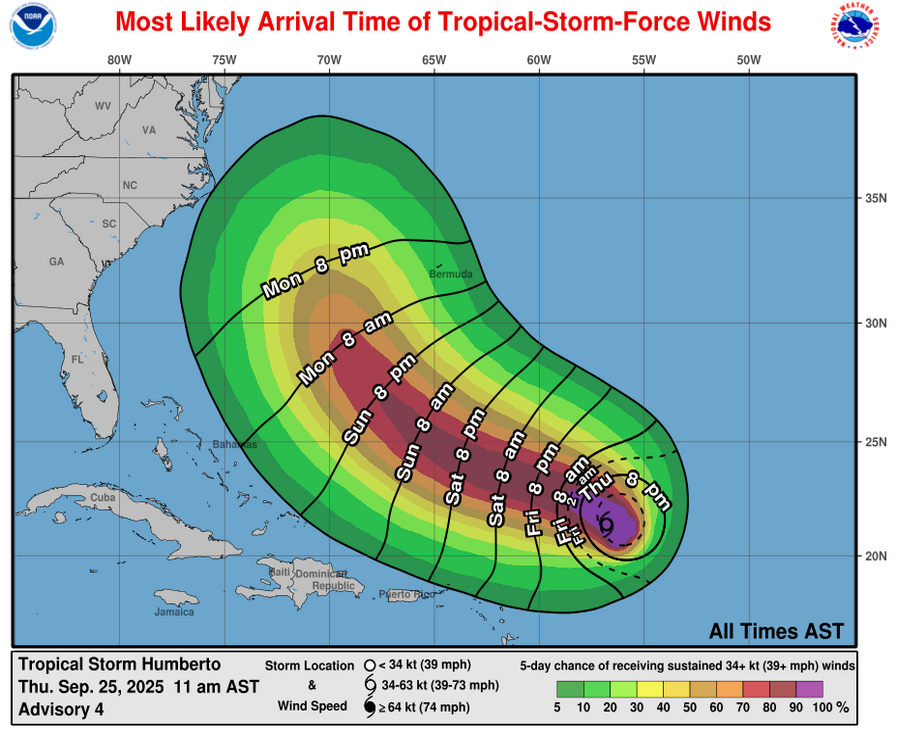
Tropical Storm Humberto: My discussion on Humberto will be shorter than the one for Invest 94-L.
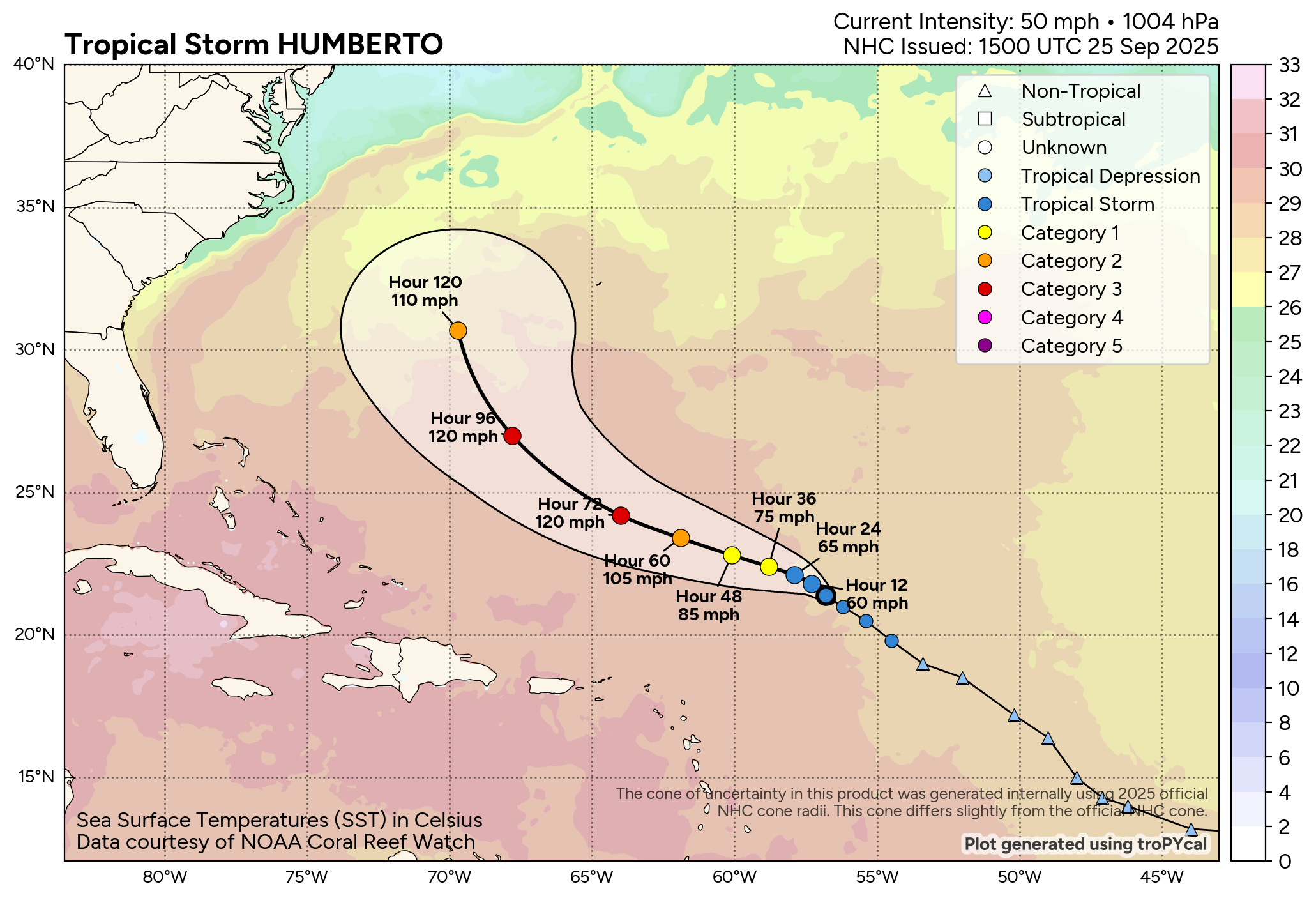
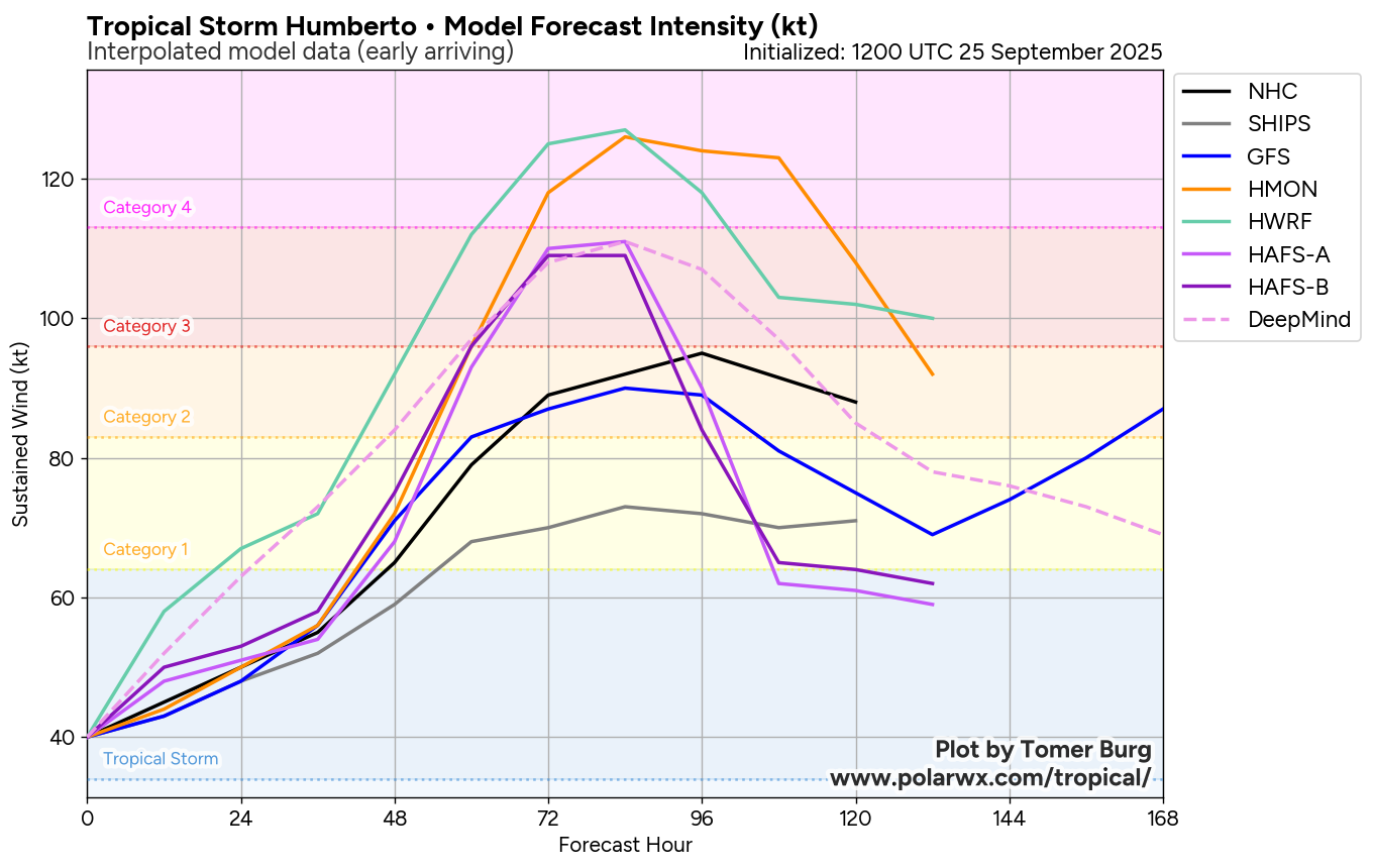
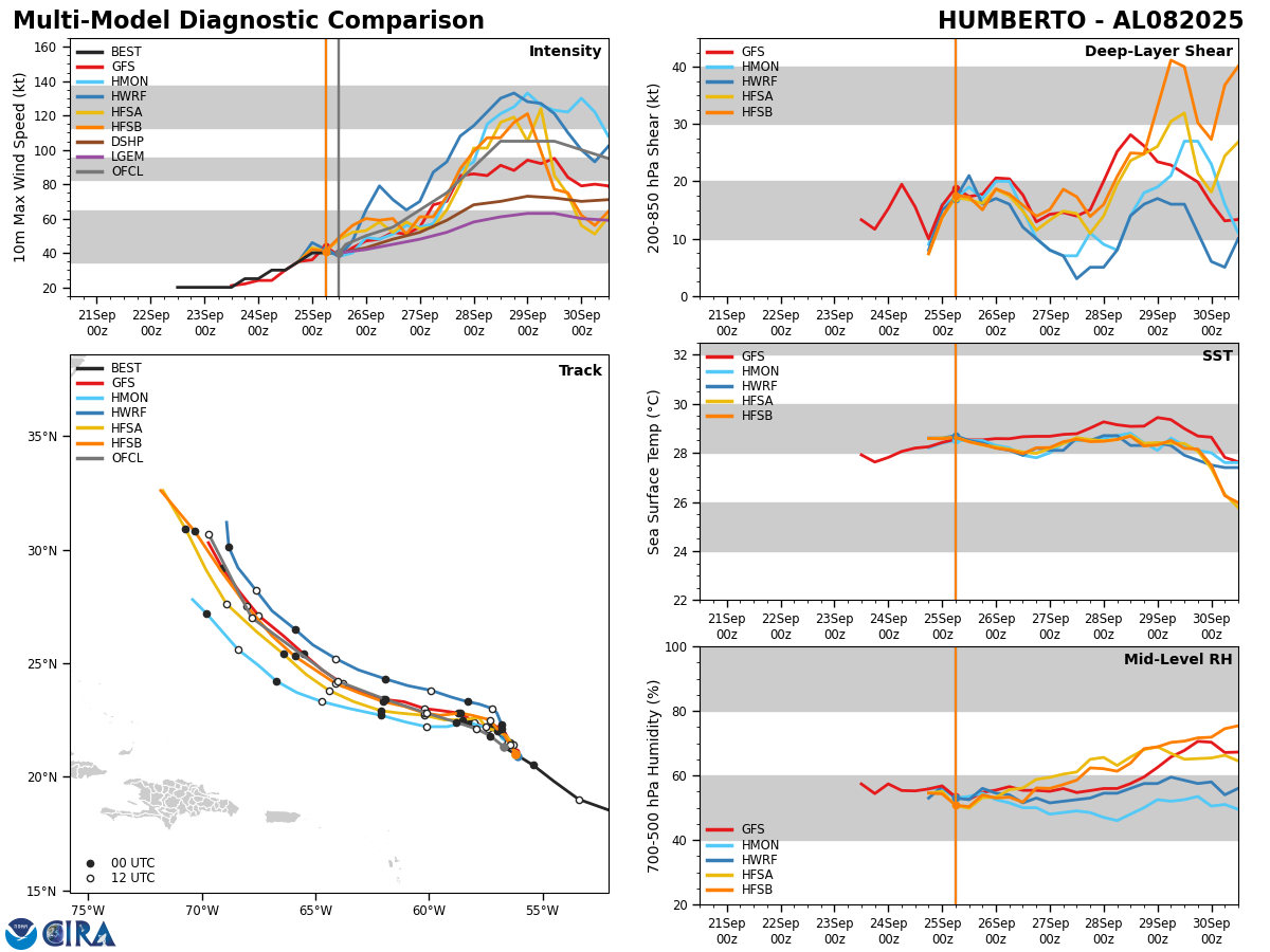
Humberto seems to be strengthening today and this strengthening is likely to continue. Because of this, it is expected to become a hurricane by late Friday or early Saturday.
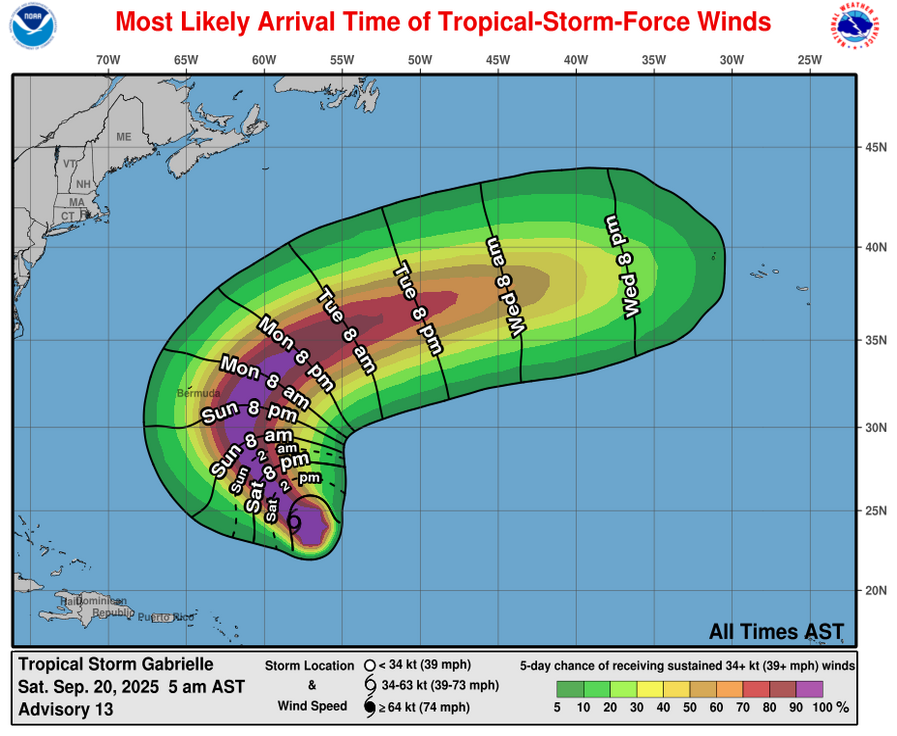
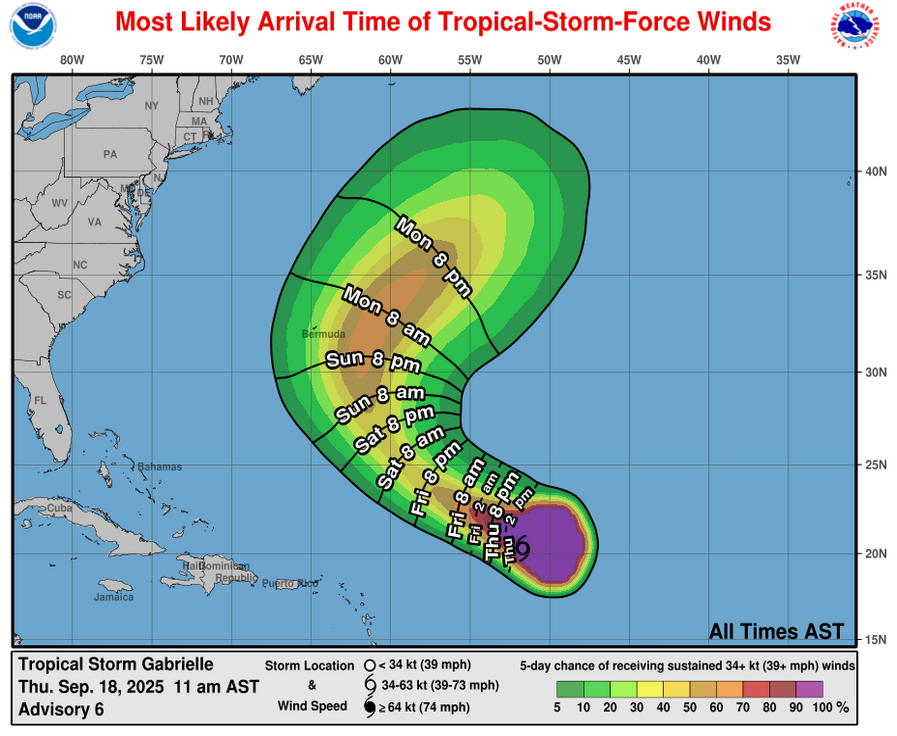
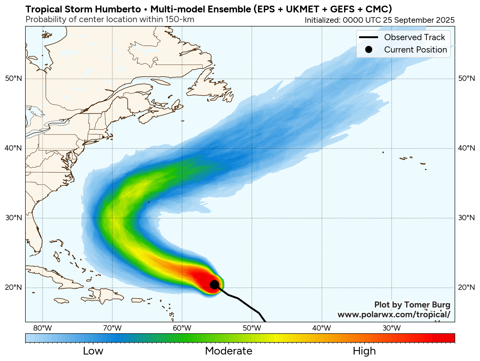
It is expected that Humberto will remain to the east of the Bahamas and the East Coast of the United States and not be a second threat to these areas.
As for Bermuda, the model guidance seems to have trended further west with the forecast track of Humberto. If these trends hold, then Humberto may end up passing to the west of the island around Tuesday and Wednesday of next week. That being said, some impacts to Bermuda are possible, especially in terms of rough surf and some of the outer rain bands affecting the island during the first half of next week.
That being said, it’s still too soon to say that Bermuda is completely out of the woods in terms of a more direct impact from Humberto. I urge those of you on the island of Bermuda to closely watch the forecasts of Humberto very closely as it’s possible it could be a strong hurricane by the time it reaches the latitude of Bermuda.
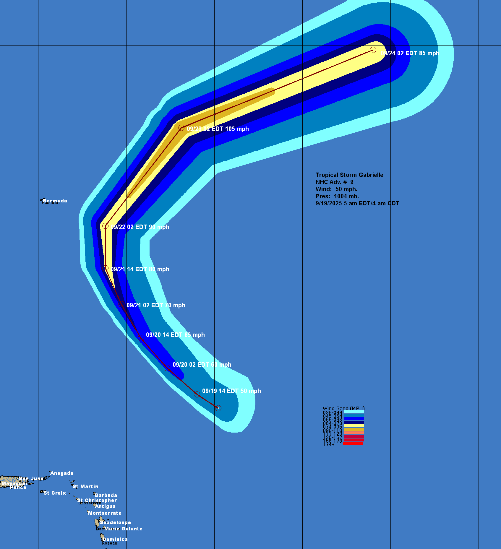
Model Track Forecast:
Satellite Imagery:
The next tropical weather discussion will be issued on Friday.