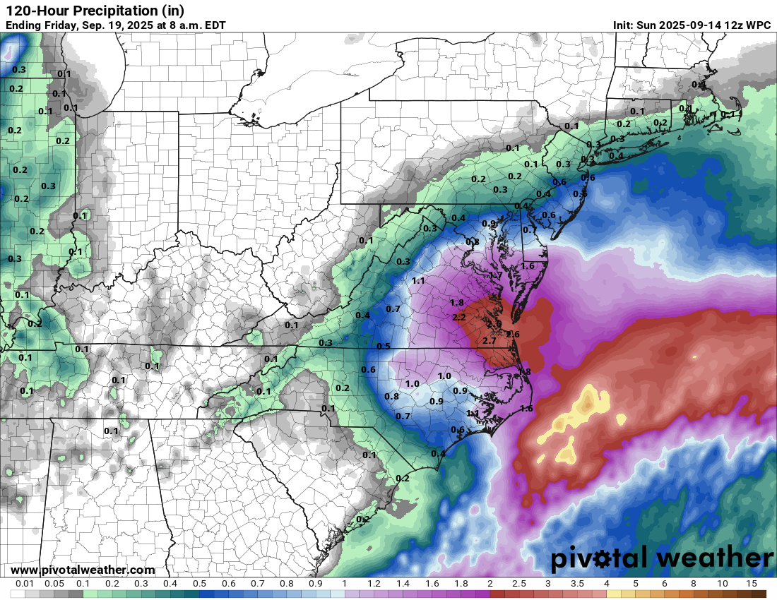
A Coastal Storm Will Bring Locally Heavy Rain, Gusty Onshore Winds & Some Coastal Flooding To The Mid-Atlantic States From Late Monday Until Thursday: Weather analysis today reveals that there is a low pressure system that is located about 175 miles to the southeast of Wilmington, North Carolina.
This low pressure system is expected to strengthen some and head towards the outer banks of North Carolina by Monday night. It is then expected that this low pressure system will sit and spin in the area between the outer banks of North Carolina and southeastern Virginia during Tuesday and Wednesday before it weakens and heads out into the open Atlantic.
There is likely to be a tight pressure gradient between this low pressure system and an area of high pressure located over the northeastern United States. This will lead to some quite gusty onshore winds occurring across eastern North Carolina, southeastern Virginia, coastal Maryland and much of Delaware during Tuesday and Wednesday. Wind gusts on the order of 30-45 mph can be expected at times, especially along the immediate coast.
In addition, it is also looking likely now that there will be heavy bands of soaking rain to occur across much of eastern North Carolina, central and eastern Virginia, much of Maryland and much of Delaware. Across these areas, rain totals of 1 to 3 inches can be expected from late Monday until Thursday morning.
Finally, the onshore gusty winds will probably lead to at least some minor coastal flooding occurring across eastern North Carolina and the outer banks, eastern and southeastern Virginia, coastal Maryland and coastal Delaware during the high tides on Tuesday, Tuesday night, Wednesday and Wednesday night.
Now, will this low pressure system become a sub-tropical or tropical storm? At this point, I think that this low pressure system will probably remain non-tropical in nature. That being said, some of the model guidance does hint at the possibility of it acquiring some sub-tropical elements to it around Tuesday. Any sub-tropical development of this system looks to be relatively short-lived.
Those of you in eastern North Carolina and the outer banks, eastern and southeastern Virginia, eastern Maryland and Delaware, be aware that the weather is going to be very inclement starting as soon as Monday afternoon, but especially during Tuesday and Wednesday. Expect on and off heavy rain, gusty easterly winds that gust up to 30-45 mph at times and overwash at the beaches at the time of high tide.
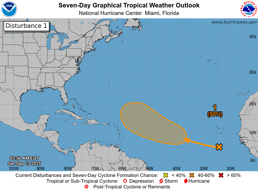
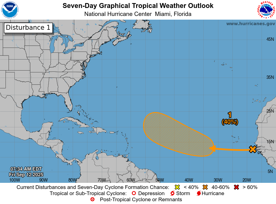
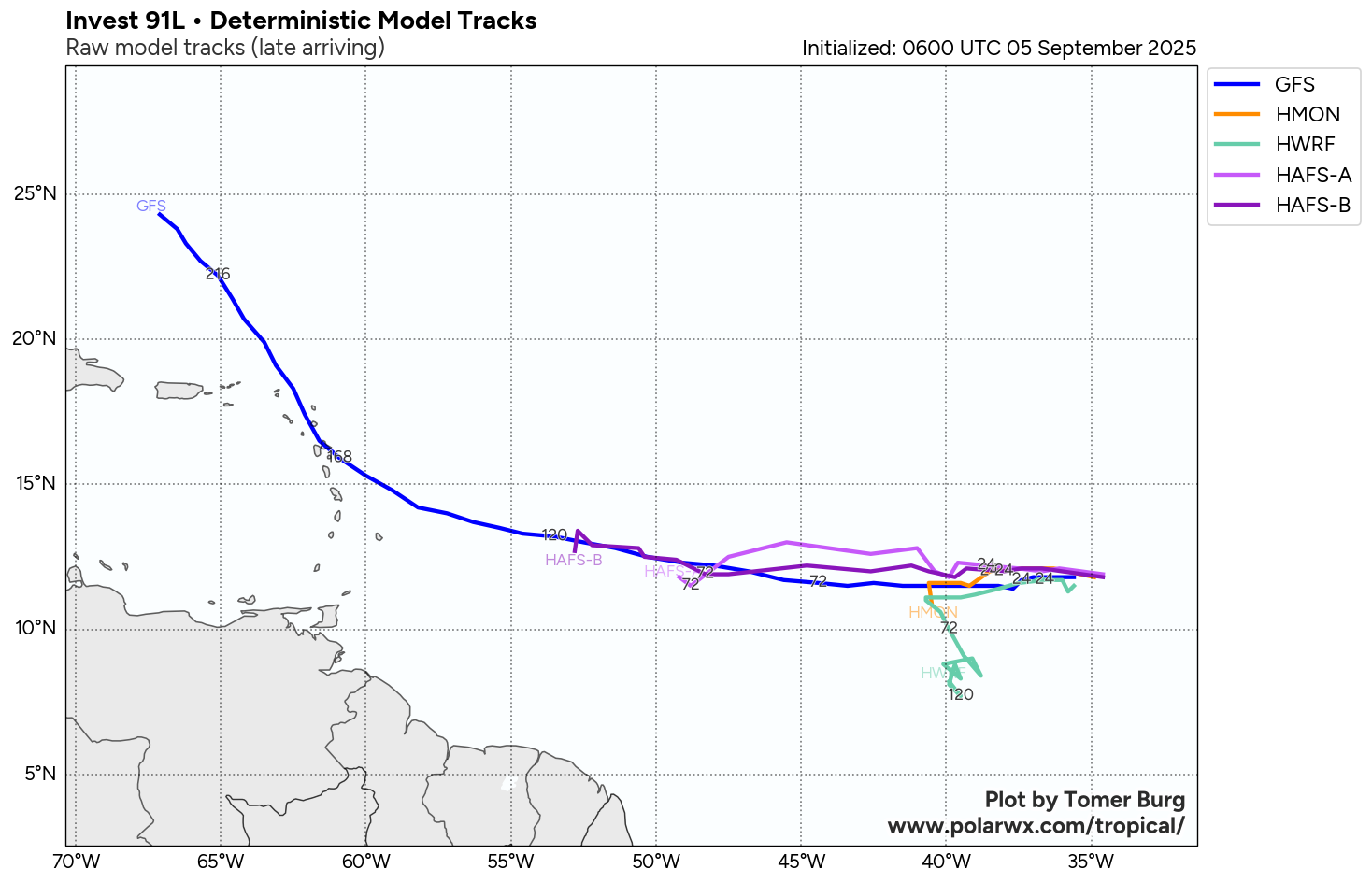
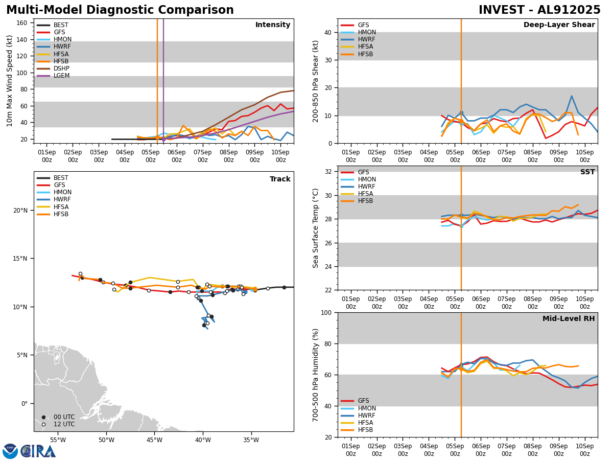
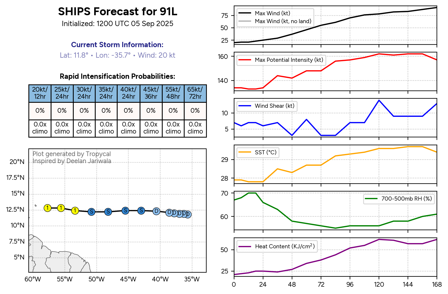
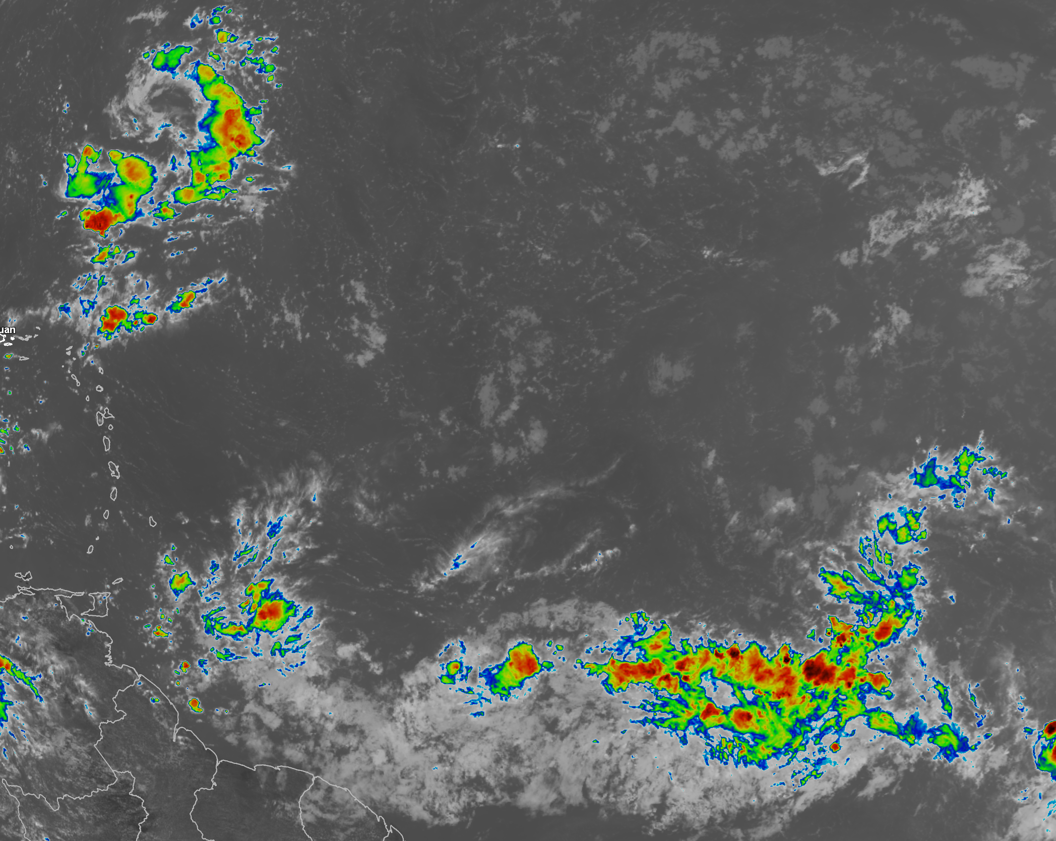
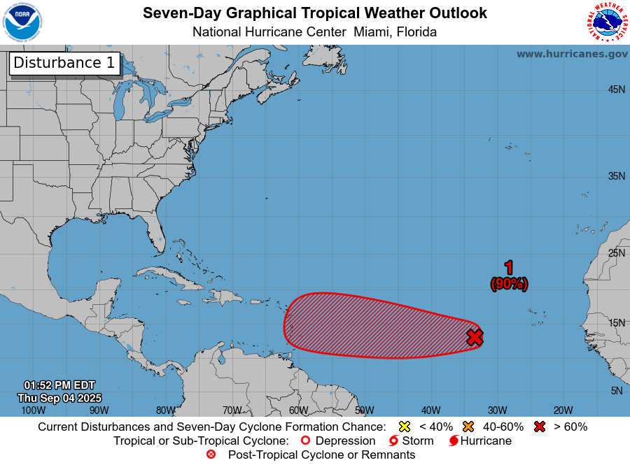
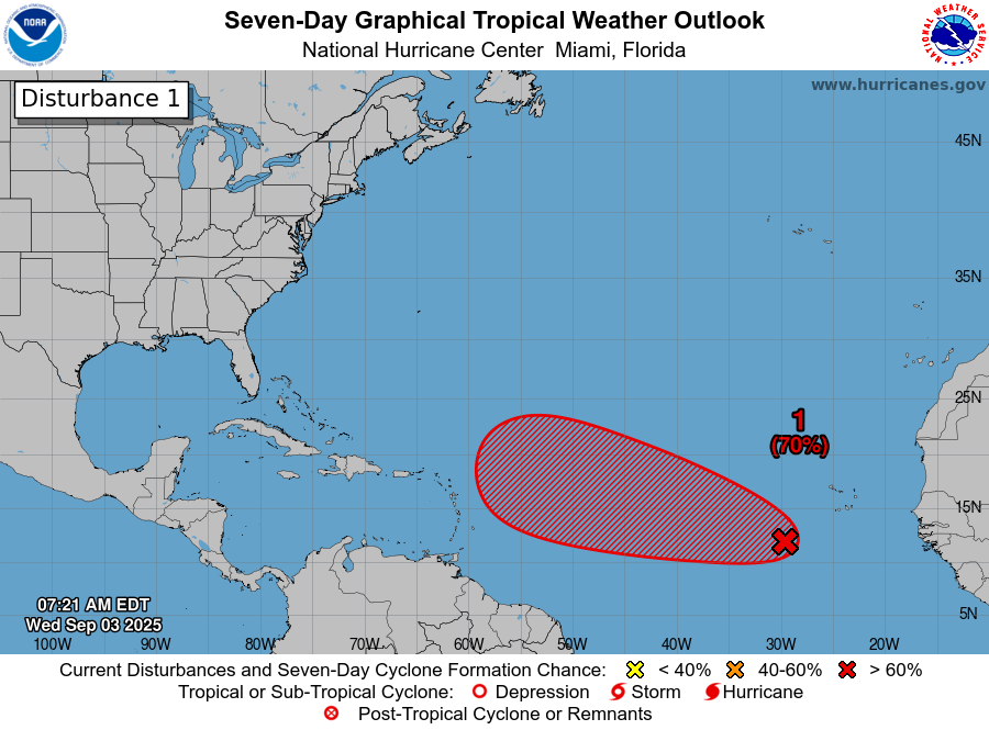
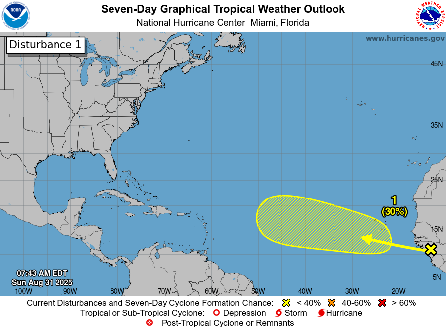
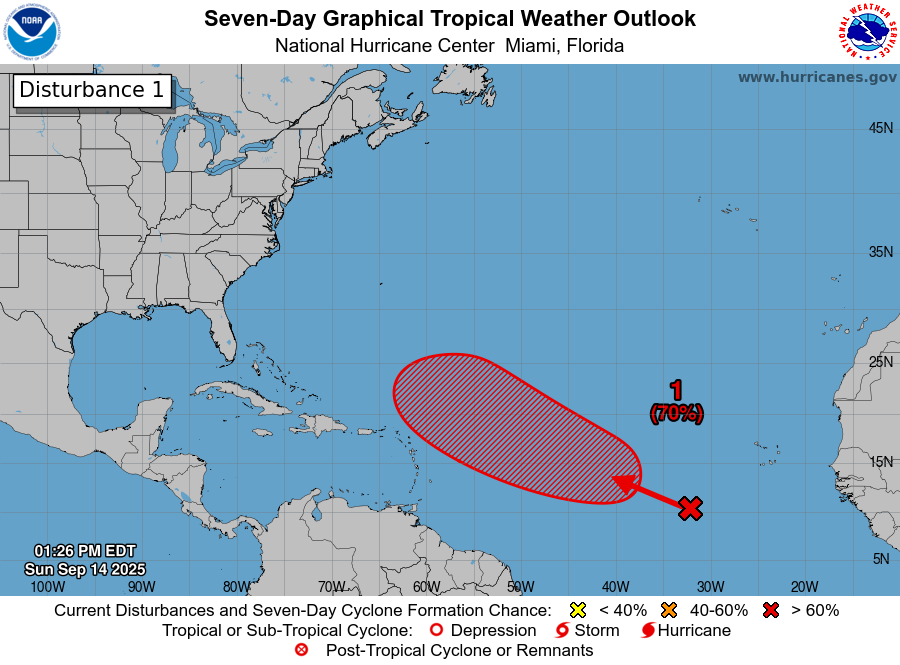
Tropical Wave Located Over The Eastern Tropical Atlantic: Satellite imagery and weather analysis reveals that the tropical wave that’s located over the eastern Tropical Atlantic near about 32 West Longitude is looking a little more convectively active than it did yesterday. Still though, this wave is disorganized as it appears that there are two competing areas of circulation that are located along the wave axis. Additionally, this wave is being affected by some dry and stable air.
The combination of disorganized look of the wave and the dry and stable air will lead to slow development of this system over at least the next couple of days.
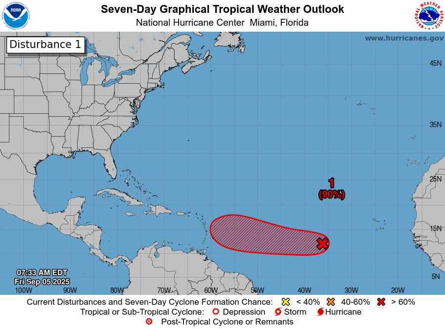
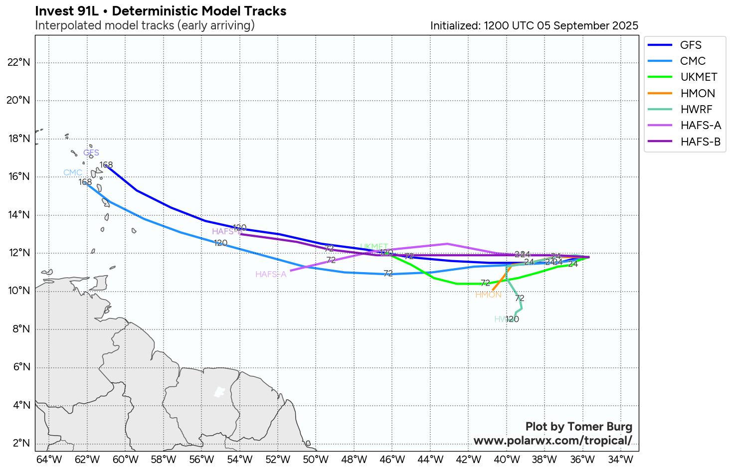
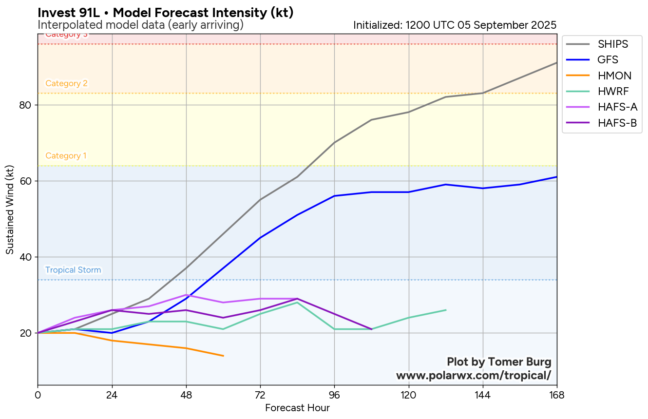
Eventually, this wave should consolidate into one concentrated circulation center & once this occurs, the rate of development will begin to increase some. The various model guidance such as the GFS and European models suggests that we’ll begin to see a little more development from this wave by about Thursday or so. That said, the environmental conditions may still be a bit unfavorable for more robust development due to strong wind shear from an upper level low pressure system located to the northwest of this system.
My thinking is that we probably will not see any sort of robust strengthening from this wave until it moves to the north of the Lesser Antilles where the conditions look much more favorable for strengthening. Because of this, I think we’ll see strengthening capped at about a tropical depression or a low end tropical storm as it moves through the central Tropical Atlantic and to the north of the Lesser Antilles by next weekend. Once this system begins to track well north of the Lesser Antilles and towards Bermuda, we should see much more robust strengthening. In fact, the GFS and European ensemble guidance are hinting at a hurricane threat to Bermuda in about 10 days from now.
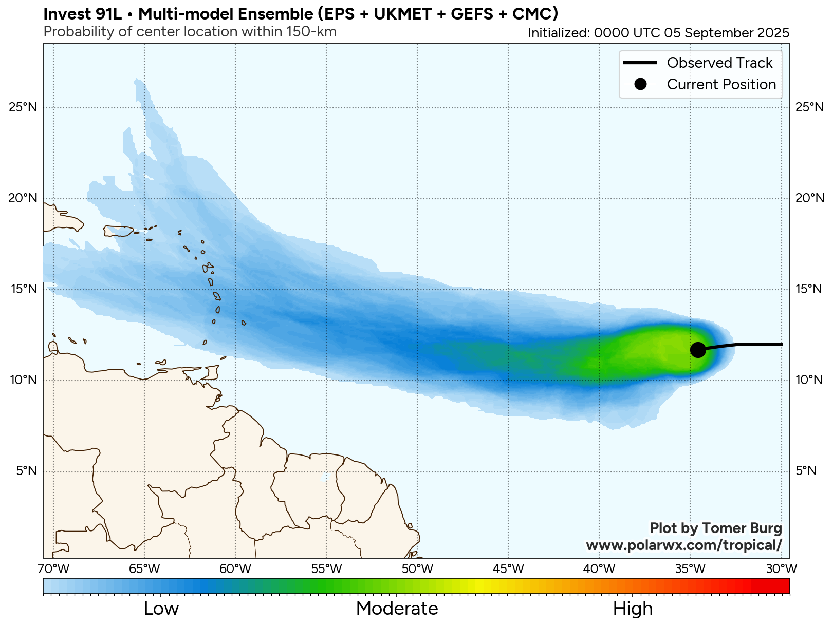
As for a track of this system, it seems that a majority of the operational and ensemble model guidance are showing a track that keeps this wave well north of the Lesser Antilles next weekend. In fact, the ensemble guidance seem to be trending towards a path that keeps this system far enough away from the Lesser Antilles to not be a problem.
It should be noted that the ensemble guidance and the AI models do point to a possible threat to the island of Bermuda in about 10 days from now & this is something to be watched closely over the next week or so.
All-in-all, this system continues to pose no threat to the Caribbean, the Bahamas or the United States. The only area that this system may be a threat to is the island of Bermuda in about 10 days from now.
The next tropical weather discussion will be issued on Monday.