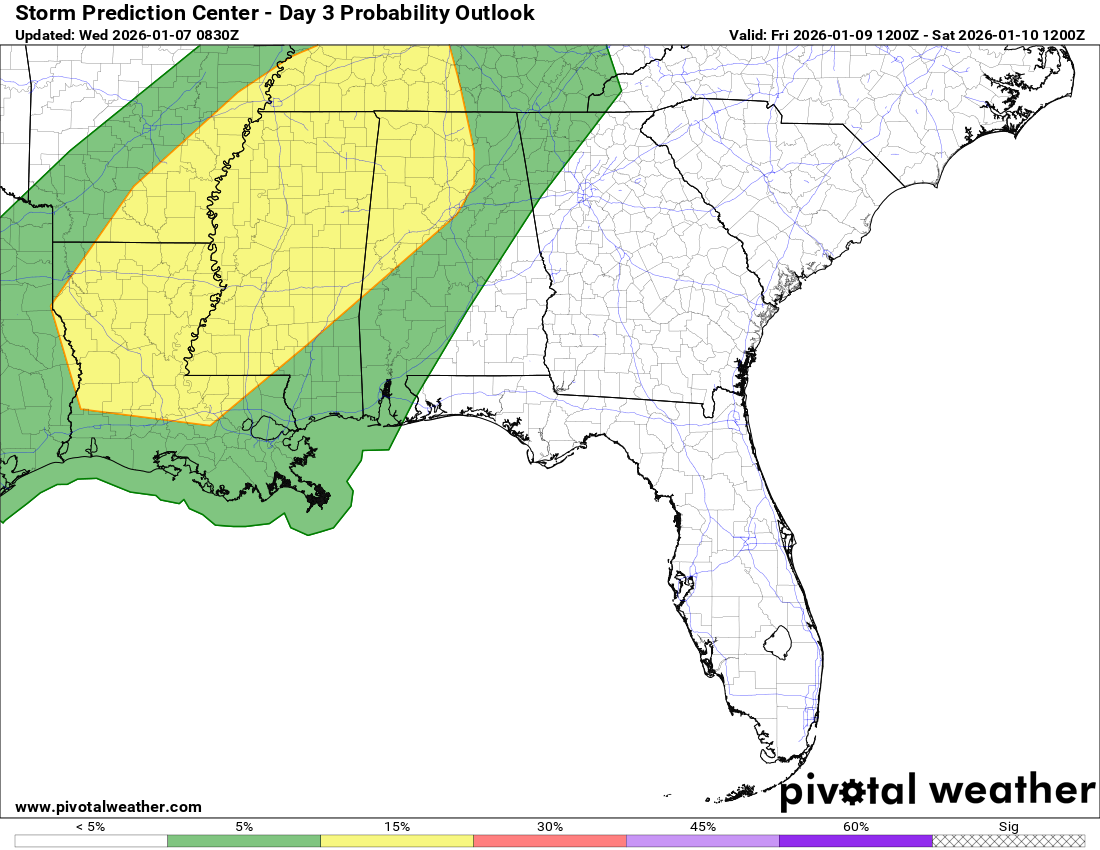
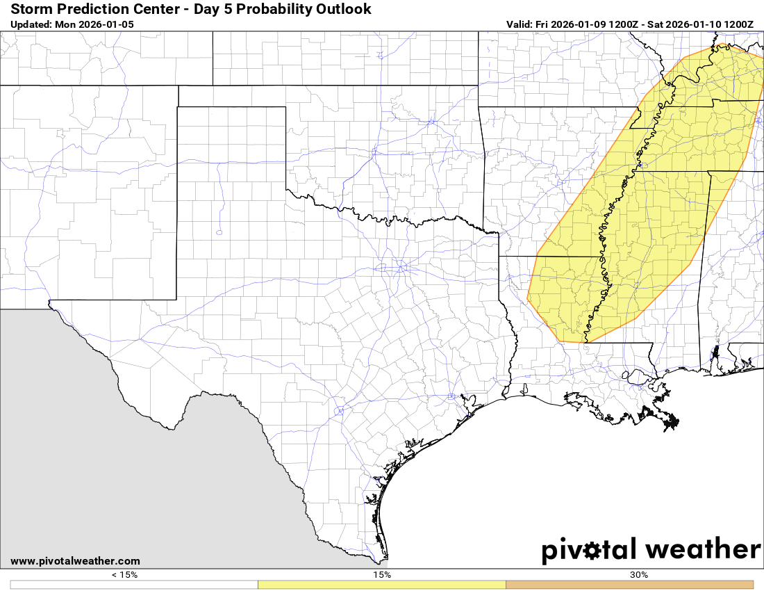
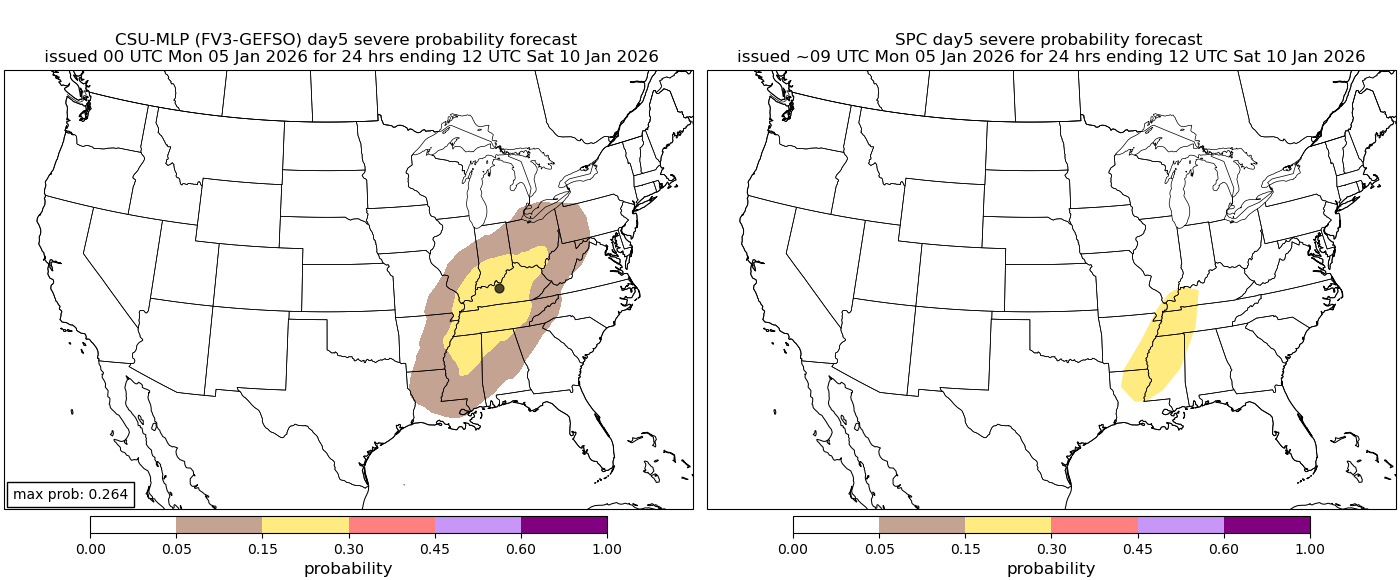
Invest 91-L Located Over The Eastern Tropical Atlantic: Invest 91-L continues to be fairly disorganized today. Satellite imagery indicated that there is some scattered convection noted with the disturbance, however, there is nothing organized or consolidated. This disorganization seems to have to do with the environmental conditions around Invest 91-L. These unfavorable conditions include a large amount of dry air noted on water vapor imagery located to the north and northwest of Invest 91-L. Additionally, there is some very strong wind shear located just to the north of Invest 91-L & this is probably contributing to it being disorganized.
As for the latest model guidance, they have shown a notable downtrend in development chances as compared to what they were showing yesterday.
In fact, the latest European model has completely dropped the idea of Invest 91-L developing at all. This is due to the European model forecasting that there will be too much dry air, which ends up choking this system.
Even the European ensemble model guidance have much fewer members that are forecasting the development of Invest 91-L as compared to what the ensemble guidance was showing over the last couple of days. In fact, out of the 50 European ensemble members, only 7 of them forecast development of Invest 91-L.
It actually seems that the GFS model is the only model that is forecasting development of Invest 91-L. Could the GFS model be correct and Invest 91-L does develop over the next couple of days? Sure. One thing that will need to happen though for the GFS model to be right is that Invest 91-L will need to start organizing and consolidating steadily between now and Sunday morning. If that does not occur, then the GFS model would be incorrect and we’d need to defer to the European model and other models that are showing no development at all.
***NOTE – The GFS model has now dropped its idea of Invest 91-L developing with its 12Z forecast***
The Google Deep Mind ensemble model guidance also now shows no development at all from Invest 91-L.
It needs to be pointed out, however, that the very few ensemble members that do develop Invest 91-L are showing it to be a strong system. This means if Invest 91-L does try to organize over the next few days, it’ll find a conducive environment for development and take off in terms of intensity. Also, it is possible that the small size of Invest 91-L is giving the models fits & thus causing them to completely miss it & in turn it leads to an incorrect no development forecast. Something to think about.
Bottom line is that there is significant model chaos when it comes to forecasting Invest 91-L as all of the models have been wildly inconsistent in their forecasts of this system. This speaks volumes as to how uncertain the forecast is with Invest 91-L & whether it even develops.
Here Are My Thoughts: I do think that the dry air and strong wind shear located to the north and northwest of Invest 91-L is going to hamper any sort of notable development over the next few days. In fact, it’s quite possible now that this disturbance never develops at all. I do think that the GFS model is wrong in its forecast of robust development this weekend (***12Z run of the GFS model now shows no development at all***) & because of that I’m leaning more towards the guidance that are showing little or no development.
That being said, those of you in the Lesser Antilles, the Virgin Islands and Puerto Rico should still closely watch the progress of Invest 91-L as whatever comes of this system will be moving across the Lesser Antilles, the Virgin Islands and Puerto Rico on about Thursday and Friday of next week. Even if Invest 91-L never develops, it’ll still bring squally weather to the islands of the eastern and northeastern Caribbean during Thursday and Friday of next week. Should Invest 91-L actually develop, then we’d be looking more in the way of wind, rain and rough seas. Uncertainty is very high right now as to what might happen with Invest 91-L, but the trends seem to be favoring no development at all.
Given the very high uncertainty with Invest 91-L as to whether it’ll even develop at all, I’m not even going to discuss any sort of threat to areas further west, including the Bahamas and the US coastline. Besides, it’s going to take almost two more weeks until Invest 91-L reaches the area near the US coastline, whether it develops or not. Please know that I will be keeping close tabs on this system, no matter what it does. This is not a system that you should be stressing or worrying about if you are located in the Bahamas or along the US coastline.
Model Track Forecast:
Satellite Imagery:
The next tropical weather discussion will be issued on Saturday.