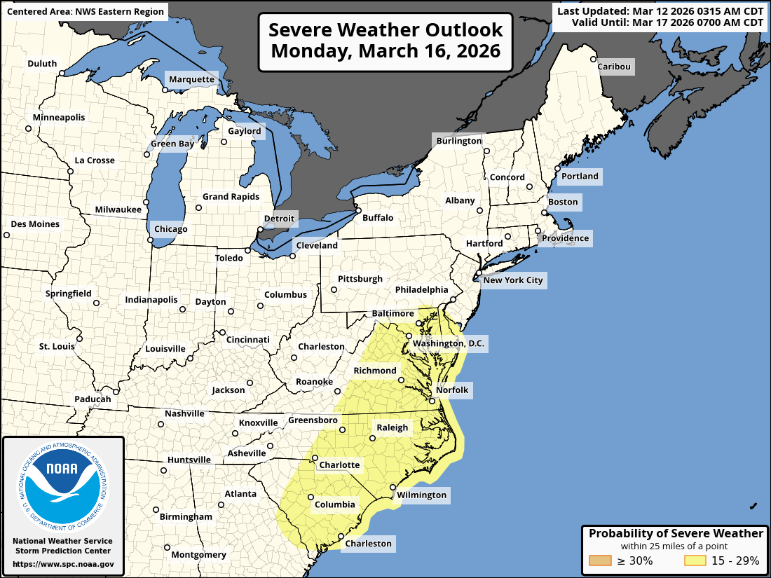
While significant severe weather is not expected this week, it seems probable that, at least, some severe weather will occur across the Mississippi Valley, the Great Lakes & the central and southern Plains states.
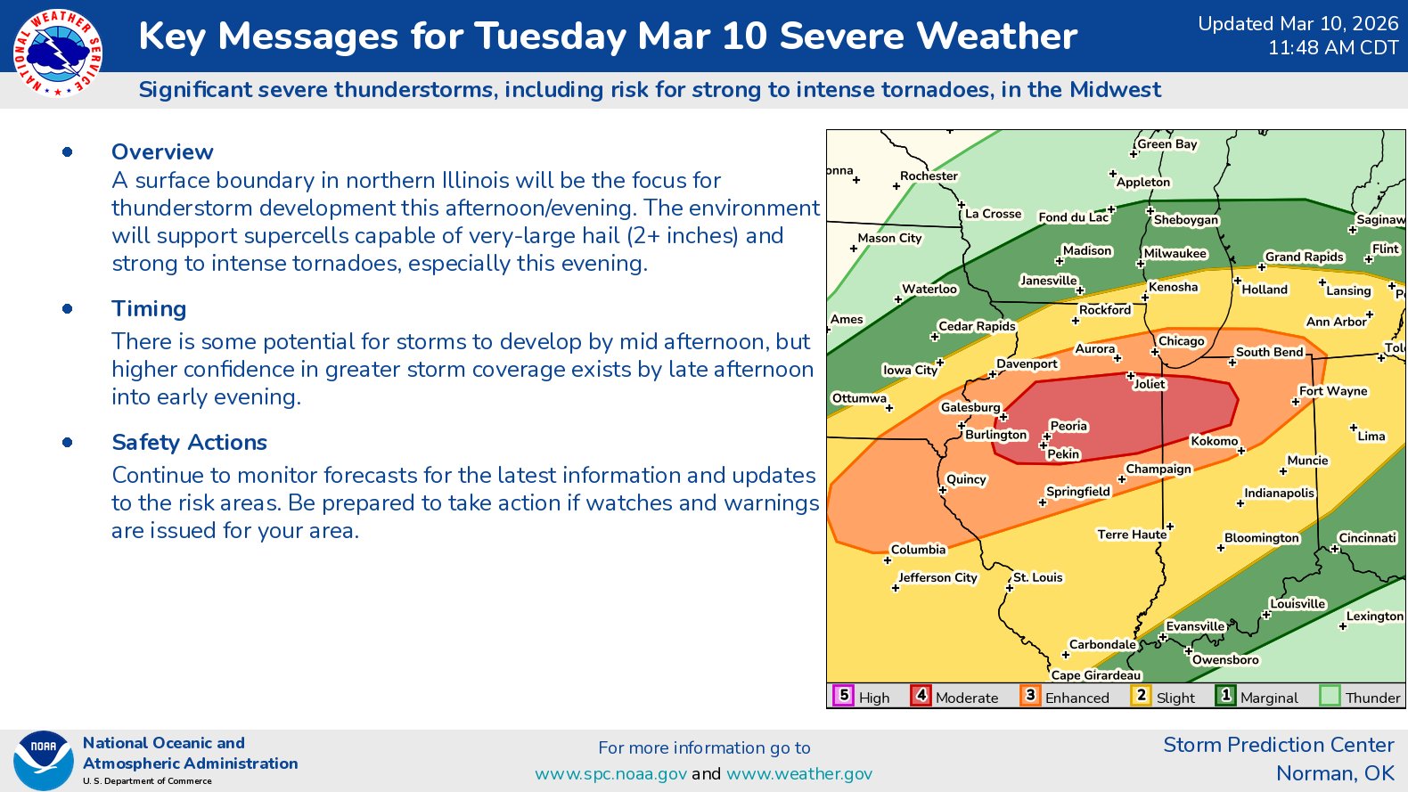
Some Severe Weather Is Expected Across The Middle & Upper Mississippi Valley Tonight: A few severe thunderstorms are expected to first develop across central Iowa between about 5 and 7 pm CDT. These storms are expected to push east-northeastward during tonight into eastern Iowa, northern Illinois and southern Wisconsin.
Any severe storms tonight may have the potential to produce large hail and some very gusty winds.
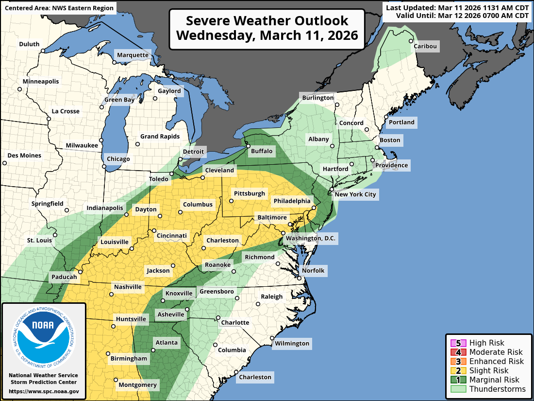
During Tuesday – Some Severe Weather Is Expected Across The Great Lakes: Scattered strong to severe storms are expected during the day on Tuesday across the Great Lakes, including northern Indiana, southern Lower Michigan, northern Ohio, northwestern Pennsylvania and western New York State.
The main threat with any severe storms look to be damaging wind gusts and hail. That said, if there are any individual supercells that might be able to develop, it could lead to a tornado threat, mainly during late Tuesday afternoon and Tuesday evening.
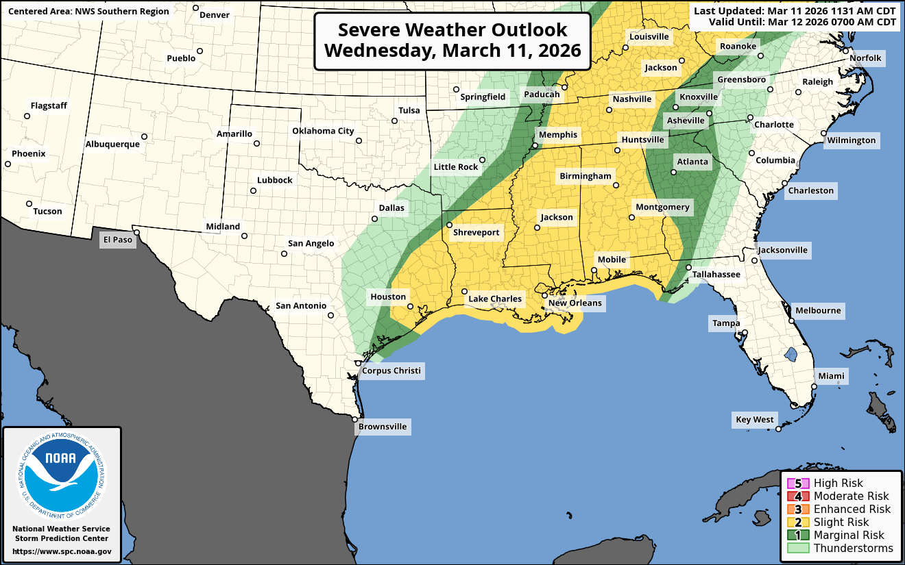
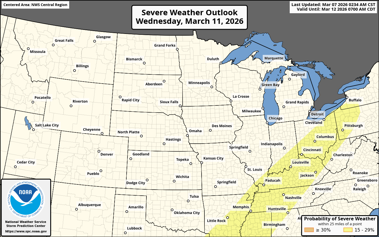
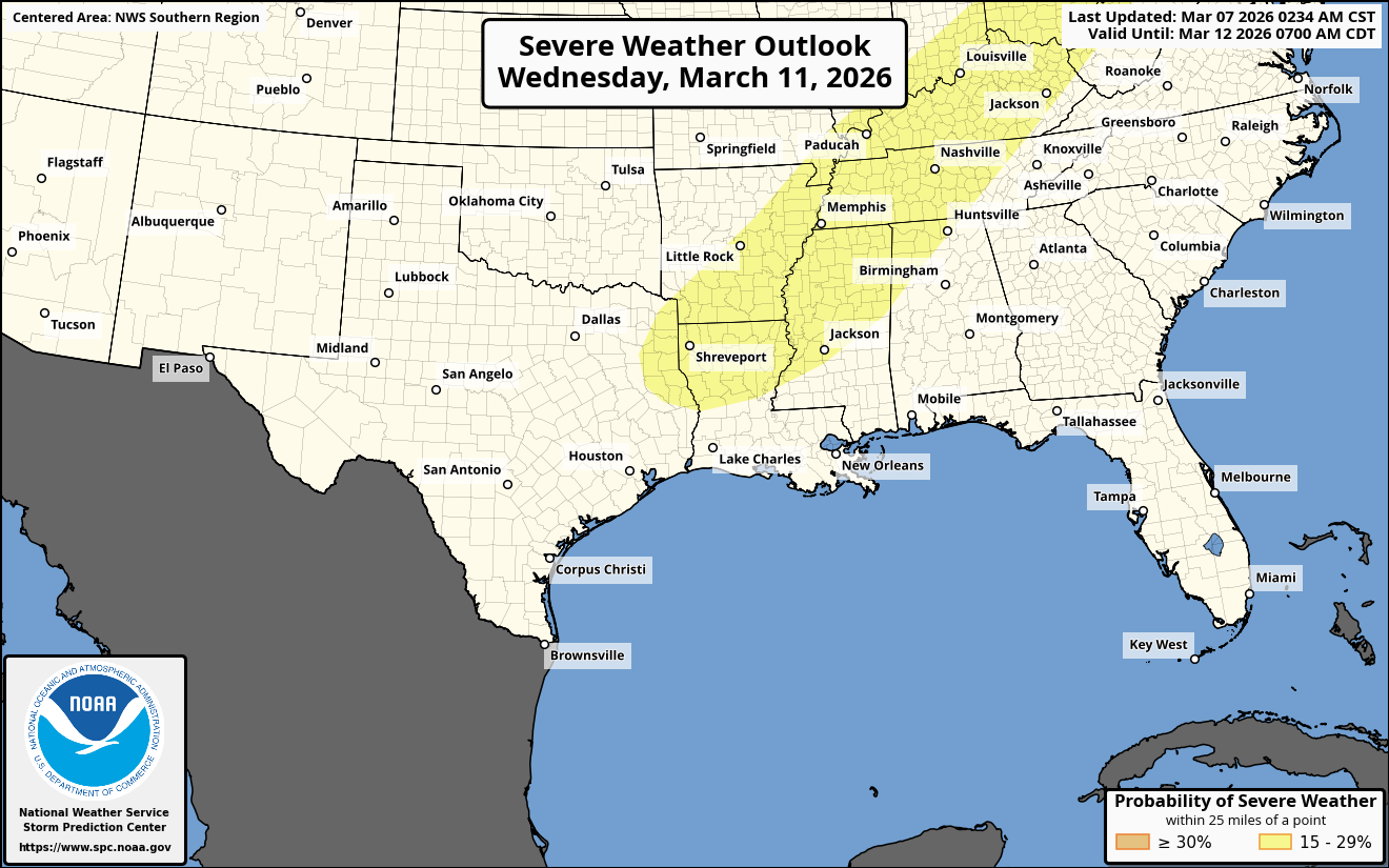
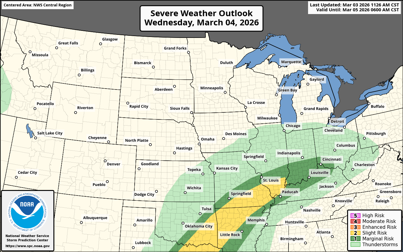
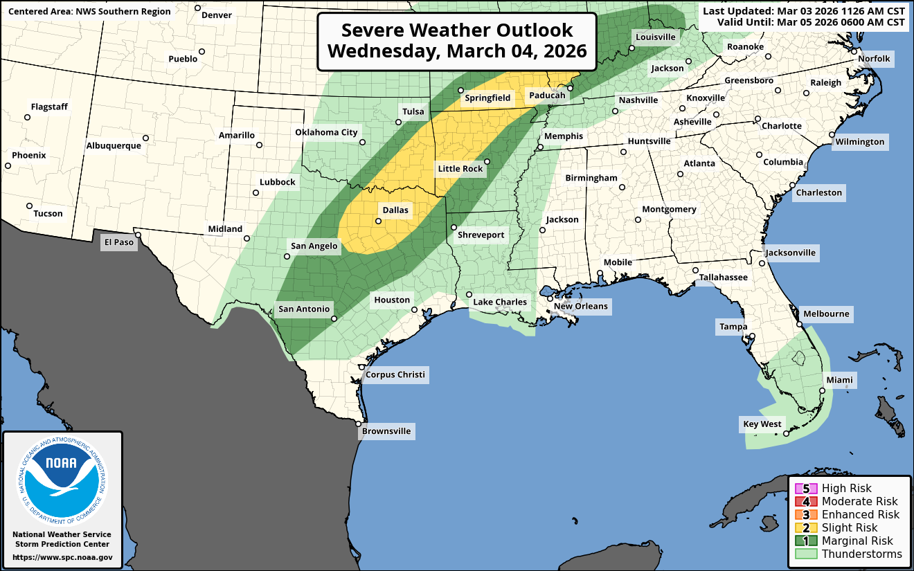
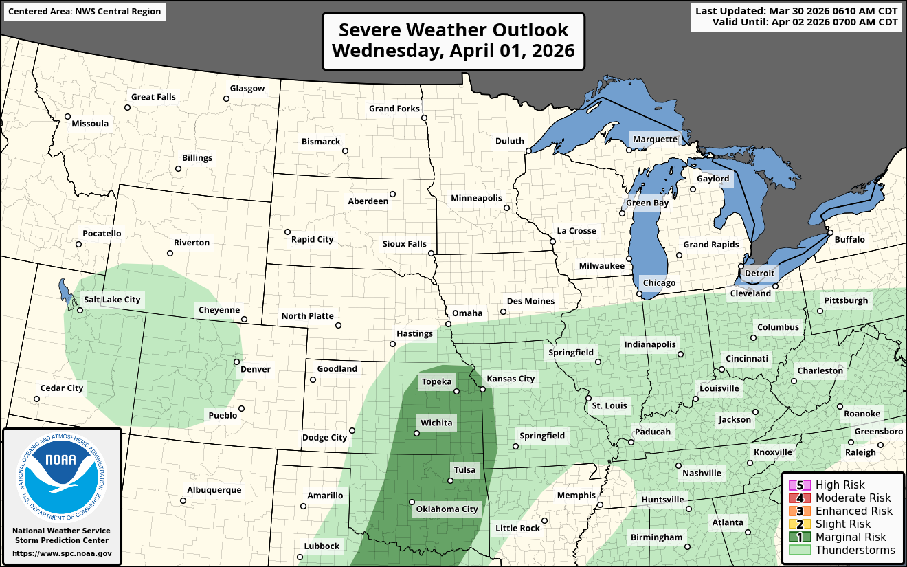
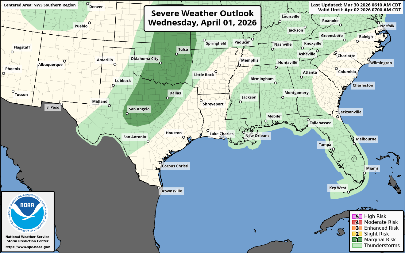
Wednesday Afternoon & Wednesday Evening – Some Severe Weather Is Possible Across The Central & Southern Plains States: Some severe weather is a possibility across the central and southern Plains from about central and eastern Kansas southward through central and eastern Oklahoma into northern Texas.
Strong to severe thunderstorms may develop by late Wednesday afternoon across north Texas and central Oklahoma. These storms will push northeastward during Wednesday evening into eastern Kansas and eastern Oklahoma.
The main threat with any severe storms late Wednesday afternoon and Wednesday evening looks to be damaging wind gusts.
Thursday – Ohio Valley: It appears that some severe weather is a possibility Thursday afternoon into Thursday night across the Ohio Valley as a cold front pushes eastward into the area. Any severe storms may have the potential to produce some very gusty winds.
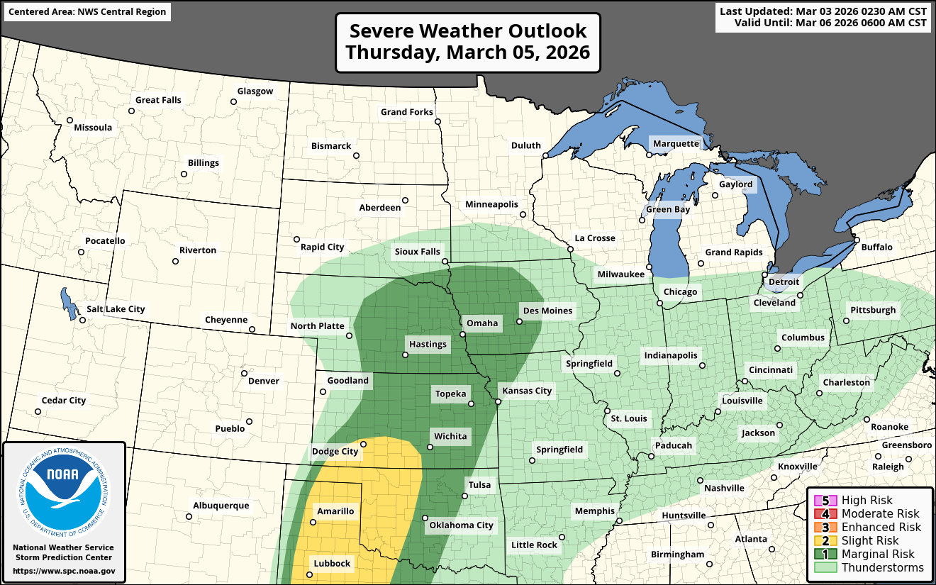
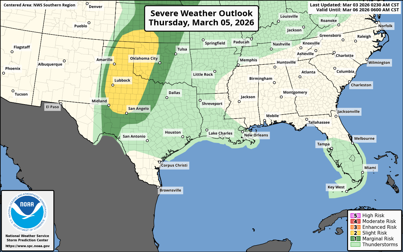
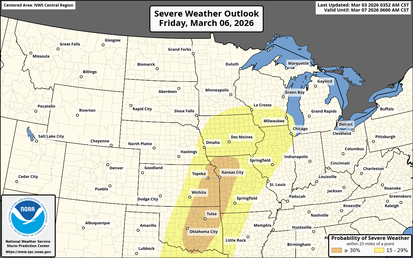
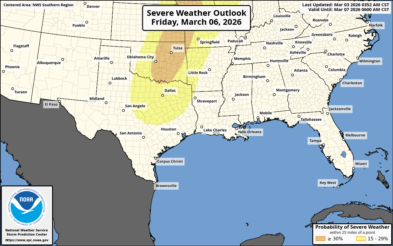
Friday – The Central & Southern Plains States: An area of low pressure is expected to form over far eastern Colorado and western Kansas during the day on Friday. To the east of this low pressure system, a surge of humid air will push northward across the southern and central Plains states.
Strong to severe thunderstorms may form across northern Oklahoma and central and eastern Kansas during Friday afternoon. This will be something to closely watch as there are strong signals in the data that suggest some substantial severe weather may occur Friday afternoon across northern Oklahoma and eastern Kansas with tornadoes, very large hail and damaging winds a possibility.
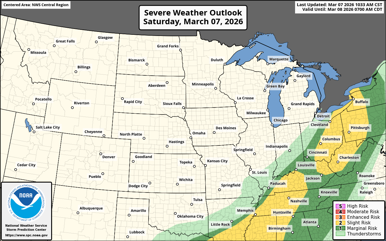
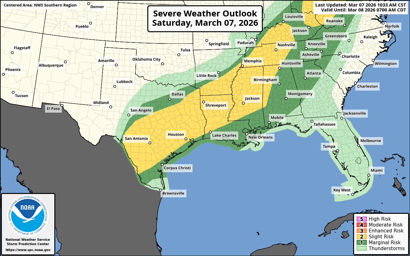
Saturday – The Ohio Valley: An area of low pressure is expected to strengthen as it pushes into the Great Lakes region during Saturday. This will lead to plenty of moisture pushing northward into the Ohio Valley by Saturday afternoon.
Thunderstorms, some strong to severe, may affect much of the Ohio Valley with damaging winds the main threat.
FINALLY – I am writing to see if you may be able to help us out & I want to explain why.
We have had what we’ve called a “perfect financial storm” over the past year or so that has drained all of our savings and other money avenues.
This includes, but is not limited to the following:
– Having to take on an unexpected car payment after a serious car accident last July, which totaled our paid off vehicle.
– Being dropped by our home insurance company because they deemed the breeds of dogs we have as uninsurable, even though we were completely upfront with them about the dogs we have when bought the house. In fact, we still have the same dogs as we did when we purchased the house. Because of this, we had to get brand x state insurance & have had to jump through hoops to keep it.
– My wife being injured in that aforementioned car accident to the point where she can barely walk at times & she hurts all of the time (both knees injured & shoulder injured). This has required me to care for her almost constantly.
– Me developing a hernia over the past several months, which will probably require surgery soon.
– Me injuring the tendons in my hand in a slip & fall accident in January.
– One of our pups tearing a tendon open back at the New Year leading to a $1100 emergency vet bill.
– Medically, with all of the stress of what’s gone on over the past year – I have developed almost constant tachycardia, which I will be seeing my doctor about tomorrow, actually.
– The property taxes on our home have almost doubled since we bought the house in November of 2021. This had led to a very notable increase in the monthly mortgage payment. We have thought about & seriously considered selling the house & buying a home in a town with much lower taxes. The problem with that is that the interest rate on homes is nearly double of what they were when we bought our home & because of this, our mortgage would probably be about the same, even with lower taxes. No win situation here.
It takes A LOT for me to ask for help & I probably should have fully explained what’s going on before. Reason for this is that I oftentimes feel too proud and I let things get too bad before I ask for help. I also have an issue with internalizing the stress & feel like I can “figure things out”, which has probably led to the tachycardia issues I’ve developed.
Anyways, I wanted to explain things much more, so that you fully understand our situation & know that this account has not been hacked.
Here’s How To Help Us Out:
To help us out using your credit card or debit card, please go to the following link –https://buy.stripe.com/8x2fZiaU4f4UcgO3Uxfw40c .
To help us out using PayPal, please go to the following link – https://www.paypal.com/paypalme/crownweather .
To help us out using Venmo, please go to the following link – https://account.venmo.com/u/crownweather (if Venmo asks you to verify payment, the last 4 digits of my phone number is 0009).
Finally, THANK YOU SO MUCH IN ADVANCE for any support you can send. It is appreciated more than you will ever know.