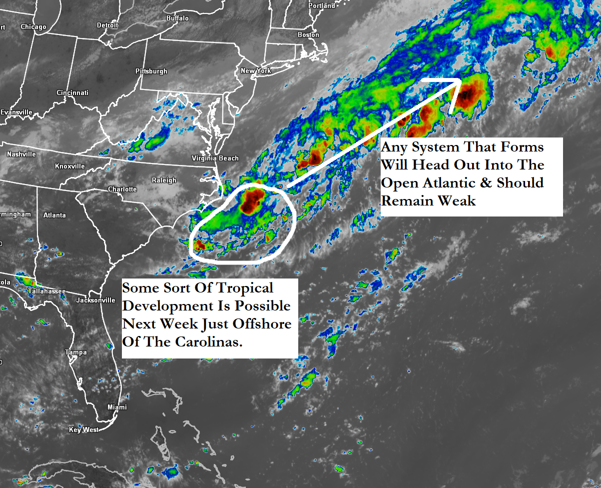
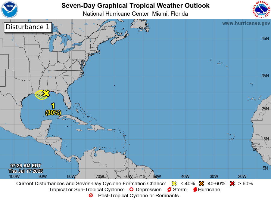
Invest 95-L Located Offshore Of The North Carolina Coast: Satellite imagery and weather analysis indicates that there is a non-tropical low pressure system located about 200 miles or so offshore of the North Carolina coast. This low pressure system is producing deep amounts of convection near its center. Also, the wind shear values around this low pressure system are favorable for development.
It’s quite possible that this low pressure system will become a tropical or sub-tropical depression or tropical storm between now and Monday as it heads east-northeastward away from the East Coast of the United States and out into the open Atlantic. This means that even if Invest 95-L does develop into a depression or a tropical storm, it will not be a threat to any land areas as it will safely move out into the open Atlantic.
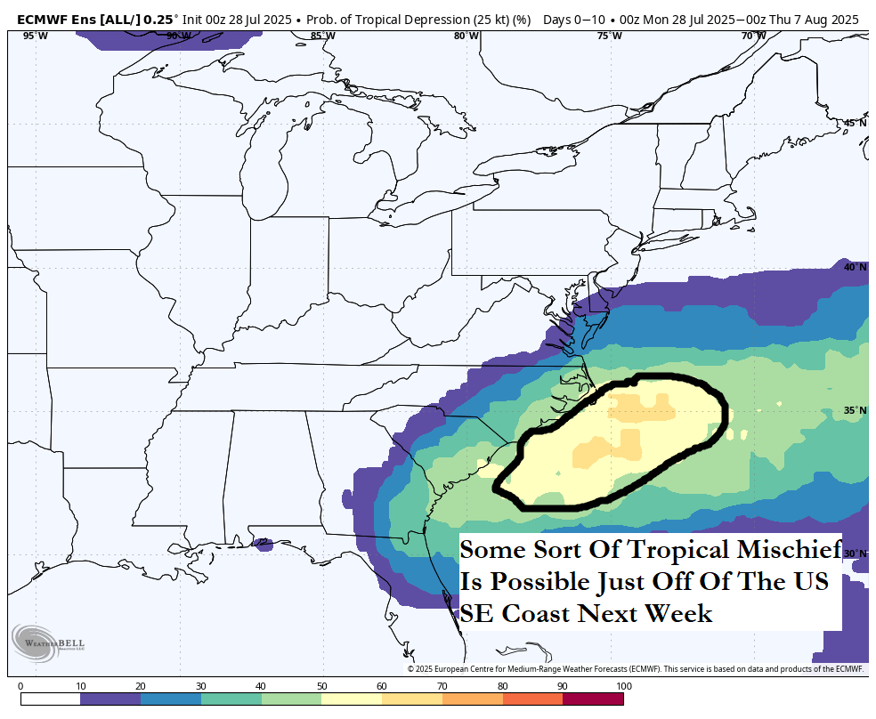
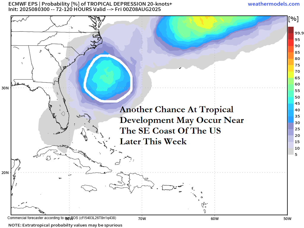
Additional Tropical Development Is Possible Near The Southeast US Coast Later This Week: Following close behind Invest 95-L, it looks quite possible that tropical development could occur near the Southeast coast of the United States by a little later this week. In fact, pretty much all of the model guidance are forecasting this to occur with the differences in the models found where this system might go.
The GFS model forecasts a system to form to the southeast of the North Carolina coast by mid-week and head towards eastern North Carolina by late this week. The GFS model then forecasts this system, which looks quite weak, to move into eastern North Carolina by about Saturday.
The Canadian model doesn’t forecast any sort of a secondary low pressure system.
The European model seems to hint at some sort of a tropical system to form to the north of the Bahamas by Wednesday and then track northward reaching the outer banks of North Carolina by Saturday.
The GFS ensemble model guidance certainly sees it as it has a cluster that are hinting at development just north of the Bahamas by Thursday. The ensemble members then diverge with some members showing a track westward into the Florida Peninsula or coastal Georgia while other members show a track northward into the Carolinas and the Mid-Atlantic states.
The European ensemble model guidance also seems to see the potential for some sort of development to the southeast of the North Carolina coast by Wednesday or Thursday. Ensemble guidance then diverges with some members forecasting tracks towards the Carolinas and the Mid-Atlantic, some members forecasting a track up towards New England and other members forecasting a track westward into northeast Florida and coastal Georgia.
Here Are My Thoughts: It seems that the system to watch for possible development will form to the southwest of Invest 95-L as it pulls out into the open Atlantic. This should occur by about Wednesday or so. An area of high pressure over the northeastern United States and Atlantic Canada should be able to push any system that tries to form to the west and northwest towards the US Southeast coast by late this week and next weekend.
For now, I’m going to go with a very low chance for development as I’d like to see its structure and what sort of environment it moves through before I raise the development chances. Those of you along the Southeast coast of the United States and especially those of you on the North Carolina coast should closely monitor the progress of this possible system.
Bottom line is that I will be keeping a close eye on this possible system and will more updates over the next few days.
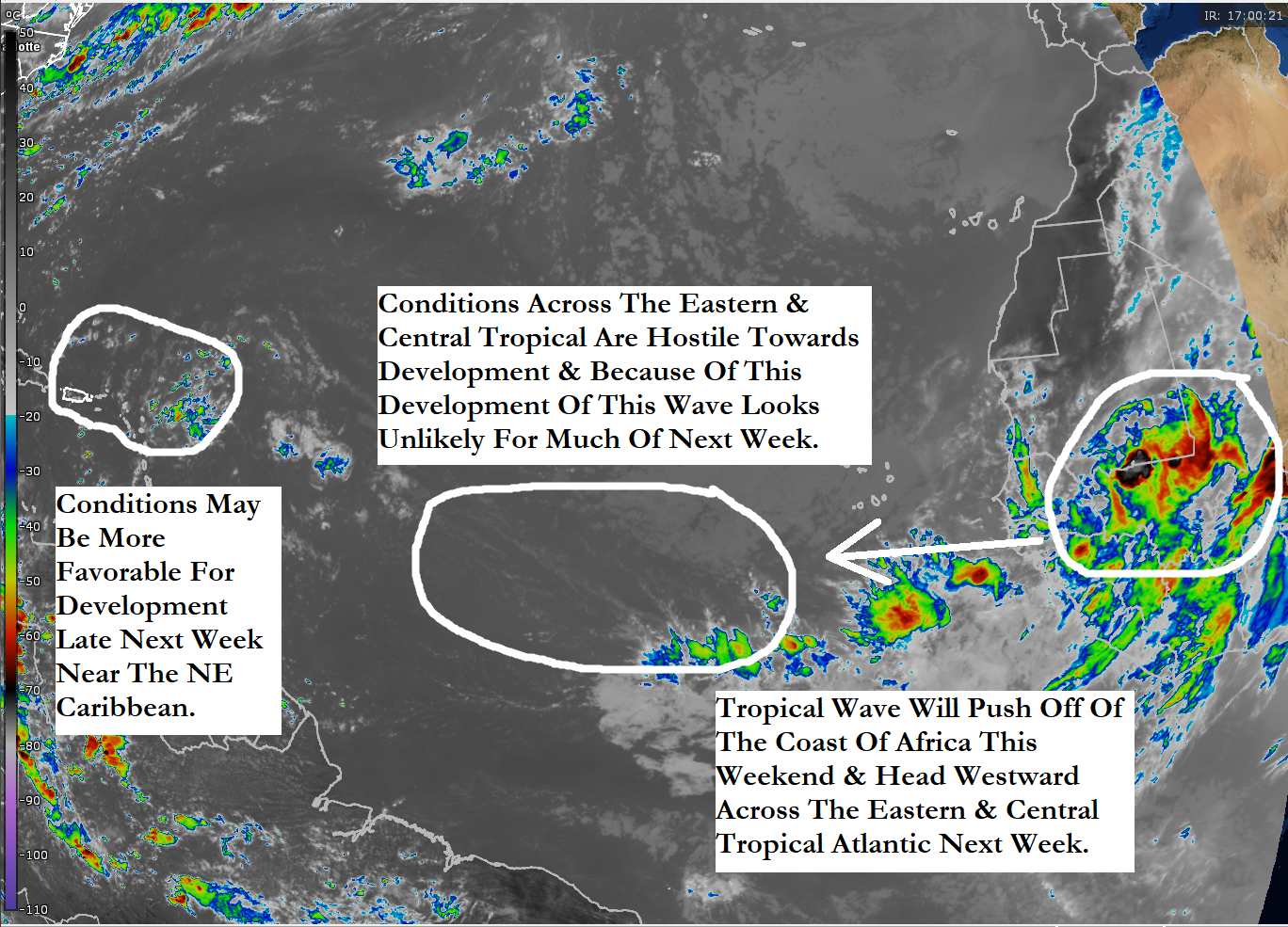
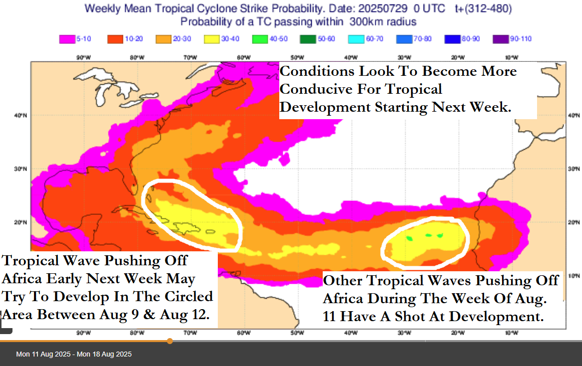
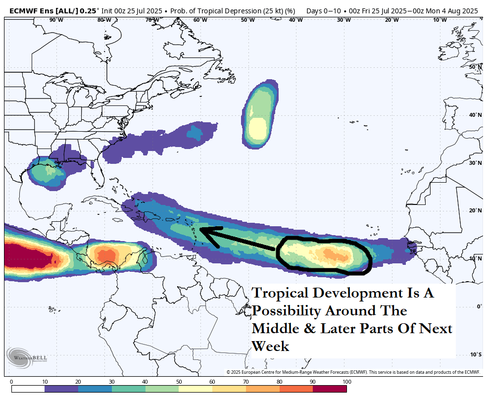
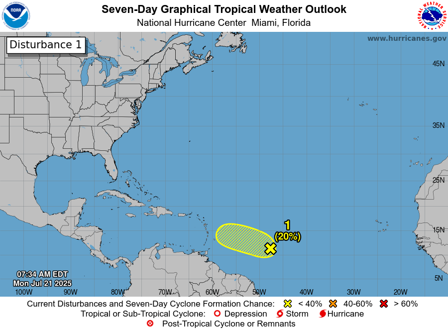
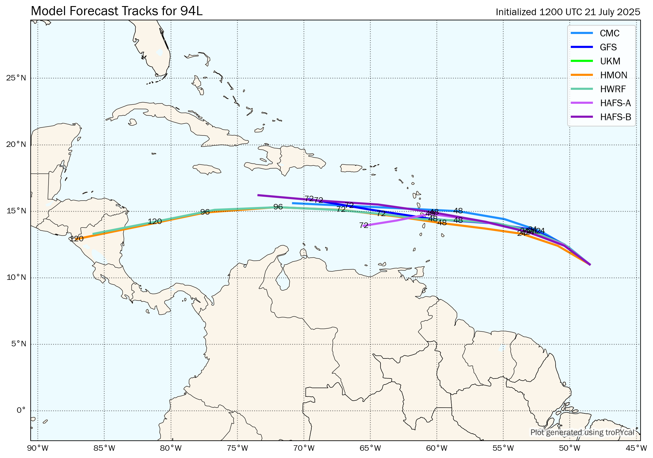
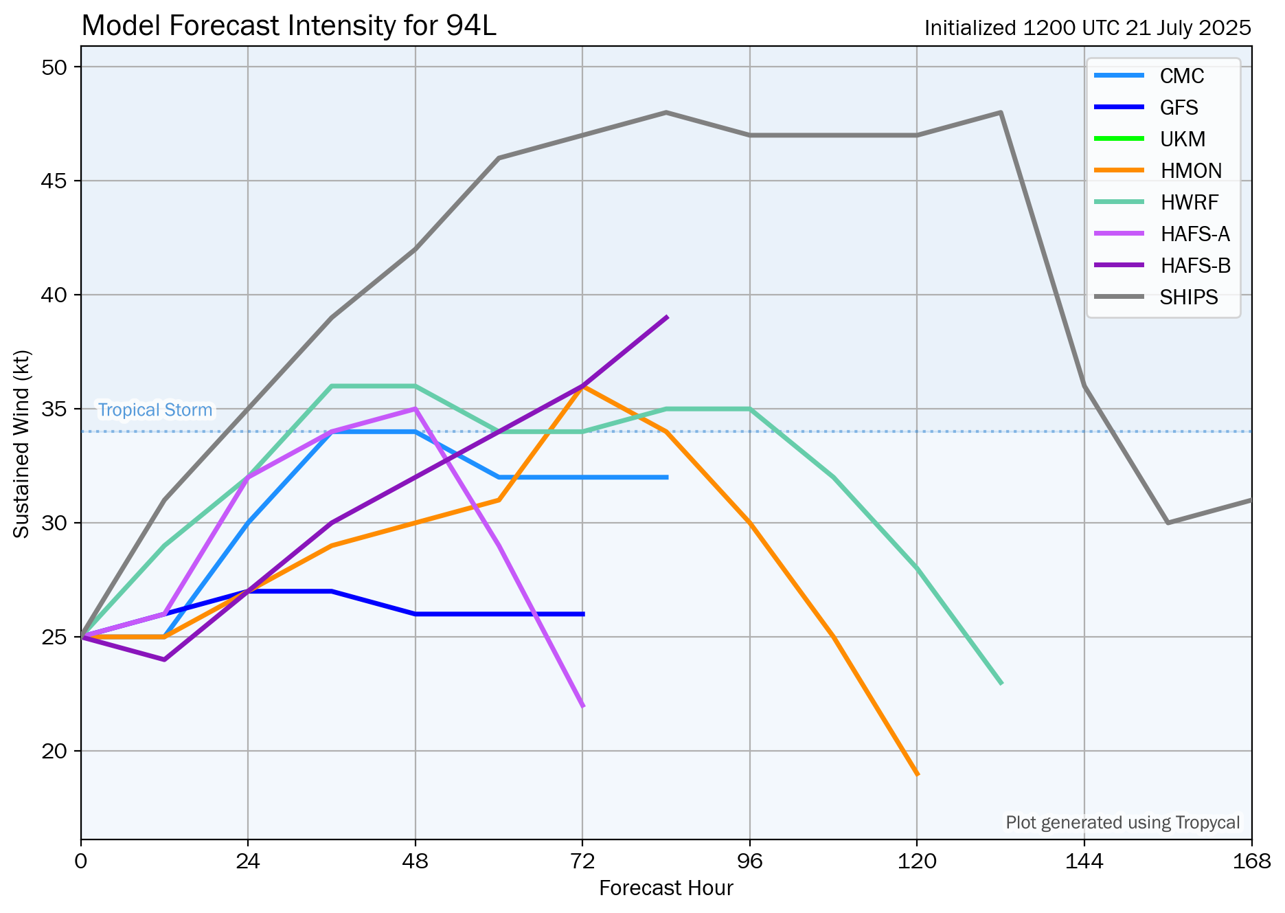
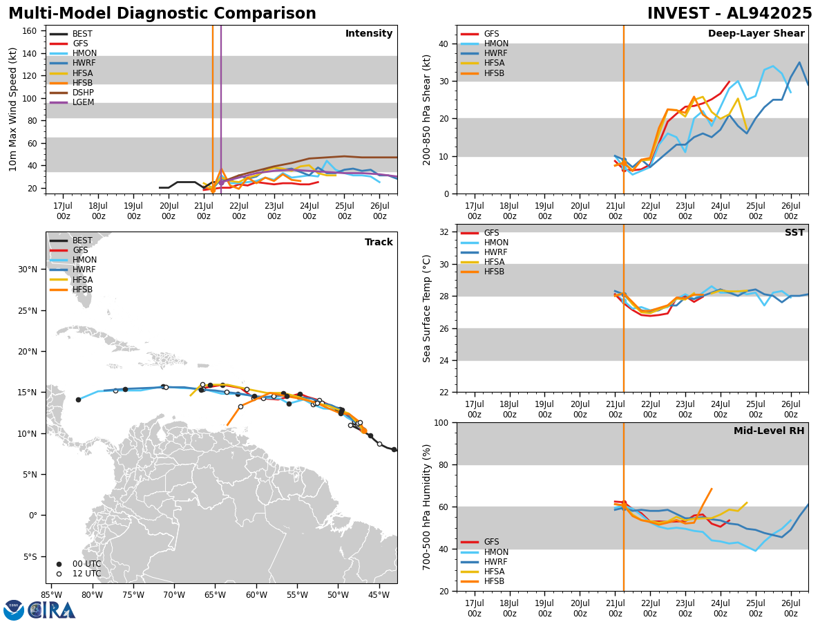
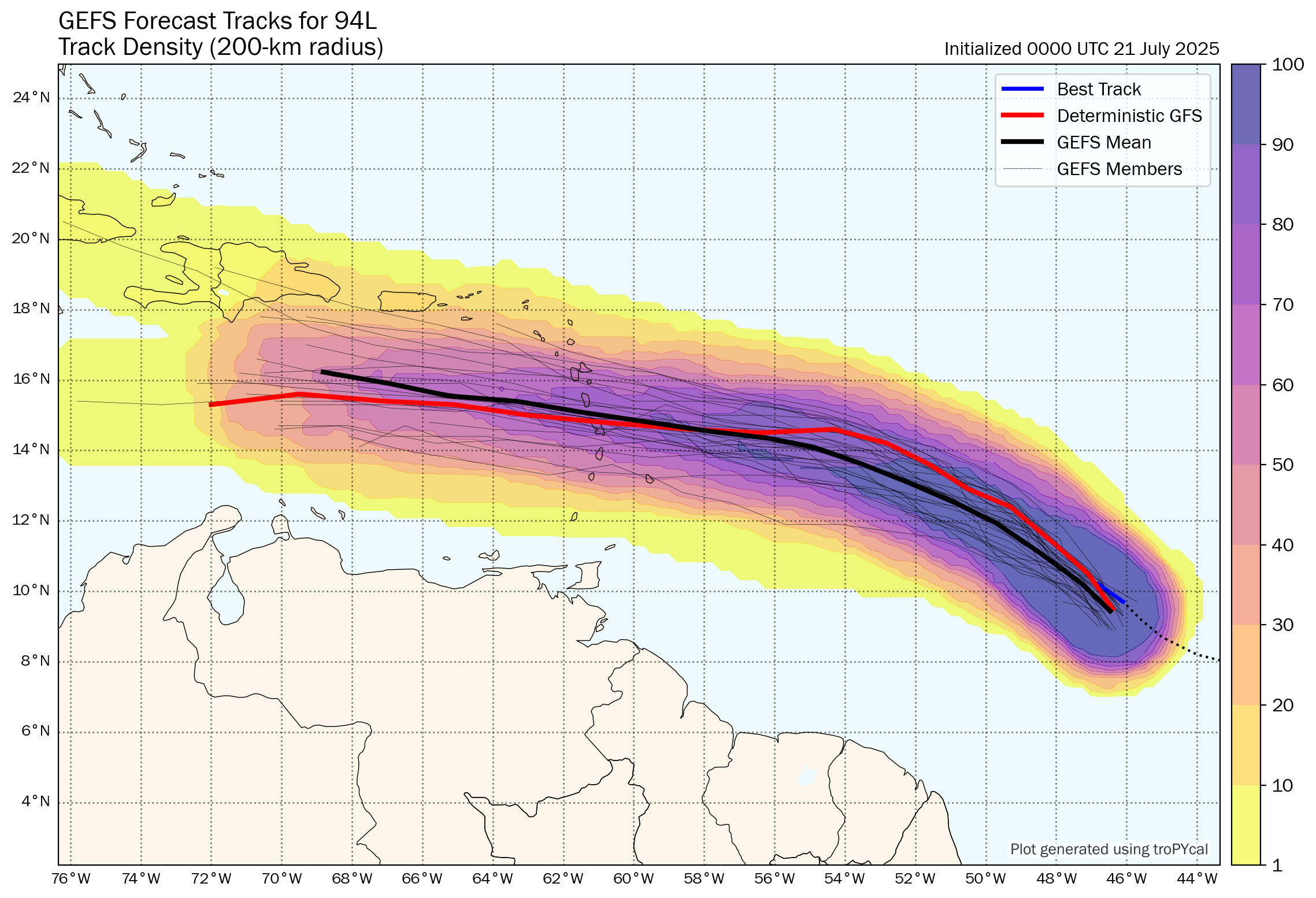
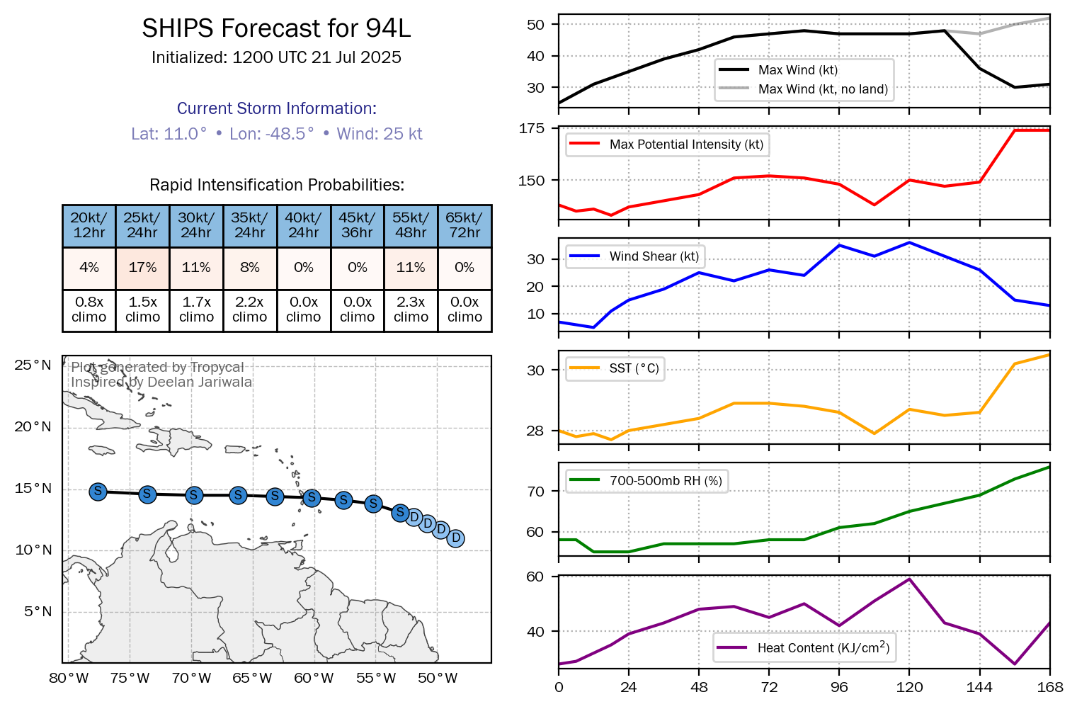
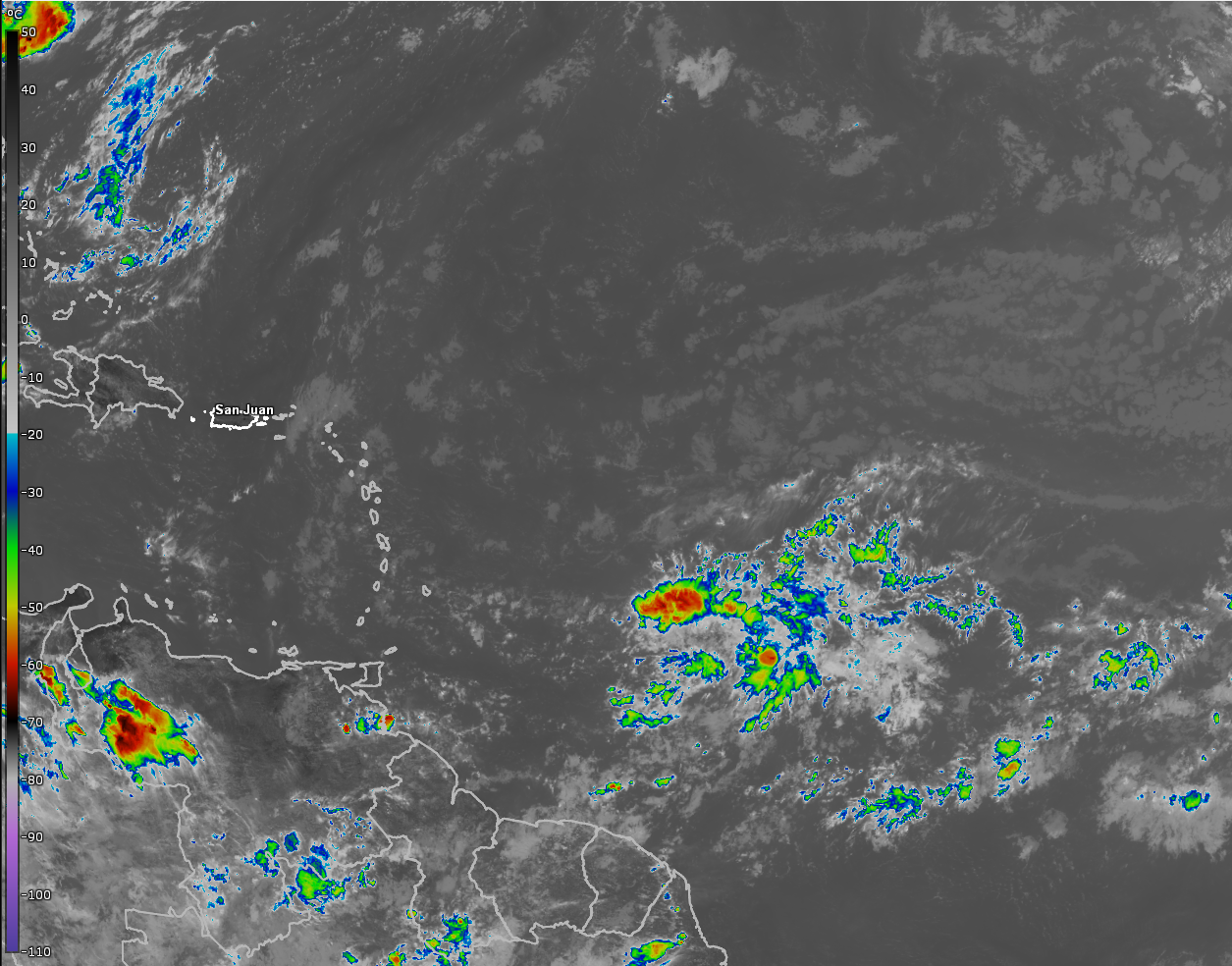
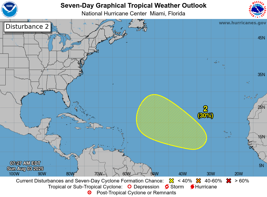
Tropical Development Is Possible By Mid To Late Week In The Central Tropical Atlantic: A tropical wave is expected to push off of the coast of Africa over the next couple of days or so. This wave is expected to push west-northwestward across the eastern and then the central Tropical Atlantic throughout this upcoming week where conditions may be favorable for some development.
Model guidance such as the GFS ensemble models and the European ensemble models seem to suggest that anything that develops may travel far enough north in latitude to miss the Lesser Antilles completely and eventually head out into the open Atlantic. That said, there are a couple of ensemble members that do show a very close track to the northeastern Caribbean by about August 11.
The Google Deep Mind AI weather model has a large spread in where it thinks any system that forms this week over the central Tropical Atlantic. Some of its ensemble members show a safe track out into the open Atlantic well away from the Caribbean, the Bahamas or the US East Coast. Other members do threaten the northeastern Caribbean by next week and then go on to threaten the Bahamas by about August 12.
Here Are My Thoughts: As I mentioned a couple of days ago, the tropical wave that will be pushing off of the coast of Africa over the next day or two definitely needs to be watched as it heads westward this week.
The environmental conditions across the eastern and central Tropical Atlantic are marginally favorable for development. There is favorable conditions across areas near and east of 40 West Longitude. This turns into unfavorable environmental conditions from about 45 West Longitude and points west. This could mean that we might see development occur by mid-week and then anything that tries to form may then struggle due to the unfavorable conditions late this week as it moves into the central Tropical Atlantic.
The weather pattern this week across the Atlantic is expected to include a weakness in the high pressure ridge east of Bermuda. This means that if this wave does develop into a tropical storm this week, it would likely be turned out into the open Atlantic well before it reaches the Lesser Antilles. On the other hand, if this wave struggles and doesn’t develop at all, it could stay further south and move in the vicinity of the Leeward Islands next weekend before heading towards the Bahamas.
It goes without saying that I will be keeping a very close eye on this tropical wave as it heads westward this week. Those of you in the Leeward Islands and the northeastern Caribbean should monitor this wave closely, just in case.
The next tropical weather discussion will be issued on Tuesday.