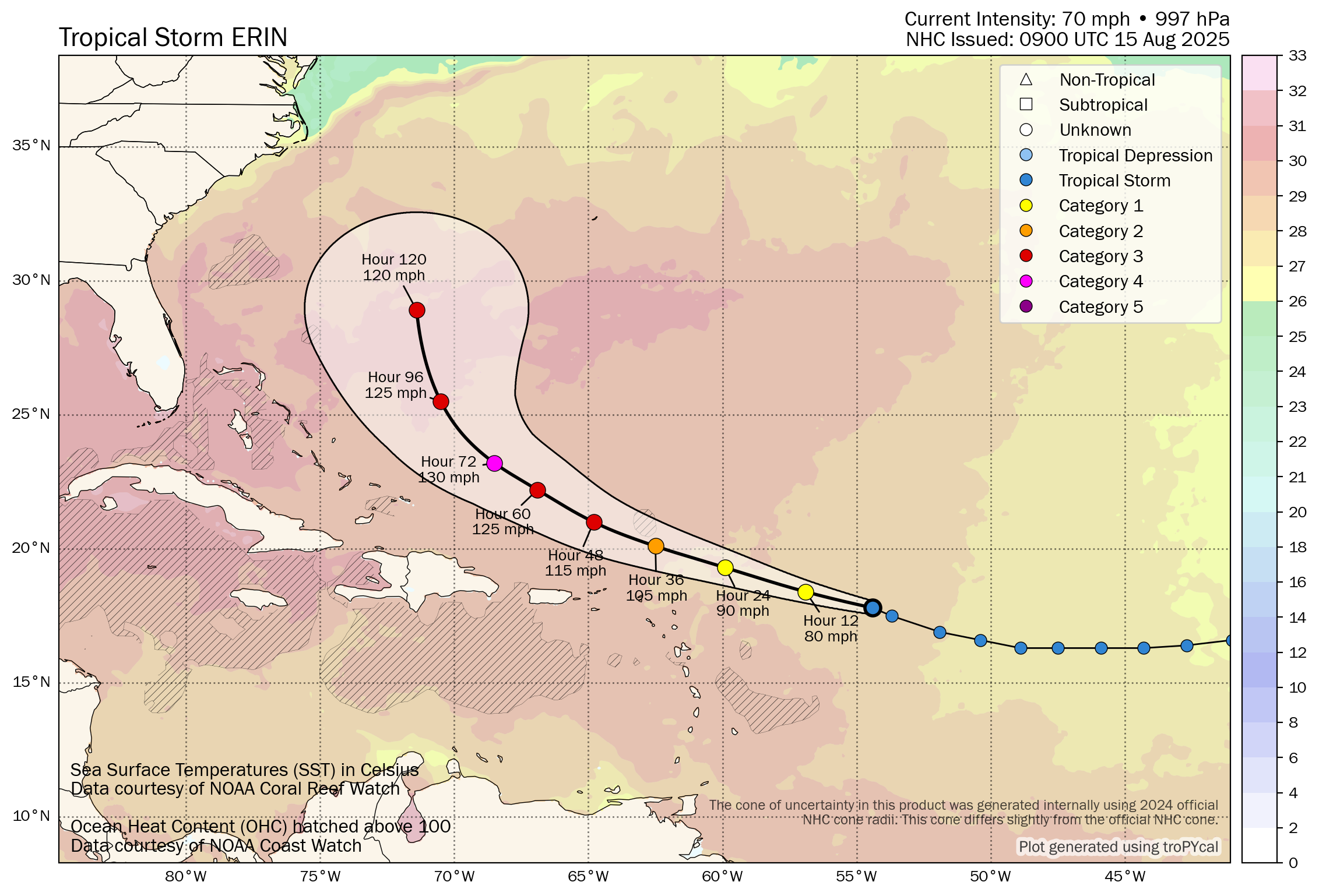
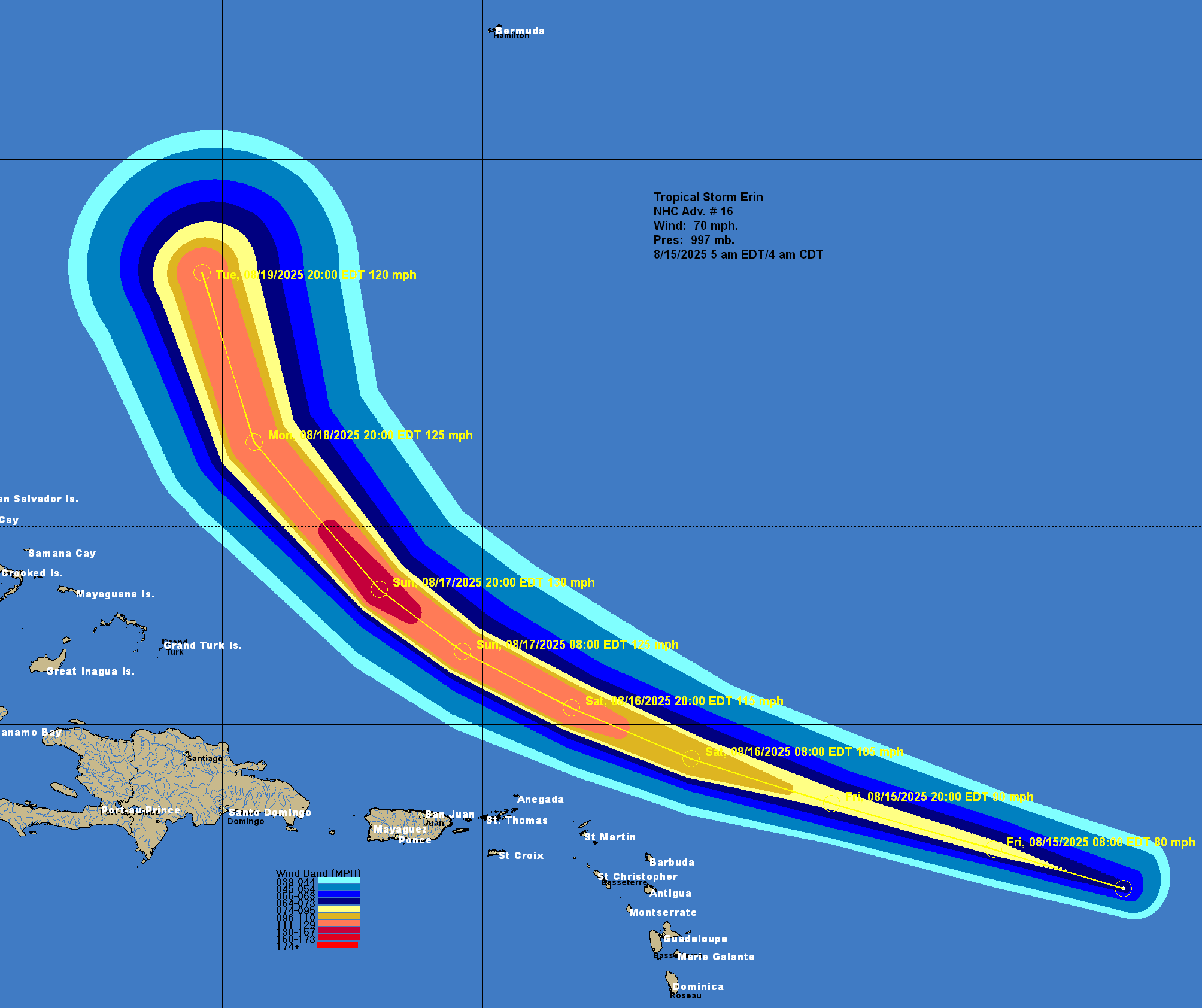
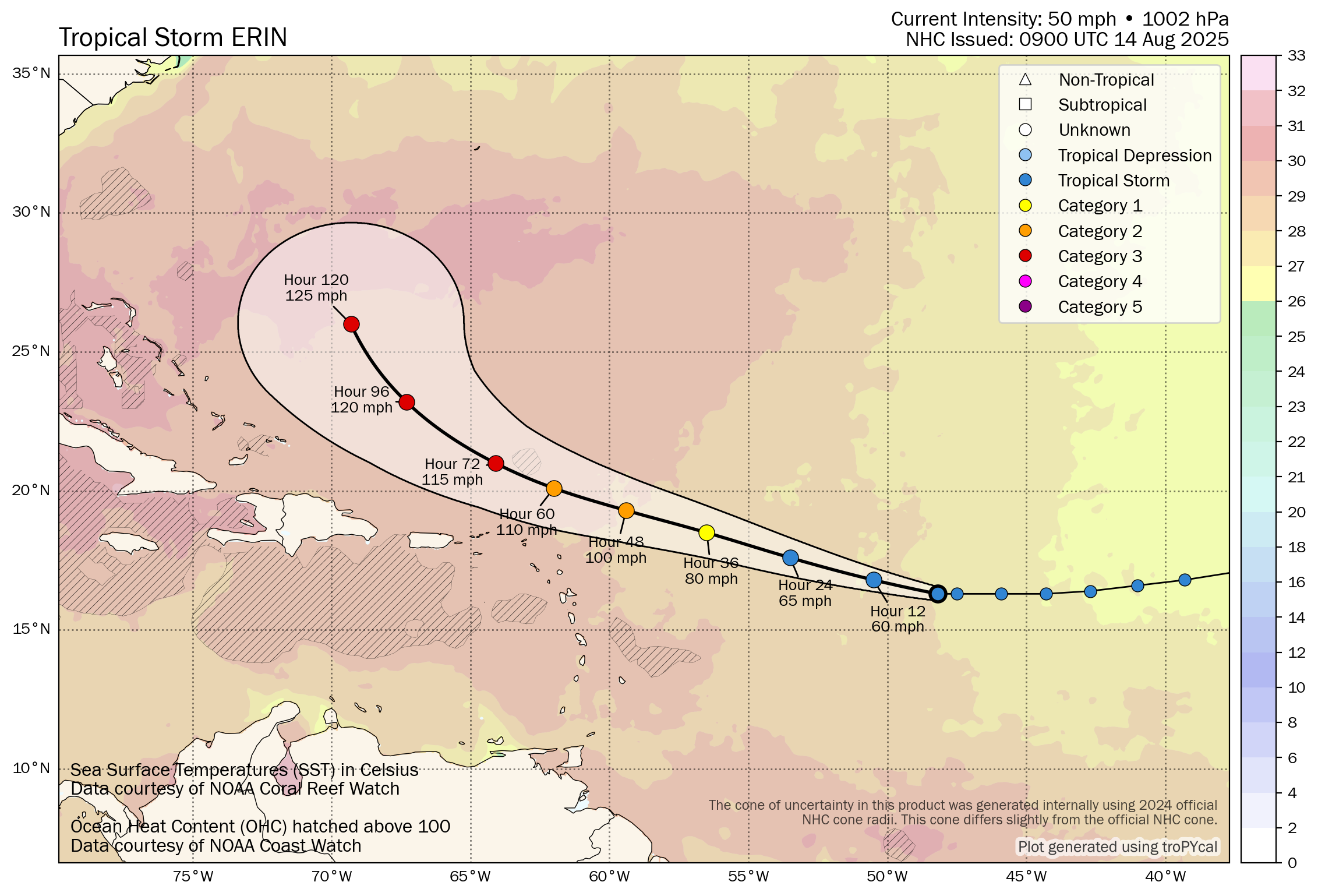
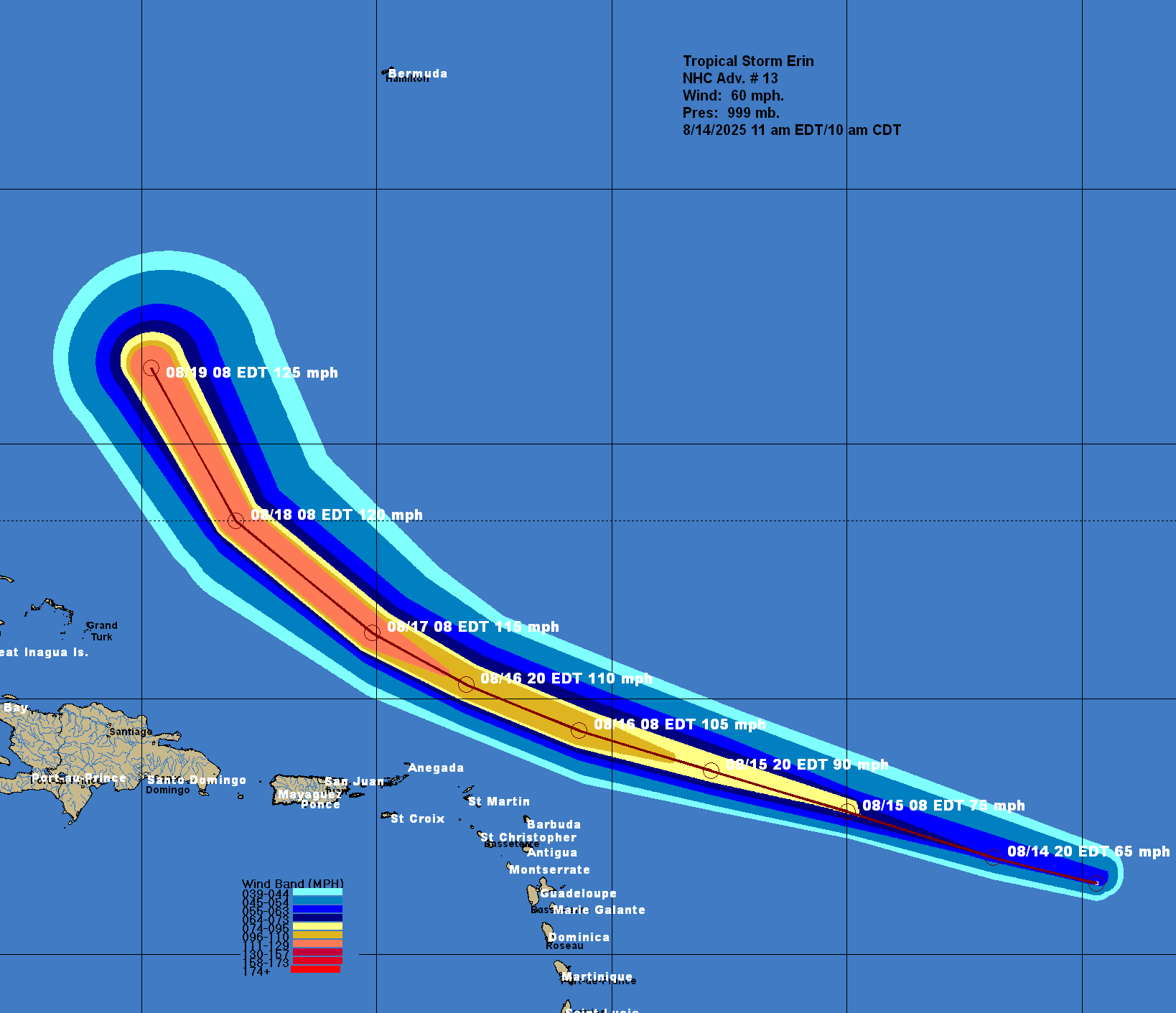
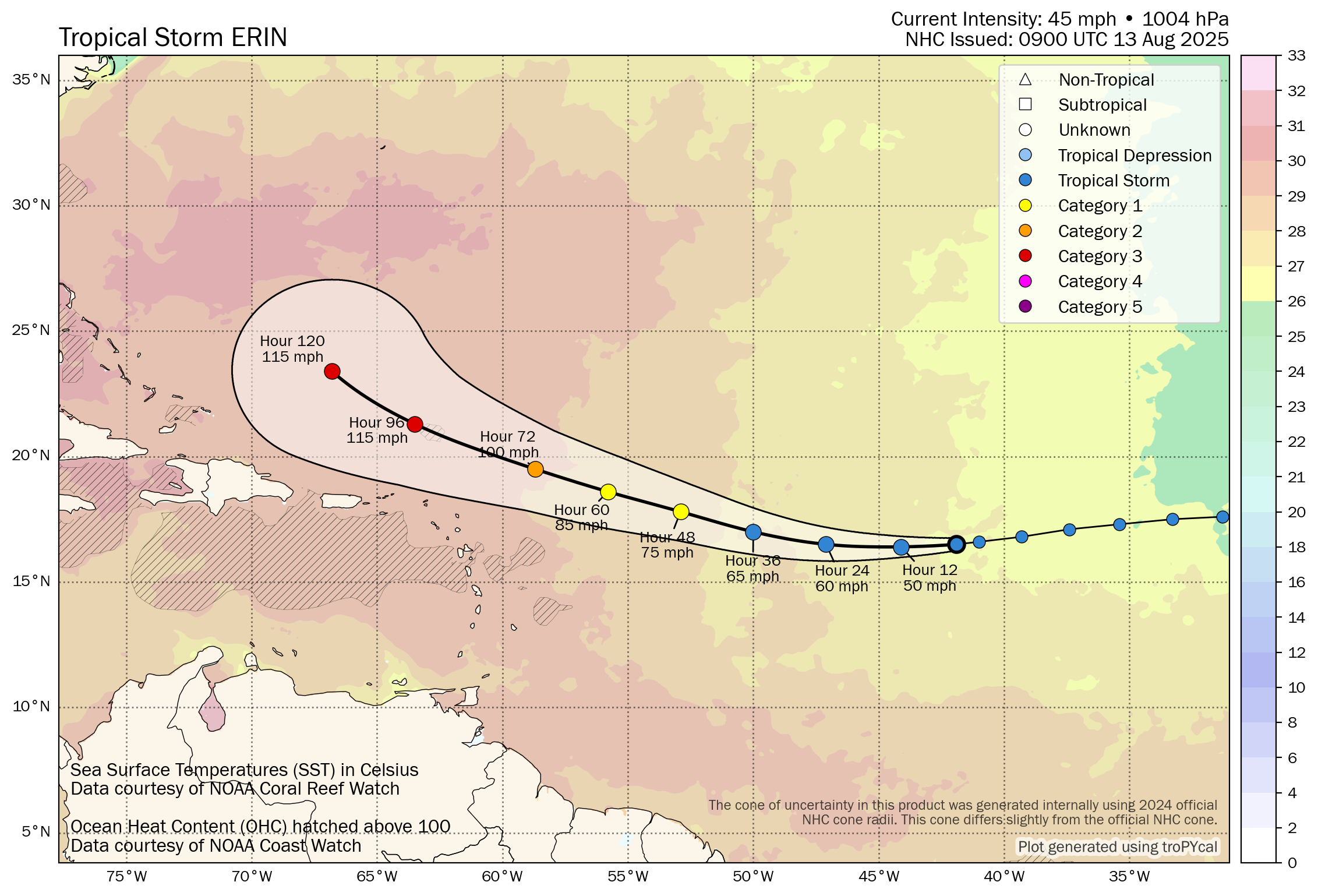
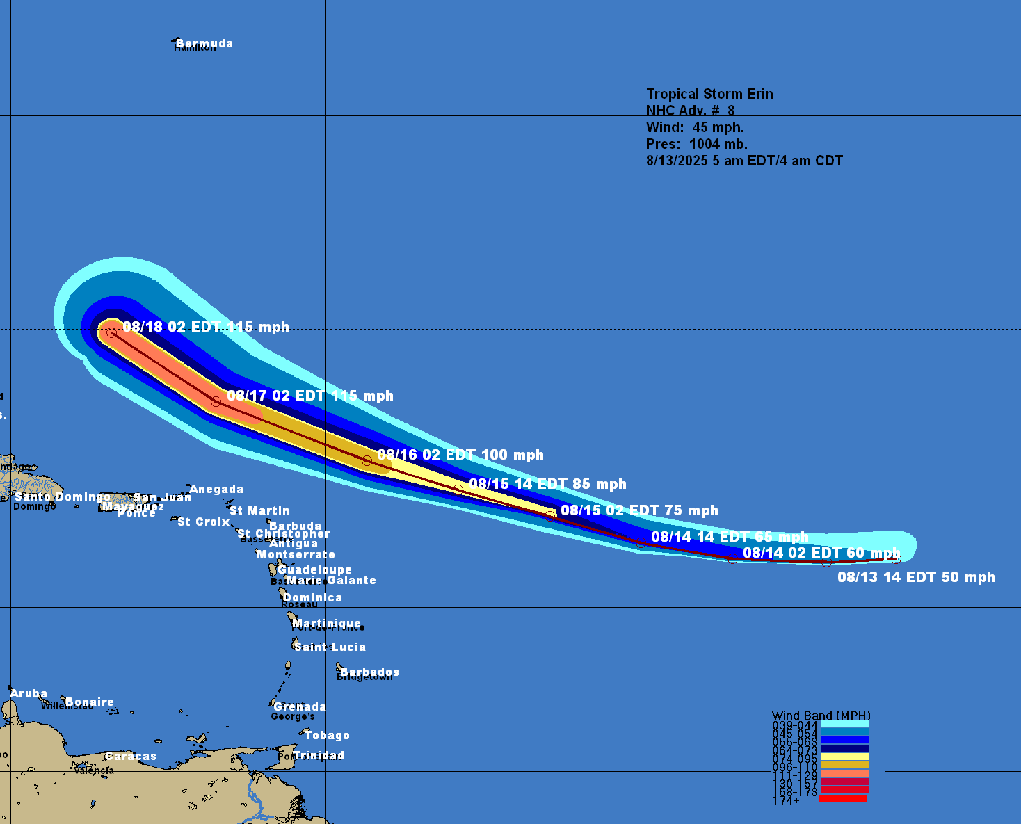
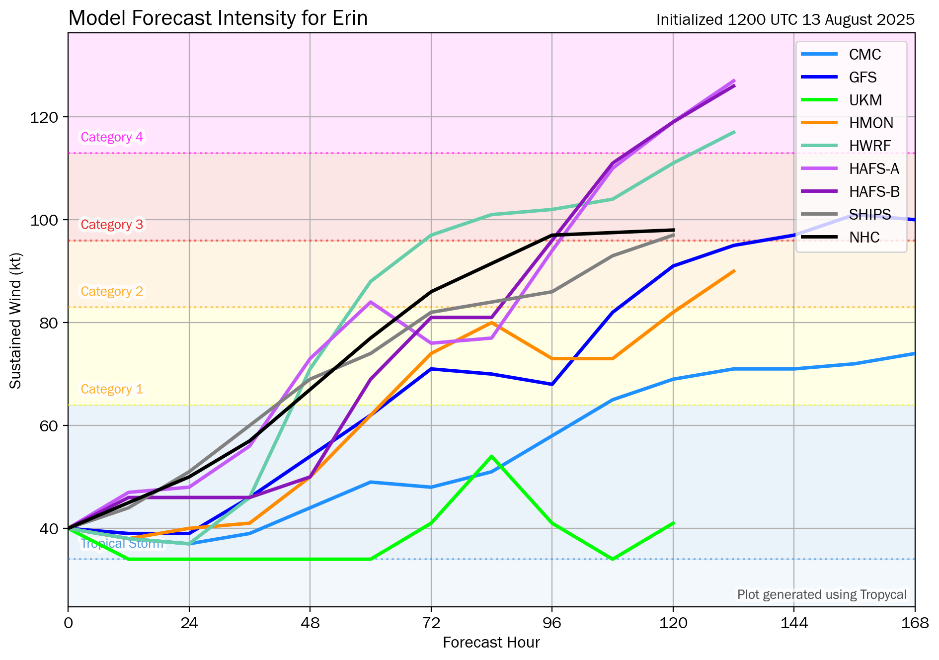
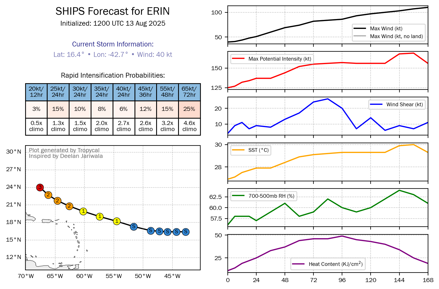
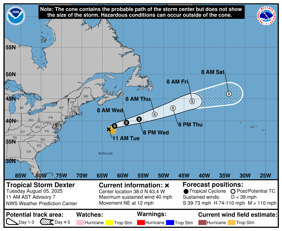
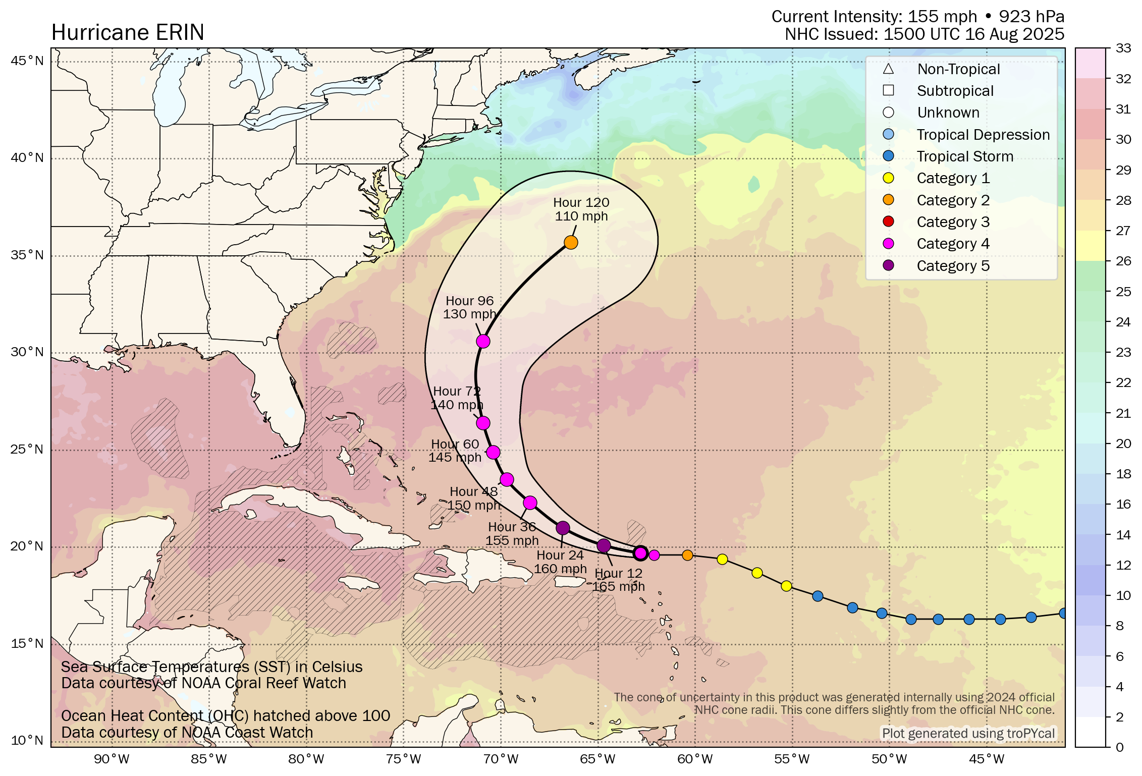
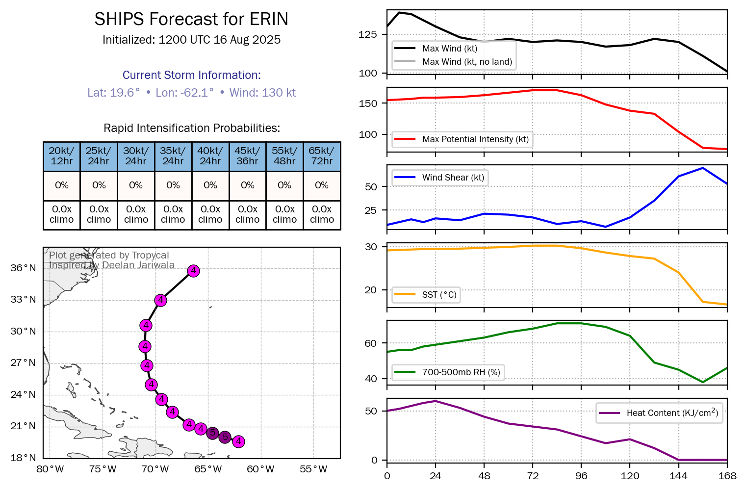
Major Hurricane Erin: Erin has undergone extremely rapid strengthening last night into this morning, going from a 75 mph Category 1 hurricane to now a 160 mph Category 5 hurricane at the time of this writing.
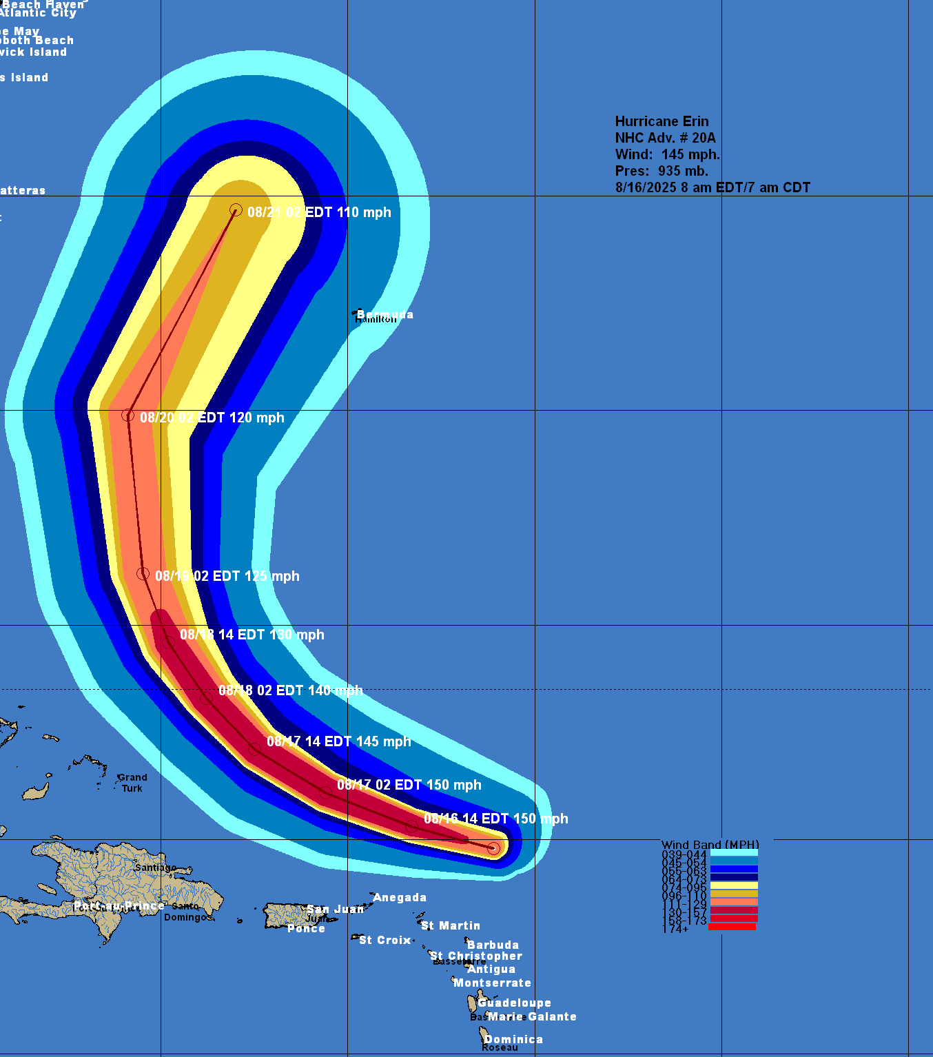
Reconnaissance aircraft have found the hurricane is rapidly strengthening with central barometric pressure falls of nearly 8 millibars per hour. The last recon pass found that Erin has a central barometric pressure of 917 millibars and maximum winds of 160 mph.
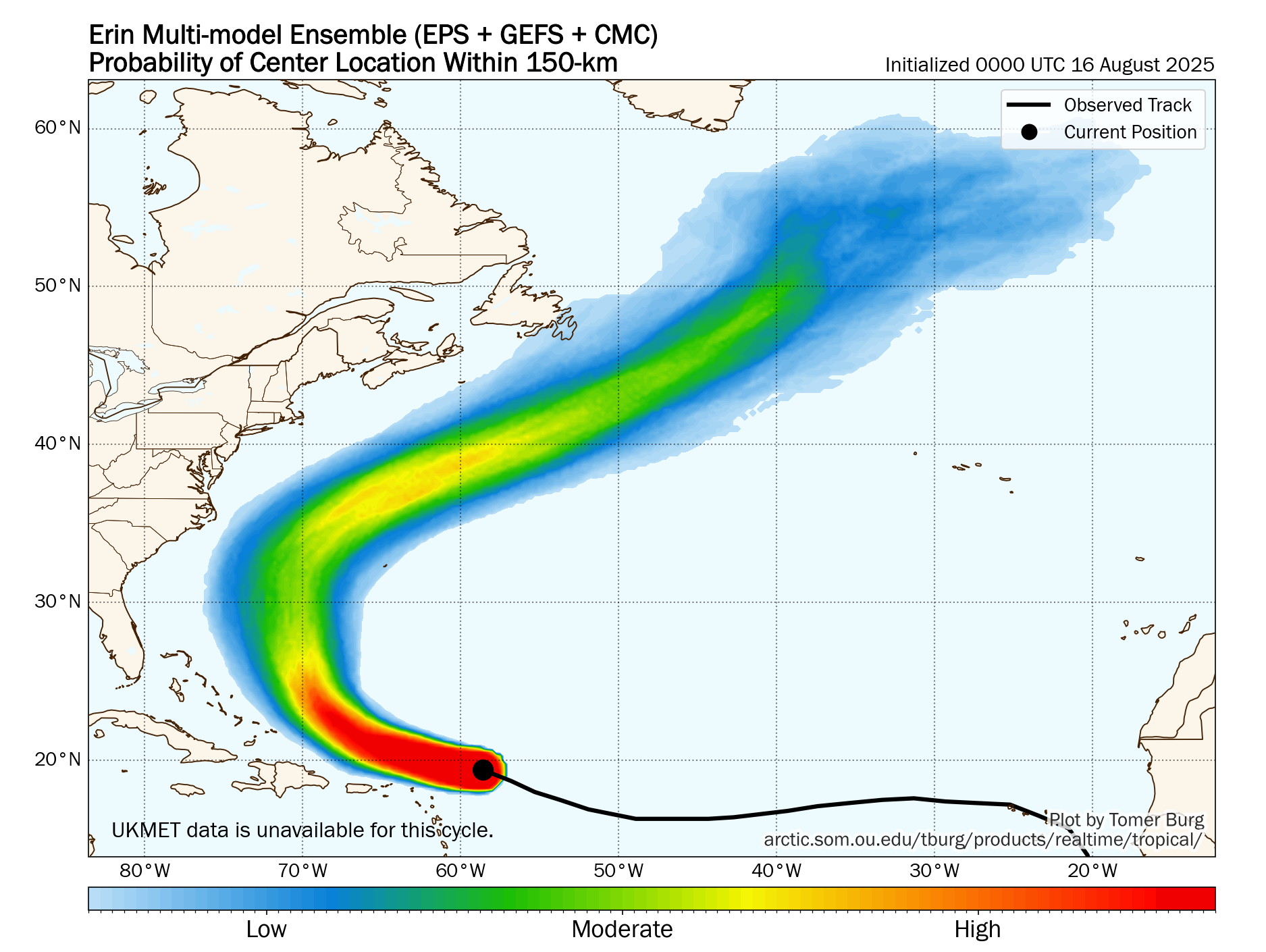
Erin’s constant and steady nearly due west track is a bit concerning as the further west it gets in longitude, the closer it will be to the Bahamas and the East Coast of the United States (especially the North Carolina Outer Banks) when it curves to the north and northeast. This due west motion by the hurricane is something that will be watched extremely closely. I will have more, including my thoughts, later on in this discussion.
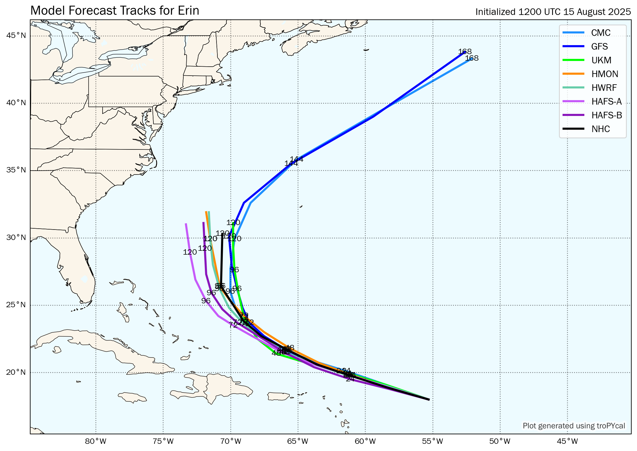
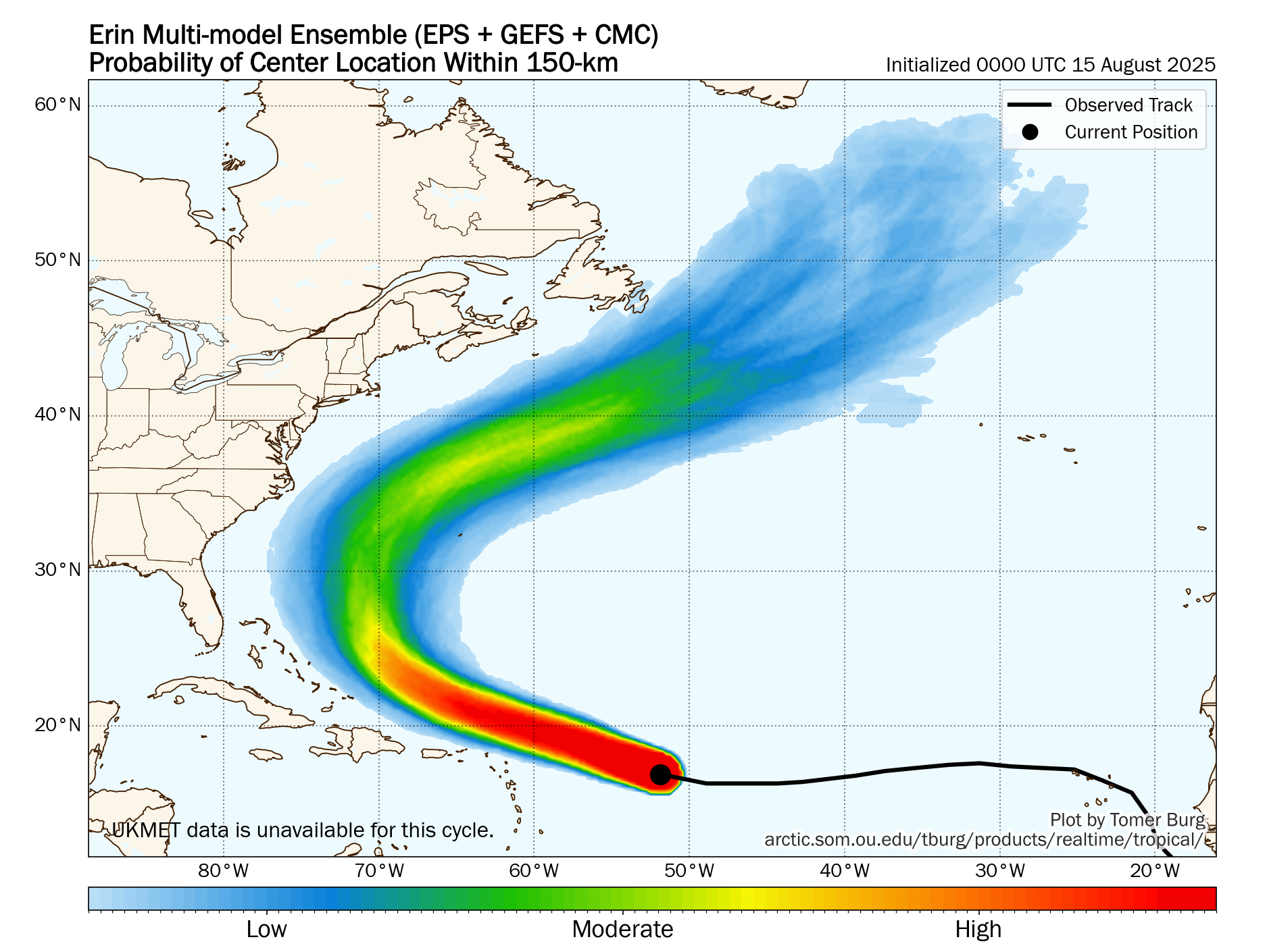
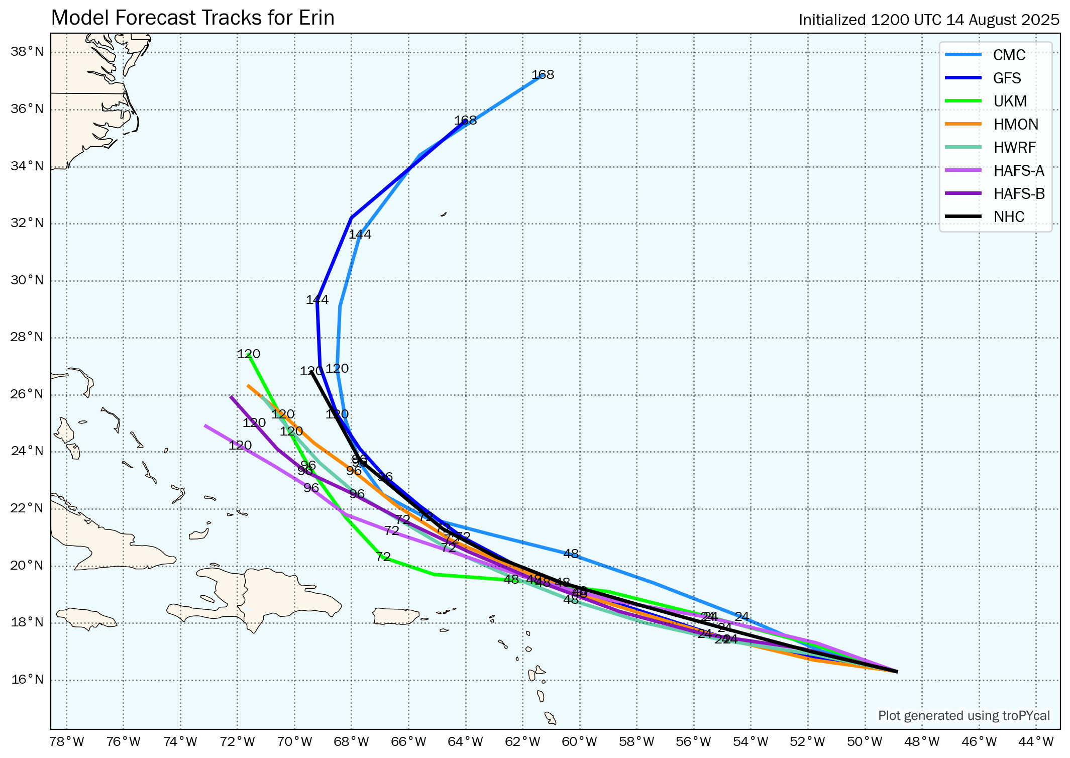
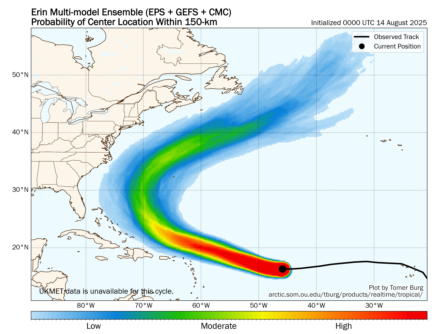
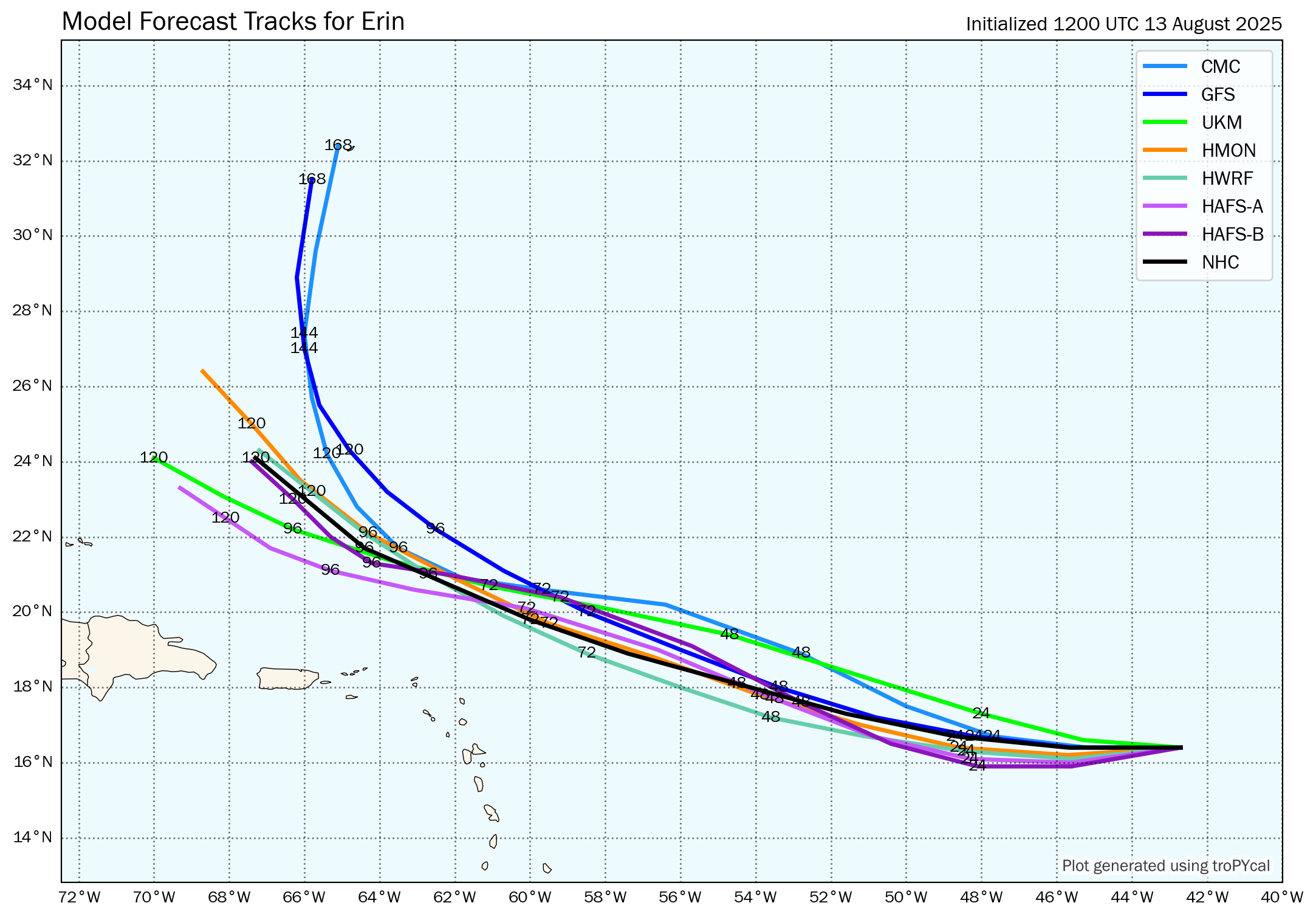
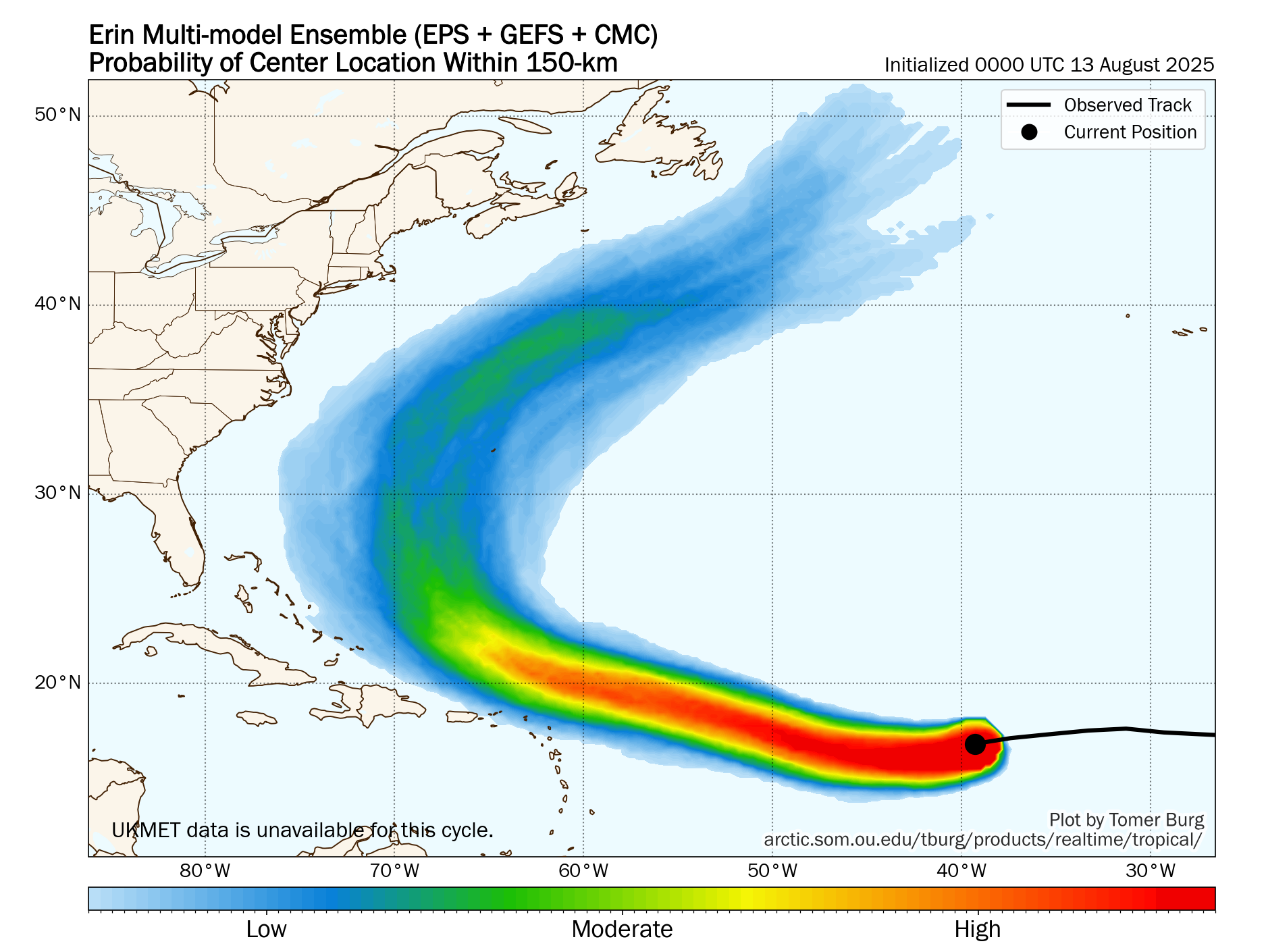
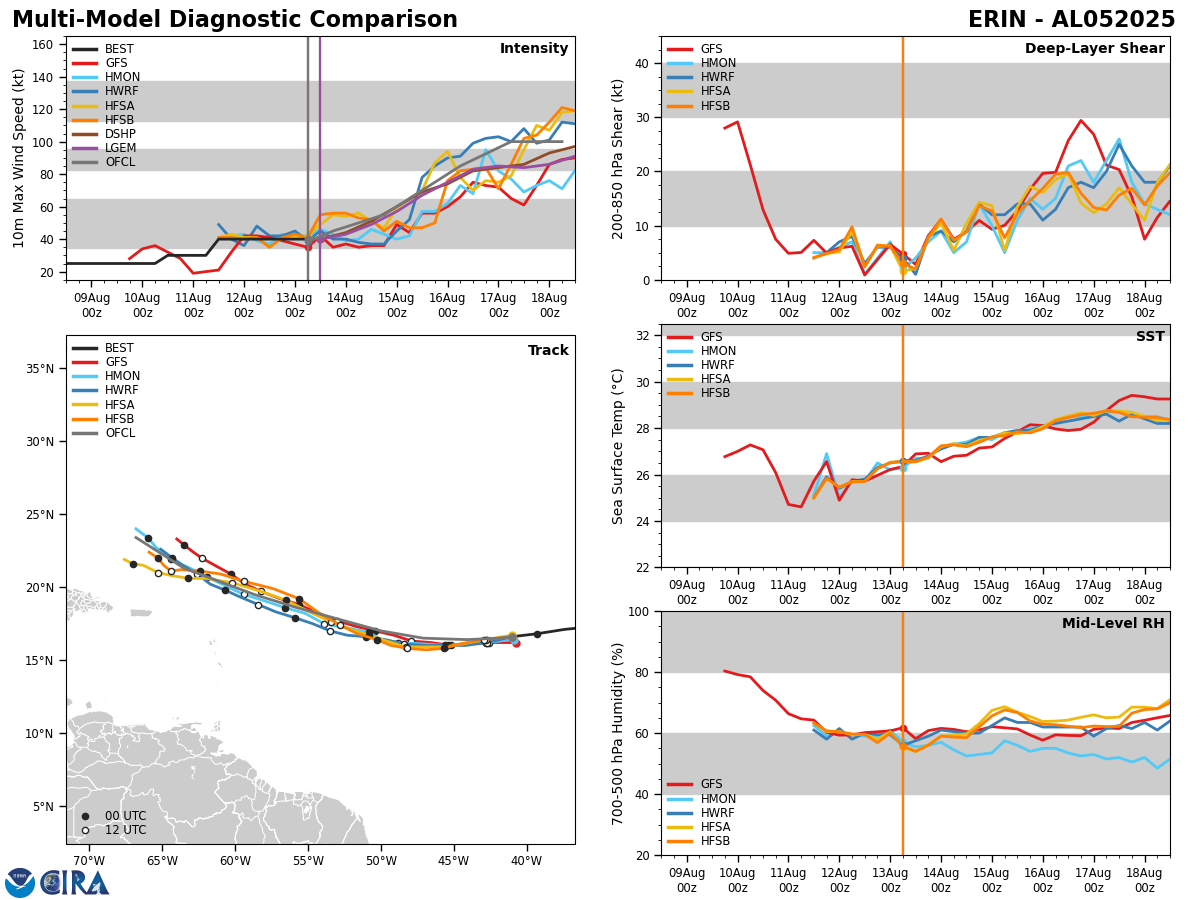
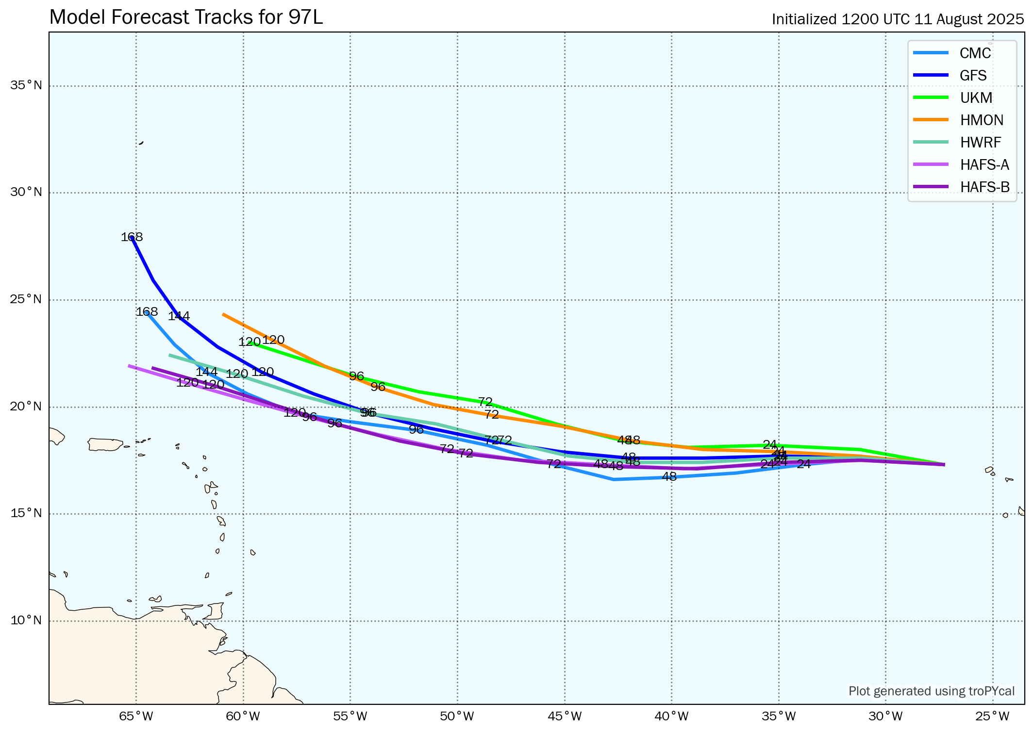
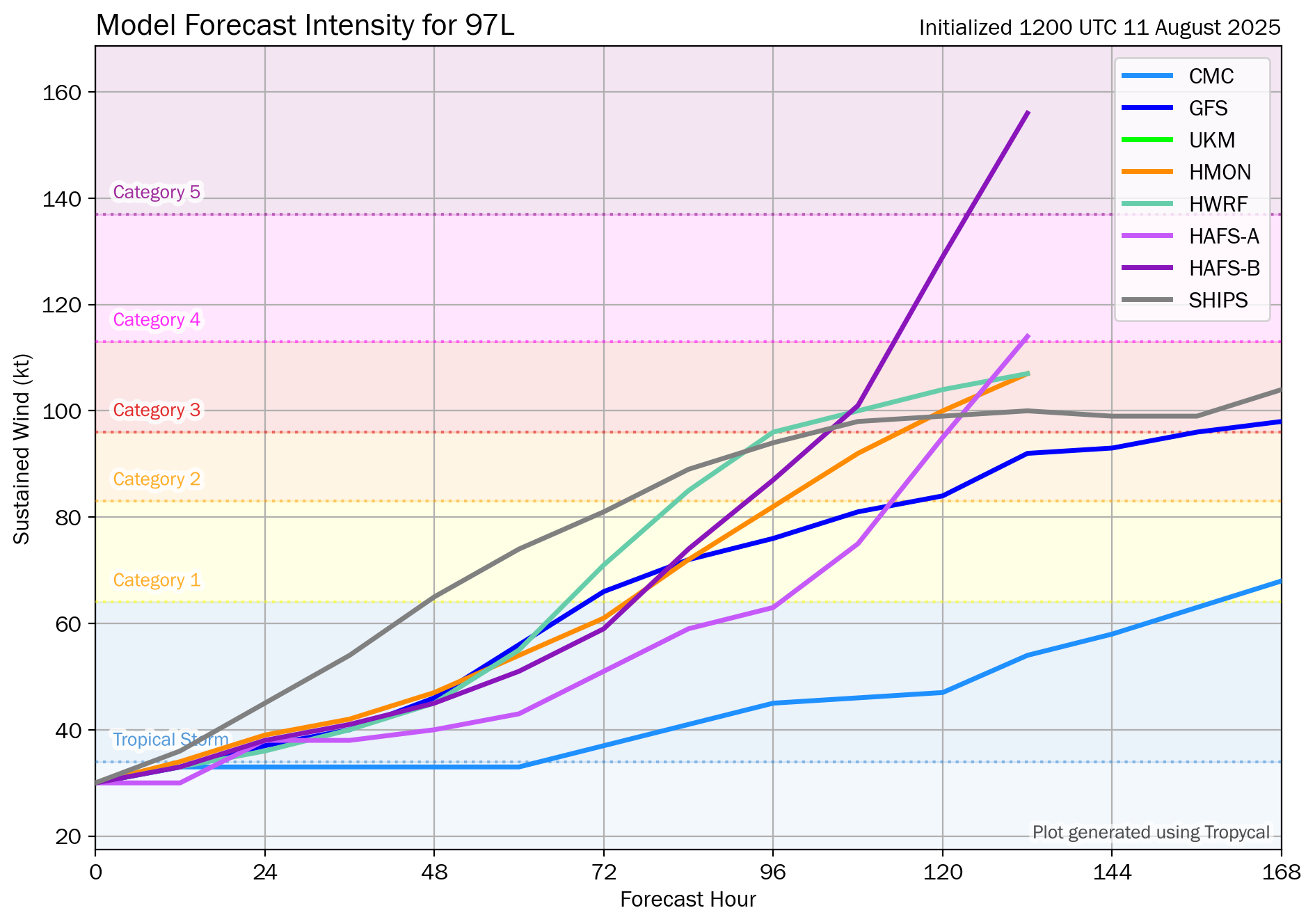
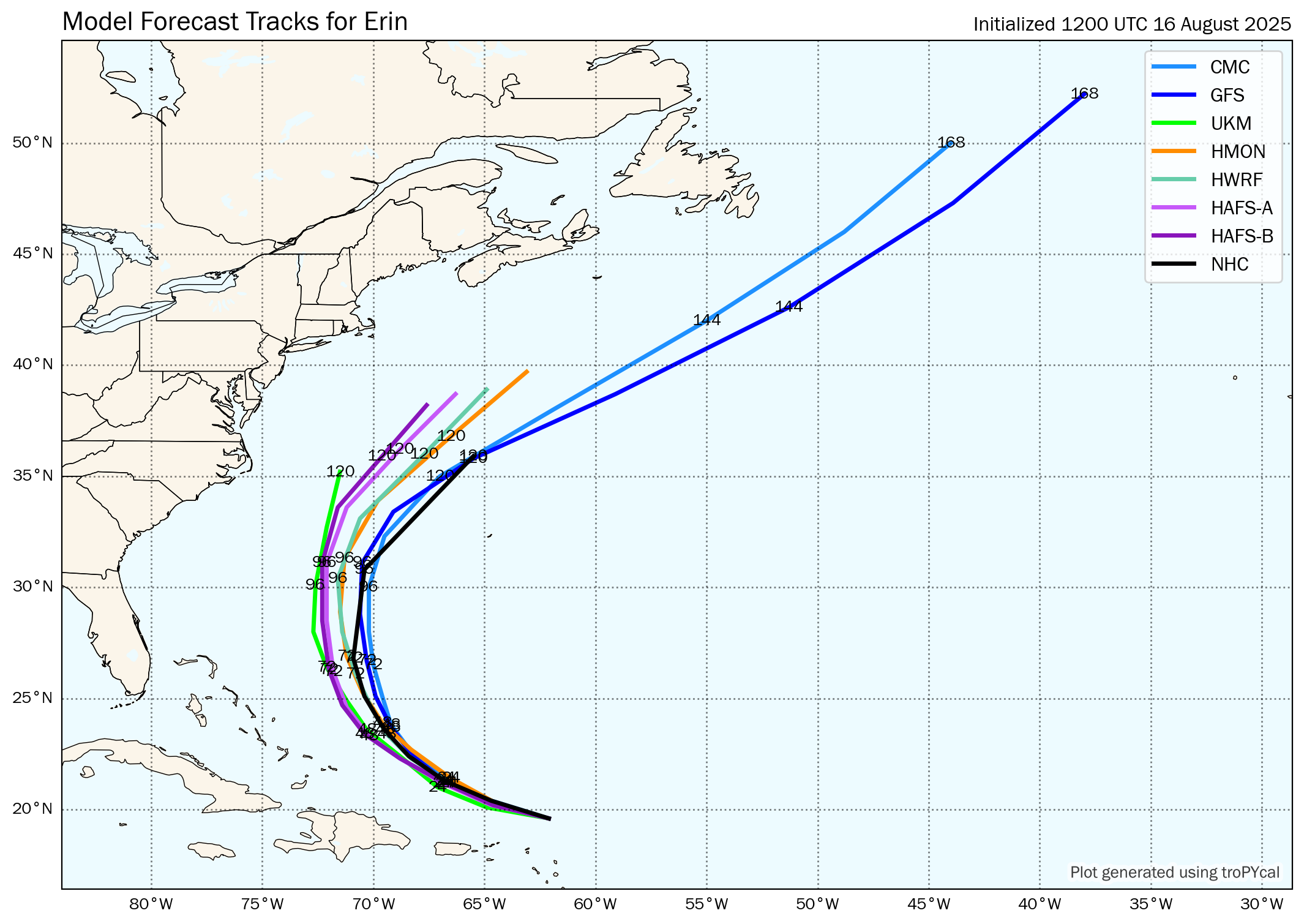
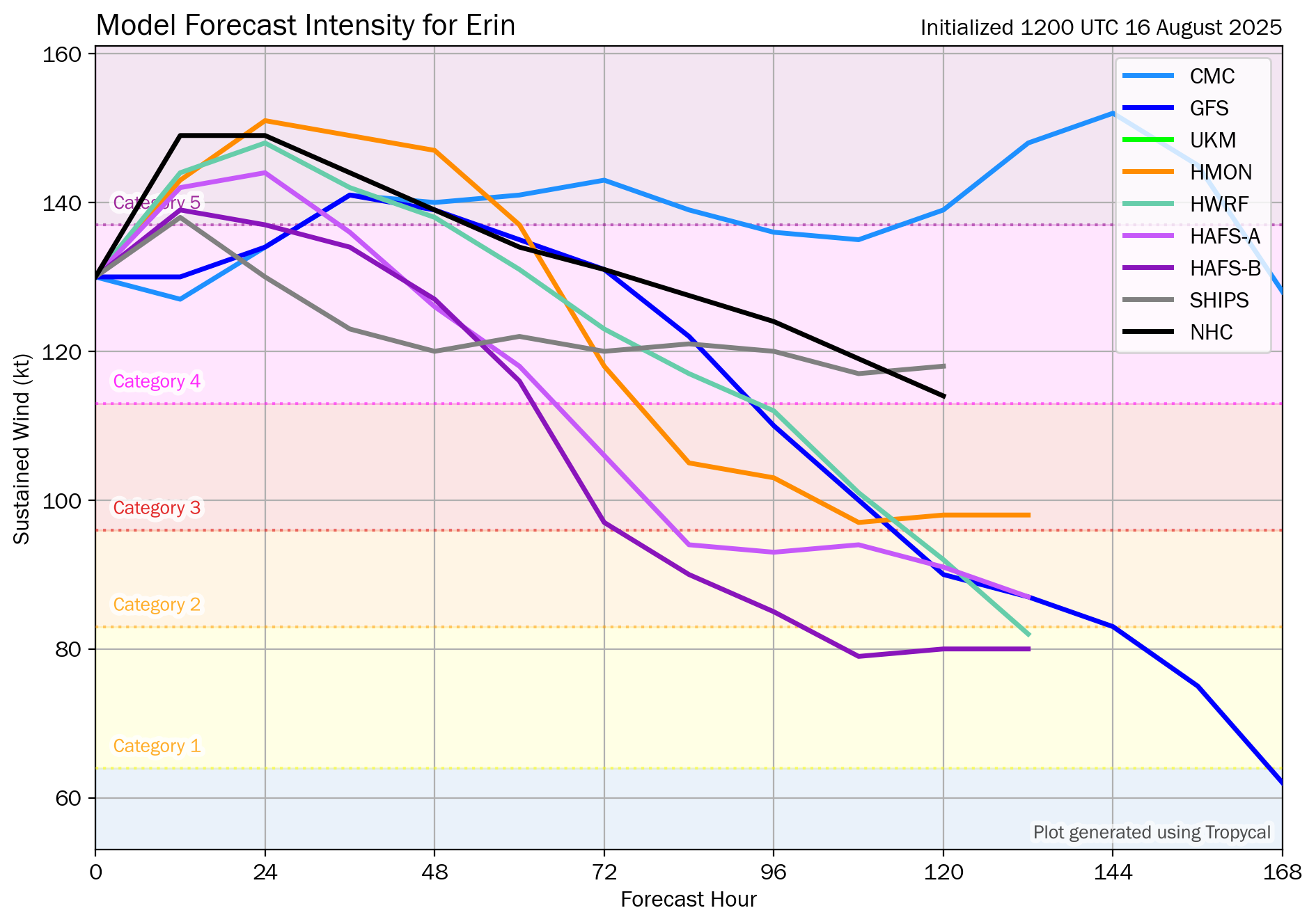
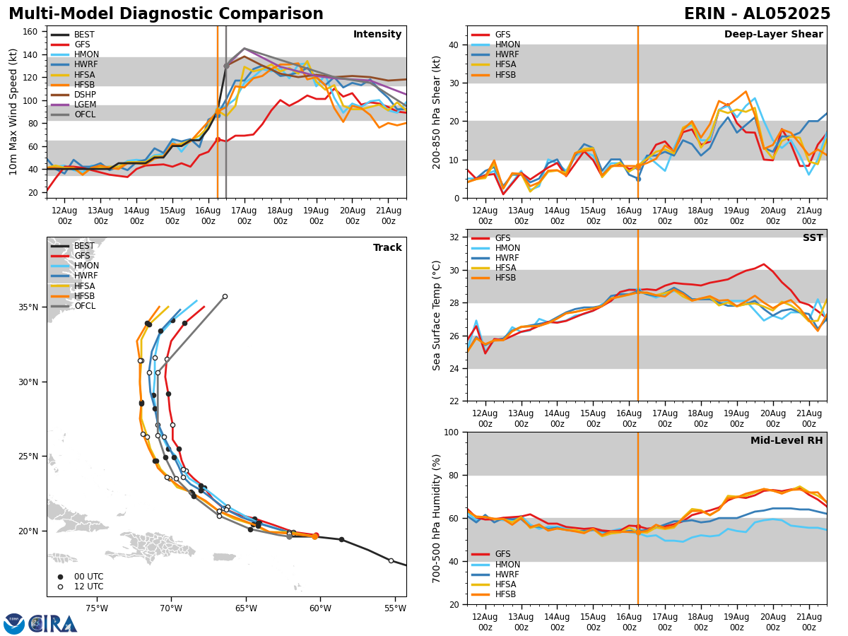
Model Guidance: Erin is currently tracking to the south of all of the European ensemble and GFS ensemble guidance members. The reason why the model guidance tracks are further north than what Erin is actually moving is due to how strong it has become. This is a factor in the forecast that is going to need to be watched very, very closely.
Looking at the model guidance reveals that the more eastward track of the GFS model is due to the model forecasting a weaker storm. The European model shows a stronger storm and thus a more westward track. Since Erin is so strong right now and is expected to remain a very powerful hurricane for at least the next couple of days, the more westward tracks of the European model are preferred.
It should be pointed out that there are no ensemble members, including the ones that show Erin being a very strong hurricanes, showing a direct landfall in the Bahamas or along the East Coast of the United States. That said, the stronger ensemble members are the ones that show Erin tracking fairly far west in longitude before it turns to the north and northeast.
So, as of this morning, I am concerned that we are going to see additional shifts to the west in the forecast track of Erin leading to guidance showing a fairly close pass to the Bahamas and the Outer Banks of North Carolina.
Here Are My Thoughts: First things first, I fully expect that Erin will keep its Category 5 strength throughout the rest of today into Sunday. I also think that Erin will probably remain a powerful hurricane for the next few days.
The big question is when exactly will Erin make that turn to the northwest and then north & how far west will it track before it makes that turn.
The weather feature that will weaken the high pressure on its western side & cause Erin to make that turn is a low pressure trough now located in the Tennessee Valley. This trough is expected to push off of the Georgia coast in about a day or two. We are going to have to see how much Erin can beat back this weakness in the high pressure ridge & try to re-enforce the ridge to the north causing the hurricane to try to track further west.
So, while I do expect that Erin will probably make that turn to the northwest and then to the north in a couple of days from now, it’s possible that it could get to 72 to even 75 West Longitude before it turns out to the northeast. If this occurs, it would lead to a very brush with the North Carolina Outer Banks around Wednesday or so.
My opinion is that Erin poses more of a threat to the Bahamas and the Outer Banks of North Carolina than to Bermuda.
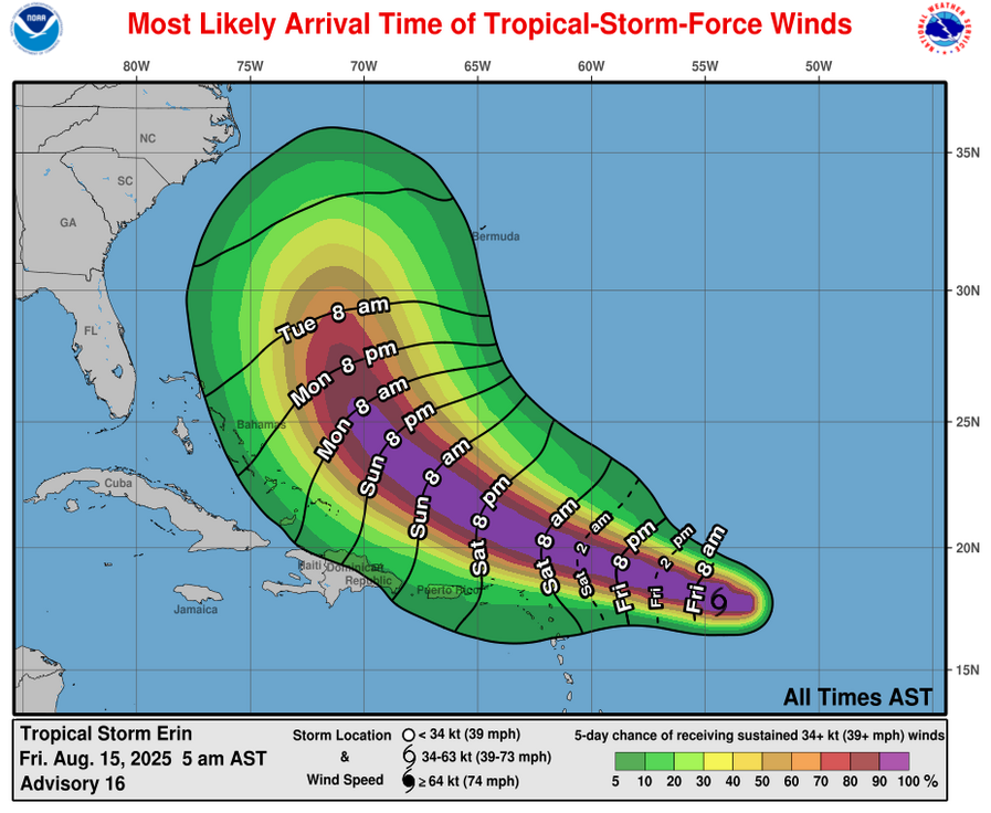
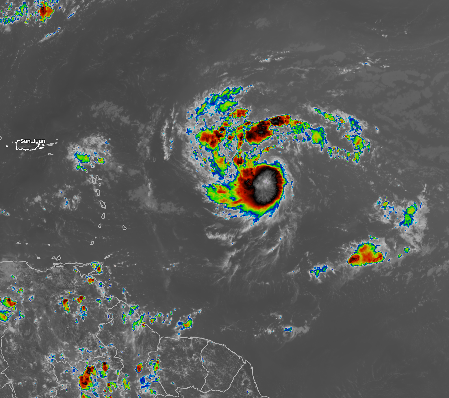
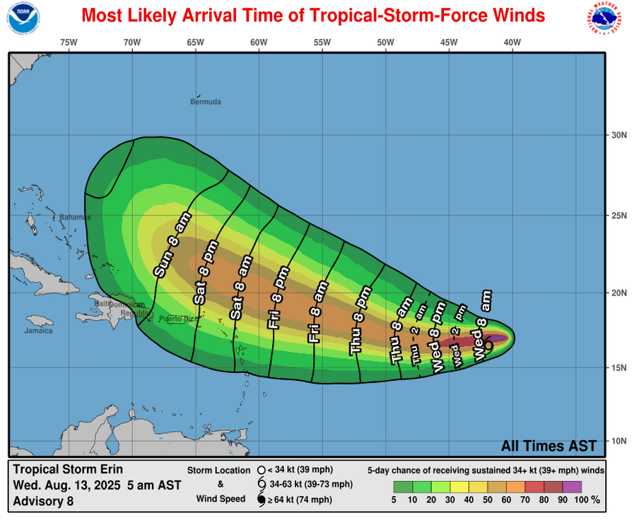
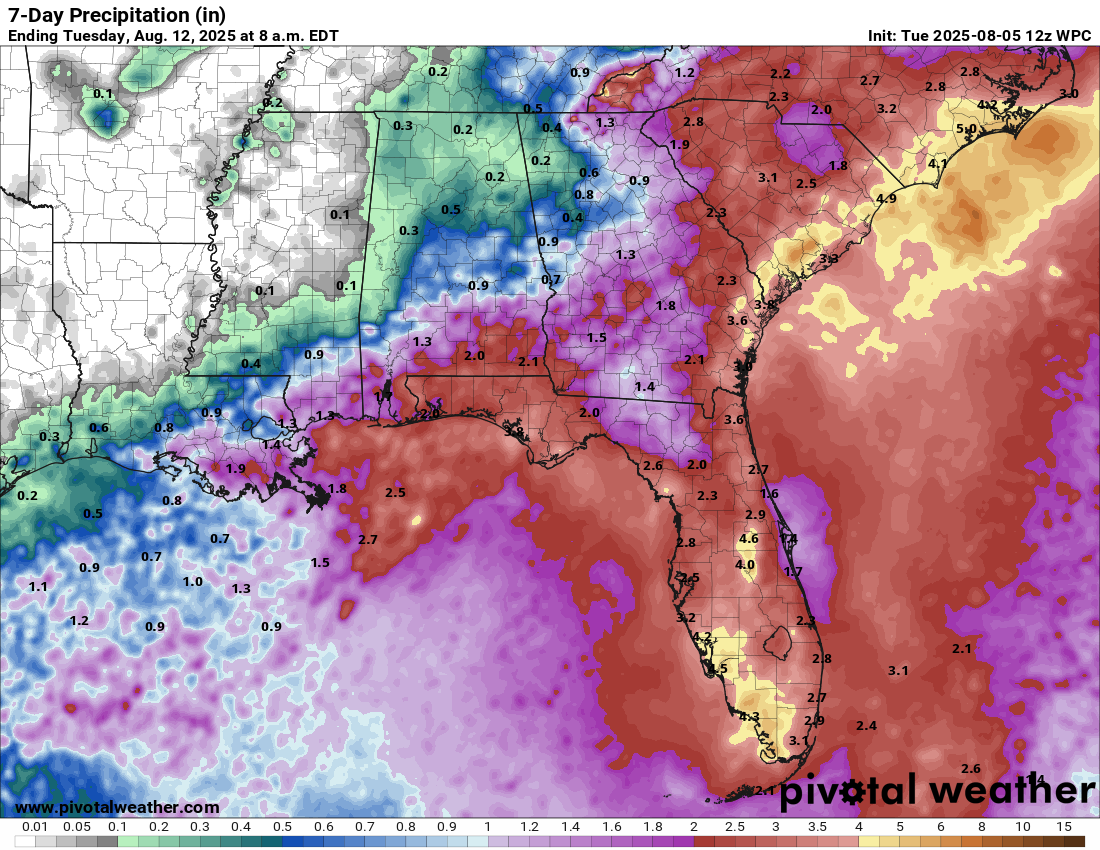
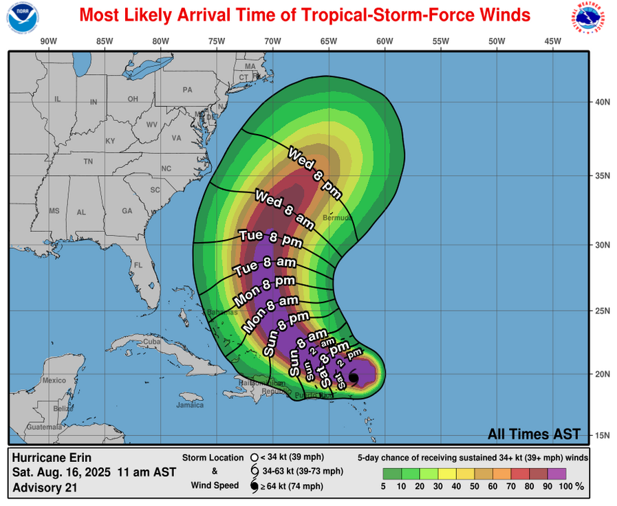
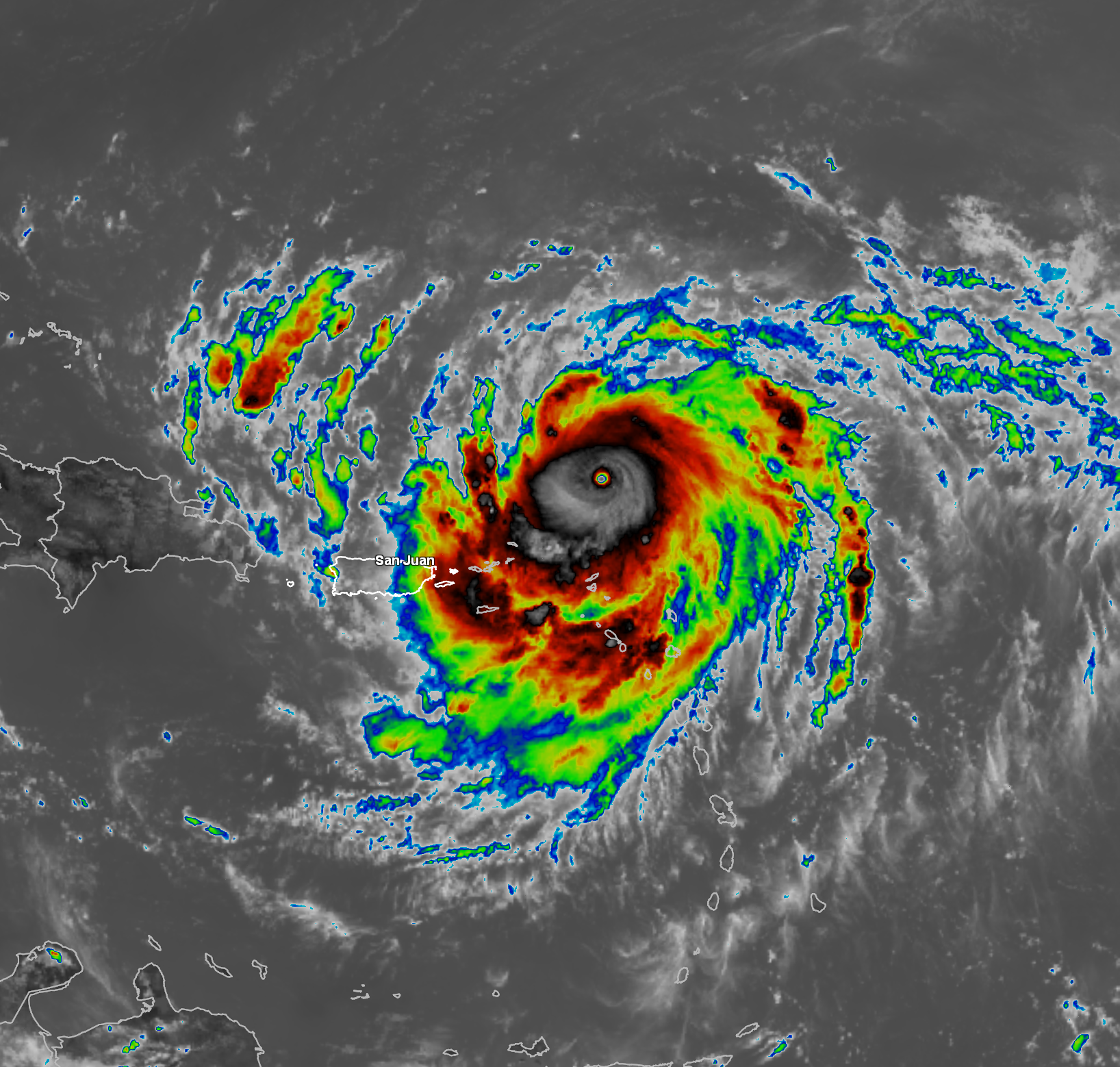
For Those Of You In The Northern Leeward Islands, The Virgin Islands, Puerto Rico & Hispaniola – Even though Erin is passing to the north of the northeastern Caribbean, its outer rain bands will continue to affect the northern Leeward Islands, the Virgin Islands this afternoon into tonight. These outer rain bands will spread across Puerto Rico and Hispaniola later this afternoon and persist through tonight and early Sunday.
Locally heavy rain, localized flooding, some gusty winds and high surf can be expected with these rain bands.
As For The Bahamas: I do think that Erin will pass to the east of the Bahamas on Monday night and Tuesday, but the passage of the hurricane’s eye could be fairly close to the eastern Bahamas. My current take is that Erin’s eye may pass about 100 miles or so to the east of the eastern Bahamas.
This means that this could be close enough for the eastern and northern Bahamas to be impacted by tropical storm conditions during Monday into Tuesday.
How close Erin gets to the Bahamas is something that will need to be watched extremely closely.
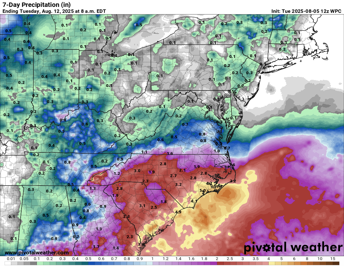
For The East Coast Of The United States & Particularly The North Carolina Outer Banks: Even though Erin is tracking south of all of the forecast models, I still think that Erin will very likely pass offshore of the East Coast of the United States from Wednesday to Friday of next week. I do think that there’s the possibility that Erin could get close enough to the outer banks of North Carolina to bring tropical storm conditions around Wednesday into Thursday.
My thinking as of this morning is that Erin might track as close as 100-150 miles or so offshore of the North Carolina Outer Banks during Wednesday into Thursday. If Erin does get that close, it could lead to bands of heavy rain to affect far eastern parts of North Carolina and the outer banks of North Carolina on Wednesday into Thursday. Some tropical storm force winds are possible on the North Carolina Outer Banks, but any hurricane force winds will very, very likely stay well offshore.
The much bigger impact from Erin along the entire US East Coast is going to be very high surf, dangerous waves and rip currents throughout next week.
For Bermuda: It continues to look very likely that Erin will pass far enough west of Bermuda to not be a direct impact. The very large size of Erin could lead to some of the outer bands of rain to affect the island around the middle part of next week.
Finally, as I mentioned yesterday, it’s going to be extremely crucial for that weakness in the high pressure ridge to develop over the next 2-3 days or so. In all likelihood, we will see that weakness develop and we will likely see Erin make that turn to the north and then northeast.
That said, until we actually see that turn to the northwest and north occur, all interests up and down the East Coast of the United States should continue to monitor the progress of Erin extremely closely. The areas that really need to watch Erin are the Bahamas and areas from eastern North Carolina & the North Carolina Outer Banks into coastal Virginia, coastal Maryland and Delaware.
Again though, the threat for a direct impact from Erin looks very low, as of right now.
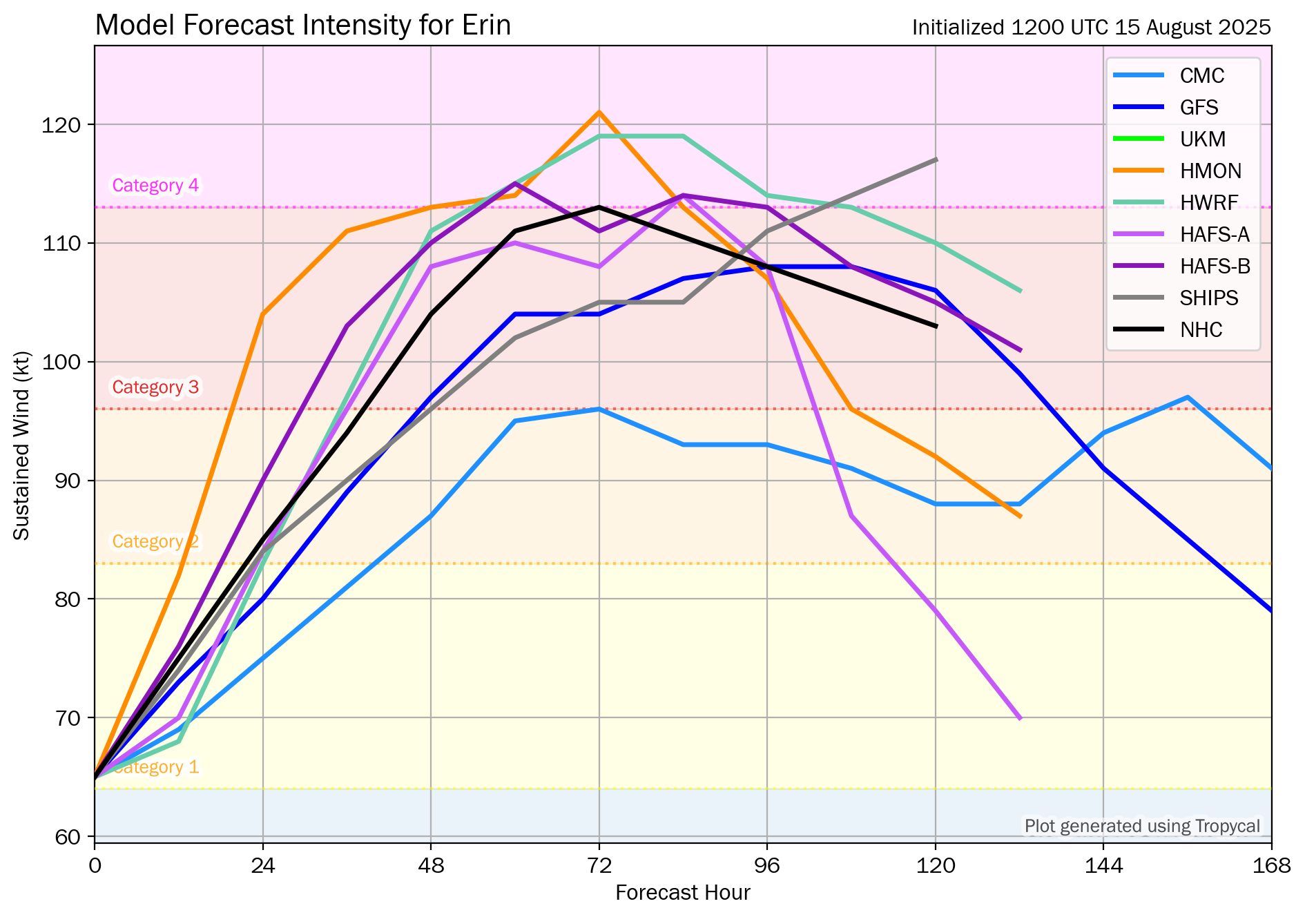
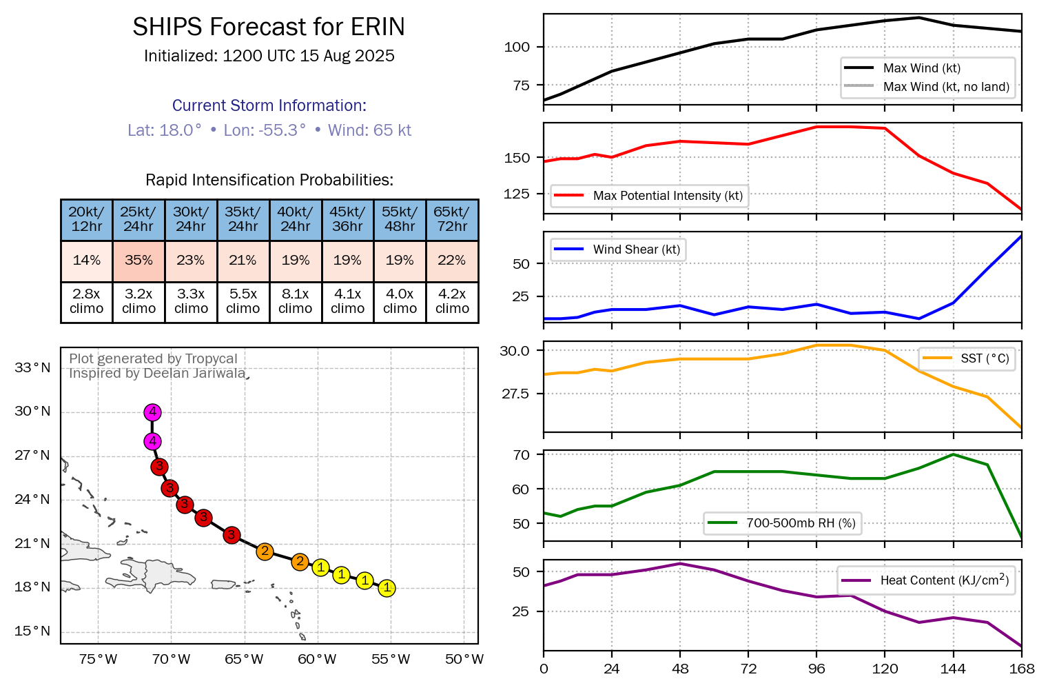
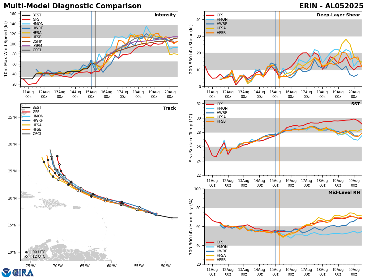
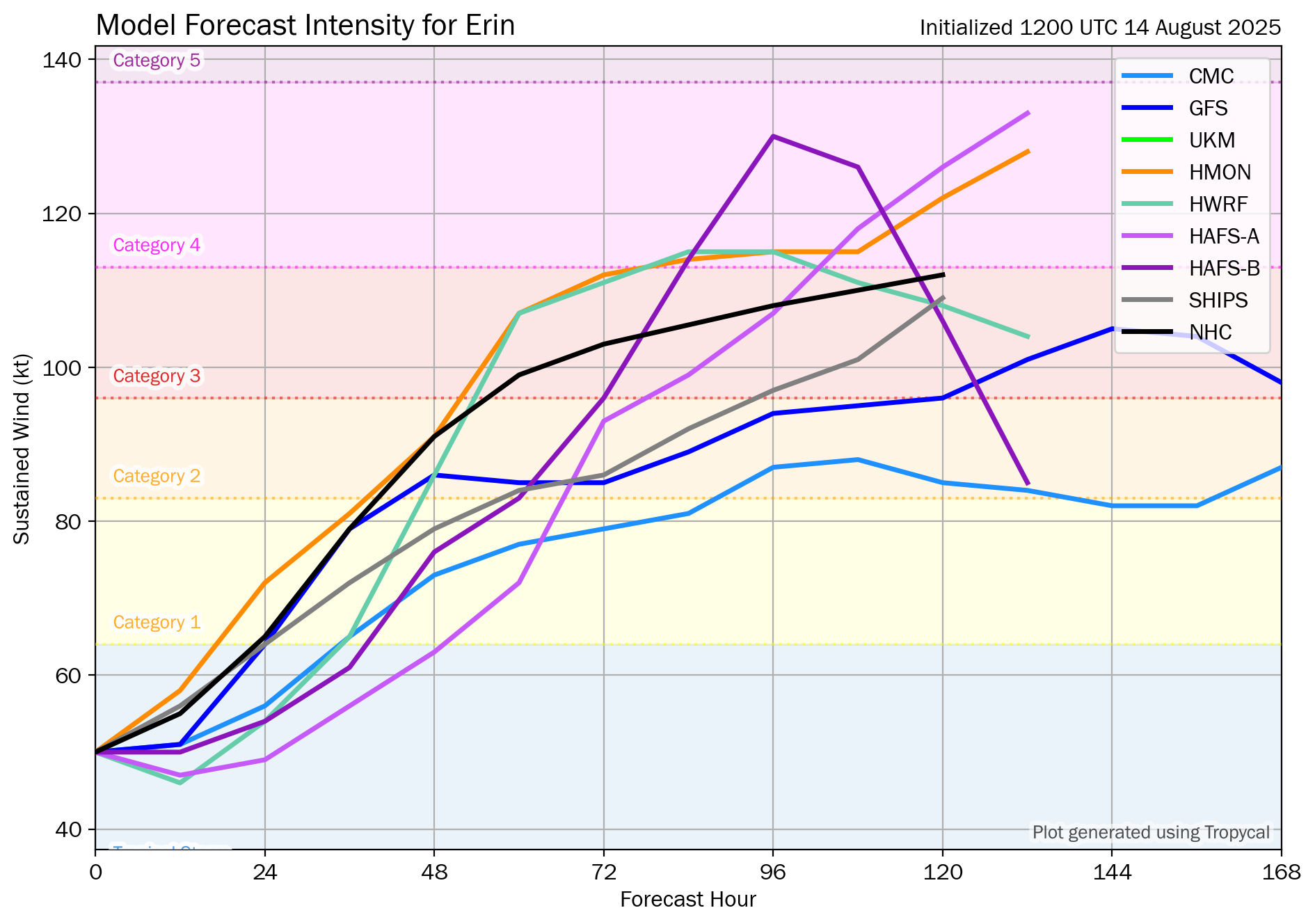
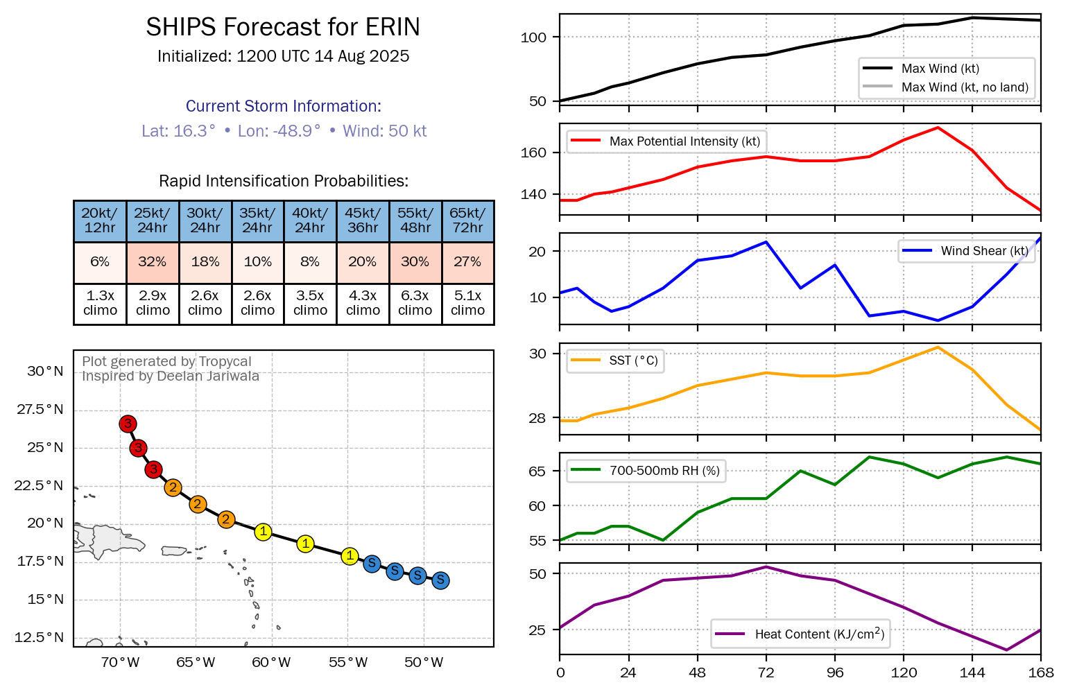
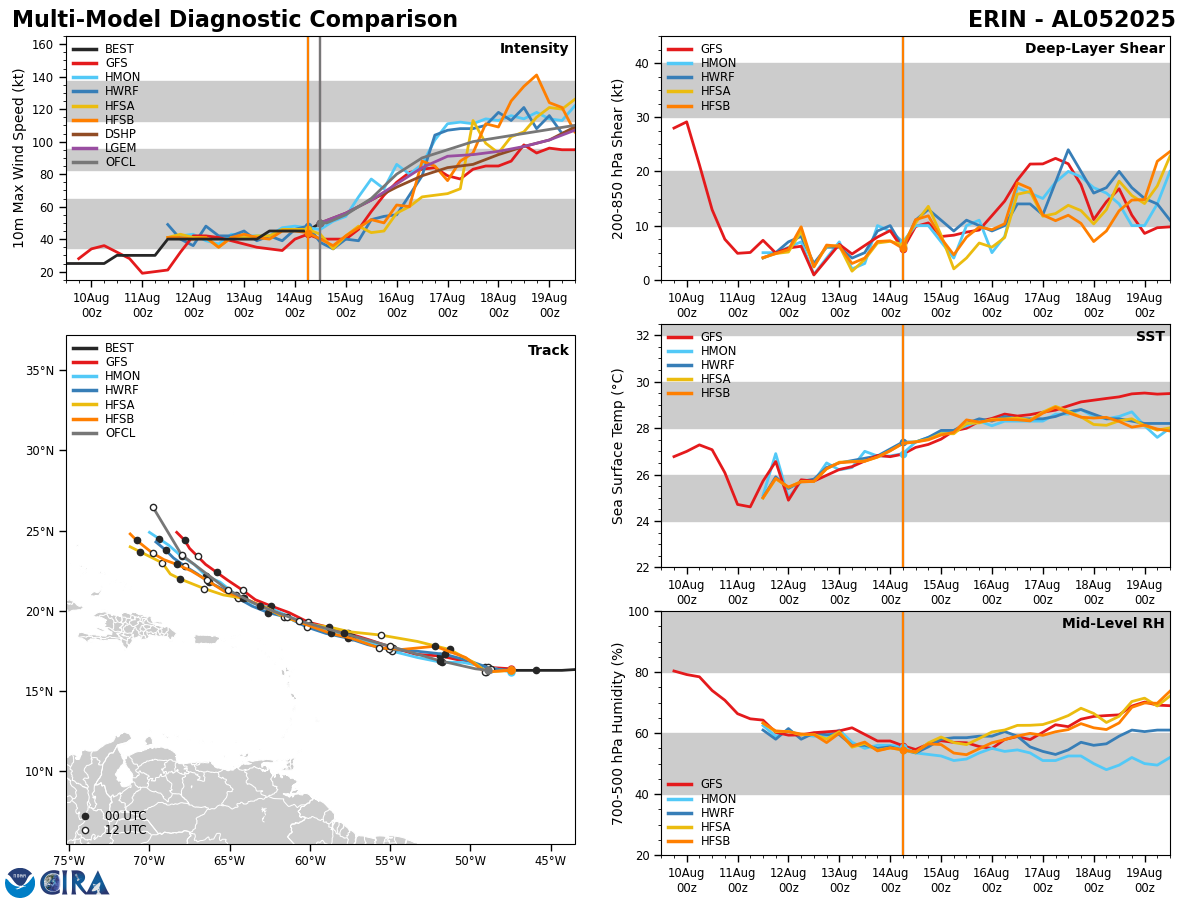
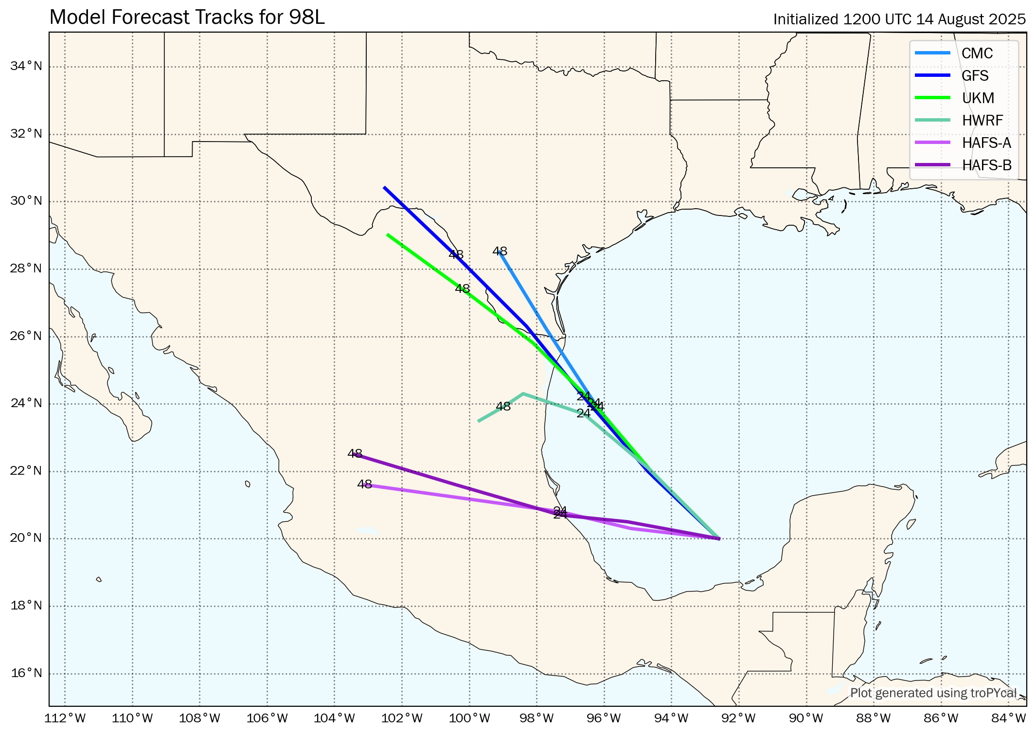
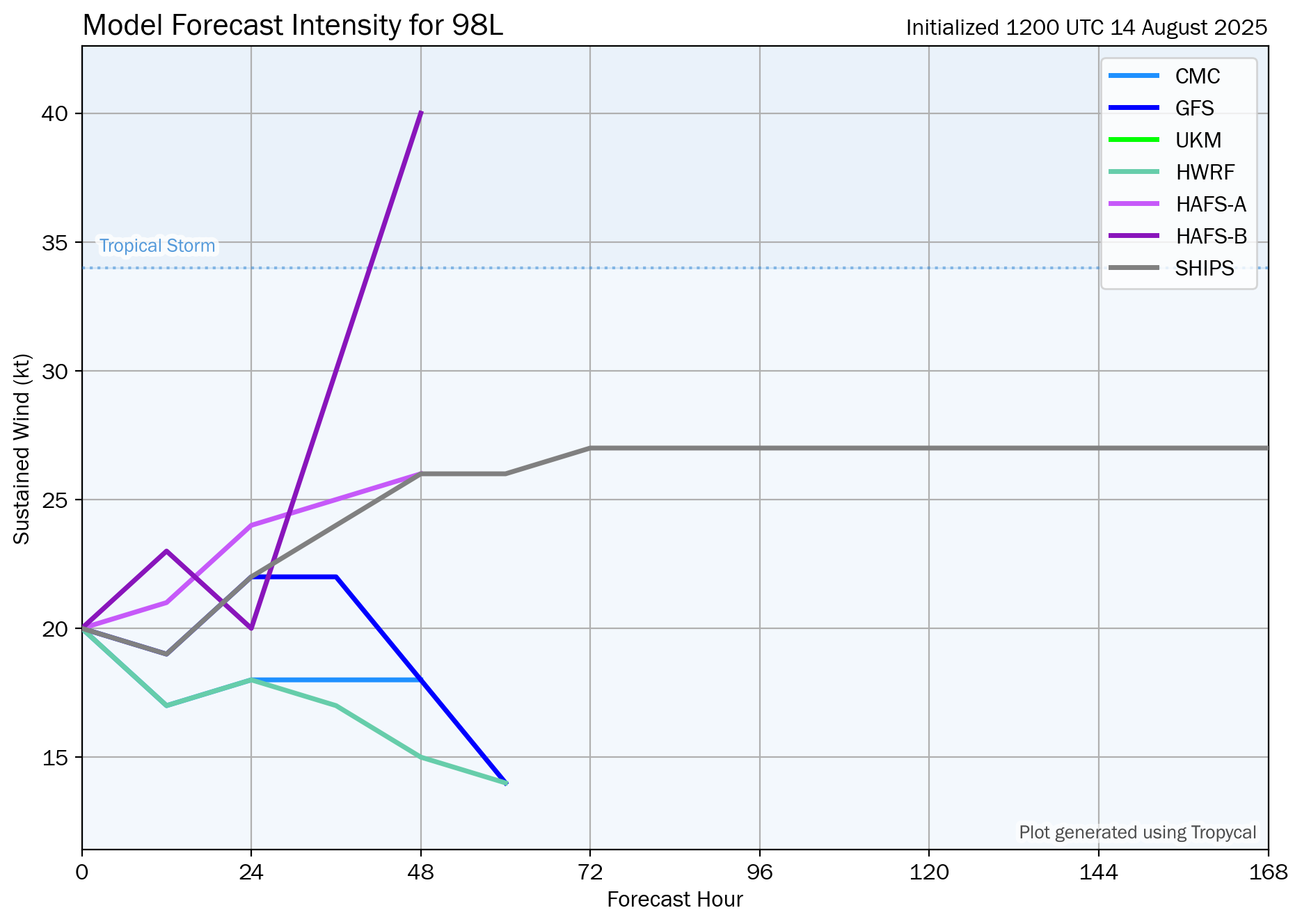
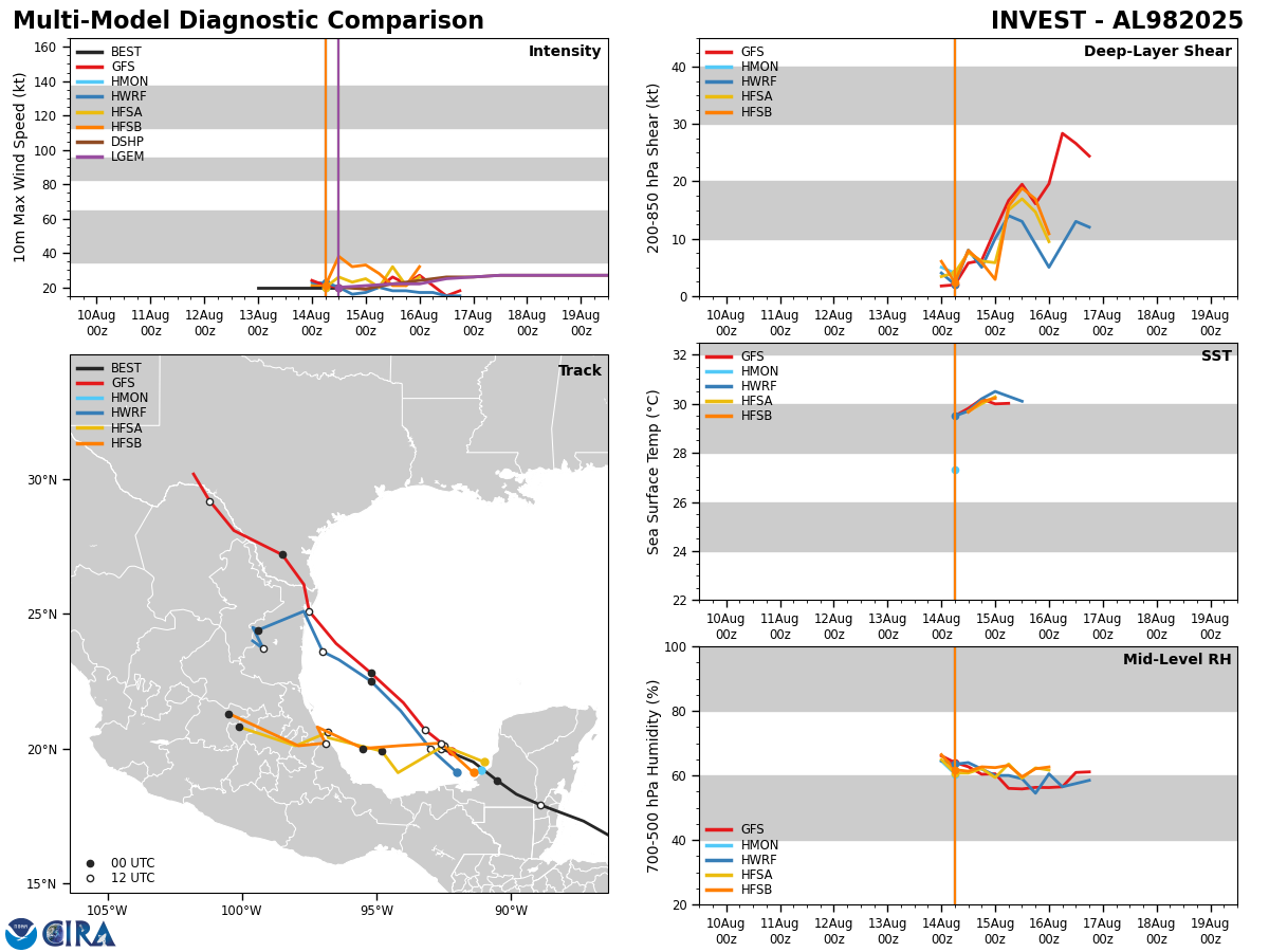
Model Track Forecast:
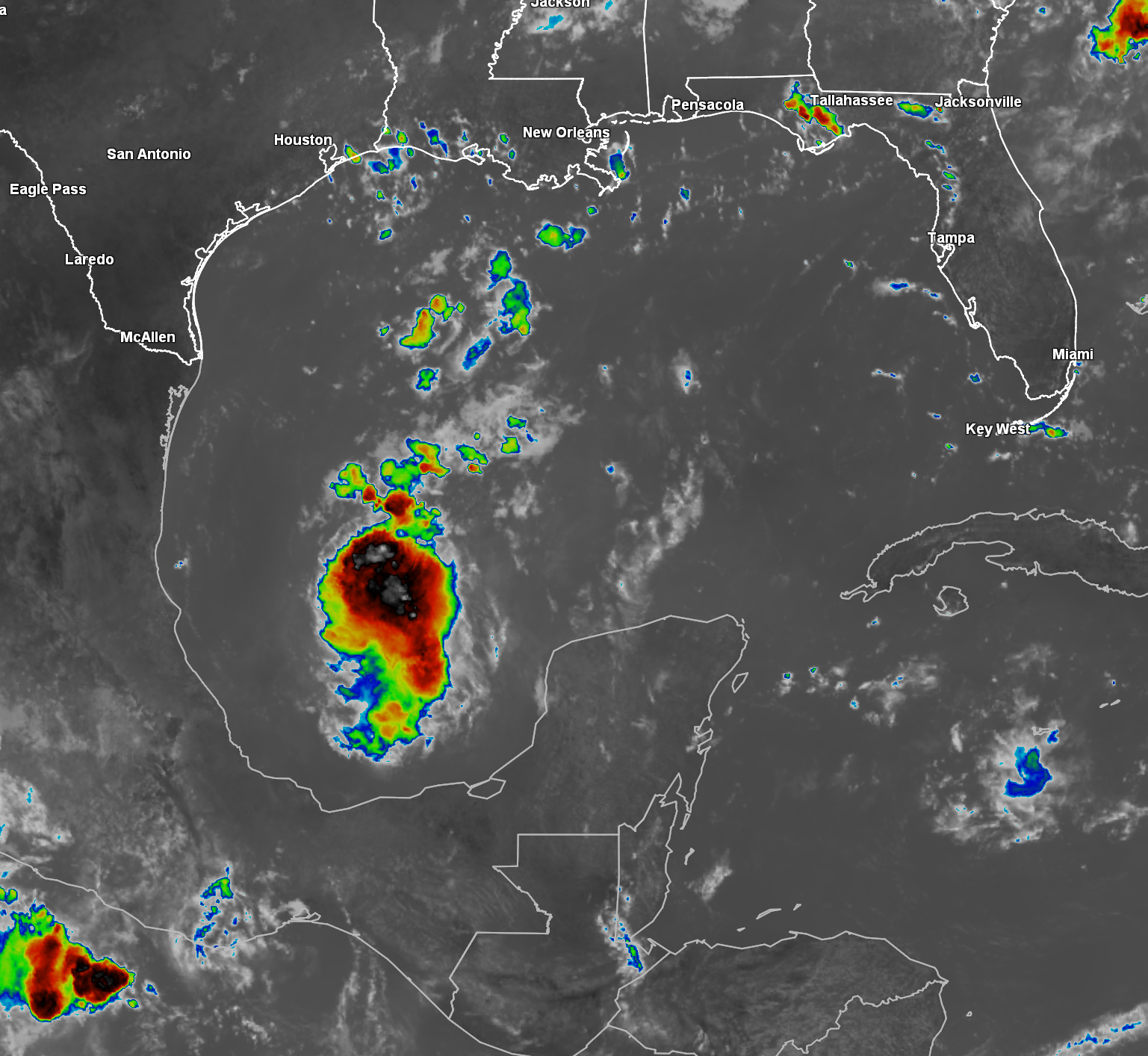
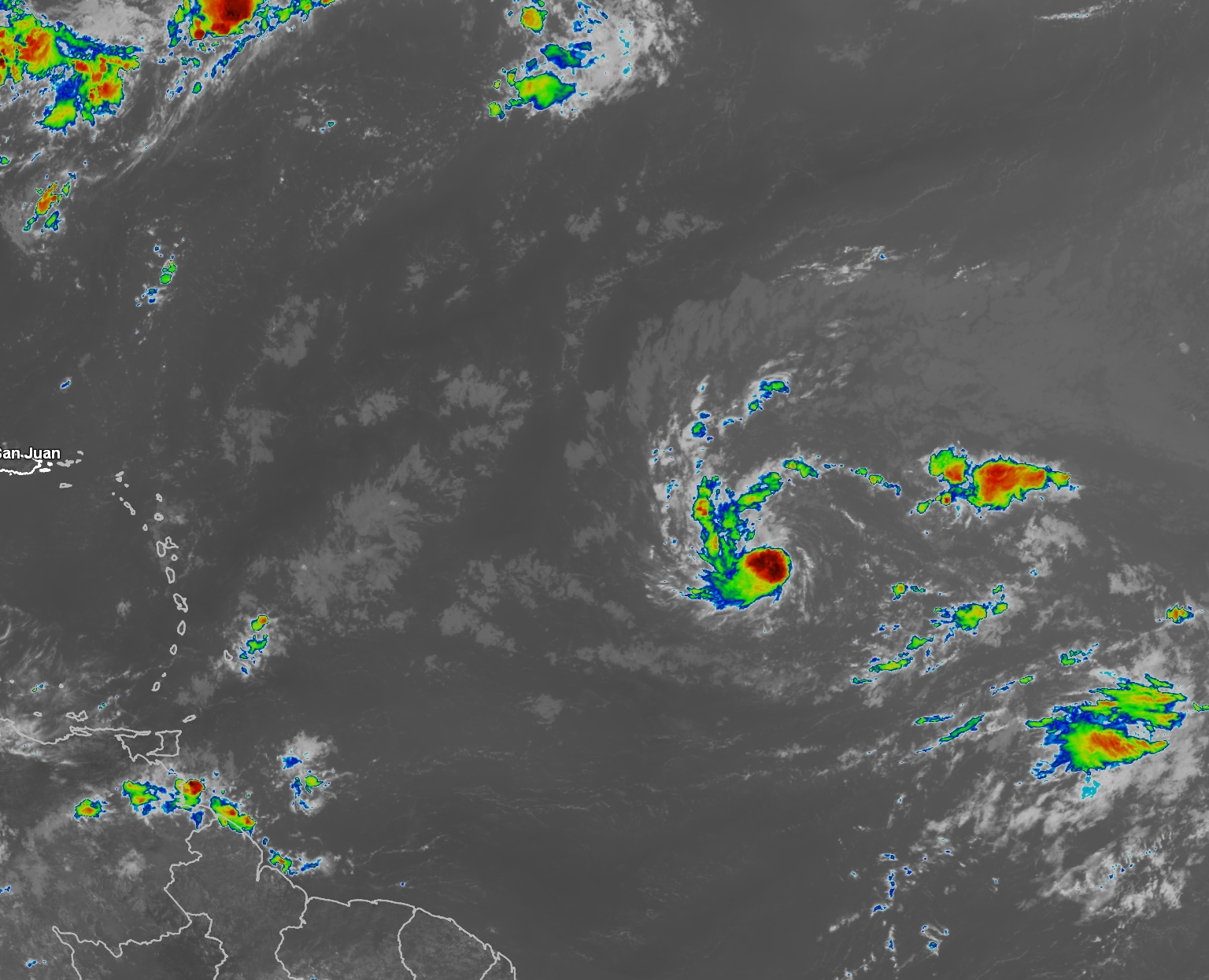
Satellite Imagery:
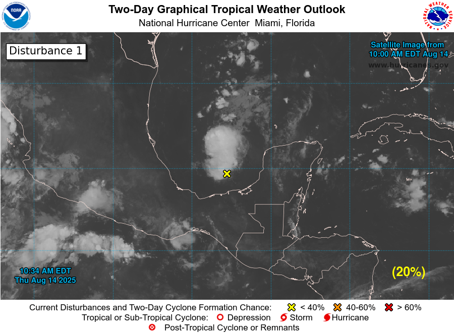
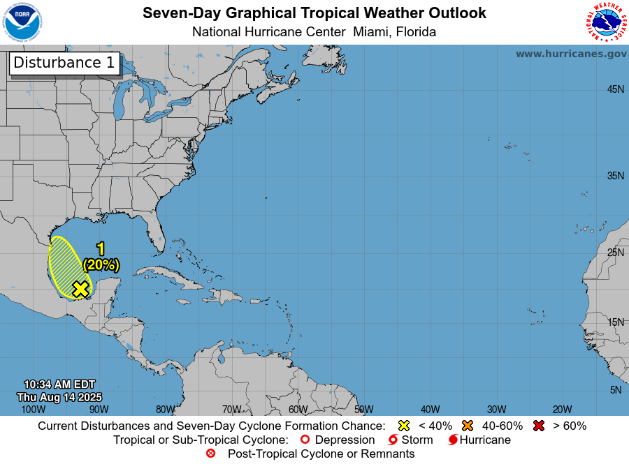
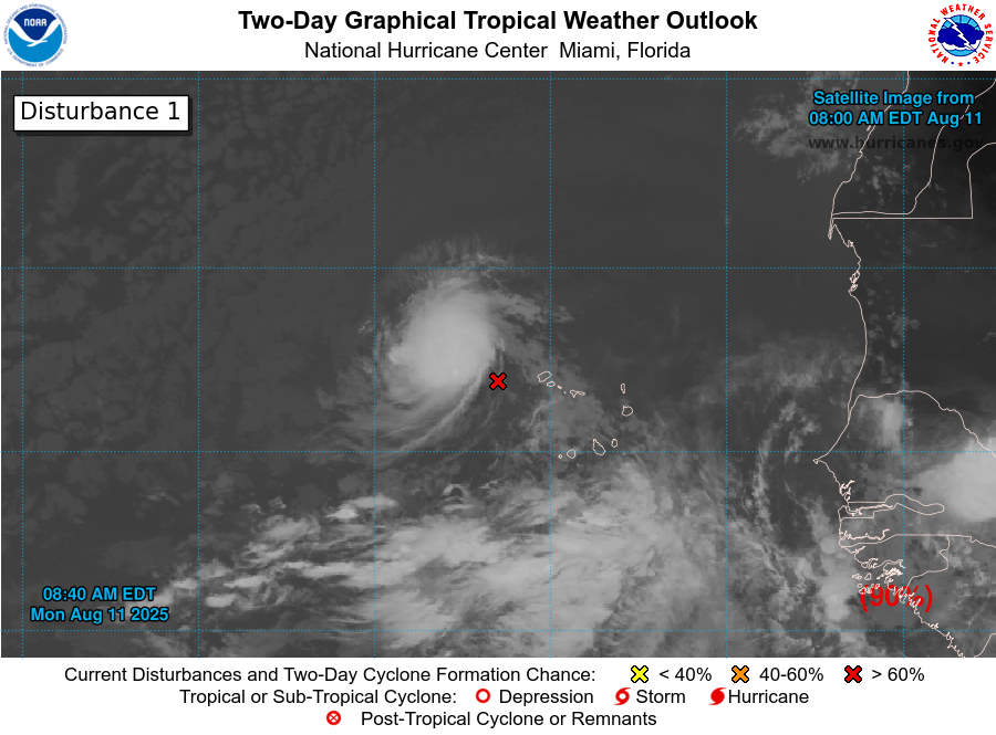
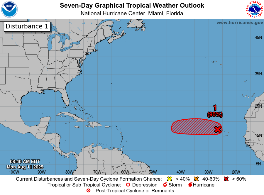
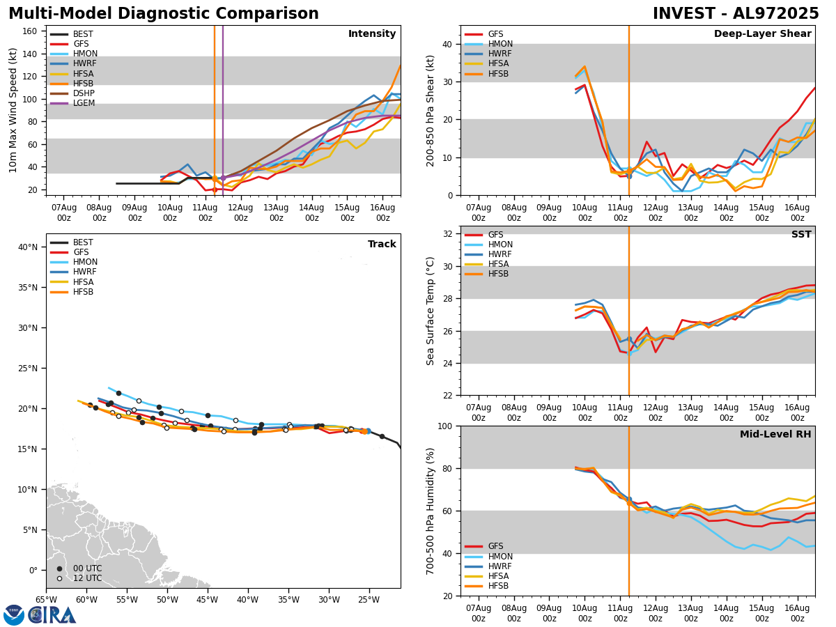
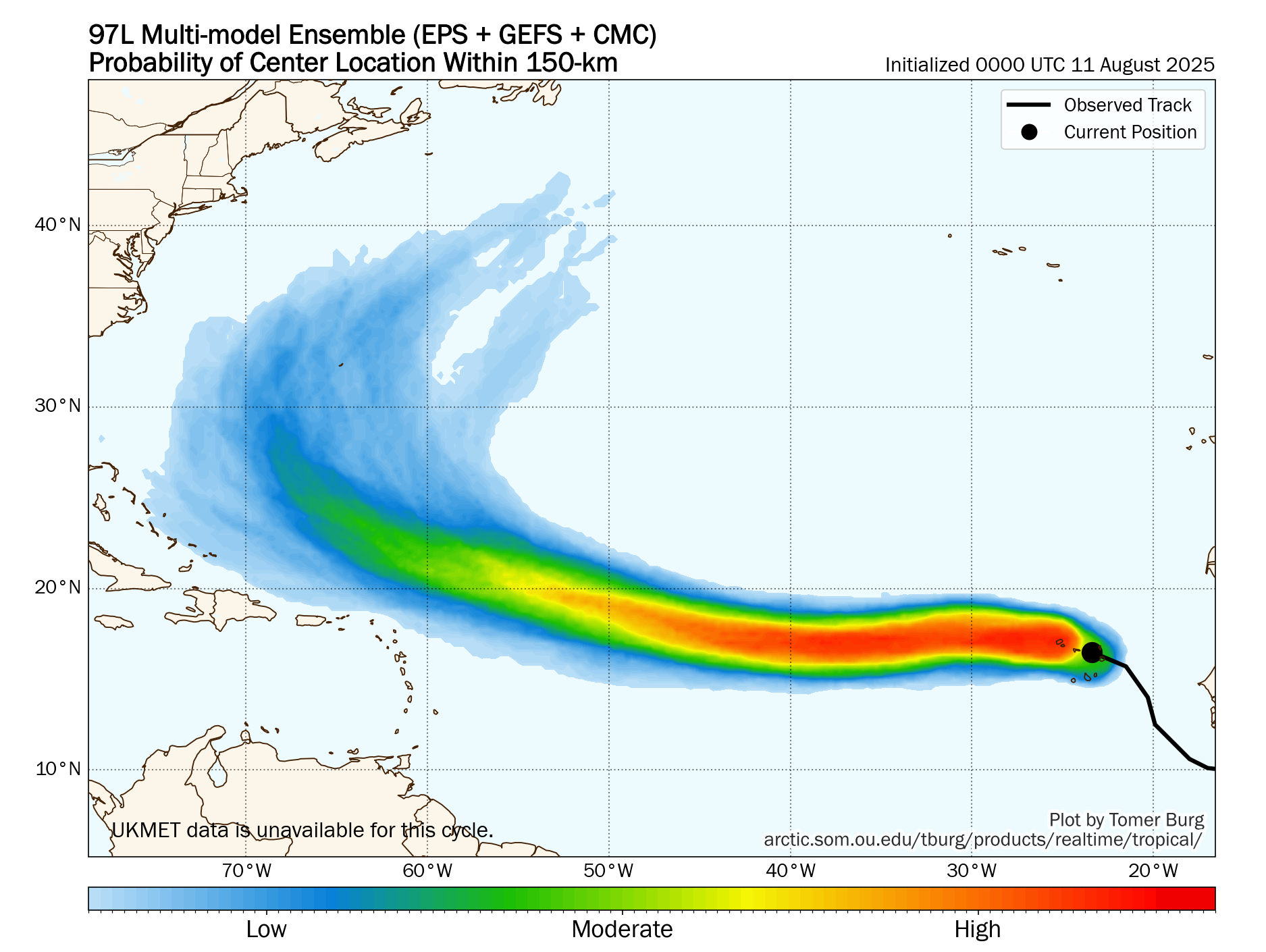
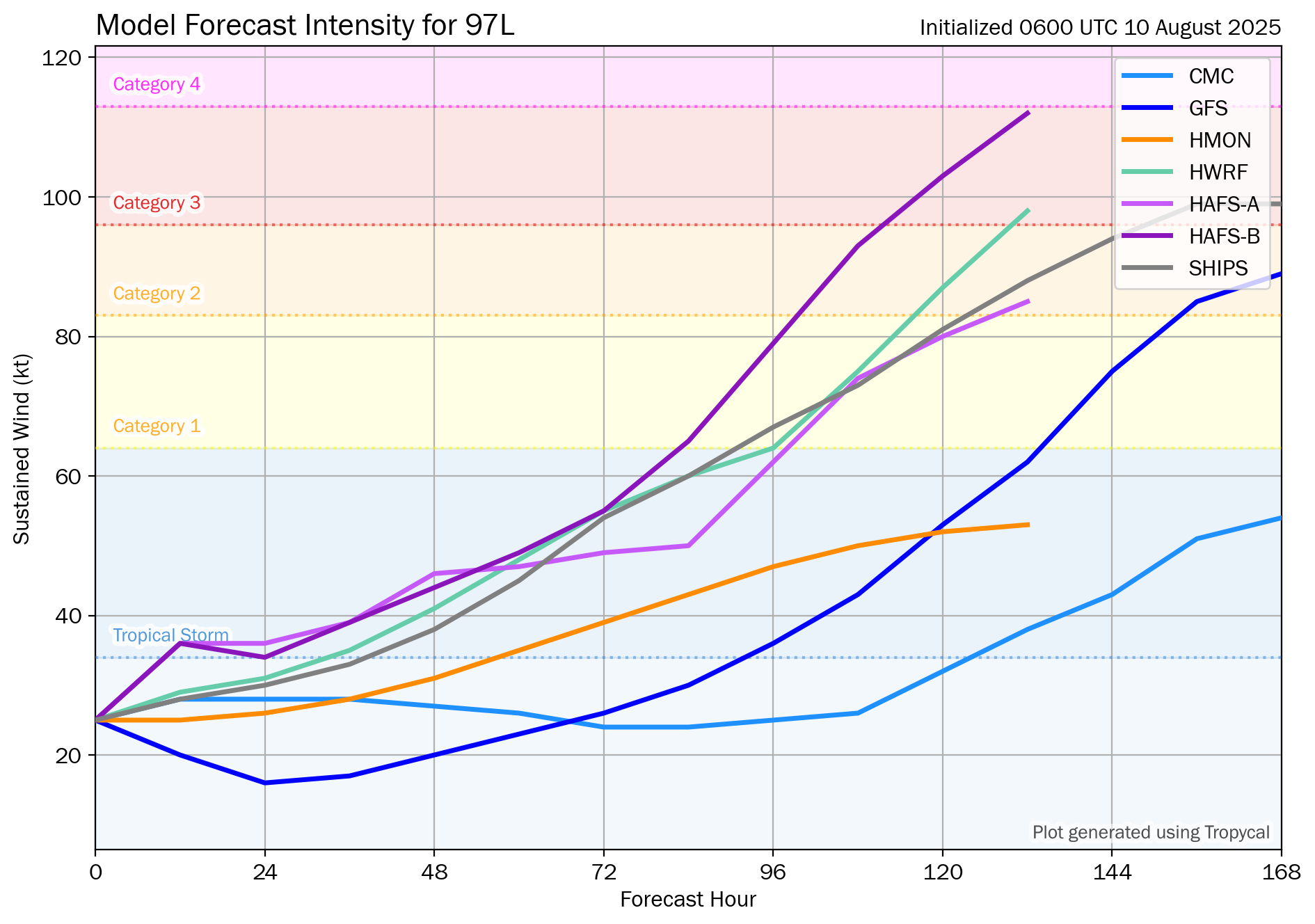
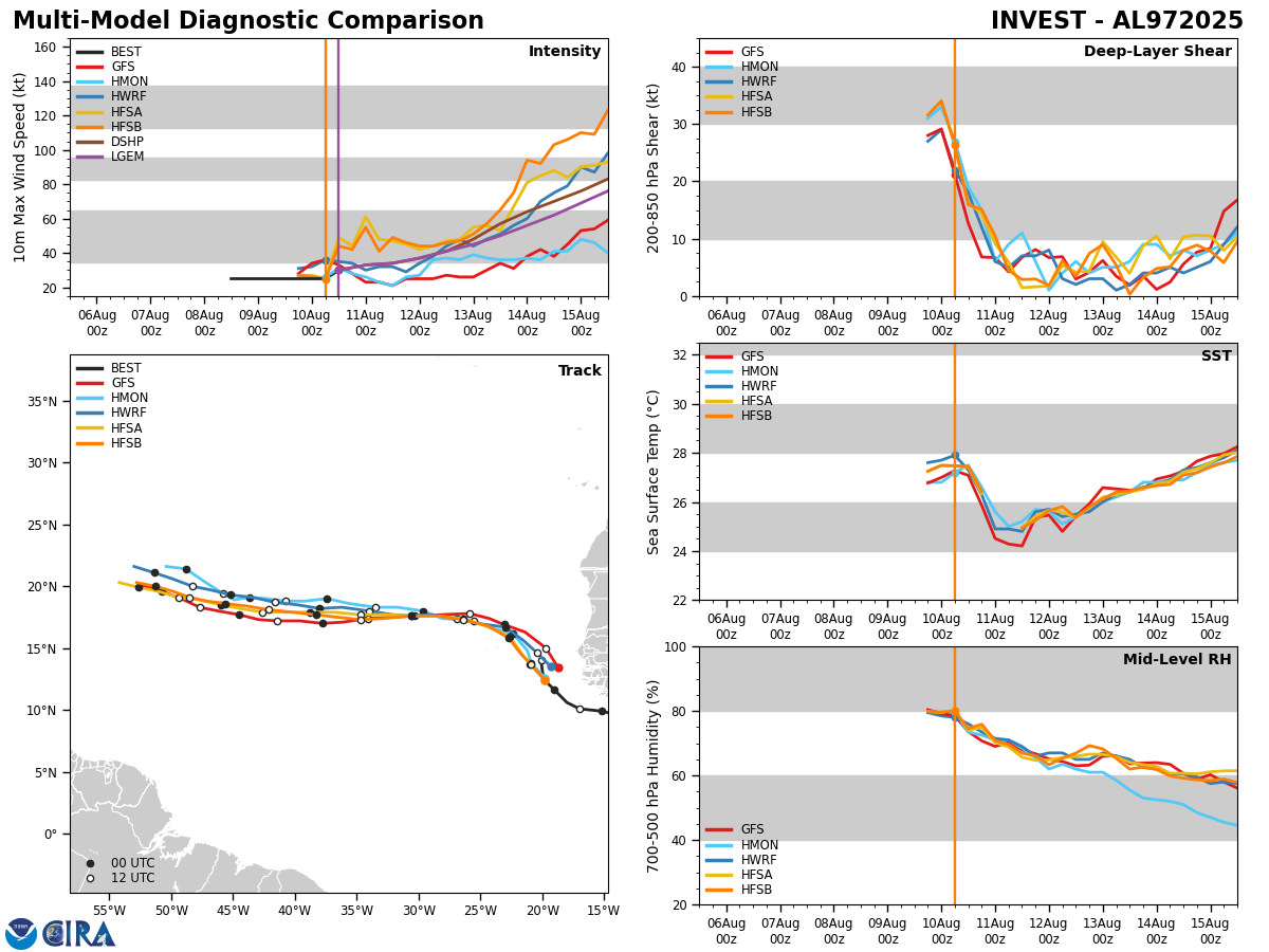
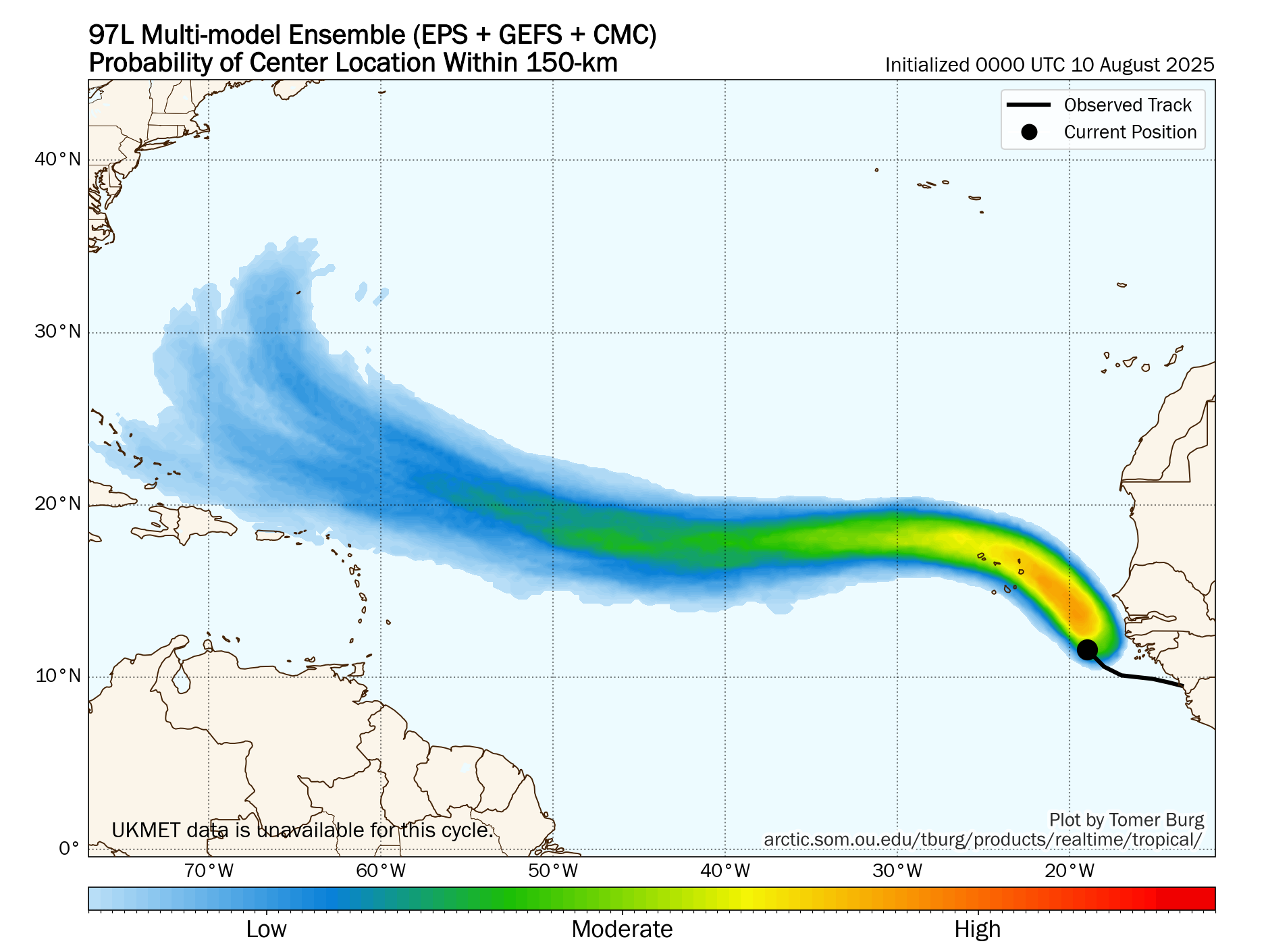
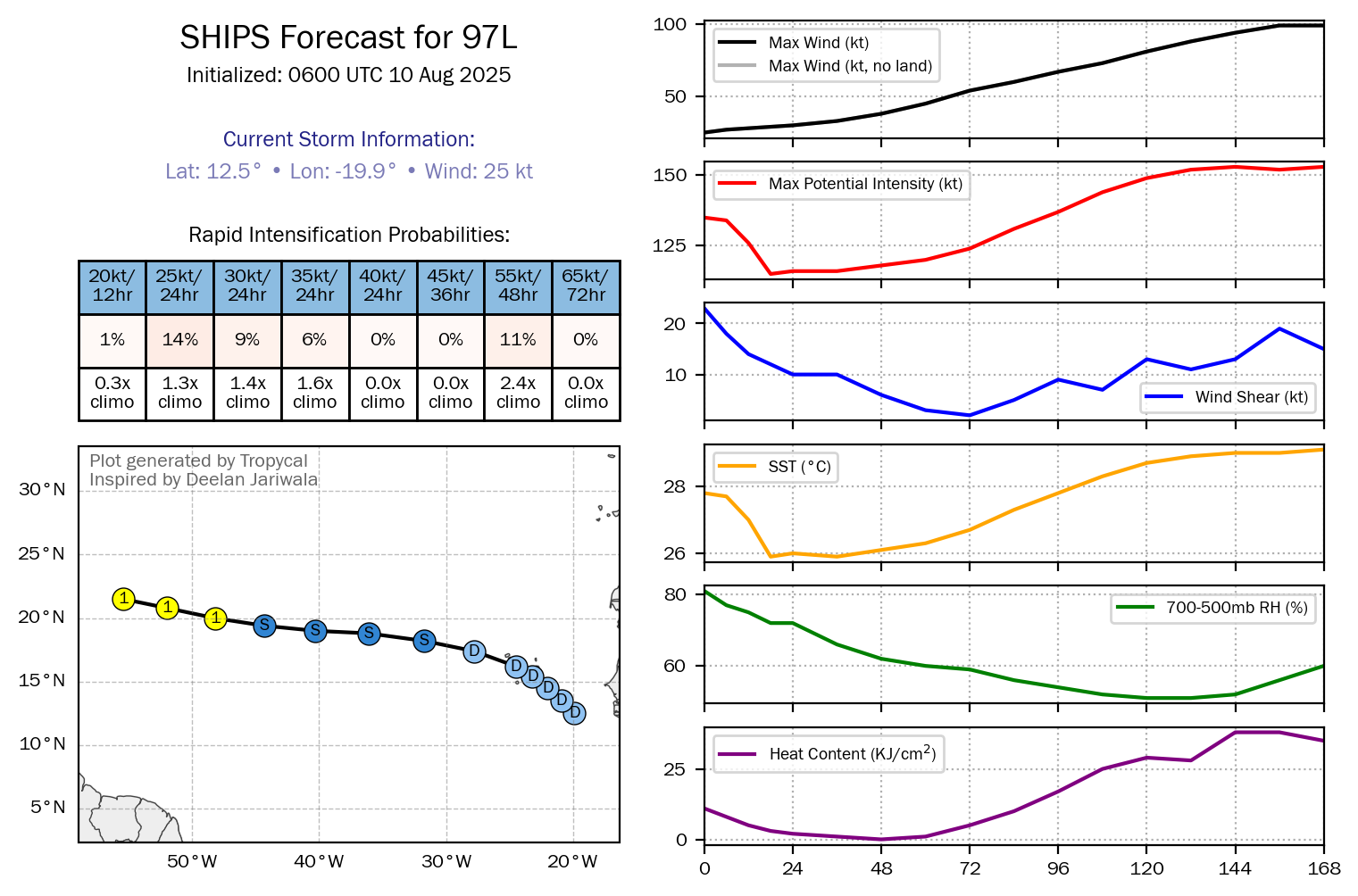
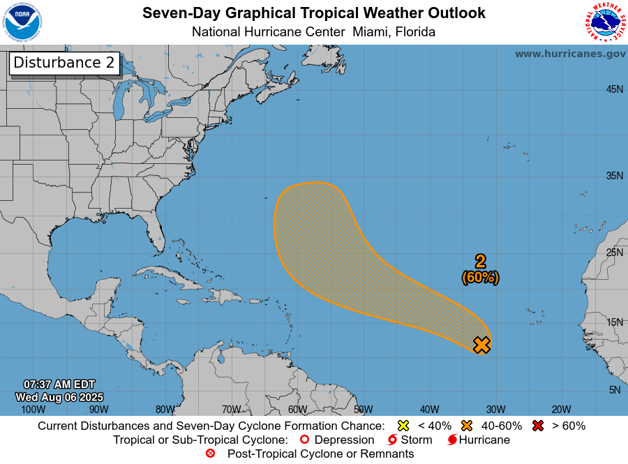
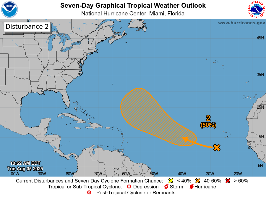
Two Tropical Waves Will Need To Be Watched Closely In The Eastern Atlantic Next Week: There are two tropical waves – one located near the west coast of Africa and the second located over western Africa – that will need to be watched very closely next week over the eastern Atlantic.
All of the model guidance and their ensemble members seem to be pointing towards the potential for at least one of these waves to develop as it heads westward reaching the Lesser Antilles at the end of next week. Additionally, the European ensemble model guidance are now showing upwards of a 50 percent chance for tropical development over the central Tropical Atlantic during the second half of next week.
It seems the model guidance are honing on the more western tropical wave (the only located right along the west coast of Africa) as the one to really keep a very close eye on, if you are in the Lesser Antilles and the eastern Caribbean.
The latest analysis of the environmental conditions over the central and eastern tropical Atlantic reveals that the conditions seem favorable for the development of any waves pushing westward. That said, we don’t know yet what the structure of the wave will be like & whether Erin’s outflow might impart any wind shear over the central and eastern Atlantic as it lifts northward.
That said, I do think the tropical wave now located near the west coast of Africa is one to really keep an eye on as it could not only stay pretty far south in latitude, but also develop into a tropical system as it heads westward. This could lead to a threat to the Lesser Antilles late next week & it’s something to closely watch in the coming days.
The next tropical weather discussion will be issued on Sunday.