

An area of low pressure is expected to form along the tail end of a stalled frontal boundary over the southern Gulf during next week. There is a very low possibility that this low pressure system could develop into a tropical system later next week into next weekend over the southern Gulf. It seems more likely that this low pressure system may end up remaining non-tropical in nature.
A look at the model guidance reveals that the chances that they are showing for tropical development seems to be decreasing as compared to what they were showing over the last couple of days. The Google Deep Mind model now shows about a 25 percent chance for tropical development of the southern Gulf low pressure system and the European ensemble model guidance is showing about a 30-40 percent chance of development in the southern Gulf late next week and next weekend.
One big reason why the model guidance are showing a lower chance for tropical development is likely due to the likelihood that there will be some very strong wind shear located to its north across the northern Gulf. This leads to anything that tries to develop to immediately run into a very unfavorable environment. So, even if we do see a tropical system develop in the southern Gulf later next week and next weekend, it would be short-lived.
My Thinking As Of Today Is that we will definitely see a low pressure system fester in the southern Gulf during next week. It may end up being in an environment that’s favorable enough for some development into a tropical system later next week and next weekend. As of right now, I’m putting the chances of tropical development at around 30 percent or so.
Now, where could this system head? It is possible that an upper level trough of low pressure could dig into the eastern United States during next weekend. Should this occur, it could lead to this system to be pulled towards the north or northeast and head towards the central or eastern US Gulf Coast. Even if this occurs, any tropical system would likely transform back into a very messy non-tropical low pressure system that brings mostly heavy rain to the central and eastern US Gulf Coast during next weekend.
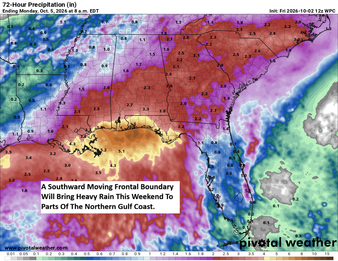
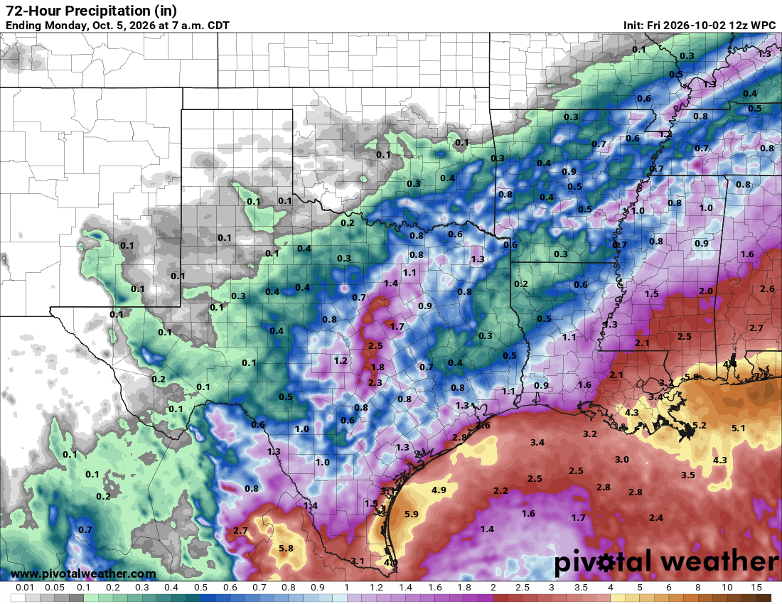
Even before this low pressure system heads north and northeastward towards the central and eastern Gulf, that frontal boundary is likely to bring quite a bit of rain to the northern Gulf Coast this weekend. Rain amounts of 3 to 6 inches are likely this weekend across southeastern Louisiana, southern Mississippi, southern Alabama and across the Florida Panhandle. The heavy rain potential then looks to sink southeastward into the central and northern Florida Peninsula during next week as that frontal boundary sinks southward.