UPDATE – Tropical Depression #2 Is Now Tropical Storm Barry Reports from reconnaissance aircraft indicate that the depression in the Bay of Campeche has found a more defined circulation with reported winds of up to 40-45 mph. Because of this, the National Hurricane Center has upgraded TD 2 to Tropical Storm Barry as of 11 am EDT/10 am CDT today.
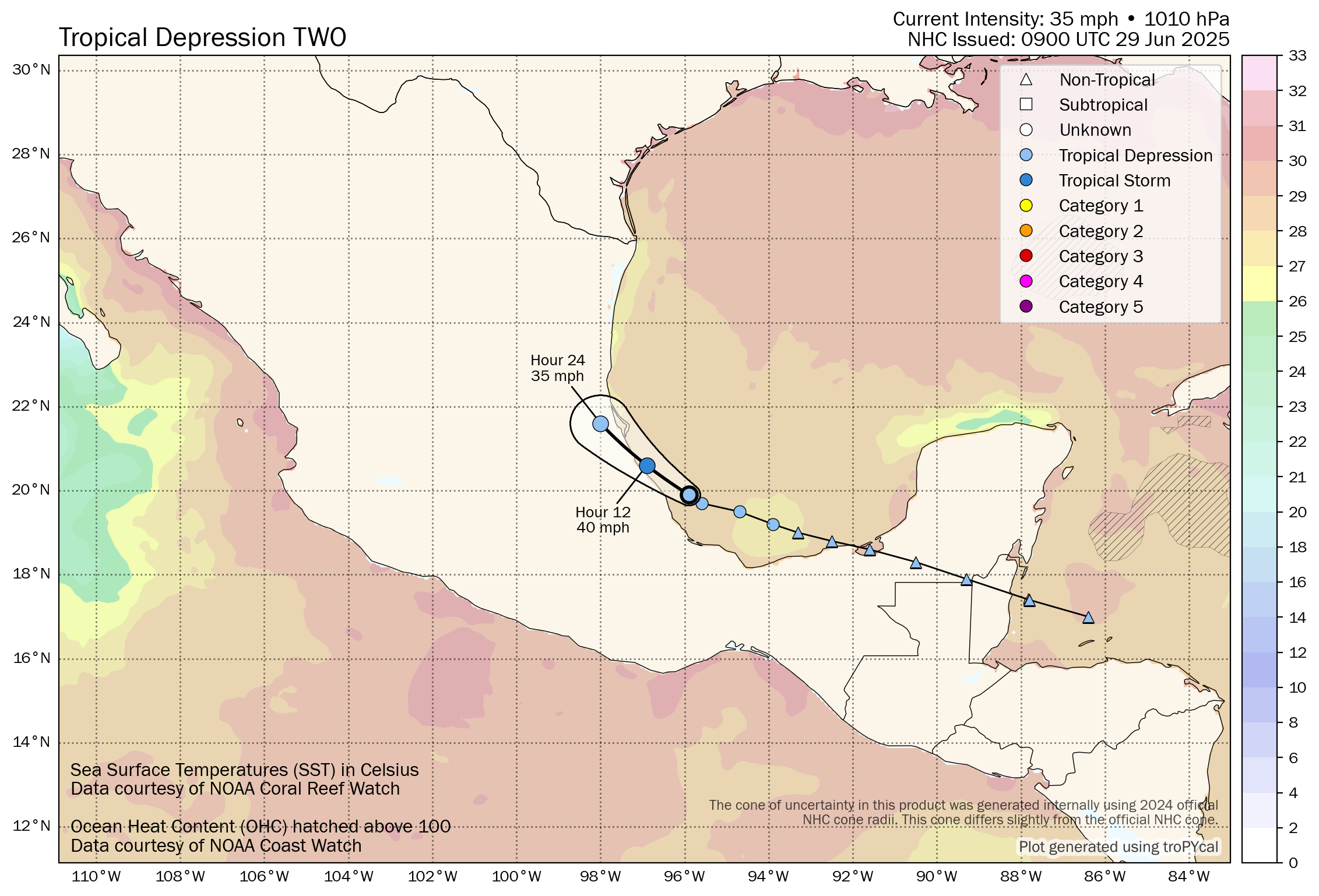
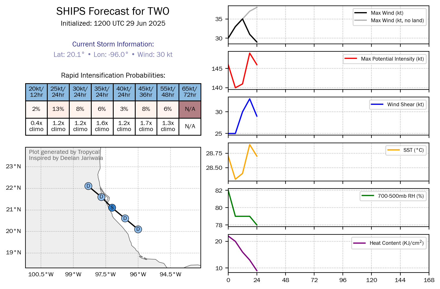
Tropical Depression #2: Reconnaissance aircraft investigated the area of disturbed weather in the Bay of Campeche yesterday afternoon and found that this system was at tropical depression strength. Because of that, the National Hurricane Center upgraded Invest 91-L to Tropical Depression #2 at 5 pm EDT/4 pm CDT yesterday afternoon.
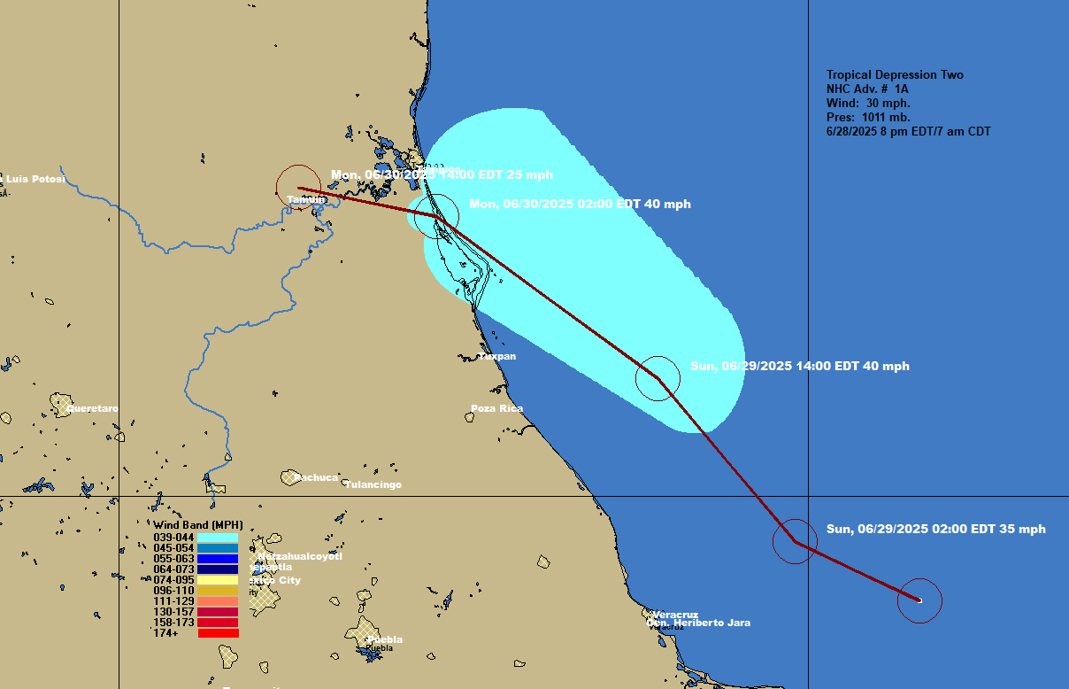
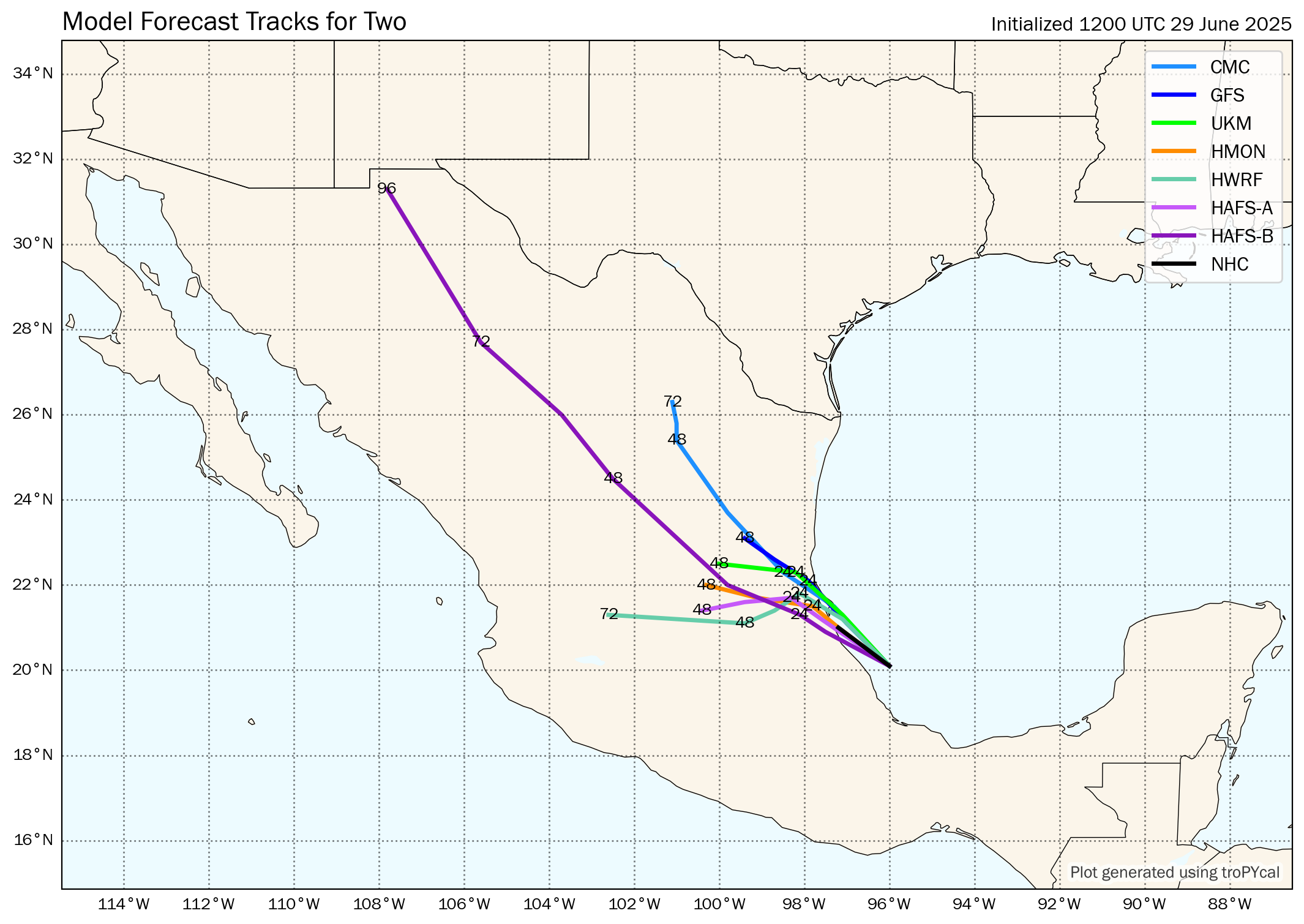
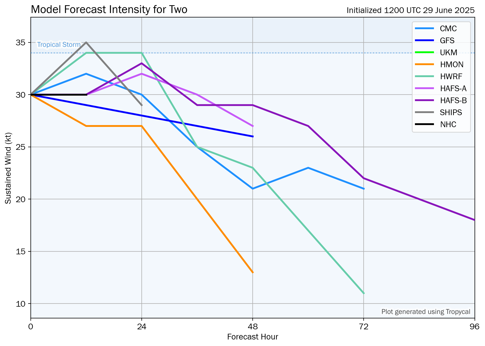
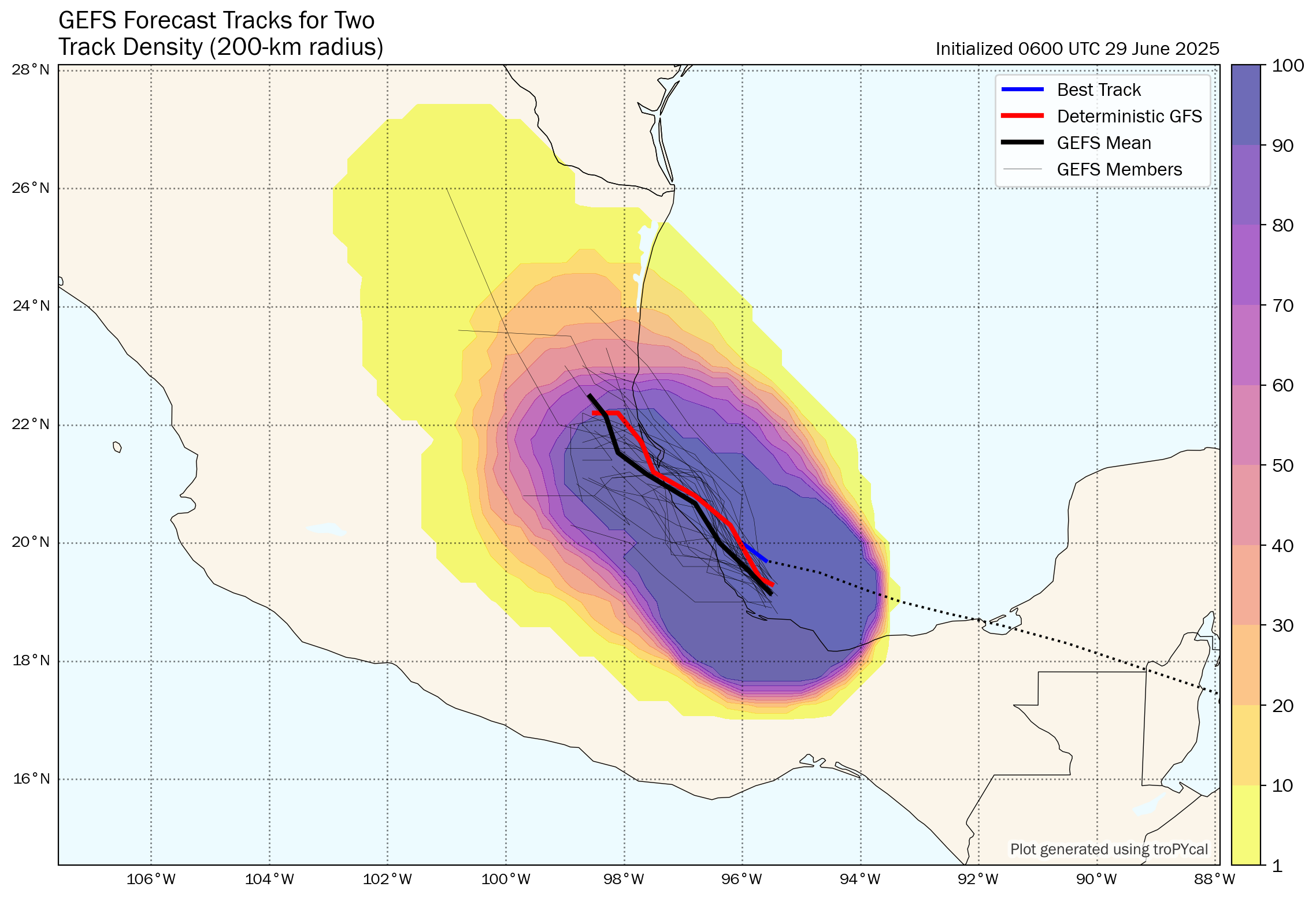
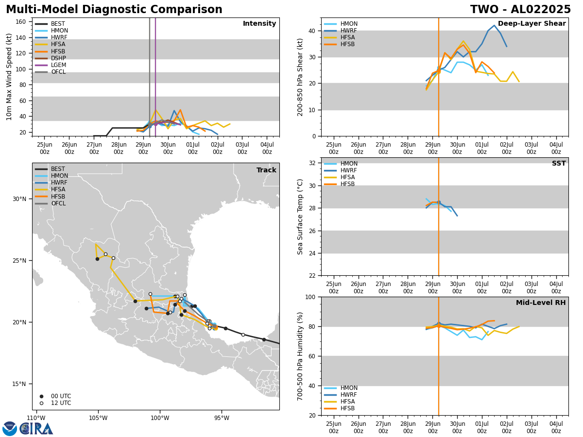
Latest reports from recon aircraft have found that TD 2 is quite disorganized & it appears quite possible that it will not reach tropical storm strength before it comes ashore in eastern Mexico by Monday morning. The depression is moving towards the west-northwest and it looks very likely that it will move in a west-northwest to northwest direction over the next 24 hours or so. Because of this, it looks probable that TD 2 will come ashore in eastern Mexico very near Tampico as soon as tonight or Monday morning.
Once TD 2 moves inland into eastern Mexico on Monday, it will quickly dissipate.
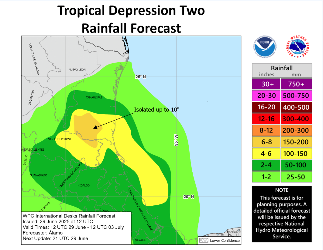
The main threat from the depression will be heavy rainfall across eastern Mexico. Rainfall totals of 3 to 6 inches with isolated amounts of up to 10 inches can be expected across the Mexican states of Veracruz, San Luis Potosi, and Tamaulipas the rest of today through Monday. This heavy rainfall has the potential to produce flash flooding and mudslides, especially in hilly terrain.
Model Track Forecast:
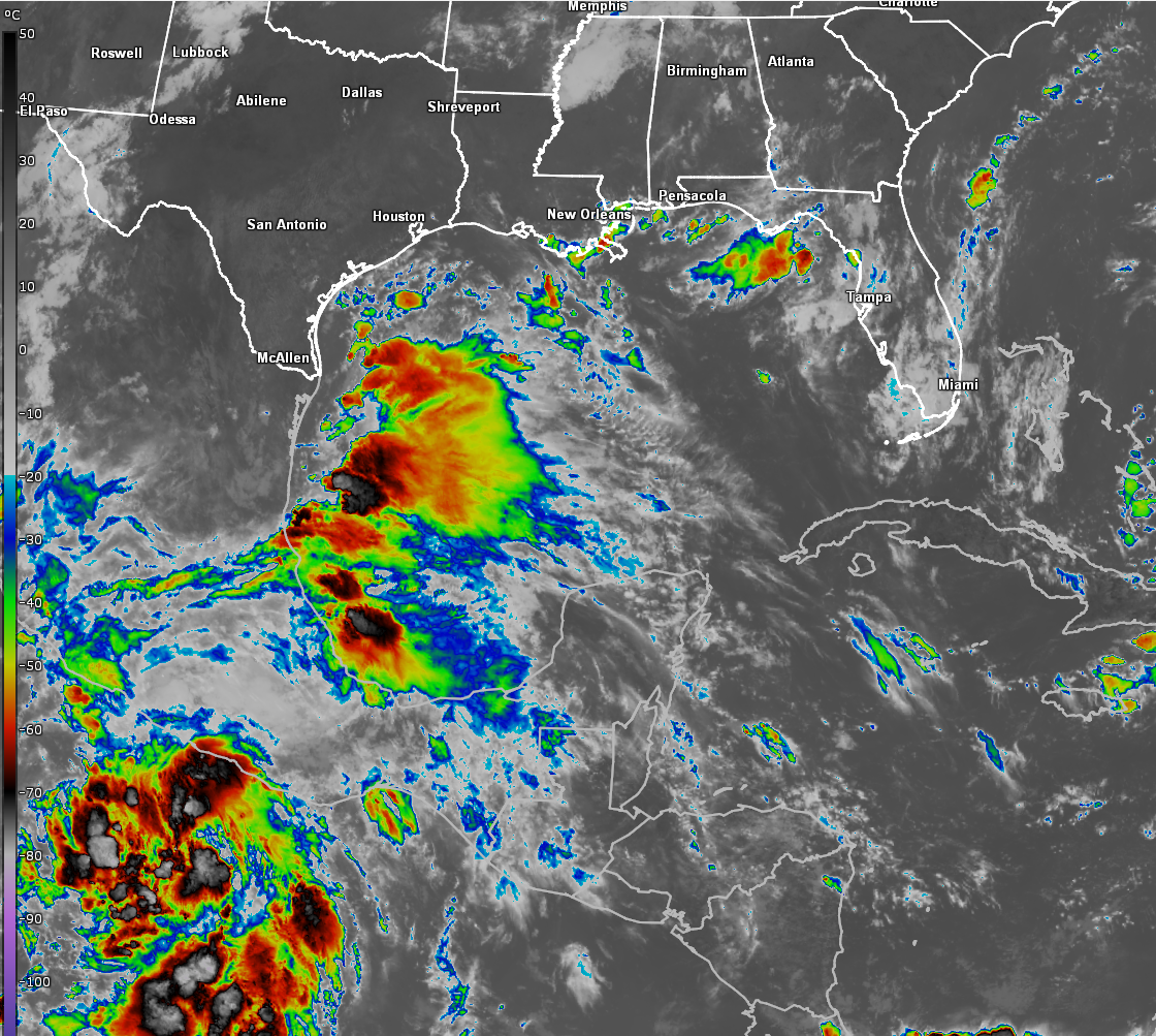
Satellite Imagery:
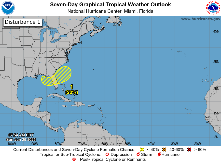
Tropical Development Continues To Be Possible From The Northeastern Gulf To Near The Southeastern Coast Of The United States Late This Coming Week: It continues to look like the area from the northeastern Gulf to near the Southeast coast of the United States will need to be watched closely for possible tropical development during the late parts of this coming week as a low pressure system may form near the tail end of an old frontal boundary.
Any possible developing tropical system may then meander around the area from the northeastern Gulf to near the Carolina coastline as we heads towards next weekend.
Looking At The Latest Model Guidance: While there continues to be agreement between all of the model guidance that tropical development may occur in the area from the northeastern Gulf to near the Southeast Coast of the United States during late this week and next weekend, they disagree as to where exactly this system might form and where it might go.
The latest GFS model run (06Z run) has backed off some with its forecast development. It now shows a weak low pressure system meandering around the northeastern Gulf late this week into next week before moving inland into southern Georgia around next Monday.
The Canadian model forecasts that any low pressure system might form just offshore of the Georgia and northeast Florida coast by Friday. It then forecasts this system to meander around near the coasts of South Carolina, Georgia and northeast Florida throughout next weekend before moving inland into southeastern Georgia or eastern South Carolina next Monday.
The European model hints at a low pressure system forming over the northeastern Gulf around Thursday or Friday and then meandering near north Florida through Saturday. Beyond this, the European model forecasts this system to meander near the coasts of northeast Florida and southeastern Georgia throughout next weekend before moving inland into southeastern Georgia by next Monday.
The European ensemble model still shows about a 40 percent chance for tropical development in the area from near the coasts of northeast Florida to coastal South Carolina late this week into next weekend.
Here Are My Thoughts: My overall thoughts regarding this possible tropical development have not changed since yesterday. I do still think that there is the chance for tropical development to occur somewhere between the northeast Gulf and the coasts of North and South Carolina late this week through next weekend. That being said, I do still think that the chances of tropical development actually occurring are pretty low.
I still don’t really know where exactly this system might form, but I do think that there is an equal chance of any system developing over the northeastern Gulf versus near the Carolina coastline. It’s going to take at least a couple of more days to figure out where any system might form.
For now, this is still nothing to be overly concerned or worried about & is something to keep an eye on.
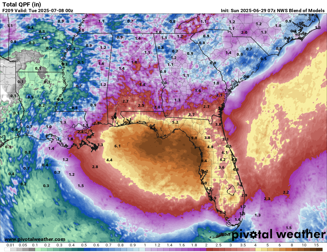
Finally, this system, whether it develops or not, has the potential to produce heavy rainfall across a large part of the Florida Panhandle and central and northern parts of the Florida Peninsula from the middle and later parts of this week through next weekend. The bullseye area of heaviest rainfall looks to be across all of the Florida Panhandle, the Big Bend area of Florida and along the west coast of Florida from about Fort Myers and points north, including the Tampa Bay area leading to localized flash flood issues.
Forecast Rainfall Amounts Later This Week Through Next Weekend:
The next tropical weather discussion will be issued on Monday.