All will be quiet across the Atlantic, Caribbean and the Gulf this weekend with no tropical development expected.
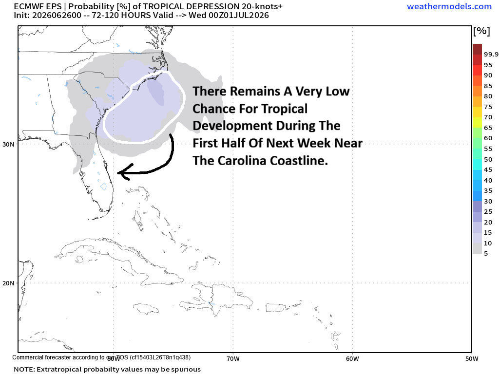
As we get into next week, there remains a very low chance that we could see a tropical system try to develop near the US Southeast coast between the Carolinas and northeast Florida & then be pushed southwestward and westward into the eastern Gulf. That said, more than likely nothing at all will develop & all will stay quiet.
Some of the model guidance & in particular, the Google Deep Mind model is showing about a 20 percent chance or so of tropical development in the area from the Southeast coast to the eastern Gulf. In addition, the European ensemble seems to show about a 10-20 percent chance for tropical development during the first half of next week near the Carolina coastline. Other model guidance such as the Canadian model and the GFS model, however, show no development at all. As I already said, I think more than likely nothing will develop next week. That said, it is still something to keep an eye on, just in case.
What may cause this possible development? It appears that we will have a decaying frontal boundary draped over the southwestern North Atlantic just off of the Southeast US coast. Some of the model guidance are hinting that a large cluster of thunderstorms will dive off of the South Carolina coastline early next week and then try to root itself on the tail end of that decaying front. If this occurs, then this process could promote a low pressure system to form leading to the possibility of development as it heads southwestward and westward towards the Florida Peninsula and then the eastern Gulf.
Even though I think that the chances for tropical development are very low (around 10 percent), the environmental conditions look favorable to promote development. This includes the expectation of low wind shear values and very warm ocean waters to the east of Florida. Because of this, the idea of possible tropical development is something to keep an eye on for next week.
Whether we see tropical development or not next week, one thing that is very highly likely is a surge of tropical moisture will push westward into the Bahamas, through much of the Florida Peninsula and into the northern and eastern Gulf. What this means is that daily pop-up thunderstorms will move from east to west & affect the Bahamas, much of the Florida Peninsula and along the northern Gulf coast during next week. It also means that these daily thunderstorms will likely reach the drought riddled areas along the I-75 corridor and the west coast of Florida, including areas from Tampa to Fort Myers.
FINALLY – I wanted to give everyone a heads-up that I will be running a Fourth Of July Lifetime Subscription Special that’ll begin tomorrow & run through July 4th. This lifetime subscription special will feature a price that is $250 off the regular price of a lifetime subscription. So, instead of paying $600, you can pay $350 for a lifetime subscription & never have to worry about renewing again.
Let your friends, family, coworkers, neighbors or anyone you know about Crown Weather & perhaps they will want to get in on this great deal too. If you’d like to take advantage of this lifetime subscription special now, let me know by emailing me.