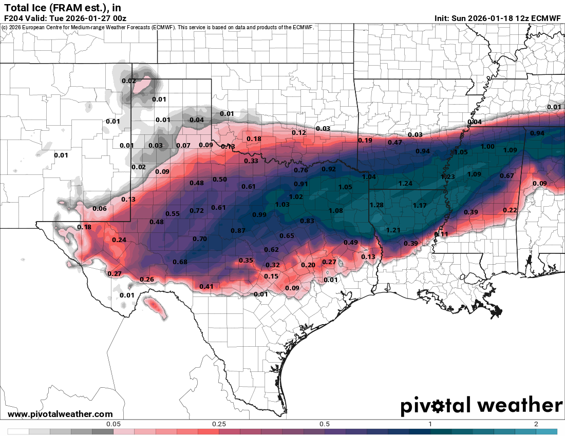
The snow that occurred last night into this morning from the Florida Panhandle into parts of Alabama and Georgia looks to be an appetizer for a much bigger winter storm threat next weekend across a large part of the Deep South.
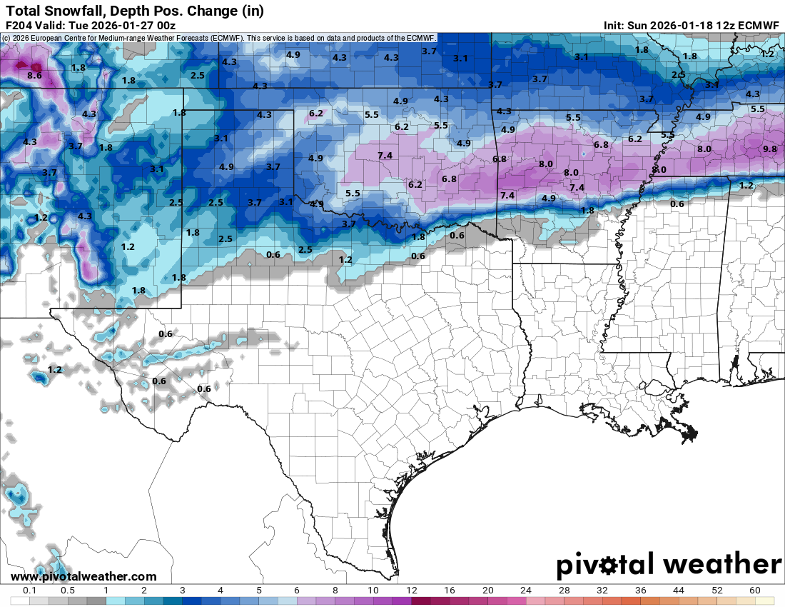
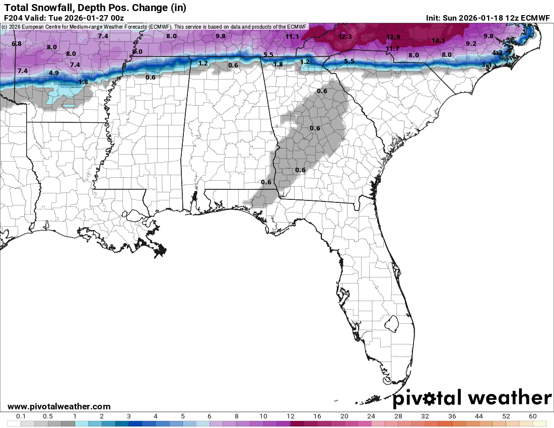
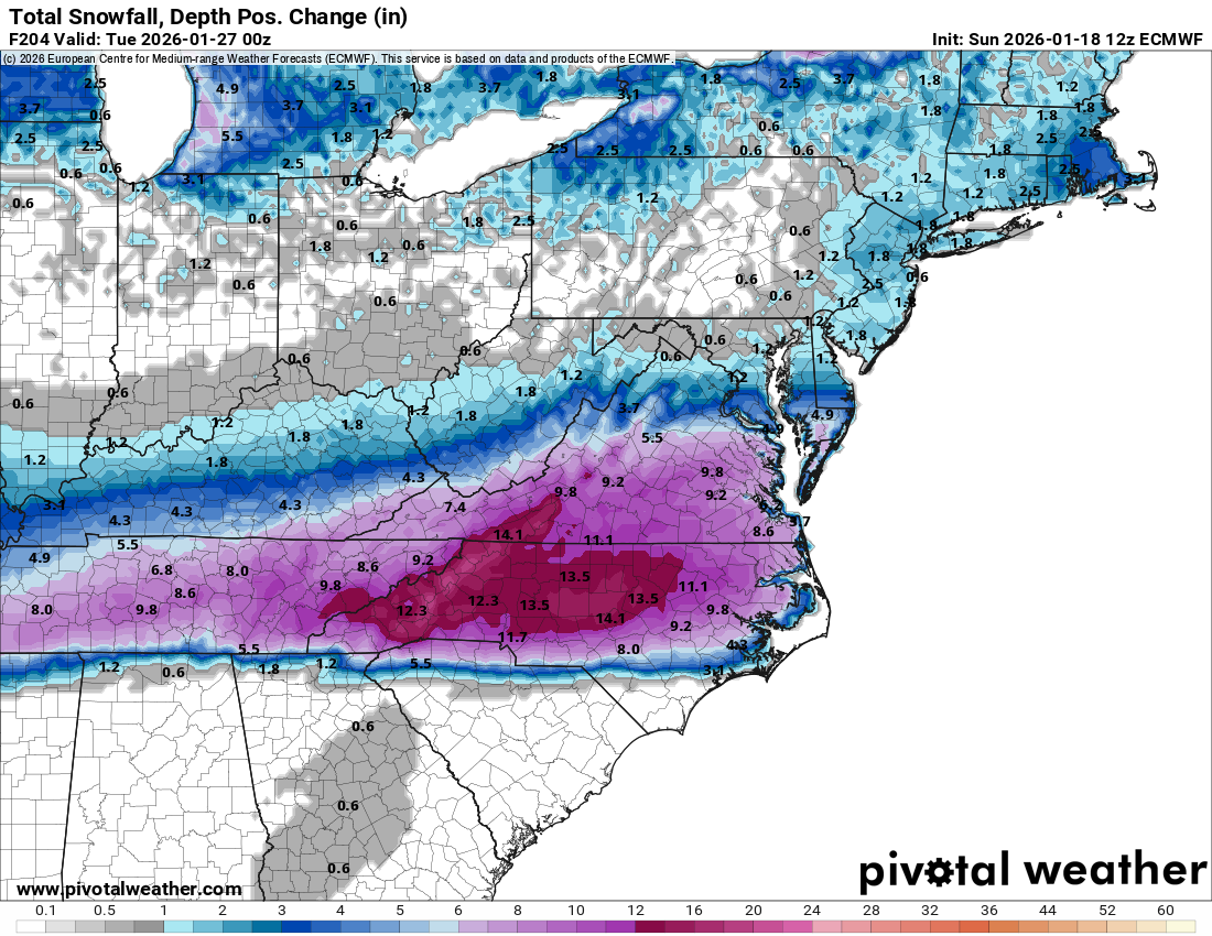
All of the major model guidance, including the GFS, European and Canadian models seem to agree that the potential is there for a widespread, high impact snow and ice event next weekend across the Deep South, including central and north Texas, northern Louisiana, much of Arkansas, central and northern Mississippi, northern Alabama, central and northern Georgia and much of the Carolinas.
A wave of low pressure may form over the northern Gulf is currently forecast to form over the Gulf on Saturday of next weekend. This low pressure system may then lift northeastward and head near the coastal Carolinas by next Sunday and next Monday. Cold air pressing southward into the Deep South may run into precipitation and moisture associated with this low pressure system leading to the possibility of winter weather impacts across parts of the Deep South next weekend.
At this point, it is way too soon to get into much more details than this. For now, consider this a heads up and be aware that snow and freezing rain could be a threat across central and north Texas, northern Louisiana, much of Arkansas, central and northern Mississippi, northern Alabama, central and northern Georgia and much of the Carolinas next weekend leading to potential serious disruptions.
A Serious Freezing Rain Threat Could Occur Across Parts Of The Deep South Next Weekend
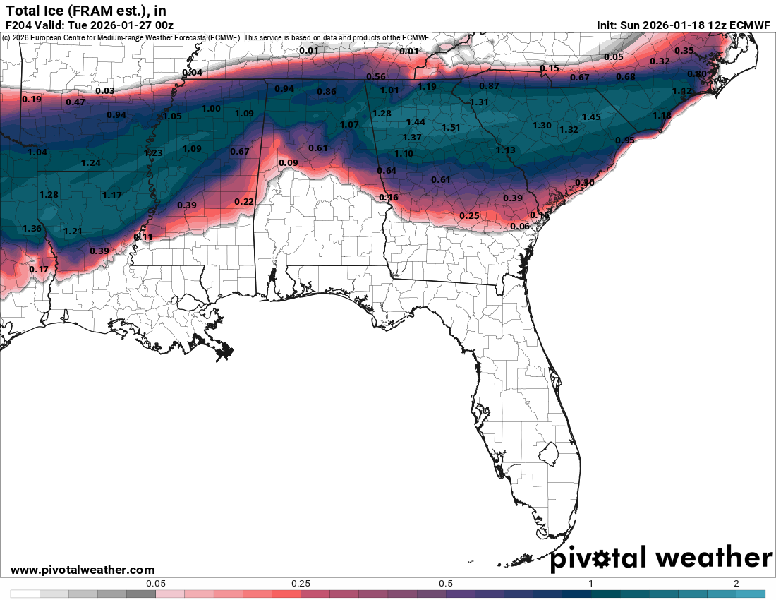
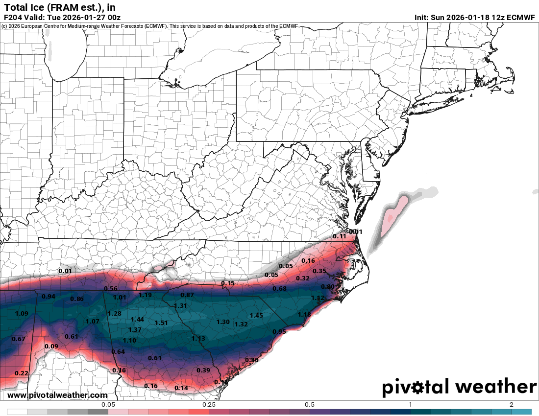
Snow Also Looks To Be A Possible Threat Next Weekend In Parts Of The South: