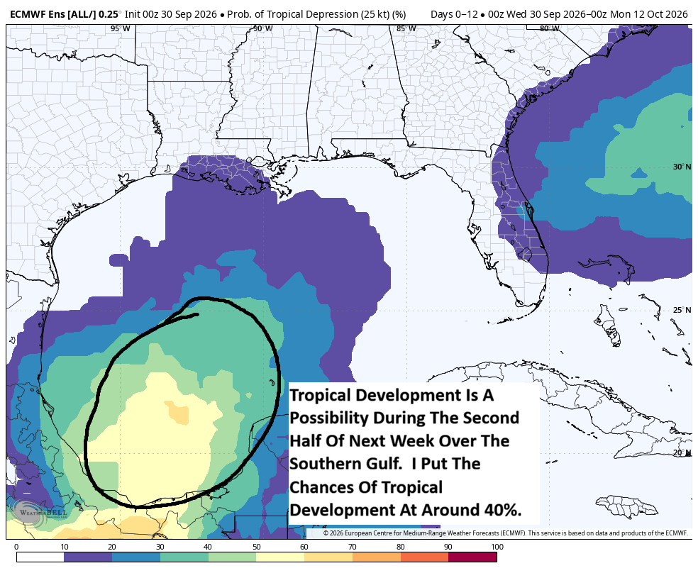


It appears that the southern Gulf might be an area to watch for possible tropical mischief during next week. A strong cold front is expected to dive southward through the southern United States during the early part of next week. This front is then expected to stall out over the Gulf during the second half of next week. What then looks to possibly occur is that an area of low pressure could form near the tail end of this front & try to spin up into a tropical system over the southern Gulf during the middle and later parts of next week.
A look at the model guidance reveals that most of them do show hints at potential tropical mischief over the southern Gulf next week. The Google Deep Mind ensemble model seems to suggest that there’s about a 30 percent chance for tropical development by about the middle part of next week over the southern Gulf. Meanwhile the European ensemble model guidance is showing about a 50 percent chance for tropical development by about the second half of next week.
Here Are My Thoughts: At this point, I do think that the possibility of tropical development in the southern Gulf is one that we do need to entertain. The combination of a low pressure system forming near the tail end of a front interacting with energy and moisture in the area and an environment that looks potentially favorable for development is one that can easily lead to tropical development.
So, what I think might occur is that we’ll see a low pressure system form near the tail end of the frontal boundary during the second half of next week. This low pressure system looks to form over the southern Gulf & I do think that if it sits over the southern Gulf long enough, it’ll easily be able to transform into a tropical system. The chances of tropical development in the southern Gulf later next week looks to me to be around 40 percent or so.
Now, where could this possible tropical system head? It is possible that an upper level trough of low pressure could dig into the eastern United States by next weekend. Should this occur, it could lead to any tropical system to be pulled towards the north or northeast and head towards the central or eastern US Gulf Coast. Alternatively, if this upper-level trough ends up weaker than currently forecast, it could miss picking up this possible tropical system & thus it would be left meandering over the Bay of Campeche or the southern Gulf.
At this point, this is something to just keep an eye on & is nothing to be overly worried or concerned about.