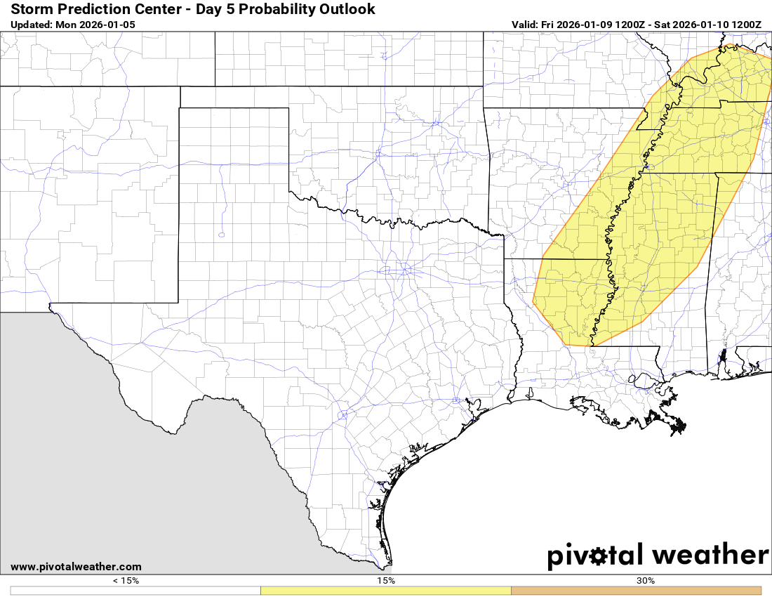
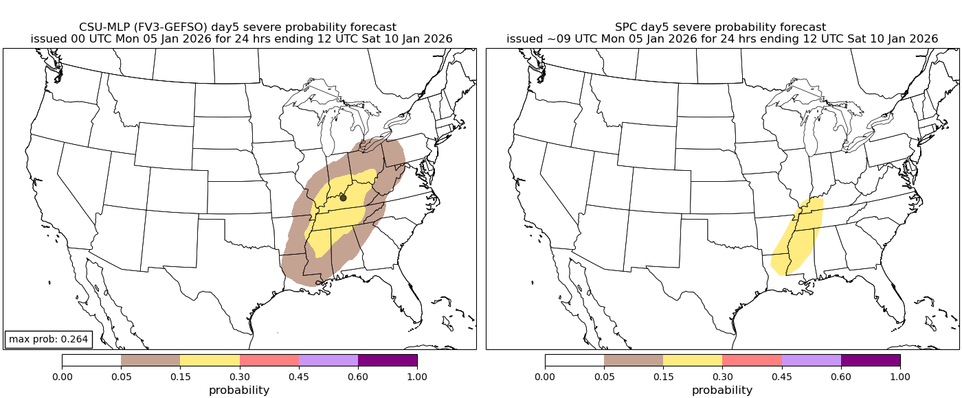
There is some possibility of severe weather during the day on Friday across the lower Mississippi Valley, as well as across parts of the Tennessee Valley and the lower Ohio Valley.
The weather maker that could produce this severe weather is going to be a strong low pressure system that’s expected to head northeastward from the southern Plains states on Thursday to the Great Lakes region by Friday. In addition to the severe weather, this strong storm system is also likely to bring heavy rain to the Plains states and snow to parts of the Rocky Mountains by the middle part of this week.
As this storm system moves into the Great Lakes, plenty of low-level moisture will surge northward from the Gulf leading to a somewhat favorable setup for severe weather. One factor that might be lacking is the amount of forcing and unstable air that might be available to tap into. Should this factor not pan out, then the severe weather risk may end up not being all that robust.
For now though, I do think that there is enough evidence in the data to support the potential for severe weather on Friday across northern Louisiana, eastern Arkansas, northern Mississippi, far northern Alabama, much of Tennessee, much of Kentucky, southern Illinois, southern Indiana and southern Ohio.
This will be something to keep an eye on as the week progresses.