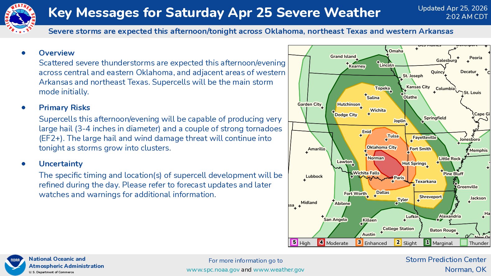
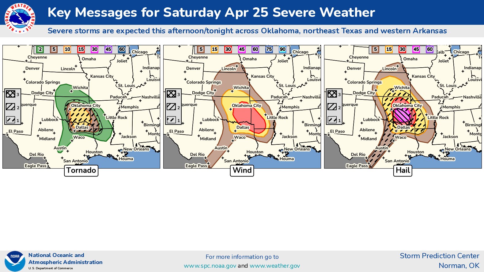
Summary: Severe thunderstorms with very large to giant hail of 2 to 4 or more inches in diameter, tornadoes, some strong and damaging winds are expected late this afternoon through this evening across central and eastern Oklahoma into the ArkLaTex.
Details: A warm front is expected to extend from northwest to southeast across central and eastern Oklahoma this afternoon. The air mass near and to the south of this warm front is likely to be very unstable to extremely unstable & there is likely to be very strong amounts of low-level wind shear present. This will be an environment that’s very favorable for supercell severe thunderstorms that will be capable of producing extremely large hail, tornadoes and damaging winds.
Several supercell severe thunderstorms look to develop between about 5 pm and 7 pm CDT across central and eastern Oklahoma (mainly east of I-35). Giant hail and tornadoes, some of which will be strong, will be a significant threat with these supercells.
These supercell severe thunderstorms will impact eastern and southeastern Oklahoma into far western Arkansas as well as across the ArkLaTex during this evening. Again, giant hail and strong tornadoes will be a significant threat.
Eventually these supercell storms will evolve into clusters of severe storms during the overnight hours, probably near and after midnight across the ArkLaTex. The main threat near and after midnight will be damaging wind gusts.
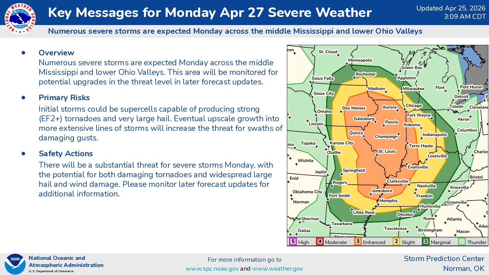
I Do Have Significant Concerns With The Severe Weather Threat On Monday Afternoon & Monday Evening: Widespread significant severe weather is expected Monday afternoon and Monday evening across the middle Mississippi Valley into the lower Ohio Valley and the Tennessee Valley. Several supercell severe thunderstorms that are capable of producing strong long track tornadoes and very large hail will be a significant threat across eastern Iowa, eastern Missouri, northeast Arkansas, much of Illinois, far western Indiana, western Kentucky and northwestern Tennessee.