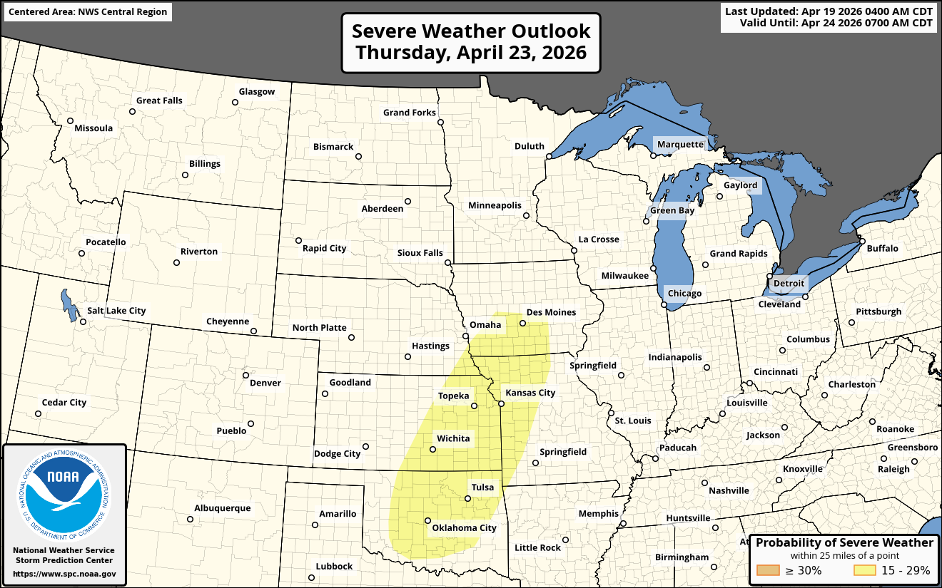
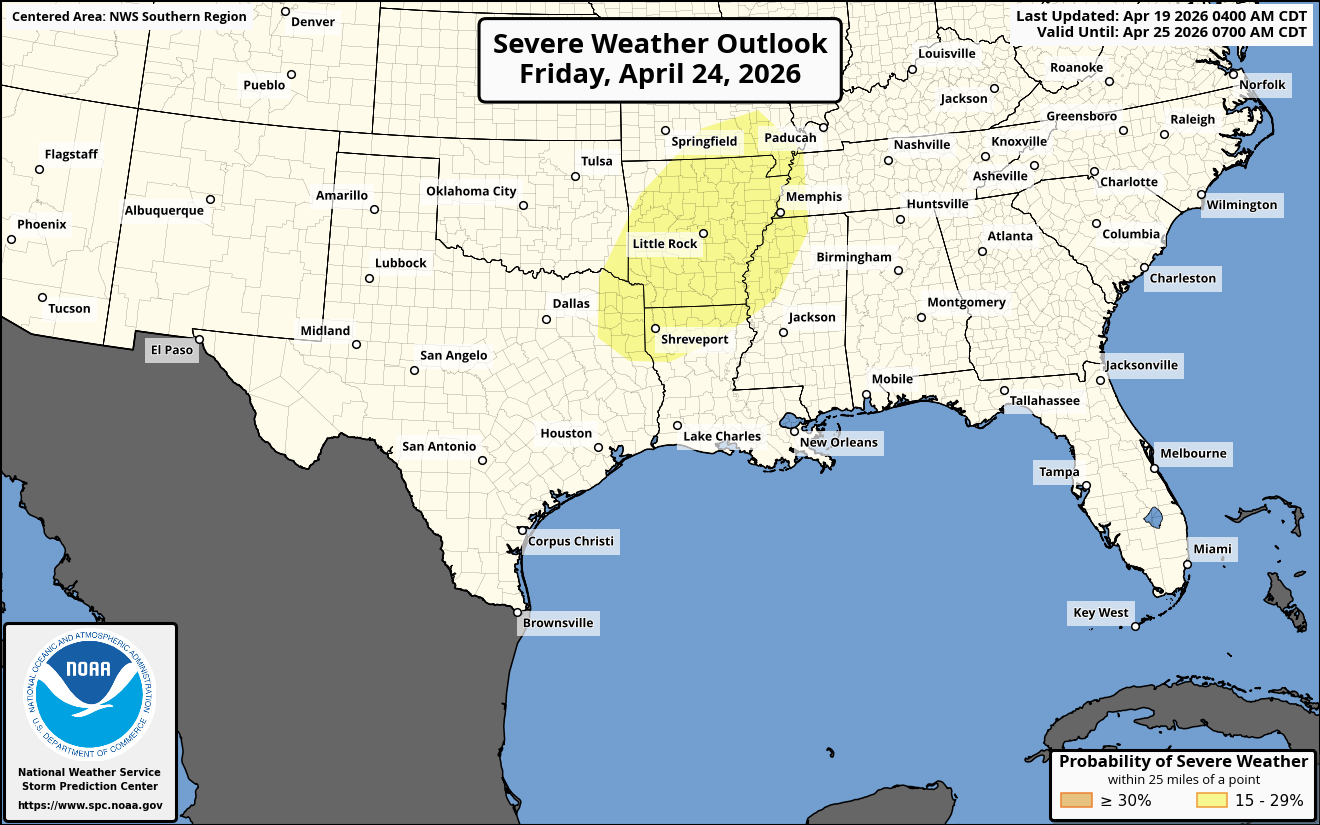
The severe weather threat is expected to increase across areas from the central and southern Plains on Thursday to the Ozarks and the middle and lower Mississippi Valley on Friday.
On Thursday – A strong low pressure system is expected to be located over the northern Plains states. Out ahead of this low pressure system, a strong southerly wind flow will pull warm and humid Gulf air northward into the Plains states.
A large area of thunderstorms along and east of a frontal boundary and these storms will affect a large part of the southern and central Plains states into parts of the Midwestern US. Severe storms look most possible Thursday afternoon into Thursday night across central and eastern Oklahoma, eastern Kansas, western Missouri and southern Iowa. Damaging winds, hail and a few tornadoes will all be a threat with the severe weather.
For Friday – Another round of severe thunderstorms are possible across northeast Texas, northern Louisiana, much of Arkansas and southern Missouri. Damaging winds, hail and perhaps a few tornadoes will again be a threat.
Turning To Next Weekend – Severe weather will continue to be a threat across an area from the southern Plains states east-southeastward through the northern Gulf coast. Across these areas, it is expected that a persistent upper level trough over the western US will produce a warm, humid and unstable air mass throughout next weekend.