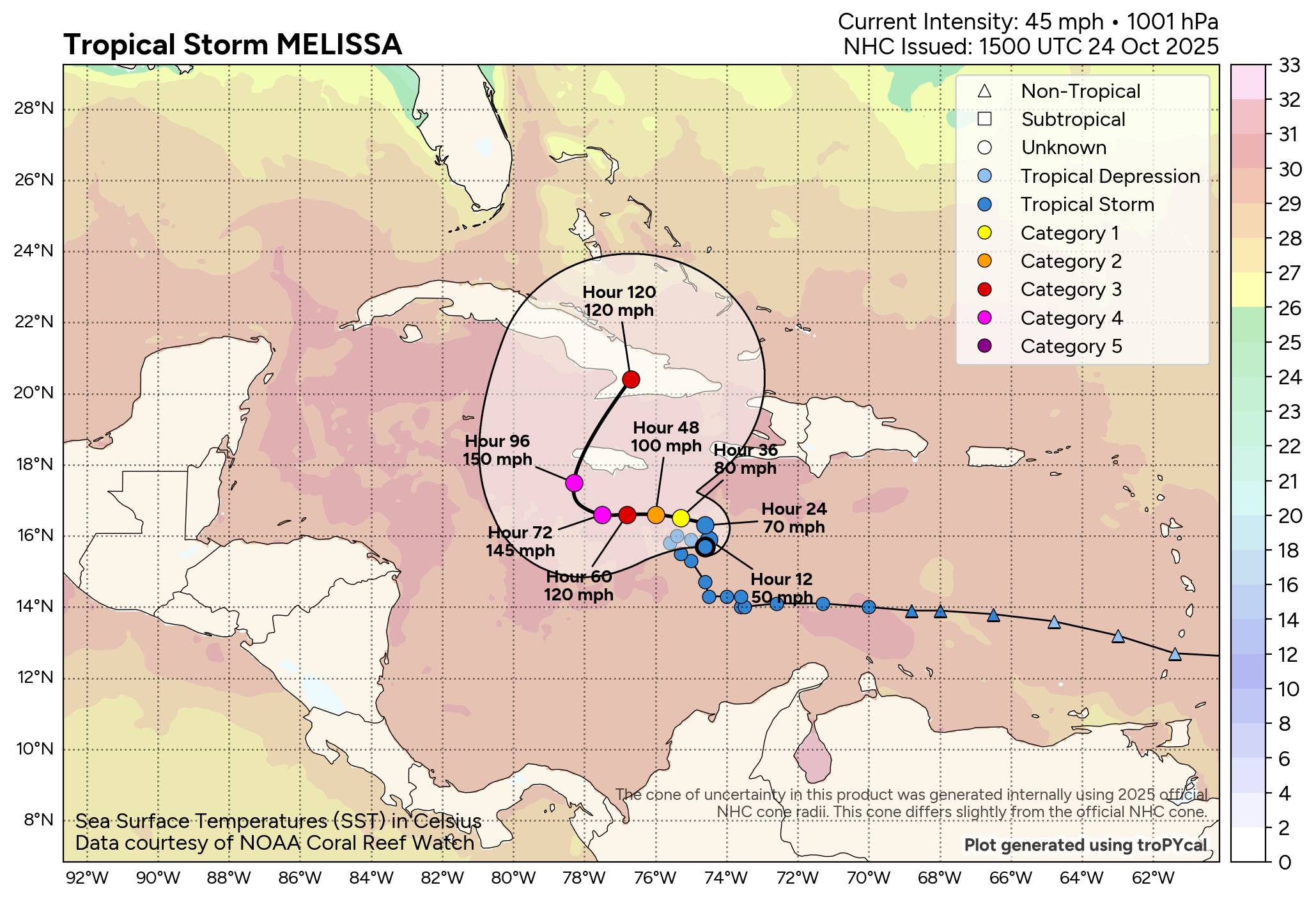
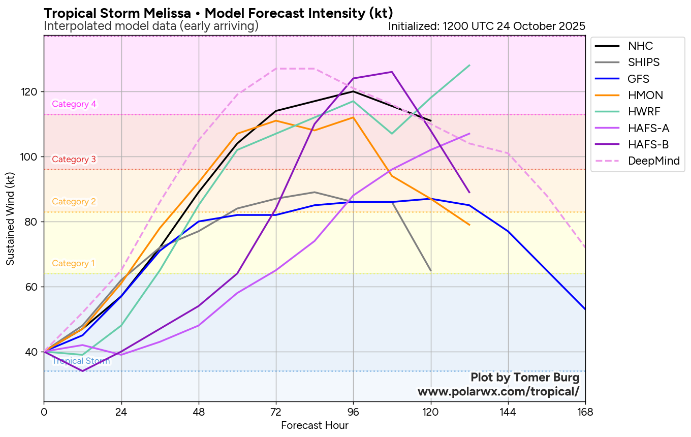
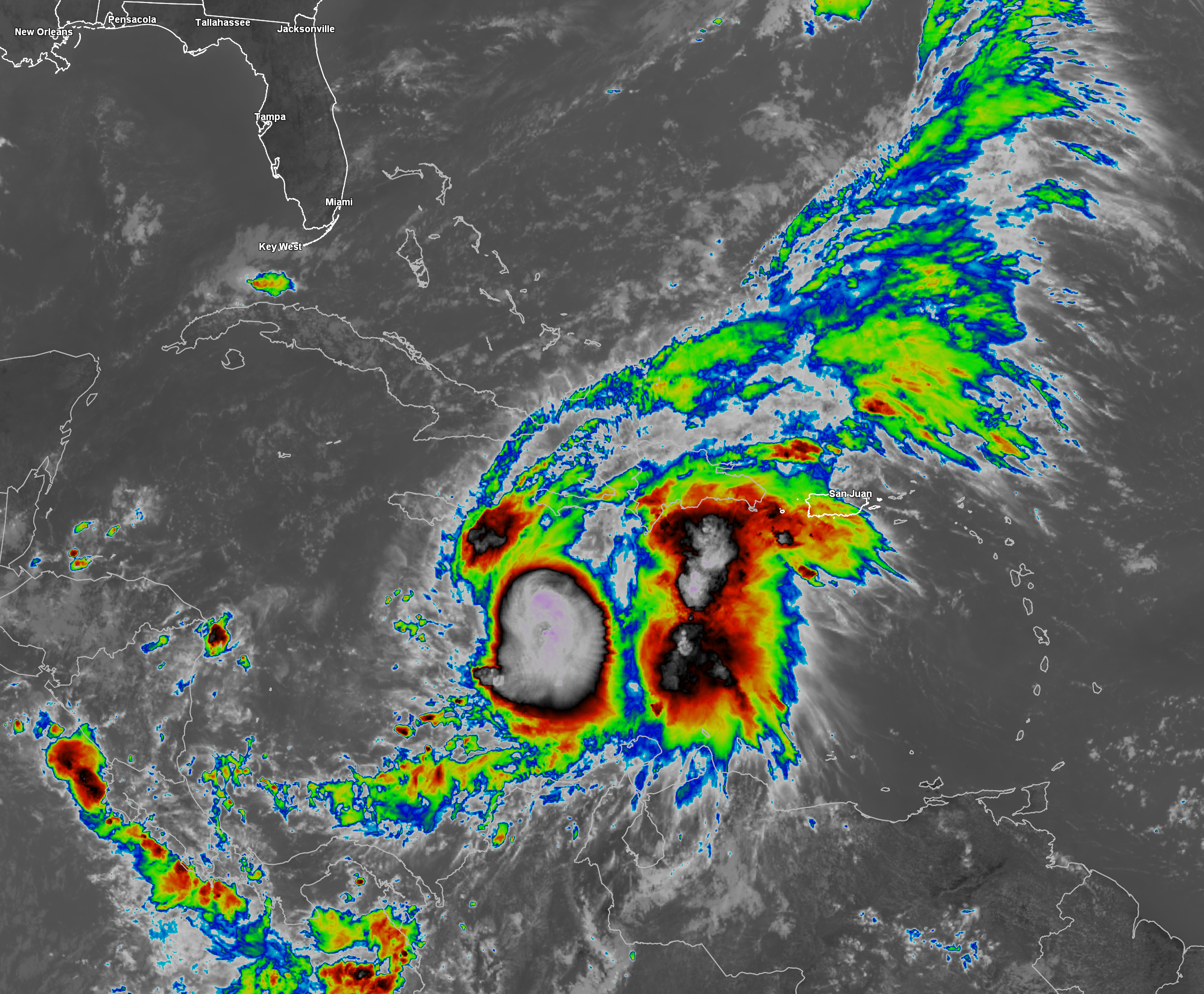
Tropical Storm Melissa: Reconnaissance aircraft have been flying through Melissa all morning long. They have found that the deep convection associated with Melissa has tugged the low-level center to the east-southeast as compared to where it was located just last night. This has caused the storm to stack a little more with the low and mid-level centers aligned on top of one another. This increase in organization is probably the first step in the process where Melissa will probably strengthen quite a bit throughout this weekend. In fact, I do think that Melissa will probably become a hurricane as soon as sometime on Saturday and may become a major hurricane as early as late Sunday or sometime on Monday.
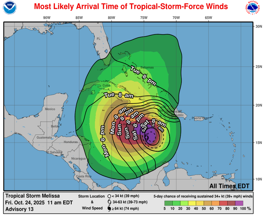
Melissa is currently caught in-between two competing high pressure systems leading it to be stuck in a weak steering environment. This means that Melissa will likely drift around with no clear direction throughout the rest of today right through Saturday.
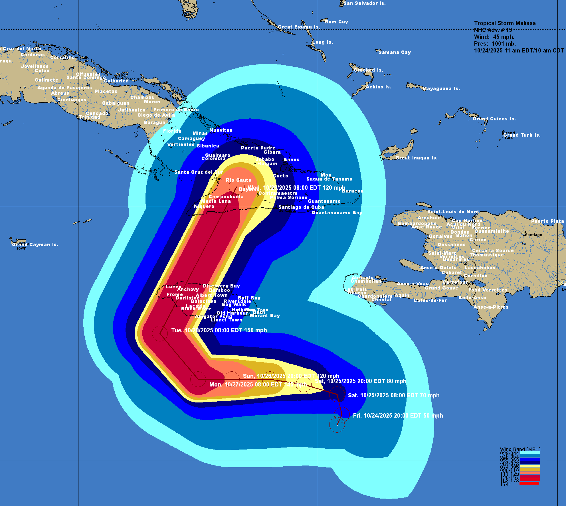
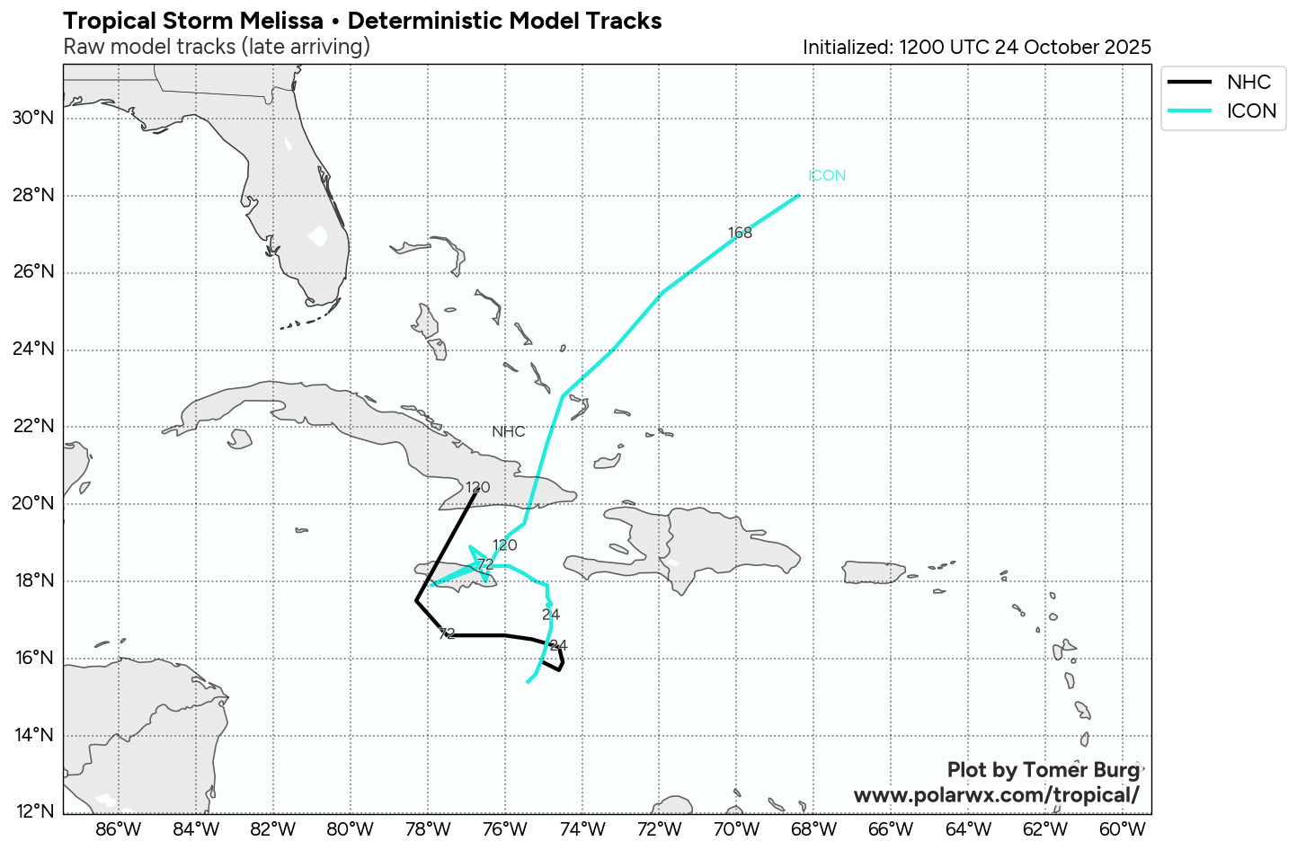
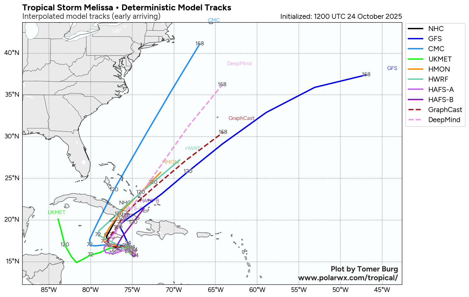
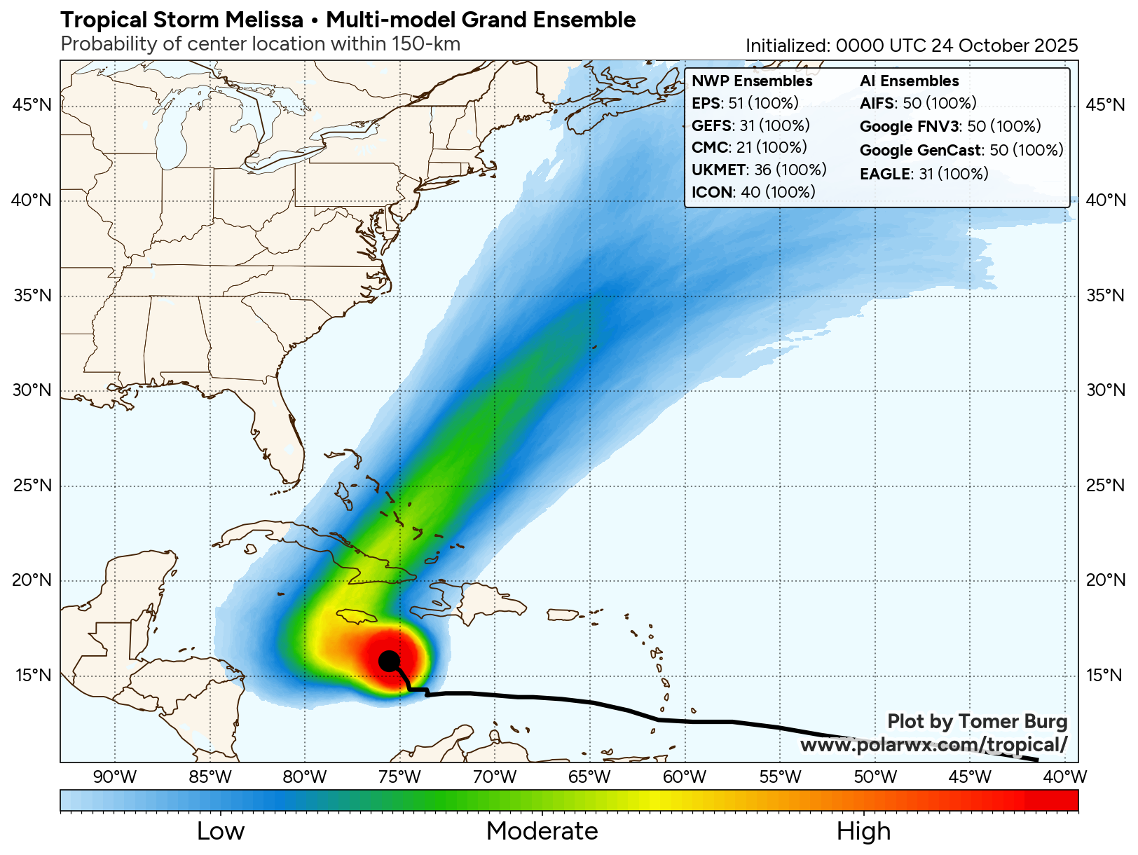
Looking beyond Saturday, it appears that Melissa will track very slowly to the west as a high pressure ridge builds to the north of the storm. This very slow movement to the west is then expected to last through Sunday, Monday and Tuesday. A majority of the track model guidance show this occurring & it appears very likely that Melissa will be moving just to the south of Jamaica during Sunday, Monday and Tuesday.
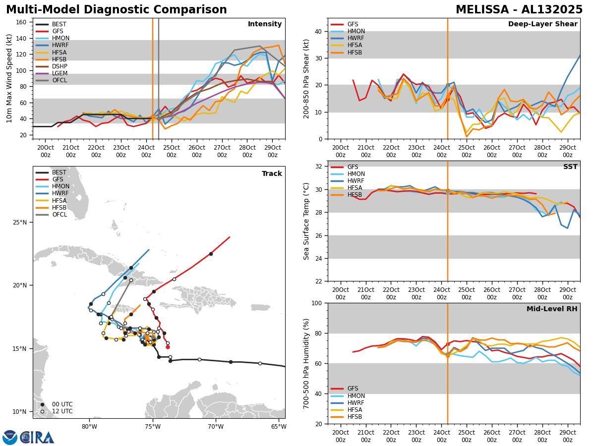
At the same time this is happening, it is expected that the wind shear values over Melissa will become much more favorable for strengthening throughout this weekend. Additionally, Melissa will be moving through some extremely warm ocean waters near and south of Jamaica. This leads me to believe that Melissa will rapidly strengthen this weekend into early next week. The most recent SHIPS rapid intensity index is forecasting that there is a 40 percent chance that Melissa could strengthen into a hurricane in less than 24 hours from now & a 32 percent chance that Melissa may strengthen into a major hurricane within the next 3 days.
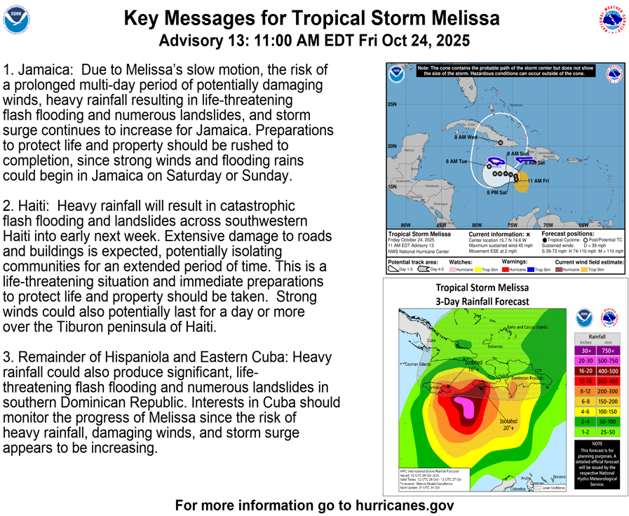
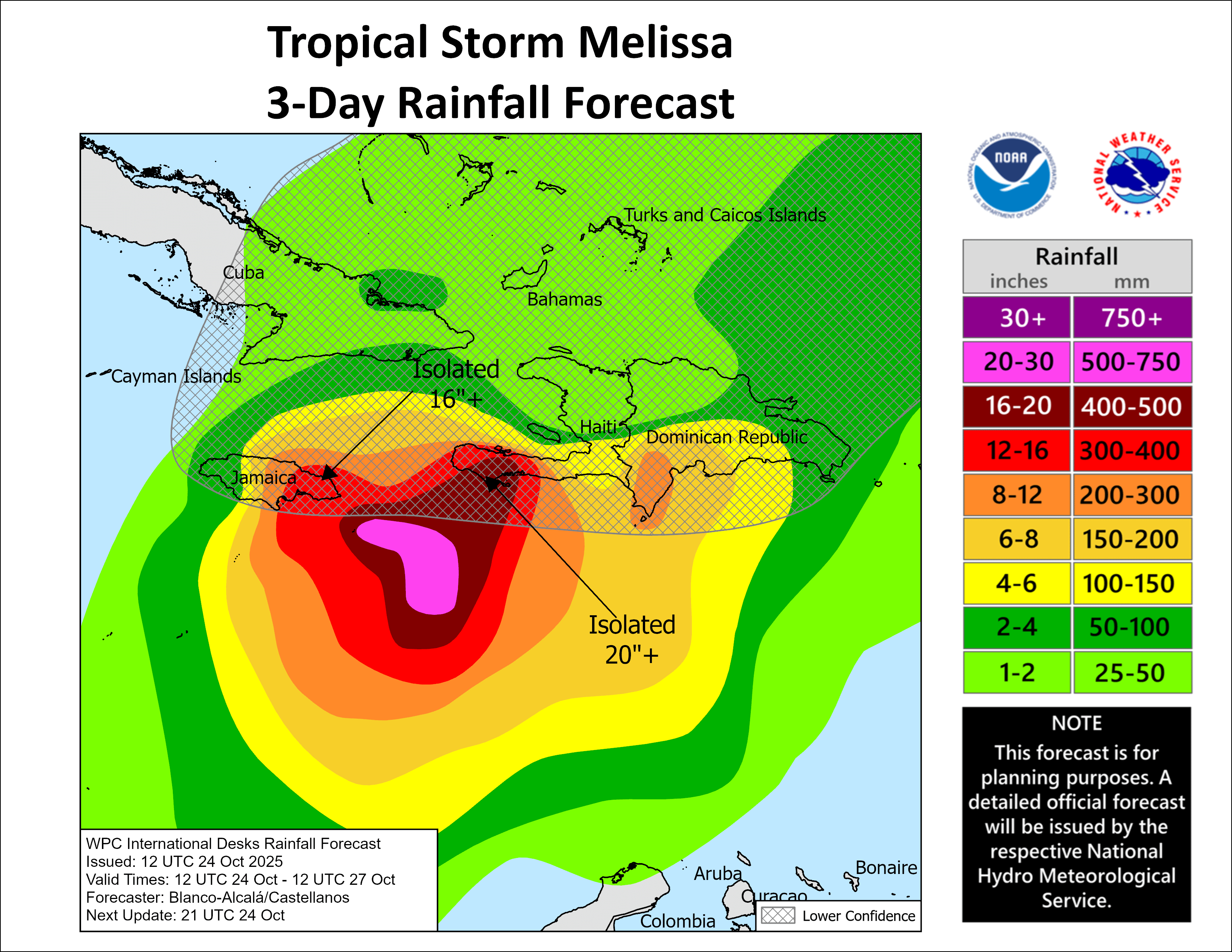
Jamaica Is In For A Prolonged Period Of Severe Impacts From Melissa That Lasts For Several Days: It is expected that Melissa will be moving very near or just south of Jamaica from Saturday until Tuesday while it is rapidly strengthening into a major hurricane. This will put the island dangerously close to its very damaging core during Sunday, Monday and Tuesday.
Even if the eyewall of Melissa stays south of Jamaica, hurricane-force winds and extremely heavy rain will still impact the island for a prolonged period of time starting on Saturday and potentially lasting through Tuesday. That’s potentially at least 72 hours of hurricane conditions & extremely heavy rain & this means that a severe very high-end hurricane impact is likely for Jamaica.
If that wasn’t enough, Melissa will turn to the northeast sometime on Tuesday, which means that major hurricane conditions could impact the island throughout Tuesday. This is in addition to the 48 to 72 hours of constant hurricane conditions that are expected on the island.
I cannot emphasize enough that Jamaica is very likely to be severely impacted by Melissa, both in the way of extremely strong winds and extremely heavy rain & catastrophic flooding. If you are on the island of Jamaica or have relatives or friends there, make sure you are in a very sturdy and safe shelter & be aware that you will be there for several days. Sadly, this is likely to end up being a humanitarian disaster for Jamaica.
A Strong Upper-Level Trough Will Pull Melissa Out Of The Caribbean Around Tuesday & Wednesday: It is expected that a strong upper-level trough of low pressure will drop into the Eastern United States by early next week. This weather feature is likely to be strong enough to grab Melissa and pull it out of the Caribbean between Tuesday and Wednesday.
This means that Melissa will probably track right over Jamaica on Tuesday and then across eastern Cuba and the central and southeastern Bahamas as potentially a very major hurricane on Tuesday night and Wednesday.
For Those Of You In Eastern Cuba, The Central & Southeastern Bahamas & The Turks & Caicos: You might want to start getting ready for a major hurricane impact now, just in case. All of the reliable track model guidance seem to insist that eastern Cuba, the central & southeastern Bahamas and the Turks and Caicos may see major hurricane conditions on Tuesday and Wednesday.
This is something that should be taken extremely seriously if you are in eastern Cuba, the central & southeastern Bahamas and the Turks and Caicos.
Finally, as Melissa is heading out away from the Bahamas and into the open Atlantic later next week, its possible that the island of Bermuda could be impacted by the storm around Thursday and Friday of next week. How close Melissa gets to Bermuda remains to be seen, but I urge all island interests to monitor the progress of Melissa extremely closely.
Model Track Forecast:
Satellite Imagery:
The next tropical weather discussion will be issued on Saturday.