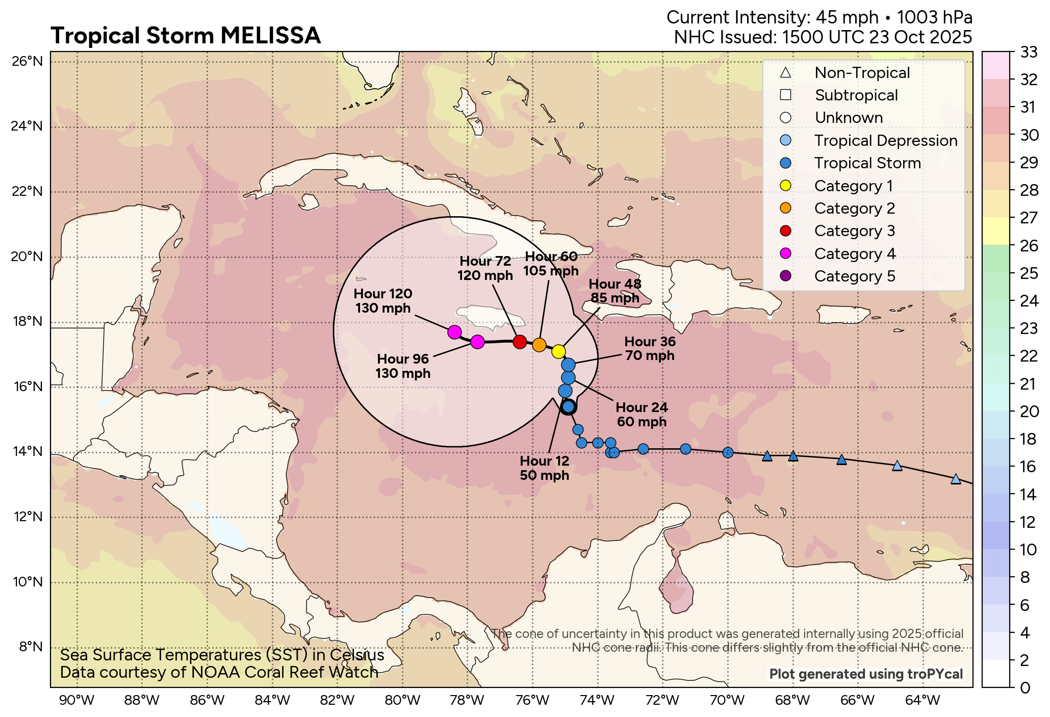
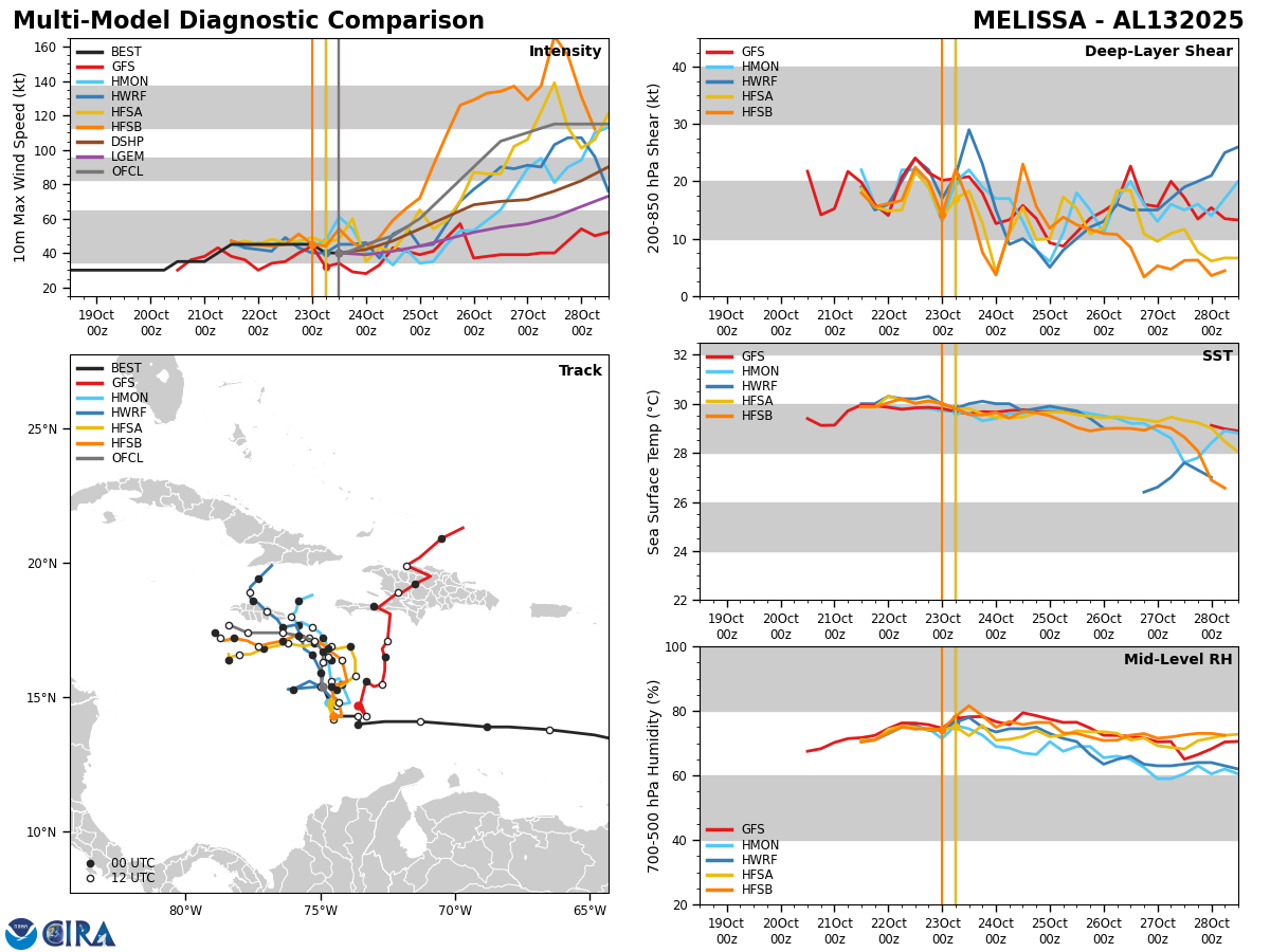
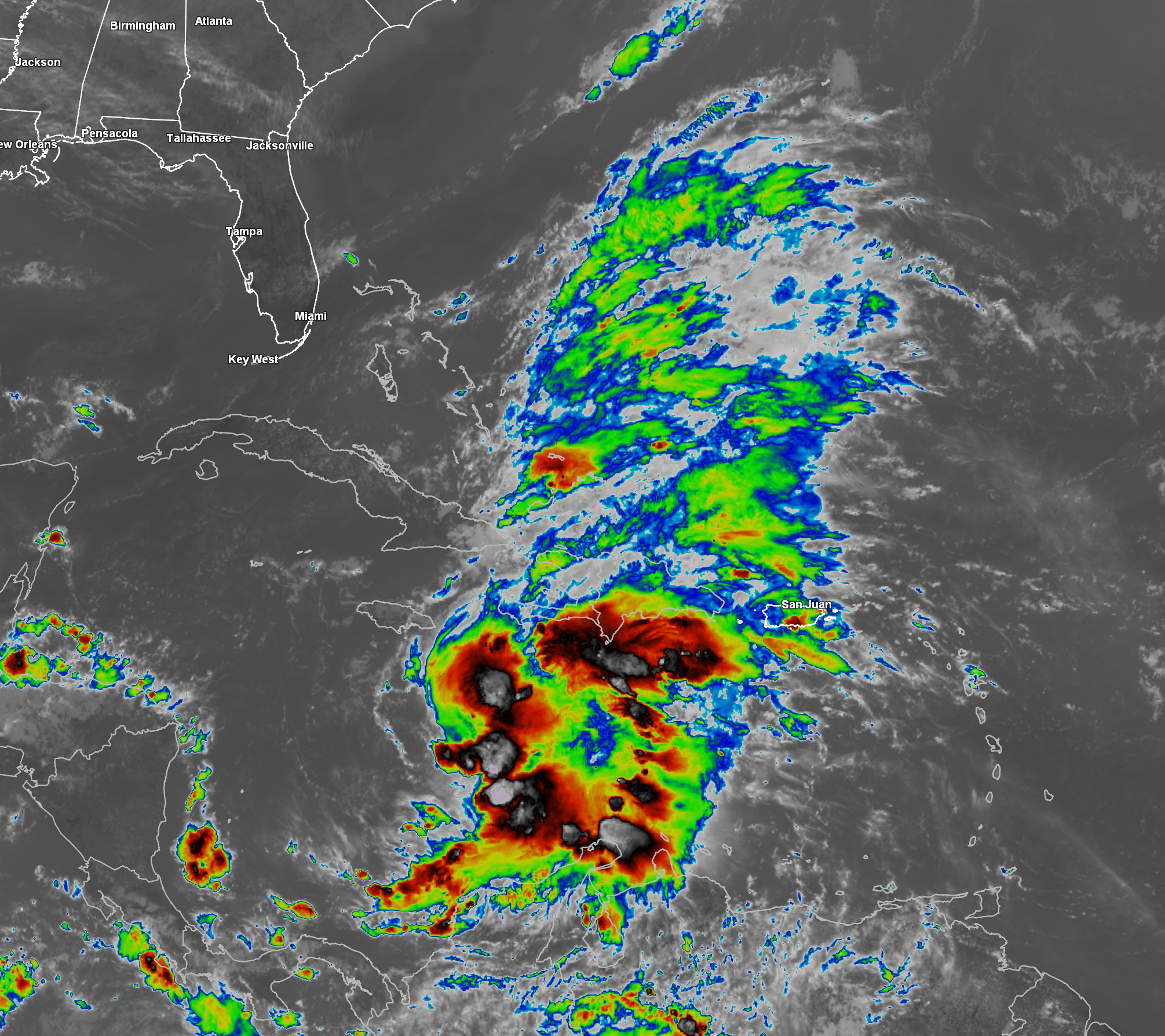
Tropical Storm Melissa: Melissa is being impacted by west-southwesterly wind shear of up to 20-30 knots today & because of this the low-level center is partially exposed. In addition, this west-southwesterly wind shear is blowing the deepest convection to the east of the low-level center. As of right now, Melissa still has 50 mph maximum winds and a central barometric pressure of between 1003 millibars and 1006 millibars.
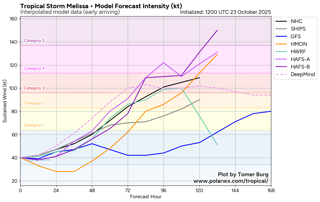
It is expected that this 20-30 knots of westerly wind shear will continue to impact Melissa through Friday. By this weekend though, the wind shear values are expected to decrease leading to the storm to undergo at least steady strengthening. There is the possibility that there could be a round of rapid strengthening this weekend into early next week as Melissa moves into an environment of lower wind shear values and extremely warm ocean waters. It should be noted that the SHIPS rapid intensity index is forecasting that there is a 22 percent chance of Melissa strengthening to a major hurricane within the next 3 days.
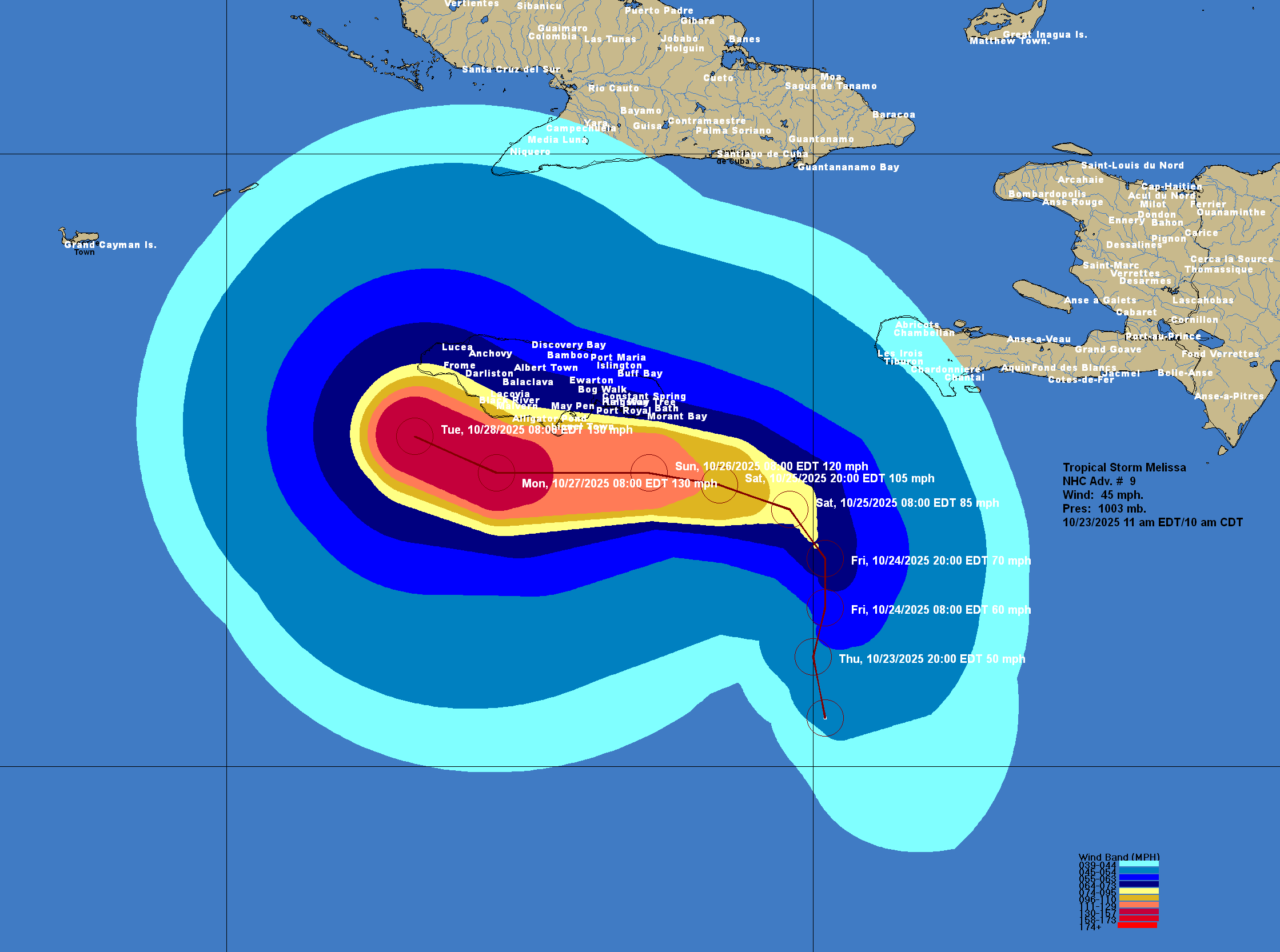
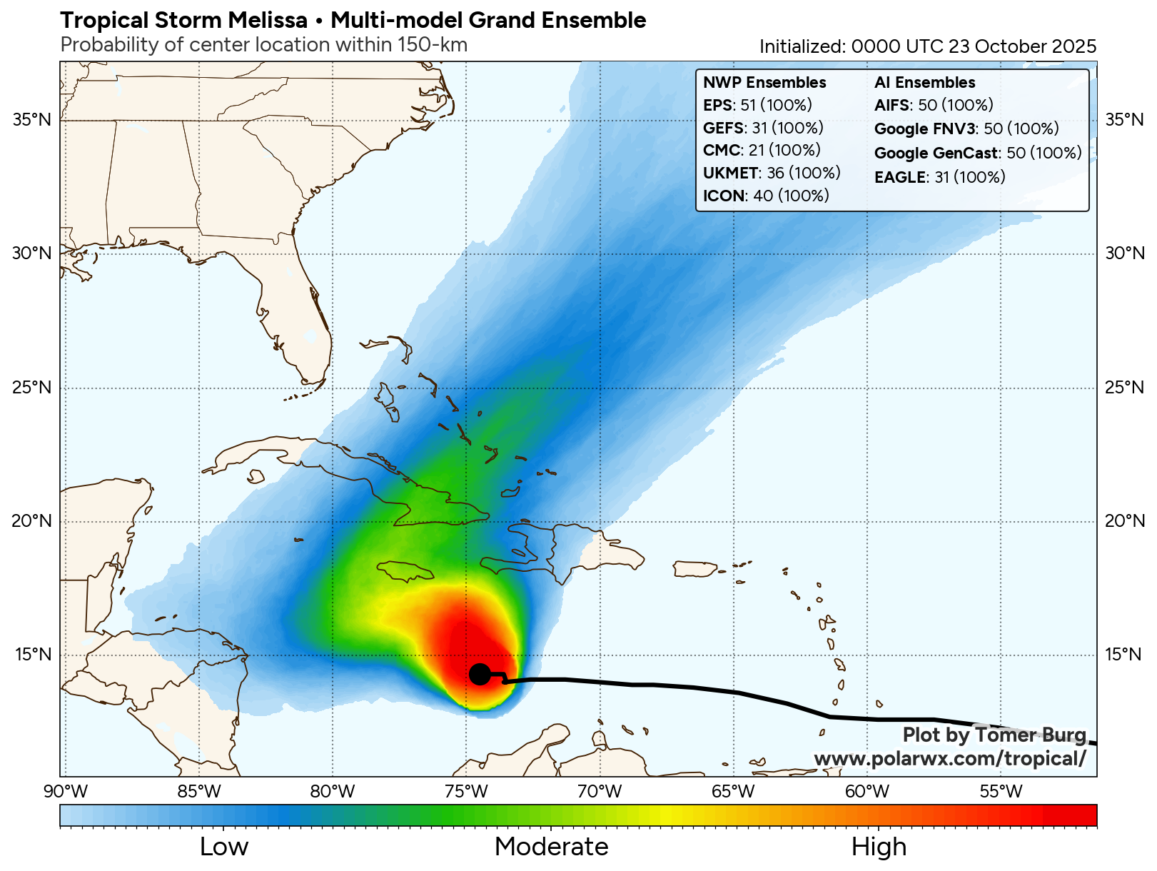
The forecast of where Melissa might track in relation to Jamaica, Cuba and Haiti remains uncertain as while it is expected that a high pressure ridge will build to the north of Melissa steering it to the west during this weekend, it is unclear as to how quickly that high pressure ridge will remain in place. If that high pressure ridge stays in place for a few days, it would lead to Melissa tracking to the south and southwest of Jamaica. On the other hand, if the high pressure ridge moves off to the east rather quickly, it would lead to a shorter westward track causing Melissa to track very near, if not right over Jamaica by early next week.
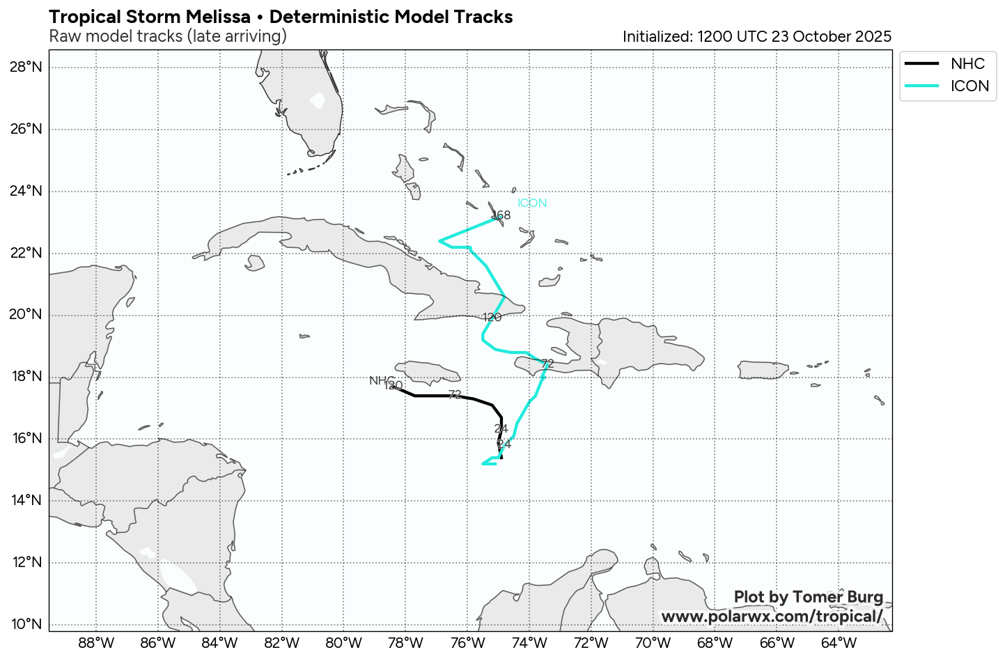
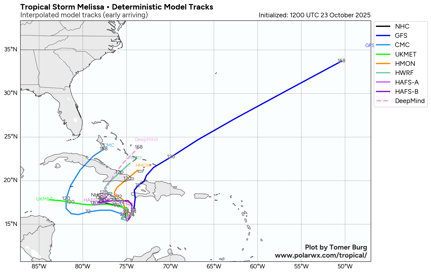
The most recent track model guidance for Melissa has trended towards a track that brings Melissa very close to, if not right over Jamaica, The Google Deep Mind ensemble guidance, which has done very well with other established tropical systems this season, forecasts that Melissa will be initially yanked to the northeast through Friday & then turn westward during this weekend. A large majority of the Deep Mind ensemble members show a track that takes Melissa extremely close to, if not right over Jamaica early next week followed by a track that brings Melissa over eastern Cuba during the middle part of next week followed by a path over the central and southeastern Bahamas
Here Are My Thoughts: I definitely think that we are going to see a very slow-moving meandering storm that very likely will become a hurricane within the next couple of days or so. There also seems to be the increasing chance that Melissa will track very close to, if not right over the island of Jamaica by early next week. This interaction with Jamaica could actually keep Melissa from strengthening into a very major hurricane. That said, I do think that Melissa will probably reach major hurricane status by early next week.
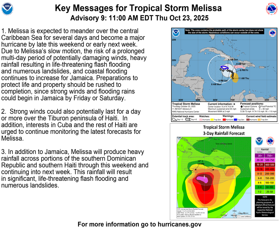
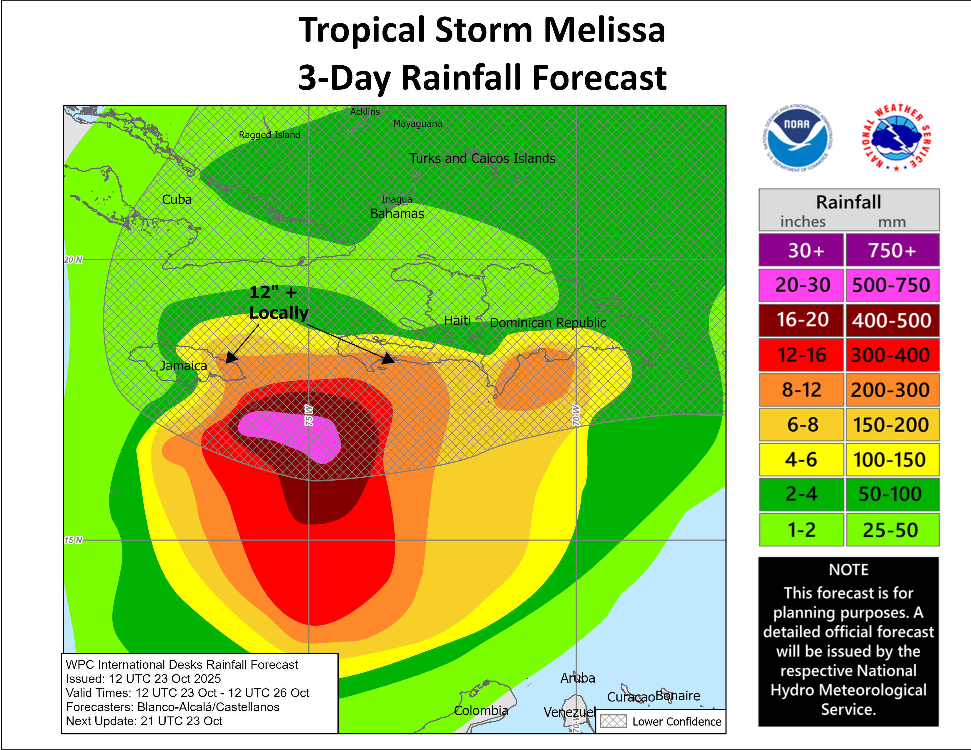
The slow-moving track near Jamaica combined with the mountainous terrain of the island is probably going to lead to major to catastrophic flooding across Jamaica, especially as we get into this weekend and next week. Serious flooding looks likely across parts of Haiti and eastern Cuba over the next several days or so.
Forecast Impacts For Jamaica, Haiti, The Dominican Republic, Eastern Cuba & The Bahamas: There is the very real threat for major to catastrophic flooding across Jamaica with similar flood issues possible across Haiti and the Dominican Republic over the next week or so.
Rainfall totals of 10 to 20 inches can be expected through this weekend across Jamaica. Additional rainfall totals of 10 to 20 more inches are possible across Jamaica during the first half of next week. This is, obviously, an extremely concerning situation for Jamaica as major to catastrophic flooding looks likely.
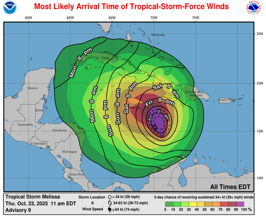
Additionally, tropical storm conditions are expected across Jamaica this weekend with hurricane conditions looking likely for Jamaica during the early part of next week.
As for the Dominican Republic, Haiti and eastern Cuba, rainfall totals of 3 to 6 inches can be expected across most of these areas. The exception looks to be along the south coast of the Dominican Republic and Haiti where 5 to 10 inches of total rainfall can be expected over the next week or so.
It goes without saying that I am extremely concerned for the island of Jamaica. Extreme precautions need to be put into place on the island to prepare for catastrophic flooding and hurricane-force winds.
Unfortunately, it may not be until about the middle part of next week that Melissa is pulled out of the Caribbean & sent northeastward. This would then put the Bahamas and especially the central and southeastern Bahamas at risk of hurricane conditions around the middle part of next week & it is something that I’m watching closely.
Bottom Line Is That late October tropical storms and hurricanes in the Caribbean are notorious for large errors in the forecast track as they can be extremely difficult to forecast. This means that more changes in the forecast track are possible as guidance adjust to what’s actually steering Melissa.
That being said, Jamaica, eastern Cuba, Haiti, the Dominican Republic, the Cayman Islands, the Bahamas and the Turks and Caicos need to keep very close tabs on the progress of Melissa & prepare for tropical storm and hurricane impacts – this particularly goes for those of you in Jamaica.
Model Track Forecast:
Satellite Imagery:
The next tropical weather discussion will be issued on Friday.