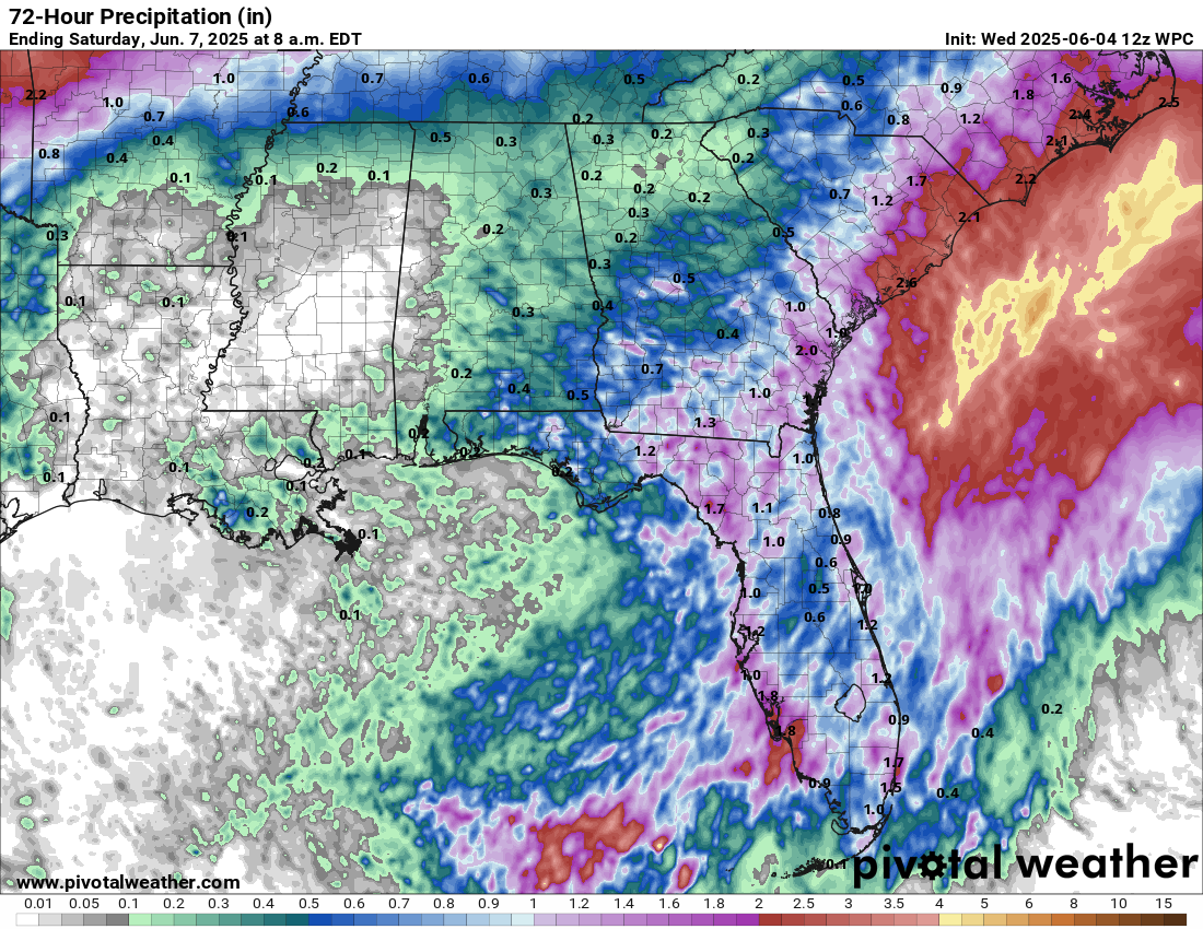
Low Pressure Will Bring Locally Heavy Rainfall From The Florida Peninsula Northward To The Coastal Carolinas The Next Couple Of Days: Satellite imagery and weather analysis indicates that a surface trough of low pressure currently extends across the Florida Peninsula. This trough is producing shower and thunderstorm activity across parts of South Florida, the northern Bahamas and now across southeastern Georgia.
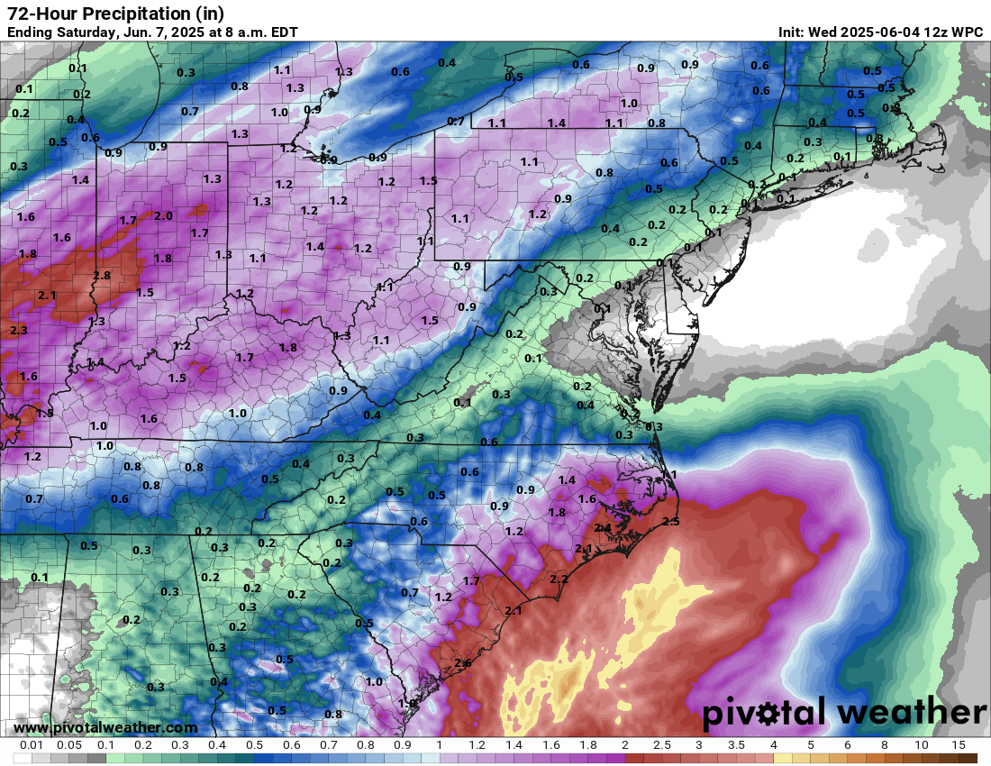
It is expected that a low pressure system will form over eastern South Carolina on Thursday and then track into eastern North Carolina by Friday. It appears that this low pressure system will remain inland across eastern South Carolina and eastern North Carolina and because of this, tropical development is no longer expected (the chances were very low anyways).
What this low pressure system will do is bring additional locally heavy rainfall to much of the Florida Peninsula, coastal Georgia and coastal South Carolina the rest of today. This locally heavy rainfall will affect southeastern Georgia, eastern South Carolina and eastern North Carolina on Thursday. This heavy rainfall may produce localized flooding issues, especially in the Charleston Metro and the South Carolina Lowcountry where any flooding will be exacerbated at the time of high tide.
Forecast Additional Rainfall Amounts Through Thursday:
Elsewhere Across The Atlantic, Caribbean and The Gulf: The rest of the Atlantic, Caribbean and the Gulf will be quiet throughout the rest of this week right through at least this weekend.
Beyond this, the GFS model continues to display its early season bias of forecasting a hurricane in the western Caribbean and the Gulf in the 10-15 day time period. This is a known bias from the GFS model and unless other models agree with the other models, the forecasts from the GFS model should be ignored.
When we look at the other model guidance, they show any tropical development occurring over the eastern Pacific rather than the Caribbean or the Gulf over the next 10-15 days or so.
One thing that I did want to mention is that the European ensemble model guidance does show some members forecasting a system to cross over from the eastern Pacific to the Bay of Campeche late next week and next weekend. That said, only 20 percent of the ensemble members show this scenario.
While the scenario of a tropical system crossing from the eastern Pacific into the Bay of Campeche and the southwestern Gulf is a very low probability one right now, it should be noted that there may be a weakness in a high pressure ridge over the Gulf. If this occurs, it could allow any tropical systems over the eastern Pacific to be drawn northward across southern Mexico and into the Bay of Campeche late next week and next weekend.
Until then though, all looks to be quiet across the Atlantic, Caribbean and the Gulf.
The next tropical weather discussion will be issued on Friday.