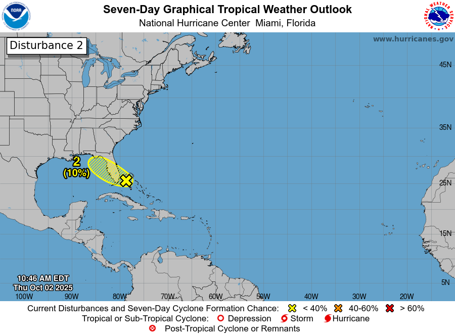
Low Pressure Expected To Develop Near South Florida Over The Next Couple Of Days: Weather analysis today reveals that there are remains of a frontal system that stretch across the northwestern Bahamas into South Florida. This weather feature is currently producing areas of showers and isolated thunderstorms across the northwestern Bahamas as well as across southeastern Florida. Analysis of radar loops seems to suggest that there may be some sort of mid-level circulation forming near the northwestern Bahamas
I do think that it is possible that we could see a low pressure system form along this old frontal boundary near southeastern Florida over the next couple of days. In fact, some of the model guidance and their ensemble members are pointing to low pressure forming in the area between southeast Florida and the northwestern Bahamas during this weekend before any low pressure system crosses Florida and gets into the eastern Gulf early next week. While these ensemble members do show low pressure forming near southeast Florida, they also point to only a 10-20 percent chance of it developing into a tropical system.
Interestingly though, the 06Z run of the GFS model does show a low-end tropical storm quickly spinning up very near the coast of southeast Florida late Friday into early Saturday. I’m not sure that I buy into this, but it is something that will be watched closely, just in case.
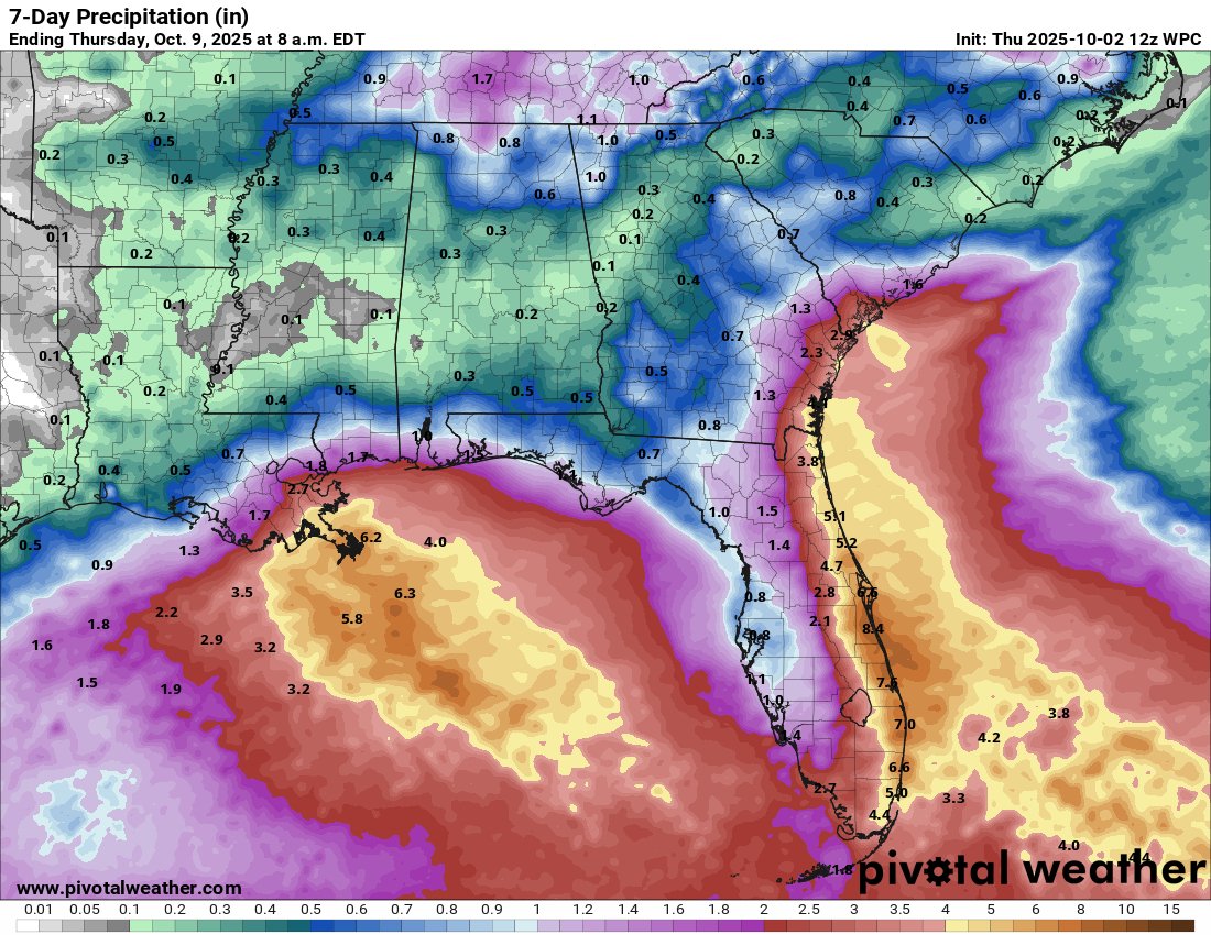
What this remnant frontal boundary and any low pressure systems that form will do is produce a very wet weekend across the eastern coast of Florida. In fact, the next 5-7 days or so could see some very heavy rainfall along Florida’s East Coast. These rainfall totals, which could amount to 5 to 10 inches is probably going to lead to urban flood issues, especially in the area from about Daytona southward to about Fort Lauderdale.
Additionally, this weather setup will also lead to a persistent onshore wind flow to be in place for the next several days along Florida’s East Coast. Because of this, expect rip currents, rough surf and hazardous marine conditions all along Florida’s East Coast.
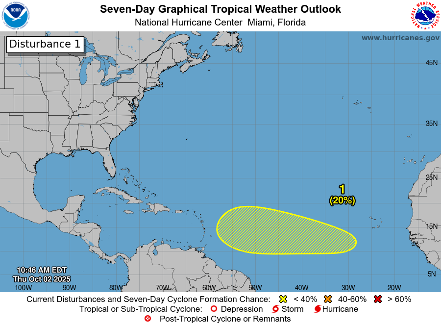
Eastern & Central Tropical Atlantic Tropical Development Continues To Be Possible As Soon As Early Next Week: I do think that it is quite possible that we could see tropical development occur somewhere in the area between the Lesser Antilles and the coast of Africa during the first half of next week.
It is expected that a tropical wave will push off of the coast of Africa over the next couple of days or so. This wave will interact with another tropical wave that’s now over the eastern Tropical Atlantic leading to the potential for a tropical system to develop sometime during the first half of next week.
Overall, there is some pretty strong model support for a tropical system to form over the eastern and central Tropical Atlantic next week as conditions look to be favorable for development. In fact, the European ensemble model guidance is showing upwards of a 50-60 percent chance of tropical development by the time this wave reaches about 40 West Longitude during the early part of next week.
A large majoirty of the ensemble guidance members seems to suggest that whatever tropical system forms early next week may end up very near, if not right over the Leeward Islands and the northeastern Caribbean around Thursday or so of next week. That said, there is a second cluster of ensemble members that forecast this system to track a little further south and cross the northern Windward Islands instead later next week & then track northwestward towards Puerto Rico and Hispaniola next weekend. Beyond this, most, if not all, of the ensemble guidance members show a curve to the north and northeast away from the Bahamas and the United States.
Here Are My Thoughts: Given everything that I’ve looked at today, I think that there is a decent chance that we will probably see a depression and very probably a tropical storm form by the time that tropical wave reaches about 40-45 West Longitude around the early part of next week. Additional development and strengthening is then quite possible as this system pushes towards the Lesser Antilles for later next week.
This means that those of you in the Lesser Antilles, the Virgin Islands, Puerto Rico and Hispaniola should closely monitor the progress of this wave. Given the current data, this system should probably affect the Lesser Antilles around Thursday of next week & then affect the Virgin Islands, Puerto Rico and Hispaniola around Friday and Saturday of next week. How strong might it be? That’s a big unknown right now, but I wouldn’t at all be surprised to see this be a tropical storm impact for the Lesser Antilles, Virgin Islands, Puerto Rico and Hispaniola.
It goes without saying that I will be keeping a very close eye on this particular wave & will have many, many more updates for you in the coming days.
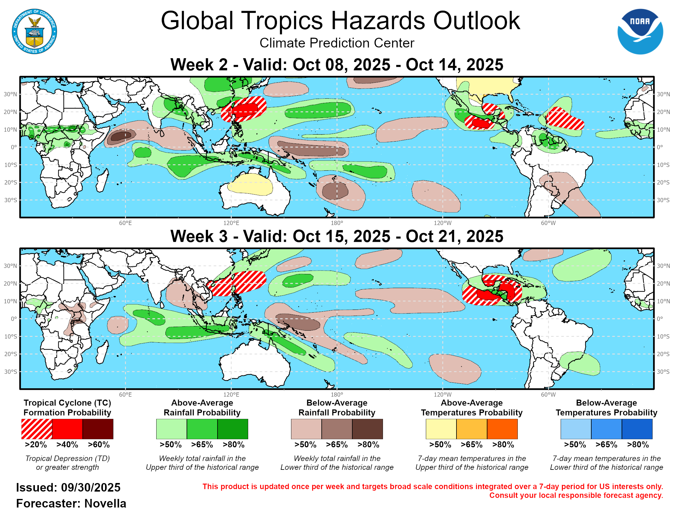
Western Caribbean Tropical Development Is A Possibility Around The Middle Part Of This Month: I really think that we are going to have to keep very close tabs on the western and northwestern Caribbean for potential tropical development around the middle part of this month.
While the model guidance aren’t quite showing a significant signal for development as of yet (there are hints in the guidance though), I think that the conditions could be quite favorable for development. It is expected that a Central American Gyre feature will develop by mid-month, which would probably lead to slow, but gradual tropical development over the western and northwestern Caribbean.
In addition, the environmental conditions, including both the wind shear values and thermodynamic setup, looks to be very favorable for development in the western half of the Caribbean during this time frame. Because of this, I do have quite a bit of concern that we will very probably see a tropical system pop in the western Caribbean during the mid-month period (around October 15-20 or so).
Also, it also looks possible that we could have an upper level trough in place over the eastern half of the United States around that time frame. If this occurs, then whatever forms in the western and northwestern Caribbean would be pulled north and northeastward towards the eastern Gulf, Florida, the Bahamas and the East Coast of the United States.
Needless to say, this setup for possible western Caribbean tropical development is something that I will be keeping a very close eye on. I will have more updates on this as needed.
The next tropical weather discussion will be issued on Friday.