


Tropical Storm Isaias: We have Tropical Storm Isaias that’s located in the southwestern Gulf today. Despite looking quite strong on satellite imagery with consistent deep convection occurring, reconnaissance aircraft have found a system that’s barely a tropical storm. Reports from reconnaissance aircraft indicate that Isaias has a broad circulation & it appears that it’s being sheared.
A look at the environmental conditions around Isaias reveals that the storm is being affected by about 10-20 knots or so of wind shear. I do think that we may end up seeing Isaias be impacted by this wind shear throughout today as it moves towards the east and east-northeast. As we get into Thursday, Isaias is expected to turn more towards the northeast and align itself with the upper-level wind flow. This could lead to low net wind shear environment over the storm & lead to more substantial strengthening during Thursday into Friday.
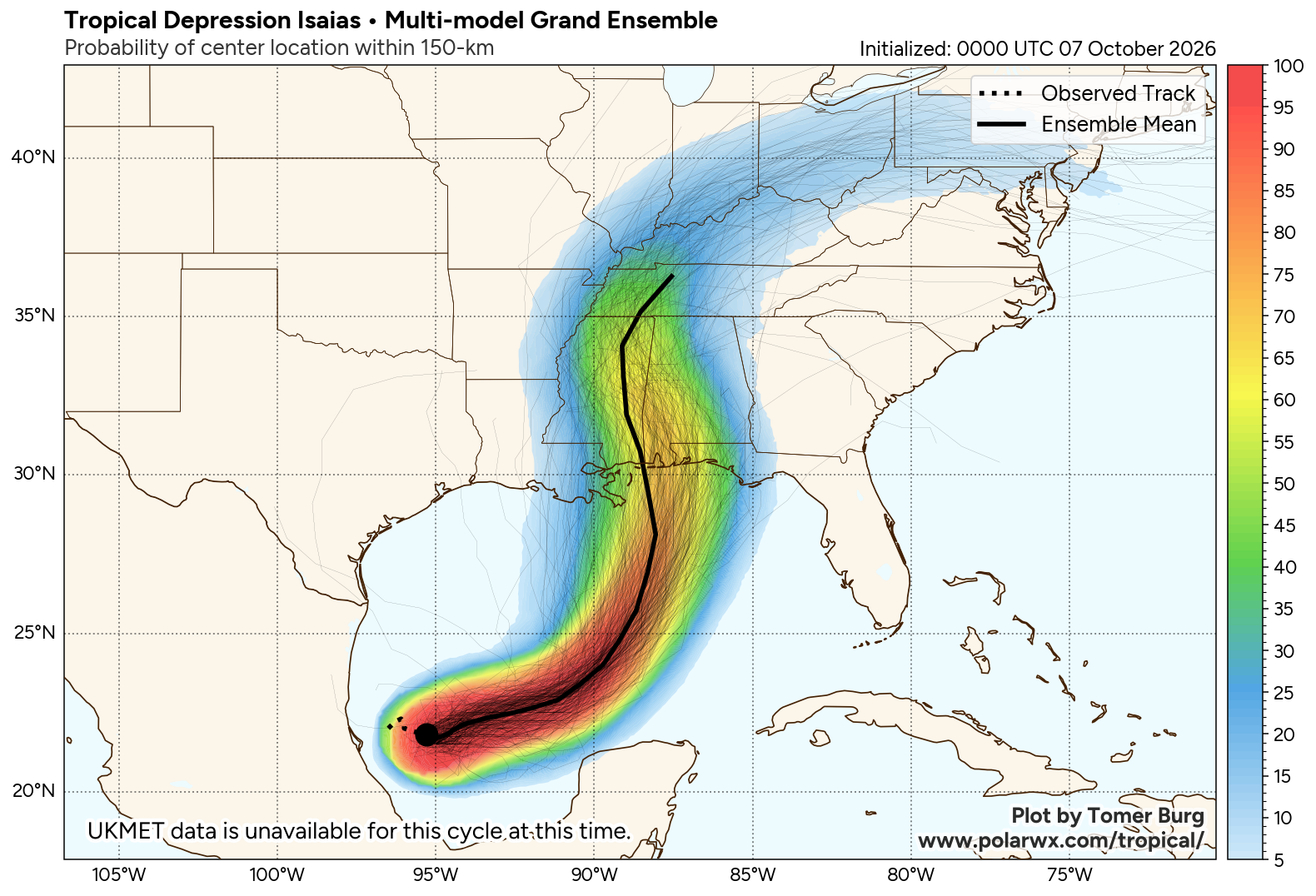
A look at the model guidance reveals how tricky the forecast is with Isaias & especially with its intensity forecast. Some of the higher resolution model guidance have shown Isaias not getting all that strong due to the strong wind shear really impacting the storm. Other model guidance show Isaias taking advantage of the southwesterly wind shear as its northeast path would lead to strong ventilation of the storm leading to substantial strengthening to not only a hurricane, but potentially a major hurricane before reaching the northern Gulf coast.
The range of possible tracks of the storm shown by model guidance has tightened up significantly with most guidance now showing Isaias making landfall somewhere between Pascagoula and Pensacola on Friday night. This would place the worst of the hurricane conditions right across southern Alabama and across the western Florida Panhandle from Friday afternoon through Friday night and into Saturday morning.
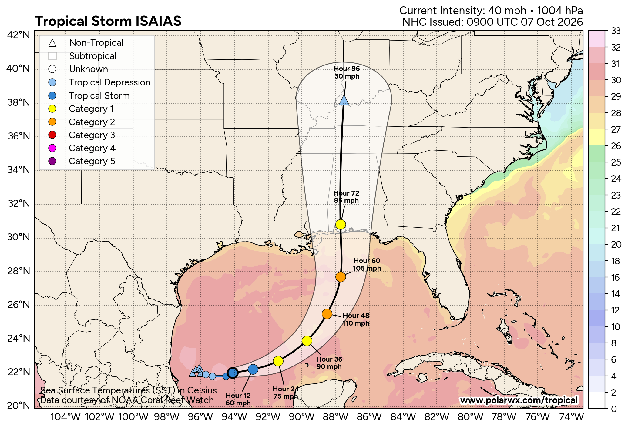
Here Are My Thoughts: I do think that we will very likely see Isaias become a hurricane, probably by sometime on Thursday. I’m not convinced that it will strengthen to a major hurricane as I think that there’s going to be too much wind shear to allow for that much strengthening. My thinking is that Isaias will peak at between 90 and 100 mph later Thursday or early Friday.
As for my thoughts on potential landfall – I think that the strong southwesterly upper-level winds will cause Isaias to head towards the northeast rather than the north-northeast or north on Thursday into Friday. Because of this, my thinking is for the storm to come ashore across southern Alabama or the western Florida Panhandle during Friday night as a 80-95 mph hurricane.

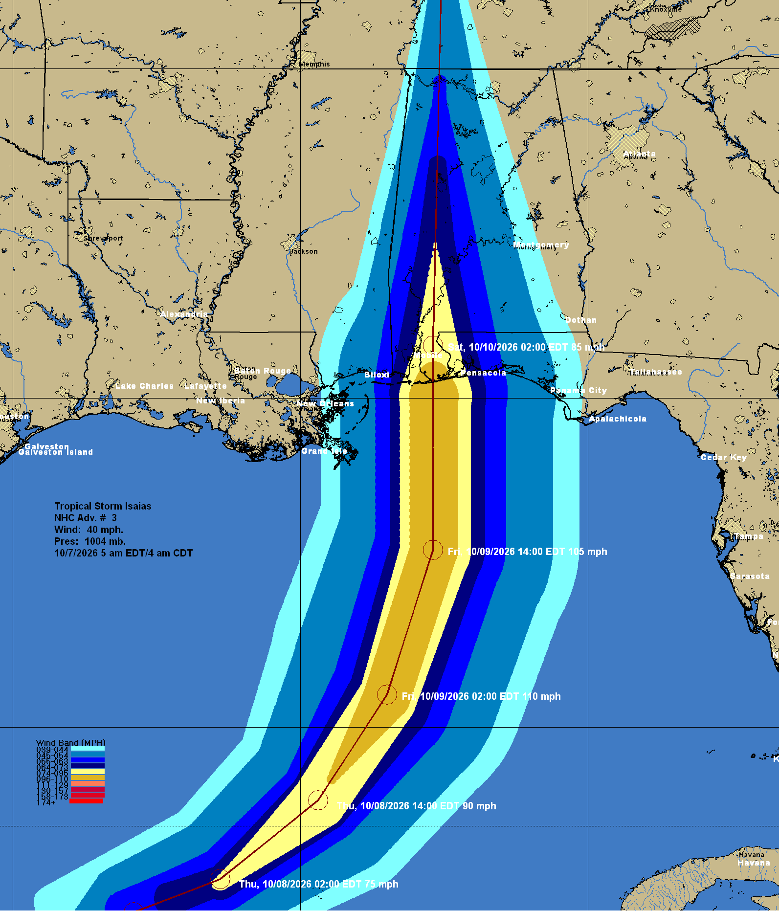
For Those Of You Along The Northern Gulf Coast, Especially Southern Alabama & The Florida Panhandle – Be aware that a hurricane landfall is now looking likely across southern Alabama and the western Florida Panhandle on Friday night. I strongly urge everyone across southern Alabama and the Florida Panhandle to keep checking back often for the latest updates.
This means that hurricane force winds will likely occur across southern Alabama and across the western Florida Panhandle during Friday night. Tropical storm force winds look like they will affect areas of the Florida Panhandle as far east as Apalachicola and possibly the Big Bend area of northwest Florida.
A storm surge of up to at least 6-8 feet looks likely along and to the east of where Isaias makes landfall. This means that storm surge related flooding looks likely across southern Alabama and across the entire Florida Panhandle during Friday, Friday night and Saturday morning.
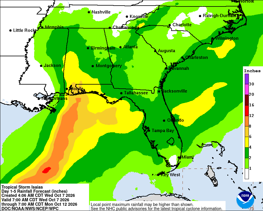
Heavy rain with the threat for flooding is also expected from Isaias across southern Alabama and across the Florida Panhandle. This is going to be a fast-moving storm & because of this, excessive amounts of rain are not expected. Still though, rain totals of 4 to 8 inches are expected from late this week into this weekend across southern and western Alabama and across the Florida Panhandle.
Also, tornadoes could be a big time threat when Isaias makes landfall. There is going to be strong amounts of wind shear occurring on the eastern side of the storm & because of this, tornadoes will be a definite threat across the Florida Panhandle and across southern Alabama on Friday night and Saturday.
I am keeping very close tabs on the progress of Isaias and will continue to have updates for you as needed.