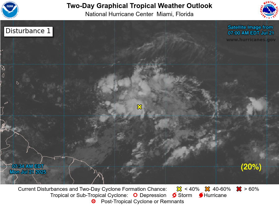
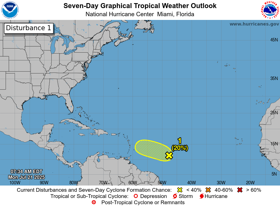
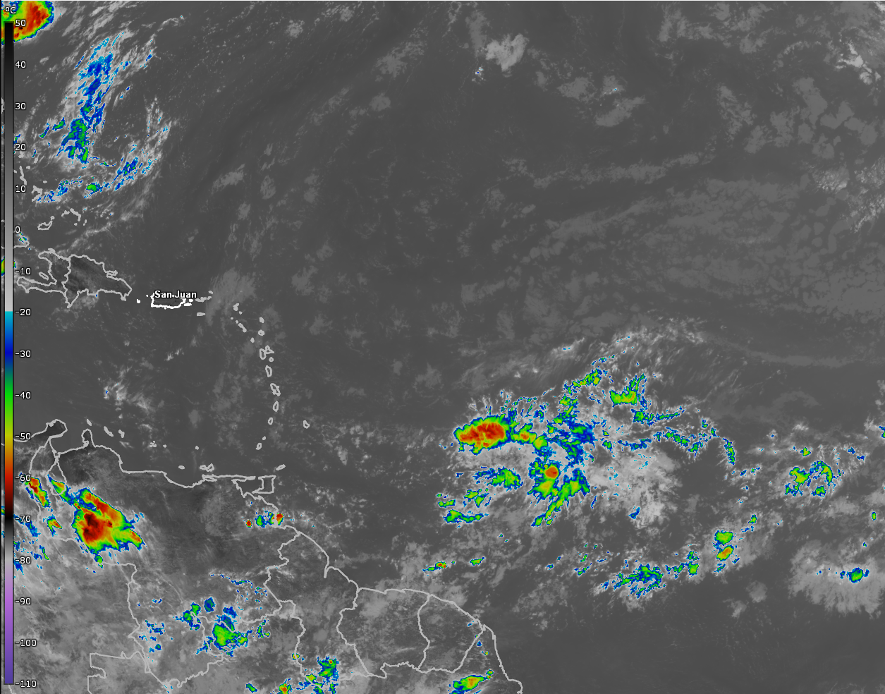
Invest 94-L Located About 700 Miles To The East-Southeast Of The Lesser Antilles: Satellite imagery today indicated that the shower and thunderstorm activity associated with an area of low pressure, designated Invest 94-L by the National Hurricane Center, has become more consolidated. That said, there really isn’t any deep convection occurring with Invest 94-L, just that the overall structure is a little more consolidated.
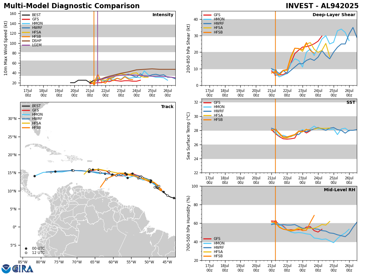
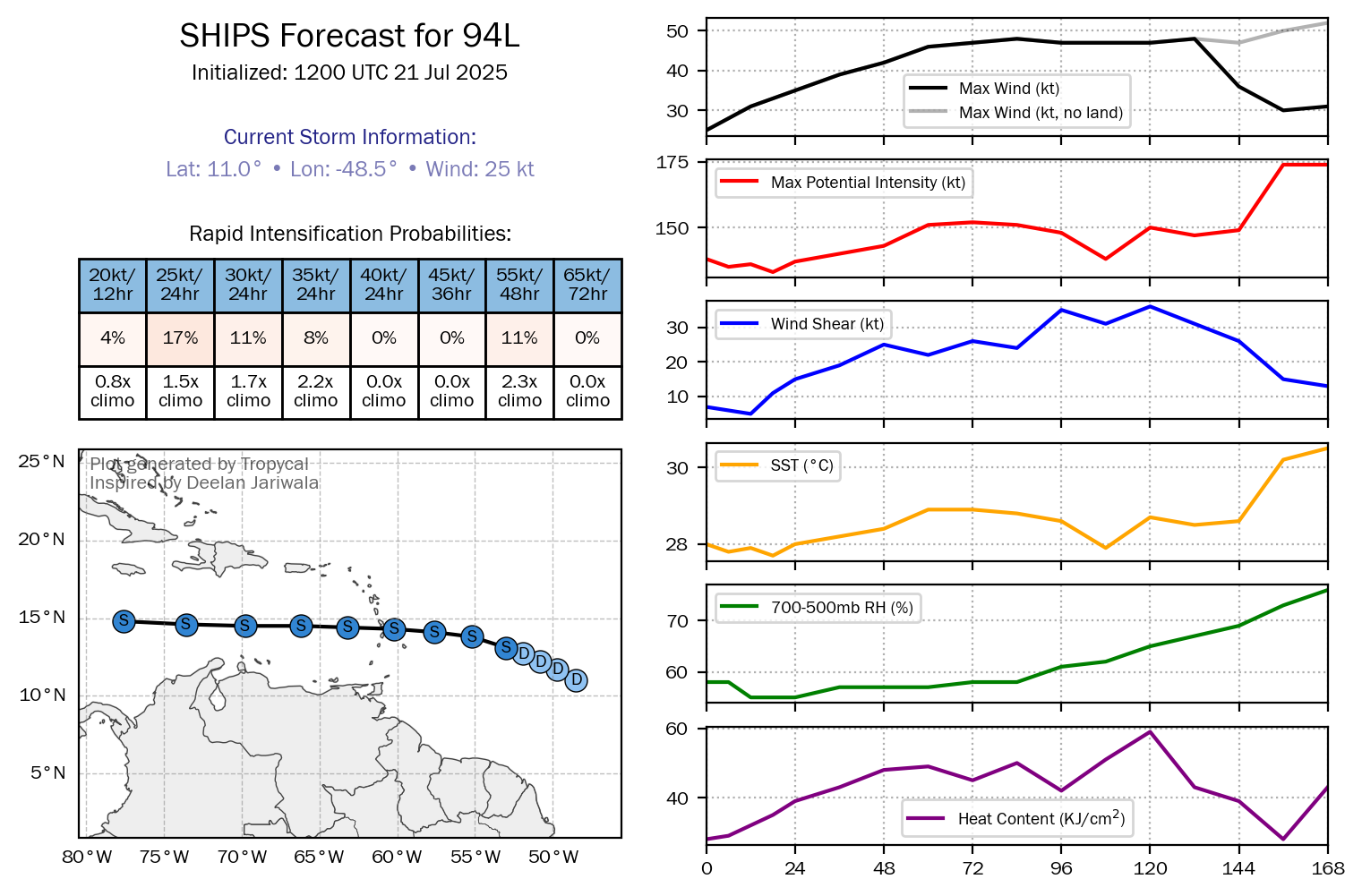
Analysis of environmental conditions reveals that there is strong wind shear occurring on the northern side of the disturbance, although the wind shear values are favorable near the low pressure center. Looking further west, the overall environmental conditions become unfavorable for development once you reach about 60 West Longitude.
It’s possible that we could see some development of Invest 94-L between today and Tuesday due to the favorable conditions, however, this system will find itself in an unfavorable environment by Wednesday leading to an end to any development.
Invest 94-L is expected to move through the southern Leeward Islands and the northern Windward Islands on Wednesday bringing squally weather to a large part of the Lesser Antilles during Wednesday and Wednesday night.
Once Invest 94-L reaches the eastern Caribbean on Thursday, it will likely fall apart.
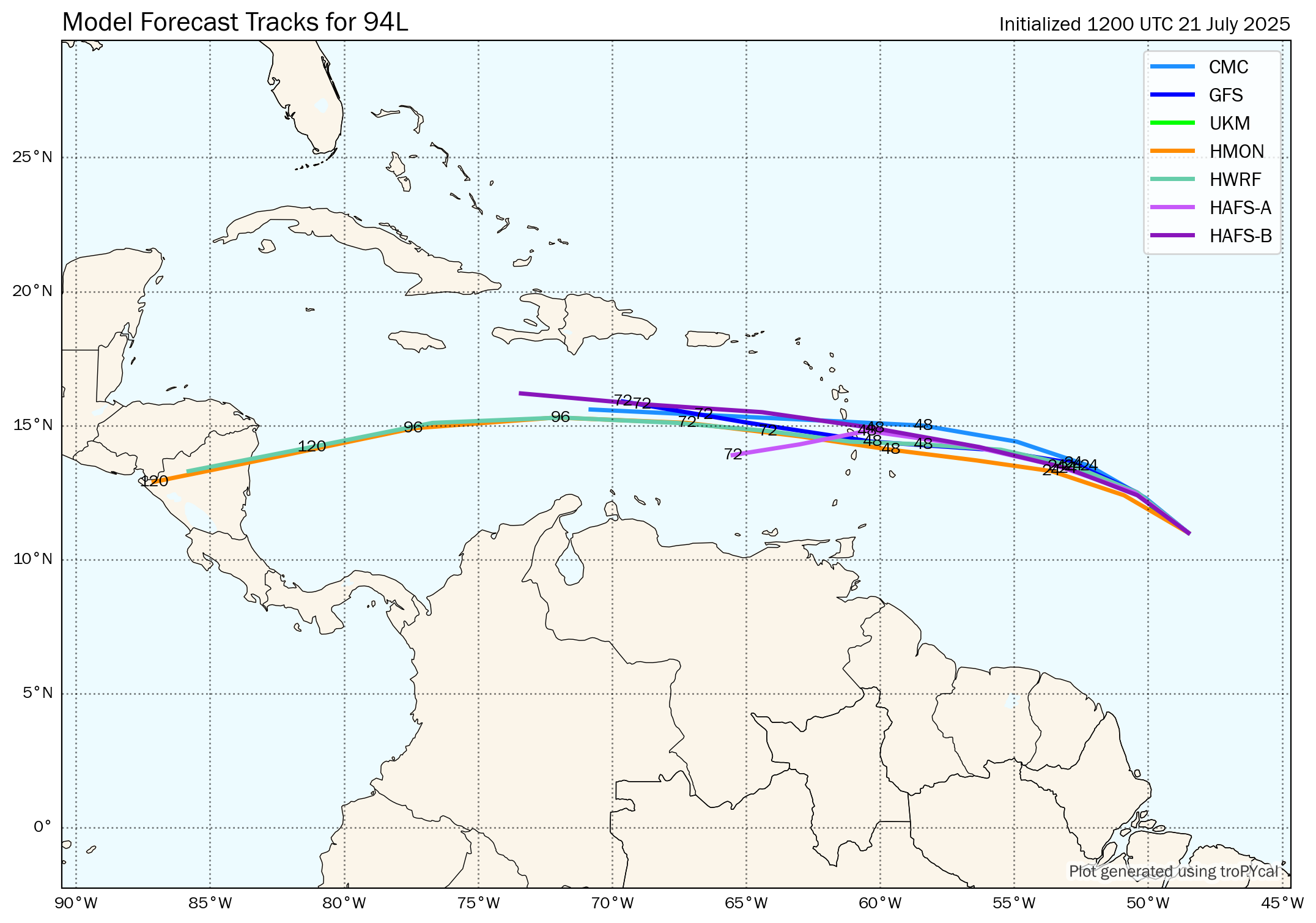
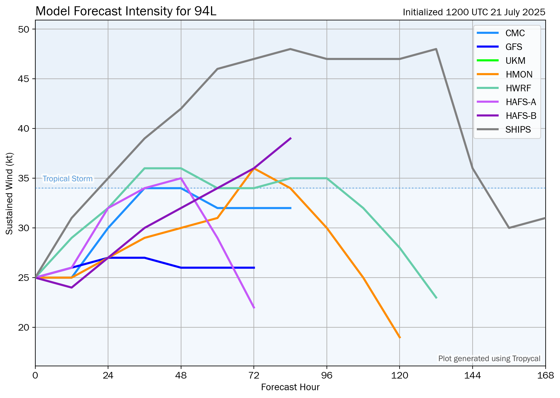
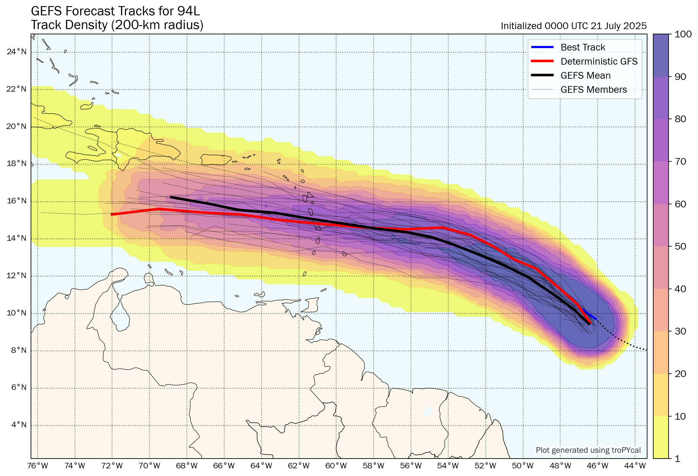
Model Track Forecast:
Satellite Imagery:
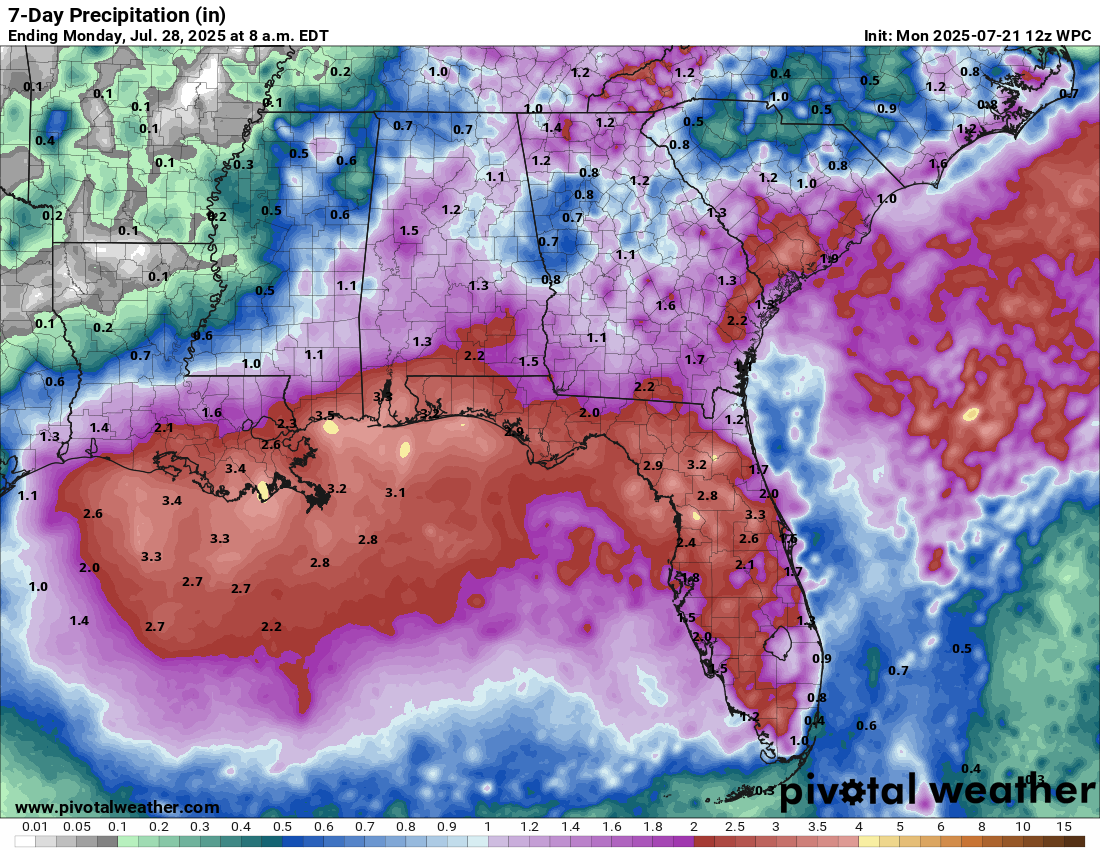
Area Of Disturbed Weather Will Move Across The Northern Gulf Mid To Late Week: It appears quite possible that a small piece of Invest 93L will move back into the northeastern Gulf by about Wednesday and then move westward across the northern Gulf during the late parts of this week.
The environmental conditions do not look favorable for development due to some marginally strong wind shear values and dry air. This means that I don’t think that we’ll see any sort of development from this disturbance.
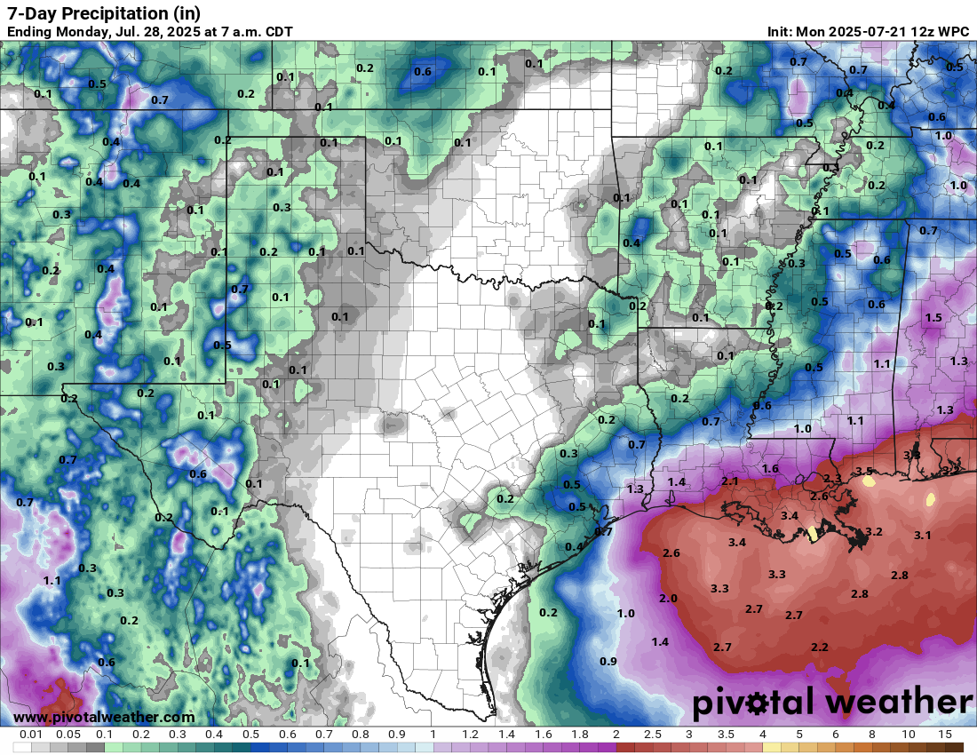
One thing that this disturbance will do is enhance the rainfall potential along much of the northern Gulf Coast, especially during the middle and later parts of this week. Rain totals of 2 to 4 inches look likely along much of the northern Gulf Coast. Some of this rain may reach the upper Texas coast by this weekend.
Tropical Disturbance Located Near The West Coast Of Africa: Another area of disturbed weather is now moving near the west coast of Africa. This disturbance will push into the far eastern Tropical Atlantic by tonight or Tuesday. This disturbance is then expected to head westward across the eastern Tropical Atlantic during the middle and later parts of this week.
A look at the environmental conditions across the eastern and central Tropical Atlantic reveals that the wind shear values are marginally favorable for development. This is probably why the model guidance aren’t too interested in forecasting development of this disturbance. That said, Invest 94-L located well to the west of this disturbance is likely to moisten up the atmosphere & because of this, this particular disturbance may try to develop during the second half of this week into this weekend as it heads from the eastern Tropical Atlantic into the central Tropical Atlantic. Something to watch, just in case.
Whether we see any development or not from this particular disturbance, it will probably bring a round of squally weather to the Lesser Antilles early next week.
The next tropical weather discussion will be issued on Tuesday.