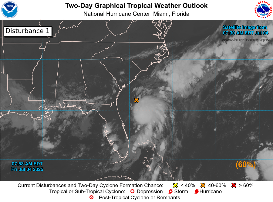
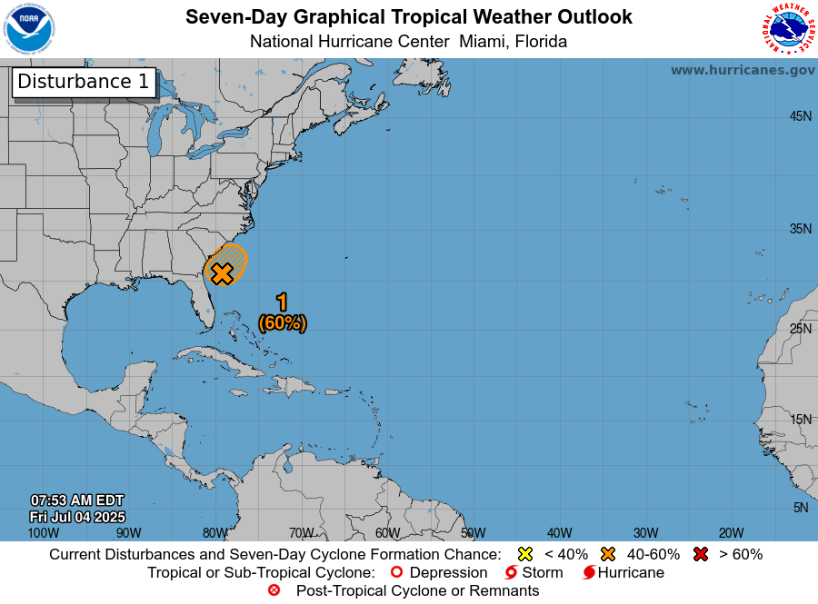
Invest 92-L Located About 100 Miles Offshore Of The Coast Of Northeast Florida: It looks like we have a developing tropical system off of the northeast Florida coast today. In fact, I think the chances are high that Invest 92-L will be a tropical storm by the time it comes ashore along the South Carolina coast on Sunday.
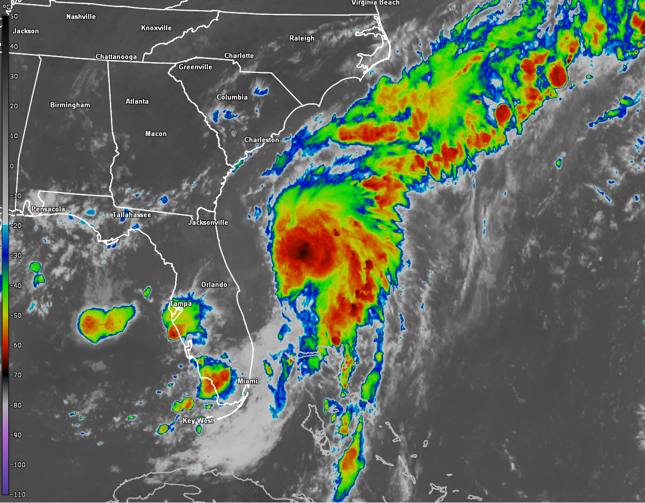
The shower and thunderstorm activity associated with an area of low pressure located offshore of the northeast Florida coast are becoming more concentrated today. This low pressure system has been designated Invest 92-L by the National Hurricane Center. It will be interesting to see what the hurricane hunters find when they fly in and investigate this system this afternoon.
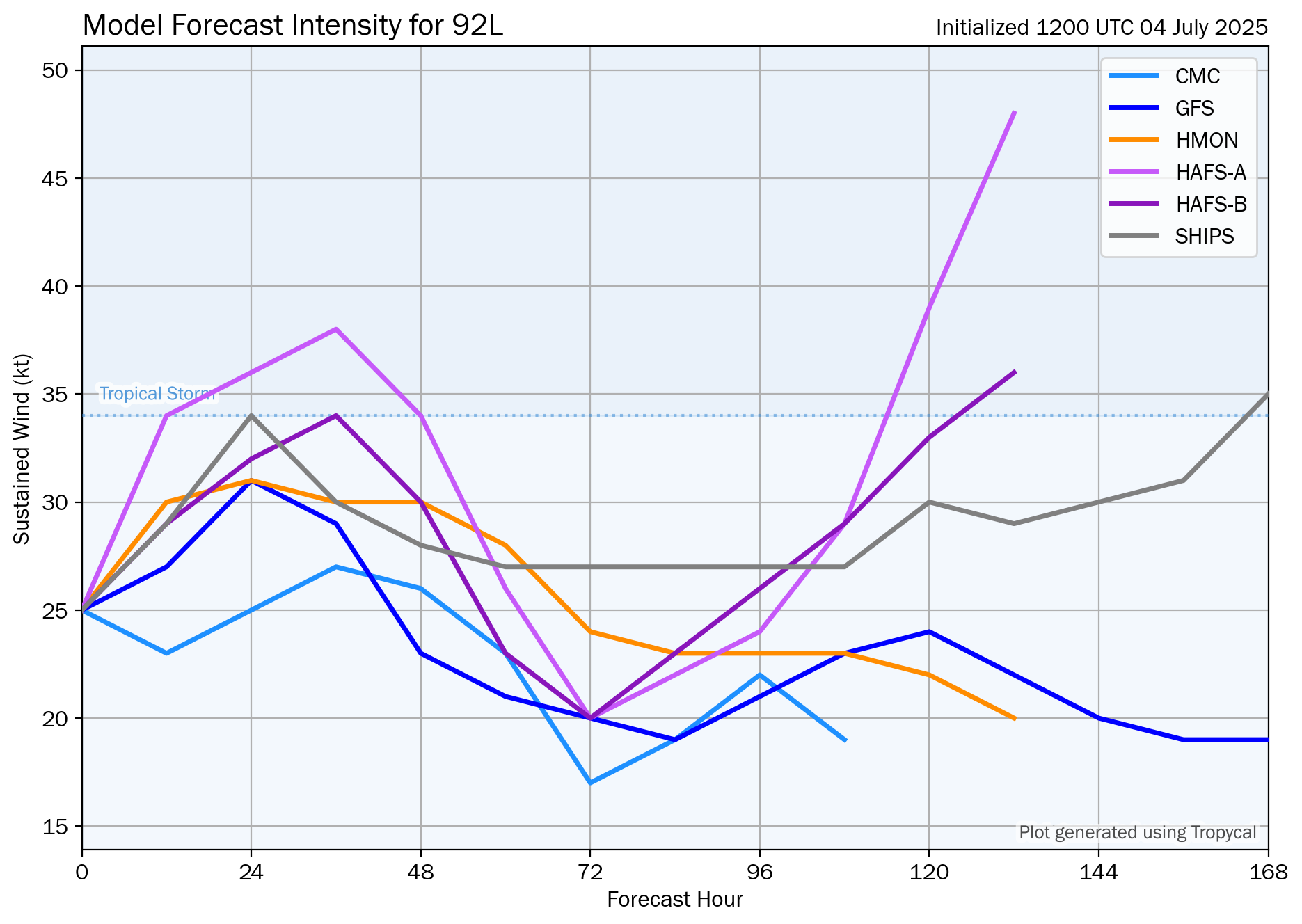
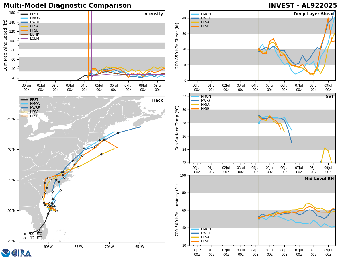
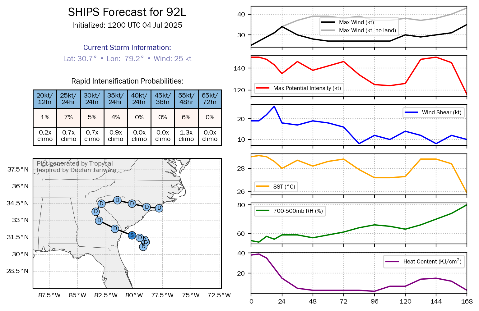
Analysis of environmental conditions reveals that the wind shear values are marginally favorable for development and strengthening of Invest 92-L. Because of this, I think the ceiling of intensification is pretty low, but I also think that it is likely that it will probably strengthen into a tropical storm probably either later tonight or during the day on Saturday.
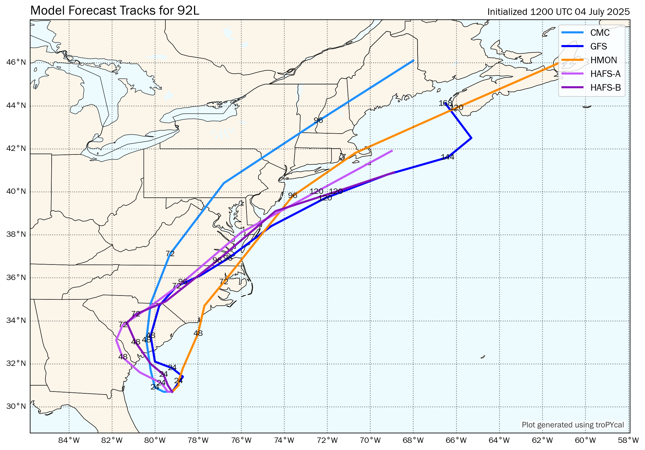
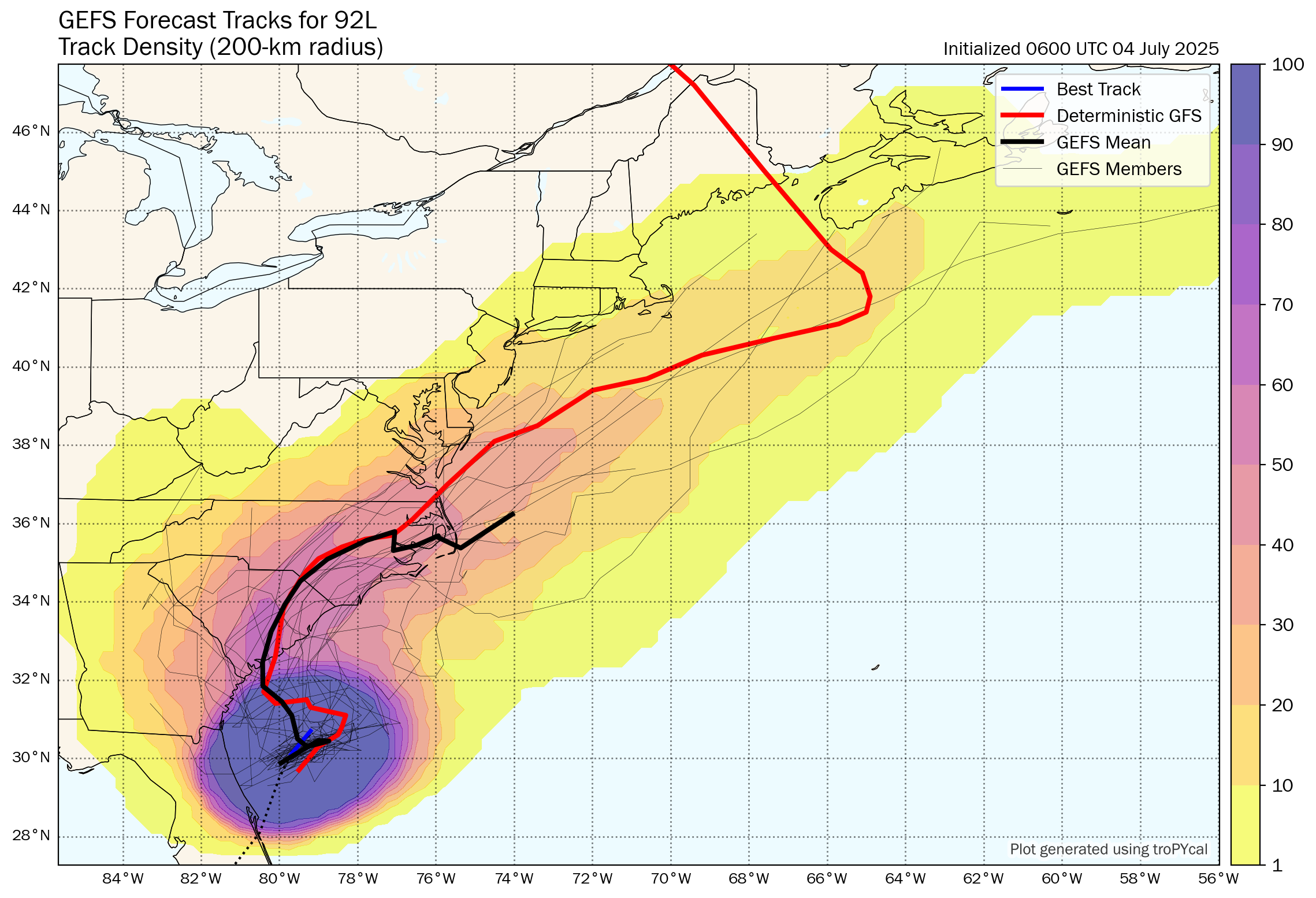
A look at the track model guidance indicates that most of the guidance forecast Invest 92-L to come ashore along the South Carolina coastline between about Hilton Head and Charleston on Sunday morning. As for intensity, most of the guidance point to Invest 92-L peaking at somewhere between a 35 mph tropical depression and a 45 mph tropical storm.
I also wanted to mention that the model guidance forecasts that Invest 92-L may reemerge off of the North Carolina or Virginia coastlines on Tuesday and then head northeastward tracking either very near Cape Cod, Massachusetts or offshore of southeastern New England around Wednesday where some of intensity guidance forecasts re-intensification into a tropical storm.
Here Are My Thoughts: I think that it is very likely that Invest 92-L will strengthen to a low-end tropical storm with perhaps 40-45 mph winds probably during the day on Saturday. Given how solid it looks on satellite imagery, I definitely can see how it will become a tropical storm sooner rather than later.
I then expect Invest 92-L to come ashore along the South Carolina coast very near Charleston either during later Saturday night or during Sunday morning as a tropical storm with 40-45 mph winds.
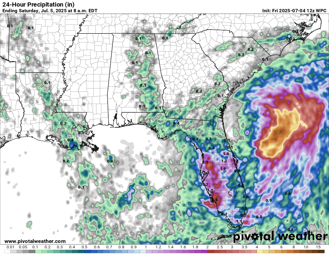
The main threat from this system will be heavy rainfall, first across the Florida Peninsula today and then across the coastal Carolinas throughout Saturday and Sunday.
Additional rainfall amounts of 1 to 3 inches can be expected throughout the rest of today along Florida’s west and southwest coasts, as well as along the I-4 corridor from Tampa through Orlando & also across Florida’s Space Coast.
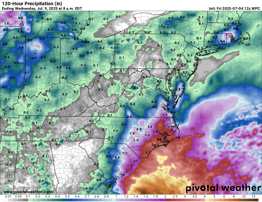
Turning to the coastal Carolinas, locally heavy rain is expected throughout Saturday and Sunday, especially across northeastern South Carolina and eastern North Carolina where 2 to 4 inches of rain can be expected.
Further north, parts of Southern New England might need to be watched for possible locally heavy rainfall around the middle part of next week as whatever is left of this system passes near or to the east of Southern New England.
Finally, rip currents will be a threat along the coast from eastern and northeastern Florida northward through the coastal Carolinas throughout this weekend.
Model Track Forecast:
Satellite Imagery:
Forecast Additional Rainfall Amounts Today:
Forecast Rainfall Amounts From Saturday Through Monday:
The next tropical weather discussion will be issued on Saturday.